 Donald 1774
 |
 |
|
|
Places Identified
Map, hand coloured engraving, 3x2 sheets, The County of Cumberland, scale about 1 inch to 1 mile, by Thomas Donald, engraved and published by Joseph Hodskinson, 29 Arundel Street, Strand, London, 1774. NB: each image includes an overlap, places in the overlap are not listed. The images are roughly equivalent to ngr 5Km squares and are listed from top left to bottom right. | ||
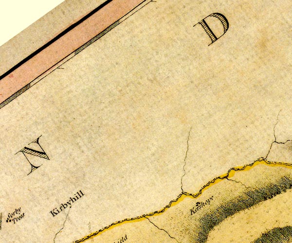
D4NY58NW.jpg Carby Hill -- earthwork -- NY49068436 ? -- 'Kirkbyhill' -- area English Kershope -- building/s -- NY52628485 -- 'Kershope' -- block or blocks, labelled in lowercase; a hamlet or just a house Kershope Burn -- river -- boundary -- NY5184 (etc etc) -- 'Kershope River' -- single or double wiggly line; a river and national boundary | ||
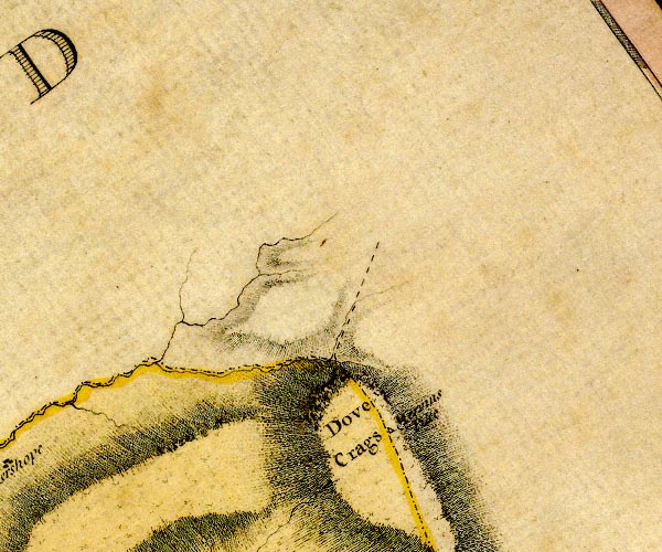
D4NY58NE.jpg Dove Crags -- hill -- NY560863 -- 'Dove Crags' -- -- hill hachuring; a hill or mountain Marven's Pike -- hill (?) -- boundary mark (?) -- NY56988742 -- 'Mervins Pike' -- spot, boundary mark | ||
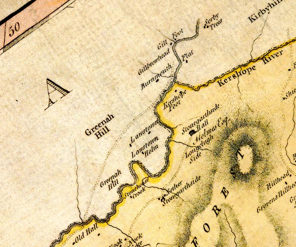
D4NY48SE.jpg Flatt -- building/s -- NY47918362 -- 'Flat' -- block or blocks, labelled in lowercase; a hamlet or just a house Gillbraehead -- building/s -- NY47428425 -- 'Gillbrowhead' -- area Gillside -- building/s -- NY47438456 -- 'Gill Foot' -- block or blocks, labelled in lowercase; a hamlet or just a house Greena Hill -- hill -- NY45908195 -- 'Greenah Hill' -- area Greena Tower -- tower (site) -- NY46168076 -- 'Greenah Hill' -- block or blocks, labelled in lowercase; a hamlet or just a house perhaps Kershope Burn -- river -- boundary -- NY5184 (etc etc) -- 'Kershope River' -- single or double wiggly line; a river and national boundary Kershopefoot -- building/s -- NY475829 (?) ? -- 'Kershope Foot' -- block or blocks, labelled in lowercase; a hamlet or just a house Lawston -- building/s -- NY46518212 (guess) -- 'Lawstown' -- block or blocks, labelled in lowercase; a hamlet or just a house Lawston -- building/s -- NY46588154 -- 'Lawstown Holm' -- block or blocks, labelled in lowercase; a hamlet or just a house Liddel Water -- river -- boundary -- national boundary -- county boundary -- NY4377 (etc) -- 'Liddel River' -- single or double wiggly line; a river and national boundary Longcleughside -- building/s -- NY47818130 -- 'Longclugh Side' -- area Nichol Forest -- area -- NY4577 (etc) -- 'NICHOL FOREST' -- area Sorbietrees -- building/s -- NY48378462 -- 'Sorby Trees' -- block or blocks, labelled in lowercase; a hamlet or just a house Stonegarthside Hall -- building/s -- NY48038186 ? -- 'Stonegarthside Hall / Holmes Esq.' -- house Stonegarthside -- locality -- NY47348032 (etc etc) -- 'Nether Stonegarthside' -- block or blocks, labelled in lowercase; a hamlet or just a house probably Stonehouse Crook -- locality -- NY46118031 -- 'Stonehouse Crook' -- block or blocks, labelled in lowercase; a hamlet or just a house possibly Stonehouse Tower -- building/s -- tower (?) -- NY46318041 -- 'Stonehouse Crook' -- block or blocks, labelled in lowercase; a hamlet or just a house perhaps Under Burnmouth -- building/s -- NY47168307 -- 'Burnmouth' -- block or blocks, labelled in lowercase; a hamlet or just a house | ||
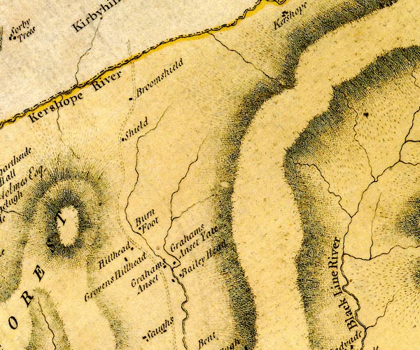
D4NY58SW.jpg Baileyhead -- building/s -- NY5180 -- 'Bailey Head' -- block or blocks, labelled in lowercase; a hamlet or just a house Burn Foot -- building/s -- NY51108083 (guess) -- 'Burn Foot' -- block or blocks, labelled in lowercase; a hamlet or just a house Burnt Shields -- wood -- locality -- NY506835 (etc) -- 'Broomshield' -- block or blocks, labelled in lowercase; a hamlet or just a house possibly Crubbins Hill -- building/s -- NY50728031 -- 'Grovens Hillhead' -- block or blocks, labelled in lowercase; a hamlet or just a house probably Graham's Onset -- building/s -- NY51538024 -- 'Grahams Anset Yate' -- block or blocks, labelled in lowercase; a hamlet or just a house Hillhead -- building/s -- NY50918049 -- 'Hillhead' -- block or blocks, labelled in lowercase; a hamlet or just a house Kershope Burn -- river -- boundary -- NY5184 (etc etc) -- 'Kershope River' -- single or double wiggly line; a river and national boundary Lordstown -- building/s -- NY51338022 -- 'Grahams Anset' -- block or blocks, labelled in lowercase; a hamlet or just a house possibly Roansgreen -- building/s -- NY50918266 (etc) -- 'Shield' -- block or blocks, labelled in lowercase; a hamlet or just a house possibly | ||
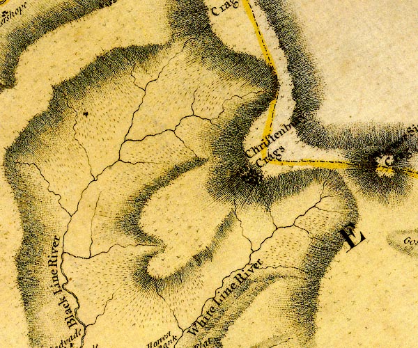
D4NY58SE.jpg Black Lyne -- river -- NY5075 -- 'Black Line River' -- single or double wiggly line; a river -- meeting the White Lyne Christianbury Crag -- hill -- NY57768228 (etc) -- 'Christenbury Crags' -- hill hachuring; a hill or mountain and boundary mark White Lyne -- river -- NY4973 (etc) -- 'White Line River' -- 'White Line River' -- meeting the Black Lyne -- single or double wiggly line; a river | ||
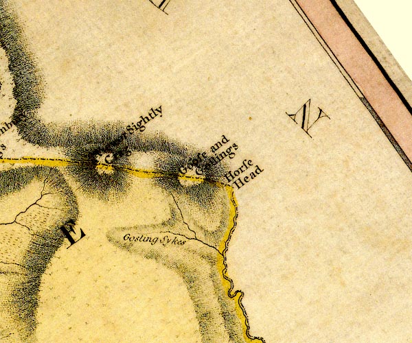
D4NY68SW.jpg Goose and Goslings -- hill -- boundary mark -- NY614814 (about) -- 'Goose and Goslings' -- hill hachuring; a hill or mountain and boundary mark Gosling Sike -- river -- NY6180 (etc) -- 'Gosling Sykes' -- single or double wiggly line; a river Horse Head -- hill -- boundary mark -- NY617810 (?) -- 'Horse Head' -- boundary mark Irthing, River -- river -- boundary -- parish boundary -- county boundary -- NY4758 (etc etc) -- 'Irthing River' -- 'Irthing River' -- single or double wiggly line; a river and county boundary Sighty Crag -- hill -- NY60138092 -- 'Viewor Sightly Crag' -- hill hachuring; a hill or mountain and boundary mark | ||
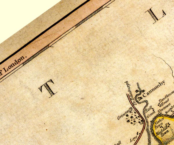
D4NY37NE.jpg Canonbie Bridge -- bridge -- NY39537655 -- double line across a river; a bridge Canonbie -- building/s -- locality -- NY39277643 (etc) -- 'Cannonby' -- blocks, perhaps a church, labelled in block caps; a town Griestail (?) -- locality (?) -- NY391763 (guess) -- 'Griestail' -- block or blocks, labelled in lowercase; a hamlet or just a house Longtown to Edinburgh -- road -- route etc -- NY36 -- 'To Edinburgh' -- double line, solid or dotted, with a dot or milestone and number at 1 mile intervals, tinted red; turnpike road -- into Scotland at Scots Dike | ||
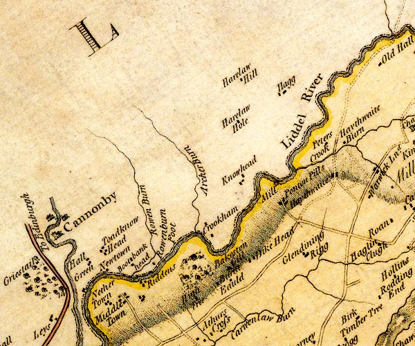
D4NY47NW.jpg Archer Beck -- river -- NY4178 (etc) -- 'Archer Burn' -- single or double wiggly line; a river Baxton Gill -- valley (?) -- NY42267587 (etc etc) -- 'Bakeston Gill' -- ?no symbol Boatbankhead -- building/s -- NY40757579 -- 'Bootbank head' -- block or blocks, labelled in lowercase; a hamlet or just a house Burntfauld -- building/s -- NY42307529 -- 'Burn Eauld' -- block or blocks, labelled in lowercase; a hamlet or just a house Crookholm -- building/s -- NY42567640 -- 'Crookham' -- block or blocks, labelled in lowercase; a hamlet or just a house Dikehead -- building/s -- NY42907578 -- 'Dike Head' -- block or blocks, labelled in lowercase; a hamlet or just a house Glendinningrigg -- building/s -- NY44017594 -- 'Glendining Rigg' -- block or blocks, labelled in lowercase; a hamlet or just a house Haithwaite -- building/s -- locality -- NY44357727 ? -- 'Haythwaite' -- block or blocks, labelled in lowercase; a hamlet or just a house Hallgreen -- building/s -- NY40047586 -- 'Hall Green' -- block or blocks, labelled in lowercase; a hamlet or just a house Harelawhagg -- building/s -- NY43377872 -- 'Hagg' -- block or blocks, labelled in lowercase; a hamlet or just a house probably Harelawhill -- building/s -- NY42817889 -- 'Harelaw Hill' -- block or blocks, labelled in lowercase; a hamlet or just a house Harelawhole -- building/s -- NY42707819 -- 'Harelaw Hole' -- block or blocks, labelled in lowercase; a hamlet or just a house High Tree -- building/s -- NY41427473 (guess) -- 'High Tree' -- block or blocks, labelled in lowercase; a hamlet or just a house Knowehead -- building/s -- NY42807727 -- 'Knowhead' -- block or blocks, labelled in lowercase; a hamlet or just a house Liddel Water -- river -- boundary -- national boundary -- county boundary -- NY4377 (etc) -- 'Liddel River' -- single or double wiggly line; a river and national boundary Middle Town -- building/s -- NY40277495 (guess) -- 'Middle Town' -- block or blocks, labelled in lowercase; a hamlet or just a house Nether Town -- building/s -- NY40087490 (guess) -- 'Nether Town' -- block or blocks, labelled in lowercase; a hamlet or just a house Newtown -- building/s -- NY40427567 -- 'Newtown' -- block or blocks, labelled in lowercase; a hamlet or just a house Penton House -- building/s -- NY43457695 -- 'Ponton Pills' -- block or blocks, labelled in lowercase; a hamlet or just a house probably Penton Mill -- building/s -- water mill (ex) -- mill (ex) -- NY43357729 -- 'Mill' -- circle with rays, mill wheel; a water mill Peter's Crook -- building/s -- NY44027789 -- 'Peters Crook' -- block or blocks, labelled in lowercase; a hamlet or just a house Riddings -- building/s -- NY40797503 (etc) -- 'Riddens' -- block or blocks, labelled in lowercase; a hamlet or just a house Rowan Burn -- river -- NY4076 (etc) -- 'Rowen Burn' -- single or double wiggly line; a river Rowanburnfoot -- building/s -- NY41187582 -- 'Rowenburn Foot' -- block or blocks, labelled in lowercase; a hamlet or just a house Todknowehead -- building/s -- NY40577585 -- 'Toadknow Head' -- block or blocks, labelled in lowercase; a hamlet or just a house | ||
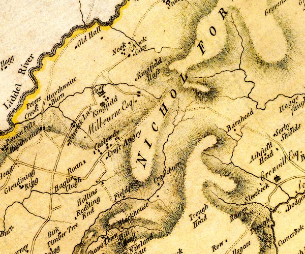
D4NY47NE.jpg Black House -- building/s -- NY46217498 -- 'Blackhouse' -- block or blocks, labelled in lowercase; a hamlet or just a house Catlowdy -- building/s -- NY45957680 (etc) -- 'Catlowdy' -- block or blocks, labelled in lowercase; a hamlet or just a house chapel, Nicholforest (2) -- chapel (site) -- NY45587809 (estimate) -- 'Chap.' -- dot circle, and building with tower probably Cragburn -- building/s -- NY47377606 -- 'Crackburn' -- block or blocks, labelled in lowercase; a hamlet or just a house Croftangry -- building/s -- NY45857667 (?) -- 'Croft Angry' -- block or blocks, labelled in lowercase; a hamlet or just a house Crookburn Head -- building/s -- NY50197846 -- 'Barnhead' -- block or blocks, labelled in lowercase; a hamlet or just a house possibly Field Foot -- building/s -- NY46597567 -- 'Fieldfoot' -- block or blocks, labelled in lowercase; a hamlet or just a house probably Hagling -- building/s -- NY44737589 -- 'Haglin Clugh' -- block or blocks, labelled in lowercase; a hamlet or just a house probably Haythwaite Burn -- building/s -- NY44357772 (guess) -- 'Haythwaite Burn' -- block or blocks, labelled in lowercase; a hamlet or just a house Hollands -- building/s -- NY454755 -- 'Hollins' -- block or blocks, labelled in lowercase; a hamlet or just a house Kingfield -- locality -- NY45527791 (about, etc) ? -- 'Kingfield / Milbourne Esq.' -- house Mid Kingfield -- building/s -- NY46397832 (estimate) -- 'Kingfield Hass' -- block or blocks, labelled in lowercase; a hamlet or just a house possibly Nichol Forest -- area -- NY4577 (etc) -- 'NICHOL FOREST' -- area Nook -- building/s -- NY463792 -- 'Nook' -- block or blocks, labelled in lowercase; a hamlet or just a house Nookgate -- building/s -- NY46487904 -- 'Nook Gate' -- block or blocks, labelled in lowercase; a hamlet or just a house Old Hall -- building/s -- NY45137905 -- 'Old Hall' -- block or blocks, labelled in lowercase; a hamlet or just a house Rawentree -- building/s -- NY492751 (guess) -- 'Rawen Tree' -- block or blocks, labelled in lowercase; a hamlet or just a house Redgatehead -- building/s -- NY45037526 -- 'Rodding End' -- block or blocks, labelled in lowercase; a hamlet or just a house possibly Roan -- building/s -- NY453766 -- 'Roan' -- block or blocks, labelled in lowercase; a hamlet or just a house Trough Head -- building/s -- NY47987518 -- 'Trough Head' -- block or blocks, labelled in lowercase; a hamlet or just a house Warwicksland -- building/s -- locality -- NY44927732 (etc) -- 'Warwick Lnd.' -- block or blocks, labelled in lowercase; a hamlet or just a house | ||
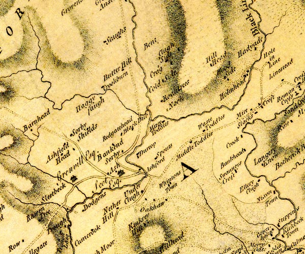
D4NY57NW.jpg Ash -- building/s -- NY51047647 -- 'Ash / Scot Esq.' -- house and blocks for other buildings, a hamlet Bailey Water -- river -- NY5179 -- single or double wiggly line; a river into the Black Lyne Bankend -- building/s -- NY51317743 -- 'Bankend' -- block or blocks, labelled in lowercase; a hamlet or just a house Bankhead -- building/s -- NY54497693 -- 'Bankhead' -- block or blocks, labelled in lowercase; a hamlet or just a house Bent, Bewcastle -- locality -- NY517793 (guess) -- 'Bent' -- no symbol Butterhill -- building/s -- NY509790 -- 'Butter Hill' -- block or blocks, labelled in lowercase; a hamlet or just a house Cleughside -- building/s -- NY51837920 -- 'Clugh Side' -- block or blocks, labelled in lowercase; a hamlet or just a house Coldside -- building/s -- NY51967877 -- 'Cold Side' -- block or blocks, labelled in lowercase; a hamlet or just a house Craigs -- building/s -- NY51987896 -- 'Crag' -- block or blocks, labelled in lowercase; a hamlet or just a house Crook -- building/s -- NY54417719 -- 'Crook' -- block or blocks, labelled in lowercase; a hamlet or just a house Crookburn -- building/s -- NY507785 -- 'Crookburn' -- block or blocks, labelled in lowercase; a hamlet or just a house Dirtup -- building/s -- NY51327692 -- 'Durtop' -- block or blocks, labelled in lowercase; a hamlet or just a house Dodgsontown -- building/s -- NY50257555 -- 'Dodgons' -- block or blocks, labelled in lowercase; a hamlet or just a house Fieldhead -- building/s -- NY50417725 -- 'Ashfield Head' -- block or blocks, labelled in lowercase; a hamlet or just a house probably High Todholes -- building/s -- NY52997752 -- 'Waste Toddles' -- block or blocks, labelled in lowercase; a hamlet or just a house probably Hillhead -- NY53157857 -- 'Hill Head' -- block or blocks, labelled in lowercase; a hamlet or just a house Hillhead -- building/s -- NY50687832 (estimate) -- 'Haggy faugh' -- block or blocks, labelled in lowercase; a hamlet or just a house possibly Holmehead -- area -- NY542782 -- 'Holmhead' -- block or blocks, labelled in lowercase; a hamlet or just a house Kinkry Hill -- building/s -- NY51427520 -- 'Kinkrey' -- block or blocks, labelled in lowercase; a hamlet or just a house; hill hachuring to SE Low Todholes -- building/s -- NY51917770 -- 'Mirey Toddles' -- block or blocks, labelled in lowercase; a hamlet or just a house Mid Todhills Farm -- building/s -- NY525772 -- 'Middle Toddles' -- block or blocks, labelled in lowercase; a hamlet or just a house Myre -- building/s -- NY54027787 -- 'Mire' -- block or blocks, labelled in lowercase; a hamlet or just a house Nether Hill -- building/s -- NY50977536 -- 'Nether Hill' -- block or blocks, labelled in lowercase; a hamlet or just a house Nook -- building/s -- NY52037807 -- 'Nook' -- block or blocks, labelled in lowercase; a hamlet or just a house Oakshaw Ford -- ford -- locality -- NY51307629 (etc) -- 'Ashford' -- block or blocks, labelled in lowercase; a hamlet or just a house and a ford? Oakshaw -- building/s -- NY52077571 -- 'Oakhaw' -- block or blocks, labelled in lowercase; a hamlet or just a house Redgatehead -- building/s -- NY51277799 -- 'Redgatehead' -- block or blocks, labelled in lowercase; a hamlet or just a house Roanstrees -- building/s -- NY51847823 -- 'Roantrees' -- block or blocks, labelled in lowercase; a hamlet or just a house Saughs -- building/s -- NY511796 -- 'Saughs' -- block or blocks, labelled in lowercase; a hamlet or just a house Saughtrees -- building/s -- NY51357813 -- 'Black Dub' -- block or blocks, labelled in lowercase; a hamlet or just a house possibly Shealahill -- building/s -- NY51047752 -- 'Sorby Shields' -- block or blocks, labelled in lowercase; a hamlet or just a house possibly Slacks -- building/s -- NY54017779 -- 'Slacks' -- block or blocks, labelled in lowercase; a hamlet or just a house Sleetbeck -- building/s -- locality -- NY49857618 -- 'Sleetbeck / Grenvill Esq.' -- house Snouts -- building/s -- NY51857673 -- 'Spouts' -- block or blocks, labelled in lowercase; a hamlet or just a house Sorbies -- building/s -- NY51137695 -- 'Sorby' -- block or blocks, labelled in lowercase; a hamlet or just a house Swangy -- building/s (?) -- NY54017628 -- 'Swanneys Croft' -- block or blocks, labelled in lowercase; a hamlet or just a house possibly Trough -- building/s -- NY49567485 -- 'Trough' -- block or blocks, labelled in lowercase; a hamlet or just a house Underheugh -- building/s -- NY51307572 -- 'Under Clugh' -- block or blocks, labelled in lowercase; a hamlet or just a house Whintingstown -- building/s -- NY52157589 -- 'Whintons Town' -- block or blocks, labelled in lowercase; a hamlet or just a house Woodside -- building/s -- NY53507832 -- 'Wood Side' -- block or blocks, labelled in lowercase; a hamlet or just a house | ||
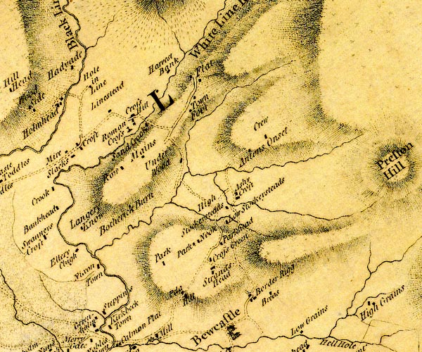
D4NY57NE.jpg Antonstown Burn -- river -- NY5677 -- single or double wiggly line; a river Antonstown -- building/s (ruins) -- NY57267769 (?) -- 'Antons Onset' -- block or blocks, labelled in lowercase; a hamlet or just a house probably Ashycroft -- building/s -- NY56727698 -- 'Ashy Croft' -- block or blocks, labelled in lowercase; a hamlet or just a house Bothrigg Burn -- river -- NY5576 -- 'Botherick Burn' -- single or double wiggly line; a river Crew -- building/s -- NY56817800 -- 'Crew' -- block or blocks, labelled in lowercase; a hamlet or just a house Croft -- building/s -- NY54317784 -- 'Croft' -- block or blocks, labelled in lowercase; a hamlet or just a house Crossgreens -- building/s -- NY56207577 -- 'Cross Green' -- block or blocks, labelled in lowercase; a hamlet or just a house Crosshill -- building/s -- NY55187816 -- 'Cross Hill' -- block or blocks, labelled in lowercase; a hamlet or just a house Ellery Cleugh -- building/s -- NY54437588 -- 'Ellery Clugh' -- block or blocks, labelled in lowercase; a hamlet or just a house Flatt, The -- locality -- NY56107862 -- 'Flat' -- block or blocks, labelled in lowercase; a hamlet or just a house Hadyaud -- building/s -- NY54217885 -- 'Hadyade' -- block or blocks, labelled in lowercase; a hamlet or just a house High Onset -- building/s -- NY55437859 -- 'Harvest Bank' -- block or blocks, labelled in lowercase; a hamlet or just a house probably Hole of Lyne -- building/s -- NY54437865 -- 'Hole in Line' -- block or blocks, labelled in lowercase; a hamlet or just a house Low Town -- building/s -- NY56467653 -- 'Low Stockeysteads' -- block or blocks, labelled in lowercase; a hamlet or just a house possibly Lynestead -- building/s -- NY54697843 -- 'Linestead' -- block or blocks, labelled in lowercase; a hamlet or just a house or locality Mains -- building/s -- NY55257773 -- 'Mains' -- block or blocks, labelled in lowercase; a hamlet or just a house Nixonstown -- building/s -- NY54707551 -- 'Nixon Town' -- block or blocks, labelled in lowercase; a hamlet or just a house Park -- building/s -- NY55127579 -- 'Park' -- block or blocks, labelled in lowercase; a hamlet or just a house Parkhead -- building/s -- NY56427627 -- 'Parkhead' -- block or blocks, labelled in lowercase; a hamlet or just a house Parknook -- building/s -- NY560763 -- 'Park Nook' -- block or blocks, labelled in lowercase; a hamlet or just a house Peel O'Hill -- building/s -- NY55897530 -- 'Pela Hill' -- block or blocks, labelled in lowercase; a hamlet or just a house Raw -- building/s -- NY550776 -- 'Row' -- block or blocks, labelled in lowercase; a hamlet or just a house Rawney -- area -- NY549762 -- 'Langery Know' -- block or blocks, labelled in lowercase; a hamlet or just a house possibly roman cross, Bewcastle -- cross (?) -- roman cross (?) -- NY550779 (guess) -- 'Roman Cross' -- cross Sandcrook -- building/s -- NY55317822 -- 'Sand Crook' -- block or blocks, labelled in lowercase; a hamlet or just a house Steppings -- building/s -- NY54377494 -- 'Steppings' -- block or blocks, labelled in lowercase; a hamlet or just a house Stockastead -- building/s -- NY56587679 -- 'High Stockeysteads' -- block or blocks, labelled in lowercase; a hamlet or just a house Strands Head -- building/s -- NY562756 (guess) -- 'Strands Head' -- block or blocks, labelled in lowercase; a hamlet or just a house Town Foot -- building/s -- NY55957838 -- 'Town Foot' -- block or blocks, labelled in lowercase; a hamlet or just a house Underwood -- building/s -- NY55827776 -- 'Under Wood' -- block or blocks, labelled in lowercase; a hamlet or just a house White Lyne -- river -- NY4973 (etc) -- 'White Line River' -- 'White Line River' -- meeting the Black Lyne -- single or double wiggly line; a river | ||
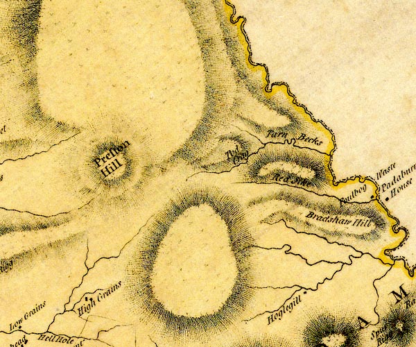
D4NY67NW.jpg Bewcastle Fells -- hill -- fell -- NY5681 -- 'Preston Hill' -- hill hachuring; a hill or mountain Breakshaw Hill -- hill -- NY63357755 (etc) -- 'Bradshaw Hill' -- hill hachuring; a hill or mountain High Grains -- building/s -- NY58787538 -- 'High Grains' -- block or blocks, labelled in lowercase; a hamlet or just a house Potsloan -- building/s -- NY63297606 -- 'Hoglegill' -- block or blocks, labelled in lowercase; a hamlet or just a house possibly Red Sike -- river -- NY6377 (etc) -- 'Red Sike' -- single or double wiggly line; a river Tarn Beck -- river -- boundary -- parish boundary -- NY5178 (etc) -- 'Tarn Becks' -- single or double wiggly line; a river Tod Crag -- rocks -- NY60797809 (etc) -- 'Tod Crag' -- hill hachuring; a hill or mountain probably | ||
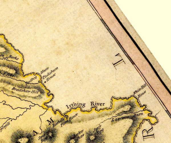
D4NY67NE.jpg Foulbog Sike -- river -- NY6376 (etc) -- single or double wiggly line; a river Foulbog Waste -- locality -- NY637781 (etc) -- 'Foulbog Waste' -- locality Irthing, River -- river -- boundary -- parish boundary -- county boundary -- NY4758 (etc etc) -- 'Irthing River' -- 'Irthing River' -- single or double wiggly line; a river and county boundary Lawrence Burn -- river -- NY6876 (etc) -- 'Lawrence Burn' -- single or double wiggly line; a river Paddaburn -- building/s -- NY64017769 -- 'Padaburn House' -- block or blocks, labelled in lowercase; a hamlet or just a house Whitehill -- building/s -- NY68007751 -- 'White Hill House' -- no symbol Wreayhill House -- building/s -- NY65017640 -- 'Raehills Farm House' -- block or blocks, labelled in lowercase; a hamlet or just a house | ||
D4NY77NW.jpg | ||
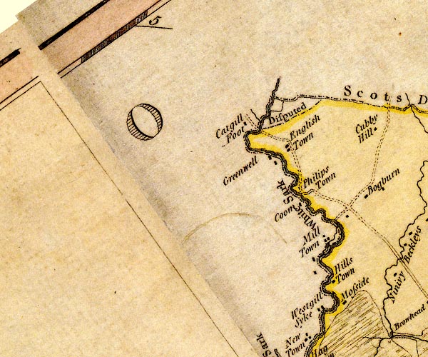
D4NY37SW.jpg Cadgillfoot -- building/s -- NY32767351 -- 'Catgill Foot' -- block or blocks, labelled in lowercase; a hamlet or just a house Coom -- building/s (site) -- NY337724 (roughly) -- 'Coom' -- block or blocks, labelled in lowercase; a hamlet or just a house Corries Mill Bridge -- bridge -- national boundary -- NY34517182 -- road crossing the White Sark at Mill Town Corries Mill -- building/s -- NY34257166 -- 'Mill Town' -- block or blocks, labelled in lowercase; a hamlet or just a house; and circle with rays, mill wheel Debatable Land -- area -- NY37 -- 'Disputed' -- disputed area between Scotland and Cumberland Englishtown -- building/s -- NY335731 -- 'English Town' -- block or blocks, labelled in lowercase; a hamlet or just a house Greenwrae -- building/s -- NY32647294 -- 'Greenwell' -- block or blocks, labelled in lowercase; a hamlet or just a house Hillstown -- building/s -- NY341710 (?) -- 'Hills Town' -- block or blocks, labelled in lowercase; a hamlet or just a house Moss Side -- building/s -- NY34377081 -- 'Mosside' -- block or blocks, labelled in lowercase; a hamlet or just a house Philipstown -- locality (?) -- NY338724 (guess) -- 'Philips Town' -- no symbol Sark, River -- river -- boundary -- national boundary -- county boundary -- NY3372 (etc) -- 'White Sark' -- 'Sark River' -- single or double wiggly line; a river and county boundary -- single or double wiggly line; a river and national boundary Westgillsyke -- building/s -- NY33677037 -- 'Westgill Syke' -- block or blocks, labelled in lowercase; a hamlet or just a house | ||
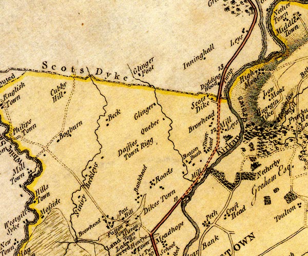
D4NY37SE.jpg Bank Head -- pele tower (?) -- NY368708 (?) -- 'Bankhead' -- block or blocks, labelled in lowercase; a hamlet or just a house Batenbush -- building/s -- NY37817150 -- 'Beaton Bush' -- block or blocks, labelled in lowercase; a hamlet or just a house Beck -- building/s -- NY36007263 -- 'Beck' -- block or blocks, labelled in lowercase; a hamlet or just a house Becklees -- building/s -- NY35517150 -- 'Beckleys' -- block or blocks, labelled in lowercase; a hamlet or just a house Bogburn -- locality -- building/s -- NY34827235 -- 'Bogburn' -- block or blocks, labelled in lowercase; a hamlet or just a house Browhead -- building/s -- NY36257022 (?) -- 'Browhead' -- block or blocks, labelled in lowercase; a hamlet or just a house Crofthead -- building/s -- NY38617048 -- 'Croft Head' -- block or blocks, labelled in lowercase; a hamlet or just a house Cubbyhill -- building/s -- NY35067337 -- 'Cubby Hill' -- block or blocks, labelled in lowercase; a hamlet or just a house Daffiestonrigg -- building/s -- NY36867230 -- 'Daffies Town Rigg' -- block or blocks, labelled in lowercase; a hamlet or just a house Esk, River -- river -- boundary -- county boundary -- parish boundary -- NY3666 (etc) -- 'Esk River' -- 'Esk River' -- single or double wiggly line; a river and national boundary with Scotland Glenzierfoot -- building/s -- NY36717376 -- 'Glinger Foot' -- block or blocks, labelled in lowercase; a hamlet or just a house Glinger Burn -- river -- NY3772 (etc) -- single or double wiggly line; a river Glingerburn -- building/s -- NY37307268 -- 'Glinger' -- block or blocks, labelled in lowercase; a hamlet or just a house Kirkandrews Tower -- building/s -- NY38877190 -- 'Kirkandrews' -- house mill, Kirkandrews -- mill -- water mill -- NY38497161 (guess) -- 'Mill' -- circle with rays, mill wheel; a water mill on the Esk Millees -- building/s -- NY38577269 -- 'Browhead' -- block or blocks, labelled in lowercase; a hamlet or just a house -- 'Mill Leys' -- block or blocks, labelled in lowercase; a hamlet or just a house Nineveh -- building/s -- NY35267082 -- 'Ninivy' -- block or blocks, labelled in lowercase; a hamlet or just a house Oakbank -- building/s -- locality -- NY36817025 -- 'Dikes Town' -- block or blocks, labelled in lowercase; a hamlet or just a house possibly Pattonstown -- building/s -- NY36447022 -- 'Patton Town' -- block or blocks, labelled in lowercase; a hamlet or just a house Peat Hill -- building/s -- NY36367026 (guess) -- 'Peat Hill' -- block or blocks, labelled in lowercase; a hamlet or just a house Peth -- building/s -- NY38137008 -- 'Peth' -- block or blocks, labelled in lowercase; a hamlet or just a house Quebec -- building/s -- NY376724 (guess) -- 'Quebec' -- block or blocks, labelled in lowercase; a hamlet or just a house Rhodds -- locality -- NY369714 (guess) -- 'Roads' -- block or blocks, labelled in lowercase; a hamlet or just a house Longtown to Edinburgh -- road -- route etc -- NY36 -- 'To Edinburgh' -- double line, solid or dotted, with a dot or milestone and number at 1 mile intervals, tinted red; turnpike road -- into Scotland at Scots Dike Scots Dike Turn Pike -- toll gate (site) -- NY38767326 -- 'Turnp.' -- marking a toll gate Scotsdike -- building/s -- NY3872 -- 'Scots Dike' -- block or blocks, labelled in lowercase; a hamlet or just a house Scots' Dike -- boundary -- national boundary -- NY3573 (etc) -- 'Scots Dyke' -- national boundary, with Scotland Tinnishall -- building/s -- NY38577483 -- 'Inninghall' -- block or blocks, labelled in lowercase; a hamlet or just a house probably Todhillwood -- building/s -- NY38647368 -- 'Dodding Wood' -- block or blocks, labelled in lowercase; a hamlet or just a house probably Townhead -- building/s -- NY38437203 (guess) -- 'Townhead' -- block or blocks, labelled in lowercase; a hamlet or just a house Woodhouselees -- building/s -- NY39447489 -- 'Leys' -- block or blocks, labelled in lowercase; a hamlet or just a house probably | ||
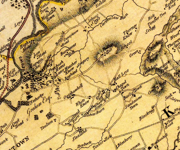
D4NY47SW.jpg Arthurs Cross, Nicholforest -- building/s -- NY42877474 (guess) -- 'Athurs Cross' -- block or blocks, labelled in lowercase; a hamlet or just a house Baileytown -- building/s -- NY43927139 -- 'Bailie Town' -- block or blocks, labelled in lowercase; a hamlet or just a house Bellfield -- building/s -- NY40817333 -- 'Bellsfield' -- locality Boghead -- building/s -- NY41277228 (guess) -- 'Boghead' -- block or blocks, labelled in lowercase; a hamlet or just a house Bruntons Hill -- building/s -- NY41147309 -- 'Burnstone Hill' -- block or blocks, labelled in lowercase; a hamlet or just a house Carwinley Burn -- river -- boundary -- parish boundary -- NY4173 (etc) -- 'Carwenlaw Burn' -- single or double wiggly line; a river Carwinley Mill -- building/s -- NY40347292 -- 'Carwen Law Mill' -- circle with rays, mill wheel; a water mill on Carwenlaw Burn Chapeltown -- building/s -- NY43357164 -- 'Chapel Town' -- block or blocks, labelled in lowercase; a hamlet or just a house Corrylees -- building/s -- NY445725 (guess) -- 'Corie Leys' -- block or blocks, labelled in lowercase; a hamlet or just a house Dashwellgreen -- building/s -- NY42577094 -- 'Dashwood Green' -- block or blocks, labelled in lowercase; a hamlet or just a house Draughtsike -- building/s -- NY43797378 -- 'School' -- block, presumably a school possibly Friar's Bush -- wood -- NY40267221 (etc) -- 'Frierbush' -- block or blocks, labelled in lowercase; a hamlet or just a house possibly Green -- building/s -- NY44087337 -- 'Green' -- block or blocks, labelled in lowercase; a hamlet or just a house Gregory -- building/s -- NY41477274 (guess) -- 'Gregory' -- block or blocks, labelled in lowercase; a hamlet or just a house Hallees -- building/s -- NY432721 -- 'Hall Leys' -- block or blocks, labelled in lowercase; a hamlet or just a house Hams Lane -- building/s -- NY40597251 (guess) -- 'Hams Lane' -- block or blocks, labelled in lowercase; a hamlet or just a house Heatheryknowe -- building/s -- NY40947259 -- 'Heather Know' -- block or blocks, labelled in lowercase; a hamlet or just a house Highmoat -- building/s -- NY39697378 -- 'High Moat' -- block or blocks, labelled in lowercase; a hamlet or just a house Hobbies Burn -- building/s -- NY42277119 -- 'Hobies Burn' -- block or blocks, labelled in lowercase; a hamlet or just a house Huggin Sike -- building/s -- NY39797304 (guess) -- 'Huggin Sike' -- block or blocks, labelled in lowercase; a hamlet or just a house Laws Hall -- building/s -- NY42167153 -- 'White Know' -- block or blocks, labelled in lowercase; a hamlet or just a house possibly Liddel Strength -- earthwork -- castle -- motte and bailey -- NY40177416 ? -- rectangular outline probably Liddel Water -- river -- boundary -- national boundary -- county boundary -- NY4377 (etc) -- 'Liddel River' -- single or double wiggly line; a river and national boundary Lowmoat -- building/s -- NY39777330 -- 'Low Moat' -- block or blocks, labelled in lowercase; a hamlet or just a house Midtown -- building/s -- NY43127184 -- 'Middle Town' -- block or blocks, labelled in lowercase; a hamlet or just a house Nether Town -- building/s -- NY42637199 (guess) -- 'Nether Town' -- block or blocks, labelled in lowercase; a hamlet or just a house Netherby -- building/s -- park -- NY39667161 -- 'Netherby / Graham Esq.' -- house Oakshaw Hill -- building/s -- NY41227128 -- 'Oakshawhill' -- block or blocks, labelled in lowercase; a hamlet or just a house Pedderhill -- building/s -- NY42787333 -- 'Ped[l ] Hill' -- block or blocks, labelled in lowercase; a hamlet or just a house Saundersbush -- building/s (ruins?) -- NY43737104 -- 'Sandersons Town' -- block or blocks, labelled in lowercase; a hamlet or just a house probably Slealands -- building/s -- NY41897013 -- 'Slealand' -- block or blocks, labelled in lowercase; a hamlet or just a house Slealandsburn -- building/s -- NY41547033 -- 'Slealand Burn' -- block or blocks, labelled in lowercase; a hamlet or just a house Sunnyrigg -- building/s -- NY41757371 -- 'Sunnyknow Head' -- block or blocks, labelled in lowercase; a hamlet or just a house probably Thornyknowe -- building/s -- NY44077428 -- 'Thorney Know' -- block or blocks, labelled in lowercase; a hamlet or just a house Toulton -- building/s -- NY40937058 (guess) -- 'Toulton' -- block or blocks, labelled in lowercase; a hamlet or just a house | ||
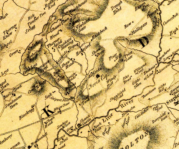
D4NY47SE.jpg Birchtimber Hill -- building/s -- NY44727471 -- 'Birk Timber Tree' -- block or blocks, labelled in lowercase; a hamlet or just a house Blackrigg -- building/s -- NY44697097 -- 'Blackrigg' -- block or blocks, labelled in lowercase; a hamlet or just a house Cays House -- building/s -- NY49287095 -- 'Cais House' -- block or blocks, labelled in lowercase; a hamlet or just a house Cleugh Head -- building/s -- NY44917049 -- 'Clugh Head' -- block or blocks, labelled in lowercase; a hamlet or just a house Cowrigg -- building/s -- NY44877175 -- 'Cow Rigg' -- block or blocks, labelled in lowercase; a hamlet or just a house Friar Hill Gate -- building/s -- NY48357313 -- 'Frier Gate' -- block or blocks, labelled in lowercase; a hamlet or just a house Friar Hill -- building/s -- NY48107311 -- 'Frier Hill' -- block or blocks, labelled in lowercase; a hamlet or just a house Gateside -- building/s -- NY46577311 -- 'Gateside' -- block or blocks, labelled in lowercase; a hamlet or just a house Gibstown -- building/s -- NY48907203 -- 'Gibbs Town' -- block or blocks, labelled in lowercase; a hamlet or just a house Greenswang -- building/s -- NY45967059 (guess) -- 'Green Swang' -- block or blocks, labelled in lowercase; a hamlet or just a house Haggbeck -- locality -- building/s -- NY47437388 -- 'Hackbeck' -- block or blocks, labelled in lowercase; a hamlet or just a house Halls Oven -- building/s -- NY46917319 -- 'Shaw Oven' -- block or blocks, labelled in lowercase; a hamlet or just a house probably Hallsford -- building/s -- NY475730 -- 'Hallsford' -- block or blocks, labelled in lowercase; a hamlet or just a house Hemplands -- building/s -- NY45237221 -- 'Hampton Ford' -- block or blocks, labelled in lowercase; a hamlet or just a house Hewstown -- building/s -- NY48017042 -- 'Hews Town' -- block or blocks, labelled in lowercase; a hamlet or just a house Hill Head -- building/s -- NY46267462 (guess) -- 'Hill Head' -- block or blocks, labelled in lowercase; a hamlet or just a house Hope's House -- building/s -- NY46507397 -- 'Hopes' -- block or blocks, labelled in lowercase; a hamlet or just a house probably Jenkinstown -- building/s -- NY46057159 -- 'Jinkins Town' -- block or blocks, labelled in lowercase; a hamlet or just a house Kirk Burn -- river -- NY4971 (etc) -- single or double wiggly line; a river running into the Line at Millholm Lyne, River -- river -- boundary -- parish boundary etc -- NY3765 (etc)Lyne, River -- river -- boundary -- parish boundary etc -- NY3765 (etc) -- 'Line River' -- single or double wiggly line; a river into the Esk Mallsgate -- building/s -- NY486741 -- 'Mallsgate' -- block or blocks, labelled in lowercase; a hamlet or just a house Solport Meeting House -- meeting house -- quaker meeting -- burial ground -- quaker burial ground -- NY45797389 -- 'Quakers Meeting' -- at Thorneyland Millholme -- building/s -- NY48687085 -- 'Millholm' -- block or blocks, labelled in lowercase; a hamlet or just a house Moss Side -- building/s -- NY47687248 -- 'Mosside / Irvin Esq.' -- house Netherhirst -- building/s -- NY44887322 -- 'Nether hirst' -- block or blocks, labelled in lowercase; a hamlet or just a house New House -- building/s -- NY46287431 -- 'Newland Gate' -- block or blocks, labelled in lowercase; a hamlet or just a house Owlethirst -- building/s -- NY45427354 -- 'Owlethirst' -- block or blocks, labelled in lowercase; a hamlet or just a house Pallyards -- building/s -- NY46947124 -- 'Raul Yard' -- block or blocks, labelled in lowercase; a hamlet or just a house Park Rigg -- building/s -- NY46107226 -- 'Park Rigg' -- block or blocks, labelled in lowercase; a hamlet or just a house Rack Bridge -- bridge -- NY47537071 -- double line across a river; a bridge over the Line Rack Gate -- building/s -- NY47377019 -- 'Rack Gate' -- block or blocks, labelled in lowercase; a hamlet or just a house Rae Burn -- river -- boundary -- parish boundary -- NY4571 & NY4675 (etc) -- single or double wiggly line; a river running into the Line at Shanks Castle Row Farm, The -- building/s -- NY48627464 -- 'Row' -- block or blocks, labelled in lowercase; a hamlet or just a house Roweltown -- building/s -- NY49437161 -- 'Roweltown' -- block or blocks, labelled in lowercase; a hamlet or just a house Scugg -- building/s -- NY44577443 -- 'Scogg' -- block or blocks, labelled in lowercase; a hamlet or just a house Shank Castle -- castle -- pele tower (?) -- NY46937043 -- 'Shank Castle' -- large building; a castle Shankfieldhead -- building/s -- NY48167142 -- 'Shankfield Head' -- block or blocks, labelled in lowercase; a hamlet or just a house Shaw Head -- building/s -- NY46607289 -- 'Shaw Head' -- block or blocks, labelled in lowercase; a hamlet or just a house Shawstown -- building/s -- NY46057470 -- 'Shaws Town' -- block or blocks, labelled in lowercase; a hamlet or just a house Sink -- building/s -- NY45457145 (guess) -- 'Sink' -- block or blocks, labelled in lowercase; a hamlet or just a house Smithsteads -- building/s -- NY46957233 -- 'Smithsteads' -- block or blocks, labelled in lowercase; a hamlet or just a house Solport Mill -- water mill -- mill -- corn mill -- NY46587141 (?) -- 'Solport Mill' -- circle with rays, mill wheel; a water mill Soutermoor -- building/s -- NY48817111 -- 'Souter Moor' -- locality Sykehead -- building/s -- NY48767245 -- 'Sike Head' -- block or blocks, labelled in lowercase; a hamlet or just a house Thornyland -- building/s -- NY45747379 -- 'Thorneyland' -- block or blocks, labelled in lowercase; a hamlet or just a house Whiteclose -- building/s -- NY46767089 -- 'White Close' -- block or blocks, labelled in lowercase; a hamlet or just a house Whitecloserigg -- building/s -- NY45627079 -- 'Sowhite Close' -- block or blocks, labelled in lowercase; a hamlet or just a house possibly Willisons Croft -- building/s -- NY489726 (guess) -- 'Willisons Croft' -- block or blocks, labelled in lowercase; a hamlet or just a house Windyhill -- building/s -- NY48107223 -- 'Windy Hill' -- block or blocks, labelled in lowercase; a hamlet or just a house Wood, Solport -- building/s -- NY46007428 -- 'Wood' -- block or blocks, labelled in lowercase; a hamlet or just a house | ||
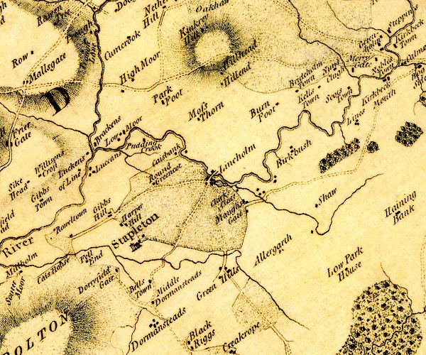
D4NY57SW.jpg Allergarth -- building/s -- NY52997141 -- 'Allergarth' -- block or blocks, labelled in lowercase; a hamlet or just a house Birch Bush -- building/s -- NY53117302 -- 'Birkbush' -- block or blocks, labelled in lowercase; a hamlet or just a house Black Lyne -- river -- NY5075 -- 'Black Line River' -- single or double wiggly line; a river -- meeting the White Lyne Breckons -- building/s -- NY49677311 -- 'Brackens' -- block or blocks, labelled in lowercase; a hamlet or just a house Brideholm Town -- building/s -- NY534742 (guess) -- 'Brideholm Town' -- block or blocks, labelled in lowercase; a hamlet or just a house Burn Foot -- building/s -- NY52897375 (guess) -- 'Burn Foot' -- block or blocks, labelled in lowercase; a hamlet or just a house possibly Clark's Close -- building/s -- NY52007228 (guess) -- 'Clark's Close' -- block or blocks, labelled in lowercase; a hamlet or just a house Crook Bridge -- bridge -- NY51667252 -- double line across a river; a bridge at Lineholm Cumcrook -- building/s -- NY50317499 ? -- 'Cumcrook' -- block or blocks, labelled in lowercase; a hamlet or just a house Dorryfield -- building/s -- NY50087062 -- 'Dorryfield Gate' -- block or blocks, labelled in lowercase; a hamlet or just a house Fellend -- building/s -- NY49717078 -- 'Fell End' -- block or blocks, labelled in lowercase; a hamlet or just a house Gibshill -- building/s -- post office (ex) -- NY49827184 -- 'Gibbs Hill' -- block or blocks, labelled in lowercase; a hamlet or just a house Harperhill -- building/s -- NY50117166 -- 'Harper Hill' -- block or blocks, labelled in lowercase; a hamlet or just a house High Dappleymoor -- building/s -- NY50427410 -- 'High Moor' -- block or blocks, labelled in lowercase; a hamlet or just a house possibly High Luckens -- building/s -- NY50037237 -- 'Luccans' -- block or blocks, labelled in lowercase; a hamlet or just a house High Mossthorn -- building/s -- NY51497344 ? ? -- 'Moss Thorn' -- block or blocks, labelled in lowercase; a hamlet or just a house possibly High Parkfoot -- building/s -- NY50887366 -- 'Park Foot' -- block or blocks, labelled in lowercase; a hamlet or just a house Hillend -- building/s -- NY52217418 -- 'Hillend' -- block or blocks, labelled in lowercase; a hamlet or just a house Hillhead -- building/s -- NY523744 (guess) -- 'Hillhead' -- block or blocks, labelled in lowercase; a hamlet or just a house Kaysbank -- building/s -- NY510728 -- 'Caisbank' -- block or blocks, labelled in lowercase; a hamlet or just a house Kilnstown -- building/s -- NY53527416 -- 'Kells Town' -- block or blocks, labelled in lowercase; a hamlet or just a house Low Dappleymoor -- building/s -- NY50297399 -- 'Low Moor' -- block or blocks, labelled in lowercase; a hamlet or just a house probably Low Luckens -- building/s -- NY49357265 -- 'Luckens of Line' -- block or blocks, labelled in lowercase; a hamlet or just a house Low Mossthorn -- building/s -- NY51557298 -- 'Moss Thorn' -- block or blocks, labelled in lowercase; a hamlet or just a house possibly Low Park House -- building/s -- NY540713 (guess) -- 'Low Park House' -- block or blocks, labelled in lowercase; a hamlet or just a house Lynecrook -- building/s -- NY50427315 -- 'Pudding Crook' -- block or blocks, labelled in lowercase; a hamlet or just a house Lyneholme -- building/s -- NY51927265 -- 'Lineholm' -- block or blocks, labelled in lowercase; a hamlet or just a house Mewsgate -- building/s -- NY52257202 -- 'Maughs Gate' -- block or blocks, labelled in lowercase; a hamlet or just a house probably mill, Lyneholmeford -- water mill -- mill -- corn mill -- NY51627246 -- circle with rays, mill wheel; a water mill at Lineholm Mirygate -- building/s -- NY54537465 -- 'Merry Gate' -- block or blocks, labelled in lowercase; a hamlet or just a house presumably North Greenhill -- building/s -- NY51837106 -- 'Green Hills' -- block or blocks, labelled in lowercase; a hamlet or just a house possibly Nunscleugh -- building/s -- NY53867419 -- 'Nuns Clugh' -- block or blocks, labelled in lowercase; a hamlet or just a house Old Town -- building/s -- NY50867039 -- 'Bells Town' -- block or blocks, labelled in lowercase; a hamlet or just a house possibly Pattieshill -- building/s -- NY50887025 -- 'Middle Dormansteads' -- block or blocks, labelled in lowercase; a hamlet or just a house probably Rough Sike -- river -- NY5374 (etc) -- single or double wiggly line; a river into the White Lyne near Scots Town Round Greencot -- building/s -- NY50377220 (guess) -- 'Round Greencot' -- block or blocks, labelled in lowercase; a hamlet or just a house Scotstown -- building/s -- NY53977434 -- 'Scots Town' -- block or blocks, labelled in lowercase; a hamlet or just a house Show Burn -- river -- NY5472 (etc) -- single or double wiggly line; a river into the White Lyne Show, The -- locality -- building/s (?) -- NY53597203 (etc) -- 'Shaw' -- block or blocks, labelled in lowercase; a hamlet or just a house probably Stapleton -- building/s -- NY50507132 (etc) -- 'Stapleton' -- blocks, and usually a church, labelled in upright lowercase; a village Troughfoot -- building/s -- NY490745 -- 'Trough Lane' -- block or blocks, labelled in lowercase; a hamlet or just a house probably White Lyne -- river -- NY4973 (etc) -- 'White Line River' -- 'White Line River' -- meeting the Black Lyne -- single or double wiggly line; a river | ||
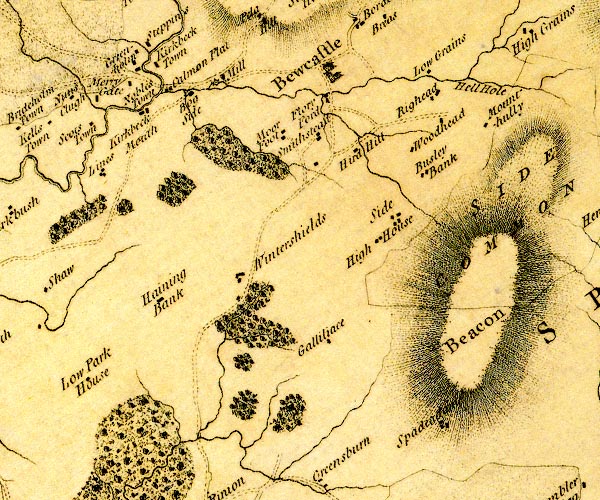
D4NY57SE.jpg Bew Castle -- castle -- NY56567468 -- 'Bewcastle' -- large building; a castle Bewcastle Mill -- water mill -- mill -- corn mill -- NY55377444 -- 'Mill' -- circle with rays, mill wheel; a water mill on the Kirk Beck Bewcastle -- locality -- building/s etc -- NY56547462 (etc) -- 'Bewcastle' -- blocks, and usually a church, labelled in upright lowercase; a village Bogside -- building/s -- NY55207434 -- 'Bog Side' -- block or blocks, labelled in lowercase; a hamlet or just a house Bushley Bank -- building/s -- NY57867358 -- 'Busley Bank' -- block or blocks, labelled in lowercase; a hamlet or just a house Common Flatt -- building/s -- NY54997450 -- 'Calmon Flat' -- block or blocks, labelled in lowercase; a hamlet or just a house Elliotstown -- building/s -- NY54657423 -- 'Kirkbeck Mouth' -- block or blocks, labelled in lowercase; a hamlet or just a house possibly Gillalees Beacon -- hill -- beacon -- NY57307184 -- 'Beacon' -- hill hachuring; a hill or mountain Gillalees -- building/s -- NY56967125 -- 'Galliliace' -- block or blocks, labelled in lowercase; a hamlet or just a house Greenholme -- building/s -- NY54437475 -- 'Greenholm' -- block or blocks, labelled in lowercase; a hamlet or just a house Hennan Bank -- building/s -- NY54667204 -- 'Haining Bank' -- block or blocks, labelled in lowercase; a hamlet or just a house Hennel Cleugh -- locality -- NY58267504 (etc) -- 'Hell Hole' -- locality probably Herd Hill -- locality -- hill (?) -- NY57057350 (etc) -- 'Hird Hill' -- block or blocks, labelled in lowercase; a hamlet or just a house High House -- building/s -- NY57237281 -- 'High House' -- block or blocks, labelled in lowercase; a hamlet or just a house Kirk Beck -- river -- boundary -- parish boundary -- NY5774 (etc) -- single or double wiggly line; a river into the White Lyne Kirkbeckstown -- building/s -- NY547747 -- 'Kirkbeck Town' -- block or blocks, labelled in lowercase; a hamlet or just a house Low Grains -- building/s -- NY57617512 -- 'Low Grains' -- block or blocks, labelled in lowercase; a hamlet or just a house Lynes -- building/s -- NY54247340 -- 'Lines' -- block or blocks, labelled in lowercase; a hamlet or just a house Mollen Wood -- wood -- NY56107092 (etc) -- tree and bush symbols; woodland Moorfoot -- locality -- NY55857394 (etc) -- 'Moor Foot' -- block or blocks, labelled in lowercase; a hamlet or just a house Mount Hulie -- locality -- building/s (remains) -- NY58467438 -- 'Mounthully' -- block or blocks, labelled in lowercase; a hamlet or just a house Noblestown -- building/s -- NY54397456 -- 'Nobles Town' -- block or blocks, labelled in lowercase; a hamlet or just a house Rigghead -- building/s -- NY57737463 -- 'Righead' -- block or blocks, labelled in lowercase; a hamlet or just a house Shopford -- locality -- building/s -- NY56517446 (etc) -- 'Flory Ford' -- block or blocks, labelled in lowercase; a hamlet or just a house Side Fell -- hill -- fell -- NY59097319 (etc etc) -- 'Side Common' -- area with a boundary Side -- building/s -- NY57587306 -- 'Side' -- block or blocks, labelled in lowercase; a hamlet or just a house Smithsteads -- building/s -- NY56467387 -- 'Smithstead' -- block or blocks, labelled in lowercase; a hamlet or just a house Spadeadam -- building/s -- NY585706 -- 'Spadeadam' -- block or blocks, labelled in lowercase; a hamlet or just a house Winter Shields -- building/s -- NY55687232 -- 'Wintershields' -- block or blocks, labelled in lowercase; a hamlet or just a house Woodhead -- building/s -- NY57707395 -- 'Woodhead' -- block or blocks, labelled in lowercase; a hamlet or just a house | ||
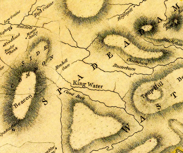
D4NY67SW.jpg Butter Burn -- river -- NY6674 -- 'Butterburn' -- single or double wiggly line; a river Caud Beck -- river -- NY6172 (etc) -- 'Cawd Beck' -- single or double wiggly line; a river into King Water Cheese Burn -- river -- NY6273 (etc) -- 'Cheeseburn' -- single or double wiggly line; a river Hen Hill -- hill -- boundary mark -- parish boundary mark -- NY601731 -- 'Henhill Gate' -- locality perhaps King Water -- river -- boundary -- parish boundary -- NY5466 (etc etc) -- 'King Water' -- 'King Water' -- 'King Water' -- single or double wiggly line; a river Side Fell -- hill -- fell -- NY59097319 (etc etc) -- 'Side Common' -- area with a boundary Spadeadam Forest -- forest -- NY6272 (etc etc)Spadeadam Forest -- forest -- NY6272 (etc etc) -- 'SPADEADAM WASTE' -- locality Toup Hill -- hill -- NY63877235 (etc) -- 'Toup Hill' -- hill hachuring; a hill or mountain | ||
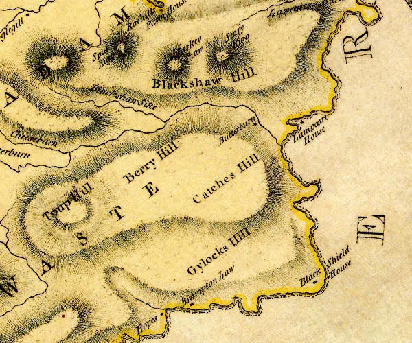
D4NY67SE.jpg Berry Hill -- hill -- NY64617305 (etc) -- 'Berry Hill' -- hill hachuring; a hill or mountain Black Shield House -- building/s -- NY69067181 (guess) -- 'Black Shield House' -- block or blocks, labelled in lowercase; a hamlet or just a house Blackshaws Hill -- hill -- NY63577491 -- 'Blackshaw Hill' -- hill hachuring; a hill or mountain Blackshaws Sike -- river -- NY6474 -- 'Blackshaw Sike' -- single or double wiggly line; a river Butterburn -- building/s -- NY67677435 -- 'Butterburn' -- block or blocks, labelled in lowercase; a hamlet or just a house Deer Hill -- hill -- NY67167320 (etc) -- 'Catches Hill' -- hill hachuring; a hill or mountain possibly Gavelock Hill -- hill -- NY68757226 (etc) -- 'Gylocks Hill' -- hill hachuring; a hill or mountain Hart Horn -- locality -- hill -- NY64407520 (etc)' -- 'Seafy Rigg' -- hill hachuring; a hill or mountain possibly Horseholme -- building/s -- NY66807106 -- 'Brampton Law' -- block or blocks, labelled in lowercase; a hamlet or just a house possibly Irthing, River -- river -- boundary -- parish boundary -- county boundary -- NY4758 (etc etc) -- 'Irthing River' -- 'Irthing River' -- single or double wiggly line; a river and county boundary Lampert -- building/s -- NY68217451 -- 'Lampeart House' -- block or blocks, labelled in lowercase; a hamlet or just a house Little Hen Hill -- hill -- NY625752 -- 'Berkey Shaw' -- hill hachuring; a hill or mountain possibly Spadeadam Forest -- forest -- NY6272 (etc etc)Spadeadam Forest -- forest -- NY6272 (etc etc) -- 'SPADEADAM WASTE' -- locality Spur Rigg -- locality -- NY64287578 (etc) -- 'Spur Rigg' -- hill hachuring; a hill or mountain | ||
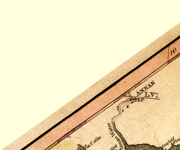
D4NY16NE.jpg Annan Bridge -- bridge -- NY19176655 (?) -- double line across a river; a bridge over Annan Water Annan -- building/s -- NY193666 -- 'ANNAN' -- blocks, perhaps a church, labelled in block caps; a town | ||
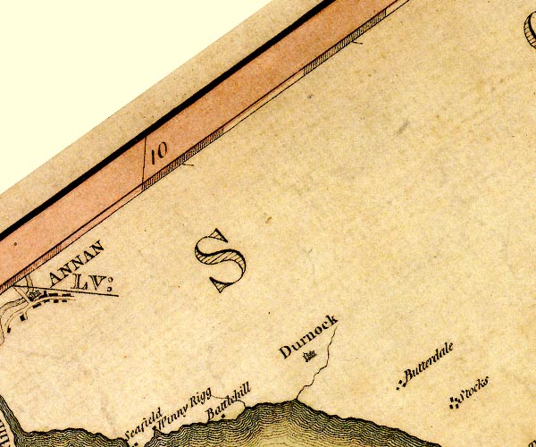
D4NY26NW.jpg Butterdales Holdings -- building/s -- NY24216568 -- 'Butterdale' -- block or blocks, labelled in lowercase; a hamlet or just a house Dornock -- building/s -- NY23396602 (etc) -- 'Durnock' -- blocks, and usually a church, labelled in upright lowercase; a village | ||
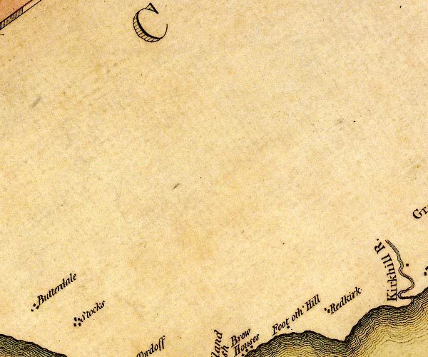
D4NY26NE.jpg Redkirk -- building/s -- NY300659 -- 'Redkirk' -- block or blocks, labelled in lowercase; a hamlet or just a house Wylies -- building/s -- NY250653 (guess) -- 'Stocks' -- block or blocks, labelled in lowercase; a hamlet or just a house possibly | ||
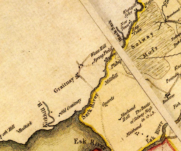
D4NY36NW.jpg Barrow -- building/s -- NY33056821 -- 'Barrow' -- block or blocks, labelled in lowercase; a hamlet or just a house Battle of Solway Moss -- battle site -- NY3469 -- 'The Battle of Solway Moss in 1543.' -- battle site Black Sark -- river -- NY3269 (etc) -- 'Black Sark' -- single or double wiggly line; a river into the Sark Gretna -- building/s -- NY317670 -- 'Graitnay' -- blocks, and usually a church, labelled in upright lowercase; a village Guards Farm -- building/s -- NY33196674 -- 'Guards' -- block or blocks, labelled in lowercase; a hamlet or just a house Hag Town -- building/s -- NY33686965 (guess) -- 'Hag Town' -- block or blocks, labelled in lowercase; a hamlet or just a house Kirtle Water -- river -- NY2968 (etc etc) -- 'Kirkhill R.' -- single or double wiggly line; a river into the sea Millhill -- locality -- building/s -- NY33686761 (etc) -- 'Millhill' -- block or blocks, labelled in lowercase; a hamlet or just a house Mossband -- building/s -- locality -- NY3565 -- 'Mosband' -- block or blocks, labelled in lowercase; a hamlet or just a house Mossbandhall -- building/s -- NY34406547 -- 'Mosband Hall' -- block or blocks, labelled in lowercase; a hamlet or just a house New Town -- building/s -- NY33366970(guess) -- 'New Town' -- block or blocks, labelled in lowercase; a hamlet or just a house Old Graitney -- building/s -- NY31256651 -- 'Old Graitnay' -- block or blocks, labelled in lowercase; a hamlet or just a house Plump Bridge -- bridge -- NY33166801 -- road across a river; a bridge? over the Sark Plump -- building/s -- NY33376812 (etc) -- 'Plump' -- block or blocks, labelled in lowercase; a hamlet or just a house Sark Bridge -- bridge -- boundary -- NY327670 -- road across a river; a bridge? over the Sark Sark, River -- river -- boundary -- national boundary -- county boundary -- NY3372 (etc) -- 'White Sark' -- 'Sark River' -- single or double wiggly line; a river and county boundary -- single or double wiggly line; a river and national boundary Solway Moss -- moss -- peat moss -- NY3469 (etc) -- 'Solway Moss' -- moss Springfield -- locality -- building/s -- NY32546827 (etc) -- 'Spring Field' -- block or blocks, labelled in lowercase; a hamlet or just a house Watch Hill -- hill -- NY32746882 -- 'Watts Hill' -- locality possibly | ||
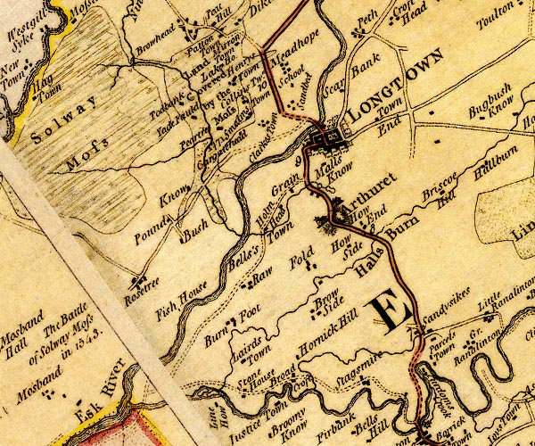
D4NY36NE.jpg Arthuret -- locality -- NY4069 (roughly) ? -- 'Arthuret' -- house and blocks and church for a village, labelled in upright lowercase text Beck Burn -- river -- NY3571 -- single or double wiggly line; a river into the Esk Bells's Town -- building/s -- NY37306743 (guess) -- 'Bells's Town' -- block or blocks, labelled in lowercase; a hamlet or just a house Brisco Hill -- building/s -- NY3967 -- 'Briscoe Hill' -- block or blocks, labelled in lowercase; a hamlet or just a house Broad Croft -- building/s -- NY37786531 (guess) -- 'Broad Croft' -- block or blocks, labelled in lowercase; a hamlet or just a house Burnfoot -- building/s -- NY36706625 -- 'Burn Foot' -- block or blocks, labelled in lowercase; a hamlet or just a house Bush on Esk -- building/s (gone) -- NY36056724 -- 'Bush' -- block or blocks, labelled in lowercase; a hamlet or just a house Cargate Head -- building/s -- NY36696866 (guess) -- 'Cargate Head' -- block or blocks, labelled in lowercase; a hamlet or just a house Clarkestown -- building/s -- NY36896871 )guess) -- 'Clarkes Town' -- block or blocks, labelled in lowercase; a hamlet or just a house Collinstown -- building/s -- NY36716926 (guess) -- 'Collins Twn.' -- block or blocks, labelled in lowercase; a hamlet or just a house Esk, River -- river -- boundary -- county boundary -- parish boundary -- NY3666 (etc) -- 'Esk River' -- 'Esk River' -- single or double wiggly line; a river and national boundary with Scotland Fauld Mill -- building/s -- mill (ex) -- water mill (ex) -- corn mill (ex) -- NY37886796 -- lake between Arthuret and Longtown Fauld, The -- building/s -- NY37696693 -- 'Fold' -- block or blocks, labelled in lowercase; a hamlet or just a house Fish House -- building/s -- NY35776608 (guess) -- 'Fish House' -- block or blocks, labelled in lowercase; a hamlet or just a house Gaitle Burn -- river -- NY3668 (etc) -- wiggly line; river into the Esk Grain -- building/s -- NY37706803 (guess) -- 'Grain' -- block or blocks, labelled in lowercase; a hamlet or just a house Hall Burn -- river -- NY4068 (etc) -- 'Halls Burn' -- single or double wiggly line; a river into the Lyne Henrystown -- building/s -- NY36606950 -- 'Henrys Town' -- block or blocks, labelled in lowercase; a hamlet or just a house Holme Head -- building/s -- NY37296749 (estimate) -- 'Holm Head' -- block or blocks, labelled in lowercase; a hamlet or just a house Hornickhill -- building/s -- NY37546574 -- 'Hornick Hill' -- block or blocks, labelled in lowercase; a hamlet or just a house How Side -- building/s -- NY38266723 (guess) -- 'How Side' -- block or blocks, labelled in lowercase; a hamlet or just a house Howend -- building/s -- NY38386752 -- 'How End' -- block or blocks, labelled in lowercase; a hamlet or just a house Know -- building/s -- NY36076809 (guess) -- 'Know' -- block or blocks, labelled in lowercase; a hamlet or just a house Lairds Town -- building/s -- NY36806576 (guess) -- 'Lairds Town' -- block or blocks, labelled in lowercase; a hamlet or just a house Lake House -- building/s -- NY36546976 (guess) -- 'Lake Ho.' -- block Longtown Bridge -- bridge -- NY37786888 -- double line across a river; a bridge over the Esk Longtown -- building/s etc -- NY37936868 -- 'LONGTOWN' -- blocks, perhaps a church, labelled in block caps; a town with street plan and garden plots Malls Know -- building/s -- NY38116840 (guess) -- 'Malls Know' -- block or blocks, labelled in lowercase; a hamlet or just a house Meadhope -- building/s -- NY37236969 (guess) -- 'Meadhope' -- block or blocks, labelled in lowercase; a hamlet or just a house Mirrenstown -- building/s -- NY36827012 (?) -- 'Mirron Town' -- block or blocks, labelled in lowercase; a hamlet or just a house Parcelstown -- building/s -- NY39486549 -- 'Parcels Town' -- block or blocks, labelled in lowercase; a hamlet or just a house Peartree -- building/s -- NY360697 (?) -- 'Peartree' -- block or blocks, labelled in lowercase; a hamlet or just a house Pound -- building/s -- NY35896741 -- 'Pound' -- block or blocks, labelled in lowercase; a hamlet or just a house Purdomscrook -- building/s -- NY39286530 -- 'Purdoms Crook' -- block or blocks, labelled in lowercase; a hamlet or just a house by a river bend! Raw -- building/s -- NY37206688 (guess) -- 'Raw' -- block or blocks, labelled in lowercase; a hamlet or just a house Carlisle to Longtown -- route -- NY35 -- double line, solid or dotted, with a dot or milestone and number at 1 mile intervals, tinted red; turnpike road -- from Scots Gate and over the Eden Longtown to Edinburgh -- road -- route etc -- NY36 -- 'To Edinburgh' -- double line, solid or dotted, with a dot or milestone and number at 1 mile intervals, tinted red; turnpike road -- into Scotland at Scots Dike Rosetrees -- building/s (gone) -- NY355667 -- 'Rosetree' -- block or blocks, labelled in lowercase; a hamlet or just a house Sandbed -- building/s -- NY37406921 -- 'Sandbed' -- block or blocks, labelled in lowercase; a hamlet or just a house Sandysike -- locality -- building/s -- NY39286585 -- 'Sandysikes' -- block or blocks, labelled in lowercase; a hamlet or just a house Scaurbank -- building/s -- NY38036931 -- 'Scar Bank' -- block or blocks, labelled in lowercase; a hamlet or just a house school, Meadhope -- school -- NY37306954 (guess) -- 'School' -- at Meadhope Smalmstown -- building/s -- NY36816895 -- 'Smalms Town' -- block or blocks, labelled in lowercase; a hamlet or just a house Solway Moss -- moss -- peat moss -- NY3469 (etc) -- 'Land Covered by the Moss 1771' -- area of moss Solway Moss -- moss -- peat moss -- NY3469 (etc) -- 'Solway Moss' -- moss Stagsmire -- building/s -- NY38486528 (guess) -- 'Stagsmire' -- block or blocks, labelled in lowercase; a hamlet or just a house Stone House -- building/s -- NY36936519 (about) -- 'Stone House' -- block or blocks, labelled in lowercase; a hamlet or just a house Todbank -- building/s -- NY35756921 (guess) -- 'Todbank' -- block or blocks, labelled in lowercase; a hamlet or just a house Townend -- building/s -- NY38536855 (guess) -- 'Town End' -- block or blocks, labelled in lowercase; a hamlet or just a house Yade Fauld -- building/s -- NY35966897 (guess) -- 'Yade Fauld' -- block or blocks, labelled in lowercase; a hamlet or just a house | ||
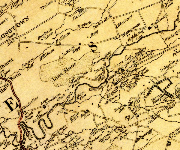
D4NY46NW.jpg Alstonby Hall -- building/s -- NY40976525 -- 'Asenby' -- block or blocks, labelled in lowercase; a hamlet or just a house Blackhill -- building/s -- NY43376619 -- 'Black Hill' -- block or blocks, labelled in lowercase; a hamlet or just a house Bleaberryrigg -- building/s -- NY43316957 -- 'Bleaberry' -- block or blocks, labelled in lowercase; a hamlet or just a house Bogbushknowe -- building/s -- NY40496903 -- 'Bugbush Know' -- block or blocks, labelled in lowercase; a hamlet or just a house Brackenhill Farm -- building/s -- NY44556947 -- 'Brackenhill / Stephenson Esqr.' -- house Broomhills -- building/s -- NY42956836 -- 'Broom Hills' -- block or blocks, labelled in lowercase; a hamlet or just a house Burnt Hill -- building/s -- NY42036583 -- 'Burnt Hill' -- block or blocks, labelled in lowercase; a hamlet or just a house Bush on Lyne -- building/s -- NY40936644 -- 'Bush' -- block or blocks, labelled in lowercase; a hamlet or just a house Charlesfield -- building/s -- NY43456697 -- 'Clugh Side' -- block or blocks, labelled in lowercase; a hamlet or just a house possibly Cleugh Head -- building/s -- NY43636715 -- 'Clugh Head' -- block or blocks, labelled in lowercase; a hamlet or just a house Cleugh Side -- building/s -- NY44346816 -- 'Russrigg' -- block or blocks, labelled in lowercase; a hamlet or just a house Cliff -- locality -- NY41406617 (etc) -- 'Cliff' -- block or blocks, labelled in lowercase; a hamlet or just a house Dike Head -- building/s -- NY43956774 -- 'Dike Head' -- block or blocks, labelled in lowercase; a hamlet or just a house Dry Beck -- river -- NY4269 (etc) ? -- 'Drybeck' -- single or double wiggly line; a river Dykeside -- building/s -- NY43806593 -- 'Dike Side' -- block or blocks, labelled in lowercase; a hamlet or just a house Haggistone Holm -- building/s -- NY41806690 -- 'Haggystone Holm' -- block or blocks, labelled in lowercase; a hamlet or just a house Hallburn Farm -- building/s -- NY41376860 -- 'Hallburn' -- block or blocks, labelled in lowercase; a hamlet or just a house Hetherside Mill -- building/s -- NY43546616 -- circle with rays, mill wheel; a water mill at Black Hill Hetherside -- building/s -- locality -- NY43696629 -- 'Hether Side' -- block or blocks, labelled in lowercase; a hamlet or just a house Hill Head -- building/s -- NY42816624 (guess) -- 'Hillhead' -- block or blocks, labelled in lowercase; a hamlet or just a house Holmfoot -- building/s -- NY41946651 -- 'Holm Foot' -- block or blocks, labelled in lowercase; a hamlet or just a house Hunter's Holme -- building/s -- NY42676729 -- 'Hunter Holm' -- block or blocks, labelled in lowercase; a hamlet or just a house Jacksonrigg -- building/s -- NY42566930 -- 'Rigg' -- block or blocks, labelled in lowercase; a hamlet or just a house probably Jawlrow -- building/s -- NY42386695 (guess) -- 'Jawlrow' -- block or blocks, labelled in lowercase; a hamlet or just a house Kirkhill -- building/s -- NY43256687 -- 'Kirkhill' -- block or blocks, labelled in lowercase; a hamlet or just a house Kirklinton Hall -- building/s -- NY43556739 -- 'Hall / Dacre Esqr.' -- house and outline of a pond? Kirklinton -- building/s -- locality -- NY43236709 (etc) -- 'Kirklinton' -- blocks, and usually a church, labelled in upright lowercase; a village Line Moor -- moor -- NY411680 (etc etc) -- 'Line Moor' -- area of moss Little Randalinton -- building/s -- NY40356615 -- 'Little Ranalinton' -- block or blocks, labelled in lowercase; a hamlet or just a house Longcleughside -- building/s -- NY44536819 -- 'Langclugh Side' -- block or blocks, labelled in lowercase; a hamlet or just a house Low Hallburn -- building/s -- NY40356837 (?) -- 'Hallburn' -- block or blocks, labelled in lowercase; a hamlet or just a house mill, Kirklinton -- water mill -- mill -- NY43656738 (guess) -- circle with rays, mill wheel; a water mill near Mr Dacre's Hall mill, Milltown -- building/s -- water mill (ex) -- mill (ex) -- corn mill (ex) -- NY42766710 -- circle with rays, mill wheel; a water mill near Milltown Milltown -- building/s -- NY42826708 -- 'Milltwn.' -- block or blocks, labelled in lowercase; a hamlet or just a house Moorstown -- building/s -- NY41516661 -- 'Moor Town' -- block or blocks, labelled in lowercase; a hamlet or just a house Nethertown -- building/s -- NY43626933 (guess) -- 'Nethertown' -- block or blocks, labelled in lowercase; a hamlet or just a house Newbiggin -- building/s -- NY42366510 -- 'Newbiggen' -- block or blocks, labelled in lowercase; a hamlet or just a house Nook on Lyne -- building/s -- NY42946771 -- 'Nook' -- block or blocks, labelled in lowercase; a hamlet or just a house Randalinton -- building/s -- NY40096580 -- 'Gr. Ranalinton' -- block or blocks, labelled in lowercase; a hamlet or just a house probably Rigg -- building/s -- NY42126891 -- 'Jackson Rigg' -- block or blocks, labelled in lowercase; a hamlet or just a house Ryehill -- building/s -- NY44136571 -- 'Rye Hill' -- block or blocks, labelled in lowercase; a hamlet or just a house Sikeside -- building/s -- NY44586653 -- 'Sike Side' -- block or blocks, labelled in lowercase; a hamlet or just a house Tinker Hole -- building/s -- NY42976972 (guess) -- 'Tinker Hole' -- block or blocks, labelled in lowercase; a hamlet or just a house Uppertown -- building/s -- NY44116719 -- 'Upper Town' -- block or blocks, labelled in lowercase; a hamlet or just a house Willow Bank -- building/s -- NY43586521 -- 'Scugh Heads' -- block or blocks, labelled in lowercase; a hamlet or just a house possibly Willow Hill -- building/s -- NY41676561 -- 'Willow Hill' -- block or blocks, labelled in lowercase; a hamlet or just a house | ||
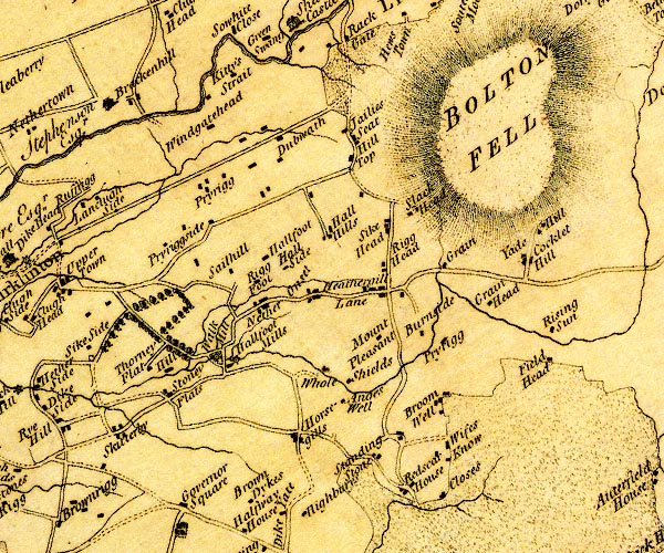
D4NY46NE.jpg Anguswell -- building/s -- NY47186602 -- 'An[g]es Well' -- block or blocks, labelled in lowercase; a hamlet or just a house Bolton Fell -- hill -- fell -- peat moss -- NY4868 -- 'BOLTON FELL' -- hill hachuring; a hill or mountain Brackenhill Tower -- tower -- NY44586948 ? ? -- 'Brackenhill' -- block or blocks, labelled in lowercase; a hamlet or just a house Broomwell -- building/s -- well -- NY48396612 -- 'Broom Well' -- block or blocks, labelled in lowercase; a hamlet or just a house Burnside -- building/s -- NY48176679 -- 'Burnside' -- block or blocks, labelled in lowercase; a hamlet or just a house Close -- building/s -- NY48516507 -- 'Closes' -- block or blocks, labelled in lowercase; a hamlet or just a house Cocklet Hill -- building/s -- NY49236754 -- 'Cocklet Hill' -- block or blocks, labelled in lowercase; a hamlet or just a house Fieldhead -- building/s -- NY49306688 -- 'Field Head' -- block or blocks, labelled in lowercase; a hamlet or just a house Grainbrow -- building/s -- NY48556730 -- 'Grain' -- block or blocks, labelled in lowercase; a hamlet or just a house probably Grainhead -- building/s -- NY48636713 -- 'Grain Head' -- block or blocks, labelled in lowercase; a hamlet or just a house Hall Hills -- building/s -- NY47156788 -- 'Hall Hills' -- block or blocks, labelled in lowercase; a hamlet or just a house Hallfoot Mill -- building/s -- water mill (ex) -- mill (ex) -- corn mill (ex) -- NY46136655 -- 'Hallfoot Mills' -- circle with rays, mill wheel; a water mill -- 'Walk Mill' -- circle with rays, mill wheel; a water mill Hallfoot -- building/s -- NY46726776 -- 'Hallfoot' -- block or blocks, labelled in lowercase; a hamlet or just a house Hallside -- building/s -- NY46746754 -- 'Hall Side' -- block or blocks, labelled in lowercase; a hamlet or just a house Hethersgill -- building/s -- NY47826718 (etc) -- 'Hethergill Lane' -- block or blocks, labelled in lowercase; a hamlet or just a house (or the road) High Dubwath -- building/s -- NY46986920 -- 'Dubwath' -- block or blocks, labelled in lowercase; a hamlet or just a house possibly Hill -- building/s -- NY45256643 (guess) -- 'Hill' -- block or blocks, labelled in lowercase; a hamlet or just a house Holeshields -- building/s -- NY47076630 -- 'Whole Shields' -- block or blocks, labelled in lowercase; a hamlet or just a house Horsegills -- building/s -- NY46686547 -- 'Horsegills' -- block or blocks, labelled in lowercase; a hamlet or just a house Kirklinton Park -- park -- building/s -- NY45036656 -- 'Thorney Flat' -- block or blocks, labelled in lowercase; a hamlet or just a house probably Kitty Strait -- building/s -- NY45886949 -- 'Kitty's Strait' -- block or blocks, labelled in lowercase; a hamlet or just a house Lodge Hill -- building/s -- NY47526876 -- 'Hill Top' -- block or blocks, labelled in lowercase; a hamlet or just a house probably Mid Dubwath -- building/s -- NY46516877 -- 'Dubwath' -- block or blocks, labelled in lowercase; a hamlet or just a house possibly Mount Pleasant -- building/s -- NY47756669 -- 'Mount Pleasant' -- block or blocks, labelled in lowercase; a hamlet or just a house Nether Onset -- building/s -- NY46946702 -- 'Nether Onset' -- block or blocks, labelled in lowercase; a hamlet or just a house Newlands -- building/s -- NY47626914 -- 'Jailies Seat' -- block or blocks, labelled in lowercase; a hamlet or just a house possibly Prior House -- building/s -- locality -- NY45676825 -- 'Pryrigg' -- block or blocks, labelled in lowercase; a hamlet or just a house possibly Prior Rigg -- building/s -- locality -- NY46316820 -- 'Pryriggside' -- block or blocks, labelled in lowercase; a hamlet or just a house probably Prior Rigg -- building/s -- NY48306691 -- 'Pryrigg' -- block or blocks, labelled in lowercase; a hamlet or just a house Riggfoot House -- building/s -- NY46776725 -- 'Rigg Foot' -- block or blocks, labelled in lowercase; a hamlet or just a house Rigghead -- building/s -- NY47746730 -- 'Rigg Head' -- block or blocks, labelled in lowercase; a hamlet or just a house Rising Sun -- inn (?) -- NY49316745 (guess) -- 'Rising Sun' -- block or blocks, labelled in lowercase; a hamlet or just a house Sailhill -- building/s -- NY46296752 (guess) -- 'Sailhill' -- block or blocks, labelled in lowercase; a hamlet or just a house Scare -- building/s -- NY48076507 -- 'Redscar House' -- block or blocks, labelled in lowercase; a hamlet or just a house probably Skitby -- building/s -- NY44816570 -- 'Skitterby' -- block or blocks, labelled in lowercase; a hamlet or just a house Slackheads -- building/s -- NY48026793 -- 'Slack Head' -- block or blocks, labelled in lowercase; a hamlet or just a house Standing Stone -- building/s -- NY47736536 (guess) -- 'Standing Stone' -- block or blocks, labelled in lowercase; a hamlet or just a house Stoneflatts -- building/s -- NY45236600 -- 'Stoney Flats' -- block or blocks, labelled in lowercase; a hamlet or just a house Sykehead -- building/s -- NY47856786 -- 'Sike Head' -- block or blocks, labelled in lowercase; a hamlet or just a house Waingatehead -- building/s -- NY45576921 -- 'Windgatehead' -- block or blocks, labelled in lowercase; a hamlet or just a house West Knowe -- building/s -- NY48386554 -- 'Wifes Know' -- block or blocks, labelled in lowercase; a hamlet or just a house Yad Hill -- building/s -- NY49306795 -- 'Yade Hill' -- block or blocks, labelled in lowercase; a hamlet or just a house | ||
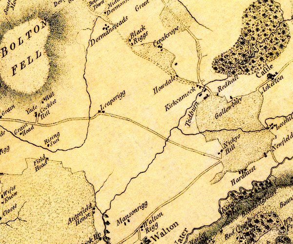
D4NY56NW.jpg Auterfield House -- building/s -- NY51156552 -- 'Auterfield House' -- block or blocks, labelled in lowercase; a hamlet or just a house Blackrigg -- building/s -- NY51276992 -- 'Black Riggs' -- block or blocks, labelled in lowercase; a hamlet or just a house Cam Beck -- river -- NY5469 (etc) -- 'Todburn' -- single or double wiggly line; a river into the Irthing Cracrop -- building/s -- NY52136985 -- 'Creakrope' -- block or blocks, labelled in lowercase; a hamlet or just a house Dormansteads -- building/s -- NY50887001 -- 'Dormansteads' -- block or blocks, labelled in lowercase; a hamlet or just a house Gallowberry -- building/s -- NY54266872 -- 'Gallowbury' -- block or blocks, labelled in lowercase; a hamlet or just a house Hardhurst -- building/s -- NY546668 -- 'Hardhirst' -- block or blocks, labelled in lowercase; a hamlet or just a house Howdale -- building/s -- NY52846909 -- 'Howdale' -- block or blocks, labelled in lowercase; a hamlet or just a house King Hill -- building/s -- NY54196556 -- 'King Hill' -- block or blocks, labelled in lowercase; a hamlet or just a house Kirkcambeck -- building/s -- NY53376899 (etc) -- 'Kirkcamock' -- block or blocks, labelled in lowercase; a hamlet or just a house Leaps Rigg -- building/s -- NY50876772 -- 'Leapsrigg' -- block or blocks, labelled in lowercase; a hamlet or just a house Nickie's Hill -- building/s -- locality -- NY53886714 -- 'Nickys Hill' -- block or blocks, labelled in lowercase; a hamlet or just a house Red Hall -- building/s -- NY53846874 -- 'Redhall' -- block or blocks, labelled in lowercase; a hamlet or just a house Tod Burn -- river -- NY5368 (etc) -- single or double wiggly line; a river | ||
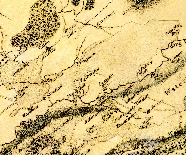
D4NY56NE.jpg Allensteads -- building/s -- NY57836685 -- 'Allansteads' -- block or blocks, labelled in lowercase; a hamlet or just a house Askerton Castle -- castle -- pele tower (?) -- NY55036920 ? -- 'Castle / Askerton' -- large building; a castle Askerton Park -- park -- NY55327105 (etc etc) -- tree and bush symbols; woodland, at Askerton Burthinghurst -- building/s -- NY54986613 -- 'Burthinghirst' -- block or blocks, labelled in lowercase; a hamlet or just a house Carshill -- building/s -- NY58986702 (guess) -- 'Carshill' -- block or blocks, labelled in lowercase; a hamlet or just a house possibly Clark's Hill -- building/s -- NY58806726 -- 'Boak Hills' -- block or blocks, labelled in lowercase; a hamlet or just a house Craig Hill -- building/s -- NY57096579 -- 'Crag Hill' -- block or blocks, labelled in lowercase; a hamlet or just a house Craigburn -- building/s -- NY56476876 -- 'Cragburn' -- block or blocks, labelled in lowercase; a hamlet or just a house Demesne -- building/s -- NY59846701 (guess) -- 'Demesn' -- house Desoglin -- building/s -- NY57826781 -- 'Desoglin' -- block or blocks, labelled in lowercase; a hamlet or just a house Greensburn -- building/s -- NY57136998 -- 'Greensburn' -- block or blocks, labelled in lowercase; a hamlet or just a house Hall Guards -- building/s -- NY58726664 -- 'Hall Guards' -- block or blocks, labelled in lowercase; a hamlet or just a house Lees Hill -- locality -- building/s -- NY55546802 -- 'Leeshill' -- block or blocks, labelled in lowercase; a hamlet or just a house Mill Beck -- river -- NY5866 (etc) -- single or double wiggly line; a river into King Water Miller Hill -- building/s -- NY59076637 -- 'Millar Hill' -- block or blocks, labelled in lowercase; a hamlet or just a house Moorguards -- building/s -- NY58246764 -- 'Moor Guards' -- block or blocks, labelled in lowercase; a hamlet or just a house Newfield -- building/s -- NY55176729 -- 'Newfield' -- block or blocks, labelled in lowercase; a hamlet or just a house Palmer Hill -- building/s -- NY59006835 -- 'Palmer Hill' -- block or blocks, labelled in lowercase; a hamlet or just a house Park Nook -- building/s -- NY58176686 -- 'Park Nook' -- block or blocks, labelled in lowercase; a hamlet or just a house Rinnion Hills -- building/s -- NY56236981 -- 'Rinion Hill' -- block or blocks, labelled in lowercase; a hamlet or just a house Rowantree Hill -- building/s -- NY56586663 -- 'Bountreehill' -- block or blocks, labelled in lowercase; a hamlet or just a house probably Swaites -- building/s -- NY56066666 -- 'Swaits' -- block or blocks, labelled in lowercase; a hamlet or just a house Tercrosset -- building/s -- NY57026814 -- 'Tercrosset' -- block or blocks, labelled in lowercase; a hamlet or just a house Triermain -- building/s -- NY59406679 -- 'Toddermain' -- block or blocks, labelled in lowercase; a hamlet or just a house Tweedy Hill -- building/s -- NY58506745 -- 'Tweedy Hills' -- block or blocks, labelled in lowercase; a hamlet or just a house West Hall -- building/s -- locality -- NY56676772 (etc) -- 'West Hall' -- block or blocks, labelled in lowercase; a hamlet or just a house Wrygarth -- building/s -- NY57506701 -- 'Rye Garth' -- block or blocks, labelled in lowercase; a hamlet or just a house | ||
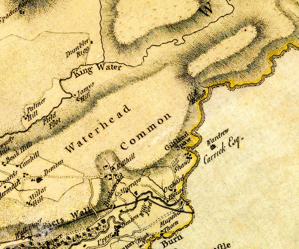
D4NY66NW.jpg Birdoswald -- building/s -- NY61526635 (etc) -- 'Birdoswald' -- block or blocks, labelled in lowercase; a hamlet or just a house Dumblar Rigg -- building/s -- NY60577039 -- 'Dumbler Rigg' -- block or blocks, labelled in lowercase; a hamlet or just a house Field Foot -- building/s -- NY59706812 (guess) -- 'Field Foot' -- block or blocks, labelled in lowercase; a hamlet or just a house Gilsland Spa Hotel -- inn -- hotel -- NY63596769 -- 'Shaws' -- block or blocks, labelled in lowercase; a hamlet or just a house Gilsland Spa -- locality -- spa -- spring -- NY63686775 (etc) -- 'Gilsland Spaw' -- a block Irthing, River -- river -- boundary -- parish boundary -- county boundary -- NY4758 (etc etc) -- 'Irthing River' -- 'Irthing River' -- single or double wiggly line; a river and county boundary Kiln Hill -- building/s -- NY61506696 -- 'Killhill' -- block or blocks, labelled in lowercase; a hamlet or just a house King Water -- river -- boundary -- parish boundary -- NY5466 (etc etc) -- 'King Water' -- 'King Water' -- 'King Water' -- single or double wiggly line; a river mill, Gilsland -- water mill -- mill -- corn mill -- NY63386641 (guess) -- circle with rays, mill wheel; a water mill on the Poltross Burn Mumps Hall -- building/s -- NY63306642 -- 'Mumpshall' -- block or blocks, labelled in lowercase; a hamlet or just a house Murrays -- building/s -- NY61756680 (guess) -- 'Murrays' -- block or blocks, labelled in lowercase; a hamlet or just a house Old House -- building/s -- NY63416910 (guess) -- 'Old House' -- block or blocks, labelled in lowercase; a hamlet or just a house Orchard House -- building/s -- NY63216683 -- 'Orchard House' -- block or blocks, labelled in lowercase; a hamlet or just a house Poltross Burn -- river -- boundary -- county boundary -- NY634664 -- 'Poultross Burn' -- single or double wiggly line; a river into the Irthing, and county boundary Snowden Close -- building/s -- NY60326866 -- 'Jamys Hill' -- block or blocks, labelled in lowercase; a hamlet or just a house probably Wardrew -- building/s -- NY638679 -- 'Wardrew / Carrick Esq.' -- house Waterhead Common -- common -- NY617685 (etc etc) -- 'Waterhead Common' -- locality Willowford -- building/s -- NY62466650 -- 'Willy Ford' -- block or blocks, labelled in lowercase; a hamlet or just a house, on The Wall | ||
D4NY66NE.jpg Wileysike House -- building/s -- NY66247094 -- 'Hopes' -- block or blocks, labelled in lowercase; a hamlet or just a house possibly | ||
D4NY16SE.jpg Annan, River -- river -- NY1865 (etc) -- 'Annan Water' -- single or double wiggly line; a river into the sea Barnkirk Hill -- hill -- NY190643 -- 'Barnkirk Hills' -- hill hachuring; a hill or mountain Black Dubs -- pond (?) -- NY189606 (guess) -- 'Black Dubs' -- lake Newbie Castle -- castle (site) -- motte and bailey -- NY17416472 (about) -- 'Newby Castle' -- large building; a castle and blocks for other buildings, a hamlet road, through Cardurnock -- road -- route -- NY26 -- 'G Pt. to B. 6:4:8' -- double line, narrower, solid or dotted with a dot and number at 1 mile intervals; road -- miles.furlongs.poles; Grune Point to Bowness? Moricambe sands road -- road sands -- route -- NY15 -- 'G Pt. to B. 6:4:8' -- double line, narrower, solid or dotted with a dot and number at 1 mile intervals; road -- miles.furlongs.poles; Grune Point to Bowness Scargavel Point -- headland -- NY19616163 (etc) -- 'Scargavel' -- hill hachuring; a hill or mountain Solway Firth -- estuary -- river estuary -- sea area -- NY16 (etc) ? -- 'SOLWAY FIRTH or EDEN RIVER' -- estuary | ||
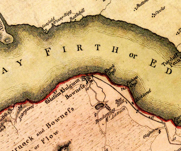
D4NY26SW.jpg Battlehill -- building/s -- NY21796502 -- 'Battlehill' -- block or blocks, labelled in lowercase; a hamlet or just a house Bog Hall -- building/s -- NY240616 (guess) -- 'Bog Hall' -- block or blocks, labelled in lowercase; a hamlet or just a house Bowness Common -- common -- NY2059 -- 'Cardurnock and Bowness Moss or Flow' -- area of moss Bowness-on-Solway -- building/s -- selected place (secondary) -- NY22306272 (etc) -- 'Bowness' -- blocks, labelled in upright lowercase; a village, street plan with blocks and a house Brackenrigg -- building/s -- NY23176140 -- 'Brackenrigg / Mr. Lawson' -- block, avenue of trees and a lake Grey Havens -- building/s -- police station (ex) -- NY23016274 -- 'Knock Cross' -- a spot Hadrian's Wall -- roman wall -- NY6166 (etc)Hadrian's Wall -- roman wall -- NY6166 (etc) -- 'Picts Wall' -- 'Picts Wall' -- 'Picts Wall' -- double line with ?palings -- at Bowness-on-Solway -- N of Carlisle -- into Northumberland Kirkland House -- building/s -- NY24336171 -- 'Kirkland' -- block or blocks, labelled in lowercase; a hamlet or just a house Port Carlisle -- building/s -- NY24066218 (etc) -- 'Fisher Cross' -- no symbol Carlisle to Bowness-on-Solway -- route -- NY35 -- 'B. to C. 12:7:28' -- double line, narrower, solid or dotted with a dot and number at 1 mile intervals; road -- miles.furlongs.poles; Bowness to Carlisle -- from Irish Gate, over the Caldew road, through Cardurnock -- road -- route -- NY26 -- 'G Pt. to B. 6:4:8' -- double line, narrower, solid or dotted with a dot and number at 1 mile intervals; road -- miles.furlongs.poles; Grune Point to Bowness? Wigton to Bowness-on-Solway -- road -- route -- NY24 -- 'W. to B. 10:2:20' -- double line, narrower, solid or dotted with a dot and number at 1 mile intervals; road -- miles.furlongs.poles; Wigton to Bowness Maia -- roman fort -- NY222626 -- 'Blatum Bulgium' -- square within a square; roman fort; English Black Letter Moricambe sands road -- road sands -- route -- NY15 -- 'G Pt. to B. 6:4:8' -- double line, narrower, solid or dotted with a dot and number at 1 mile intervals; road -- miles.furlongs.poles; Grune Point to Bowness Seafield -- locality -- building/s -- NY20666460 -- 'Seafield' -- block or blocks, labelled in lowercase; a hamlet or just a house Solway Firth -- estuary -- river estuary -- sea area -- NY16 (etc) ? -- 'SOLWAY FIRTH or EDEN RIVER' -- estuary Whinnyrigg -- building/s -- NY20896482 -- 'Winny Rigg' -- block or blocks, labelled in lowercase; a hamlet or just a house | ||
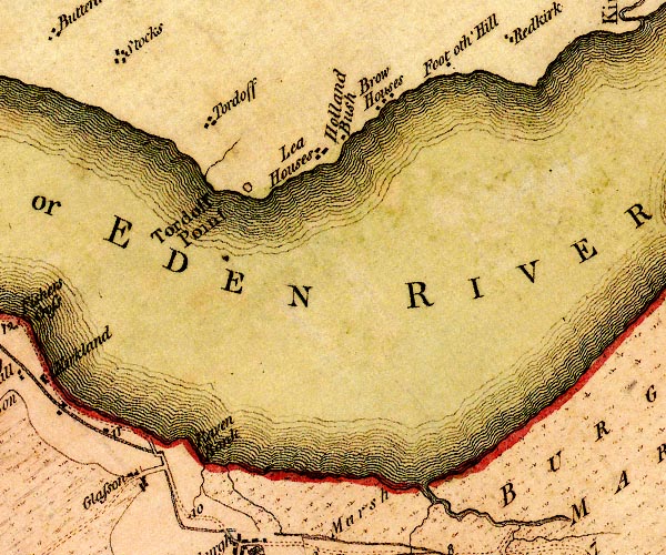
D4NY26SE.jpg Browhouses -- building/s -- locality -- NY28106497 (etc) -- 'Brow Houses' -- block or blocks, labelled in lowercase; a hamlet or just a house Foot oth' Hill -- building/s -- NY292657 (guess) -- 'Foot oth' Hill' -- block or blocks, labelled in lowercase; a hamlet or just a house Fresh Creek -- river -- parish boundary -- boundary -- NY2860 (etc) -- single or double wiggly line; a river from the marsh into the sea Glasson -- building/s -- NY2560 -- 'Glasson' -- block or blocks, labelled in lowercase; a hamlet or just a house Grass Dike -- river -- boundary -- parish boundary -- NY28056024 -- single or double wiggly line; a river from the marsh into the sea Holynbush -- building/s -- NY27686456 -- 'Holland Bush' -- block or blocks, labelled in lowercase; a hamlet or just a house Leehouses -- building/s -- NY27286453 -- 'Lea Houses' -- block or blocks, labelled in lowercase; a hamlet or just a house Raven Bank -- sandbank (?) -- NY26246057 (etc) -- 'Raven Bank' -- coastline or sandbank? Solway Firth -- estuary -- river estuary -- sea area -- NY16 (etc) ? -- 'SOLWAY FIRTH or EDEN RIVER' -- estuary Torduff Point -- headland -- NY26506388 (etc) -- 'Tordoff Point' -- headland Torduff -- locality -- NY25826465 -- 'Tordoff' -- block or blocks, labelled in lowercase; a hamlet or just a house | ||
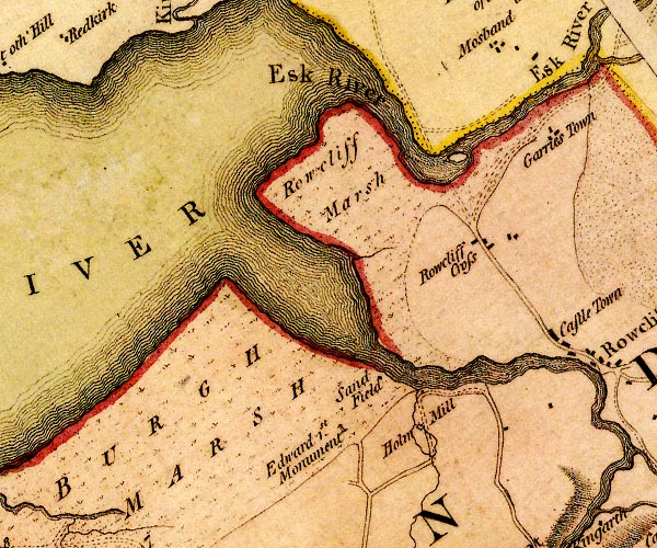
D4NY36SW.jpg Burgh Marsh -- marsh -- NY3060 (etc) -- 'BURGH MARSH' -- area of marsh Eden, River -- river -- boundary -- parish boundary -- NY3658 (etc) -- 'Eden River' -- 'Eden R.' -- estuary -- single or double wiggly line; a river and county boundary, into the sea Edward I Monument -- memorial -- monument -- NY32576091 -- 'Edward 1st. Monument' -- monument Esk, River -- river -- boundary -- county boundary -- parish boundary -- NY3666 (etc) -- 'Esk River' -- 'Esk River' -- single or double wiggly line; a river and national boundary with Scotland Holmes Mill -- building/s -- water mill (ex) -- mill (ex) -- corn mill (ex) -- NY33746124 -- 'Holm Mill' -- circle with rays, mill wheel; a water mill Old Sandsfield -- building/s -- inn (once) -- NY33176165 -- 'Sand Field' -- block or blocks, labelled in lowercase; a hamlet or just a house Rockcliffe Cross -- building/s -- NY3462 -- 'Rowcliff Cross' -- block or blocks, labelled in lowercase; a hamlet or just a house Rockcliffe Marsh -- marsh -- NY3163 (etc) -- 'Rowcliff Marsh' -- area of marsh | ||
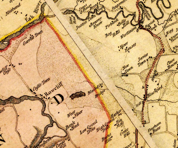
D4NY36SE.jpg Bankend -- building/s -- NY36746049 -- 'Bank End' -- block or blocks, labelled in lowercase; a hamlet or just a house Blackdike -- building/s -- NY37946224 -- 'Blackdike / Bridge' -- block or blocks, labelled in lowercase; a hamlet or just a house Blackford -- building/s -- locality -- NY39686206 (etc) -- 'Blackford' -- block or blocks, labelled in lowercase; a hamlet or just a house Boggs, The -- building/s -- NY39066349 -- 'Bog Hall' -- block or blocks, labelled in lowercase; a hamlet or just a house probably Broomy Know -- building/s -- NY36656447 (guess) -- 'Broomy Know' -- block or blocks, labelled in lowercase; a hamlet or just a house Castletown -- locality -- NY353620 (etc) -- 'Castle Town' -- block or blocks, labelled in lowercase; a hamlet or just a house Firbank -- building/s -- NY38156478 -- 'Firbank' -- block or blocks, labelled in lowercase; a hamlet or just a house Garriestown -- building/s -- NY35156439 -- 'Garries Town' -- block or blocks, labelled in lowercase; a hamlet or just a house Grearshill -- building/s -- NY39016026 -- 'Greers Hill' -- block or blocks, labelled in lowercase; a hamlet or just a house Hen Moss -- building/s -- NY38646045 (guess) -- 'Hen Moss' -- block or blocks, labelled in lowercase; a hamlet or just a house High Crindledike -- building/s -- NY38116046 -- 'High Grinel Dike' -- block or blocks, labelled in lowercase; a hamlet or just a house Hill, The -- building/s -- NY39526144 -- 'Hill' -- block or blocks, labelled in lowercase; a hamlet or just a house Jerriestown -- building/s -- NY398632 -- 'Jerries Town' -- block or blocks, labelled in lowercase; a hamlet or just a house Justicetown -- building/s -- NY37416465 -- 'Justice Town' -- block or blocks, labelled in lowercase; a hamlet or just a house Low Crindledyke -- building/s -- NY37386052 -- 'Low Grinel Dike' -- block or blocks, labelled in lowercase; a hamlet or just a house Low Harker -- locality -- building/s -- NY38776085 (etc) -- 'Harker' -- block or blocks, labelled in lowercase; a hamlet or just a house Lyne, River -- river -- boundary -- parish boundary etc -- NY3765 (etc)Lyne, River -- river -- boundary -- parish boundary etc -- NY3765 (etc) -- 'Line River' -- single or double wiggly line; a river into the Esk Lynefoot -- building/s -- NY36386507 -- 'Line How' -- block or blocks, labelled in lowercase; a hamlet or just a house probably mill, Westlinton -- water mill -- mill -- corn mill (?) -- NY39326461 (guess) -- circle with rays, mill wheel; a water mill at Westlinton Moor Houses -- building/s -- NY38416361 -- 'Moor Houses' -- block or blocks, labelled in lowercase; a hamlet or just a house Newtown of Rockcliffe -- building/s -- NY38956254 (etc) -- 'New Town' -- block or blocks, labelled in lowercase; a hamlet or just a house Oakdene -- building/s -- NY38556448 -- 'Bells Hill' -- block or blocks, labelled in lowercase; a hamlet or just a house Carlisle to Longtown -- route -- NY35 -- double line, solid or dotted, with a dot or milestone and number at 1 mile intervals, tinted red; turnpike road -- from Scots Gate and over the Eden Rockcliffe -- building/s -- NY3561 -- 'Rowcliff' -- blocks, and usually a church, labelled in upright lowercase; a village Tarn (?) -- lake -- NY37226165 (etc) -- 'Lough' -- lake West View -- building/s -- NY37136069 -- 'West Moor' -- block or blocks, labelled in lowercase; a hamlet or just a house Westlinton Bridge -- bridge -- boundary mark -- parish boundary mark -- NY39286465 -- double line across a river; a bridge at Westlinton Westlinton -- building/s -- locality -- NY39296451 (etc) -- 'Westlinton' -- block or blocks, labelled in lowercase; a hamlet or just a house | ||
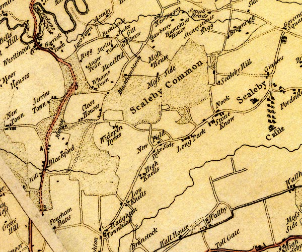
D4NY46SW.jpg Alstonby Grange -- building/s -- NY40546470 -- 'Joys Town' -- block or blocks, labelled in lowercase; a hamlet or just a house Angerton -- building/s -- NY40626381 (guess) -- 'Anger Town' -- block or blocks, labelled in lowercase; a hamlet or just a house possibly Barrockstown -- building/s -- NY39976452 -- 'Borrick Town' -- block or blocks, labelled in lowercase; a hamlet or just a house Becklands -- building/s -- NY41396414 -- 'Becklands' -- block or blocks, labelled in lowercase; a hamlet or just a house Blackhamilton -- building/s -- NY41456370 -- 'Blackhambleton' -- block or blocks, labelled in lowercase; a hamlet or just a house Brownrigg -- building/s -- NY44256466 (etc) -- 'Brownrigg' -- block or blocks, labelled in lowercase; a hamlet or just a house Brunstock Beck -- river -- boundary -- parish boundary -- NY4261 -- single or double wiggly line; a river -- at Rickerby Close House -- building/s -- NY41066272 -- 'Close Houses' -- block or blocks, labelled in lowercase; a hamlet or just a house Dikeside -- building/s -- NY42116170 -- 'Dyke Side' -- block or blocks, labelled in lowercase; a hamlet or just a house Down by Rigg -- building/s -- NY40526404 -- 'Rigg' -- block or blocks, labelled in lowercase; a hamlet or just a house Fourham Butts -- building/s -- NY39906017 (guess) -- 'Fourham Butts' -- block or blocks, labelled in lowercase; a hamlet or just a house Gilestown -- building/s -- NY41366448 -- 'Jaylies Town' -- block or blocks, labelled in lowercase; a hamlet or just a house Gill, The -- building/s -- NY41516466 -- 'Gill' -- block or blocks, labelled in lowercase; a hamlet or just a house Gillbrow -- building/s -- NY41606458 -- 'Gillbrow' -- block or blocks, labelled in lowercase; a hamlet or just a house High Knells -- building/s -- NY41696120 -- 'High Knells' -- block or blocks, labelled in lowercase; a hamlet or just a house Howberry -- building/s -- NY42086452 -- 'Hawberry' -- block or blocks, labelled in lowercase; a hamlet or just a house Humphrie's House -- building/s -- NY42946425 -- 'Humphry's House' -- block or blocks, labelled in lowercase; a hamlet or just a house Knells House -- building/s -- NY41386057 -- 'Low Knells' -- block or blocks, labelled in lowercase; a hamlet or just a house probably Lake -- building/s -- NY41366459 -- 'Lake' -- block or blocks, labelled in lowercase; a hamlet or just a house Long Park -- building/s -- NY42926202 -- 'Long Park' -- block or blocks, labelled in lowercase; a hamlet or just a house Longpark -- park -- building/s -- NY42626189 -- 'Long Park' -- block or blocks, labelled in lowercase; a hamlet or just a house Moat Hill -- building/s -- NY41506428 (guess) -- 'Moat Hill' -- block or blocks, labelled in lowercase; a hamlet or just a house Mounts -- locality -- NY40116243 -- 'Mounts' -- block or blocks, labelled in lowercase; a hamlet or just a house New Field -- building/s -- NY42266184 -- 'New Field' -- block or blocks, labelled in lowercase; a hamlet or just a house Nook -- building/s -- NY44256291 (?) -- 'Nook' -- block or blocks, labelled in lowercase; a hamlet or just a house Parkend -- building/s -- NY42436359 -- 'Moss House' -- block or blocks, labelled in lowercase; a hamlet or just a house possibly Scaleby Moss -- moss -- NY429634 (etc) -- 'Scaleby Common' -- locality Scalebyhill -- locaity -- building/s -- NY44026364 (etc) -- 'Scaleby Hill' -- block or blocks, labelled in lowercase; a hamlet or just a house Silver Hill -- building/s -- NY42406354 -- 'Moss Side' -- block or blocks, labelled in lowercase; a hamlet or just a house possibly Standingstonerigg -- building/s -- NY43416460 -- 'Stoneystones Rigg' -- block or blocks, labelled in lowercase; a hamlet or just a house Stoneknowe -- building/s -- NY44016261 -- 'Stone Know' -- block or blocks, labelled in lowercase; a hamlet or just a house Walby -- locality -- building/s -- NY43726029 (etc) -- 'Wallby' -- block or blocks, labelled in lowercase; a hamlet or just a house Whamtown -- building/s -- NY40726332 (?) -- 'Whams Town' -- block or blocks, labelled in lowercase; a hamlet or just a house Wide open Dikes -- building/s -- NY41176241 -- 'Widopen Dykes' -- block or blocks, labelled in lowercase; a hamlet or just a house | ||
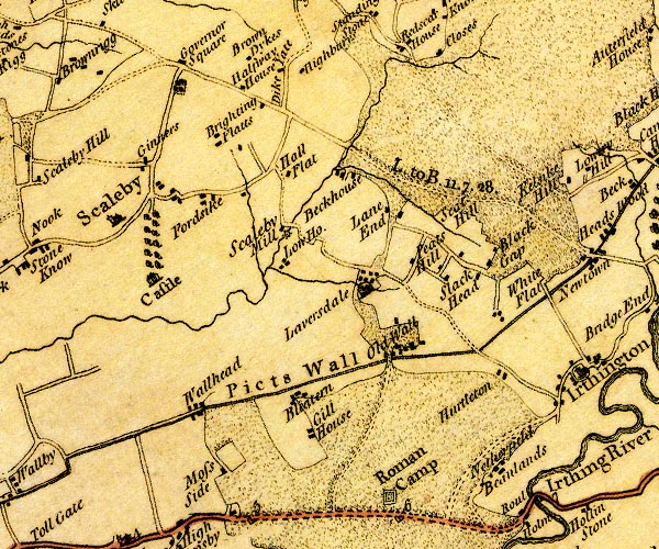
D4NY46SE.jpg Beanlands Park -- building/s -- NY49016055 -- 'Beanlands' -- block or blocks, labelled in lowercase; a hamlet or just a house Beck House -- building/s -- NY47296377 -- 'Beckhouse' -- block or blocks, labelled in lowercase; a hamlet or just a house Black Gaps -- track -- NY49576284 (etc) -- 'Black Gap' -- block or blocks, labelled in lowercase; a hamlet or just a house; or a locality? Bleatarn -- locality -- building/s -- NY46716112 (etc) -- 'Bleatern' -- block or blocks, labelled in lowercase; a hamlet or just a house Brightenflat -- building/s -- NY45966398 -- 'Brighting Flatts' -- block or blocks, labelled in lowercase; a hamlet or just a house Brown Dyke -- building/s -- NY46206498 -- 'Brown Dykes' -- block or blocks, labelled in lowercase; a hamlet or just a house Dike Yate -- building/s -- NY46526480 (guess) -- 'Dike Yate' -- block or blocks, labelled in lowercase; a hamlet or just a house Fordsyke -- building/s -- NY45716321 -- 'Fordsike' -- block or blocks, labelled in lowercase; a hamlet or just a house Gill House -- building/s -- NY47106060 -- 'Gill House' -- block or blocks, labelled in lowercase; a hamlet or just a house Hadrian's Wall -- roman wall -- NY6166 (etc)Hadrian's Wall -- roman wall -- NY6166 (etc) -- 'Picts Wall' -- 'Picts Wall' -- 'Picts Wall' -- double line with ?palings -- at Bowness-on-Solway -- N of Carlisle -- into Northumberland Halfway House -- building/s -- NY46096453 -- 'Halfway House' -- block or blocks, labelled in lowercase; a hamlet or just a house Hall Flatt -- building/s -- NY46606365 -- 'Hall Flat' -- block or blocks, labelled in lowercase; a hamlet or just a house Highberries Beck -- river -- boundary -- parish boundary -- NY4763 (etc) -- single or double wiggly line; a river, works Scaleby Mill Highberries -- building/s -- NY46846475 -- 'Highburys' -- block or blocks, labelled in lowercase; a hamlet or just a house Hunley -- building/s -- NY45366479 -- 'Governor Square' -- block or blocks, labelled in lowercase; a hamlet or just a house; a planation to the south probably Hurtleton -- building/s -- NY49126150 -- 'Hurtleton' -- block or blocks, labelled in lowercase; a hamlet or just a house Laversdale Beck -- river -- NY4662 (etc) -- single or double wiggly line; a river Laversdale Lane -- locality -- building/s -- NY47846364 -- 'Lane End' -- block or blocks, labelled in lowercase; a hamlet or just a house probably Laversdale -- locality -- building/s -- NY47636255 (etc) -- 'Laversdale' -- block or blocks, labelled in lowercase; a hamlet or just a house Low House -- building/s -- NY46636281 -- 'Low Ho.' -- block or blocks, labelled in lowercase; a hamlet or just a house Moss Side -- building/s -- NY45986030 -- 'Moss Side' -- block or blocks, labelled in lowercase; a hamlet or just a house Netherfield -- building/s -- NY48796036 -- 'Netherfield' -- block or blocks, labelled in lowercase; a hamlet or just a house Nook, The -- building/s -- NY44906360 -- 'Ginners' -- block or blocks, labelled in lowercase; a hamlet or just a house possibly Oldwall -- building/s -- NY48066170 (etc) -- 'Old Wall' -- block or blocks, labelled in lowercase; a hamlet or just a house Pateshill -- building/s -- NY48426270 -- 'Peats Hill' -- block or blocks, labelled in lowercase; a hamlet or just a house Brampton to Longtown -- route -- NY56 -- 'L. to B. 11.7.28' -- miles.furlongs.poles; Longtown to Brampton roman fort, Watchcross -- roman fort -- NY47606013 -- 'Roman Camp' -- square within a square; roman fort Scaleby Castle -- castle -- NY44956251 -- 'Castle' -- large building; a castle and avenue of trees Scaleby Mill -- building/s -- water mill (ex) -- corn mill (ex) -- mill (ex) -- NY46576308 -- 'Scaleby Mill' -- circle with rays, mill wheel; a water mill Scaleby -- building/s -- locality -- NY44716311 (etc) -- 'Scaleby' -- blocks, and usually a church, labelled in upright lowercase; a village Seat Hill -- building/s -- NY48256336 -- 'Seat Hill' -- no symbol Slackhead -- building/s -- NY48846263 -- 'Slack Head' -- block or blocks, labelled in lowercase; a hamlet or just a house Wallhead -- building/s -- NY45726097 -- 'Wallhead' -- block or blocks, labelled in lowercase; a hamlet or just a house Whiteflat -- building/s -- NY49576247 -- 'White Flat' -- block or blocks, labelled in lowercase; a hamlet or just a house | ||
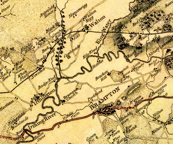
D4NY56SW.jpg Beck Farm, The -- building/s -- NY50536346 -- 'Beck' -- block or blocks, labelled in lowercase; a hamlet or just a house Black House -- building/s -- NY50906442 (guess) -- 'Black Ho.' -- block or blocks, labelled in lowercase; a hamlet or just a house Brampton -- building/s -- locality etc -- NY53036109 (etc) -- 'BRAMPTON' -- blocks, perhaps a church, labelled in block caps; a town, street plan, note that there is no church Breconhill -- building/s -- NY52816251 -- 'Bracken Hill' -- block or blocks, labelled in lowercase; a hamlet or just a house Burtholme -- building/s -- NY5463 -- 'Burth Holm' -- block or blocks, labelled in lowercase; a hamlet or just a house Cam Beck -- river -- NY5469 (etc) -- 'Todburn' -- single or double wiggly line; a river into the Irthing Cambeck Bridge -- bridge -- NY50946267 -- double line across a river; a bridge over the Cam Beck Cambeckhill -- building/s -- NY50806365 -- 'Cambeck Hill' -- block or blocks, labelled in lowercase; a hamlet or just a house Castlesteads -- building/s -- NY51136329 ? -- 'Castlesteads' -- house Cotehill -- building/s -- NY53426246 -- 'Coathill' -- block or blocks, labelled in lowercase; a hamlet or just a house Garthside -- building/s -- NY54426461 -- 'Garth Side' -- block or blocks, labelled in lowercase; a hamlet or just a house Great Easby -- building/s -- locality -- NY53876288 -- 'Great Easby' -- block or blocks, labelled in lowercase; a hamlet or just a house Hadrian's Wall -- roman wall -- NY6166 (etc)Hadrian's Wall -- roman wall -- NY6166 (etc) -- 'Picts Wall' -- 'Picts Wall' -- 'Picts Wall' -- double line with ?palings -- at Bowness-on-Solway -- N of Carlisle -- into Northumberland Harley Bank -- building/s -- NY53556448 (guess) -- 'Harley Bank' -- block or blocks, labelled in lowercase; a hamlet or just a house Heads Wood -- building/s -- NY50336322 -- 'Heads Wood' -- block or blocks, labelled in lowercase; a hamlet or just a house Hemblesgate -- building/s -- NY53576051 -- 'Hemble Gate' -- block or blocks, labelled in lowercase; a hamlet or just a house Holmes -- building/s -- NY52456324 -- 'Holmes' -- block or blocks, labelled in lowercase; a hamlet or just a house Howgill -- building/s -- NY53916429 -- 'Howgill' -- block or blocks, labelled in lowercase; a hamlet or just a house Irthing Bridge -- bridge -- NY51286232 -- double line across a river; a bridge or ford on the Irthing Irthing House -- building/s -- NY50736235 -- 'Bridge End' -- block or blocks, labelled in lowercase; a hamlet or just a house possibly Irthing, River -- river -- boundary -- parish boundary -- county boundary -- NY4758 (etc etc) -- 'Irthing River' -- 'Irthing River' -- single or double wiggly line; a river and county boundary Irthington Mill -- building/s -- water mill (ex) -- mill (ex) -- corn mill (? ex) -- NY50836241 -- circle with rays, mill wheel; a water mill at Bridge End Irthington -- building/s -- NY49846165 -- 'Irthington' -- blocks, and usually a church, labelled in upright lowercase; a village, and street plan Kellwood -- building/s -- NY52366345 -- 'Kile Wood' -- block or blocks, labelled in lowercase; a hamlet or just a house King Water -- river -- boundary -- parish boundary -- NY5466 (etc etc) -- 'King Water' -- 'King Water' -- 'King Water' -- single or double wiggly line; a river Kylesyke Hill -- building/s -- NY49816345 -- 'Kelsike Hill' -- block or blocks, labelled in lowercase; a hamlet or just a house Little Easby -- building/s -- NY53776241 (estimate) -- 'Little Easby' -- block or blocks, labelled in lowercase; a hamlet or just a house Low Rigg -- building/s -- NY52106506 -- 'Walton Rigg' -- block or blocks, labelled in lowercase; a hamlet or just a house probably Low Wall -- building/s -- NY53506424 -- 'Low Wall' -- block or blocks, labelled in lowercase; a hamlet or just a house Lowryhill -- building/s -- NY50066355 -- 'Lowery Hill' -- block or blocks, labelled in lowercase; a hamlet or just a house Masonrigg -- building/s -- NY51536542 -- 'Mansonrigg' -- block or blocks, labelled in lowercase; a hamlet or just a house Middle Farm -- building/s -- NY51136061 -- 'Middle Farm' -- block or blocks, labelled in lowercase; a hamlet or just a house milestone, Brampton (2) -- milestone -- NY50596039 -- '8' -- milestone; from Carlisle towards Newcastle milestone, Brampton (3) -- milestone -- NY52136080 -- '9' -- milestone; from Carlisle towards Newcastle milestone, Brampton (6) -- milestone -- NY53656120 -- '10' -- milestone; from Carlisle towards Newcastle Mote, The -- motte and bailey -- castle -- NY53326128 (etc) -- hill hachuring; a hill or mountain Newtown -- building/s -- NY50026278 (etc) -- 'Newtown' -- block or blocks, labelled in lowercase; a hamlet or just a house Old Church -- church -- NY51006156 ? -- 'Brampton Church' -- church and blocks Park Head -- locality -- NY52136144 (etc) -- 'Parkhead' -- block or blocks, labelled in lowercase; a hamlet or just a house Red Cleugh -- building/s -- NY54356522 (guess) -- 'Red Clugh' -- block or blocks, labelled in lowercase; a hamlet or just a house Brampton to Alston -- route -- NY56 -- double line, narrower, solid or dotted with a dot and number at 1 mile intervals; road -- part in Northumberland Brampton to Carlisle -- road -- route -- NY56 -- double line, solid or dotted, with a dot or milestone and number at 1 mile intervals, tinted red; turnpike road -- from Scots Gate and over the Eden Haltwhistle to Brampton -- road -- route etc -- NY76 -- 'To Newcastle' -- double line, solid or dotted, with a dot or milestone and number at 1 mile intervals, tinted red; turnpike road -- into Northumberland Camboglanna -- roman fort -- NY51226349 -- 'Castlesteads' -- square within a square; roman fort Sandysike -- building/s -- NY51616407 -- 'Sandy Sike' -- block or blocks, labelled in lowercase; a hamlet or just a house Wall, The -- building/s -- NY54116440 -- 'Wall' -- block or blocks, labelled in lowercase; a hamlet or just a house Walton -- building/s -- locality -- NY52146448 (etc) -- 'Walton' -- blocks, and usually a church, labelled in upright lowercase; a village Warren House -- building/s -- NY54056129 -- 'Warren House' -- block or blocks, labelled in lowercase; a hamlet or just a house | ||
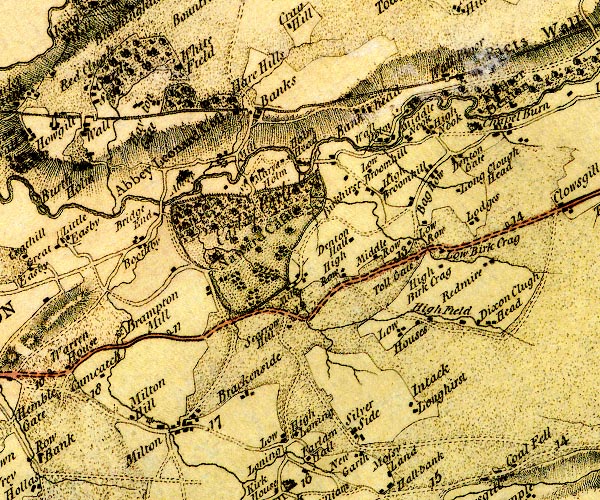
D4NY56SE.jpg Baggarah -- building/s -- NY58916396 -- 'Bag Row' -- block or blocks, labelled in lowercase; a hamlet or just a house Banks Burn -- river -- NY5645 (etc) -- wiggly line; river, into the Irthing Bankshead -- building/s -- NY57936491 -- 'Bankhead' -- block or blocks, labelled in lowercase; a hamlet or just a house Birchcraig -- building/s -- NY59116276 -- 'High Birk Crag' -- block or blocks, labelled in lowercase; a hamlet or just a house Boothby -- building/s -- locality -- NY55066288 -- 'Boothby' -- block or blocks, labelled in lowercase; a hamlet or just a house Brackenside -- building/s -- locality -- NY56206078 -- 'Brackenside' -- block or blocks, labelled in lowercase; a hamlet or just a house Bridge End -- building/s -- NY552632 -- 'Bridge End' -- block or blocks, labelled in lowercase; a hamlet or just a house Carnetley -- building/s -- NY58176114 -- 'Intack' -- block or blocks, labelled in lowercase; a hamlet or just a house probably Cleugh Head -- building/s -- NY59616197 -- 'Dixon Clugh' -- block or blocks, labelled in lowercase; a hamlet or just a house Cumcatch -- building/s -- NY54756115 -- 'Cumcatch' -- block or blocks, labelled in lowercase; a hamlet or just a house Denton Hall -- building/s -- NY57836304 -- 'Denton Hall' -- block or blocks, labelled in lowercase; a hamlet or just a house Denton Mill -- building/s -- water mill (ex) -- mill (ex) -- NY57216225 -- 'Mill' -- circle with rays, mill wheel; a water mill near Scarrow Hill Hadrian's Wall -- roman wall -- NY6166 (etc)Hadrian's Wall -- roman wall -- NY6166 (etc) -- 'Picts Wall' -- 'Picts Wall' -- 'Picts Wall' -- double line with ?palings -- at Bowness-on-Solway -- N of Carlisle -- into Northumberland Hare Hill -- building/s -- NY56286463 -- 'Hare Hills' -- block or blocks, labelled in lowercase; a hamlet or just a house Haytongate -- building/s -- NY55366452 -- 'Hayton Gate' -- block or blocks, labelled in lowercase; a hamlet or just a house High Birkhurst -- building/s -- NY58026359 -- 'Birkhirst' -- block or blocks, labelled in lowercase; a hamlet or just a house probably High Broom Hill -- building/s -- NY58336358 -- 'High Broomhill' -- block or blocks, labelled in lowercase; a hamlet or just a house High Lonning -- building/s -- NY57026037 -- 'High Loning' -- block or blocks, labelled in lowercase; a hamlet or just a house High Nook -- building/s -- NY58916444 -- 'High Nook' -- block or blocks, labelled in lowercase; a hamlet or just a house High Row -- building/s -- NY57766233 -- 'High Row' -- block or blocks, labelled in lowercase; a hamlet or just a house Highfield -- building/s -- NY58966205 -- 'High Field' -- block or blocks, labelled in lowercase; a hamlet or just a house Holmehead -- building/s -- NY56966388 -- 'Holm Head' -- block or blocks, labelled in lowercase; a hamlet or just a house Irthing, River -- river -- boundary -- parish boundary -- county boundary -- NY4758 (etc etc) -- 'Irthing River' -- 'Irthing River' -- single or double wiggly line; a river and county boundary Island Cottages -- building/s -- NY56126384 ? -- 'Mill' -- circle with rays, mill wheel; a water mill near St Mary's Holm possibly Lane Head -- building/s -- NY59236421 -- 'Denton Gate' -- block or blocks, labelled in lowercase; a hamlet or just a house Lanercost Bridge -- bridge -- NY55346332 -- double line across a river; a bridge Lanercost Priory -- priory -- religious house -- NY55626373 (etc) -- 'Abbey' -- building Lanercost -- building/s -- NY554638 -- 'Abbey Leonard Cost' -- blocks, and usually a church, labelled in upright lowercase; a village Lodges -- building/s -- NY59536337 -- 'Lodges' -- block or blocks, labelled in lowercase; a hamlet or just a house Long Clough Head -- building/s -- NY59466374 -- 'Long Clough Head' -- block or blocks, labelled in lowercase; a hamlet or just a house Longhirst -- building/s -- NY58106134 -- 'Longhirst' -- block or blocks, labelled in lowercase; a hamlet or just a house Low Birk Crag -- building/s -- NY59136295 (guess) -- 'Low Birk Crag' -- block or blocks, labelled in lowercase; a hamlet or just a house Low Broom Hill -- building/s -- NY58146402 -- 'Low Broomhill' -- block or blocks, labelled in lowercase; a hamlet or just a house Low Houses -- locality -- building/s -- NY58756194 (etc) -- 'Low Houses' -- block or blocks, labelled in lowercase; a hamlet or just a house Low Lonning -- building/s -- NY56766035 -- 'Low Loning' -- block or blocks, labelled in lowercase; a hamlet or just a house Low Nook -- building/s -- NY58726439 -- 'Middle Nook' -- block or blocks, labelled in lowercase; a hamlet or just a house probably Low Row -- locality -- building/s -- NY58506303 (etc) -- 'Low Row' -- block or blocks, labelled in lowercase; a hamlet or just a house Middle Banks -- building/s -- NY56906458 -- 'Banks' -- block or blocks, labelled in lowercase; a hamlet or just a house possibly Middle Row -- building/s -- NY58316266 -- 'Middle Row' -- block or blocks, labelled in lowercase; a hamlet or just a house milestone, Brampton (4) -- milestone -- NY55116160 -- '11' -- milestone; from Carlisle towards Newcastle milestone, Brampton (5) -- milestone -- NY56666199 -- '12' -- milestone; from Carlisle towards Newcastle mill, Brampton -- water mill -- mill -- NY55156063 (guess) -- circle with rays, mill wheel; a water mill at Milton Milton Hill -- building/s -- NY54976058 -- 'Milton Hill' -- block or blocks, labelled in lowercase; a hamlet or just a house Milton -- locality -- building/s -- NY55476053 (etc) -- 'Milton' -- block or blocks, labelled in lowercase; a hamlet or just a house Naworth Castle -- castle -- NY55996259 ? -- 'Naward Castle / Earl of Carlisle' -- large building; a castle and double outline with suggested fence palings; a park Nether Denton -- parish -- NY5962 -- 'Nether Denton' -- blocks, and usually a church, labelled in upright lowercase; a village New Mills -- building/s -- water mill (ex) -- mill (ex) -- corn mill (ex) -- NY54996175 -- 'Brampton Mill' -- circle with rays, mill wheel; a water mill Redmire -- building/s -- NY59846277 (guess) -- 'Redmire' -- block or blocks, labelled in lowercase; a hamlet or just a house Haltwhistle to Brampton -- road -- route etc -- NY76 -- 'To Newcastle' -- double line, solid or dotted, with a dot or milestone and number at 1 mile intervals, tinted red; turnpike road -- into Northumberland Scarrow Hill -- building/s -- NY56956185 -- 'Scarrow Hill' -- block or blocks, labelled in lowercase; a hamlet or just a house Silver Side -- building/s -- NY57776072 -- 'Silver Side' -- block or blocks, labelled in lowercase; a hamlet or just a house St Mary's Holme -- building/s -- NY56536390 -- 'St. Marys Holm' -- block or blocks, labelled in lowercase; a hamlet or just a house toll gate, Nether Denton -- building/s -- toll gate (site) -- toll house (ex) -- NY58556263 -- 'Toll Gate' -- building near Low Row, at mile 13 Wall Bowers -- building/s -- NY59186550 -- 'Wall [M]oor' -- block or blocks, labelled in lowercase; a hamlet or just a house probably Wallholme -- building/s -- NY58356434 -- 'Wall Holm' -- block or blocks, labelled in lowercase; a hamlet or just a house Whitefield -- building/s -- NY55846501 -- 'White Field' -- block or blocks, labelled in lowercase; a hamlet or just a house | ||
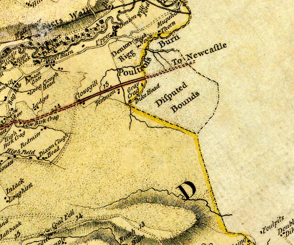
D4NY66SW.jpg Back Dike -- river -- NY6261 (etc) -- single or double wiggly line; a river probably Bush Nook -- building/s -- NY62116517 (guess) -- 'Bush Nook' -- block or blocks, labelled in lowercase; a hamlet or just a house Chapelburn -- locality -- building/s -- NY59746457 (etc) -- 'Chapel Burn' -- block or blocks, labelled in lowercase; a hamlet or just a house Crag Cottage -- building/s -- NY62326407 -- 'Gray Crag' -- block or blocks, labelled in lowercase; a hamlet or just a house probably Cumberland: threapland 1 -- threapland -- county boundary -- NY624637 (etc) -- 'Disputed Bounds' -- area east of Poltross Burn Denton Rigg -- area -- NY61756504 (etc) -- 'Denton Rigg' -- locality Hadrian's Wall -- roman wall -- NY6166 (etc)Hadrian's Wall -- roman wall -- NY6166 (etc) -- 'Picts Wall' -- 'Picts Wall' -- 'Picts Wall' -- double line with ?palings -- at Bowness-on-Solway -- N of Carlisle -- into Northumberland High Closegill -- building/s -- NY60676346 -- 'Clowsgill' -- block or blocks, labelled in lowercase; a hamlet or just a house possibly Hill Head -- building/s -- NY61966356 -- 'Dike Head' -- block or blocks, labelled in lowercase; a hamlet or just a house Low Closegill -- building/s -- NY60496340 -- 'Clowsgill' -- block or blocks, labelled in lowercase; a hamlet or just a house possibly milestone, Nether Denton (2) -- milestone -- NY59576309 -- '14' -- milestone; from Carlisle towards Newcastle milestone, Nether Denton (3) -- milestone -- NY61076365 -- '15' -- milestone; from Carlisle towards Newcastle Poltross Burn -- river -- boundary -- county boundary -- NY634664 -- 'Poultross Burn' -- single or double wiggly line; a river into the Irthing, and county boundary Haltwhistle to Brampton -- road -- route etc -- NY76 -- 'To Newcastle' -- double line, solid or dotted, with a dot or milestone and number at 1 mile intervals, tinted red; turnpike road -- into Northumberland Temon -- building/s -- NY61696382 -- 'Temmon' -- block or blocks, labelled in lowercase; a hamlet or just a house Throp, The -- building/s -- NY62776563 -- 'Thorn' -- block or blocks, labelled in lowercase; a hamlet or just a house probably Upper Denton -- building/s -- NY61616546 (etc) ? -- 'Upper Denton' -- block or blocks, labelled in lowercase; a hamlet or just a house, with church | ||
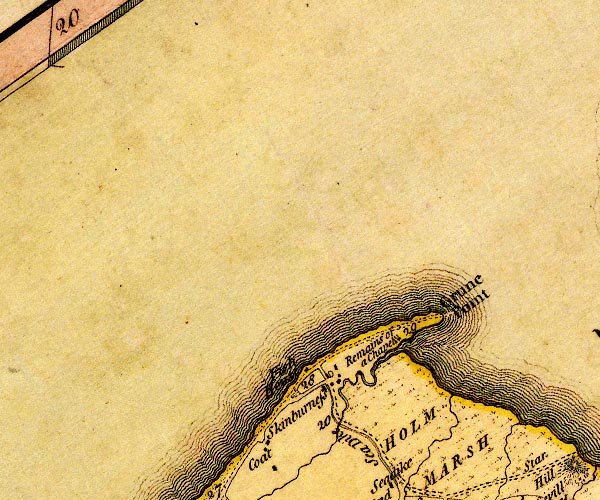
D4NY15NW.jpg Chapel of the Grune -- chapel -- church -- NY13655645 -- 'Remains of a Chapel' -- block with added elements? Great Gutter -- river -- boundary -- parish boundary -- NY1355 (etc) -- single or double wiggly line; a river into the sea S of Grune Point Grune Point -- headland -- NY14335690 (etc) -- 'Grune Point' -- headland Abbey Town to Grune Point -- road -- route -- NY15 -- double line, narrower, solid or dotted with a dot and number at 1 mile intervals; road -- distances from Cockermouth Maryport to Silloth -- route -- NY03 -- 'A. to GPt. 10:0:0' -- 'M. to A. 5:0:2' -- double line, narrower, solid or dotted with a dot and number at 1 mile intervals; road -- a mile and a half beyond Skinburness to Grune Point; distances from Whitehaven -- miles.furlongs.poles; Allonby to Grune Point -- miles.furlongs.poles; Maryport to Allonby Silloth to Grune Point -- road -- route -- NY15 -- 'A. to GPt. 10:0:0' -- double line, narrower, solid or dotted with a dot and number at 1 mile intervals; road -- distances from Whitehaven -- further south the road is labelled -- miles.furlongs.poles; Allonby to Grune Point Sea Dike -- Moricambe etc -- NY13065536 (etc) -- 'Sea Dike' -- double line, perhaps a sea wall on landward side of the road Skinburness Marsh -- marsh -- NY14005580 (etc) -- 'HOLM MARSH' -- area of marsh Skinburness -- building/s -- port etc -- NY12715593 -- 'Skinburness' -- block or blocks, labelled in lowercase; a hamlet or just a house Skinburnessbank -- building/s -- NY12445602 -- 'Fish House' -- block or blocks, labelled in lowercase; a hamlet or just a house possibly | ||
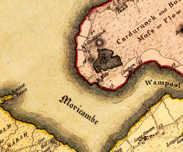
D4NY15NE.jpg Anthorn -- locality -- building/s -- NY19225798 (etc) -- 'Anthorn' -- block or blocks, labelled in lowercase; a hamlet or just a house and a house Bowness Common -- common -- NY2059 -- 'Cardurnock and Bowness Moss or Flow' -- area of moss Cardurnock Lough -- lake (drained?) -- NY179582 (etc) -- 'Lough' -- lake with islands Cardurnock -- locality -- building/s -- NY17245880 (etc) -- 'Cardurnock' -- block or blocks, labelled in lowercase; a hamlet or just a house mill, Cardurnock -- water mill -- mill -- NY17855766 (guess) -- 'Mills' -- circle with rays, mill wheel; a water mill Moricambe -- bay -- foreshore -- NY16275693 (etc etc) -- 'Moricambe' -- bay; lettered in English Black Letter road, through Cardurnock -- road -- route -- NY26 -- 'G Pt. to B. 6:4:8' -- double line, narrower, solid or dotted with a dot and number at 1 mile intervals; road -- miles.furlongs.poles; Grune Point to Bowness? Moricambe sands road -- road sands -- route -- NY15 -- 'G Pt. to B. 6:4:8' -- double line, narrower, solid or dotted with a dot and number at 1 mile intervals; road -- miles.furlongs.poles; Grune Point to Bowness windmill, Cardurnock -- windmill -- mill -- NY17725770 (guess) -- 'Mills' -- tower and sails; a windmill | ||
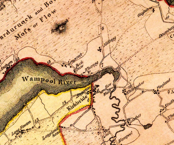
D4NY25NW.jpg Angerton -- building/s -- NY22915703 -- 'Angerton' -- block or blocks, labelled in lowercase; a hamlet or just a house Beckbrow -- building/s -- NY21915779 -- 'Beckbrow' -- block or blocks, labelled in lowercase; a hamlet or just a house Bowness Common -- common -- NY2059 -- 'Cardurnock and Bowness Moss or Flow' -- area of moss Howwath Bridge -- bridge -- NY23815733 -- 'How Wath' -- ford over the Wampool probably Kirkbride -- building/s -- NY22905635 (etc) -- 'Kirkbride' -- blocks, and usually a church, labelled in upright lowercase; a village Laythes -- building/s -- locality -- NY24385570 -- 'Leathes' -- block or blocks, labelled in lowercase; a hamlet or just a house Longcroft Farm -- building/s -- locality -- NY21435815 -- 'Longcroft' -- block or blocks, labelled in lowercase; a hamlet or just a house Longlands Head -- building/s -- NY21675531 -- 'Langlandhead' -- block or blocks, labelled in lowercase; a hamlet or just a house mill, Laythes -- water mill -- mill -- corn mill (?) -- NY24175610 (estimate) -- circle with rays, mill wheel; a water mill at Leathes Millrigg -- building/s -- locality -- NY23115898 -- 'Millrigg' -- block or blocks, labelled in lowercase; a hamlet or just a house Carlisle to Abbey Town -- route -- NY35 -- 'A. to C. 17:3:28' -- double line, narrower, solid or dotted with a dot and number at 1 mile intervals; road -- miles.furlongs.poles; Abbey Holm to Carlisle -- from Irish gate, over the Caldew road, through Cardurnock -- road -- route -- NY26 -- 'G Pt. to B. 6:4:8' -- double line, narrower, solid or dotted with a dot and number at 1 mile intervals; road -- miles.furlongs.poles; Grune Point to Bowness? Wigton to Bowness-on-Solway -- road -- route -- NY24 -- 'W. to B. 10:2:20' -- double line, narrower, solid or dotted with a dot and number at 1 mile intervals; road -- miles.furlongs.poles; Wigton to Bowness Rogersceugh -- building/s -- NY21595980 -- 'Rogerscugh' -- block or blocks, labelled in lowercase; a hamlet or just a house on a hill Moricambe sands road -- road sands -- route -- NY15 -- 'G Pt. to B. 6:4:8' -- double line, narrower, solid or dotted with a dot and number at 1 mile intervals; road -- miles.furlongs.poles; Grune Point to Bowness Wampool, River -- river -- boundary -- parish boundary etc -- NY1757 (etc) ? -- 'Wampool River' -- 'Wampool River' -- single or double wiggly line; a river and estuary Whitrigg Bridge -- bridge -- NY22825761 -- ford north of Kirkbride probably Whitrigg -- locality -- building/s -- NY22565778 (etc) -- 'Whitrigg' -- block or blocks, labelled in lowercase; a hamlet or just a house Whitrigglees -- locality -- building/s -- NY24135718 -- 'Whitrigglees' -- block or blocks, labelled in lowercase; a hamlet or just a house | ||
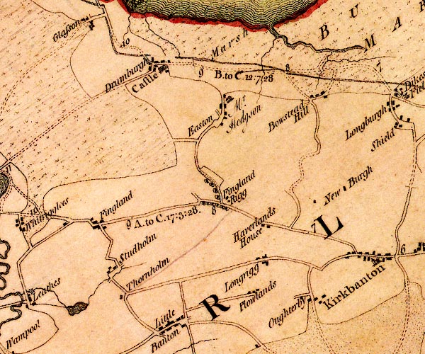
D4NY25NE.jpg Boustead Hill -- building/s -- NY29335913 (etc) -- 'Bowstead Hill' -- block or blocks, labelled in lowercase; a hamlet or just a house Drumburgh Castle -- castle -- NY26575977 -- 'Castle' -- large building; a castle at Drumburgh Drumburgh -- locality -- building/s -- NY26495978 (etc) -- 'Drumburgh' -- block or blocks, labelled in lowercase; a hamlet or just a house Easton Marsh -- marsh -- NY27615977 (etc) -- 'Marsh' -- area of marsh Easton -- locality -- building/s -- NY27675900 -- 'Easton' -- block or blocks, labelled in lowercase; a hamlet or just a house Farhill -- building/s -- NY29985756 -- 'New Burgh' -- block or blocks, labelled in lowercase; a hamlet or just a house possibly Fingland Rigg -- building/s -- NY2757 -- 'Fingland Rigg' -- block or blocks, labelled in lowercase; a hamlet or just a house Fingland -- building/s -- NY25505709 -- 'Fingland' -- block or blocks, labelled in lowercase; a hamlet or just a house Hadrian's Wall -- roman wall -- NY6166 (etc)Hadrian's Wall -- roman wall -- NY6166 (etc) -- 'Picts Wall' -- 'Picts Wall' -- 'Picts Wall' -- double line with ?palings -- at Bowness-on-Solway -- N of Carlisle -- into Northumberland Haverlands House -- building/s -- NY28655698 -- 'Haverlands House' -- block or blocks, labelled in lowercase; a hamlet or just a house lake, Kirkbampton -- lake -- NY25045574 (etc, guess) -- lake Longrigg -- locality -- building/s -- NY28625640 (etc) -- 'Longrigg' -- block or blocks, labelled in lowercase; a hamlet or just a house Marsh House -- building/s -- NY27685912 -- 'Easton / Mr. Hodgson' -- house probably Oughterby -- locality -- building/s -- NY29355577 (etc) -- 'Oughterby' -- block or blocks, labelled in lowercase; a hamlet or just a house Ploughlands -- locality -- building/s -- NY28125593 (etc) -- 'Plowlands' -- block or blocks, labelled in lowercase; a hamlet or just a house Carlisle to Abbey Town -- route -- NY35 -- 'A. to C. 17:3:28' -- double line, narrower, solid or dotted with a dot and number at 1 mile intervals; road -- miles.furlongs.poles; Abbey Holm to Carlisle -- from Irish gate, over the Caldew Carlisle to Bowness-on-Solway -- route -- NY35 -- 'B. to C. 12:7:28' -- double line, narrower, solid or dotted with a dot and number at 1 mile intervals; road -- miles.furlongs.poles; Bowness to Carlisle -- from Irish Gate, over the Caldew Studholme -- locality -- building/s -- NY25985609 -- 'Studholm' -- block or blocks, labelled in lowercase; a hamlet or just a house Thornholm -- building/s -- NY26245576 (guess) -- 'Thornholm' -- block or blocks, labelled in lowercase; a hamlet or just a house | ||
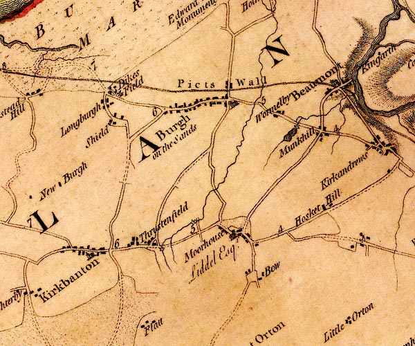
D4NY35NW.jpg Beaumont -- locality -- building/s -- NY34855932 (etc) -- 'Beaumont' -- blocks, and usually a church, labelled in upright lowercase; a village Bow -- locality -- building/s -- NY33555611 (etc) -- 'Bow' -- block or blocks, labelled in lowercase; a hamlet or just a house Burgh by Sands -- locality -- building/s -- NY32755914 (etc) -- 'Burgh on the Sands' -- blocks, and usually a church, labelled in upright lowercase; a village Dykesfield -- building/s -- locality -- NY30765922 -- 'Dikes Field' -- block or blocks, labelled in lowercase; a hamlet or just a house Hadrian's Wall -- roman wall -- NY6166 (etc)Hadrian's Wall -- roman wall -- NY6166 (etc) -- 'Picts Wall' -- 'Picts Wall' -- 'Picts Wall' -- double line with ?palings -- at Bowness-on-Solway -- N of Carlisle -- into Northumberland High Mill -- building/s -- water mill (ex) -- mill (ex) -- corn mill (ex) -- NY31795655 -- circle with rays, mill wheel; a water mill Hoskethill -- locality -- building/s -- NY34765726 (etc) -- 'Hosket Hill' -- block or blocks, labelled in lowercase; a hamlet or just a house Kirkbampton -- locality -- building/s -- NY30495649 (etc) -- 'Kirkbanton' -- blocks, and usually a church, labelled in upright lowercase; a village Longburgh -- locality -- building/s -- NY30925895 (etc) -- 'Longburgh' -- block or blocks, labelled in lowercase; a hamlet or just a house Low Mill -- water mill -- mill -- corn mill -- NY32355713 -- circle with rays, mill wheel; a water mill Monkhill Lough -- lake (mill dam, drained?) -- area -- NY33785835 (etc) -- lake by Munkhill Monkhill Mill -- windmill -- mill -- corn mill -- NY34025869 -- circle with rays, mill wheel; a water mill at Munkhill Monkhill -- building/s -- locality -- NY34345864 -- 'Munkhill' -- block or blocks, labelled in lowercase; a hamlet or just a house Moorhouse Hall -- building/s -- NY33165674 -- 'Moorhouse / Liddel Esqr.' -- house probably Moorhouse -- building/s -- NY33275681 (etc) -- 'Moorhouse' -- block or blocks, labelled in lowercase; a hamlet or just a house Powburgh Beck -- river -- boundary -- parish boundary -- NY3360 (etc) -- wiggly line; a river Carlisle to Abbey Town -- route -- NY35 -- 'A. to C. 17:3:28' -- double line, narrower, solid or dotted with a dot and number at 1 mile intervals; road -- miles.furlongs.poles; Abbey Holm to Carlisle -- from Irish gate, over the Caldew Carlisle to Bowness-on-Solway -- route -- NY35 -- 'B. to C. 12:7:28' -- double line, narrower, solid or dotted with a dot and number at 1 mile intervals; road -- miles.furlongs.poles; Bowness to Carlisle -- from Irish Gate, over the Caldew Shield -- locality -- building/s -- NY30915868 (etc) -- 'Shield' -- block or blocks, labelled in lowercase; a hamlet or just a house Thurstonfield -- locality -- building/s -- NY31595662 (etc) -- 'Thrustenfield' -- block or blocks, labelled in lowercase; a hamlet or just a house windmill, Dykesfield -- windmill -- mill -- NY30925917 (guess) -- windmill at Dikes Field Wormanby -- locality -- building/s -- NY33565885 -- 'Wormelby' -- block or blocks, labelled in lowercase; a hamlet or just a house | ||
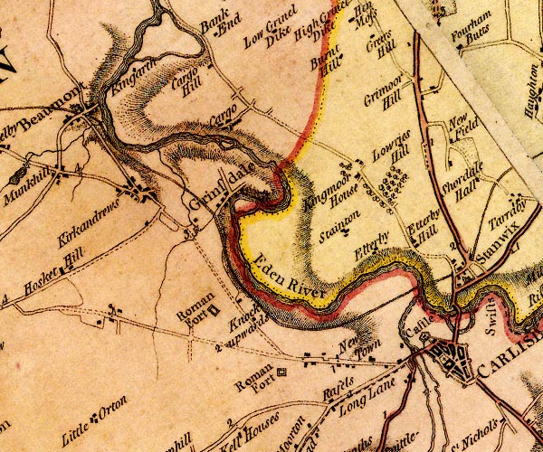
D4NY35NE.jpg Brunthill -- building/s -- NY38175991 -- 'Burnt Hill' -- block or blocks, labelled in lowercase; a hamlet or just a house Caldew Bridge -- bridge -- NY395560 -- double line across a river; a bridge Caldew, River -- river -- boundary -- parish boundary -- NY3851 (etc) ? -- 'Caldew River' -- 'Caldew River' -- single or double wiggly line; a river into the Eden Cargo -- building/s -- NY36625923 -- 'Cargo' -- block or blocks, labelled in lowercase; a hamlet or just a house Cargohill -- building/s -- NY36636015 -- 'Cargo Hill' -- block or blocks, labelled in lowercase; a hamlet or just a house Carlisle Castle -- castle -- NY397563 -- 'Castle' -- large building; a castle Carlisle Cathedral -- church -- NY39885596 -- cross Wigton Road -- street -- NY38745541 (etc) -- 'Long Lane' -- block or blocks, labelled in lowercase; a hamlet or just a house Doudle Beck -- river -- NY3658 (etc) -- single or double wiggly line; a river into the Eden Eden, River -- river -- boundary -- parish boundary -- NY3658 (etc) -- 'Eden River' -- 'Eden R.' -- estuary -- single or double wiggly line; a river and county boundary, into the sea Etterby -- locality -- building/s -- NY39055734 (etc) -- 'Etterby' -- 'Etterby Hill' -- block or blocks, labelled in lowercase; a hamlet or just a house Greymoorhill -- locality -- building/s -- NY39455981 -- 'Grimoor Hill' -- block or blocks, labelled in lowercase; a hamlet or just a house Grinsdale -- locality -- building/s -- NY36905801 (etc) -- 'Grinsdale' -- blocks, and usually a church, labelled in upright lowercase; a village Hadrian's Wall -- roman wall -- NY6166 (etc)Hadrian's Wall -- roman wall -- NY6166 (etc) -- 'Picts Wall' -- 'Picts Wall' -- 'Picts Wall' -- double line with ?palings -- at Bowness-on-Solway -- N of Carlisle -- into Northumberland Hopsteps Beck -- river -- NY3557 (etc) -- single or double wiggly line; a river into the Eden King Garth -- building/s -- NY35505980 -- 'Kingarth' -- block or blocks, labelled in lowercase; a hamlet or just a house Kingmoor House -- building/s -- NY38365847 -- 'Kingmoor House' -- block or blocks, labelled in lowercase; a hamlet or just a house Kirkandrews upon Eden -- locality -- building/s -- NY35405837 (etc) -- 'Kirkandrews' -- block or blocks, labelled in lowercase; a hamlet or just a house Knockupworth -- building/s -- locality -- NY37015656 -- 'Knockupwards' -- block or blocks, labelled in lowercase; a hamlet or just a house Lowryhill -- building/s -- NY39125880 (estimate) -- 'Lowries Hill' -- block or blocks, labelled in lowercase; a hamlet or just a house Mill Beck -- river -- NY36035797 (etc) -- single or double wiggly line; a river into the Eden Mill Beck -- building/s -- water mill (ex) -- mill (ex) -- corn mill (ex) -- NY36055789 -- circle with rays, mill wheel; a water mill near Grinsdale mill, Carlisle -- water mil -- mill -- NY39945520 (guess) -- circle with rays, mill wheel; a water mill on the Caldew Newtown -- locality -- building/s -- NY38335598 (etc) -- 'New Town' -- block or blocks, labelled in lowercase; a hamlet or just a house Raffles -- locality -- building/s -- NY38085561 (etc) -- 'Rafels' -- block or blocks, labelled in lowercase; a hamlet or just a house Carlisle to Abbey Town -- route -- NY35 -- 'A. to C. 17:3:28' -- double line, narrower, solid or dotted with a dot and number at 1 mile intervals; road -- miles.furlongs.poles; Abbey Holm to Carlisle -- from Irish gate, over the Caldew Carlisle to Bowness-on-Solway -- route -- NY35 -- 'B. to C. 12:7:28' -- double line, narrower, solid or dotted with a dot and number at 1 mile intervals; road -- miles.furlongs.poles; Bowness to Carlisle -- from Irish Gate, over the Caldew Carlisle to Longtown -- route -- NY35 -- double line, solid or dotted, with a dot or milestone and number at 1 mile intervals, tinted red; turnpike road -- from Scots Gate and over the Eden Carlisle to Wigton -- route -- 'W. to C. 10:6:8' -- double line, narrower, solid or dotted with a dot and number at 1 mile intervals; road -- miles.furlongs.poles; Wigton to Carlisle Keswick to Carlisle -- route etc -- double line, solid or dotted, with a dot or milestone and number at 1 mile intervals, tinted red; turnpike road roman fort, Belle Vue -- roman fort -- NY37765576 (guess) -- 'Roman Fort' -- square within a square; roman fort Far Camp -- hill -- NY36215697 -- 'Roman Fort' -- square within a square; roman fort Stainton -- locality -- building/s -- NY38065691 (etc) -- 'Stainton' -- block or blocks, labelled in lowercase; a hamlet or just a house | ||
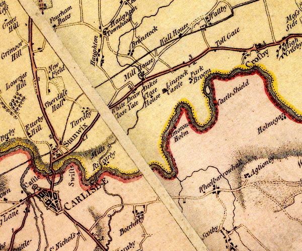
D4NY45NW.jpg Aglionby -- locality -- building/s -- NY44795665 (etc) -- 'Aglionby' -- block or blocks, labelled in lowercase; a hamlet or just a house Ambrose Holme -- building/s -- NY43045775 (estimate) -- 'Amorous Holm' -- block or blocks, labelled in lowercase; a hamlet or just a house Botcherby Bridge -- bridge -- NY41755591 -- double line across the Petteril, W of Botcherby; a bridge Botcherby Mill -- water mill -- mill -- corn mill -- NY41555579 (estimate) -- circle on Petteril; mill Botcherby -- locality -- building/s -- NY42265564 (etc) -- 'Botcherby' -- block or blocks, labelled in lowercase; a hamlet or just a house bridge, Carlisle -- bridge -- NY41375634 -- double line across the Petteril; a bridge Brunstock Beck -- river -- boundary -- parish boundary -- NY4261 -- single or double wiggly line; a river -- at Rickerby Brunstock -- locality -- building/s -- NY41805945 (etc) -- 'Brunstock' -- block or blocks, labelled in lowercase; a hamlet or just a house Carlisle -- building/s etc -- NY403558 (etc) -- 'CARLISLE' -- city; blocks, town walls and bastions, street plan, castle cathedral; lettered in upright block caps Castleshields -- building/s -- NY43855836 -- 'Castle Shield' -- block or blocks, labelled in lowercase; a hamlet or just a house Close House -- building/s -- NY42335841 -- 'Close House' -- block or blocks, labelled in lowercase; a hamlet or just a house Crosby Turnpike -- toll gate (site) -- NY43865953 -- 'Toll Gate' -- block by road; toll house and toll gate Drawdykes Castle -- castle (?) -- peel -- NY41925858 -- 'Draw Dikes' -- block or blocks, labelled in lowercase; a hamlet or just a house Drawdykes Mill -- water mill -- mill -- corn mill -- NY41615793 (estimate) -- 'Mills' -- circle with dots N of Rickerby probably Eden Bridge -- bridge -- NY40105640 (about) -- two bridges over the Eden. Eden Bridge -- bridge -- NY40075656 -- two bridges over the Eden. Hadrian's Wall -- roman wall -- NY6166 (etc)Hadrian's Wall -- roman wall -- NY6166 (etc) -- 'Picts Wall' -- 'Picts Wall' -- 'Picts Wall' -- double line with ?palings -- at Bowness-on-Solway -- N of Carlisle -- into Northumberland Houghton -- locality -- building/s -- NY40885925 (etc) -- 'Haughton' -- block or blocks, labelled in lowercase; a hamlet or just a house Linstock Castle -- castle -- pele tower -- haunted house -- NY42895848 -- 'Linstock Castle' -- large building; a castle milestone, Carlisle (8) -- milestone -- NY40485718 (about) -- '1' -- milestone; from Carlisle towards Newcastle milestone, Stanwix Rural (3) -- milestone -- NY41615840 (?) -- '2' -- milestone; from Carlisle towards Newcastle milestone, Stanwix Rural -- milestone -- NY43005916 -- '3' -- milestone; from Carlisle towards Newcastle Mill House -- building/s -- NY42035878 ? -- 'Mill House' -- block or blocks, labelled in lowercase; a hamlet or just a house mill, Carlisle (2) -- water mill -- mill -- woollen mill -- NY41335556 (estimate) -- circle on Petteril; mill -- water mill -- mill -- corn mill (?) -- NY41955882 -- circle with rays, mill wheel; a water mill at Mill House Newfieldhead -- building/s -- NY39905894 -- 'New Field' -- block or blocks, labelled in lowercase; a hamlet or just a house probably Park Broom -- locality -- building/s -- NY43255889 (etc) -- 'Park Broom' -- block or blocks, labelled in lowercase; a hamlet or just a house Petteril, River -- river -- boundary -- parish boundary -- NY4935 (etc etc) -- 'Pettrill River' -- 'Petterill River' -- single or double wiggly line; a river into the Eden Pow Maughan -- river -- NY4552 (etc etc) -- single or double wiggly line; a river by Wheelbarrowhall Rickerby -- locality -- building/s -- NY41485707 (etc) -- 'Ricarby' -- block or blocks, labelled in lowercase; a hamlet or just a house Brampton to Carlisle -- road -- route -- NY56 -- double line, solid or dotted, with a dot or milestone and number at 1 mile intervals, tinted red; turnpike road -- from Scots Gate and over the Eden Penrith to Carlisle -- route -- road -- NY53 -- 'P. to C. 18:0:0' -- double line, solid or dotted, with a dot or milestone and number at 1 mile intervals, tinted red; turnpike road -- from English Gate -- miles.furlongs.poles; Penrith to Carlisle Shortdale Farm -- building/s -- NY40385850 -- 'Shoredale Hall' -- block or blocks, labelled in lowercase; a hamlet or just a house possibly Stanwix -- locality -- building/s etc -- NY39995708 -- 'Stanwix' -- blocks, and usually a church, labelled in upright lowercase; a village Swifts, The -- locality -- NY405566 (etc) -- 'Swifts' -- locality Tarraby -- building/s -- locality -- NY40935811 -- 'Tarraby' -- block or blocks, labelled in lowercase; a hamlet or just a house Town Head Farm -- building/s -- NY40865996 -- 'Haughton Townhead' -- block or blocks, labelled in lowercase; a hamlet or just a house probably Wall House -- building/s -- NY42845944 (guess) -- 'Wall House' -- block or blocks, labelled in lowercase; a hamlet or just a house Wheelbarrow Hall -- building/s -- workhouse (once) -- NY43825634 -- 'Wheelbarrowhall' -- block or blocks, labelled in lowercase; a hamlet or just a house Whiteclosegate -- locality -- building/s -- NY41095784 (etc) -- 'White Close Yate' -- nosymbol | ||
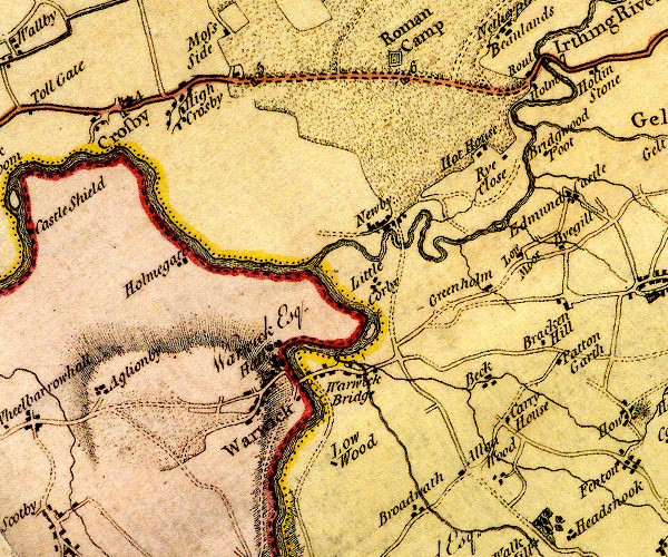
D4NY45NE.jpg Allenwood -- locality -- building/s -- NY48955587 (etc) -- 'Allan Wood' -- block or blocks, labelled in lowercase; a hamlet or just a house Bracken Hill -- building/s -- NY49765772 (guess) -- 'Bracken Hill' -- block or blocks, labelled in lowercase; a hamlet or just a house Bridgewood Foot -- building/s -- NY49375915 (estimate) -- 'Bridgwood Foot' -- block or blocks, labelled in lowercase; a hamlet or just a house Cairn Beck -- river -- boundary -- parish boundary -- NY5054 (etc) -- single or double wiggly line; a river into the Eden Corry House -- building/s -- NY49275619 -- 'Carry House' -- block or blocks, labelled in lowercase; a hamlet or just a house cross, Wetheral -- cross -- NY46965543 (guess) -- cross between road and river between Warwick and Wetheral Eden, River -- river -- boundary -- parish boundary -- NY3658 (etc) -- 'Eden River' -- 'Eden R.' -- estuary -- single or double wiggly line; a river and county boundary, into the sea Greenholme -- building/s -- NY48855790 -- 'Greenholm' -- block or blocks, labelled in lowercase; a hamlet or just a house High Crosby -- locality -- building/s -- NY45485972 (etc) -- 'High Crosby' -- block or blocks, labelled in lowercase; a hamlet or just a house Holme Gate -- building/s -- NY45395793 -- 'Holmegate' -- block or blocks, labelled in lowercase; a hamlet or just a house Hott -- building/s -- NY48665907 -- 'Hot House' -- block or blocks, labelled in lowercase; a hamlet or just a house ? Irthing, River -- river -- boundary -- parish boundary -- county boundary -- NY4758 (etc etc) -- 'Irthing River' -- 'Irthing River' -- single or double wiggly line; a river and county boundary Little Corby -- building/s -- NY47755730 (estimate) -- 'Little Corby' -- block or blocks, labelled in lowercase; a hamlet or just a house Low Crosby -- locality -- building/s -- NY44665950 (etc) -- 'Crosby' -- blocks, and usually a church, labelled in upright lowercase; a village Low Moor -- building/s -- NY49305807 -- 'Low Moor' -- block or blocks, labelled in lowercase; a hamlet or just a house Low Wood -- building/s -- NY474556 -- 'Low Wood' -- block or blocks, labelled in lowercase; a hamlet or just a house milestone, Irthington (3) -- milestone -- NY47645995 -- '6' -- milestone; from Carlisle towards Newcastle milestone, Low Crosby -- milestone -- NY44525950 -- '4' -- milestone; from Carlisle towards Newcastle -- milestone -- NY46045987 -- '5' -- milestone; from Carlisle towards Newcastle Newby Bridge -- bridge -- NY47685806 -- double line across a river; a bridge over the Irthing at Newby Newby East -- locality -- building/s -- NY47595836 (etc) -- 'Newby' -- block or blocks, labelled in lowercase; a hamlet or just a house Brampton to Carlisle -- road -- route -- NY56 -- double line, solid or dotted, with a dot or milestone and number at 1 mile intervals, tinted red; turnpike road -- from Scots Gate and over the Eden Ruleholme -- locality -- NY49155996 (etc) -- 'Roul Holm' -- block or blocks, labelled in lowercase; a hamlet or just a house Ryeclose -- building/s -- NY48985912 -- 'Rye Close' -- block or blocks, labelled in lowercase; a hamlet or just a house Trout Beck -- river -- boundary -- parish boundary -- NY4856 (etc) -- single or double wiggly line; a river into the Trout Beck Trout Beck -- river -- NY5056 (etc) -- single or double wiggly line; a river into the Cairn Beck Troutbeck -- building/s -- NY49015678 -- 'Beck' -- block or blocks, labelled in lowercase; a hamlet or just a house probably Warwick Bridge -- bridge -- NY46915671 -- 'Warwick Bridge' -- double line across a river; a bridge Warwick Bridge -- building/s -- NY46915672 -- block or blocks, labelled in lowercase; a hamlet or just a house Warwick Hall -- building/s -- NY46665695 -- 'Hall / Warwick Esq.' -- house Warwick-on-Eden -- locality -- building/s -- NY46525659 (etc) -- 'Warwick' -- blocks, and usually a church, labelled in upright lowercase; a village | ||
D4NY55NW.jpg Aaron's Town -- building/s -- NY53336008 -- 'Arons Town' -- block or blocks, labelled in lowercase; a hamlet or just a house Byegill -- building/s -- NY49805815 -- 'Byegill' -- block or blocks, labelled in lowercase; a hamlet or just a house Capon Tree -- tree -- NY52575981 -- 'Capon Tree' -- tree Castle Carrock Common -- area -- NY535558 (etc) -- 'Castle Carrick Common' -- locality, common Castle Carrock -- building/s -- NY54245540 (etc) -- 'Castle Carrick' -- blocks, and usually a church, labelled in upright lowercase; a village Closehead -- building/s -- NY51135582 -- 'Close Head' -- block or blocks, labelled in lowercase; a hamlet or just a house Common Gate -- building/s -- NY51455897 (estimate) -- 'Gale' -- block or blocks, labelled in lowercase; a hamlet or just a house Cote Hill -- building/s -- NY50845616 -- 'Catch Hill' -- block or blocks, labelled in lowercase; a hamlet or just a house Cowran -- building/s -- NY52365642 -- 'Cowren' -- block or blocks, labelled in lowercase; a hamlet or just a house Edmond Castle -- castle -- building/s -- NY49725857 -- 'Edmund Castle' -- block or blocks, labelled in lowercase; a hamlet or just a house Fenton -- building/s -- NY50205605 -- 'Fenton' -- block or blocks, labelled in lowercase; a hamlet or just a house Flatt Farm, The -- building/s -- NY52375583 -- 'Flatts' -- block or blocks, labelled in lowercase; a hamlet or just a house Gelt House -- building/s -- NY50475912 -- 'Gelt Ho.' -- no symbol Gelt Mill -- building/s -- mill (ex) -- water mill (ex) -- NY53695654 -- circle with rays, mill wheel; a water mill at Greenwell Gelt, River -- river -- NY5456 (etc) ? -- 'Gelt River' -- 'Gelt River' -- single or double wiggly line; a river Geltside -- building/s -- NY51665919 -- 'Gelt Side' -- block or blocks, labelled in lowercase; a hamlet or just a house Greenwell -- building/s -- NY53695644 (etc) -- 'Greenwell' -- block or blocks, labelled in lowercase; a hamlet or just a house Hayton -- locality -- building/s -- NY50765773 (etc) ? -- 'Hayton' -- blocks, and usually a church, labelled in upright lowercase; a village Hell Beck -- river -- boundary -- parish boundary -- NY5358 (etc) -- 'Hell Beck' -- single or double wiggly line; a river High Moor Farm -- building/s -- NY51925705 -- 'High Moor' -- block or blocks, labelled in lowercase; a hamlet or just a house probably Hill, The -- building/s -- NY53495655 -- 'Hill' -- block or blocks, labelled in lowercase; a hamlet or just a house Hollas -- building/s -- NY53785968 (guess) -- 'Hollas' -- block or blocks, labelled in lowercase; a hamlet or just a house Hollinstone -- building/s -- locality -- NY49906006 -- 'Hollin Stone' -- block or blocks, labelled in lowercase; a hamlet or just a house How Mill -- building/s -- locality -- water mill (ex) -- mill (ex) -- corn mill (ex) -- sawmill (ex) -- NY51005651 -- 'How Mill' -- circle with rays, mill wheel; a water mill How -- building/s -- NY50665640 (etc) -- 'How' -- block or blocks, labelled in lowercase; a hamlet or just a house Low Gelt Bridge -- bridge -- NY51975916 -- 'Gelt Bridge' -- double line across a river; a bridge Low Geltbridge -- building/s -- NY51975929 -- 'Gelt Bridge' -- block or blocks, labelled in lowercase; a hamlet or just a house Patton Garth -- building/s -- NY49905696 (guess) -- 'Patton Garth' -- block or blocks, labelled in lowercase; a hamlet or just a house Pepper Hill -- building/s -- NY53785941 -- 'Pepper Hill' -- block or blocks, labelled in lowercase; a hamlet or just a house Ring Gate -- building/s -- locality -- NY52915622 -- 'King Gate' -- block or blocks, labelled in lowercase; a hamlet or just a house Tarn End -- building/s -- NY54385834 -- 'Tarn End' -- block or blocks, labelled in lowercase; a hamlet or just a house Towan Bank -- building/s -- NY53676024 -- 'Row Bank' -- block or blocks, labelled in lowercase; a hamlet or just a house probably Townhead -- locality -- building/s -- NY51635776 (etc) -- 'Town Head' -- block or blocks, labelled in lowercase; a hamlet or just a house Wreay -- building/s -- NY53315948 -- 'Wrey' -- block or blocks, labelled in lowercase; a hamlet or just a house | ||
D4NY55NE.jpg Black Sike Coal Pit -- coal mine -- NY576570 (etc) -- 'Coal Pitts' -- 2 cirlces, coal mines probably Clowsgill Holme -- building/s -- NY58935944 -- 'Clowsgill Holm' -- block or blocks, labelled in lowercase; a hamlet or just a house Clowsgill Limeworks -- quarry -- limestone quarry -- limekiln (etc) -- NY59045916 (etc) -- 'Lime Kilns' -- two circles; limekilns Farlam Hall -- building/s -- NY56996013 -- 'Farlam Hall' -- block or blocks, labelled in lowercase; a hamlet or just a house Farlam -- building/s -- NY55545883 -- 'Farlam' -- block or blocks, labelled in lowercase; a hamlet or just a house Garth Head -- building/s -- NY55195556 -- 'Garth Head' -- block or blocks, labelled in lowercase; a hamlet or just a house Hallbankgate -- locality -- building/s -- NY57975963 (etc) -- 'Hallbank' -- block or blocks, labelled in lowercase; a hamlet or just a house High Bowbank, -- building/s -- NY56665934 -- 'High Bowbank' -- block or blocks, labelled in lowercase; a hamlet or just a house High Close -- building/s -- NY55845726 -- 'High Close' -- block or blocks, labelled in lowercase; a hamlet or just a house Hullerbank -- building/s -- NY55545794 -- 'Huller Bank' -- block or blocks, labelled in lowercase; a hamlet or just a house Jockey Shield -- building/s -- NY55755561 -- 'Jockeys Shield' -- block or blocks, labelled in lowercase; a hamlet or just a house Kirkhouse Farm -- building/s -- NY56715984 -- 'Kirk House' -- block or blocks, labelled in lowercase; a hamlet or just a house probably Kirkhouse -- building/s -- locality -- NY56755983 (etc) -- 'Farlam' -- blocks, and usually a church, labelled in upright lowercase; a village Low Bowbank, -- building/s -- NY56675948 -- 'Low Bowbank' -- block or blocks, labelled in lowercase; a hamlet or just a house Moss Hill -- building/s -- NY580600 -- 'Mossy Land' -- block or blocks, labelled in lowercase; a hamlet or just a house Moss Pladdow -- building/s -- NY55975762 -- 'Mossplad House' -- block or blocks, labelled in lowercase; a hamlet or just a house New Garth -- building/s -- NY58006043 -- 'New Garth' -- block or blocks, labelled in lowercase; a hamlet or just a house Brampton to Alston -- route -- NY56 -- double line, narrower, solid or dotted with a dot and number at 1 mile intervals; road -- part in Northumberland Talkin Tarn -- lake -- NY54525875 (etc) -- 'Talkin Tarn' -- lake Talkin -- building/s -- NY54945737 (etc) -- 'Talkin' -- block or blocks, labelled in lowercase; a hamlet or just a house Talkinhead -- building/s -- locality -- NY55275651 -- 'Talkin Head' -- block or blocks, labelled in lowercase; a hamlet or just a house Waygill Hill -- building/s -- NY55115677 -- 'Wygill Hill' -- block or blocks, labelled in lowercase; a hamlet or just a house Williamgill -- building/s -- NY57045963 (?) -- 'William Gill' -- block or blocks, labelled in lowercase; a hamlet or just a house | ||
D4NY65NW.jpg Black Burn -- river -- boundary -- county boundary -- NY6258 -- 'Black Burn' -- single or double wiggly line; a river and county boundary Bruthwaite Forest -- forest -- NY60945758 (etc etc) -- 'Bruthwaite Forest' -- area Butt of Blackburn -- county boundary mark -- NY63295638 -- 'The Keld' -- locality on county boundary probably Byers Pike -- hill -- NY63695730 -- 'Byers Pike' -- hill hachuring; hill or mountain, and triangle symbol, on one of the county boundaries Coalfell -- locality -- building/s -- NY59406001 -- 'Coal Fell' -- block or blocks, labelled in lowercase; a hamlet or just a house Cold Fell -- hill -- boundary mark -- NY60575563 (etc) -- 'Cold Pike Fell' -- hill hachuring; hill or mountain, and triangle symbol possibly Cumberland: threapland 2 -- threapland -- county boundary -- NY632575 (etc) -- 'Disputed Bounds' -- area by Byers Pike, with county boundary Howgill Beck -- river -- NY5957 (etc) -- single or double wiggly line; a river into Tindale Tarn King's Forest of Geltsdale -- forest -- NY59595312 (etc etc) -- 'KINGS FOREST OF GELTSDALE' -- area Riggfoot Farm -- building/s -- NY62075934 -- 'Tarn Rigg' -- block or blocks, labelled in lowercase; a hamlet or just a house Roachburn -- locality -- building/s -- NY61605977 (etc) -- 'Reach Bian' -- block or blocks, labelled in lowercase; a hamlet or just a house Brampton to Alston -- route -- NY56 -- double line, narrower, solid or dotted with a dot and number at 1 mile intervals; road -- part in Northumberland Sibenese (?) -- building/s -- NY6458 (roughly) -- 'Sibineze' -- block or blocks, labelled in lowercase; a hamlet or just a house Tarn Beck -- river -- NY6158 (etc) -- single or double wiggly line; a river from Tindale Tarn Tarn House -- building/s -- NY60585848 -- 'Tarn House' -- block or blocks, labelled in lowercase; a hamlet or just a house Temple Garth -- building/s -- NY59875972 -- 'Temple Garth' -- block or blocks, labelled in lowercase; a hamlet or just a house Thorn Pits -- coal mine -- mine -- NY58815696 (etc, guess) -- 'Thorn Pitts' -- circles, coal mines Tindale Tarn -- lake -- NY60545875 (etc) -- 'Tendale Tarn' -- lake | ||
D4NY65NE.jpg Foulpits -- building/s -- NY64795962 (guess) -- 'Foulpits' -- block or blocks, labelled in lowercase; a hamlet or just a house Haining Burn -- river -- NY6459 (etc) -- single or double wiggly line; a river into the Black Burn Haining House -- building/s -- NY64276001 -- 'Haining House' -- block or blocks, labelled in lowercase; a hamlet or just a house Halton Lea -- building/s -- NY6558 -- 'Halton Lee' -- block or blocks, labelled in lowercase; a hamlet or just a house Hill House -- building/s -- NY64435930 -- 'Hill' -- block or blocks, labelled in lowercase; a hamlet or just a house Maiden Way -- roman road -- road etc -- NY62 -- 'Maiden Way' -- 'Maiden Way' -- double dotted line, track, labelled in English Black Letter North Doubledykes -- building/s -- NY65415953 -- 'Double Dikes' -- block or blocks, labelled in lowercase; a hamlet or just a house probably Brampton to Alston -- route -- NY56 -- double line, narrower, solid or dotted with a dot and number at 1 mile intervals; road -- part in Northumberland | ||
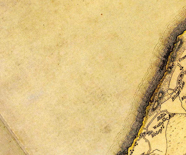
D4NY05SE.jpg New House -- building/s -- NY09815009 -- 'New Ho.' -- block or blocks, labelled in lowercase; a hamlet or just a house | ||
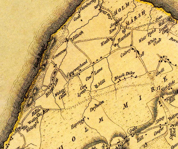
D4NY15SW.jpg Blackdyke -- locality -- building/s -- NY14365245 (etc) -- 'Black Dike' -- block or blocks, labelled in lowercase; a hamlet or just a house Blitterlees -- locality -- building/s -- NY10925211 (etc) -- 'Blitter Lees' -- block or blocks, labelled in lowercase; a hamlet or just a house Calvo Marsh -- marsh -- NY15185490 (etc etc) -- 'HOLM MARSH' -- area of marsh Calvo -- locality -- building/s -- NY14415380 -- 'Calvey' -- block or blocks, labelled in lowercase; a hamlet or just a house Causewayhead -- locality -- building/s -- NY11955253 (etc) -- 'Causewayhead' -- block or blocks, labelled in lowercase; a hamlet or just a house Close, The -- building/s -- NY11465158 -- 'Wolsty Close' -- block or blocks, labelled in lowercase; a hamlet or just a house Cowlane -- building/s -- NY12645267 -- 'Cow Lane' -- block or blocks, labelled in lowercase; a hamlet or just a house Cowlyers -- building/s -- NY12385212 -- 'Cow Lyers' -- block or blocks, labelled in lowercase; a hamlet or just a house Dryholme -- building/s -- NY12735141 -- 'Dryholm' -- block or blocks, labelled in lowercase; a hamlet or just a house East Cote -- locality -- building/s -- NY11995516 (etc) -- 'Coat' -- block or blocks, labelled in lowercase; a hamlet or just a house Greenrow -- building/s -- NY11205263 (etc) -- 'Greenrow' -- no symbol Hartlaw -- building/s -- NY13715396 (?) -- 'Hartlaw' -- block or blocks, labelled in lowercase; a hamlet or just a house Hayrigg House -- building/s -- NY12585050 -- 'Hayrigg' -- block or blocks, labelled in lowercase; a hamlet or just a house Hayrigg -- building/s -- locality -- NY12575068 -- 'Hayrigg' -- block or blocks, labelled in lowercase; a hamlet or just a house Low Holme Mire (?) -- marsh (now drained?) -- NY128501 (etc etc) -- 'LOW HOLM MIRE' -- area of moss Abbey Town to Grune Point -- road -- route -- NY15 -- double line, narrower, solid or dotted with a dot and number at 1 mile intervals; road -- distances from Cockermouth Maryport to Silloth -- route -- NY03 -- 'A. to GPt. 10:0:0' -- 'M. to A. 5:0:2' -- double line, narrower, solid or dotted with a dot and number at 1 mile intervals; road -- a mile and a half beyond Skinburness to Grune Point; distances from Whitehaven -- miles.furlongs.poles; Allonby to Grune Point -- miles.furlongs.poles; Maryport to Allonby Silloth to Grune Point -- road -- route -- NY15 -- 'A. to GPt. 10:0:0' -- double line, narrower, solid or dotted with a dot and number at 1 mile intervals; road -- distances from Whitehaven -- further south the road is labelled -- miles.furlongs.poles; Allonby to Grune Point Seadyke End -- building/s -- NY13725473 -- 'Seadike End' -- block or blocks, labelled in lowercase; a hamlet or just a house Silloth Bank -- sandbank -- foreshore -- NY1055 (etc) -- 'Silloth Banks' -- line of sand dunes or foreshore? S of Silloth possibly Silloth -- building/s etc -- NY11055369 (etc) -- 'Silloth' -- block or blocks, labelled in lowercase; a hamlet or just a house Skinburness Marsh -- marsh -- NY14005580 (etc) -- 'HOLM MARSH' -- area of marsh Wath -- locality -- building/s -- NY13455419 (etc) -- 'Wath' -- block or blocks, labelled in lowercase; a hamlet or just a house Windmill, The -- building/s -- windmill (gone?) -- mill (gone?) -- NY12855207 -- 'Mill' -- windmill by Cow Lyers Wolsty Castle -- castle (ruin) -- NY10485060 -- 'Wolsty Castle' -- square within a square; roman fort Wolsty Hall -- building/s -- NY10565099 -- 'Hall' -- block or blocks, labelled in lowercase; a hamlet or just a house Wolsty -- locality -- building/s -- NY10435031 -- 'Wolsty' -- block or blocks, labelled in lowercase; a hamlet or just a house | ||
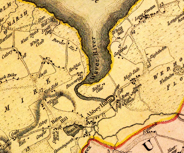
D4NY15SE.jpg Abbey Cowper -- building/s -- locality -- NY15835060 -- 'Abbey Couper' -- block or blocks, labelled in lowercase; a hamlet or just a house Abbey Terrace -- building/s -- NY17585035 -- circle with rays, mill wheel; a water mill at Abbey Holm Abbey Town -- locality -- building/s etc -- NY17655081 (etc) -- 'Abbey Holm' -- blocks, and usually a church, labelled in upright lowercase; a village Broompark -- building/s -- NY19315200 -- 'Broom Park' -- block or blocks, labelled in lowercase; a hamlet or just a house Brownrigg -- building/s -- NY16885274 -- 'Brownrigg' -- block or blocks, labelled in lowercase; a hamlet or just a house East Border -- building/s -- NY16825401 -- 'Border Hos.' -- block or blocks, labelled in lowercase; a hamlet or just a house High House -- building/s -- NY19385193 -- 'High House' -- block or blocks, labelled in lowercase; a hamlet or just a house Holme Hill -- hill (?) -- NY16355092 (etc) -- 'Holm Hill' -- hill hachuring; a hill or mountain ? Kelsick -- locality -- building/s -- NY19875025 (etc) -- 'Kelswick' -- block or blocks, labelled in lowercase; a hamlet or just a house Kingside Hill -- locality -- building/s -- NY15775146 (etc) -- 'Kingside Hill' -- block or blocks, labelled in lowercase; a hamlet or just a house Knowehill -- building/s -- NY18585160 -- 'Know Hill' -- block or blocks, labelled in lowercase; a hamlet or just a house Mireside -- building/s -- NY15995205 -- 'Mire Side' -- block or blocks, labelled in lowercase; a hamlet or just a house Moss Side -- locality -- building/s -- NY19495266 (etc) -- 'Moss Side' -- block or blocks, labelled in lowercase; a hamlet or just a house New Bridge -- bridge -- NY18385143 -- double line across a river; a bridge at Abbey Holm Newton Arlosh -- locality -- building/s -- NY19865520 (etc) -- 'Long Newton' -- block or blocks, labelled in lowercase; a hamlet or just a house, with a church Raby Cote -- building/s -- NY17955238 -- 'Raby Coat' -- block or blocks, labelled in lowercase; a hamlet or just a house Raby Grange -- building/s -- NY18515197 -- 'Grange' -- block or blocks, labelled in lowercase; a hamlet or just a house Red Flatt -- building/s -- NY16925294 -- 'Redflat' -- block or blocks, labelled in lowercase; a hamlet or just a house Abbey Town to Grune Point -- road -- route -- NY15 -- double line, narrower, solid or dotted with a dot and number at 1 mile intervals; road -- distances from Cockermouth Carlisle to Abbey Town -- route -- NY35 -- 'A. to C. 17:3:28' -- double line, narrower, solid or dotted with a dot and number at 1 mile intervals; road -- miles.furlongs.poles; Abbey Holm to Carlisle -- from Irish gate, over the Caldew Cockermouth to Abbey Town -- road -- route -- NY13 -- double line, narrower, solid or dotted with a dot and number at 1 mile intervals; road Wigton to Silloth -- route -- NY24 -- 'A to W. 6:0:0' -- double line, narrower, solid or dotted with a dot and number at 1 mile intervals; road -- miles.furlongs.poles; Abbey Holm to Wigton Salt Cotes -- locality -- building/s -- NY18655350 (etc) -- 'Saltcoat' -- block or blocks, labelled in lowercase; a hamlet or just a house Seaville Cote -- building/s -- NY15875441 -- 'Sevill Coat' -- block or blocks, labelled in lowercase; a hamlet or just a house Seaville -- building/s -- NY15555331 -- 'Sevill' -- block or blocks, labelled in lowercase; a hamlet or just a house Sleightholme -- building/s -- NY19765358 -- 'Slightholm' -- block or blocks, labelled in lowercase; a hamlet or just a house Stank End -- building/s -- NY16345050 -- 'Stank End' -- block or blocks, labelled in lowercase; a hamlet or just a house Stank -- area -- NY16945042 (etc) -- 'Stank' -- lake Starry Hill -- hill -- NY15985517 (?) -- 'Star Hill' -- hill hachuring; a hill or mountain Waitefield -- building/s -- NY15065428 -- 'Wait Field' -- block or blocks, labelled in lowercase; a hamlet or just a house Waver, River -- river etc -- NY1751 (etc) -- 'Waver River' -- 'Waver R.' -- single or double wiggly line; a river and estuary West Border -- building/s -- NY16325426 -- 'Border Hos.' -- block or blocks, labelled in lowercase; a hamlet or just a house Whinclose -- building/s -- NY15435417 -- 'Whin Close' -- block or blocks, labelled in lowercase; a hamlet or just a house Whitehill -- building/s -- NY18605421 -- 'White Hill' -- block or blocks, labelled in lowercase; a hamlet or just a house | ||
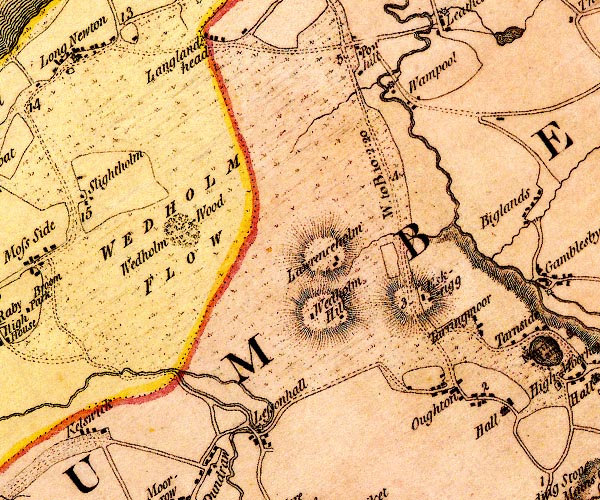
D4NY25SW.jpg Eskrigg -- building/s -- NY24275196 -- 'Eskrigg' -- block or blocks, labelled in lowercase; a hamlet or just a house Lawrenceholme -- building/s -- NY23265260 -- 'Lawrenceholm' -- block or blocks, labelled in lowercase; a hamlet or just a house Lessonhall -- locality -- building/s -- NY22265019 (etc) -- 'Lessonhall' -- block or blocks, labelled in lowercase; a hamlet or just a house mill, Wampool -- water mill -- mill -- NY23925484 (guess) -- circle with rays, mill wheel; a water mill New Bridge -- bridge -- NY22065035 -- double line across a river; a bridge over the Waver Old Mill -- building/s -- water mill (ex) -- mill (ex) -- corn mill (ex) -- NY22305026 -- circle with rays, mill wheel; a water mill probably Oulton -- building/s -- NY24855072 (etc) -- 'Oughton' -- block or blocks, labelled in lowercase; a hamlet or just a house Powhill -- building/s -- NY23645533 -- 'Powhill' -- block or blocks, labelled in lowercase; a hamlet or just a house Wigton to Bowness-on-Solway -- road -- route -- NY24 -- 'W. to B. 10:2:20' -- double line, narrower, solid or dotted with a dot and number at 1 mile intervals; road -- miles.furlongs.poles; Wigton to Bowness Tarnriggmoor -- building/s -- locality -- NY24945177 -- 'Tarringmoor' -- block or blocks, labelled in lowercase; a hamlet or just a house Wampool -- locality -- building/s -- NY24095465 -- 'Wampool' -- block or blocks, labelled in lowercase; a hamlet or just a house Wedholme Flow -- moss -- peat moss -- NY22215291 (etc etc) -- 'WEDHOLM FLOW' -- area of moss Wedholme Hill -- building/s -- NY23055189 -- 'Wedholm Hill' -- block or blocks, labelled in lowercase; a hamlet or just a house Wedholme Wood -- wood -- NY21525329 (etc, guess) -- 'Wedholm Wood' -- wood | ||
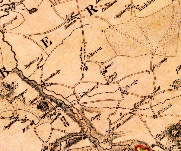
D4NY25SE.jpg Aikton -- locality -- building/s -- NY27465345 (etc) -- 'Aketon' -- blocks, and usually a church, labelled in upright lowercase; a village, the church outside the settlement Bampton Beck -- river -- NY2654 (etc) -- single or double wiggly line; a river, into the Wampool Biglands -- locality -- building/s -- NY25605319 (etc) -- 'Biglands' -- block or blocks, labelled in lowercase; a hamlet or just a house Down Hall -- building/s -- castle (site) -- NY28325250 -- 'Down Hall' -- block or blocks, labelled in lowercase; a hamlet or just a house Drumleaning -- building/s -- locality -- NY27105181 -- 'Drumlining' -- block or blocks, labelled in lowercase; a hamlet or just a house Gamelsby -- locality -- building/s -- NY25875242 (etc) -- 'Gamblesby' -- block or blocks, labelled in lowercase; a hamlet or just a house Hardcake Hall -- building/s -- NY30215179 -- 'Hardcake Hall' -- block or blocks, labelled in lowercase; a hamlet or just a house Little Bampton -- locality -- building/s -- NY27225525 (etc) -- 'Little Banton' -- block or blocks, labelled in lowercase; a hamlet or just a house Martin Tarn Castle, Woodside -- folly -- NY257517 (about) -- ?tower E of Martin Tarn probably Martin Tarn -- lake -- NY25805156 (etc) -- 'Martin Tarn' -- lake Micklethwaite -- locality -- building/s -- NY28415037 (etc) -- 'Micklethwaite' -- block or blocks, labelled in lowercase; a hamlet or just a house -- building/s -- water mill (ex) -- mill (ex) -- corn mill (ex) -- NY25845234 -- circle with rays, mill wheel; a water mill Moorhouse Hall -- building/s -- NY26465111 -- 'Hall' -- house, and avenue of trees Moorhouse Mill Bridge -- bridge -- NY26795146 -- double line across a river; a bridge SW of Drumleaning Moorhouse Mill -- building/s -- water mill(ex) -- mill (ex) -- corn mill (ex) -- NY26775140 -- circle with rays, mill wheel; a water mill Moorhouse -- locality -- building/s -- NY25925119 -- 'High Moorhouse' -- block or blocks, labelled in lowercase; a hamlet or just a house Oulton Hall -- building/s -- NY25225064 -- 'Hall' -- house, and a hamlet probably Parton -- locality -- building/s -- NY27755087 (etc) -- 'Parton' -- block or blocks, labelled in lowercase; a hamlet or just a house Pow Beck -- river -- boundary -- parish boundary -- NY3152 (etc) -- single or double wiggly line; a river by Drumleaning Carlisle to Wigton -- route -- 'W. to C. 10:6:8' -- double line, narrower, solid or dotted with a dot and number at 1 mile intervals; road -- miles.furlongs.poles; Wigton to Carlisle Scholar's Pool Bridge -- bridge -- NY26905159 -- double line across a river; a bridge SW of Drumleaning probably St Andrew's Church -- church -- NY28245284 -- 'Church' -- church Stony Bridge -- bridge -- NY25625306 -- double line across a river; a bridge by Biglands Tarnside -- building/s -- NY25645176 -- 'Tarnside' -- block or blocks, labelled in lowercase; a hamlet or just a house Thornby -- locality -- building/s -- NY28905204 (etc) -- 'Thornby' -- block or blocks, labelled in lowercase; a hamlet or just a house Wiza Beck -- river -- NY2745 (etc) -- 'Wiza River' -- meeting by Parton -- single or double wiggly line; a river | ||
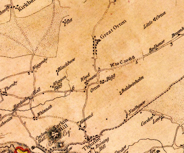
D4NY35SW.jpg Baldwinholme -- building/s -- NY33765193 -- 'Baldwinholm' -- block or blocks, labelled in lowercase; a hamlet or just a house Blackbrow -- building/s -- NY31595299 -- 'Blackbrow' -- block or blocks, labelled in lowercase; a hamlet or just a house Flat -- building/s -- NY31685505 (etc) -- 'Flatt' -- block or blocks, labelled in lowercase; a hamlet or just a house Great Orton -- building/s -- NY32835403 (etc) -- 'Great Orton' -- blocks, and usually a church, labelled in upright lowercase; a village Low Whinnow Farm -- building/s -- NY30345087 -- 'Whinnah' -- block or blocks, labelled in lowercase; a hamlet or just a house Moorend -- locality -- building/s -- NY32135061 (etc) -- 'Moorend' -- block or blocks, labelled in lowercase; a hamlet or just a house Nealhouse -- building/s -- NY34045114 (etc) -- 'Nealhouse' -- block or blocks, labelled in lowercase; a hamlet or just a house Orton Rigg -- locality -- building/s -- NY33085242 (etc) -- 'Orton Rigg' -- block or blocks, labelled in lowercase; a hamlet or just a house Carlisle to Wigton -- route -- 'W. to C. 10:6:8' -- double line, narrower, solid or dotted with a dot and number at 1 mile intervals; road -- miles.furlongs.poles; Wigton to Carlisle Torkin Hill -- hill -- NY31265038 (?) -- 'Torkin Hill' -- hill hachuring; hill or mountain, wooded Wiggonrigg -- building/s -- NY31125224 -- 'Wiggon Rigg' -- block or blocks, labelled in lowercase; a hamlet or just a house Wiggonby -- locality -- building/s -- NY29635306 (etc) -- 'Wiggonby' -- block or blocks, labelled in lowercase; a hamlet or just a house Woodhouses -- locality -- building/s -- NY32485216 (etc) -- 'Woodhouses' -- block or blocks, labelled in lowercase; a hamlet or just a house | ||
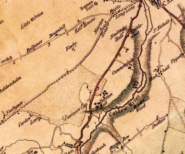
D4NY35SE.jpg Blackhall Wood -- building/s -- NY38735113 -- 'Bleckhall Wood' -- block or blocks, labelled in lowercase; a hamlet or just a house Broomhills -- building/s -- NY36265435 -- 'Broomhill' -- block or blocks, labelled in lowercase; a hamlet or just a house Caldew, River -- river -- boundary -- parish boundary -- NY3851 (etc) ? -- 'Caldew River' -- 'Caldew River' -- single or double wiggly line; a river into the Eden Cardewlees -- locality -- building/s -- NY34925127 -- 'Cardew / Lees' -- block or blocks, labelled in lowercase; a hamlet or just a house Cummersdale Print Works -- building/s -- water mill (ex) -- mill (ex) -- NY39415312 -- circle with rays, mill wheel; a water mill near Cummersdale probably Dalston Hall -- building/s -- NY37655159 (etc) -- 'Dalston Hall / Davinson Esqr.' -- house High Cummersdale -- building/s -- NY3953 -- 'Cummersdale' -- block or blocks, labelled in lowercase; a hamlet or just a house probably Keld Houses -- locality -- building/s -- NY37215503 -- 'Kell Houses' -- block or blocks, labelled in lowercase; a hamlet or just a house Little Orton -- locality -- building/s -- NY35255511 (etc) -- 'Little Orton' -- block or blocks, labelled in lowercase; a hamlet or just a house Low Mill -- building/s -- water mill (ex) -- mill (ex) -- corn mill (ex) -- NY37755112 -- circle with rays, mill wheel; a water mill near Dalston Hall Morton Community Centre -- building/s -- NY38265498 ? -- 'Moorton Head' -- block or blocks, labelled in lowercase; a hamlet or just a house possibly Newby West -- locality -- building/s -- NY36785386 (etc) ? ? -- 'Newby' -- block or blocks, labelled in lowercase; a hamlet or just a house Newlaiths Hall -- building/s -- NY385545 (estimate) -- 'Newleaths Hall' -- block or blocks, labelled in lowercase; a hamlet or just a house Red House -- building/s -- NY35245379 -- 'Redhouse' -- block or blocks, labelled in lowercase; a hamlet or just a house Carlisle to Wigton -- route -- 'W. to C. 10:6:8' -- double line, narrower, solid or dotted with a dot and number at 1 mile intervals; road -- miles.furlongs.poles; Wigton to Carlisle Keswick to Carlisle -- route etc -- double line, solid or dotted, with a dot or milestone and number at 1 mile intervals, tinted red; turnpike road Spital Moor -- building/s -- NY38935456 -- 'Spittlemoor' -- block or blocks, labelled in lowercase; a hamlet or just a house | ||
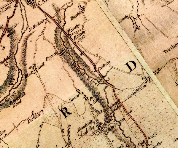
D4NY45SW.jpg Blackwell -- locality -- building/s -- NY40245298 (etc) -- 'Bleckhall' -- block or blocks, labelled in lowercase; a hamlet or just a house Brisco Hill -- building/s -- NY42565141 -- 'Brisco Hill' -- block or blocks, labelled in lowercase; a hamlet or just a house Brisco -- locality -- building/s -- NY42025196 (etc) -- 'Brisco' -- block or blocks, labelled in lowercase; a hamlet or just a house Carleton Mill -- building/s -- water mill (ex) -- mill (ex) -- corn mill (ex) -- NY42895261 -- circle with rays, mill wheel; a water mill near Carleton Carleton -- locality -- building/s -- NY42815283 (etc) -- 'Carleton' -- block or blocks, labelled in lowercase; a hamlet or just a house Cumwhinton -- locality -- building/s -- NY45225285 (etc) -- 'Cumwhinton' -- block or blocks, labelled in lowercase; a hamlet or just a house Durdar -- locality -- building/s -- NY40465098 (etc) -- 'Durdare' -- block or blocks, labelled in lowercase; a hamlet or just a house Harraby Bridge -- bridge -- NY41335469 -- double line across a river; a bridge N of Harraby Harraby Cross -- cross -- NY41775420 (guess) -- 'Haraby Cross' -- cross in the road Harraby -- locality -- building/s -- NY41605433 (etc) -- 'Haraby' -- block or blocks, labelled in lowercase; a hamlet or just a house milestone, Carlisle (2) -- milestone -- NY42215363 -- '2' -- milestone; from Carlisle to Penrith -- milestone -- NY41215482 (about) -- '1' -- milestone; from Carlisle to Penrith milestone, St Cuthbert Without (3) -- milestone -- NY43255244 (?) -- '3' -- milestone; from Carlisle to Penrith milestone, St Cuthbert Without -- milestone -- NY44225117 -- '4' -- milestone; from Carlisle to Penrith Alabaster Mill -- building/s -- water mill (ex) -- mill (ex) -- NY41365358 -- circle with rays, mill wheel; a water mill at Upperby Newbiggin Bridge -- bridge -- footbridge -- NY43525129 -- river crossing near Quar[] Gate Newbiggin -- locality -- building/s -- NY43375101 (etc) -- 'Newbiggen' -- block or blocks, labelled in lowercase; a hamlet or just a house Petteril, River -- river -- boundary -- parish boundary -- NY4935 (etc etc) -- 'Pettrill River' -- 'Petterill River' -- single or double wiggly line; a river into the Eden Quarry Gate -- building/s (gone, under motorway) -- NY43735150 -- 'Quar[y] Gate' -- block or blocks, labelled in lowercase; a hamlet or just a house Penrith to Carlisle -- route -- road -- NY53 -- 'P. to C. 18:0:0' -- double line, solid or dotted, with a dot or milestone and number at 1 mile intervals, tinted red; turnpike road -- from English Gate -- miles.furlongs.poles; Penrith to Carlisle Scotby -- locality -- building/s -- NY44095513 (etc) -- 'Scotby' -- block or blocks, labelled in lowercase; a hamlet or just a house St Nicholas's -- locality -- NY40755499 (etc, supposed) -- 'St Nichol's' -- block or blocks, labelled in lowercase; a hamlet or just a house Upperby Bridge -- bridge -- NY41415366 -- double line across a river; a bridge Upperby -- locality -- building/s -- NY40745371 (etc) ? -- 'Upperby' -- block or blocks, labelled in lowercase; a hamlet or just a house Woodside Park -- building/s -- NY42825057 -- 'Woodside / Losh Esqr.' -- house and hamlet | ||
D4NY45SE.jpg Broadwath -- locality -- building/s -- NY48505530 -- 'Broadwath' -- block or blocks, labelled in lowercase; a hamlet or just a house Brocklewath -- building/s -- NY48755180 -- 'Brokle Wath' -- block or blocks, labelled in lowercase; a hamlet or just a house Coathouse Island -- island -- NY47885241 (etc) -- island near Coat House Corby Castle -- castle -- garden -- NY47105422 -- 'Castle / Phillip Howard Esq.' -- large building; a castle with flags Cote House -- building/s -- NY47555242 -- 'Coat House' -- ? Duncowfold -- building/s -- NY48255121 -- 'Duncow Fold' -- block or blocks, labelled in lowercase; a hamlet or just a house Eden, River -- river -- boundary -- parish boundary -- NY3658 (etc) -- 'Eden River' -- 'Eden R.' -- estuary -- single or double wiggly line; a river and county boundary, into the sea ferry, Wetheral -- ferry -- NY46975437 -- river crossing at Wetheral Glencairn Mill -- building/s -- NY495548 -- 'Walk Mill' -- circle with rays, mill wheel; a water mill Great Corby -- building/s -- NY47235439 (etc) -- 'Corby' -- block or blocks, labelled in lowercase; a hamlet or just a house Sike Foot -- building/s -- NY49465061 (guess) -- 'Sike Foot' -- block or blocks, labelled in lowercase; a hamlet or just a house Wetheral Priory -- priory -- religious house -- NY46805412 -- 'Abbey' -- perhaps a tower Wetheral Shield -- building/s -- locality -- NY46365235 -- 'Wetheral Shield' -- no symbol? Wetheral -- locality -- building/s -- NY46625447 (etc) -- 'Wetheral' -- blocks, and usually a church, labelled in upright lowercase; a village | ||
D4NY55SW.jpg Bogfield -- building/s -- NY54315400 (guess) -- 'Bogfield' -- block or blocks, labelled in lowercase; a hamlet or just a house Brown Rigg -- building/s -- NY53985305 (guess) -- 'Brown Rigg' -- block or blocks, labelled in lowercase; a hamlet or just a house Cairnbridge -- building/s -- NY50305416 -- 'Cairnbrig Know' -- block or blocks, labelled in lowercase; a hamlet or just a house Carlatton Demesne -- building/s -- NY52335253 -- 'Carlatton' -- block or blocks, labelled in lowercase; a hamlet or just a house Carlatton Mill -- building/s -- water mill (ex) -- mill (ex) -- NY52385165 -- circle with rays, mill wheel; a water mill by Hall's Tenement Castle Carrock Common -- area -- NY535558 (etc) -- 'Castle Carrick Common' -- locality, common Cumwhitton -- locality -- building/s -- NY50515222 (etc) -- 'Cumwhitton' -- blocks, and usually a church, labelled in upright lowercase; a village Faugh -- locality -- building/s -- NY50815505 (etc) -- 'Faugh' -- block or blocks, labelled in lowercase; a hamlet or just a house Fellend -- building/s -- NY53455108 -- 'Fellend' -- block or blocks, labelled in lowercase; a hamlet or just a house Gill Foot -- locality -- building/s -- NY53785132 (etc) -- 'Gill Foot' -- block or blocks, labelled in lowercase; a hamlet or just a house Hall's Tenement -- building/s -- NY52785174 -- 'Halls Tenament' -- block or blocks, labelled in lowercase; a hamlet or just a house Heads Nook -- locality -- building/s -- NY49495510 (etc) -- 'Headsnook' -- block or blocks, labelled in lowercase; a hamlet or just a house Long Dyke -- building/s -- NY53975441 -- 'Long Dike' -- no symbol Longdyke Farm -- building/s -- NY53865353 -- 'Long Dike' -- block or blocks, labelled in lowercase; a hamlet or just a house mill, Cairnbridge -- water mill -- mill -- NY50485423 -- 'Mill' -- circle with rays, mill wheel; a water mill mill, Carlatton -- water mill -- mill -- NY52795159 (guess) -- 'Mill' -- circle with rays, mill wheel; a water mill by Halls Tenement Moorthwaite -- locality -- building/s -- NY50565050 (etc) -- 'Moorthwaite' -- block or blocks, labelled in lowercase; a hamlet or just a house Morley Hill -- building/s -- NY50815303 -- 'Morley Hill' -- block or blocks, labelled in lowercase; a hamlet or just a house Moss Nook -- building/s -- locality -- NY50745451 -- 'Moss End' -- block or blocks, labelled in lowercase; a hamlet or just a house probably Nunfield -- building/s -- NY50635128 -- 'Nunfield' -- block or blocks, labelled in lowercase; a hamlet or just a house Piperstile -- building/s -- NY50745087 (?) -- 'Tarn Hill' -- block or blocks, labelled in lowercase; a hamlet or just a house possibly Roughet Hill -- building/s -- NY54615373 -- 'Rawthwaite Hill' -- block or blocks, labelled in lowercase; a hamlet or just a house Saughtreegate -- building/s -- NY53995164 -- 'Saughter Gate' -- block or blocks, labelled in lowercase; a hamlet or just a house Scarrowhill -- locality -- building/s -- NY51365054 (etc) -- 'Scarrow Hill' -- block or blocks, labelled in lowercase; a hamlet or just a house Sirelands -- building/s -- NY52245474 -- 'Syrells' -- block or blocks, labelled in lowercase; a hamlet or just a house Stonebridge Lees -- building/s -- NY51145377 -- 'Stonebrig Leys' -- block or blocks, labelled in lowercase; a hamlet or just a house Tombank -- building/s -- NY52795133 -- 'Tom Bank' -- block or blocks, labelled in lowercase; a hamlet or just a house Whinnyhill -- building/s -- NY50895071 -- 'Whinny Hill' -- block or blocks, labelled in lowercase; a hamlet or just a house Whitehead Hill -- building/s -- NY512528 -- 'Whitehead Hill' -- block or blocks, labelled in lowercase; a hamlet or just a house | ||
D4NY55SE.jpg Albyfield -- building/s -- locality -- NY54835245 -- 'Alby Field' -- block or blocks, labelled in lowercase; a hamlet or just a house Birkshall -- building/s -- NY54695347 (guess) -- 'Birkshall' -- block or blocks, labelled in lowercase; a hamlet or just a house Brackenthwaite -- building/s -- NY5453 -- 'Brackenthwaite' -- block or blocks, labelled in lowercase; a hamlet or just a house Castle Carrock Fell -- hill -- fell -- NY55945401 (etc etc) -- 'Castle Carrick Fell' -- hill hachuring; a hill or mountain Cumrew Fell -- hill -- fell -- NY56585173 (etc etc) ? -- 'Cumrew Fell' -- hill hachuring; a hill or mountain Cumrew -- building/s -- NY55025041 (etc) -- 'Cumrew' -- blocks, and usually a church, labelled in upright lowercase; a village Garth Foot House -- building/s -- NY54695531 -- 'Garth Foot' -- block or blocks, labelled in lowercase; a hamlet or just a house possibly Gelt, River -- river -- NY5456 (etc) ? -- 'Gelt River' -- 'Gelt River' -- single or double wiggly line; a river Geltsdale House -- building/s -- NY56985372 -- 'Geltsdale House' -- block or blocks, labelled in lowercase; a hamlet or just a house King's Forest of Geltsdale -- forest -- NY59595312 (etc etc) -- 'KINGS FOREST OF GELTSDALE' -- area Nixon Head -- building/s -- NY54725395 -- 'Nixonhead' -- block or blocks, labelled in lowercase; a hamlet or just a house Tottergill -- building/s -- NY54895443 -- 'Tottergill' -- block or blocks, labelled in lowercase; a hamlet or just a house Turnberry -- building/s -- NY55305171 -- 'Tarnbury' -- block or blocks, labelled in lowercase; a hamlet or just a house | ||
D4NY65SW.jpg Batsmoor Currick -- currick -- boundary mark -- county boundary mark -- NY63285112 -- 'Batsmore Rigg Pike' -- triangle on county boundary possibly Blackbrock Stone -- boundary stone -- NY61225460 (guess) -- 'Blackbrock Stone' -- a circle on county boundary probably Crookburn Pike -- hill -- NY613518 -- 'Crookburn Pike' -- triangle on county boundary possibly Great Blacklaw Hill -- hill -- boundary mark -- county boundary mark -- NY62225339 (etc) -- 'Blacklaw Hill' -- hill hachuring; hill or mountain, on county boundary King's Forest of Geltsdale -- forest -- NY59595312 (etc etc) -- 'KINGS FOREST OF GELTSDALE' -- area Little Blacklaw Hill -- hill -- boundary mark -- county boundary mark -- NY62335289 (etc) -- 'Blacklaw Hill' -- hill hachuring; hill or mountain, on county boundary Old Water -- river -- NY5853 (etc) -- 'Old Water' -- single or double wiggly line; a river pile of stones, West Dun Hill -- pile of stones -- boundary mark -- county boundary mark -- NY62805231 -- 'Hallburn Pike' -- triangle on county boundary possibly | ||
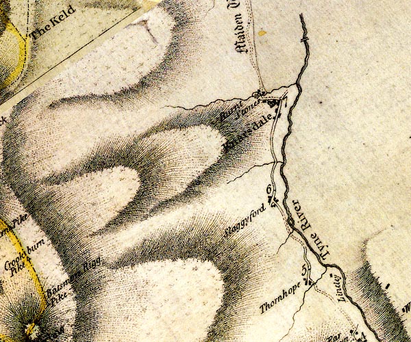
D4NY65SE.jpg Burntstones -- building/s -- NY67475435 -- 'Burnt Stones' -- block or blocks, labelled in lowercase; a hamlet or just a house Knarsdale -- building/s -- NY677548 -- 'Knarsdale' -- blocks, and usually a church, labelled in upright lowercase; a village Lintley -- building/s -- NY68805114 -- 'Lintley' -- block or blocks, labelled in lowercase; a hamlet or just a house Low Thornhope -- building/s -- NY68315095 -- 'Thornhope' -- block or blocks, labelled in lowercase; a hamlet or just a house Brampton to Alston -- route -- NY56 -- double line, narrower, solid or dotted with a dot and number at 1 mile intervals; road -- part in Northumberland Slaggyford -- building/s -- NY677524 -- 'Slaggyford' -- block or blocks, labelled in lowercase; a hamlet or just a house South Tyne, River -- river etc -- NY7441 (etc) ? -- 'Tyne River' -- 'Tyne River' -- 'Tyne River' -- 'Tyne River' -- 'Tyne River' -- single or double wiggly line; a river | ||
D4NY75SW.jpg | ||
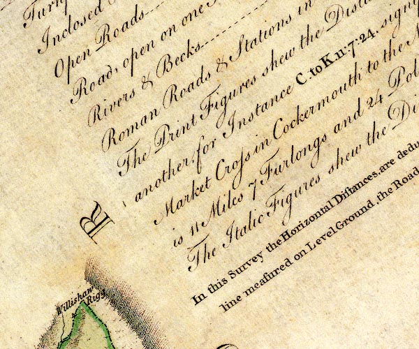
D4NY75SE.jpg | ||
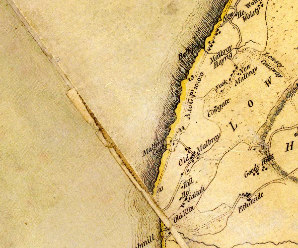
D4NY04NE.jpg Beckfoot -- locality -- building/s -- NY09364973 (etc) -- 'Beckfoot' -- block or blocks, labelled in lowercase; a hamlet or just a house Cowgate -- building/s -- NY09294776 -- 'Cowgate' -- block or blocks, labelled in lowercase; a hamlet or just a house Edderside -- locality -- building/s -- NY10134550 (etc) -- 'Etherside' -- block or blocks, labelled in lowercase; a hamlet or just a house Hill House -- building/s -- NY08254548 -- 'Hill / House' -- block or blocks, labelled in lowercase; a hamlet or just a house Low Holme Mire (?) -- marsh (now drained?) -- NY128501 (etc etc) -- 'LOW HOLM MIRE' -- area of moss Mawbray Cote -- locality -- building/s -- NY08254676 -- 'Malbray Coa[t]' -- block or blocks, labelled in lowercase; a hamlet or just a house Mawbray Hayrigg -- building/s -- NY09914914 -- 'Malbray Hayrig' -- block or blocks, labelled in lowercase; a hamlet or just a house Mawbray -- locality -- building/s -- NY08754666 (etc) -- 'Old Malbray' -- block or blocks, labelled in lowercase; a hamlet or just a house Newtown -- locality -- building/s -- NY09924849 (etc) -- 'New Malbray' -- block or blocks, labelled in lowercase; a hamlet or just a house Nook -- building/s -- NY09464817 -- 'Nook' -- block or blocks, labelled in lowercase; a hamlet or just a house Oldkiln -- building/s -- NY07994477 -- 'Old Kiln' -- block or blocks, labelled in lowercase; a hamlet or just a house ? Maryport to Silloth -- route -- NY03 -- 'A. to GPt. 10:0:0' -- 'M. to A. 5:0:2' -- double line, narrower, solid or dotted with a dot and number at 1 mile intervals; road -- a mile and a half beyond Skinburness to Grune Point; distances from Whitehaven -- miles.furlongs.poles; Allonby to Grune Point -- miles.furlongs.poles; Maryport to Allonby Salta -- locality -- building/s -- NY08434553 -- 'Saltah' -- block or blocks, labelled in lowercase; a hamlet or just a house | ||
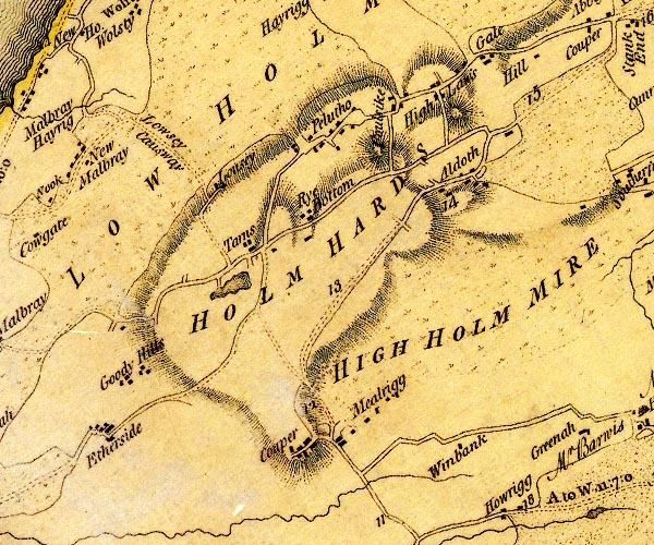
D4NY14NW.jpg Aldoth -- locality -- building/s -- NY14344869 (etc) -- 'Aldoth' -- block or blocks, labelled in lowercase; a hamlet or just a house Common Moss -- moss -- NY147472 (etc) -- 'HIGH HOLM MIRE' -- area of moss Foulsyke -- building/s -- NY13364939 -- 'Foulsike' -- block or blocks, labelled in lowercase; a hamlet or just a house Gale, The -- building/s -- NY14564992 -- 'Gale' -- block or blocks, labelled in lowercase; a hamlet or just a house Goodyhills -- building/s -- NY10834678 -- 'Goody Hills' -- block or blocks, labelled in lowercase; a hamlet or just a house Highlaws -- locality -- building/s -- NY14144976 (etc) -- 'High Laws' -- block or blocks, labelled in lowercase; a hamlet or just a house Hill Farm, The -- building/s -- NY15054999 -- 'Hill' -- block or blocks, labelled in lowercase; a hamlet or just a house Holme Hards -- hill -- NY13654915 (etc) -- 'HOLM HARDS' -- raised area Low Holme Mire (?) -- marsh (now drained?) -- NY128501 (etc etc) -- 'LOW HOLM MIRE' -- area of moss Lowsay Causeway -- road -- causeway -- NY10674882 (etc) -- 'Lowsey Causway' -- track Lowsay -- building/s -- NY11234844 ? -- 'Lousey' -- block or blocks, labelled in lowercase; a hamlet or just a house Mealrigg Hall -- building/s -- NY12864555 -- 'Mealrigg' -- block or blocks, labelled in lowercase; a hamlet or just a house New Cowper -- building/s -- locality -- NY12224538 -- 'Couper' -- block or blocks, labelled in lowercase; a hamlet or just a house Pelutho -- locality -- building/s -- NY12594915 (etc) -- 'Pelutho' -- block or blocks, labelled in lowercase; a hamlet or just a house Cockermouth to Abbey Town -- road -- route -- NY13 -- double line, narrower, solid or dotted with a dot and number at 1 mile intervals; road Rye Bottom -- building/s (gone) -- NY12534853 -- 'Rye Bottom' -- block or blocks, labelled in lowercase; a hamlet or just a house Tarns Dub -- lake -- NY115474 -- lake near Tarns Tarns, The -- locality -- NY12104805 (etc) -- 'Tarns' -- block or blocks, labelled in lowercase; a hamlet or just a house Whinbank -- building/s -- NY14144551 -- 'Winbank' -- block or blocks, labelled in lowercase; a hamlet or just a house | ||
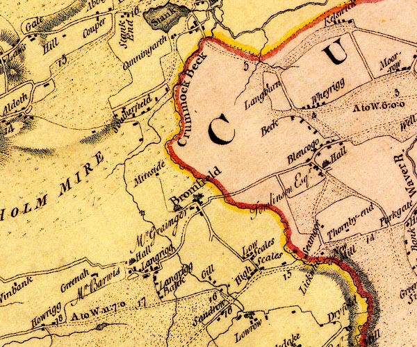
D4NY14NE.jpg Beck Farm -- building/s -- NY19084882 -- 'Beck' -- block or blocks, labelled in lowercase; a hamlet or just a house Blencogo Hall -- building/s -- NY19784771 -- 'Hall / Tomlinson Esqr.' -- house at Blencogo Blencogo -- locality -- building/s -- NY19574789 -- 'Blencogo' -- block or blocks, labelled in lowercase; a hamlet or just a house Hall, The -- building/s -- NY17334685 -- 'Mr. Grainger' -- house at Bromfield Bromfield -- locality -- building/s -- NY17584698 (etc) -- 'Bromfield' -- blocks, and usually a church, labelled in upright lowercase; a village Common Moss -- moss -- NY147472 (etc) -- 'HIGH HOLM MIRE' -- area of moss Crummock Beck -- river -- NY1846 (etc) ? ? -- 'Crummock Beck' -- single or double wiggly line; a river Cunning Garth -- building/s -- NY17095013 -- 'Cunningarth' -- block or blocks, labelled in lowercase; a hamlet or just a house Gill House -- building/s -- NY17904562 -- 'Gill' -- block or blocks, labelled in lowercase; a hamlet or just a house probably Greenah Hall -- building/s -- NY15614580 -- 'Greenah' -- block or blocks, labelled in lowercase; a hamlet or just a house High Scales -- building/s -- NY18784548 -- 'High Scales' -- block or blocks, labelled in lowercase; a hamlet or just a house Langrigg Bank -- building/s -- NY17024537 -- 'Langrigg Bank' -- block or blocks, labelled in lowercase; a hamlet or just a house Langrigg Beck -- river -- NY1646 (etc) -- single or double wiggly line; a river into Crummock Beck Langrigg Hall -- building/s -- NY16434594 -- 'Hall / Mr. Barwis' -- house at Langrigg Langrigg -- locality -- building/s -- NY16494578 (etc) -- 'Langrigg' -- block or blocks, labelled in lowercase; a hamlet or just a house Leegate House -- building/s -- NY19954623 -- 'Lickwhit' -- block or blocks, labelled in lowercase; a hamlet or just a house Longburn -- building/s -- NY18674934 -- 'Langburn' -- block or blocks, labelled in lowercase; a hamlet or just a house Low Scales -- building/s -- NY18504608 -- 'Low Scales' -- block or blocks, labelled in lowercase; a hamlet or just a house Mereside -- building/s -- NY16694743 -- 'Mireside' -- block or blocks, labelled in lowercase; a hamlet or just a house mill, Bromfield -- water mill -- mill -- NY16274697 (guess) -- circle with rays, mill wheel; a water mill W of Bromfield New Mill -- building/s -- water mill (ex) -- mill (ex) -- NY20154593 -- 'New Mill' -- circle with rays, mill wheel; a water mill Carlisle to Allonby -- route etc -- 'A. to W. 11:7:0' -- double line, narrower, solid or dotted with a dot and number at 1 mile intervals; road -- distances from Carlisle -- miles.furlongs.poles; Allonby to Wigton Wigton to Silloth -- route -- NY24 -- 'A to W. 6:0:0' -- double line, narrower, solid or dotted with a dot and number at 1 mile intervals; road -- miles.furlongs.poles; Abbey Holm to Wigton Seymour House -- building/s -- NY19524632 -- 'Seamoor' -- block or blocks, labelled in lowercase; a hamlet or just a house Southerfield -- locality -- building/s -- NY16124862 (etc) -- 'Southerfield' -- locality, with blocks Wheyrigg -- locality -- building/s -- NY19624880 (etc) -- 'Wheyrigg' -- block or blocks, labelled in lowercase; a hamlet or just a house | ||
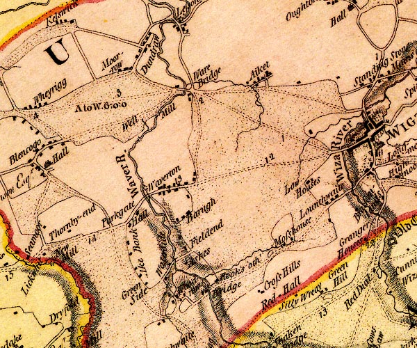
D4NY24NW.jpg Aikbank -- building/s -- locality -- NY21544573 -- 'Ake Bank' -- block or blocks, labelled in lowercase; a hamlet or just a house Aikhead -- locality -- building/s -- NY23734930 (etc) -- 'Aiket' -- block or blocks, labelled in lowercase; a hamlet or just a house Ashes -- building/s -- NY22204579 -- 'Ashes' -- block or blocks, labelled in lowercase; a hamlet or just a house Barugh -- locality -- building/s -- NY22204666 (etc) -- 'Barugh' -- block or blocks, labelled in lowercase; a hamlet or just a house Bridge Mill -- building/s -- water mill (ex) -- mill (ex) -- corn mill (ex) -- NY22774550 -- circle with rays, mill wheel; a water mill near Woodrow bridge, Dundraw -- bridge -- NY21414818 -- double line across a river; a bridge Crosshill -- building/s -- NY23734501 -- 'Cross Hills' -- block or blocks, labelled in lowercase; a hamlet or just a house Dundraw -- locality -- building/s -- NY21584986 (etc) -- 'Dundraw' -- block or blocks, labelled in lowercase; a hamlet or just a house Eller House -- building/s -- NY21774741 -- circle with rays, mill wheel; a water mill at Waverton Greenhill Lodge -- inn -- NY24834554 -- 'Green Hill' -- block or blocks, labelled in lowercase; a hamlet or just a house Greenside -- building/s -- NY21734559 -- 'Green Side' -- block or blocks, labelled in lowercase; a hamlet or just a house Holy Well -- spring -- holy well -- well -- NY21494860 -- 'Well' -- spot and a small stream into the Waver; a well? probably Little Waver -- river -- NY2343 (etc) -- single or double wiggly line; a river into the Waver near Ashes Longthwaite -- locality -- building/s -- NY24854707 (etc) -- 'Lounthwaite' -- block or blocks, labelled in lowercase; a hamlet or just a house Low Houses -- building/s -- NY24544763 -- 'Low Houses' -- block or blocks, labelled in lowercase; a hamlet or just a house Mill Villa -- building/s -- NY22984564 -- 'Rook's 'o th' Bridge' -- block or blocks, labelled in lowercase; a hamlet or just a house possibly Moor Row -- locality -- building/s -- NY20854919 (etc) -- 'Moor-row' -- block or blocks, labelled in lowercase; a hamlet or just a house Moss -- building/s -- NY23994623 (estimate) -- 'Mosshouse' -- block or blocks, labelled in lowercase; a hamlet or just a house Parkgate Hall -- building/s -- NY21534672 -- 'Hall' -- block or blocks, labelled in lowercase; a hamlet or just a house Parkgate -- locality -- building/s -- NY21534680 (etc) -- 'Parkgate' -- block or blocks, labelled in lowercase; a hamlet or just a house Red Hall -- building/s -- NY24294576 -- 'Red Hall' -- block or blocks, labelled in lowercase; a hamlet or just a house Carlisle to Allonby -- route etc -- 'A. to W. 11:7:0' -- double line, narrower, solid or dotted with a dot and number at 1 mile intervals; road -- distances from Carlisle -- miles.furlongs.poles; Allonby to Wigton Wigton to Silloth -- route -- NY24 -- 'A to W. 6:0:0' -- double line, narrower, solid or dotted with a dot and number at 1 mile intervals; road -- miles.furlongs.poles; Abbey Holm to Wigton Thornby End -- building/s -- NY20544659 -- 'Thornby-end' -- block or blocks, labelled in lowercase; a hamlet or just a house Waterside -- locality -- building/s -- NY22134579 (etc) -- 'Water Side' -- block or blocks, labelled in lowercase; a hamlet or just a house Waver Bridge -- bridge -- NY22294908 -- double line across a river; a bridge at Ware Bridge Waver, River -- river etc -- NY1751 (etc) -- 'Waver River' -- 'Waver R.' -- single or double wiggly line; a river and estuary Waverbridge Mill -- building/s -- water mill (ex) -- mill (ex) -- corn mill (ex) -- NY21954886 -- 'Mill' -- circle with rays, mill wheel; a water mill Waverbridge -- locality -- building/s -- NY22334908 (etc) -- 'Ware Bridge' -- block or blocks, labelled in lowercase; a hamlet or just a house Waverton Bridge -- bridge -- NY21804717 -- road crossing the Waver at Waverton Waverton -- locality -- building/s -- NY22454744 (etc) ? ? -- 'Waverton' -- block or blocks, labelled in lowercase; a hamlet or just a house Woodlands -- building/s -- NY22224607 -- 'Fieldend' -- block or blocks, labelled in lowercase; a hamlet or just a house Woodrow -- locality -- building/s -- NY22284534 (etc) -- 'Woodrow' -- block or blocks, labelled in lowercase; a hamlet or just a house Wreay, The -- building/s -- NY24544569 -- 'Silly Wreay' -- block or blocks, labelled in lowercase; a hamlet or just a house | ||
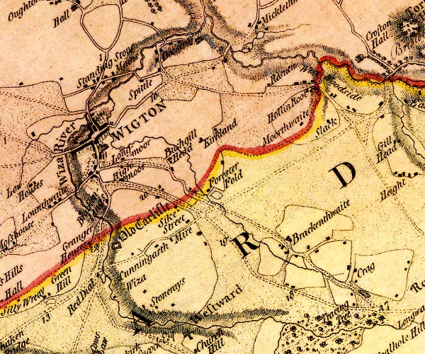
D4NY24NE.jpg Brackenlands Farm -- building/s -- NY25764730 -- 'Brackenlands' -- block or blocks, labelled in lowercase; a hamlet or just a house Brackenthwaite -- locality -- building/s -- NY29324646 (etc) -- 'Brackenthwaite' -- block or blocks, labelled in lowercase; a hamlet or just a house Bushgillhead -- building/s -- NY26804798 -- 'Bushgill Head' -- block or blocks, labelled in lowercase; a hamlet or just a house Cunningarth -- building/s -- NY26714643 -- 'Cunningarth' -- block or blocks, labelled in lowercase; a hamlet or just a house Dockray -- building/s -- NY26704984 -- 'Dockeray' -- block or blocks, labelled in lowercase; a hamlet or just a house and house ford, Wigton -- ford -- footbridge -- NY26234945 -- double line across a river; a bridge at Spittle Forester Fold -- building/s -- NY27584759 -- 'Forester Fold' -- block or blocks, labelled in lowercase; a hamlet or just a house Grainger Houses -- building/s -- NY25304623 -- 'Granger Houses' -- block or blocks, labelled in lowercase; a hamlet or just a house Highmoor -- building/s -- folly -- tower -- NY26194761 -- 'Highmoor' -- block or blocks, labelled in lowercase; a hamlet or just a house Hollin Root -- building/s -- NY29504938 -- 'Hollin Root' -- block or blocks, labelled in lowercase; a hamlet or just a house Jackson Bridge -- bridge -- NY25754699 -- road crossing the Wiza Kirkland -- locality -- building/s -- NY27634839 (etc) -- 'Kirkland' -- block or blocks, labelled in lowercase; a hamlet or just a house Little Mill -- water mill -- mill -- corn mill -- NY26344817 -- circle with rays, mill wheel; a water mill near Longmoor Longmoor -- locality -- NY26194796 (etc) -- 'Longmoor' -- block or blocks, labelled in lowercase; a hamlet or just a house Low Wiza Bridge -- bridge -- NY25414870 -- double line across a river; a bridge over the Wiza N side of Wigton Mains Farm -- building/s -- NY25824936 -- 'Mains' -- block or blocks, labelled in lowercase; a hamlet or just a house Micklethwaite Bridge -- bridge -- NY27985000 -- double line across a river; a bridge over the Wampool Mire -- building/s -- NY26904654 -- 'Mire' -- block or blocks, labelled in lowercase; a hamlet or just a house Moorthwaite -- building/s -- NY29324874 -- 'Moorthwaite' -- block or blocks, labelled in lowercase; a hamlet or just a house Old Carlisle -- building/s -- NY26284646 -- 'Old Carlisle' -- square within a square; roman fort lebelled in english black letter Red Dial -- locality -- building/s -- NY255574602 (etc) -- 'Red Dial' -- block or blocks, labelled in lowercase; a hamlet or just a house Carlisle to Allonby -- route etc -- 'A. to W. 11:7:0' -- double line, narrower, solid or dotted with a dot and number at 1 mile intervals; road -- distances from Carlisle -- miles.furlongs.poles; Allonby to Wigton Carlisle to Wigton -- route -- 'W. to C. 10:6:8' -- double line, narrower, solid or dotted with a dot and number at 1 mile intervals; road -- miles.furlongs.poles; Wigton to Carlisle Cockermouth to Carlisle -- road -- route -- NY13 -- 'C. to W. 16:0:0' -- double line, narrower, solid or dotted with a dot and number at 1 mile intervals; road -- distances from Carlisle -- miles.furlongs.poles; Cockermouth to Wigton Wigton to Bowness-on-Solway -- road -- route -- NY24 -- 'W. to B. 10:2:20' -- double line, narrower, solid or dotted with a dot and number at 1 mile intervals; road -- miles.furlongs.poles; Wigton to Bowness Rosewain -- locality -- building/s -- NY28924927 (etc) -- 'Resu[e]n' -- block or blocks, labelled in lowercase; a hamlet or just a house Slack -- building/s -- NY29804874 -- 'Slack' -- block or blocks, labelled in lowercase; a hamlet or just a house Spital -- building/s -- NY26304940 -- 'Spittle' -- block or blocks, labelled in lowercase; a hamlet or just a house Standingstone -- locality -- building/s -- NY25504920 (etc) -- 'Standing Stone' -- block or blocks, labelled in lowercase; a hamlet or just a house Stoneraise Place -- building/s -- NY27344566 -- 'Stonerays' -- block or blocks, labelled in lowercase; a hamlet or just a house possibly Street -- building/s -- NY27184696 -- 'Street' -- block or blocks, labelled in lowercase; a hamlet or just a house Stubb Bridge -- bridge -- NY25194744 -- road crossing the Wiza Syke -- building/s -- NY27044726 -- 'Sike' -- block or blocks, labelled in lowercase; a hamlet or just a house Tracentree -- building/s -- locality -- NY30234543 -- 'Tracing Tree' -- block or blocks, labelled in lowercase; a hamlet or just a house Wampool, River -- river -- boundary -- parish boundary etc -- NY1757 (etc) ? -- 'Wampool River' -- 'Wampool River' -- single or double wiggly line; a river and estuary West Woodside -- locality -- building/s -- NY29864915 (etc) -- 'West Woodside' -- block or blocks, labelled in lowercase; a hamlet or just a house Whins Mill -- building/s -- water mill (ex) -- mill (ex) -- corn mill (ex) -- NY28244989 -- circle with rays, mill wheel; a water mill S of Miklethwaite Wigton -- building/s etc -- NY25494840 (etc) -- 'WIGTON' -- blocks, perhaps a church, labelled in block caps; a town Wiza Beck -- river -- NY2745 (etc) -- 'Wiza River' -- meeting by Parton -- single or double wiggly line; a river Wiza Bridge -- bridge -- NY25024816 -- double line across a river; a bridge over the Wiza at Wigton Wizabottom -- building/s -- NY25924558 (estimate) -- 'Wiza' -- block or blocks, labelled in lowercase; a hamlet or just a house Woodside Mill -- building/s -- water mill (ex) -- mill (ex) -- corn mill (ex) -- NY29664932 -- circle with rays, mill wheel; a water mill by Hollin Root | ||
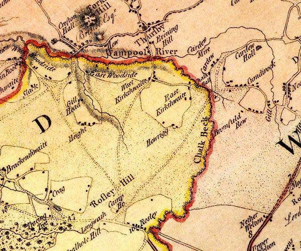
D4NY34NW.jpg Broomfield -- locality -- building/s -- NY34924807 -- 'Bromfield Row' -- block or blocks, labelled in lowercase; a hamlet or just a house Cardew Mires -- moss -- NY34575059 (etc) -- 'Cardew Mire' -- single or double wiggly line; a river ? or locality Cardew -- locality -- building/s -- NY34234956 (etc) -- 'Cardew' -- block or blocks, labelled in lowercase; a hamlet or just a house Chalk Beck -- river -- parish boundary -- boundary -- NY3243 (etc) -- 'Chalk Beck' -- single or double wiggly line; a river into the Wampool Chalk Hall -- building/s -- NY33534876 (estimate) -- 'Chalk Hall' -- block or blocks, labelled in lowercase; a hamlet or just a house Crags -- locality -- NY30884610 (etc) -- 'Crag' -- block or blocks, labelled in lowercase; a hamlet or just a house Crofton Bridge -- bridge -- NY30814949 -- double line across a river; a bridge over the Wampool nr Crofton Hall Crofton Hall -- building/s -- NY30325004 -- 'Crofton Hall / Briscoe Esqr.' -- house and avenue of trees East Curthwaite -- locality -- building/s -- NY33374876 (etc) -- 'East Kirkthwaite' -- block or blocks, labelled in lowercase; a hamlet or just a house East Woodside -- building/s -- NY31664900 -- 'East Woodside' -- block or blocks, labelled in lowercase; a hamlet or just a house Eveninghill -- locality -- NY32614974 (etc) -- 'Evening Hill' -- block or blocks, labelled in lowercase; a hamlet or just a house Ghyll Head -- building/s -- NY31034836 -- 'Gill Head' -- block or blocks, labelled in lowercase; a hamlet or just a house Height, The -- building/s -- NY31074772 -- 'Height' -- block or blocks, labelled in lowercase; a hamlet or just a house Hope and Anchor Inn -- building/s -- inn -- NY31824557 -- 'Camp Ho.' -- block or blocks, labelled in lowercase; a hamlet or just a house Howend -- locality -- building/s -- NY31574982 (etc) -- 'How' -- block or blocks, labelled in lowercase; a hamlet or just a house Howrigg -- locality -- building/s -- NY32984756 (etc) -- 'Howrigg' -- block or blocks, labelled in lowercase; a hamlet or just a house Longwath -- building/s -- NY31424539 -- 'Longwath' -- block or blocks, labelled in lowercase; a hamlet or just a house Rosley Hill -- hill -- fell -- NY31534596 (etc) -- 'Rosley Hill' -- area Rosley -- building/s -- locality -- NY32324513 (etc etc) -- 'Rosley' -- block or blocks, labelled in lowercase; a hamlet or just a house Thursby Mill -- building/s -- mill (ex) -- water mill (ex) -- NY32424937 -- circle with rays, mill wheel; a water mill S of Thursby Thursby -- locality -- building/s -- NY32655023 (etc) -- 'Thursby' -- blocks, and usually a church, labelled in upright lowercase; a village Wampool Bridge -- bridge -- NY32494933 -- double line across a river; a bridge S of Thursby ?plural Wampool, River -- river -- boundary -- parish boundary etc -- NY1757 (etc) ? -- 'Wampool River' -- 'Wampool River' -- single or double wiggly line; a river and estuary West Curthwaite -- locality -- building/s -- NY32404893 (etc) -- 'West Kirkthwaite' -- block or blocks, labelled in lowercase; a hamlet or just a house | ||
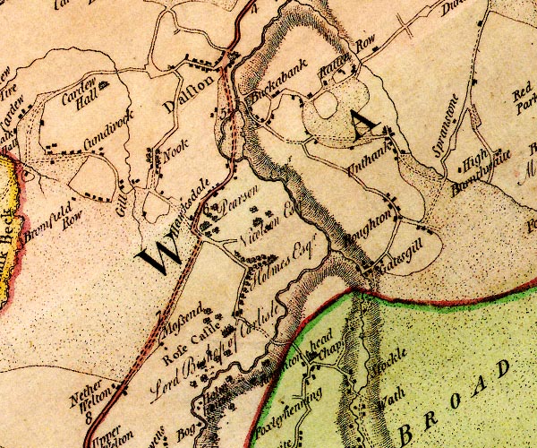
D4NY34NE.jpg All Saints Church -- church -- NY37934557 -- 'Roughtonhead Chap.' -- block or blocks, labelled in lowercase; a hamlet or just a house and church Bishop Mill -- building/s -- water mill (ex) -- mill (ex) -- corn mill (ex) -- NY37114903 (estimate) -- circle with rays, mill wheel; a water mill S of Buckabank probably Buckabank -- locality -- building/s -- NY37374920 (etc) -- 'Buckabank' -- block or blocks, labelled in lowercase; a hamlet or just a house Caldew, River -- river -- boundary -- parish boundary -- NY3851 (etc) ? -- 'Caldew River' -- 'Caldew River' -- single or double wiggly line; a river into the Eden Cardew Hall -- building/s -- NY35004990 -- 'Cardew Hall' -- house Cumdivock -- locality -- building/s -- NY34494866 (etc) -- 'Cumdivock' -- block or blocks, labelled in lowercase; a hamlet or just a house Dalston Bridge -- bridge -- NY36964910 ? -- double line across a river; a bridge at Buckabank Dalston -- locality -- building/s -- NY36915012 (etc) -- 'Dalston' -- blocks, and usually a church, labelled in upright lowercase; a village Gaitsgill -- locality -- building/s -- NY38824676 (etc) -- 'Gatesgill' -- block or blocks, labelled in lowercase; a hamlet or just a house Gill, The -- building/s -- NY35764844 -- 'Gill' -- block or blocks, labelled in lowercase; a hamlet or just a house Hawksdale Bridge -- bridge -- NY37074880 -- double line across a river; a bridge Hawksdale Hall -- building/s -- NY37454772 -- 'Nicolson Esqr.' -- house Hawksdale -- building/s -- NY36764812 (etc) -- 'Hawksdale' -- block or blocks, labelled in lowercase; a hamlet or just a house Holm House -- building/s -- NY36634481 -- 'Holmhouse' -- block or blocks, labelled in lowercase; a hamlet or just a house Holme Hill -- building/s -- NY37644719 -- 'Holmes Esqr.' -- house with an avenue of trees probably Holmhill Farm -- building/s -- NY37504746 -- 'Pearson Esqr.' -- house at Hawksdale possibly mill, Stockdalewath -- water mill -- mill -- NY38634570 (guess) -- circle with rays, mill wheel; a water mill N of Stockle Moss End -- building/s -- NY36094599 -- 'Mossend' -- block or blocks, labelled in lowercase; a hamlet or just a house Nether Welton -- locality -- building/s -- NY35704551 (etc) -- 'Nether Welton' -- block or blocks, labelled in lowercase; a hamlet or just a house Nook -- building/s -- NY36194848 -- 'Nook' -- block or blocks, labelled in lowercase; a hamlet or just a house Ratten Row -- locality -- building/s -- NY39424961 -- 'Ratten Row' -- block or blocks, labelled in lowercase; a hamlet or just a house Raughton -- locality -- building/s -- NY39104765 (etc) -- 'Roughton' -- block or blocks, labelled in lowercase; a hamlet or just a house Keswick to Carlisle -- route etc -- double line, solid or dotted, with a dot or milestone and number at 1 mile intervals, tinted red; turnpike road Roe, River -- river -- NY3845 (etc) -- 'Raw Beck' -- single or double wiggly line; a river into the Caldew Rose Bridge -- bridge -- NY37464590 -- double line across a river; a bridge E of Rose Castle Rose Castle -- bishop's palace -- palace -- castle -- garden -- NY37084616 -- 'Rose Castle / Lord Bishop of Carlisle' -- house Stockdalewath -- locality -- building/s -- NY38734503 (etc) -- 'Stockle Wath' -- block or blocks, labelled in lowercase; a hamlet or just a house Unthank -- locality -- building/s -- NY39314864 (etc) -- 'Unthank' -- block or blocks, labelled in lowercase; a hamlet or just a house | ||
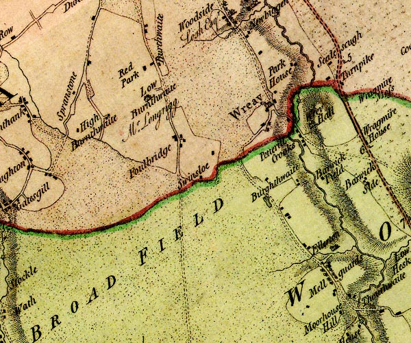
D4NY44NW.jpg Bankdale Farm -- building/s -- NY41434893 -- 'Low Burnthwaite / Mr. Longrigg' -- house Barrock Field -- building/s -- NY45044778 (guess) -- 'Barwick Field' -- block or blocks, labelled in lowercase; a hamlet or just a house Birkthwaite -- building/s -- NY43994784 -- 'Burghthwaite' -- block or blocks, labelled in lowercase; a hamlet or just a house Blackhall Park -- building/s -- NY41234955 -- 'Red Park' -- block or blocks, labelled in lowercase; a hamlet or just a house probably Broad Field -- locality -- NY42534460 (etc) -- 'BROAD FIELD' -- area Burthwaite -- locality -- building/s -- NY41524960 (etc) -- 'Burthwaite' -- block or blocks, labelled in lowercase; a hamlet or just a house Ellerton Grange -- building/s -- NY44334671 -- 'Ellerton' -- block or blocks, labelled in lowercase; a hamlet or just a house Foulbridge -- building/s -- NY41944833 -- 'Foulbridge' -- block or blocks, labelled in lowercase; a hamlet or just a house High Burnthwaite -- building/s -- NY40674836 -- 'High Burnthwaite' -- block or blocks, labelled in lowercase; a hamlet or just a house Mellguards -- building/s -- NY44494602 -- 'Mellguards' -- block or blocks, labelled in lowercase; a hamlet or just a house Park House -- building/s -- NY44114974 -- 'Park House' -- block or blocks, labelled in lowercase; a hamlet or just a house Petteril Crooks -- locality -- NY44374796 (etc) -- 'Petterill Crooks' -- block or blocks, labelled in lowercase; a hamlet or just a house Petteril, River -- river -- boundary -- parish boundary -- NY4935 (etc etc) -- 'Pettrill River' -- 'Petterill River' -- single or double wiggly line; a river into the Eden Scalesceugh -- building/s -- NY44794969 -- 'Scalescugh' -- block or blocks, labelled in lowercase; a hamlet or just a house Sprunston Farm -- building/s -- NY39894849 -- 'Spranstone' -- block or blocks, labelled in lowercase; a hamlet or just a house probably Swineslaw -- building/s -- NY42504806 (estimate) -- 'Swinsloe' -- block or blocks, labelled in lowercase; a hamlet or just a house Wreay Hall Mill -- water mill -- mill -- NY44194911 -- circle with rays, mill wheel; a water mill E of Wreay Wreay Hall -- building/s -- NY44294860 -- 'Wrey Hall' -- house Wreay -- building/s -- NY43554891 (etc) -- 'Wreay' -- blocks, and usually a church, labelled in upright lowercase; a village | ||
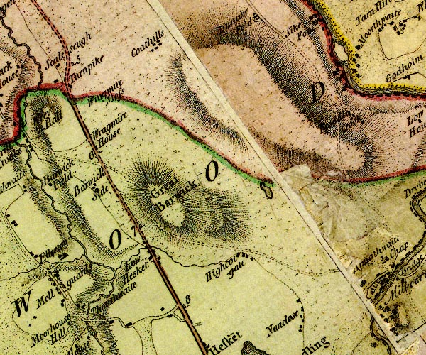
D4NY44NE.jpg Aiketgate -- locality -- building/s -- NY48074660 (etc) -- 'Highcotgate' -- block or blocks, labelled in lowercase; a hamlet or just a house Barrock Fell -- hill -- fell -- NY46874723 (etc) -- 'Great Barwick' -- hill hachuring; a hill or mountain Barrock Side -- building/s -- NY45474781 -- 'Barwick Side' -- block or blocks, labelled in lowercase; a hamlet or just a house Blackmoss Pool -- pond -- NY48534779 (etc) -- lake probably Cotehill -- locality -- building/s -- NY46885027 (etc) -- 'Coathills' -- block or blocks, labelled in lowercase; a hamlet or just a house Eden, River -- river -- boundary -- parish boundary -- NY3658 (etc) -- 'Eden River' -- 'Eden R.' -- estuary -- single or double wiggly line; a river and county boundary, into the sea Fishgarth Holm -- island -- NY49765012 (etc) -- island in the Eden near Moorthwaite Froddle Crook -- locality -- building/s -- NY50054891 (etc) -- 'Froddle Crook' -- block or blocks, labelled in lowercase; a hamlet or just a house Low Hesket -- locality -- building/s -- NY46524633 (etc) ? -- 'Low Hesket' -- block or blocks, labelled in lowercase; a hamlet or just a house milestone, Hesket (2) -- milestone -- NY46254689 -- '7' -- milestone; from Carlisle to Penrith milestone, Hesket (3) -- milestone -- NY47014547 -- '8' -- milestone; from Carlisle to Penrith milestone, Hesket -- milestone -- NY45504830 -- '6' -- milestone; from Carlisle to Penrith milestone, St Cuthbert Without (2) -- milestone -- NY45024981 -- '5' -- milestone; from Carlisle to Penrith Nunclose -- building/s -- NY48954551 (etc) -- 'Nunclose' -- block or blocks, labelled in lowercase; a hamlet or just a house Penrith to Carlisle -- route -- road -- NY53 -- 'P. to C. 18:0:0' -- double line, solid or dotted, with a dot or milestone and number at 1 mile intervals, tinted red; turnpike road -- from English Gate -- miles.furlongs.poles; Penrith to Carlisle Southwaite Bridge -- bridge -- NY45084512 -- double line across a river; a bridge at Thouthwaite Southwaite -- locality -- building/s -- NY44914512 (etc) -- 'Thouthwaite' -- block or blocks, labelled in lowercase; a hamlet or just a house toll gate, Wragmire -- toll gate (site) -- NY44984944 (?) -- 'Turnpike' -- block; toll gate Wragmire House -- building/s -- NY46324969 -- 'Wragmire House' -- block or blocks, labelled in lowercase; a hamlet or just a house Wragmire Moss -- moss -- NY45554942 (etc) -- 'Wragmire Moss' -- area of moss | ||
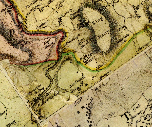
D4NY54NW.jpg Ainstable Hall -- building/s -- NY52534652 -- 'Hall' -- house at Ainstable Ainstable -- locality -- building/s -- NY53214620 (etc) -- 'Ainstable' -- blocks, and usually a church, labelled in upright lowercase; a village Armathwaite Bridge -- bridge -- NY50714603 -- double line across a river; a bridge at Armathwaite Armathwaite Castle -- building/s -- pele tower -- castle (once) -- NY50584589 -- 'Castle / Milbourne Esq.' -- large building; a castle at Armathwaite Bascodyke Head -- building/s -- NY52874498 -- '[ ] Head' -- block or blocks, labelled in lowercase; a hamlet or just a house Bascodyke -- building/s -- NY52954521 -- 'Basco Dike' -- unidenitifed possibly Christ and St Mary's Church -- church -- NY50604620 -- 'Armathwaite Chap.' -- block or blocks, labelled in lowercase; a hamlet or just a house and church Drybeck -- building/s -- locality -- NY51414786 -- 'Drybeck' -- block or blocks, labelled in lowercase; a hamlet or just a house Eden, River -- river -- boundary -- parish boundary -- NY3658 (etc) -- 'Eden River' -- 'Eden R.' -- estuary -- single or double wiggly line; a river and county boundary, into the sea Fieldhead -- building/s -- NY52504969 -- 'Field Head' -- block or blocks, labelled in lowercase; a hamlet or just a house Gateshaw Mill -- building/s -- water mill (ex) -- mill (ex) -- corn mill (? ex) -- NY54464974 -- 'Mill' -- circle with rays, mill wheel; a water mill and block Gateshawhill -- building/s -- NY54834927 -- 'Gateshaw Hill' -- block or blocks, labelled in lowercase; a hamlet or just a house Harras, The -- building/s -- NY53654640 -- 'Harrows' -- block or blocks, labelled in lowercase; a hamlet or just a house High Northsceugh -- building/s -- NY53074808 -- 'High Noscoe' -- block or blocks, labelled in lowercase; a hamlet or just a house Holm Wrangle -- island -- NY51554848 (etc) -- island near Holmwrangle Holmwrangle -- building/s -- NY51714843 -- 'Holmwrangle' -- block or blocks, labelled in lowercase; a hamlet or just a house Hornsby -- locality -- building/s -- NY51595011 (etc) -- 'Hornsby' -- block or blocks, labelled in lowercase; a hamlet or just a house Hornsbygate -- locality -- building/s -- NY52205028 (etc) -- 'Hornsby Gate' -- block or blocks, labelled in lowercase; a hamlet or just a house King Harry -- locality -- NY541485 (etc) -- 'King Harry' -- hill hachuring; a hill or mountain Knott, The -- building/s -- NY53474758 -- 'Knot' -- block or blocks, labelled in lowercase; a hamlet or just a house Low Holme -- building/s -- NY50924960 -- 'Godholm' -- block or blocks, labelled in lowercase; a hamlet or just a house possibly Low House -- building/s -- NY51444813 -- 'Low House' -- block or blocks, labelled in lowercase; a hamlet or just a house probably Low Northsceugh -- building/s -- NY52774886 -- 'Low Noscoe' -- block or blocks, labelled in lowercase; a hamlet or just a house | ||
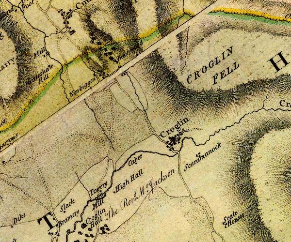
D4NY54NE.jpg Bovewood -- building/s -- NY56314940 -- 'Boonwood' -- block or blocks, labelled in lowercase; a hamlet or just a house probably Caber -- building/s -- NY56664638 -- 'Caber' -- block or blocks, labelled in lowercase; a hamlet or just a house Croglin Bridge -- bridge -- NY57564699 -- double line across a river; a bridge at Croglin Croglin Fell -- hill -- fell -- NY62004886 (etc etc) -- 'CROGLIN FELL' -- hill hachuring; a hill or mountain Croglin High Hall -- building/s -- NY56114579 -- 'High Hall' -- block or blocks, labelled in lowercase; a hamlet or just a house Croglin Low Hall -- building/s -- NY55434502 ? ? -- 'Croglin Hall / The Revd. Mr. Jackson' -- house Croglin -- locality -- building/s -- NY57454724 (etc) -- 'Croglin' -- blocks, and usually a church, labelled in upright lowercase; a village Newbiggin -- building/s -- NY55764918 (etc) -- 'Newbiggen' -- block or blocks, labelled in lowercase; a hamlet or just a house Scarrowmanwick -- locality -- building/s -- NY58084707 (etc) -- 'Scaramanock' -- block or blocks, labelled in lowercase; a hamlet or just a house Slack -- building/s -- NY55074548 -- 'Slack' -- block or blocks, labelled in lowercase; a hamlet or just a house Wallmoorsike Mill -- building/s -- water mill (ex) -- mill (ex) -- NY55754590 -- 'Towery Mill' -- circle with rays, mill wheel; a water mill | ||
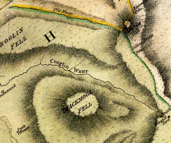
D4NY64NW.jpg Croglin Water -- river -- NY5746 (etc) -- 'Croglin Water' -- single or double wiggly line; a river into the Eden Gillingbrig Gate -- currick -- boundary mark -- county boundary mark -- gate (?) -- NY62934933 -- 'Gillian Briggs Pike' -- triangle on county boundary possibly Merelaw Hill -- hill -- NY62755051 -- 'Meerlaw Hill' -- hill hachuring; hill or mountain, on county boundary Thack Moor -- moor -- NY610461 (etc) -- 'THACKMOOR FELL' -- hill hachuring; a hill or mountain | ||
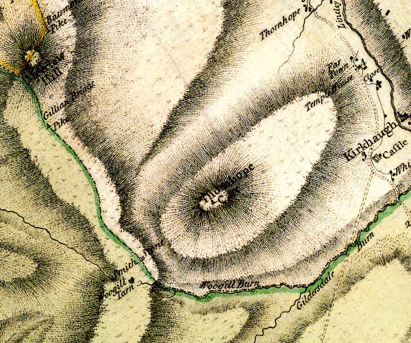
D4NY64NE.jpg Gilderdale Burn -- river -- county boundary -- boundary -- NY704489 -- 'Gildersdale Burn' -- single or double wiggly line; a river and county boundary Thornhope Carrs -- hill -- NY66384765 (etc) -- 'Thornhope Carr' -- hill hachuring; hill or mountain, and triangle symbol Tom Smith's Stone -- stone -- boundary stone -- county boundary mark -- parish boundary mark -- NY65174650 -- 'Smith Stone' -- boundary stone on county boundary Woldgill Burn -- river -- boundary -- NY6746 (etc) -- 'Woogill Burn' -- single or double wiggly line; a river and county boundary Woldgill Tarn -- lake -- boundary mark -- parish boundary mark -- NY65124626 -- 'Woogill Tarn' -- lake | ||
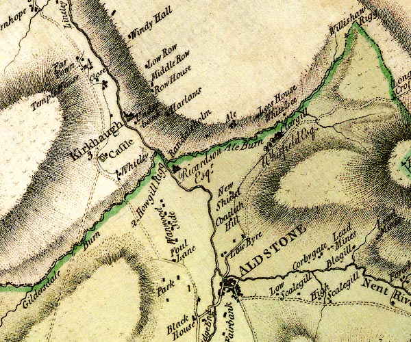
D4NY74NW.jpg Alston Bridge -- bridge -- NY71634615 -- double line across a river; a bridge in Alston Alston -- locality -- building/s etc -- NY71874649 (etc) -- 'ALDSTONE' -- blocks, perhaps a church, labelled in block caps; a town and street plan Ayle Burn -- river -- boundary -- county boundary -- NY7149 -- 'Ale Burn' -- single or double wiggly line; a river and county boundary Ayle -- building/s -- NY716494 -- 'Ale' -- block or blocks, labelled in lowercase; a hamlet or just a house Clarghyll Hall -- building/s -- NY72574932 -- 'Clargill / Whitfield Esq.' -- house Coatlith Hill -- building/s -- NY71884765 -- 'Coatleth Hill' -- block or blocks, labelled in lowercase; a hamlet or just a house Corby Gates Farm -- building/s -- NY73324710 -- 'Corbygate' -- block or blocks, labelled in lowercase; a hamlet or just a house Far Town -- building/s -- NY68955025 -- 'Far Town' -- block or blocks, labelled in lowercase; a hamlet or just a house Foul Loaning -- building/s -- NY70844687 -- 'Foul Lane' -- block or blocks, labelled in lowercase; a hamlet or just a house Gilderdale Burn -- river -- county boundary -- boundary -- NY704489 -- 'Gildersdale Burn' -- single or double wiggly line; a river and county boundary Harelaw -- building/s -- NY761770 -- 'Harlaws' -- block or blocks, labelled in lowercase; a hamlet or just a house High Row -- building/s -- NY70314969 -- 'Row House' -- block or blocks, labelled in lowercase; a hamlet or just a house possibly High Skelgill -- building/s -- NY73594643 -- 'High Scalegill' -- block or blocks, labelled in lowercase; a hamlet or just a house Howgill Rigg -- building/s -- NY70404836 -- 'Howgill Rigg' -- block or blocks, labelled in lowercase; a hamlet or just a house Kirkhaugh -- building/s -- NY6949 -- 'Kirkhaugh' -- blocks, and usually a church, labelled in upright lowercase; a village Leazes House -- building/s -- NY72034960 -- 'Lees House' -- block or blocks, labelled in lowercase; a hamlet or just a house Low Row -- building/s -- NY70125019 -- 'Low Row' -- block or blocks, labelled in lowercase; a hamlet or just a house Low Skelgill -- building/s -- NY72614645 -- 'Low Scalegill' -- block or blocks, labelled in lowercase; a hamlet or just a house Lowbyer Manor -- inn -- NY71724686 -- 'Low Byre' -- block or blocks, labelled in lowercase; a hamlet or just a house Middle Row -- building/s -- NY70254983 -- 'Middle Row' -- block or blocks, labelled in lowercase; a hamlet or just a house -- lead mine -- iron mine -- mine -- NY73844755 (etc) -- 'Lead Mines' -- two plus signs Nent Bridge -- bridge -- NY71734666 -- double line across a river; a bridge in Alston Nent, River -- river -- NY7446 (etc etc) -- 'Nent River' -- single or double wiggly line; a river Newshield -- building/s -- NY71844814 -- 'New Shield' -- block or blocks, labelled in lowercase; a hamlet or just a house Park -- building/s -- locality -- NY70694653 -- 'Park' -- block or blocks, labelled in lowercase; a hamlet or just a house Randalholm Hall -- building/s -- NY70804857 -- 'Randaleholm / Ricardson Esqr.' -- house Brampton to Alston -- route -- NY56 -- double line, narrower, solid or dotted with a dot and number at 1 mile intervals; road -- part in Northumberland Epiacum -- roman fort -- NY695487 -- 'Castle' -- square within a square; roman fort probably South Tyne, River -- river etc -- NY7441 (etc) ? -- 'Tyne River' -- 'Tyne River' -- 'Tyne River' -- 'Tyne River' -- 'Tyne River' -- single or double wiggly line; a river Temple House -- building/s -- NY69255000 (?) -- 'Temple House' -- block or blocks, labelled in lowercase; a hamlet or just a house Underbank -- building/s -- NY70054933 -- 'Underbank' -- block or blocks, labelled in lowercase; a hamlet or just a house Wanwood Side -- locality -- building/s -- NY70654775 -- 'Wanwood Side' -- block or blocks, labelled in lowercase; group of houses White Lea -- building/s -- NY72494970 -- 'White Lee' -- block or blocks, labelled in lowercase; a hamlet or just a house Whitley (?) -- locality -- NY6948 (approx) -- 'Whitley' -- block or blocks, labelled in lowercase; a hamlet or just a house Windy Hall -- building/s -- NY69955075 -- 'Windy Hall' -- block or blocks, labelled in lowercase; a hamlet or just a house | ||
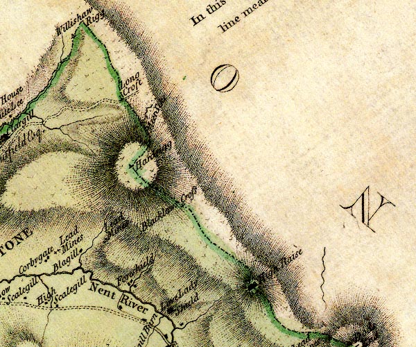
D4NY74NE.jpg Blacklaw Cross -- boundary mark -- county boundary mark -- cross (?) -- NY75804832 -- 'Blacklaws Cross' -- cross (plus sign) Blagill -- locality -- building/s -- NY73934733 (etc) -- 'Blagill' -- block or blocks, labelled in lowercase; a hamlet or just a house Foreshield -- building/s -- NY74884677 (etc) -- 'Foreshield' -- block or blocks, labelled in lowercase; a hamlet or just a house Hard Rigg -- hill -- NY74994876 -- 'Hardrigg' -- triangle on county boundary High Raise -- hill -- NY770646655 (etc) -- 'High Raise' -- hill hachuring; hill or mountain, and rocks? on county boundary Long Cross -- cross (?) -- county boundary mark -- boundary mark -- NY74475010 -- 'Long Croft' -- cross on county boundary Lovelady Shield -- building/s -- NY75694633 -- 'Love Lady Shield' -- house mines, Blagillhead -- lead mine -- coal mine -- mine -- NY74384803 (etc) -- 'Lead Mines' -- two plus signs Nent, River -- river -- NY7446 (etc etc) -- 'Nent River' -- single or double wiggly line; a river Willyshaw Rigg -- hill -- county boundary mark -- NY736514 (etc) -- 'Willishaw Rigg' -- triangle on county boundary | ||
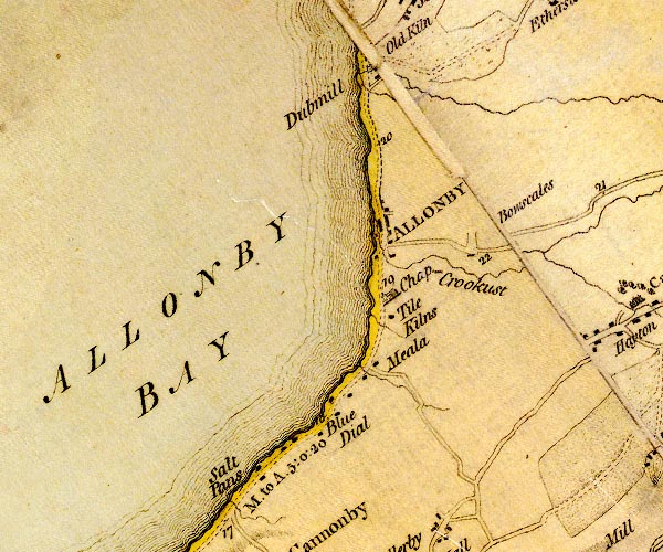
D4NY04SE.jpg Allonby Bay -- bay -- NY06854250 (etc) -- 'ALLONBY BAY' -- bay Allonby Beck -- river -- NY0842 -- single or double wiggly line; a river at Allonby Allonby -- locality -- building/s -- NY08134300 (etc) -- 'ALLONBY' -- blocks, perhaps a church, labelled in block caps; a town Black Dub -- river -- boundary -- parish boundary -- NY0944 (etc) -- single or double wiggly line; a river Blue Dial -- building/s -- NY07394073 -- 'Blue Dial' -- block or blocks, labelled in lowercase; a hamlet or just a house Bowscale -- building/s -- NY09104281 -- 'Bowscales' -- no symbol Christ Church -- church -- NY08034231 -- 'Chap.' -- church S of Allonby Crookhurst -- building/s -- NY08744251 -- 'Crookust' -- river? Dub Mill -- water mill -- mill -- corn mill -- NY07844498 -- 'Dubmill' -- circle with rays, mill wheel; a water mill kiln, Allonby -- kiln -- tile kiln -- NY08074209 (guess) -- 'Tile Kilns' -- building/s Mealo House -- building/s -- NY07904154 -- 'Meala' -- block or blocks, labelled in lowercase; a hamlet or just a house Carlisle to Allonby -- route etc -- 'A. to W. 11:7:0' -- double line, narrower, solid or dotted with a dot and number at 1 mile intervals; road -- distances from Carlisle -- miles.furlongs.poles; Allonby to Wigton Maryport to Silloth -- route -- NY03 -- 'A. to GPt. 10:0:0' -- 'M. to A. 5:0:2' -- double line, narrower, solid or dotted with a dot and number at 1 mile intervals; road -- a mile and a half beyond Skinburness to Grune Point; distances from Whitehaven -- miles.furlongs.poles; Allonby to Grune Point -- miles.furlongs.poles; Maryport to Allonby Saltpans -- salt pans -- building/s -- NY06684013 (etc) -- 'Salt Pans' -- block or blocks, labelled in lowercase; a hamlet or just a house; or salt pans on the foreshore? | ||
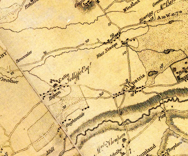
D4NY14SW.jpg Arkleby Bridge -- bridge -- NY14274044 -- double line across a river; a bridge over the Ellen Arkleby Mill -- building/s -- water mill -- mill -- corn mill -- NY14384041 -- circle with rays, mill wheel; a water mill on the Ellen Aspatria -- locality -- building/s etc -- NY14294176 (etc) -- 'Aspatria' -- blocks, and usually a church, labelled in upright lowercase; a village and street plan Ellen, River -- river -- NY2436 (etc) -- 'Ellen River' -- 'Ellen River' -- single or double wiggly line; a river into the sea at Maryport fish pond, Brayton Park -- fish pond -- lake -- NY16334238 (etc) -- lake near Aspatria Hayton Castle -- castle -- NY11004175 -- 'Castle / Jolliffe Esqr.' -- house at Hayton Hayton -- locality -- building/s -- NY10804149 (etc) -- 'Hayton' -- block or blocks, labelled in lowercase; a hamlet or just a house Howrigg -- building/s -- NY14344443 -- 'Howrigg' -- block or blocks, labelled in lowercase; a hamlet or just a house Oughterside -- locality -- building/s -- NY11774029 (etc) -- 'Oughterside' -- block or blocks, labelled in lowercase; a hamlet or just a house Carlisle to Allonby -- route etc -- 'A. to W. 11:7:0' -- double line, narrower, solid or dotted with a dot and number at 1 mile intervals; road -- distances from Carlisle -- miles.furlongs.poles; Allonby to Wigton Cockermouth to Abbey Town -- road -- route -- NY13 -- double line, narrower, solid or dotted with a dot and number at 1 mile intervals; road Sandwith Beck -- river -- NY1443 (etc) -- wiggly line; a river Westnewton -- locality -- building/s -- NY13544414 (etc) -- 'West Newton' -- block or blocks, labelled in lowercase; a hamlet or just a house Yearngill Mill -- water mill -- mill -- corn mill -- NY13884388 -- circle with rays, mill wheel; a water mill at West Newton | ||
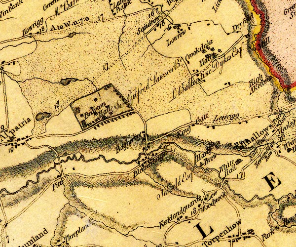
D4NY14SE.jpg Aspatria East Mill -- water mill -- mill -- corn mill -- NY15724139 -- circle with rays, mill wheel; a water mill at Fitts Baggrow -- locality -- building/s -- NY17884196 (etc) -- 'Baggertey' -- block or blocks, labelled in lowercase; a hamlet or just a house Blennerhasset Bridge -- bridge -- NY17854160 -- double line across a river; bridge over the Ellen at Blennerhasset Blennerhasset Mill -- water mill -- mill -- NY18434189 -- circle with rays, mill wheel; a water mill at Blennerhasset Blennerhasset -- locality -- building/s -- NY17854155 -- 'Blennerhasset' -- block or blocks, labelled in lowercase; a hamlet or just a house Brayton Park -- park -- building/s (once) -- NY16524271 (etc) -- 'Brayton Hall / Sir Gilfried Lawson Bt.' -- house in -- double outline with suggested fence palings; a park, and trees, pond, etc bridge, Aspatria -- bridge -- NY15744127 -- double line across a river; a bridge over the Ellen at Fitts Cock Bridge -- bridge -- NY19874106 -- double line across a river; a bridge over the Ellen at White Hall Crookdake Hall -- building/s -- NY19754430 -- 'Hall / L Ballentine Dykes Esqr.' -- house at Crookdake with trees around Crookdake -- locality -- building/s -- NY19284401 (etc) -- 'Crookdake' -- block or blocks, labelled in lowercase; a hamlet or just a house Dry Fold -- building/s -- NY19934495 -- 'Dryfold' -- block or blocks, labelled in lowercase; a hamlet or just a house Ellen, River -- river -- NY2436 (etc) -- 'Ellen River' -- 'Ellen River' -- single or double wiggly line; a river into the sea at Maryport Fitz -- building/s -- NY16104001 -- 'Fitts' -- block or blocks, labelled in lowercase; a hamlet or just a house Harby Brow Mill -- water mill -- mill -- corn mill -- NY19384142 -- circle with rays, mill wheel; a water mill at Harby Brow Harbybrow -- building/s -- NY19214152 -- 'Harby Brow / Salkeld Esqr.' -- house, small Kinggate -- building/s -- NY18954245 -- 'King Gate' -- block or blocks, labelled in lowercase; a hamlet or just a house Kirkland Guards -- building/s -- NY18654010 -- 'Kirklandguards' -- block or blocks, labelled in lowercase; a hamlet or just a house lake, Aspatria (2) -- marsh -- lake (? drained) -- NY15944488 (etc) -- lake lake, Aspatria -- lake (? drained) -- NY161436 (about) ? -- lake Leesrigg Farm -- building/s -- NY19894211 -- 'Leesrigg' -- block or blocks, labelled in lowercase; a hamlet or just a house probably Low Mill -- water mill -- mill -- NY20284061 -- circle with rays, mill wheel; a water mill SE of White Hall Low Row -- locality -- building/s -- NY19094490 (etc) -- 'Lowrow' -- block or blocks, labelled in lowercase; a hamlet or just a house Low Woodnook -- building/s -- NY19314055 -- 'Low Woodnook' -- block or blocks, labelled in lowercase; a hamlet or just a house Cockermouth to Carlisle -- road -- route -- NY13 -- 'C. to W. 16:0:0' -- double line, narrower, solid or dotted with a dot and number at 1 mile intervals; road -- distances from Carlisle -- miles.furlongs.poles; Cockermouth to Wigton Sandraw -- building/s -- locality -- NY18194489 -- 'Sandrow' -- block or blocks, labelled in lowercase; a hamlet or just a house Whitehall -- building/s -- moat -- NY20184159 -- 'White Hall' -- house and hamlet | ||
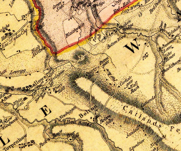
D4NY24SW.jpg Allhallows -- locality -- NY19724248 (etc) -- 'Allhallows' -- blocks, and usually a church, labelled in upright lowercase; a village Blaithwaite House -- building/s -- NY21334474 -- 'Blaithwaite' -- block or blocks, labelled in lowercase; a hamlet or just a house probably Bolton Wood House -- building/s -- NY24224421 -- 'Bolton Wood' -- no symbol possibly Boltongate Bridge -- bridge -- NY22914050 -- double line across the Ellen; a bridge Boltongate Mill -- mill (once) -- NY22924053 -- circle with rays, mill wheel; a water mill at Bolton Boltongate -- locality -- building/s -- NY22924081 (etc) -- 'Bolton' -- 'Bolton Gate' -- blocks, and usually a church, labelled in upright lowercase; a village, ? a pond -- block or blocks, labelled in lowercase; a hamlet or just a house Carlisle Gate -- building/s -- NY23864171 -- 'Carlisle gate' -- block or blocks, labelled in lowercase; a hamlet or just a house Catlands Fell -- hill -- NY247408 (etc) -- 'Catlands Fell' -- hill hachuring; a hill or mountain Catlands -- building/s -- NY24624110 (estimate) -- 'Catlands' -- block or blocks, labelled in lowercase; a hamlet or just a house Cockshot Beck -- river -- boundary -- parish boundary -- NY20704061 -- single or double wiggly line; a river into the Ellen below Newbiggin Grange Cowslaw Bridge -- bridge -- NY25634465 -- double line across a river; a bridge over the Waver N of Pow Crookdake Mill -- water mill -- mill -- corn mill -- NY20764452 -- 'Mill' -- circle with rays, mill wheel; a water mill on Crummock Beck Dryrigg Farm -- building/s -- NY22814448 -- 'Drayrigg' -- block or blocks, labelled in lowercase; a hamlet or just a house Ellen, River -- river -- NY2436 (etc) -- 'Ellen River' -- 'Ellen River' -- single or double wiggly line; a river into the sea at Maryport Far Row -- building/s -- NY23604210 (guess) -- 'Far Row' -- block or blocks, labelled in lowercase; a hamlet or just a house High Aketon -- building/s -- NY20864383 -- 'High Aketons' -- block or blocks, labelled in lowercase; a hamlet or just a house High Pow -- building/s -- NY25024360 -- 'Pow' -- block or blocks, labelled in lowercase; a hamlet or just a house Knapethorn -- building/s -- NY20804242 -- 'Na[l]p Thorn' -- block or blocks, labelled in lowercase; a hamlet or just a house Low Pow -- building/s -- NY25094381 -- 'Pow' -- block or blocks, labelled in lowercase; a hamlet or just a house Mealsgate -- locality -- building/s -- NY20914210 (etc) -- 'Mealsgate' -- block or blocks, labelled in lowercase; a hamlet or just a house Newbiggin Grange -- building/s -- NY21414062 -- 'Newbiggen' -- block or blocks, labelled in lowercase; a hamlet or just a house Newlands Row Farm -- building/s -- NY21094193 -- 'Newlands Row' -- block or blocks, labelled in lowercase; a hamlet or just a house Pasture House -- building/s -- NY23104469 -- 'Pasture Side' -- block or blocks, labelled in lowercase; a hamlet or just a house Pattenfoot -- building/s -- NY22424322 -- 'Patten gate' -- no symbol? possibly Priestcroft -- building/s -- NY20974257 -- 'Priest Croft' -- block or blocks, labelled in lowercase; a hamlet or just a house Quarry Hill Farm -- building/s -- NY22294173 -- 'Quarry Hill' -- block or blocks, labelled in lowercase; a hamlet or just a house possibly Cockermouth to Carlisle -- road -- route -- NY13 -- 'C. to W. 16:0:0' -- double line, narrower, solid or dotted with a dot and number at 1 mile intervals; road -- distances from Carlisle -- miles.furlongs.poles; Cockermouth to Wigton Sandale -- locality -- building/s -- NY24804025 (etc) -- 'Sandall' -- block or blocks, labelled in lowercase; a hamlet or just a house Shaking Bridge -- bridge -- NY23924452 -- 'Shaken Bridge' -- block or blocks, labelled in lowercase; a hamlet or just a house and road/river crossing Waver, River -- river etc -- NY1751 (etc) -- 'Waver River' -- 'Waver R.' -- single or double wiggly line; a river and estuary Weary Hall -- building/s -- moat -- NY21754179 -- 'Weary Hall' -- house Wellrash Farm -- building/s -- well -- NY24404163 -- 'Wall Rash' -- block or blocks, labelled in lowercase; a hamlet or just a house | ||
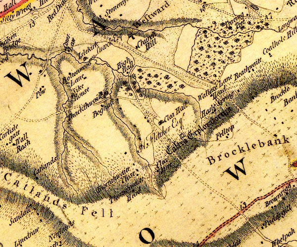
D4NY24SE.jpg Bog Hall -- building/s -- NY26384318 -- 'Boghall' -- block or blocks, labelled in lowercase; a hamlet or just a house Bolton Wood Lane -- locality -- building/s -- NY25434423 (etc) -- 'Boltonwood Lane' -- block or blocks, labelled in lowercase; a hamlet or just a house bridge, Islekirk -- bridge -- NY26044455 -- double line across a river; a bridge at Islekirk Brocklebank Fell (?) -- hill -- NY304423 -- 'Brocklebank Fell' -- hill hachuring; a hill or mountain Catlands Fell -- hill -- NY247408 (etc) -- 'Catlands Fell' -- hill hachuring; a hill or mountain Church Hill -- building/s -- NY27264465 -- 'Church Hill' -- block or blocks, labelled in lowercase; a hamlet or just a house Clea Hall -- building/s -- NY27854282 -- 'Clea Hall / H. Fletcher Esqr.' -- house Cleamire -- building/s -- NY27724152 -- 'Clea Mire' -- block or blocks, labelled in lowercase; a hamlet or just a house Cowslaw -- building/s -- NY25584465 -- 'Cows Law' -- block or blocks, labelled in lowercase; a hamlet or just a house Hazelsprings Farm -- building/s -- NY29024315 -- 'Hasle Spring' -- block or blocks, labelled in lowercase; a hamlet or just a house High Hall -- building/s -- NY27074399 -- 'High Hall' -- block or blocks, labelled in lowercase; a hamlet or just a house Hilltop -- building/s -- NY29494247 -- 'Felltop' -- block or blocks, labelled in lowercase; a hamlet or just a house probably Islekirk Hall -- building/s -- NY25984455 -- 'Islekirk / Lucock Esq' -- house mill, Islekirk -- water mill -- mill -- corn mill -- NY26154461 (estimate) -- circle with rays, mill wheel; a water mill at Islekirk mill, Westward -- water mill -- mill -- NY27144397 (guess) -- circle with rays, mill wheel; a water mill at High Hall Castra Exploratorum -- roman fort -- NY283422 (about) -- 'Castra Exploratorum' -- square within a square; roman fort Solway View -- building/s -- NY29254363 -- 'Wallace Lane Head' -- block or blocks, labelled in lowercase; a hamlet or just a house possibly Syke House -- building/s -- NY25664365 -- 'Sike House' -- block or blocks, labelled in lowercase; a hamlet or just a house Thackthwaite Beck -- river -- boundary -- parish boundary -- NY2643 (etc) -- single or double wiggly line; a river Thackthwaite Hall -- building/s -- NY26434352 -- 'Thackthwaite' -- no symbol? except trees Thornthwaite Beck -- river -- boundary -- parish boundary -- NY2742 (etc) -- single or double wiggly line; a river Thornthwaite Close -- building/s -- NY27074187 -- 'Thornthwaite Close' -- block or blocks, labelled in lowercase; a hamlet or just a house Thornthwaite Head -- building/s -- NY27524123 (estimate) -- 'Thornthwaite Head' -- block or blocks, labelled in lowercase; a hamlet or just a house Townthwaite Beck -- river -- NY2743 (etc) -- single or double wiggly line; a river Westward -- locality -- building/s -- NY27294484 (etc) -- 'Westward' -- blocks, and usually a church, labelled in upright lowercase; a village | ||
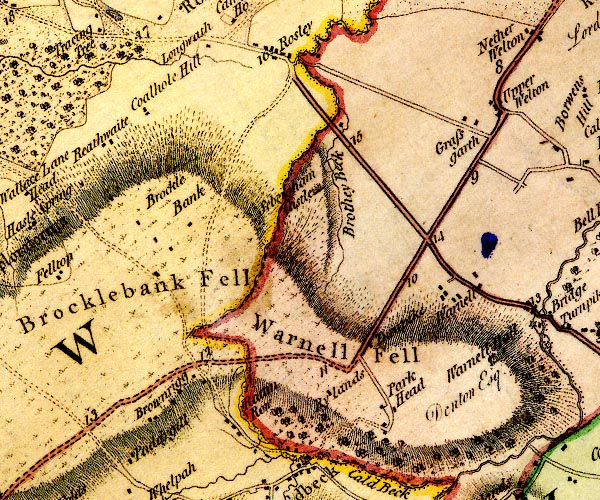
D4NY34SW.jpg Brocklebank Fell (?) -- hill -- NY304423 -- 'Brocklebank Fell' -- hill hachuring; a hill or mountain Brocklebank -- locality -- building/s -- NY30724271 (etc) -- 'Brockle Bank' -- block or blocks, labelled in lowercase; a hamlet or just a house Brothy Beck -- river -- NY3343 (etc) -- 'Brothey Beck' -- single or double wiggly line; a river ?square? Brownrigg -- locality -- NY31024058 (etc) -- 'Brownrigg' -- block or blocks, labelled in lowercase; a hamlet or just a house Coalhole Hill -- building/s -- NY30714460 (estimate) -- 'Coalhole Hill' -- block or blocks, labelled in lowercase; a hamlet or just a house Grassgarth -- locality -- building/s -- NY34624406 (etc) -- 'Grassgarth' -- block or blocks, labelled in lowercase; a hamlet or just a house Parkhead -- locality -- building/s -- NY33894053 (etc) -- 'Park Head' -- block or blocks, labelled in lowercase; a hamlet or just a house Ratten Row -- locality -- building/s -- NY32144012 -- 'Rattin Row' -- block or blocks, labelled in lowercase; a hamlet or just a house Reathwaite -- building/s -- NY30044414 -- 'Reathwaite' -- block or blocks, labelled in lowercase; a hamlet or just a house Keswick to Carlisle -- route etc -- double line, solid or dotted, with a dot or milestone and number at 1 mile intervals, tinted red; turnpike road Penrith to Wigton -- route -- NY44 -- 'W. to P. 21:0:32' -- double line, solid or dotted, with a dot or milestone and number at 1 mile intervals, tinted red; turnpike road -- distances from Penrith -- miles.furlongs.poles; Wigton to Penrith Rylands -- building/s -- NY33174091 -- 'Rylands' -- block or blocks, labelled in lowercase; a hamlet or just a house Sebergham Castle -- castle -- NY33224367 (?) -- 'Sebergham Castle' -- large building; a castle toll gate, Sebergham -- toll gate (site) -- NY33574150 (guess) -- 'Turnpike' -- block by road; toll house and toll gate Warnell Fell -- hill -- NY33784128 (etc) -- 'Warnell Fell' -- hill hachuring; a hill or mountain Warnell Hall -- building/s -- NY35044134 ? -- 'Warnell Hall / Denton Esq.' -- house Warnell -- locality -- NY34534184 (etc) -- 'Warnell' -- block or blocks, labelled in lowercase; a hamlet or just a house Welton -- building/s -- NY35244433 (etc) -- 'Upper Welton' -- block or blocks, labelled in lowercase; a hamlet or just a house | ||
D4NY34SE.jpg Ashes -- building/s -- NY39164270 -- 'Ashes' -- block or blocks, labelled in lowercase; a hamlet or just a house Bell Bridge -- bridge -- NY36604299 -- 'Bell Br.' -- double line across a river; a bridge on the Caldew Bellbridge -- building/s -- NY36424310 -- 'Bell Br.' -- block or blocks, labelled in lowercase; a hamlet or just a house Birks Hill -- building/s -- NY37694306 -- 'Birkshill' -- block or blocks, labelled in lowercase; a hamlet or just a house Birks, The -- building/s -- NY37584280 -- 'Birks' -- block or blocks, labelled in lowercase; a hamlet or just a house Bog -- building/s -- NY36614462 (estimate) -- 'Bog' -- block or blocks, labelled in lowercase; a hamlet or just a house Borrans Farm Hill -- building/s -- NY36064449 -- 'Borwens Hill' -- block or blocks, labelled in lowercase; a hamlet or just a house bridge, Highbridge House -- bridge -- NY39414396 -- double line across a river; a bridge at Raw Beck Bustabeck -- building/s -- NY37304196 -- 'Bustabeck' -- block or blocks, labelled in lowercase; a hamlet or just a house Caldew, River -- river -- boundary -- parish boundary -- NY3851 (etc) ? -- 'Caldew River' -- 'Caldew River' -- single or double wiggly line; a river into the Eden Caldewbeck -- building/s -- NY36314404 -- 'Caldew Beck' -- block or blocks, labelled in lowercase; a hamlet or just a house Crookholme Mill -- building/s -- NY36364350 -- circle with rays, mill wheel; a water mill at Caldew Beck Foxley Henning -- building/s -- NY38014423 -- 'Foxleyhenning' -- block or blocks, labelled in lowercase; a hamlet or just a house Greens, The -- building/s -- NY37274284 -- 'Greens' -- block or blocks, labelled in lowercase; a hamlet or just a house Ive, River -- river -- NY4242 (etc) -- 'Ivegill' -- single or double wiggly line; a river into the Roe Lambfield -- building/s -- NY37984347 -- 'Lamb Field' -- block or blocks, labelled in lowercase; a hamlet or just a house Low Cowrigg -- building/s -- NY3742 -- 'Corrigg' -- block or blocks, labelled in lowercase; a hamlet or just a house Oaks -- building/s -- NY37964298 -- 'Oaks' -- block or blocks, labelled in lowercase; a hamlet or just a house Penrith to Wigton -- route -- NY44 -- 'W. to P. 21:0:32' -- double line, solid or dotted, with a dot or milestone and number at 1 mile intervals, tinted red; turnpike road -- distances from Penrith -- miles.furlongs.poles; Wigton to Penrith Hesket Newmarket road -- route -- NY33Hesket Newmarket road -- route -- NY33 -- 'H. to C. 13:3:28' -- miles.furlongs.poles; Hesket to Carlisle Roe, River -- river -- NY3845 (etc) -- 'Raw Beck' -- single or double wiggly line; a river into the Caldew Sebergham Bridge -- bridge -- NY35734185 -- 'Bridge' -- double line across a river; a bridge over the Caldew Sebergham Mill -- building/s -- mill (ex) -- water mill (ex) -- NY35524193 -- circle with rays, mill wheel; a water mill at Bridge possibly Sebergham -- locality -- building/s -- NY36454164 (etc) -- 'Sebergham' -- blocks, and usually a church, labelled in upright lowercase; a village Sour Nook -- locality -- building/s -- NY37184073 (etc) -- 'Sournook' -- block or blocks, labelled in lowercase; a hamlet or just a house Sowerby Mill -- building/s -- NY35724152 -- circle with rays, mill wheel; a water mill Thethwaite -- building/s -- NY37444400 -- 'Thethwaite' -- block or blocks, labelled in lowercase; a hamlet or just a house toll gate, Sebergham (2) -- toll gate (site) -- NY33644159 (guess) -- 'Turnpike' -- block by road; toll house and toll gate | ||
D4NY44SW.jpg Braithwaite Bridge -- bridge -- NY42804220 -- double line across a river; a bridge at Low Braithwaite Colt Close -- building/s -- NY43654261 -- 'Cow'd Close' -- block or blocks, labelled in lowercase; a hamlet or just a house High Braithwaite -- locality -- NY41204150 (etc) -- 'High Braithwaite' -- block or blocks, labelled in lowercase; a hamlet or just a house High Head Castle -- castle (burnt out shell) -- NY40214339 ? ? -- 'Highhead Castle / Mrs. Richmond' -- large building; a castle, -- house, avenue of trees, church Hill Top -- building/s -- NY43014358 -- 'Hill Top' -- block or blocks, labelled in lowercase; a hamlet or just a house Itonfield Street -- locality -- road (?) -- NY42834293 (etc) -- 'Itenfield Street' -- block or blocks, labelled in lowercase; a hamlet or just a house Ive, River -- river -- NY4242 (etc) -- 'Ivegill' -- single or double wiggly line; a river into the Roe Ivegill Mill -- building/s -- water mill (ex) -- mill (ex) -- corn mill (ex) -- NY40614358 -- circle with rays, mill wheel; a water mill on the Ive Low Braithwaite -- locality -- building/s -- NY42634218 (etc) -- 'Low Braithwaite' -- block or blocks, labelled in lowercase; a hamlet or just a house Maceybank -- building/s -- NY42694404 -- 'Macey Bank' -- block or blocks, labelled in lowercase; a hamlet or just a house Middlesceugh -- locality -- NY40334170 (etc) -- 'Middlescugh' -- block or blocks, labelled in lowercase; a hamlet or just a house Old Hayclose -- building/s -- NY44244184 -- 'Hay Close' -- block or blocks, labelled in lowercase; a hamlet or just a house probably Sceugh -- building/s -- locality -- NY44074326 -- 'SCUGH' -- area, with inclosures perhaps Thomas Close -- locality -- building/s -- NY43474059 -- 'Thomas Close' -- block or blocks, labelled in lowercase; a hamlet or just a house | ||
D4NY44SE.jpg Blaze Fell -- hill -- NY49624330 (etc etc) -- 'Blaze Fell' -- hill hachuring; a hill or mountain Calthwaite -- locality -- building/s -- NY46894017 (etc) -- 'Calthwaite' -- block or blocks, labelled in lowercase; a hamlet or just a house High Hesket -- building/s -- NY47584442 ? -- 'High Hesket' -- blocks, and usually a church, labelled in upright lowercase; a village High House Farm -- building/s -- NY44884453 -- 'High House' -- block or blocks, labelled in lowercase; a hamlet or just a house Hill Houses -- building/s -- NY45344097 -- 'Hill Houses' -- block or blocks, labelled in lowercase; a hamlet or just a house Lowhouse Mill -- water mill -- mill -- corn mill -- NY45244494 -- circle with rays, mill wheel; a water mill at High House milestone, Hesket (4) -- milestone -- NY48794103 -- '11' -- milestone; from Carlisle to Penrith milestone, Hesket (8) -- milestone -- NY48464236 -- '10' -- milestone; from Carlisle to Penrith milestone, High Hesket -- milestone -- NY47764404 -- '9' -- milestone; from Carlisle to Penrith Moorhousehill -- building/s -- NY45534513 -- 'Moorhouse Hill' -- block or blocks, labelled in lowercase; a hamlet or just a house Old Town -- locality -- building/s -- NY47904370 (etc) -- 'Old Town' -- block or blocks, labelled in lowercase; a hamlet or just a house Petteril Bank -- locality -- NY46214318 (etc) -- 'Petteril Banks' -- area, with blocks for buildings Petteril, River -- river -- boundary -- parish boundary -- NY4935 (etc etc) -- 'Pettrill River' -- 'Petterill River' -- single or double wiggly line; a river into the Eden Penrith to Carlisle -- route -- road -- NY53 -- 'P. to C. 18:0:0' -- double line, solid or dotted, with a dot or milestone and number at 1 mile intervals, tinted red; turnpike road -- from English Gate -- miles.furlongs.poles; Penrith to Carlisle Tarn Wadling -- lake (drained) -- NY48334445 -- 'Tarn Wadling' -- lake Thiefside Hill -- hill -- NY48314166 (etc) -- 'Thiefside Fell' -- hill hachuring; a hill or mountain Wooloaks Mill -- building/s -- NY47324169 -- circle with rays, mill wheel; a water mill | ||
D4NY54SW.jpg Baronwood Park -- park -- NY5241 -- '[BARREN WOOD PARK]' -- double outline with suggested fence palings; a park Baronwood -- building/s -- NY5143 -- 'Barren Wood House' -- house possibly Beck -- building/s -- NY52444420 -- 'Beck' -- block or blocks, labelled in lowercase; a hamlet or just a house Cotehill -- building/s -- NY53764106 -- 'Coal Hills' -- block or blocks, labelled in lowercase; a hamlet or just a house Croglin Low Bridge -- bridge -- NY53904281 -- double line across a river; a bridge over the Croglin Water Croglin Water -- river -- NY5746 (etc) -- 'Croglin Water' -- single or double wiggly line; a river into the Eden Crossfield -- building/s -- NY54484359 -- 'Crossfield / Aglionby Esq.' -- house Eden, River -- river -- boundary -- parish boundary -- NY3658 (etc) -- 'Eden River' -- 'Eden R.' -- estuary -- single or double wiggly line; a river and county boundary, into the sea Fieldgarth -- building/s -- NY54204201 -- 'Fieldgarth' -- block or blocks, labelled in lowercase; a hamlet or just a house High Dykes -- building/s -- NY53484482 -- 'Dike' -- block or blocks, labelled in lowercase; a hamlet or just a house probably mill, Nunnery -- water mill -- mill -- saw mill -- NY53944294 -- circle with rays, mill wheel; a water mill at Nunnery Nunnery -- locality -- NY53754293 (etc) -- 'Nunnery' -- house Ruckcroft -- locality -- building/s -- NY53224428 (etc) -- 'Ruccroft' -- block or blocks, labelled in lowercase; a hamlet or just a house Staffield -- locality -- building/s -- NY54334289 (etc) -- 'Staffield' -- block or blocks, labelled in lowercase; a hamlet or just a house Woodend -- building/s -- NY54054103 (?) -- 'Woodend' -- block or blocks, labelled in lowercase; a hamlet or just a house | ||
D4NY54SE.jpg Blunderfield -- building/s -- NY56434324 -- 'Blunderfield' -- block or blocks, labelled in lowercase; a hamlet or just a house Bramery -- building/s -- NY54464522 -- 'Bramery' -- block or blocks, labelled in lowercase; a hamlet or just a house Raven Bridge (?) -- bridge -- NY55564112 -- double line across a river; a bridge over Raven Beck Cherbuckle -- building/s (?) -- NY57674222 (guess) -- 'Cherbuckle' -- block or blocks, labelled in lowercase; a hamlet or just a house ? College, The -- building/s -- NY55474109 -- 'College / Featherstonhaugh Esqr.' -- house Crindledyke -- building/s -- NY55534376 -- 'Trundle Dike' -- no symbol probably Dale Mill -- building/s -- NY54794504 -- circle with rays, mill wheel; a water mill near Croglin Hall Dale -- building/s -- NY54464410 -- 'Dale' -- block or blocks, labelled in lowercase; a hamlet or just a house Eden Bridge -- bridge -- NY55074039 -- double line across a river; a bridge over the Eden Eden, River -- river -- boundary -- parish boundary -- NY3658 (etc) -- 'Eden River' -- 'Eden R.' -- estuary -- single or double wiggly line; a river and county boundary, into the sea Fog Close -- building/s -- NY56414121 -- 'Fog Close' -- block or blocks, labelled in lowercase; a hamlet or just a house Harberry Beck -- river -- NY5943 (etc) -- single or double wiggly line; a river High Bankhill -- locality -- building/s -- NY56074207 (etc) -- 'High Bank Head' -- block or blocks, labelled in lowercase; a hamlet or just a house Kirkoswald Castle -- castle -- park (?) -- NY559410 -- 'Castle' -- large building; a castle Kirkoswald -- building/s etc -- NY55504121 -- 'KIRKOSWALD' -- blocks, perhaps a church, labelled in block caps; a town Nether Haresceugh -- building/s -- NY57704214 -- 'Harescugh' -- block or blocks, labelled in lowercase; a hamlet or just a house ? Park Head -- building/s -- locality -- NY58354170 (etc) -- 'Park Head' -- block or blocks, labelled in lowercase; a hamlet or just a house Raven Beck -- river -- NY5942 (etc) -- 'Raven Beck' -- single or double wiggly line; a river Renwick Mill -- building/s -- water mill (ex) -- mill (ex) -- corn mill (ex) -- NY59374267 -- circle with rays, mill wheel; a water mill SW of Renwick Penrith to Brampton -- route etc -- 'P. to K. 8:3:12' -- double line, narrower, solid or dotted with a dot and number at 1 mile intervals; road -- miles.furlongs.poles; Penrith to Kirkoswald Scale Houses -- locality -- building/s -- NY58834514 (etc) -- 'Scale Houses' -- block or blocks, labelled in lowercase; a hamlet or just a house Scales -- locality -- building/s -- NY57104308 (etc) -- 'Scales' -- block or blocks, labelled in lowercase; a hamlet or just a house St Oswald's Church -- church -- NY55504091 -- 'Church' -- church, with two crosses to NE Westgarth Hill -- building/s -- NY55114265 -- 'Westgarth Hill' -- block or blocks, labelled in lowercase; a hamlet or just a house | ||
D4NY64SW.jpg Busk Rigg -- building/s -- NY60954212 -- 'Busk' -- block or blocks, labelled in lowercase; a hamlet or just a house Cannerheugh -- building/s -- NY61484172 -- 'Canahaugh' -- block or blocks, labelled in lowercase; a hamlet or just a house Fellgate -- building/s -- NY61544297 -- 'Fellgate' -- no symbol Haresceugh Castle -- castle -- NY61044282 (?) -- 'Castle' -- large building; a castle at Harescugh Haresceugh -- locality -- building/s -- NY60954290 (etc) -- 'Harescugh' -- block or blocks, labelled in lowercase; a hamlet or just a house Huddlesceugh Hall -- building/s -- NY59764225 ? -- 'Huddlescugh Hall' -- block or blocks, labelled in lowercase; a hamlet or just a house Outhwaite -- building/s -- NY60784354 -- 'Outhwaite' -- block or blocks, labelled in lowercase; a hamlet or just a house Raven Bridge -- bridge -- NY60204309 -- double line across a river; a bridge over the Raven at Renwick Renwick -- building/s -- NY59724352 (etc) -- 'Renwick' -- blocks, and usually a church, labelled in upright lowercase; a village Penrith to Alston -- route -- NY52 -- double line, narrower, solid or dotted with a dot and number at 1 mile intervals; road -- miles, furlongs; Penrith to Alston Selah -- building/s -- NY61964284 -- 'Selah' -- block or blocks, labelled in lowercase; a hamlet or just a house Swarthgill -- building/s -- NY61644190 -- 'Swaithgill' -- block or blocks, labelled in lowercase; a hamlet or just a house Unthank -- locality -- building/s -- NY60984046 (etc) -- 'Unthank' -- block or blocks, labelled in lowercase; a hamlet or just a house Viol Moor -- moor -- NY59174069 -- 'Vial Moor' -- area with blocks for buildings | ||
D4NY64SE.jpg Daffenside Beacon -- beacon -- NY64794371 -- 'Daffenside Beacon' -- hill hachuring; a hill or mountain Hartside Cross -- locality -- NY64624185 (etc) -- 'Hartside Cross' -- stone Hartside Height -- hill -- NY65104267 (etc) -- 'HARTSIDE FELL' -- hill hachuring; a hill or mountain Maiden Way -- roman road -- road etc -- NY62 -- 'Maiden Way' -- 'Maiden Way' -- double dotted line, track, labelled in English Black Letter Mere Sike -- river -- boundary (?) -- parish boundary (?) -- NY6742 (etc) -- 'Meer Syke' -- single or double wiggly line; a river Penrith to Alston -- route -- NY52 -- double line, narrower, solid or dotted with a dot and number at 1 mile intervals; road -- miles, furlongs; Penrith to Alston Rowgill Burn -- river -- NY6741 (etc) -- 'Rowgill Burn' -- single or double wiggly line; a river | ||
D4NY74SW.jpg Ameshaugh -- building/s -- NY71044403 -- 'Hameshaugh' -- block or blocks, labelled in lowercase; a hamlet or just a house Annat Walls -- building/s -- NY71954508 -- 'Annet Walls' -- block or blocks, labelled in lowercase; a hamlet or just a house Bayles -- locality -- building/s -- NY70724508 (etc) -- 'Bales' -- block or blocks, labelled in lowercase; a hamlet or just a house Black Burn -- river -- NY6841 -- 'Black Burn' -- 'Black Burn' -- single or double wiggly line; a river, running into the South Tyne Black House -- building/s -- inn (ex) -- NY71324594 -- 'Black House' -- block or blocks, labelled in lowercase; a hamlet or just a house Blackburn Bridge -- bridge -- NY70774355 -- double line across a river; a bridge Blackburn Mill -- water mill (ex) -- mill (ex) -- building/s -- corn mill (ex) -- NY70754356 -- circle with rays, mill wheel; a water mill at Howburn Bleagate -- building/s -- NY71674366 -- 'Bleagate' -- block or blocks, labelled in lowercase; a hamlet or just a house Bridge End -- building/s -- NY71434576 -- 'Bridge End' -- block or blocks, labelled in lowercase; a hamlet or just a house Bridgend Mill -- building/s -- water mill (ex) -- mill (ex) -- corn mill (ex) -- NY71644592 -- circle with rays, mill wheel; a water mill at Bridge End Brownside -- building/s -- NY70674433 -- 'Brownrigg' -- block or blocks, labelled in lowercase; a hamlet or just a house probably Cragshield -- building/s -- NY73514295 -- 'Cragfield' -- block or blocks, labelled in lowercase; a hamlet or just a house probably Crosslands -- building/s -- NY71314508 -- 'Cross Lands' -- block or blocks, labelled in lowercase; a hamlet or just a house Dryburn -- building/s -- NY72324270 -- 'Dryburn' -- block or blocks, labelled in lowercase; a hamlet or just a house Fairhill -- building/s -- locality -- NY71964562 -- 'Fairbank' -- block or blocks, labelled in lowercase; a hamlet or just a house Fewsteads -- building/s -- NY74044251 -- 'Fewsteads' -- block or blocks, labelled in lowercase; a hamlet or just a house High Ameshaugh -- building/s -- NY70794370 -- 'Hameshaugh' -- block or blocks, labelled in lowercase; a hamlet or just a house High Crag -- building/s -- NY73854258 -- 'High Crag' -- block or blocks, labelled in lowercase; a hamlet or just a house High Nest -- building/s -- NY71904448 -- 'Nest' -- block or blocks, labelled in lowercase; a hamlet or just a house High Redwing -- building/s -- NY73664172 -- 'Red Wing' -- block or blocks, labelled in lowercase; a hamlet or just a house High Skydes -- building/s -- NY73254219 -- 'Skides' -- block or blocks, labelled in lowercase; a hamlet or just a house Howburn -- building/s -- NY71034327 -- 'How Burn' -- block or blocks, labelled in lowercase; a hamlet or just a house Howhill -- building/s -- NY72964324 -- 'How' -- block or blocks, labelled in lowercase; a hamlet or just a house probably Leadgate -- locality -- building/s -- NY70724381 (etc) -- 'Leadgate' -- block or blocks, labelled in lowercase; a hamlet or just a house Low Ameshaugh -- building/s -- NY71134395 -- 'Hameshaugh' -- block or blocks, labelled in lowercase; a hamlet or just a house Low Cowgap -- building/s -- NY71684416 -- 'Cowgap' -- block or blocks, labelled in lowercase; a hamlet or just a house Low Crag -- building/s -- NY72754278 -- 'Low Crag' -- block or blocks, labelled in lowercase; a hamlet or just a house Low Nest -- building/s -- NY71754458 -- 'Nest' -- block or blocks, labelled in lowercase; a hamlet or just a house Low Redwing -- building/s -- NY73434187 -- 'Red Wing' -- block or blocks, labelled in lowercase; a hamlet or just a house Low Sillyhall -- building/s -- NY71984334 -- 'Silly Hall' -- block or blocks, labelled in lowercase; a hamlet or just a house Low Skydes -- building/s -- NY72894243 -- 'Skides' -- block or blocks, labelled in lowercase; a hamlet or just a house Meadow Flatt -- building/s -- NY72124357 -- 'Flat' -- block or blocks, labelled in lowercase; a hamlet or just a house Middle Crag -- building/s -- NY73244258 -- 'Middle Crag' -- block or blocks, labelled in lowercase; a hamlet or just a house Middle Skydes -- building/s -- NY73154234 -- 'Skides' -- block or blocks, labelled in lowercase; a hamlet or just a house Nattrass -- building/s -- NY73234505 -- 'Natrass' -- block or blocks, labelled in lowercase; a hamlet or just a house Nent, River -- river -- NY7446 (etc etc) -- 'Nent River' -- single or double wiggly line; a river Penrith to Alston -- route -- NY52 -- double line, narrower, solid or dotted with a dot and number at 1 mile intervals; road -- miles, furlongs; Penrith to Alston Rotherhope Side -- locality -- building/s -- NY71444289 (etc) -- 'Rotherhope Side' -- block or blocks, labelled in lowercase; a hamlet or just a house Scilly Hall -- building/s -- NY72274338 -- 'Silly Hall' -- block or blocks, labelled in lowercase; a hamlet or just a house South Tyne, River -- river etc -- NY7441 (etc) ? -- 'Tyne River' -- 'Tyne River' -- 'Tyne River' -- 'Tyne River' -- 'Tyne River' -- single or double wiggly line; a river Turnings -- building/s -- NY73904146 -- 'Turnings' -- block or blocks, labelled in lowercase; a hamlet or just a house Woodstock -- building/s -- NY71834409 -- 'Cowgap' -- block or blocks, labelled in lowercase; a hamlet or just a house | ||
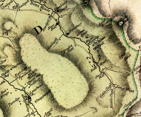
D4NY74SE.jpg Black Burn -- river -- NY6841 -- 'Black Burn' -- 'Black Burn' -- single or double wiggly line; a river, running into the South Tyne Dodbury -- building/s -- NY74534198 -- 'Dodbury' -- block or blocks, labelled in lowercase; a hamlet or just a house Galligill -- building/s -- NY75724466 -- 'Galligill' -- block or blocks, labelled in lowercase; a hamlet or just a house Garrigill Bridge -- bridge -- NY74544161 -- double line across a river; a bridge at Garrigillgate Garrigill -- building/s -- NY74464155 (etc) ? -- 'Garrigillgate' -- block or blocks, labelled in lowercase; a hamlet or just a house with a church Grassfield -- building/s -- NY76844457 -- 'Grass Field' -- block or blocks, labelled in lowercase; a hamlet or just a house Greenends -- building/s -- NY77264503 -- 'Green Ends' -- block or blocks, labelled in lowercase; a hamlet or just a house Gudham Gill Mines -- mine -- NY78404510 -- 'Lead Mines' -- no symbol possibly High Galligill -- building/s -- NY75704498 -- 'Galligill' -- block or blocks, labelled in lowercase; a hamlet or just a house Hudgill Burn -- river -- NY7545 (etc) -- 'Hoodgill Burn' -- single or double wiggly line; a river, running into the Nent Loaning Head -- building/s -- NY74754174 (etc) -- 'Lanehead' -- block or blocks, labelled in lowercase; a hamlet or just a house Low Galligill -- building/s -- NY76104491 -- 'Galligill' -- block or blocks, labelled in lowercase; a hamlet or just a house Mid Galligill -- building/s -- NY75754474 -- 'Galligill' -- block or blocks, labelled in lowercase; a hamlet or just a house Middle Cleugh Burn -- river -- NY7942 (etc) -- 'Middle Clugh' -- single or double wiggly line; a river Middle Houses -- building/s -- NY74284219 ? ? ? -- 'Middle House' -- block or blocks, labelled in lowercase; a hamlet or just a house mines, Nenthead -- lead mine -- mine -- NY78854222 (etc) -- two plus signs Nent Hall -- building/s -- NY75804573 -- 'Nent Hall' -- house Nenthall Bridge -- bridge -- NY75884577 -- double line across a river; a bridge at Nent Hall Nenthead Mines -- museum -- NY782435 (etc) -- 'Smelt Mill' -- circle with rays, mill wheel; a water mill probably Nenthead -- locality -- building/s -- NY78114372 (etc) -- 'Nent Head' -- block or blocks, labelled in lowercase; a hamlet or just a house Nentsberry Bridge -- bridge -- NY76764491 -- double line across a river; a bridge at Nentsbury Nentsberry -- locality -- building/s -- NY76384518 (etc) -- 'Nentsbury' -- house Old Carr's Burn -- river -- NY7842 (etc) -- 'Cable Clugh' -- single or double wiggly line; a river probably Pry House -- building/s -- NY77904474 -- 'Pryhouse' -- block or blocks, labelled in lowercase; a hamlet or just a house Shieldhill Cottage -- building/s -- NY74444227 -- 'Shield Hill' -- block or blocks, labelled in lowercase; a hamlet or just a house Snappergill -- building/s -- NY74884130 -- 'Snappergill' -- block or blocks, labelled in lowercase; a hamlet or just a house Water Meeting, Alston Moor -- building/s (? or locality) -- NY77574472 -- 'Water Meeting' -- block or blocks, labelled in lowercase; a hamlet or just a house Wellgill -- locality -- building/s -- NY77814439 (etc) -- 'Willgill' -- block or blocks, labelled in lowercase; a hamlet or just a house | ||
D4NY84SW.jpg cross, Alston Moor -- cross (several?) -- NY79574168 -- 'Shorts Cross' -- cross on county boundary Dodds End -- hill -- boundary mark -- county boundary mark -- NY79014563 (etc) -- 'Dods End' -- hill hachuring; hill or mountain, on county boundary Killhope Cross -- cross -- county boundary mark -- boundary mark -- NY79934323 -- 'Killhope Cross' -- cross on county boundary Killhope Head -- hill -- NY79794379 (etc) -- 'Killhope Head' -- triangle on county boundary, and note the Northumberland/Durham boundary Long Cleugh Burn -- river -- NY7942 (etc) -- 'Long Clugh' -- single or double wiggly line; a river mines, Killhope Head -- lead mine -- mine -- NY79594407 (etc) -- 'Lead Mines' -- four plus signs | ||
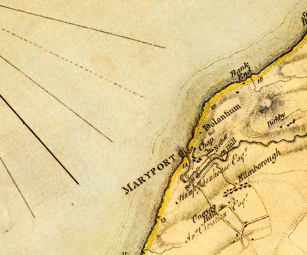
D4NY03NW.jpg Bank End Farm -- building/s -- NY04793835 -- 'Bank End' -- block or blocks, labelled in lowercase; a hamlet or just a house Ellen Bridge -- bridge -- NY03963646 -- double line across a river; a bridge nr Nether Hall Ellen, River -- river -- NY2436 (etc) -- 'Ellen River' -- 'Ellen River' -- single or double wiggly line; a river into the sea at Maryport Ellenborough -- locality -- building/s -- NY04643593 -- 'Ellenborough' -- block or blocks, labelled in lowercase; a hamlet or just a house Ewanrigg Hall -- building/s -- NY04443531 -- 'Unerigg Hall / Jno. Christian Esqr.' -- house forge, Maryport -- forge -- ironworks (?) -- NY03513617 (guess) -- 'Forge' -- SSE of Maryport ? mill ? Furnace Mill -- water mill -- mill -- corn mill -- NY03553627 (estimate) -- circle with rays, mill wheel; a water mill Maryport Harbour -- harbour -- NY03173676 (etc) -- mole projecting NW Maryport -- building/s etc -- NY037366 -- 'MARYPORT' -- blocks, perhaps a church, labelled in block caps; a town mill, Maryport (2) -- water mill -- mill -- NY04023663 -- circle with rays, mill wheel; a water mill mill, Maryport -- water mill -- mill -- paper mill (?) -- NY03293625 -- circle with rays, mill wheel; a water mill Netherhall -- building/s -- earthwork (on site) -- NY04213674 -- 'Nether Hall / Humpy. Senhouse Esqr.' -- house Maryport to Silloth -- route -- NY03 -- 'A. to GPt. 10:0:0' -- 'M. to A. 5:0:2' -- double line, narrower, solid or dotted with a dot and number at 1 mile intervals; road -- a mile and a half beyond Skinburness to Grune Point; distances from Whitehaven -- miles.furlongs.poles; Allonby to Grune Point -- miles.furlongs.poles; Maryport to Allonby Workington to Maryport -- route -- NX92 -- 'W. to M. 6:3:0' -- double line, narrower, solid or dotted with a dot and number at 1 mile intervals; road -- miles.furlongs.poles; Workington to Maryport Alauna -- roman fort -- NY039372 -- 'Volantium' -- square within a square; roman fort St Mary's Church -- church -- NY03793660 -- 'Chap' -- church probably | ||
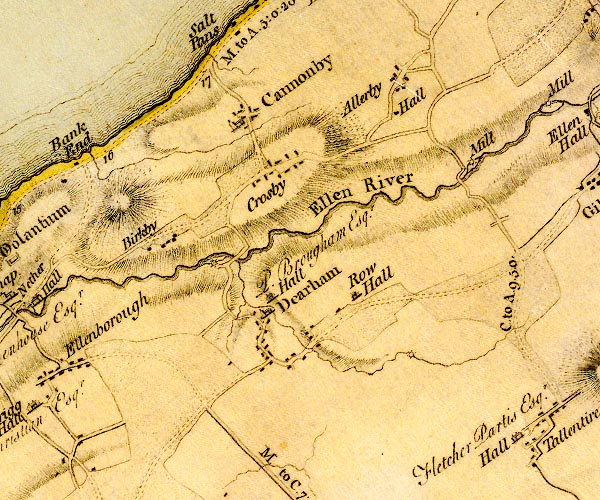
D4NY03NE.jpg Allerby Hall -- building/s -- NY08813930 -- 'Hall' -- block; building/s, at Allerby Allerby Mill -- building/s -- water mill (ex) -- mill (ex) -- corn mill (ex) -- NY09653864 -- circle with rays, mill wheel; a water mill Allerby -- locality -- building/s -- NY08903955 (etc) -- 'Allerby' -- block or blocks, labelled in lowercase; a hamlet or just a house Birkby -- locality -- building/s -- NY05963760 (etc) -- 'Birkby' -- block or blocks, labelled in lowercase; a hamlet or just a house Bullgill Bridge -- bridge -- NY09603848 -- double line across a river; a bridge Crosby -- locality -- building/s -- NY07393842 (etc) ? -- 'Crosby' -- block or blocks, labelled in lowercase; a hamlet or just a house Crosscanonby -- locality -- building/s -- NY06933905 (etc) ? -- 'Cannonby' -- blocks, and usually a church, labelled in upright lowercase; a village Dearham Bridge -- bridge -- NY06913718 -- double line across a river, a bridge over the Ellen Dearham Hall -- building/s -- NY07413647 -- 'Hall / P. Brougham Esqr.' -- house Dearham Mill -- building/s -- water mill (ex) -- mill (ex) -- corn mill (ex) -- NY06633713 -- circle with rays, mill wheel; a water mill Dearham -- locality -- building/s -- NY07093615 -- 'Dearham' -- blocks, and usually a church, labelled in upright lowercase; a village Ellen, River -- river -- NY2436 (etc) -- 'Ellen River' -- 'Ellen River' -- single or double wiggly line; a river into the sea at Maryport Maryport to Silloth -- route -- NY03 -- 'A. to GPt. 10:0:0' -- 'M. to A. 5:0:2' -- double line, narrower, solid or dotted with a dot and number at 1 mile intervals; road -- a mile and a half beyond Skinburness to Grune Point; distances from Whitehaven -- miles.furlongs.poles; Allonby to Grune Point -- miles.furlongs.poles; Maryport to Allonby Row Beck -- river -- NY0836 (etc) -- single or double wiggly line; a river into the Ellen Row Hall -- building/s -- NY08423676 -- 'Row Hall' -- house Rowbeck Mill -- building/s -- water mill (ex) -- mill (ex) -- corn mill (ex) -- NY07673595 -- 'Mill' -- circle with rays, mill wheel; a water mill possibly | ||
D4NY13NW.jpg Arkleby Hall -- building/s -- NY14303970 -- 'Mrs. Thompson' -- house at Arkleby Arkleby -- locality -- building/s -- NY14033940 (etc) -- 'Arkleby' -- block or blocks, labelled in lowercase; a hamlet or just a house Ellen Hall -- building/s -- NY11563884 -- 'Ellen Hall' -- block or blocks, labelled in lowercase; a hamlet or just a house Ellen, River -- river -- NY2436 (etc) -- 'Ellen River' -- 'Ellen River' -- single or double wiggly line; a river into the sea at Maryport Ellenhall Mill -- building/s -- water mill (ex) -- mill (ex) -- corn mill (ex) -- NY11633878 -- circle with rays, mill wheel; a water mill at Ellen Hall Gilcrux -- locality -- building/s -- NY11613813 (etc) -- 'Gillcrux' -- blocks, and usually a church, labelled in upright lowercase; a village High Close -- building/s -- NY14773838 -- 'High Close' -- block or blocks, labelled in lowercase; a hamlet or just a house Leathersgill Beck -- river -- boundary -- parish boundary -- NY1238 (etc) -- single or double wiggly line; a river by Gilcrux Millstonemoor -- building/s -- NY13653590 -- 'Millstone Moor House' -- block or blocks, labelled in lowercase; a hamlet or just a house Moota Hill -- hill -- NY14443632 (etc) -- 'Moutay' -- hill hachuring; a hill or mountain Oughterside Mill -- building/s -- water mill (ex) -- mill (ex) -- corn mill (ex) -- NY11113901 -- 'Mill' -- circle with rays, mill wheel; a water mill on the Ellen Parsonby -- locality -- building/s -- NY14333888 (etc) -- 'Parsonby' -- block or blocks, labelled in lowercase; a hamlet or just a house Plumbland -- locality -- building/s -- NY14973908 (etc) -- 'Plumland' -- blocks, and usually a church, labelled in upright lowercase; a village Cockermouth to Abbey Town -- road -- route -- NY13 -- double line, narrower, solid or dotted with a dot and number at 1 mile intervals; road Cockermouth to Allerby -- road -- route -- NY13 -- 'C. to A. 9.5.0.' -- miles.furlongs.poles; Cockermouth to Allerby? Tallentire Hall -- building/s -- NY10413516 -- 'Hall / Fletcher Partis Esqr.' -- house at Tallentire Tallentire -- locality -- building/s -- NY10813536 (etc) -- 'Tallentire' -- block or blocks, labelled in lowercase; a hamlet or just a house Wardhall Hall -- building/s -- NY13073841 -- 'Warthall Hall / Dykes Esqr.' -- house | ||
D4NY13NE.jpg Blindcrake -- locality -- building/s -- NY14813473 (etc) -- 'Blincrake' -- block or blocks, labelled in lowercase; a hamlet or just a house Bothel -- locality -- building/s -- NY18163887 (etc) -- 'Bothel' -- block or blocks, labelled in lowercase; a hamlet or just a house Cockermouth to Carlisle -- road -- route -- NY13 -- 'C. to W. 16:0:0' -- double line, narrower, solid or dotted with a dot and number at 1 mile intervals; road -- distances from Carlisle -- miles.furlongs.poles; Cockermouth to Wigton Sunderland -- locality -- building/s -- NY17963549 (etc) -- 'Sunderland' -- block or blocks, labelled in lowercase; a hamlet or just a house Threapland -- locality -- building/s -- NY15673933 (etc) -- 'Threpland' -- block or blocks, labelled in lowercase; a hamlet or just a house Torpenhow -- locality -- building/s -- NY20403973 (etc) -- 'Torpenhow' -- block or blocks, labelled in lowercase; a hamlet or just a house | ||
D4NY23NW.jpg Binsey -- hill -- NY22513553 -- 'Binsey' -- hill hachuring; a hill or mountain Bird House -- building/s -- NY20303783 -- 'Birdhouse' -- block or blocks, labelled in lowercase; a hamlet or just a house Birkmire -- building/s -- NY24383921 -- 'Birk Mire' -- block or blocks, labelled in lowercase; a hamlet or just a house bridge, Snittlegarth -- bridge -- NY22013821 -- double line across a river; a bridge at Snittlegarth probably Gill Beck -- river -- boundary -- parish boundary -- NY2439 (etc) -- single or double wiggly line; a river into the Ellen at Ireby High Houses -- building/s -- NY21733724 -- 'High House' -- block or blocks, labelled in lowercase; a hamlet or just a house High Ireby -- locality -- building/s -- NY23073720 (etc) -- 'High Ireby' -- block or blocks, labelled in lowercase; a hamlet or just a house Ireby High Bridge -- bridge -- NY23943849 -- double line across a river; a bridge over the Ellen Ireby Low Bridge -- bridge -- NY24083921 -- double line across a river; a bridge over the Ellen Ireby Mill -- building/s -- water mill (ex) -- mill (ex) -- corn mill (ex) -- NY23903862 -- circle with rays, mill wheel; a water mill at Ireby Ireby Old Chancel -- church -- NY22393930 -- 'Ireby Church' -- church Ireby -- locality -- building/s etc -- NY23383874 (etc) -- 'IREBY' -- blocks, perhaps a church, labelled in block caps; a town with street plan Lynedraw -- building/s -- NY24393943 -- 'Linedraw' -- block or blocks, labelled in lowercase; a hamlet or just a house mill, Ireby -- building/s -- water mill (ex) -- mill (ex) -- corn mill (? ex) -- NY24123921 (guess) -- circle with rays, mill wheel; a water mill at Ireby New Park -- building/s -- NY22673890 -- 'New Park' -- block or blocks, labelled in lowercase; a hamlet or just a house Nook House -- building/s -- NY23823645 -- 'Nook' -- block or blocks, labelled in lowercase; a hamlet or just a house Park House -- building/s -- NY21174010 -- 'Park House' -- block or blocks, labelled in lowercase; a hamlet or just a house Prior Hall -- building/s -- NY22513995 -- 'Prior Hall' -- block or blocks, labelled in lowercase; a hamlet or just a house Hesket Newmarket road -- route -- NY33Hesket Newmarket road -- route -- NY33 -- 'C. to H. 13:7:36' -- double line, narrower, solid or dotted with a dot and number at 1 mile intervals; road -- distances from Carlisle? -- miles.furlongs.poles; Cockermouth to Hesket Ruthwaite -- locality -- building/s -- NY23803677 (etc) -- 'Ruthwaite' -- block or blocks, labelled in lowercase; a hamlet or just a house Scawthwaite Close -- building/s -- NY24813560 -- 'Calthwaite Close' -- block or blocks, labelled in lowercase; a hamlet or just a house probably Snittlegarth -- building/s -- locality -- NY21923789 -- 'Snittlegarth / R. Williamson Esqr.' -- house St James's Church -- church -- NY24013794 -- 'Uldale Church' -- church Uldale Mill -- building/s -- water mill (ex) -- mill (ex) -- corn mill (ex) -- NY23983788 (?) -- circle with rays, mill wheel; a water mill at Uldale church Uldale -- locality -- building/s -- NY24953695 (etc) -- 'Uldale' -- blocks, and usually a church, labelled in upright lowercase; a village Whitrigg -- locality -- building/s -- NY20553855 (etc) -- 'Whitrigg' -- block or blocks, labelled in lowercase; a hamlet or just a house | ||
D4NY23NE.jpg Aughertree -- building/s -- NY25503847 (etc) -- 'Aughertree' -- block or blocks, labelled in lowercase; a hamlet or just a house Baggra Yeat -- building/s -- NY26763670 -- 'Bagrowgate' -- block or blocks, labelled in lowercase; a hamlet or just a house Branthwaite -- locality -- building/s -- NY29803731 (etc) (etc) -- 'Branthwaite' -- block or blocks, labelled in lowercase; a hamlet or just a house Burblethwaite -- building/s -- NY28713714 -- 'Burblethwaite' -- block or blocks, labelled in lowercase; a hamlet or just a house Chapel House Farm -- building/s -- NY25873604 -- 'Chapless' -- block or blocks, labelled in lowercase; a hamlet or just a house Ellen, River -- river -- NY2436 (etc) -- 'Ellen River' -- 'Ellen River' -- single or double wiggly line; a river into the sea at Maryport Faulds -- building/s -- NY29713942 -- 'Folds' -- block or blocks, labelled in lowercase; a hamlet or just a house Gill -- building/s -- NY26103892 (guess) -- 'Gill' -- block or blocks, labelled in lowercase; a hamlet or just a house Greenrigg -- locality -- building/s -- NY29693814 (etc) -- 'Greenrigg' -- block or blocks, labelled in lowercase; a hamlet or just a house High Intack -- building/s -- NY27573761 -- 'Intack' -- block or blocks, labelled in lowercase; a hamlet or just a house Ireby Dale -- valley -- NY25213888 (etc etc) -- 'Ireby Dale' -- valley, hill hachures Longlands -- locality -- building/s -- NY2673601 (etc) -- 'Langlands' -- block or blocks, labelled in lowercase; a hamlet or just a house Low Intack -- building/s -- NY27983788 -- 'Intack' -- block or blocks, labelled in lowercase; a hamlet or just a house Middle Intack -- building/s -- NY27693774 -- 'Intack' -- block or blocks, labelled in lowercase; a hamlet or just a house Newlands Farm -- building/s -- NY25373952 -- 'Newlands' -- block or blocks, labelled in lowercase; a hamlet or just a house Norman -- building/s -- NY27823686 -- 'Norman' -- block or blocks, labelled in lowercase; a hamlet or just a house Rash -- building/s -- NY25263930 -- 'Rash' -- block or blocks, labelled in lowercase; a hamlet or just a house Keswick to Carlisle -- route etc -- double line, solid or dotted, with a dot or milestone and number at 1 mile intervals, tinted red; turnpike road Hesket Newmarket road -- route -- NY33Hesket Newmarket road -- route -- NY33 -- 'C. to H. 13:7:36' -- double line, narrower, solid or dotted with a dot and number at 1 mile intervals; road -- distances from Carlisle? -- miles.furlongs.poles; Cockermouth to Hesket Stanthwaite -- building/s -- NY25303657 -- 'Stanthwaite' -- block or blocks, labelled in lowercase; a hamlet or just a house Sworley -- building/s (ruin) -- NY27243660 -- 'Sworley' -- block or blocks, labelled in lowercase; a hamlet or just a house Thorney Stone -- stone -- boundary mark -- parish boundary mark -- NY27563820 -- 'Thorney Stone' -- block or blocks, labelled in lowercase; a hamlet or just a house toll gate, Caldbeck -- toll gate (site) -- NY27983824 (guess) -- 'Turnp.' -- building at Thorney Stone; toll house and toll gate | ||
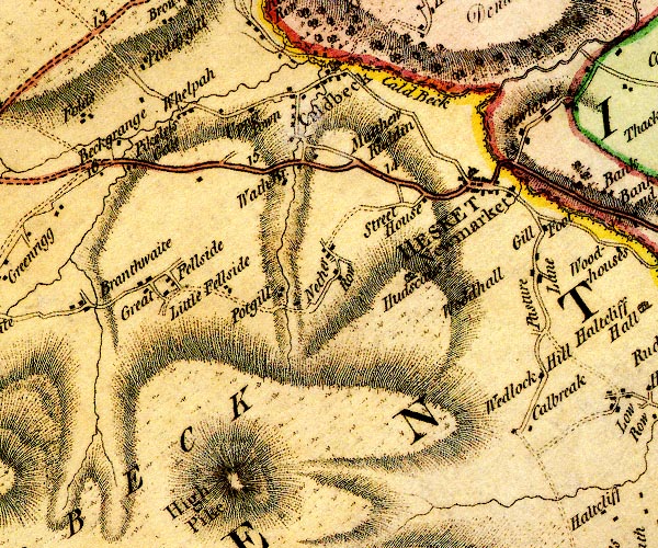
D4NY33NW.jpg Beck Grange -- building/s -- NY29983907 -- 'Beckgrange' -- block or blocks, labelled in lowercase; a hamlet or just a house Cald Beck -- river -- NY3339 (etc) -- 'Cald Beck' -- single or double wiggly line; a river into the Caldew Caldbeck Fells -- hill -- fell -- NY317350 (etc etc) -- 'Caldbeck Fells' -- 'CALDBECK FELLS' -- hill hachuring; a hill or mountain Caldbeck -- locality -- building/s -- NY32403977 (etc) -- 'Caldbeck' -- blocks, and usually a church, labelled in upright lowercase; a village Caldew, River -- river -- boundary -- parish boundary -- NY3851 (etc) ? -- 'Caldew River' -- 'Caldew River' -- single or double wiggly line; a river into the Eden Calebreck -- locality -- building/s -- NY34583587 (etc) -- 'Calbreak' -- block or blocks, labelled in lowercase; a hamlet or just a house Fell Side -- locality -- building/s -- NY30543756 (etc) -- 'Great Fellside' -- block or blocks, labelled in lowercase; a hamlet or just a house Gates Bridge -- bridge -- NY32333971 -- double line across a river; a bridge over Cald Beck Gill Beck (3) -- river -- NY3138 (etc) -- 'Cald Beck' -- single or double wiggly line; a river into the Cald Beck Gillfoot -- building/s -- locality -- NY34803816 -- 'Gill Foot' -- block or blocks, labelled in lowercase; a hamlet or just a house Hesket Bridge -- packhorse bridge -- bridge (?) -- NY34313886 -- double line across a river; a bridge over the Caldew at Hesket Newmarket Hesket Newmarket -- locality -- building/s etc -- NY34073863 (etc) -- 'HESKET Newmarket' -- blocks, and usually a church, labelled in upright lowercase; a village and a house High Pike -- hill -- NY31873501 (etc) -- 'High Pike' -- hill hachuring; a hill or mountain Hudscales -- building/s -- locality -- NY33123754 -- 'Hudscales' -- house Little Fellside -- building/s -- NY31283733 -- 'Little Fellside' -- block or blocks, labelled in lowercase; a hamlet or just a house Matthew Rudding -- building/s -- NY33033901 -- 'Matthew Ruddin' -- block or blocks, labelled in lowercase; a hamlet or just a house Nether Row -- locality -- building/s -- NY32393780 (etc) -- 'Nether Row' -- block or blocks, labelled in lowercase; a hamlet or just a house Newlands -- locality -- building/s -- NY34883959 (etc) -- 'Newlands' -- block or blocks, labelled in lowercase; a hamlet or just a house Paddigill -- building/s -- NY30164023 -- 'Paddygill' -- block or blocks, labelled in lowercase; a hamlet or just a house Pasture Lane Farm -- building/s -- NY34733685 -- 'Pasture Lane' -- block or blocks, labelled in lowercase; a hamlet or just a house Pasture Lane House -- building/s -- NY34803643 -- 'Wedlock Hill' -- block or blocks, labelled in lowercase; a hamlet or just a house Pasture Lane -- road -- NY34713742 (etc) -- 'Pasture Lane' -- road Pikeless Gate -- toll gate (site ?) -- gate -- NY29943888 -- 'Pikeless Gate' -- block or blocks, labelled in lowercase; a hamlet or just a house Potts Gill -- building/s -- NY31813734 -- 'Potgill' -- block or blocks, labelled in lowercase; a hamlet or just a house Priests Mill -- craft shop -- museum (gone) -- water mill -- mill -- NY32613990 -- circle with rays, mill wheel; a water mill at Caldbeck Hesket Newmarket road -- route -- NY33Hesket Newmarket road -- route -- NY33 -- 'C. to H. 13:7:36' -- double line, narrower, solid or dotted with a dot and number at 1 mile intervals; road -- distances from Carlisle? -- miles.furlongs.poles; Cockermouth to Hesket Street Head -- building/s -- NY33443850 -- 'Street House' -- block or blocks, labelled in lowercase; a hamlet or just a house Upton -- locality -- building/s -- NY32083927 (etc) -- 'Upper Town' -- block or blocks, labelled in lowercase; a hamlet or just a house probably Wath -- building/s -- NY32103882 -- 'Wath Br.' -- block or blocks, labelled in lowercase; a hamlet or just a house and bridge Whelpo Bridge -- bridge -- NY30823965 -- double line across a river; a bridge at Whelpo Whelpo -- locality -- building/s -- NY30823963 (etc) -- 'Whelpah' -- block or blocks, labelled in lowercase; a hamlet or just a house Wood Hall -- building/s -- NY34053729 -- 'Woodhall' -- block or blocks, labelled in lowercase; a hamlet or just a house | ||
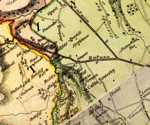
D4NY33NE.jpg Bankend Mill -- building/s -- water mill (ex) -- mill (ex) -- NY35773807 -- circle with rays, mill wheel; a water mill at Castlehow Bankend -- building/s -- NY35873818 -- 'Bankend' -- block or blocks, labelled in lowercase; a hamlet or just a house Banks -- building/s -- NY35483837 -- 'Bank' -- block or blocks, labelled in lowercase; a hamlet or just a house Bishopspot -- building/s -- NY37483608 -- 'Bishop Pot' -- block or blocks, labelled in lowercase; a hamlet or just a house bridge, Haltcliff -- bridge -- NY36373636 -- double line across a river; a bridge over Carrock Beck Caldew, River -- river -- boundary -- parish boundary -- NY3851 (etc) ? -- 'Caldew River' -- 'Caldew River' -- single or double wiggly line; a river into the Eden Carrock Beck -- river -- NY3435 (etc) -- single or double wiggly line; a river into the Caldew at Haltcliff Castle Sowerby -- locality -- building/s -- NY38043613 (etc) -- 'Castle Sowerby' -- blocks, and usually a church, labelled in upright lowercase; a village Castlehow -- building/s -- NY35933830 -- 'Castlehow' -- block or blocks, labelled in lowercase; a hamlet or just a house Deer Rudding -- building/s -- NY36613703 -- 'Ruddin' -- block or blocks, labelled in lowercase; a hamlet or just a house Field House -- building/s -- NY38033692 -- 'Field ho.' -- block or blocks, labelled in lowercase; a hamlet or just a house Gill Field -- building/s -- NY38323526 -- 'Gill Field' -- block or blocks, labelled in lowercase; a hamlet or just a house Hallfield -- building/s -- NY36173842 -- 'Hallfield' -- block or blocks, labelled in lowercase; a hamlet or just a house Haltcliff Bridge -- bridge -- NY36763643 -- double line across a river; a bridge over the Caldew Haltcliff Bridge -- locality -- NY36713657 (etc) -- 'Haltcliff Br.' -- block or blocks, labelled in lowercase; a hamlet or just a house Haltcliff Hall -- building/s -- NY36013722 -- 'Haltcliff Hall' -- house Hegglefoot -- building/s -- NY36643598 -- 'Heggil Foot' -- block or blocks, labelled in lowercase; a hamlet or just a house Hewerhill -- locality -- building/s -- NY37353897 (etc) -- 'Ewerhill' -- block or blocks, labelled in lowercase; a hamlet or just a house How Hill -- locality -- building/s -- NY39323607 (etc) -- 'Howhill' -- block or blocks, labelled in lowercase; a hamlet or just a house Howgill -- building/s -- castle (?) -- NY36054028 -- 'Cowgill' -- block or blocks, labelled in lowercase; a hamlet or just a house Low Moor Dyke -- building/s -- NY37463749 -- 'Mossdikes' -- block or blocks, labelled in lowercase; a hamlet or just a house Low Row -- locality -- building/s -- NY35833641 (etc) -- 'Low Row' -- block or blocks, labelled in lowercase; a hamlet or just a house Mill House -- building/s -- NY36653660 -- circle with rays, mill wheel; a water mill at Haltcliff Bridge mill, Millhouse -- building/s -- water mill (ex) -- mill (ex) -- corn mill (ex) -- NY36233756 -- circle with rays, mill wheel; a water mill at Mill House Millhouse Bridge -- bridge -- NY36173767 -- double line across a river; a bridge at Mill House Millhouse -- locality -- building/s -- NY36263759 (etc) -- 'Mill House' -- block or blocks, labelled in lowercase; a hamlet or just a house New Yeat -- building/s -- inn (ex?) -- NY37583774 -- 'Newgate' -- block or blocks, labelled in lowercase; a hamlet or just a house Newsham -- building/s -- NY39173520 -- 'Newsham' -- block or blocks, labelled in lowercase; a hamlet or just a house Penrith to Hesket Newmarket -- route etc -- 'H. to P. 13:2:12' -- double line, solid or dotted, with a dot or milestone and number at 1 mile intervals, tinted red; turnpike road -- miles.furlongs.poles; Hesket to Penrith Penrith to Wigton -- route -- NY44 -- 'W. to P. 21:0:32' -- double line, solid or dotted, with a dot or milestone and number at 1 mile intervals, tinted red; turnpike road -- distances from Penrith -- miles.furlongs.poles; Wigton to Penrith Scalerigg House -- building/s -- NY36533631 -- 'Foulgap' -- block or blocks, labelled in lowercase; a hamlet or just a house probably Southernby -- locality -- building/s -- NY36653937 (etc) -- 'Southernby' -- block or blocks, labelled in lowercase; a hamlet or just a house Sowerby Row -- locality -- building/s -- NY39233998 -- 'Sowerby Row' -- block or blocks, labelled in lowercase; a hamlet or just a house rather dispersed Spittle House -- building/s -- NY37563853 -- 'Spittlehouse' -- block or blocks, labelled in lowercase; a hamlet or just a house Thackmire -- building/s -- NY35793976 -- 'Thackmoor' -- block or blocks, labelled in lowercase; a hamlet or just a house Vicargate -- building/s -- NY38013655 -- 'Vicargate' -- block or blocks, labelled in lowercase; a hamlet or just a house Well House -- building/s -- NY37653673 -- 'Well' -- block or blocks, labelled in lowercase; a hamlet or just a house Welfoot -- building/s -- NY37413705 -- 'Well Foot' -- block or blocks, labelled in lowercase; a hamlet or just a house Woodhouse -- building/s -- NY35673791 -- 'Woodhouses' -- block or blocks, labelled in lowercase; a hamlet or just a house | ||
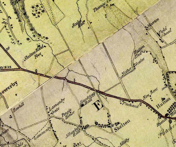
D4NY43NW.jpg Ellonby Hall -- building/s -- NY42643519 (?) -- 'Allanby Hall' -- house and buildings Ellonby -- locality -- building/s -- NY42493540 (etc) -- 'Allanby Hall' -- house and buildings Hardrigg Hall -- building/s -- NY42483618 -- 'Hardrigg Hall' -- house Hutton End -- locality -- building/s -- NY44963853 (etc) -- 'Hutton End' -- block or blocks, labelled in lowercase; a hamlet or just a house Lamonby -- locality -- building/s -- NY40933579 (etc) -- 'Lamonby Gate' -- 'Lammonby' -- block or blocks, labelled in lowercase; a hamlet or just a house Netherscales -- building/s -- locality -- NY44793794 -- 'Nether Scales' -- block or blocks, labelled in lowercase; a hamlet or just a house Pringle House -- building/s -- NY41783609 -- 'Pingle House' -- block or blocks, labelled in lowercase; a hamlet or just a house Penrith to Hesket Newmarket -- route etc -- 'H. to P. 13:2:12' -- double line, solid or dotted, with a dot or milestone and number at 1 mile intervals, tinted red; turnpike road -- miles.furlongs.poles; Hesket to Penrith Penrith to Wigton -- route -- NY44 -- 'W. to P. 21:0:32' -- double line, solid or dotted, with a dot or milestone and number at 1 mile intervals, tinted red; turnpike road -- distances from Penrith -- miles.furlongs.poles; Wigton to Penrith Scales Hall -- building/s -- NY42594001 -- 'Scales Hall' -- block or blocks, labelled in lowercase; a hamlet or just a house Skelton Wood End -- locality -- building/s -- NY40963864 (etc) -- 'Skelton Wood Foot' -- block or blocks, labelled in lowercase; a hamlet or just a house probably Skelton -- locality -- building/s -- NY43723545 (etc) -- 'Skelton' -- blocks, and usually a church, labelled in upright lowercase; a village Unthank -- locality -- building/s -- NY45433605 (etc) -- 'Unthank' -- block or blocks, labelled in lowercase; a hamlet or just a house | ||
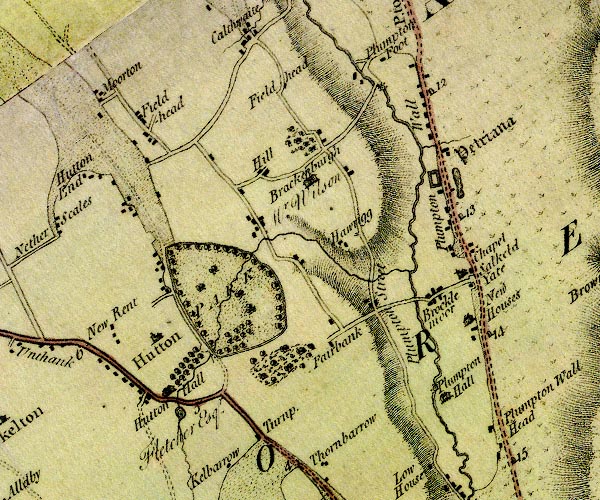
D4NY43NE.jpg Brackenburgh -- building/s -- locality -- NY47583841 -- 'Brackenburgh / Mr. Wilson' -- house Brockleymoor House -- building/s -- NY49263698 -- 'Brockle moor' -- block or blocks, labelled in lowercase; a hamlet or just a house Calthwaite House -- building/s -- NY47373956 -- 'Fieldhead' -- block or blocks, labelled in lowercase; a hamlet or just a house possibly Fair Bank -- building/s -- NY48023638 -- 'Fairbank' -- block or blocks, labelled in lowercase; a hamlet or just a house Fieldhead -- locality -- building/s -- NY45713911 (etc) -- 'Fieldhead' -- block or blocks, labelled in lowercase; a hamlet or just a house Hallrigg -- building/s -- NY48093751 -- 'Hawrigg' -- block or blocks, labelled in lowercase; a hamlet or just a house Hill, The -- building/s -- NY47023844 -- 'Hill' -- block or blocks, labelled in lowercase; a hamlet or just a house Hutton-in-the-Forest -- building/s -- garden -- castle -- pele tower -- park -- fish pond -- NY46053577 -- 'Hutton Hall / Fletcher Esqr.' -- 'PARK' -- house, avenue of trees -- outline of wall of trees; a park -- lake, by Hutton Hall lake, Plumpton -- lake -- NY49533831 (etc) -- lake, at Petriana Middle Bridge -- bridge -- NY48953689 -- double line across a river; a bridge at Brocklemoor milestone, Hesket (5) -- milestone -- NY49163946 -- '12' -- milestone; from Carlisle to Penrith milestone, Hesket (6) -- milestone -- NY49573791 -- '13' -- milestone; from Carlisle to Penrith milestone, Hesket (7) -- milestone -- NY49943635 -- '14' -- milestone; from Carlisle to Penrith Morton -- locality -- building/s -- NY45053958 (etc) -- 'Moorton' -- block or blocks, labelled in lowercase; a hamlet or just a house New Rent -- locality -- building/s -- NY45673649 (etc) -- 'New Rent' -- block or blocks, labelled in lowercase; a hamlet or just a house Newhouse -- building/s -- NY49903661 (about) -- 'New Houses' -- block or blocks, labelled in lowercase; a hamlet or just a house and a house Old Petteril -- river -- NY4737 (etc) -- single or double wiggly line; a river thro Hutton Park Petteril, River -- river -- boundary -- parish boundary -- NY4935 (etc etc) -- 'Pettrill River' -- 'Petterill River' -- single or double wiggly line; a river into the Eden Plumpton Hall -- building/s -- NY49493557 -- 'Plumpton Hall' -- house Plumpton -- locality -- building/s -- NY49763709 (etc) -- 'Plumpton Wall' -- block or blocks, labelled in lowercase; a hamlet or just a house Plumptonfoot Bridge -- bridge -- NY48423965 -- double line across a river; a bridge near Plumpton Foot Plumptonfoot Mill -- building/s -- water mill (ex) -- mill (ex) -- NY48483965 -- circle with rays, mill wheel; a water mill near Plumpton Foot Plumptonfoot -- locality -- building/s -- NY48433968 (etc) -- 'Plumpton Foot' -- block or blocks, labelled in lowercase; a hamlet or just a house Plumptonhall Mill -- building/s -- water mill (ex) -- mill (ex) -- NY49353580 -- circle with rays, mill wheel; a water mill at Plumpton Hall Penrith to Carlisle -- route -- road -- NY53 -- 'P. to C. 18:0:0' -- double line, solid or dotted, with a dot or milestone and number at 1 mile intervals, tinted red; turnpike road -- from English Gate -- miles.furlongs.poles; Penrith to Carlisle -- 'Plumpton Street' -- road Penrith to Hesket Newmarket -- route etc -- 'H. to P. 13:2:12' -- double line, solid or dotted, with a dot or milestone and number at 1 mile intervals, tinted red; turnpike road -- miles.furlongs.poles; Hesket to Penrith Penrith to Wigton -- route -- NY44 -- 'W. to P. 21:0:32' -- double line, solid or dotted, with a dot or milestone and number at 1 mile intervals, tinted red; turnpike road -- distances from Penrith -- miles.furlongs.poles; Wigton to Penrith Voreda -- roman fort -- NY49333846 ? -- 'Petriana' -- square within a square; roman fort Salkeld Gate -- building/s -- NY49763718 -- 'Salkeld Yate' -- block or blocks, labelled in lowercase; a hamlet or just a house St James's Church -- church -- NY45933644 -- 'Hutton' -- blocks, and usually a church, labelled in upright lowercase; a village St John's Church -- church -- NY49703716 -- 'Chapel' -- church toll gate, Catterlen -- toll gate (site) -- NY47423498 (guess) -- 'Turnp.' -- building by road; toll house and toll gate | ||
D4NY53NW.jpg Brackenbank -- building/s -- locality -- NY53803927 -- 'Brackenbank' -- block or blocks, labelled in lowercase; a hamlet or just a house Brown Rigg -- hill -- locality -- NY51723711 (etc) -- 'Brownrigg' -- hill hachuring; a hill or mountain Cold Keld -- spring -- NY53343752 -- 'Cold Keld' -- no symbol, at head of a stream Garthfolds -- building/s -- NY54143997 -- 'Garth Fold' -- block or blocks, labelled in lowercase; a hamlet or just a house Great Salkeld -- locality -- building/s -- NY55113675 (etc) -- 'Great Salkeld' -- blocks, and usually a church, labelled in upright lowercase; a village Nunwick Hall -- building/s -- garden -- NY55303591 -- 'Nunwick Hall / Ricardson Esq.' -- house Plumton Head -- building/s -- NY50183497 -- 'Plumpton Wall Head' -- block or blocks, labelled in lowercase; a hamlet or just a house Penrith to Brampton -- route etc -- 'P. to K. 8:3:12' -- double line, narrower, solid or dotted with a dot and number at 1 mile intervals; road -- miles.furlongs.poles; Penrith to Kirkoswald Salkeld Dykes -- locality -- building/s -- NY54563647 (etc) -- 'Salkeld Dike' -- block or blocks, labelled in lowercase; a hamlet or just a house Scalehill -- building/s -- NY54393852 -- 'Scalehill' -- block or blocks, labelled in lowercase; a hamlet or just a house Scatterbeck Mill -- building/s -- water mill (ex) -- mill (ex) -- NY54933837 -- 'Mill' -- circle with rays, mill wheel; a water mill | ||
D4NY53NE.jpg Addingham -- locality -- NY57453834 (etc) -- 'Addingham' -- blocks, and usually a church, labelled in upright lowercase; a village Briggle Beck -- river -- NY5745 (etc) -- single or double wiggly line; a river into the Eden Eden, River -- river -- boundary -- parish boundary -- NY3658 (etc) -- 'Eden River' -- 'Eden R.' -- estuary -- single or double wiggly line; a river and county boundary, into the sea Farmanby -- building/s -- NY59283710 -- 'Farmanby' -- block or blocks, labelled in lowercase; a hamlet or just a house Force Mill -- water mill (gone) -- mill (gone) -- building/s -- NY56213800 -- 'Mill' -- circle with rays, mill wheel; a water mill Gawtreehouse -- building/s -- NY58793588 -- 'Gotree' -- block or blocks, labelled in lowercase; a hamlet or just a house Glassonby Beck -- river -- NY5639 (etc) -- single or double wiggly line; a river into the Eden N of Glassonby Glassonby -- locality -- building/s -- NY57663884 (etc) -- 'Glassonby' -- block or blocks, labelled in lowercase; a hamlet or just a house Hunsonby -- locality -- building/s -- NY58073558 (etc) -- 'Hunsonby' -- block or blocks, labelled in lowercase; a hamlet or just a house Langwathby Mill -- building/s -- water mill (ex) -- mill (exe) -- corn mill (exe) -- NY56623520 -- circle with rays, mill wheel; a water mill Lazonby -- locality -- building/s -- NY54763967 (etc) -- 'Lazonby' -- blocks, and usually a church, labelled in upright lowercase; a village Little Salkeld -- locality -- building/s -- NY56603618 (etc) -- 'Little Salkeld' -- block or blocks, labelled in lowercase; a hamlet or just a house Long Meg and Her Daughters -- stone circle -- NY57113721 (etc) -- 'Long Megg & her Daughrs.' -- circle of stones and standing stone to W Longmeg -- building/s -- NY57083737 -- 'Lodge Field' -- area probably Low Wath -- ford -- NY56143668 (approx) -- ford across the Eden E of Gt Salkeld Mains -- building/s -- NY56143994 -- 'Mains' -- block or blocks, labelled in lowercase; a hamlet or just a house Maughanby -- building/s -- NY57283802 -- 'Maughonby' -- block or blocks, labelled in lowercase; a hamlet or just a house Little Salkeld Mill -- water mill -- mill -- workplace -- NY56673599 -- circle with rays, mill wheel; a water mill near Little Salkeld Old Parks -- building/s -- NY57444004 -- 'Park' -- block or blocks, labelled in lowercase; a hamlet or just a house Robberby Water -- river -- NY5635 (etc) -- single or double wiggly line; a river into the Robberby -- building/s -- NY58983664 -- 'Robberby' -- block or blocks, labelled in lowercase; a hamlet or just a house St Michael's Church -- church -- NY57433831 -- 'Addingham' -- blocks, and usually a church, labelled in upright lowercase; a village Winskill -- locality -- building/s -- NY58063494 (etc) -- 'Winskell' -- no symbol | ||
D4NY63NW.jpg Broadmeadows -- building/s -- NY59903746 -- 'Hillmoorhead' -- block or blocks, labelled in lowercase; a hamlet or just a house possibly Crofton Sike -- river -- NY6140 (etc) -- single or double wiggly line; a river Eller Beck -- river -- NY6141 (etc) -- single or double wiggly line; a river Gale Hall -- building/s -- NY62953648 -- 'Galehall' -- block or blocks, labelled in lowercase; a hamlet or just a house Gamblesby Beck -- river -- NY6139 (etc) -- single or double wiggly line; a river Gamblesby -- locality -- building/s -- NY60983941 (etc) -- 'Gamblesby' -- block or blocks, labelled in lowercase; a hamlet or just a house Gill Beck -- river -- boundary -- parish boundary -- NY5938 (etc) -- single or double wiggly line; a river Hartside Height -- hill -- NY65104267 (etc) -- 'HARTSIDE FELL' -- hill hachuring; a hill or mountain Hazel Rigg -- building/s -- NY61554024 -- 'Hasel Rigg' -- block or blocks, labelled in lowercase; a hamlet or just a house Hazelrigg Beck -- river -- NY6040 (etc) -- single or double wiggly line; a river Holm Beck -- river -- NY6236 (etc) -- single or double wiggly line; a river Melmerby Beck -- river -- NY6037 (etc) -- single or double wiggly line; a river Melmerby Hall -- building/s -- NY61133736 -- 'Hall / Pattinson Esqr.' -- house Melmerby Mill -- water mill (ex) -- mill (ex) -- NY60123732 -- circle with rays, mill wheel; a water mill W of Melmerby Melmerby -- locality -- building/s -- NY61523735 (etc) -- 'Melmerby' -- blocks, and usually a church, labelled in upright lowercase; a village Penrith to Alston -- route -- NY52 -- double line, narrower, solid or dotted with a dot and number at 1 mile intervals; road -- miles, furlongs; Penrith to Alston Sandwath Beck -- river -- NY5939 (etc) -- single or double wiggly line; a river Sunnygill Beck -- river -- boundary -- parish boundary (old) -- NY6136 (etc) -- single or double wiggly line; a river | ||
D4NY63NE.jpg Aglionby Beck -- river -- boundary -- parish boundary -- NY6539 (etc) -- 'Swarth Beck' -- single or double wiggly line; a river probably Black Burn -- river -- NY6938 (etc) -- 'Dirtpot Burn' -- single or double wiggly line; a river probably Hartside Height -- hill -- NY65104267 (etc) -- 'HARTSIDE FELL' -- hill hachuring; a hill or mountain Maiden Way -- roman road -- road etc -- NY62 -- 'Maiden Way' -- 'Maiden Way' -- double dotted line, track, labelled in English Black Letter Shield Water -- river -- boundary -- parish boundary -- NY6840 (etc) -- 'Shields Water' -- single or double wiggly line; a river Smittergill Burn -- river -- NY6839 (etc) -- 'Smittergill B.' -- single or double wiggly line; a river Swarth Beck -- river -- NY6838 (etc) -- 'Swarthbeck B.' -- single or double wiggly line; a river | ||
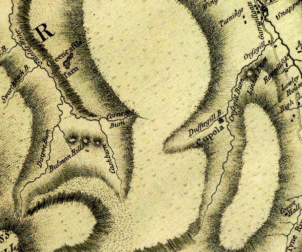
D4NY73NW.jpg Bullman Hills -- hill -- NY70533724 (etc) -- 'Bulman Hills' -- hill hachuring; hill or mountain, three Cash Burn -- river -- boundary -- parish boundary -- NY7137 (etc) -- 'Cashburn' -- single or double wiggly line; a river Cross Gill -- river -- NY7440 (etc) -- 'Crossgill Burn' -- single or double wiggly line; a river Duffergill Burn -- river -- NY7338 (etc) -- 'Duffergill B.' -- single or double wiggly line; a river Greencastle Tarn -- lake -- NY69743989 (etc) -- 'Greencastle Tarn' -- lake Linkin How -- hill -- NY74233983 (etc) -- 'Linkin Know' -- hill hachuring; a hill or mountain smelter, Alston Moor -- smelter -- NY73783904 (guess) -- 'Cupola' -- large builing, labelled in upright lowercase Stanners Gill -- river -- NY7139 (etc) -- 'Cornrigg Burn' -- single or double wiggly line; a river probably | ||
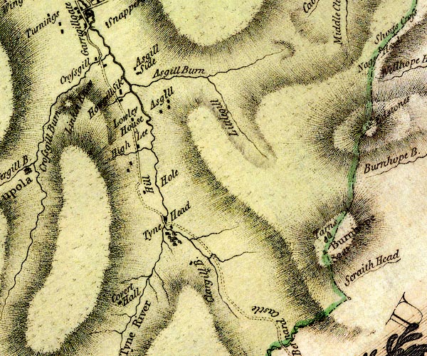
D4NY73NE.jpg Ash Gill -- river -- NY7540 (etc) -- 'Asgill Burn' -- single or double wiggly line; a river Ashgill -- locality -- building/s -- NY76034080 (etc) -- 'Asgill' -- block or blocks, labelled in lowercase; a hamlet or just a house Ashgillside -- building/s -- NY75404066 ? ? -- 'Asgill Side' -- block or blocks, labelled in lowercase; a hamlet or just a house Burnhope Seat -- hill -- boundary mark -- county boundary mark -- NY78793755 -- 'Burnhope Seat' -- hill hachuring; hill or mountain, and stone on county boundary Calvertfold -- building/s -- sheepfold (?) -- NY75343639 -- 'Covert Hall' -- block or blocks, labelled in lowercase; a hamlet or just a house probably Clargill Burn -- river -- NY7637 (etc) -- 'Clargill B.' -- single or double wiggly line; a river Crossgill Bridge -- bridge -- NY74794074 -- double line across a river; a bridge at Crossgill Crossgill -- locality -- building/s -- NY74784084 (etc) -- 'Crossgill' -- block or blocks, labelled in lowercase; a hamlet or just a house Hill House -- building/s -- NY75723866 -- 'Hill' -- block or blocks, labelled in lowercase; a hamlet or just a house Hole House -- building/s -- NY75963878 -- 'Hole' -- no symbol Howgillsike -- building/s -- NY75194024 -- 'Howgill Sike' -- block or blocks, labelled in lowercase; a hamlet or just a house Little Gill -- river -- NY7739 (etc) -- 'Littlegill' -- single or double wiggly line; a river Low Lee House -- building/s -- NY75373984 -- 'Lowley House' -- block or blocks, labelled in lowercase; a hamlet or just a house mine, Tyne Head -- mine (disused) -- NY76903698 (etc) -- cross (+) ?mine by Clargill Burn Over Lee House -- building/s -- NY75543936 -- 'High Lee' -- block or blocks, labelled in lowercase; a hamlet or just a house South Tyne, River -- river etc -- NY7441 (etc) ? -- 'Tyne River' -- 'Tyne River' -- 'Tyne River' -- 'Tyne River' -- 'Tyne River' -- single or double wiggly line; a river tarn, Burnhope Seat -- lake -- NY78683761 (etc) -- 'Tarns' -- lake, on Burnhope Seat Tynehead -- building/s -- NY76243802 -- 'Tyne Head' -- block or blocks, labelled in lowercase; a hamlet or just a house | ||
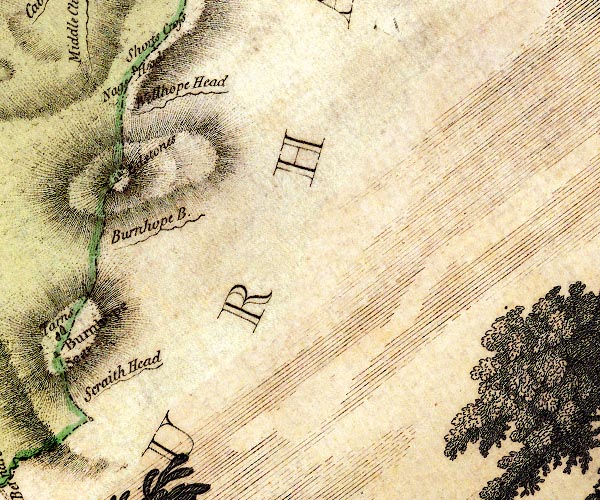
D4NY83NW.jpg boundary stone, Nag's Head -- boundary stone -- county boundary mark -- NY79444131 -- stone on county boundary Dead Stones -- stone -- pile of stones -- boundary stone (?) -- county boundary mark -- NY79373992 (etc) -- 'Edstones' -- 2 stones on hill, on county boundary Nag's Head -- hill -- boundary mark -- county boundary mark -- NY79454130 (etc) -- 'Nags Head' -- on county boundary Sally Grain -- river -- NY7939 (etc) -- 'Burnhope B.' -- single or double wiggly line; a river probably Scraith Head -- pass (saddle) -- NY79113690 -- 'Scraith Head' -- single or double wiggly line; a river Wellhope Head -- locality -- NY796404 (etc) -- 'Wellhope Head' -- single or double wiggly line; a river | ||
D4NX93SE.jpg | ||
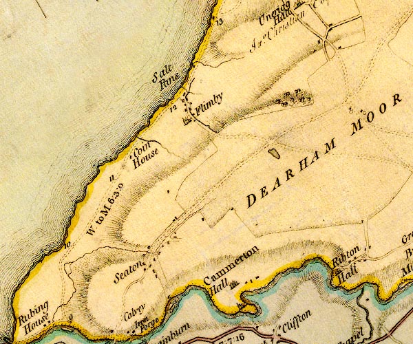
D4NY03SW.jpg Broughton Moor -- moor -- NY046327 (etc etc) -- 'DEARHAM MOOR' -- area Camerton Hall -- building/s -- NY03303062 -- 'Cammerton Hall' -- house Coin House -- building/s -- NY01213265 (guess) -- 'Coin House' -- block or blocks, labelled in lowercase; a hamlet or just a house Derwent, River -- river -- NY2515 (etc) -- 'Derwent River' -- 'Derwent River' -- single or double wiggly line; a river in and from Derwent Water; into the sea Flimby -- locality -- building/s -- NY02263372 (etc) ? -- 'Flimby' -- block or blocks, labelled in lowercase; a hamlet or just a house Little Tarn -- tarn -- NY04103274 (etc) -- lake, on Dearham Moor possibly Ribton Hall -- building/s -- NY04763053 ? -- 'Ribton Hall' -- house Workington to Maryport -- route -- NX92 -- 'W. to M. 6:3:0' -- double line, narrower, solid or dotted with a dot and number at 1 mile intervals; road -- miles.furlongs.poles; Workington to Maryport salt pans, Flimby -- salt pans -- NY02233428 (estimate) -- 'Salt Pans' -- by Flimby Seaton -- locality -- building/s etc -- NY02233068 (etc) -- 'Seaton' -- block or blocks, labelled in lowercase; a hamlet or just a house St Peter's Church -- church -- NY03543005 -- church by Cammerton Hall | ||
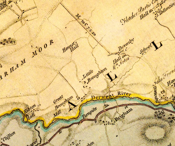
D4NY03SE.jpg Bridekirk Dovenby School -- school -- NY10533342 -- 'School' -- school, E of Dovenby Bridgefoot Turnpike -- toll gate (site) -- NY07613030 -- 'Turnpike' -- W of Brigham; toll house and toll gate Brigham -- locality -- building/s -- NY08723032 (etc) -- 'Brigham' -- blocks, and usually a church, labelled in upright lowercase; a village, the church to the N Broughton Mill -- water mill -- mill -- corn mill -- NY06633032 (estimate) -- 'Mill' -- circle with rays, mill wheel; a water mill Broughton Moor -- moor -- NY046327 (etc etc) -- 'DEARHAM MOOR' -- area Derwent, River -- river -- NY2515 (etc) -- 'Derwent River' -- 'Derwent River' -- single or double wiggly line; a river in and from Derwent Water; into the sea Dovenby Hall -- building/s -- haunted house -- NY09483319 -- 'Hall / Mrs. Irton' -- house by Dovenby Dovenby -- locality -- building/s -- NY09463336 (etc) -- 'Dovenby' -- block or blocks, labelled in lowercase; a hamlet or just a house Great Broughton -- locality -- building/s -- NY07473130 (etc) -- 'Great Broughton' -- block or blocks, labelled in lowercase; a hamlet or just a house Hennah Hall -- building/s -- NY07273382 -- 'Hennet Hall' -- block or blocks, labelled in lowercase; a hamlet or just a house Little Broughton -- locality -- building/s -- NY07813174 (etc) -- 'Little Broughton' -- block or blocks, labelled in lowercase; a hamlet or just a house Marron, River -- river -- NY0624 -- 'Marron River' -- single or double wiggly line; a river into the Derwent by Ribton Cockermouth to Maryport -- route -- NY13 -- 'M. to C. 7:3:20' -- miles.furlongs.poles; Maryport to Cockermouth Cockermouth to Whitehaven -- route -- road -- NY13 -- 'W. to C. 13:6:12' -- double line, solid or dotted, with a dot or milestone and number at 1 mile intervals, tinted red; turnpike road -- miles.furlongs.poles; Whitehaven to Cockermouth Cockermouth to Workington -- road -- route -- NY13 -- 'W. to C. 7:7:16' -- double line, solid or dotted, with a dot or milestone and number at 1 mile intervals, tinted red; turnpike road | ||
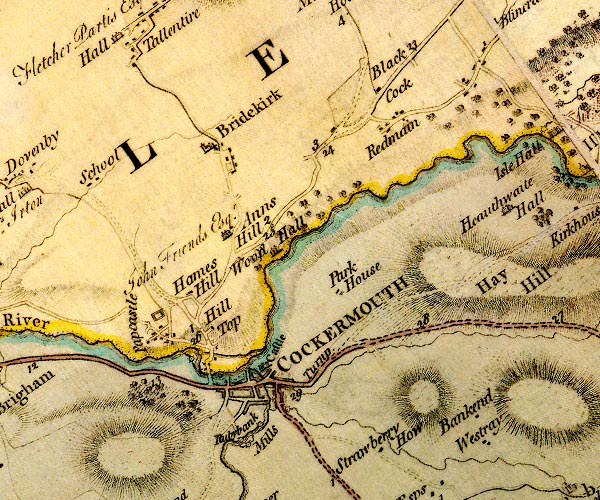
D4NY13SW.jpg Anns Hill -- building/s -- NY11903259 -- 'Anns Hill' -- house Bankend -- building/s -- NY15073038 (guess) -- 'Bankend' -- block or blocks, labelled in lowercase; a hamlet or just a house Black Cock -- inn -- NY13713437 -- 'Black Cock' -- building at road junction Bridekirk -- locality -- building/s -- NY11823358 (etc) -- 'Bridekirk' -- blocks, and usually a church, labelled in upright lowercase; a village Cocker Bridge -- bridge -- NY12233072 -- double line across a river; a bridge over the Cocker Cocker, River -- river -- NY1426 ? -- 'Cocker River' -- single or double wiggly line; a river into the Derwent Cockermouth Castle -- castle -- NY12243086 -- 'Castle' -- large building; a castle Cockermouth -- locality -- building/s etc -- NY12093071 (etc) -- 'COCKERMOUTH' -- blocks, perhaps a church, labelled in block caps; a town, with a street plan Derwent Bridge -- bridge -- NY11643071 ? -- double line across a river; a bridge over the Derwent Derwent, River -- river -- NY2515 (etc) -- 'Derwent River' -- 'Derwent River' -- single or double wiggly line; a river in and from Derwent Water; into the sea Double Mills -- water mill -- mill -- corn mill -- NY11882986 -- single or double wiggly line; a river into the Cocker Fitz Mill -- water mill (ex) -- mill (ex) -- flax mill (ex) -- NY11413111 -- circle with rays, mill wheel; a water mill Goat Mills -- building/s -- water mill (ex) -- mill (ex) -- corn mill (ex) -- NY11503113 (estimate) -- circle with rays, mill wheel; a water mill Hames Hall -- building/s -- NY11663134 -- 'Hill Top' -- block or blocks, labelled in lowercase; a hamlet or just a house Hames Hill -- building/s -- NY11403201 (guess) -- 'Hames Hill' -- block or blocks, labelled in lowercase; a hamlet or just a house presumably Hay -- hill -- locality -- NY15063180 (etc) -- 'Hay Hill' -- hill hachuring; a hill or mountain Papcastle -- locality -- building/s -- NY10933135 (etc) -- 'Papcastle' -- block or blocks, labelled in lowercase; a hamlet or just a house Park House -- building/s -- NY13083181 -- 'Park House' -- block or blocks, labelled in lowercase; a hamlet or just a house Redmain -- locality -- building/s -- NY13783386 (etc) -- 'Redmain' -- block or blocks, labelled in lowercase; a hamlet or just a house Borrowdale and Buttermere -- route -- road -- NY22Borrowdale and Buttermere -- route -- road -- NY22 -- double line, narrower, solid or dotted with a dot and number at 1 mile intervals; road -- to junction S of Seatoller Cockermouth to Abbey Town -- road -- route -- NY13 -- double line, narrower, solid or dotted with a dot and number at 1 mile intervals; road Cockermouth to Carlisle -- road -- route -- NY13 -- 'C. to W. 16:0:0' -- double line, narrower, solid or dotted with a dot and number at 1 mile intervals; road -- distances from Carlisle -- miles.furlongs.poles; Cockermouth to Wigton Cockermouth to Whitehaven -- route -- road -- NY13 -- 'W. to C. 13:6:12' -- double line, solid or dotted, with a dot or milestone and number at 1 mile intervals, tinted red; turnpike road -- miles.furlongs.poles; Whitehaven to Cockermouth Cockermouth to Workington -- road -- route -- NY13 -- 'W. to C. 7:7:16' -- double line, solid or dotted, with a dot or milestone and number at 1 mile intervals, tinted red; turnpike road Keswick to Cockermouth -- road -- route -- NY22 -- 'C. to K. 11.7.24' -- double line, solid or dotted, with a dot or milestone and number at 1 mile intervals, tinted red; turnpike road -- 'C. to K. 15:0:13' -- double line, solid or dotted, with a dot or milestone and number at 1 mile intervals, tinted red; turnpike road -- miles.furlongs.poles; Cockermouth to Keswick Derventio -- roman fort -- NY10953145 (guess) -- square within a square; roman fort at Papcastle Rubbybanks Mill -- hat factory -- fulling mill -- NY12153012 -- 'Rubybank Mills' -- circle with rays, mill wheel; a water mill, 3, on the Cocker St Helen's Toll Gate -- toll gate (site) -- toll house -- NY13623123 -- 'Turnp.' -- E of Cockermouth on Keswick Road; toll house and toll gate probably Strawberry How -- building/s -- NY13822986 -- 'Strawberry How' -- block or blocks, labelled in lowercase; a hamlet or just a house Westray -- building/s -- NY15163003 -- 'Westray' -- block or blocks, labelled in lowercase; a hamlet or just a house Wood Hall -- building/s -- garden -- NY12533252 -- 'Wood Hall' -- house Wood Mill -- water mill -- mill -- bobbin mill -- NY11932987 -- circle with rays, mill wheel; a water mill | ||
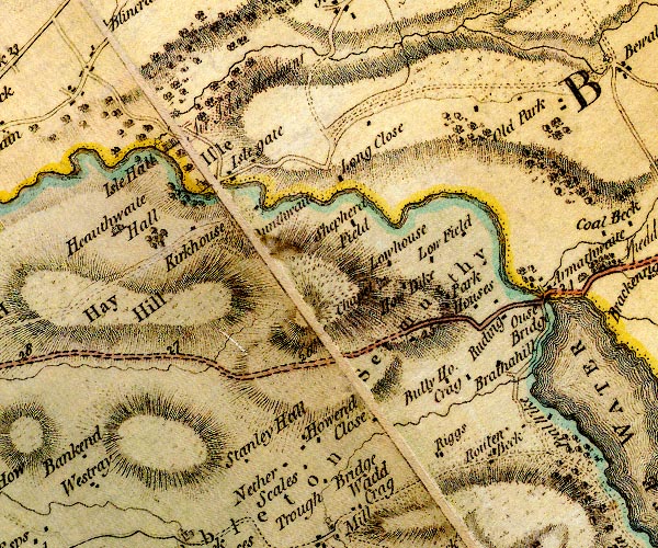
D4NY13SE.jpg Barkhouse -- building/s -- NY19583199 -- 'Park Houses' -- block or blocks, labelled in lowercase; a hamlet or just a house probably Brathay Hill -- building/s -- NY19263117 -- 'Brathahill' -- block or blocks, labelled in lowercase; a hamlet or just a house bridge, Ouse Bridge -- bridge -- NY20073220 -- double line across a river; a bridge N of Ouse Bridge possibly Bully House -- building/s -- NY18573104 -- 'Bully Ho.' -- block or blocks, labelled in lowercase; a hamlet or just a house Close Farm -- building/s -- NY18263078 -- 'Close' -- block or blocks, labelled in lowercase; a hamlet or just a house Coal Beck -- river -- boundary -- parish boundary -- NY2032 (etc) -- single or double wiggly line; a river into Derwent Water Crag -- building/s -- locality -- NY19033133 -- 'Crag' -- block or blocks, labelled in lowercase; a hamlet or just a house Derwent, River -- river -- NY2515 (etc) -- 'Derwent River' -- 'Derwent River' -- single or double wiggly line; a river in and from Derwent Water; into the sea Dubwath Beck -- river -- NY20043117 -- single or double wiggly line; a river into Bassenthwaite Lake Dunthwaite -- building/s -- NY17393282 -- '[D]unthwaite' -- block or blocks, labelled in lowercase; a hamlet or just a house Hay -- hill -- locality -- NY15063180 (etc) -- 'Hay Hill' -- hill hachuring; a hill or mountain Hewthwaite Hall -- building/s -- NY15233283 -- 'Heauthwaite Hall' -- house High Netherscale -- building/s -- NY17363015 -- 'Nether Scales' -- block or blocks, labelled in lowercase; a hamlet or just a house How Dyke -- building/s -- NY18503215 -- 'How Dike' -- block or blocks, labelled in lowercase; a hamlet or just a house How End -- building/s -- NY17393050 -- 'Howend' -- block or blocks, labelled in lowercase; a hamlet or just a house Isel Hall -- building/s -- NY15843367 -- 'Isle Hall / Sir John Merdaunt' -- house Isel Old Park -- park -- building/s -- NY19403435 -- 'Old Park' -- block or blocks, labelled in lowercase; a hamlet or just a house Isel -- locality -- building/s -- NY16403334 (etc) -- 'Isle' -- blocks, and usually a church, labelled in upright lowercase; a village, lacking buildings Iselgate, -- building/s -- NY16733348 -- 'Islegate' -- block or blocks, labelled in lowercase; a hamlet or just a house Kirkhouse -- building/s -- NY16643297 -- 'Kirkhouse' -- block or blocks, labelled in lowercase; a hamlet or just a house Long Close Farm -- building/s -- NY17923336 -- 'Long Close' -- block or blocks, labelled in lowercase; a hamlet or just a house Low House -- building/s -- NY18513236 -- 'Lowhouse' -- block or blocks, labelled in lowercase; a hamlet or just a house Low Netherscale -- building/s -- NY17473023 -- 'Nether Scales' -- block or blocks, labelled in lowercase; a hamlet or just a house Lowfield -- building/s -- NY18803256 -- 'Low Field' -- block or blocks, labelled in lowercase; a hamlet or just a house Ouse Bridge -- bridge -- NY19973210 ? -- 'Ouse Bridge' -- double line across a river; a bridge over the Derwent, and buildings Peel Wyke -- building/s -- locality -- NY20323082 -- 'Pull Wike' -- block or blocks, labelled in lowercase; a hamlet or just a house Riggs -- building/s -- NY19023033 -- 'Riggs' -- block or blocks, labelled in lowercase; a hamlet or just a house Keswick to Cockermouth -- road -- route -- NY22 -- 'C. to K. 15:0:13' -- double line, solid or dotted, with a dot or milestone and number at 1 mile intervals, tinted red; turnpike road -- miles.furlongs.poles; Cockermouth to Keswick Routenbeck -- building/s -- NY19523038 (etc) -- 'Routen Beck' -- block or blocks, labelled in lowercase; a hamlet or just a house Ruddings, The -- locality -- building/s -- NY19673189 -- 'Ruding' -- block or blocks, labelled in lowercase; a hamlet or just a house Setmurthy -- locality -- NY1832 -- 'Setmurthy' -- area Shepherds Field -- building/s -- NY17943274 -- 'Shepherd Field' -- block or blocks, labelled in lowercase; a hamlet or just a house St Barnabas's Church -- church -- NY18463221 -- 'Chapel' -- church Stanley Hall -- building/s -- NY16763037 -- 'Stanley Hall' -- block or blocks, labelled in lowercase; a hamlet or just a house Trough Bridge -- building/s -- NY17713007 -- 'Trough Bridge' -- block or blocks, labelled in lowercase; a hamlet or just a house | ||
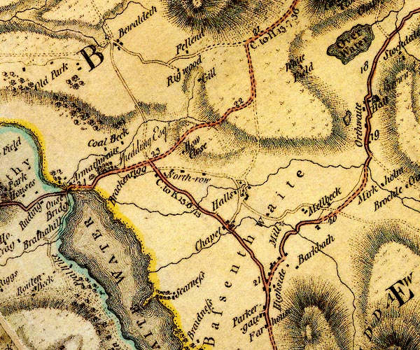
D4NY23SW.jpg Armathwaite Hall -- building/s -- hotel -- NY20703249 -- 'Armathwaite / Spedding Esqr.' -- house Barkbeth -- building/s -- NY24143125 -- 'Barkbath' -- block or blocks, labelled in lowercase; a hamlet or just a house Bassenthwaite Lake -- lake -- NY215298 -- 'BASSENTHWAITE WATER' -- lake Bassenthwaite -- parish -- NY2331 -- 'Bassenthwaite' -- area Bewaldeth -- locality -- building/s -- NY21053480 -- 'Bewaldeth' -- block or blocks, labelled in lowercase; a hamlet or just a house Brackenrigg Cottages -- building/s -- NY21163244 -- 'Brackenrigg' -- block or blocks, labelled in lowercase; a hamlet or just a house Chapel Beck -- river -- NY2331 (etc) -- single or double wiggly line; a river Chapel -- locality -- building/s -- NY22763163 (etc) -- 'Chapel' -- block or blocks, and a church, labelled in lowercase; a hamlet Coalbeck -- building/s -- NY20633285 -- 'Coal Beck' -- block or blocks, labelled in lowercase; a hamlet or just a house Fellend -- building/s -- NY22193471 -- 'Fellend' -- block or blocks, labelled in lowercase; a hamlet or just a house Halls Beck -- river -- NY2432 (etc) -- single or double wiggly line; a river Halls -- building/s -- NY22883224 (guess) -- 'Halls' -- block or blocks, labelled in lowercase; a hamlet or just a house High Bewaldeth Cottage -- building/s -- NY22373418 -- 'Gill' -- block or blocks, labelled in lowercase; a hamlet or just a house High Mill -- water mill -- mill -- corn mill -- NY23843197 (estimate) -- 'Mill' -- circle with rays, mill wheel; a water mill High Side -- building/s -- locality -- NY23483060 -- 'Highside' -- block or blocks, labelled in lowercase; a hamlet or just a house How Close -- building/s -- NY22083289 (guess) -- 'How Close' -- block or blocks, labelled in lowercase; a hamlet or just a house Little Tarn -- lake -- NY24893380 (etc) -- lake, at Orthwaite Melbecks -- locality -- building/s -- NY24193191 (etc) -- 'Mellbeck' -- block or blocks, labelled in lowercase; a hamlet or just a house mill, Bewaldeth -- water mill -- mill -- NY21053485 (guess) -- circle with rays, mill wheel; a water mill at Bewaldeth North Row -- locality -- building/s -- NY22343247 (etc) -- 'North-row' -- block or blocks, labelled in lowercase; a hamlet or just a house Overwater Hall -- inn -- NY24343461 -- 'White Field' -- block or blocks, labelled in lowercase; a hamlet or just a house Parkergate -- building/s -- NY23443033 -- 'Parkergate' -- block or blocks, labelled in lowercase; a hamlet or just a house Riggwood -- building/s -- NY22003437 -- 'Rig wood' -- block or blocks, labelled in lowercase; a hamlet or just a house Keswick to Carlisle -- route etc -- double line, solid or dotted, with a dot or milestone and number at 1 mile intervals, tinted red; turnpike road Keswick to Cockermouth -- road -- route -- NY22 -- 'C. to K. 15:0:13' -- double line, solid or dotted, with a dot or milestone and number at 1 mile intervals, tinted red; turnpike road -- miles.furlongs.poles; Cockermouth to Keswick Scar Ness -- headland -- locality -- NY213304 -- headland into Bassenthwaite Lake Scarness -- locality -- building/s -- NY21993056 (etc) -- 'Scarness' -- block or blocks, labelled in lowercase; a hamlet or just a house | ||
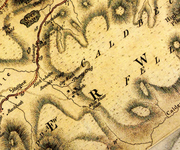
D4NY23SE.jpg Bell House -- building/s -- NY26713262 -- 'Thorny Crag' -- block or blocks, labelled in lowercase; a hamlet or just a house probably Brocklecrag -- building/s -- NY25963267 -- 'Brockle Craig' -- block or blocks, labelled in lowercase; a hamlet or just a house Caldbeck Fells -- hill -- fell -- NY317350 (etc etc) -- 'Caldbeck Fells' -- 'CALDBECK FELLS' -- hill hachuring; a hill or mountain Cow Wath -- building/s -- NY26363244 -- 'Cow Wath' -- block or blocks, labelled in lowercase; a hamlet or just a house Dash Farm -- building/s -- NY26833215 -- 'Dash' -- house Mirkholme -- building/s -- NY25423273 -- 'Mirkholm' -- block or blocks, labelled in lowercase; a hamlet or just a house Orthwaite Hall -- building/s -- NY25263418 -- 'Hall / Brown Esqr.' -- house at Orthwaite Orthwaite -- locality -- building/s -- NY25253413 (etc) -- 'Orthwaite' -- block or blocks, labelled in lowercase; a hamlet or just a house Over Water -- lake -- NY251350 -- 'Over Water' -- lake Keswick to Carlisle -- route etc -- double line, solid or dotted, with a dot or milestone and number at 1 mile intervals, tinted red; turnpike road Stockdale -- building/s -- NY25893493 -- 'Stockdale' -- block or blocks, labelled in lowercase; a hamlet or just a house Whitewater Dash -- waterfall -- NY27213134 (etc) -- 'White Water Dash' -- with a ravine below | ||
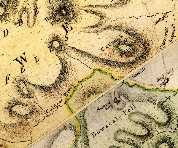
D4NY33SW.jpg Bowscale Fell -- hill -- fell -- NY333305 (etc) -- 'Bowscale Fell' -- hill hachuring; a hill or mountain Bowscale Tarn -- lake -- NY33663134 (etc) -- 'Bowscale Tarn' -- lake Caldbeck Fells -- hill -- fell -- NY317350 (etc etc) -- 'Caldbeck Fells' -- 'CALDBECK FELLS' -- hill hachuring; a hill or mountain Caldew, River -- river -- boundary -- parish boundary -- NY3851 (etc) ? -- 'Caldew River' -- 'Caldew River' -- single or double wiggly line; a river into the Eden Carrock Fell -- hill -- fell -- NY34153365 (etc) -- 'Carrock Fell' -- hill hachuring; a hill or mountain Swineside -- building/s -- NY34253239 -- 'Swinside' -- block or blocks, labelled in lowercase; a hamlet or just a house | ||
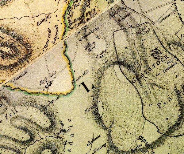
D4NY33SE.jpg Bowscale -- locality -- building/s -- NY35873165 (etc) -- 'Bowscale' -- block or blocks, labelled in lowercase; a hamlet or just a house Caldew, River -- river -- boundary -- parish boundary -- NY3851 (etc) ? -- 'Caldew River' -- 'Caldew River' -- single or double wiggly line; a river into the Eden Greystoke Castle -- castle -- park -- haunted house -- pele tower (?) -- NY43543089 -- 'Castle / Honble. Charles Howard Esqr.' -- 'GRAYSTOCK PARK' -- large building; a castle at Greystoke -- double outline with suggested fence palings; a park Haltcliff View -- building/s -- NY35133585 -- 'Haltcliff' -- block or blocks, labelled in lowercase; a hamlet or just a house Heggle Lane -- locality -- building/s -- street -- NY36473527 (etc) -- 'Heggil Lane' -- block or blocks, labelled in lowercase; a hamlet or just a house Hegglehead -- building/s -- NY37213477 -- 'Heggil Head' -- block or blocks, labelled in lowercase; a hamlet or just a house Hutton Roof -- locality -- building/s -- NY37293411 (etc) -- 'Hutton Roof' -- block or blocks, labelled in lowercase; a hamlet or just a house Linewath -- building/s -- NY35603431 -- 'Linewath' -- block or blocks, labelled in lowercase; a hamlet or just a house Low Mill Bridge -- bridge -- NY36573249 -- double line across a river; a bridge at Low Mill Low Mill -- building/s -- water mill (ex) -- mill (ex) -- corn mill (ex) -- NY36613262 -- 'Low Mill' -- circle with rays, mill wheel; a water mill Mabil Cross -- cross (site) -- NY39883469 (estimate) -- 'Mable Cross' -- block or blocks, labelled in lowercase; a hamlet or just a house mill, Mungrisdale -- water mill -- mill -- NY36313028 -- circle with rays, mill wheel; a water mill at Mungrisdale Mosedale Bridge -- bridge -- NY35703199 -- double line across a river; a bridge Mossdale/Bowscale Mosedale -- locality -- building/s -- NY35713227 (etc) ? -- 'Mossdale' -- block or blocks, labelled in lowercase; a hamlet or just a house Mungrisdale -- locality -- building/s -- NY36333047 (etc) -- buildings Murrah -- locality -- building/s -- NY37643160 (etc) -- 'Murrah' -- block or blocks, labelled in lowercase; a hamlet or just a house Norman Crag -- building/s -- NY36493436 -- 'Orman Crag' -- block or blocks, labelled in lowercase; a hamlet or just a house Scales -- building/s -- NY37953339 -- 'Scales' -- block or blocks, labelled in lowercase; a hamlet or just a house St Kentigern's Church -- church -- NY36363044 -- 'Chap:' -- church at Mungrisdale Stone Ends -- building/s -- NY35523363 -- 'Stone ends' -- block or blocks, labelled in lowercase; a hamlet or just a house Thwaite Hall -- building/s -- NY37483499 -- 'White Hall' -- house probably | ||
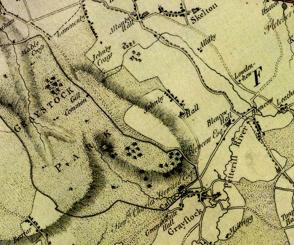
D4NY43SW.jpg Auldby -- building/s -- NY44403428 -- 'Alldby' -- block or blocks, labelled in lowercase; a hamlet or just a house Blencow Hall -- building/s -- NY45023259 -- 'Blencow Hall / Blencow Esqr.' -- house bridge, Greystoke (2) -- bridge -- ford (?) -- NY44703053 -- double line across a river; a bridge over the Petteril bridge, Greystoke -- bridge -- NY44423067 -- double line across a river; a bridge over the North Petteril Gillcambon -- locality -- NY41083247 (etc) -- 'Gill Common' -- block or blocks, labelled in lowercase; a hamlet or just a house Greenthwaite Hall -- building/s -- NY43153021 -- 'Greenthwaite Hall' -- block or blocks, labelled in lowercase; a hamlet or just a house Greystoke Castle -- castle -- park -- haunted house -- pele tower (?) -- NY43543089 -- 'Castle / Honble. Charles Howard Esqr.' -- 'GRAYSTOCK PARK' -- large building; a castle at Greystoke -- double outline with suggested fence palings; a park Greystoke Mill -- water mill (ex) -- mill (ex) -- NY44933223 -- circle with rays, mill wheel; a water mill near Blencow Greystoke -- locality -- building/s -- NY44023085 (etc) -- 'Graystock' -- blocks, and usually a church, labelled in upright lowercase; a village Johnby Crags -- rocks -- NY44013222 (etc) -- 'Johnby Crags' -- hillside marked by hachures Johnby Hall -- building/s -- NY43413275 -- 'Hall' -- house at Johnby Johnby -- locality -- building/s -- NY43213312 (etc) -- 'Johnby' -- block or blocks, labelled in lowercase; a hamlet or just a house Loaden How -- loclaity -- NY45443348 (etc) -- 'Lowdenhow' -- block or blocks, labelled in lowercase; a hamlet or just a house North Petteril -- river -- NY4430 (etc) -- single or double wiggly line; a river into the Petteril at Greystoke Petteril, River -- river -- boundary -- parish boundary -- NY4935 (etc etc) -- 'Pettrill River' -- 'Petterill River' -- single or double wiggly line; a river into the Eden Storch Bridge -- bridge -- NY44543115 -- double line across a river; a bridge over the Petteril | ||
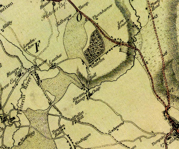
D4NY43SE.jpg Blencow -- locality -- NY4532 (etc) -- 'Blencow' -- block or blocks, labelled in lowercase; a hamlet or just a house Catterlen Bridge -- railway bridge -- bridge -- NY49683357 -- double line across a river; a bridge over the Petteril Catterlen Hall -- building/s -- pele tower -- NY47813205 -- 'Hall' -- house near Catterlen Catterlen -- locality -- building/s -- NY48283326 (etc) -- 'Catterlen' -- block or blocks, labelled in lowercase; a hamlet or just a house Kelbarrow -- building/s -- NY46763473 -- 'Kelbarrow' -- block or blocks, labelled in lowercase; a hamlet or just a house Laithes Mill -- water mill -- mill -- corn mill -- NY46283291 -- circle with rays, mill wheel; a water mill Laithes -- locality -- building/s -- NY46473298 (etc) -- 'Leathes' -- block or blocks, labelled in lowercase; a hamlet or just a house Lamb Beck -- river -- boundary -- parish boundary -- NY4334 (etc) -- single or double wiggly line; a river into the Petteril at Blencow Lowhouse -- building/s -- NY493348 -- 'Low House' -- block or blocks, labelled in lowercase; a hamlet or just a house mill, Newton Reigny -- water mill -- mill -- NY47743198 (guess) -- circle with rays, mill wheel; a water mill at Newton Reigny Newton Reigny -- locality -- building/s -- NY47923161 (etc) -- 'Newton Raney' -- block or blocks, labelled in lowercase; a hamlet or just a house Pallet Hill -- building/s -- locality -- NY47403057 -- 'Pallot Hill' -- block or blocks, labelled in lowercase; a hamlet or just a house Petteril, River -- river -- boundary -- parish boundary -- NY4935 (etc etc) -- 'Pettrill River' -- 'Petterill River' -- single or double wiggly line; a river into the Eden Penrith to Hesket Newmarket -- route etc -- 'H. to P. 13:2:12' -- double line, solid or dotted, with a dot or milestone and number at 1 mile intervals, tinted red; turnpike road -- miles.furlongs.poles; Hesket to Penrith Penrith to Wigton -- route -- NY44 -- 'W. to P. 21:0:32' -- double line, solid or dotted, with a dot or milestone and number at 1 mile intervals, tinted red; turnpike road -- distances from Penrith -- miles.furlongs.poles; Wigton to Penrith Sewborwens -- building/s -- NY49173026 -- 'Sewborwens' -- block or blocks, labelled in lowercase; a hamlet or just a house Spire House -- building/s -- folly -- NY46263128 -- ?building, monument or boundary marker, cross on top probably St John's Church -- church -- NY47983160 -- 'Chap:' -- church at Newton Reigny Thornbarrow -- building/s -- NY47943477 -- 'Thornbarrow' -- block or blocks, labelled in lowercase; a hamlet or just a house Tymparon Hall -- building/s -- NY46713008 -- 'Timpron Hall' -- block or blocks, labelled in lowercase; a hamlet or just a house | ||
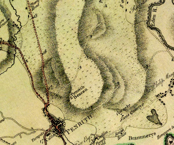
D4NY53SW.jpg Cowraik Quarry -- stone quarry -- quarry -- NY54203096 (etc) -- 'Cowrake Stone Quarrys' -- block, building/s milestone, Penrith (2) -- milestone -- NY50273319 -- '16' -- milestone; from Carlisle to Penrith milestone, Penrith (3) -- milestone -- NY50313478 -- '15' -- milestone; from Carlisle to Penrith milestone, Penrith (4) -- milestone -- NY50603167 -- '17' -- milestone; from Carlisle to Penrith Penrith Beacon -- hill -- beacon -- viewpoint -- station -- NY52123138 -- 'Penrith Beacon' -- tower Penrith -- locality -- building/s etc -- NY51573014 (etc) -- 'PENRITH' -- blocks, perhaps a church, labelled in block caps; a town with street plan Penrith to Brampton -- route etc -- 'P. to K. 8:3:12' -- double line, narrower, solid or dotted with a dot and number at 1 mile intervals; road -- miles.furlongs.poles; Penrith to Kirkoswald Penrith to Carlisle -- route -- road -- NY53 -- 'P. to C. 18:0:0' -- double line, solid or dotted, with a dot or milestone and number at 1 mile intervals, tinted red; turnpike road -- from English Gate -- miles.furlongs.poles; Penrith to Carlisle Penrith to Hesket Newmarket -- route etc -- 'H. to P. 13:2:12' -- double line, solid or dotted, with a dot or milestone and number at 1 mile intervals, tinted red; turnpike road -- miles.furlongs.poles; Hesket to Penrith Penrith to Wigton -- route -- NY44 -- 'W. to P. 21:0:32' -- double line, solid or dotted, with a dot or milestone and number at 1 mile intervals, tinted red; turnpike road -- distances from Penrith -- miles.furlongs.poles; Wigton to Penrith | ||
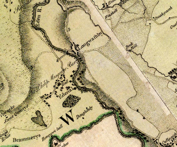
D4NY53SE.jpg Beck Mill -- building/s -- water mill (ex) -- mill (ex) -- NY59033356 -- 'Beck Mill' -- circle with rays, mill wheel; a water mill Dolphenby -- building/s -- NY57633118 -- 'Doughenby' -- block or blocks, labelled in lowercase; a hamlet or just a house Eamont, River -- river -- NY469243 (from) ? ? -- 'Eamont River' -- single or double wiggly line; a river from Ullswater, and county boundary, into the Eden Eden Hall -- building/s -- NY56463226 -- 'Hall / Sir Philip Musgrave Bart.' -- house at Edenhall Eden, River -- river -- boundary -- parish boundary -- NY3658 (etc) -- 'Eden River' -- 'Eden R.' -- estuary -- single or double wiggly line; a river and county boundary, into the sea Edenhall -- locality -- building/s -- NY56543242 (etc) -- 'Edenal' -- blocks, and usually a church, labelled in upright lowercase; a village Langwathby Bridge -- bridge -- NY56603353 -- double line across a river; a bridge over the Eden Langwathby -- locality -- building/s -- NY56893362 (etc) -- 'Longwathby' -- blocks, and usually a church, labelled in upright lowercase; a village mill, Edenhall -- water mill -- mill -- NY57273202 (guess) -- circle with rays, mill wheel; a water mill at Edenhall Penrith to Alston -- route -- NY52 -- double line, narrower, solid or dotted with a dot and number at 1 mile intervals; road -- miles, furlongs; Penrith to Alston Whins Pond -- pond -- NY55543079 (etc) -- lake, near Edenhall | ||
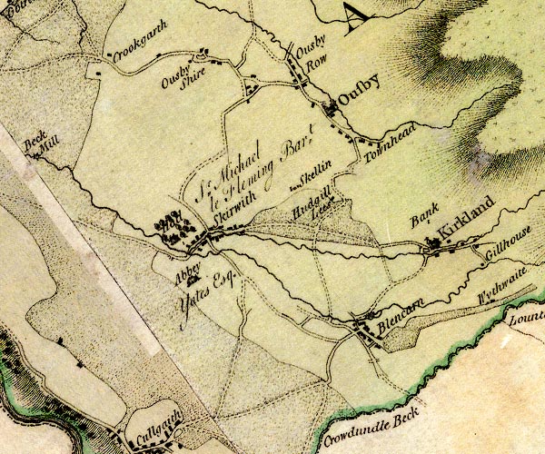
D4NY63SW.jpg Bank Hall -- building/s -- NY64633301 -- 'Bank' -- block or blocks, labelled in lowercase; a hamlet or just a house Blencarn -- locality -- building/s -- NY63743130 (etc) -- 'Blencarn' -- block or blocks, labelled in lowercase; a hamlet or just a house Burrellhill -- building/s -- NY63263319 -- 'Hudgill Lees' -- block or blocks, labelled in lowercase; a hamlet or just a house possibly Crewgarth -- building/s -- NY60143483 -- 'Crookgarth' -- block or blocks, labelled in lowercase; a hamlet or just a house Kirkland Beck -- river -- NY6633 (etc) -- single or double wiggly line; a river into the Skirwith Beck Kirkland -- locality -- building/s -- NY64663250 (etc) -- 'Kirkland' -- blocks, and usually a church, labelled in upright lowercase; a village mill, Blencarn -- water mill -- mill -- corn mill -- NY63823150 (estimate) -- circle with rays, mill wheel; a water mill at Blencarn mill, Ousby -- water mill -- mill -- corn mill -- NY63053452 -- circle with rays, mill wheel; a water mill at Ousby Ousby -- locality -- building/s -- NY62343472 (etc) -- 'Ousby' -- blocks, and usually a church, labelled in upright lowercase; a village Row -- locality -- building/s -- NY62653480 (etc) -- 'Ousby Row' -- block or blocks, labelled in lowercase; a hamlet or just a house Shire -- locality -- building/s -- NY61473517 (etc) -- 'Ousby Shire' -- block or blocks, labelled in lowercase; a hamlet or just a house Skelling -- building/s -- NY62743332 -- 'Skellin' -- block or blocks, labelled in lowercase; a hamlet or just a house Skirwith Abbey -- building/s -- abbey (ex) -- religious house (ex) -- NY61483206 -- 'Abbey / Yates Esq.' -- house at Skirwith Skirwith Beck -- river -- NY6132 (etc) -- single or double wiggly line; a river into Blencarn Beck at Skirwith Skirwith Hall -- building/s -- NY61053259 -- 'Hall / Sr. Michael le Fleming Bart.' -- house at Skirwith Skirwith -- locality -- building/s -- NY61583263 (etc) -- 'Skirwith' -- block or blocks, labelled in lowercase; a hamlet or just a house Sootyhill -- building/s -- NY60153513 -- 'Crookgarth' -- block or blocks, labelled in lowercase; a hamlet or just a house Townhead -- locality -- building/s -- NY63463404 (etc) -- 'Townhead' -- block or blocks, labelled in lowercase; a hamlet or just a house | ||
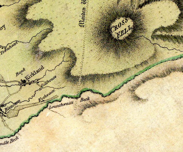
D4NY63SE.jpg Cross Fell -- hill -- NY68733432 (etc) -- 'CROSS FELL' -- hill hachuring; a hill or mountain Crowdundle Beck -- river -- boundary -- parish boundary -- county boundary (once) -- NY6228 (etc) -- 'Lounthwaite Beck' -- 'Crowdundle Beck' -- single or double wiggly line; a river and county boundary Ranbeck -- building/s -- NY65403227 -- 'Gillhouse' -- block or blocks, labelled in lowercase; a hamlet or just a house probably Wythwaite -- building/s -- NY65443171 -- 'Wythwaite' -- block or blocks, labelled in lowercase; a hamlet or just a house | ||
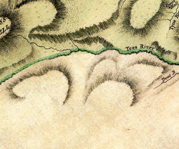
D4NY73SW.jpg Tees, River -- river -- boundary -- county boundary -- NY7831 (etc etc) -- 'Tees River' -- single or double wiggly line; a river and county boundary | ||
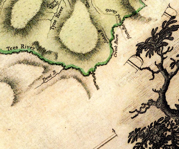
D4NY73SE.jpg Crook Burn -- river -- boundary -- county boundary -- NY7835 (etc etc) -- 'Crook Burn' -- single or double wiggly line; a river and county boundary John's Burn -- river -- NY7735 (etc) -- 'John's B.' -- single or double wiggly line; a river Alston to Barnard Castle -- route etc -- NY74 ? -- 'From Bernard Castle' -- road at county boundary South Tyne, River -- river etc -- NY7441 (etc) ? -- 'Tyne River' -- 'Tyne River' -- 'Tyne River' -- 'Tyne River' -- 'Tyne River' -- single or double wiggly line; a river Tees, River -- river -- boundary -- county boundary -- NY7831 (etc etc) -- 'Tees River' -- single or double wiggly line; a river and county boundary Trout Beck -- river -- boundary -- parish boundary -- NY7432 (etc) -- 'Trout B.' -- single or double wiggly line; a river | ||
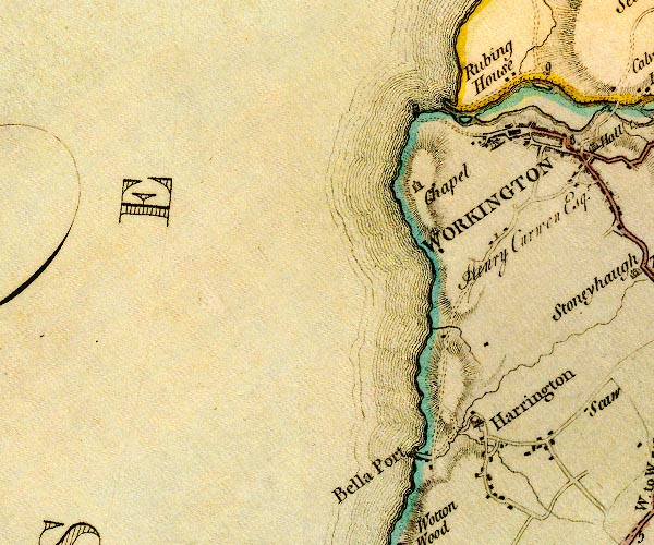
D4NX92NE.jpg Derwent, River -- river -- NY2515 (etc) -- 'Derwent River' -- 'Derwent River' -- single or double wiggly line; a river in and from Derwent Water; into the sea Eller Beck -- river -- NX9926 (etc) -- single or double wiggly line; a river at Harrington and into the sea Harrington Harbour -- harbour -- NX98762527 (etc) -- 'Bella Port' -- harbour mole; labelled in upright lowercase Harrington -- locality -- building/s -- NX98052529 (etc) -- 'Harrington' -- blocks, and usually a church, labelled in upright lowercase; a village Port of Workington -- harbour -- NX991293 (etc) -- harbour moles? Rubing House -- building/s -- NX995295 (?) -- 'Rubing House' -- block or blocks, labelled in lowercase; a hamlet or just a house St Michael's Chapel -- chapel -- NX98532831 (guess) ? -- 'Chapel' -- church Workington -- locality -- building/s etc -- NY00572855 (etc) -- 'WORKINGTON' -- blocks, perhaps a church, labelled in block caps; a town with street plan Wyre, River -- river -- NX9925 (etc) -- single or double wiggly line; a river at Harrington and into the sea | ||
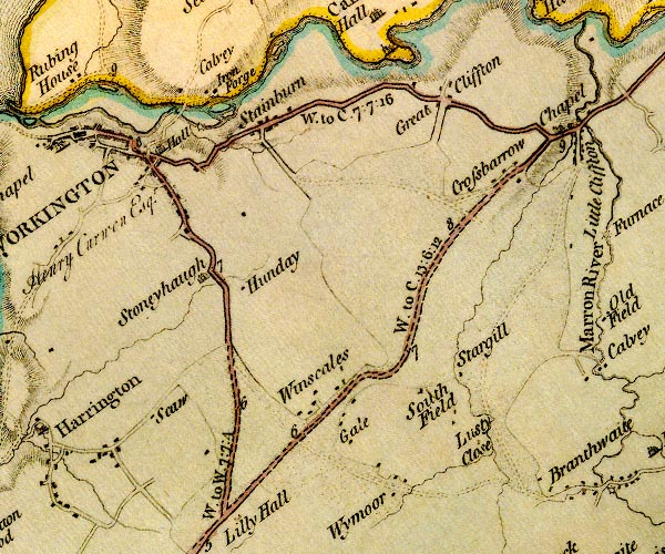
D4NY02NW.jpg Beerpot Ironworks -- ironworks -- NY013294 (?) -- 'Iron Forge' -- blocks, building/s; and circle with rays, mill wheel; a water mill Calva -- locality -- building/s -- NY00292929 (etc) -- 'Calvey' -- no symbol probably Crossbarrow -- locality -- building/s -- NY04862862 (etc) -- 'Crossbarrow' -- block or blocks, labelled in lowercase; a hamlet or just a house Derwent, River -- river -- NY2515 (etc) -- 'Derwent River' -- 'Derwent River' -- single or double wiggly line; a river in and from Derwent Water; into the sea Gale House -- building/s -- NY02882569 -- 'Gale' -- block or blocks, labelled in lowercase; a hamlet or just a house Great Clifton -- locality -- building/s -- NY04062971 (etc) ? ? -- 'Great Cliffton' -- block or blocks, labelled in lowercase; a hamlet or just a house High Scaw -- building/s -- NY00642587 -- 'Scaw' -- block or blocks, labelled in lowercase; a hamlet or just a house High Southfield -- building/s -- NY03472592 (estimate) -- 'South Field' -- block or blocks, labelled in lowercase; a hamlet or just a house Hunday -- building/s -- NY01882639 -- 'Hunday' -- block or blocks, labelled in lowercase; a hamlet or just a house Low Scaw -- building/s -- NY00532592 -- 'Scaw' -- block or blocks, labelled in lowercase; a hamlet or just a house Low Southfield -- building/s -- NY03812582 (guess) -- 'South Field' -- block or blocks, labelled in lowercase; a hamlet or just a house Lucy Close -- building/s -- NY04412542 -- 'Lusty Close' -- block or blocks, labelled in lowercase; a hamlet or just a house Middle Southfield -- building/s -- NY03532602 (estimate) -- 'South Field' -- block or blocks, labelled in lowercase; a hamlet or just a house Cockermouth to Whitehaven -- route -- road -- NY13 -- 'W. to C. 13:6:12' -- double line, solid or dotted, with a dot or milestone and number at 1 mile intervals, tinted red; turnpike road -- miles.furlongs.poles; Whitehaven to Cockermouth Cockermouth to Workington -- road -- route -- NY13 -- 'W. to C. 7:7:16' -- double line, solid or dotted, with a dot or milestone and number at 1 mile intervals, tinted red; turnpike road Whitehaven to Workington -- route -- NX91 -- 'W. to W. 7:7:4' -- double line, solid or dotted, with a dot or milestone and number at 1 mile intervals, tinted red; turnpike road -- miles.furlongs.poles; Whitehaven to Workington Workington to Maryport -- route -- NX92 -- 'W. to M. 6:3:0' -- double line, narrower, solid or dotted with a dot and number at 1 mile intervals; road -- miles.furlongs.poles; Workington to Maryport Stainburn -- locality -- building/s -- NY01982913 ? -- 'Stainburn' -- block or blocks, labelled in lowercase; a hamlet or just a house Stargill -- building/s -- NY04342628 -- 'Stargill' -- block or blocks, labelled in lowercase; a hamlet or just a house Stonyhough -- building/s -- NY00832726 -- 'Stoneyhaugh' -- house Winscales -- locality -- building/s -- NY02752624 (etc) -- 'Winscales' -- block or blocks, labelled in lowercase; a hamlet or just a house Workington Bridge -- bridge -- NY00782908 -- double line across a river; a bridge Workington Hall Mill -- water mill -- mill -- NY01192907 -- circle with rays, mill wheel; a water mill Workington Hall -- building/s -- castle -- NY00762879 -- 'Hall / Henry Curwen Esqr.' -- house Wythemoor House -- building/s -- NY03592497 -- 'Wymoor' -- block or blocks, labelled in lowercase; a hamlet or just a house Wythemoor Sough -- building/s -- NY03532488 -- 'Wymoor' -- block or blocks, labelled in lowercase; a hamlet or just a house | ||
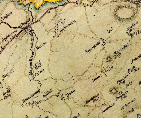
D4NY02NE.jpg Branthwaite Hall -- building/s -- NY06522534 -- 'Hall' -- house near Branthwaite Branthwaite -- locality -- building/s -- NY05902490 (etc) -- 'Branthwaite' -- block or blocks, labelled in lowercase; a hamlet or just a house Branthwaite Bridge (?) -- bridge -- NY05952493 -- double line across a river; a bridge over the Marron at Branthwaite Bridgefoot Bridge -- bridge -- NY05652923 -- double line across a river; a bridge over the Marron Calva Hall -- building/s -- NY05912644 -- 'Calvey' -- block or blocks, labelled in lowercase; a hamlet or just a house Crag Hills -- hill -- NY09652723 (etc) -- 'Eaglesfield Crag' -- hill hachuring; a hill or mountain by Eaglesfield Crag Dean -- locality -- building/s -- NY07372521 (etc) -- 'Dean' -- blocks, and usually a church, labelled in upright lowercase; a village Deanscales -- locality -- building/s -- NY09342658 (etc) -- 'Dean Scales' -- block or blocks, labelled in lowercase; a hamlet or just a house Dubs, The -- building/s -- NY09772881 -- 'Dub' -- block or blocks, labelled in lowercase; a hamlet or just a house Eaglesfield Crag -- building/s -- NY09942740 -- 'Eaglesfield Crag' -- block or blocks, labelled in lowercase; a hamlet or just a house Eaglesfield -- locality -- building/s -- NY09482817 (etc) -- 'Eaglesfield' -- block or blocks, labelled in lowercase; a hamlet or just a house Greysouthen -- locality -- building/s -- NY07142907 (etc) -- 'Graysouthen' -- block or blocks, labelled in lowercase; a hamlet or just a house High Mill -- building/s -- water mill (ex) -- mill (ex) -- corn mill (ex) -- NY05982488 -- circle with rays, mill wheel; a water mill at Branthwaite ironworks, Greysouthen -- ironworks (?) -- NY05972792 -- 'Furnace' -- circle with rays, mill wheel; a water mill Leegate -- building/s -- NY09392534 -- 'Pardshaw Gate' -- no symbol possibly Little Clifton -- locality -- building/s -- NY05572872 (etc) ? -- 'Little Cliffton' -- block or blocks, labelled in lowercase; a hamlet or just a house Marron, River -- river -- NY0624 -- 'Marron River' -- single or double wiggly line; a river into the Derwent by Ribton mill, Bridgefoot -- building/s -- water mill (ex) -- mill (ex) -- corn mill (ex) -- NY05612921 -- circle with rays, mill wheel; a water mill at Little Clifton Oldfield -- building/s -- NY05872719 -- 'Old Field' -- block or blocks, labelled in lowercase; a hamlet or just a house packhorse bridge, Calva Hall -- packhorse bridge -- bridge -- NY05892647 -- double line across a river; a bridge over the Marron at Calvey Pardshaw Crag -- rocks -- quaker meeting -- NY10272566 (etc) -- 'Pardshaw Crag' -- hill hachuring; a hill or mountain Pardshaw -- locality -- building/s -- NY09522483 (etc) -- 'Pardshaw' -- block or blocks, labelled in lowercase; a hamlet or just a house Cockermouth to Whitehaven -- route -- road -- NY13 -- 'W. to C. 13:6:12' -- double line, solid or dotted, with a dot or milestone and number at 1 mile intervals, tinted red; turnpike road -- miles.furlongs.poles; Whitehaven to Cockermouth Cockermouth to Workington -- road -- route -- NY13 -- 'W. to C. 7:7:16' -- double line, solid or dotted, with a dot or milestone and number at 1 mile intervals, tinted red; turnpike road St Luke's Church -- church -- NY05392910 -- 'Chapel' -- church at Little Clifton | ||
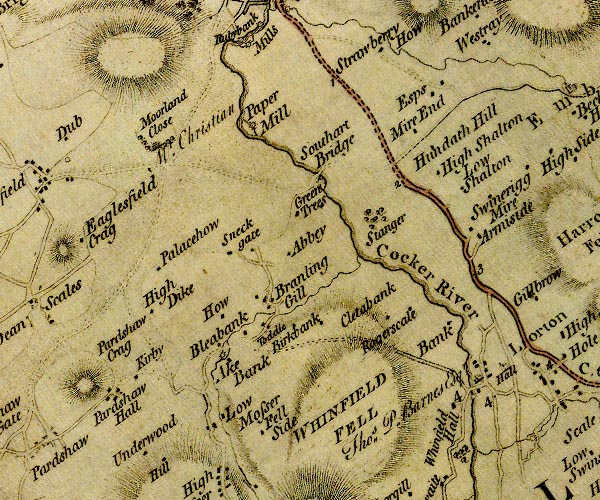
D4NY12NW.jpg Aikbank Mill -- building/s -- NY11682596 -- 'Ake Bank' -- circle with rays, mill wheel; a water mill at Ake Bank Armaside -- building/s -- NY15022759 -- 'Armiside' -- block or blocks, labelled in lowercase; a hamlet or just a house Birk Bank -- building/s -- NY12482628 -- 'Birkbank' -- block or blocks, labelled in lowercase; a hamlet or just a house Blea Bank -- building/s -- NY11652602 -- 'Bleabank' -- block or blocks, labelled in lowercase; a hamlet or just a house Brandlingill -- building/s -- NY12172651 -- 'Branling Gill' -- block or blocks, labelled in lowercase; a hamlet or just a house Cleaty Bank -- building/s (ruin) -- NY12772626 (estimate) -- 'Cleatabank' -- block or blocks, labelled in lowercase; a hamlet or just a house Cocker, River -- river -- NY1426 ? -- 'Cocker River' -- single or double wiggly line; a river into the Derwent Esps -- building/s -- NY14552930 -- 'Esps' -- block or blocks, labelled in lowercase; a hamlet or just a house Fellside -- building/s -- NY12292499 -- 'Fell Side' -- block or blocks, labelled in lowercase; a hamlet or just a house Greentrees -- building/s -- NY12592774 -- 'Green Trees' -- block or blocks, labelled in lowercase; a hamlet or just a house High Bank -- building/s -- NY14602591 -- 'Bank' -- block or blocks, labelled in lowercase; a hamlet or just a house High Dyke -- building/s -- NY10902665 -- 'High Dike' -- block or blocks, labelled in lowercase; a hamlet or just a house High Rogerscale -- building/s -- NY14652653 -- 'Rogerscale' -- block or blocks, labelled in lowercase; a hamlet or just a house How Farm -- building/s -- NY11722644 -- 'How' -- block or blocks, labelled in lowercase; a hamlet or just a house Hundith Hill Hotel -- inn -- NY14142886 -- 'Mire End' -- block or blocks, labelled in lowercase; a hamlet or just a house Hundith Hill -- building/s -- NY14372865 -- 'Hundath Hill' -- block or blocks, labelled in lowercase; a hamlet or just a house Kirby Brow -- locality -- NY10942574 (etc) -- 'Kirkby' -- block or blocks, labelled in lowercase; a hamlet or just a house Lorton Hall -- building/s -- NY15292580 -- 'Hall / Thos. P. Barnes Esqr.' -- house Lorton Low Bridge -- bridge -- NY15182564 -- double line across a river; a bridge over the Cocker at Lorton Lorton Low Mill -- building/s -- water mill (ex) -- mill (ex) -- corn mill (ex) -- NY15152563 -- circle with rays, mill wheel; a water mill on the Cocker at Lorton Low Bank Farm -- building/s -- NY14702596 -- 'Bank' -- block or blocks, labelled in lowercase; a hamlet or just a house Low Hall -- building/s -- NY12542727 -- 'Abbey' -- block or blocks, labelled in lowercase; a hamlet or just a house probably Low Rogerscale Farm -- building/s -- NY13972671 -- 'Rogerscale' -- block or blocks, labelled in lowercase; a hamlet or just a house Moorland Close -- building/s -- NY10832861 -- 'Moorland Close / Mr. Christian' -- house Mosser Mains -- building/s -- NY11512510 -- 'Low Mosser' -- block or blocks, labelled in lowercase; a hamlet or just a house Palace How -- building/s -- NY10922713 -- 'Palacehow' -- block or blocks, labelled in lowercase; a hamlet or just a house Pardshaw Hall -- locality -- building/s -- NY10332544 (etc) -- 'Pardshaw Hall' -- block or blocks, labelled in lowercase; a hamlet or just a house Borrowdale and Buttermere -- route -- road -- NY22Borrowdale and Buttermere -- route -- road -- NY22 -- double line, narrower, solid or dotted with a dot and number at 1 mile intervals; road -- to junction S of Seatoller Keswick to Cockermouth -- road -- route -- NY22 -- 'C. to K. 11.7.24' -- double line, solid or dotted, with a dot or milestone and number at 1 mile intervals, tinted red; turnpike road Sandy Beck -- river -- NY1326 (etc) -- single or double wiggly line; a river into the Cocker Shatton Hall -- building/s -- NY14752811 -- 'Low Shalton' -- block or blocks, labelled in lowercase; a hamlet or just a house Shatton Lodge -- building/s -- NY14512827 -- 'High Shalton' -- block or blocks, labelled in lowercase; a hamlet or just a house Simonscales Mill -- building/s -- water mill (ex) -- mill (ex) -- flax mill (ex) -- bobbin mill (? ex) -- NY12092884 -- 'Paper Mill' -- circle with rays, mill wheel; a water mill Sneckyeat -- building/s -- NY12062722 -- 'Sneck gate' -- block or blocks, labelled in lowercase; a hamlet or just a house Southwaite Bridge -- bridge -- NY13092835 -- 'Southart Bridge' -- double line across a river; a bridge over the Cocker Southwaite Mill -- water mill (ex) -- mill (ex) -- building/s -- NY13002834 -- circle with rays, mill wheel; a water mill by Southart Bridge Stanger -- locality -- building/s -- NY13662779 (etc) -- 'Stanger' -- area of trees Swinerigg Mire -- building/s -- NY15092791 (about) -- 'Swinerigg Mire' -- block or blocks, labelled in lowercase; a hamlet or just a house Toddell -- building/s -- locality -- NY12212639 -- 'Toddle' -- block or blocks, labelled in lowercase; a hamlet or just a house Whin Fell -- hill -- fell -- NY13512533 (etc) -- 'WHINFIELD FELL' -- hill hachuring; a hill or mountain Whinfell Hall -- building/s -- NY14972546 -- 'Whinfield Hall' -- block or blocks, labelled in lowercase; a hamlet or just a house | ||
D4NY12NE.jpg Beckhouse -- locality -- building/s -- NY16382906 (etc) -- 'Beck Houses' -- block or blocks, labelled in lowercase; a hamlet or just a house bridge, Wythop Mill -- bridge -- NY17872950 -- double line across a river; a bridge at Withop Mill Embleton -- locality -- building/s -- NY17343051 (etc) -- 'Embleton' -- area Harrot -- hill -- NY15942747 (etc) -- 'Harroth Fell' -- hill hachuring; a hill or mountain High Gilbrea -- building/s -- NY15822692 -- 'Gillbrow' -- block or blocks, labelled in lowercase; a hamlet or just a house High Lorton -- locality -- building/s -- NY16142553 (etc) ? -- 'Lorton' -- blocks, and usually a church, labelled in upright lowercase; a village High Mill -- building/s -- water mill (ex) -- mill (ex) -- corn mill (ex) -- NY15952517 -- circle with rays, mill wheel; a water mill at Scale High Side -- building/s -- NY16312855 -- 'High Side' -- block or blocks, labelled in lowercase; a hamlet or just a house High Side -- building/s -- NY16092637 -- 'High Side' -- block or blocks, labelled in lowercase; a hamlet or just a house Hole Mire -- building/s -- NY16162598 -- 'Hole Mire' -- block or blocks, labelled in lowercase; a hamlet or just a house Kelswick -- building/s -- NY19192924 -- 'Kelswick' -- block or blocks, labelled in lowercase; a hamlet or just a house Old Scales -- building/s -- NY19412862 -- 'Old Scale' -- block or blocks, labelled in lowercase; a hamlet or just a house Keswick to Cockermouth -- road -- route -- NY22 -- 'C. to K. 11.7.24' -- double line, solid or dotted, with a dot or milestone and number at 1 mile intervals, tinted red; turnpike road Scales -- building/s -- NY16692534 -- 'Scale' -- block or blocks, labelled in lowercase; a hamlet or just a house Scaw Gill -- building/s -- NY17982555 -- 'New Orchard' -- block or blocks, labelled in lowercase; a hamlet or just a house St Cuthbert's Church -- church -- NY16272941 -- church near Beck Houses Wadcrag -- building/s -- NY18202979 -- 'Wadd Crag' -- block or blocks, labelled in lowercase; a hamlet or just a house Whit Beck -- river -- NY1625 -- single or double wiggly line; a river thro Scales Wythe Sike -- building/s -- NY20022815 -- 'Withe Sike' -- block or blocks, labelled in lowercase; a hamlet or just a house Wythop Mill -- locality -- building/s -- NY17832950 (etc) -- 'Withop Mill' -- block or blocks, labelled in lowercase; a hamlet or just a house Wythop Mill -- building/s -- mill -- museum (once) -- locality -- sawmill -- NY17832957 -- 'Withop Mill' -- circle with rays, mill wheel; a water mill Wythop Old Church -- church (ruin) -- NY19362908 -- 'Chap.' -- church Wythop -- parish -- NY1928 -- 'Withop' -- area | ||
D4NY22NW.jpg Bassenthwaite Lake -- lake -- NY215298 -- 'BASSENTHWAITE WATER' -- lake Beck Wythop -- building/s -- NY214284 -- 'Beckwithop' -- block or blocks, labelled in lowercase; a hamlet or just a house Bowness Farm -- building/s -- NY22422905 -- 'Bowness' -- block or blocks, labelled in lowercase; a hamlet or just a house Broadness -- building/s -- locality -- promontory -- NY22252971 -- 'Braidness' -- block or blocks, labelled in lowercase; a hamlet or just a house Chapel Beck -- river -- NY2225 (etc) -- single or double wiggly line; a river into Newlands Beck Derwent, River -- river -- NY2515 (etc) -- 'Derwent River' -- 'Derwent River' -- single or double wiggly line; a river in and from Derwent Water; into the sea Dyke Nook -- building/s -- NY23472994 -- 'Far house' -- block or blocks, labelled in lowercase; a hamlet or just a house Little Crosthwaite -- building/s -- locality -- NY23462763 -- 'Little Crosthwaite / [ ]' -- block or blocks, labelled in lowercase; a hamlet or just a house, and an illegible resident Long Close -- building/s -- NY24002668 -- 'Long Close' -- block or blocks, labelled in lowercase; a hamlet or just a house Lothwaite Side -- building/s -- NY20502934 -- 'Lowthwaite Side' -- block or blocks, labelled in lowercase; a hamlet or just a house Low Stock Bridge -- bridge -- NY23622682 -- double line across a river; a bridge over the Derwent Lyzzick Hall -- building/s -- NY24882631 -- 'Lissick' -- block or blocks, labelled in lowercase; a hamlet or just a house Mill Beck -- river -- NY2525 -- single or double wiggly line; a river Mirehouse -- building/s -- museum -- art gallery -- garden -- NY23172837 -- 'Mire House / Storey Esq' -- house Newlands Beck -- river -- NY2319 -- single or double wiggly line; a river into Bassenthwaite Lake, from Braithwaite Keswick to Carlisle -- route etc -- double line, solid or dotted, with a dot or milestone and number at 1 mile intervals, tinted red; turnpike road Keswick to Cockermouth -- road -- route -- NY22 -- 'C. to K. 15:0:13' -- double line, solid or dotted, with a dot or milestone and number at 1 mile intervals, tinted red; turnpike road -- miles.furlongs.poles; Cockermouth to Keswick Skill Beck -- river -- NY22442878 ? -- single or double wiggly line; a river Smithy Green -- building/s -- NY21092938 -- 'Smithy Green' -- block or blocks, labelled in lowercase; a hamlet or just a house St Bega's Church -- church -- NY22652875 ? -- 'Church' -- church on the lake shore St Mary's Church -- church -- NY22642542 -- 'Chapel' -- church at Thornthwaite Thornthwaite -- locality -- building/s -- NY22412544 (etc) ? -- 'Thornthwaite' -- blocks, and usually a church, labelled in upright lowercase; a village Woodend -- building/s -- NY21922727 -- 'Woodhouse' -- block or blocks, labelled in lowercase; a hamlet or just a house probably Wythop Hall -- building/s -- park -- castle (perhaps) -- NY20312844 -- 'Hall' -- house | ||
D4NY22NE.jpg Applethwaite -- locality -- building/s -- NY26402558 (etc) -- 'Applethwaite' -- block or blocks, labelled in lowercase; a hamlet or just a house Glenderaterra Beck -- river -- NY2926 (etc) -- 'Glenderaterra' -- single or double wiggly line; a river Lonscale -- building/s -- NY29132546 -- 'Longscales' -- block or blocks, labelled in lowercase; a hamlet or just a house Low Grove Farm -- building/s -- NY25822590 -- 'Lowgrove' -- block or blocks, labelled in lowercase; a hamlet or just a house mill, Millbeck -- building/s -- water mill (ex) -- mill (ex) -- corn mill (ex) -- NY25482606 -- circle with rays, mill wheel; a water mill at Millbeck Millbeck -- locality -- building/s -- NY25612612 (etc) -- 'Millbeck' -- block or blocks, labelled in lowercase; a hamlet or just a house Ormathwaite Hall -- building/s -- NY26822531 -- 'Ormathwaite / Brownrigg Esq.' -- house Ormathwaite -- locality -- building/s -- NY26892522 (etc) -- 'Ormathwaite' -- block or blocks, labelled in lowercase; a hamlet or just a house Skiddaw Forest -- forest -- NY275295 (etc etc) -- 'SKIDDAW FOREST' -- area Skiddaw -- hill -- NY26032909 -- 'SKIDDAW' -- hill hachuring; hill or mountain, two summits Westward -- building/s -- NY25292583 -- 'Westward' -- block or blocks, labelled in lowercase; a hamlet or just a house Wind End -- building/s -- NY29812597 (guess) -- 'Wind End' -- block or blocks, labelled in lowercase; a hamlet or just a house | ||
D4NY32NW.jpg Birkettfield -- building/s -- NY34782552 -- 'Birket Field' -- block or blocks, labelled in lowercase; a hamlet or just a house Blease -- building/s -- NY31482589 -- 'Blaze' -- block or blocks, labelled in lowercase; a hamlet or just a house Bowscale Fell -- hill -- fell -- NY333305 (etc) -- 'Bowscale Fell' -- hill hachuring; a hill or mountain Derwentfolds -- building/s -- NY29762544 -- 'Derwent Fold' -- block or blocks, labelled in lowercase; a hamlet or just a house Doddick -- building/s -- locality -- NY33502654 -- 'Duddock' -- block or blocks, labelled in lowercase; a hamlet or just a house Gategill -- building/s -- NY32522608 (etc) -- 'Gategill' -- block or blocks, labelled in lowercase; a hamlet or just a house Glenderamackin, River -- river -- NY3426 -- 'Glenderamacken' -- single or double wiggly line; a river Guardhouse -- building/s -- locality -- NY33992591 -- 'Guard ho.' -- block or blocks, labelled in lowercase; a hamlet or just a house High Row -- locality -- NY30732557 (etc) -- 'High Side' -- block or blocks, labelled in lowercase; a hamlet or just a house Rigghead -- building/s -- NY34502518 -- 'Righead' -- block or blocks, labelled in lowercase; a hamlet or just a house Penrith to Keswick -- route -- NY53 -- 'K. to P. 17:5:32' -- double line, solid or dotted, with a dot or milestone and number at 1 mile intervals, tinted red; turnpike road -- miles.furlongs.poles; Keswick to Penrith Saddleback -- hill -- NY32342773 (etc) -- 'SADDLE BACK' -- hill hachuring; a hill or mountain Scales Tarn -- lake -- NY32882813 -- lake, on Blencathra Scales -- locality -- building/s -- NY34252688 (etc) -- 'Scales' -- block or blocks, labelled in lowercase; a hamlet or just a house Scogarth -- building/s -- NY34502624 -- 'Scawgarth' -- block or blocks, labelled in lowercase; a hamlet or just a house Stoneraise -- building/s -- NY34822671 -- 'Stoneraise' -- block or blocks, labelled in lowercase; a hamlet or just a house Threlkeld -- locality -- building/s -- NY32142536 (etc) -- 'Threlkeld' -- blocks, and usually a church, labelled in upright lowercase; a village | ||
D4NY32NE.jpg Askew Rigg -- building/s -- NY37112794 -- 'Askew' -- block or blocks, labelled in lowercase; a hamlet or just a house Berrier -- locality -- building/s -- NY39972964 (etc) -- 'Berriar' -- block or blocks, labelled in lowercase; a hamlet or just a house Blake Hills Farm -- building/s -- NY36552811 -- 'Blackhill' -- block or blocks, labelled in lowercase; a hamlet or just a house Blakebeck -- building/s -- NY36662776 -- 'Blackbeck' -- block or blocks, labelled in lowercase; a hamlet or just a house bridge, Mungrisdale (3) -- bridge -- NY36352822 -- double line across a river; a bridge at Blackhill Farhow -- building/s -- NY37812867 -- 'Farhouse' -- block or blocks, labelled in lowercase; a hamlet or just a house Gillsrow -- building/s -- NY37282658 -- 'Gills' -- block or blocks, labelled in lowercase; a hamlet or just a house Great Mell Fell -- hill -- NY39672538 (etc) -- 'Mell Fell' -- hill hachuring; a hill or mountain Highgate -- building/s -- NY35802579 -- 'Highgate' -- block or blocks, labelled in lowercase; a hamlet or just a house possibly Highgateclose -- building/s -- NY35832549 -- 'Highgate' -- block or blocks, labelled in lowercase; a hamlet or just a house possibly Hutton Moor End -- locality -- building/s -- NY36482713 (etc) -- 'Moorend' -- block or blocks, labelled in lowercase; a hamlet or just a house Hutton Moor -- locality -- common (?) -- NY401269 (etc etc) -- 'HUTTON MOOR' -- area Lamb Bridge -- bridge -- NY35372676 -- double line across a river; a bridge over the Glendermacken Lane Head -- building/s -- NY37462705 -- 'Lanehead' -- block or blocks, labelled in lowercase; a hamlet or just a house Liscow -- building/s -- NY36952725 -- 'Lescoe' -- block or blocks, labelled in lowercase; a hamlet or just a house Mosedale Beck -- river -- boundary -- parish boundary -- NY3523 -- single or double wiggly line; a river into the Glendermacken Mungrisdale -- parish -- NY3531 -- 'Mungrisdale' -- area Nearhow -- building/s -- NY37392876 -- 'How' -- block or blocks, labelled in lowercase; a hamlet or just a house probably Redmire -- building/s -- NY37342980 -- 'Redmire' -- block or blocks, labelled in lowercase; a hamlet or just a house Redsike -- building/s -- NY36342639 -- 'Red Sike' -- block or blocks, labelled in lowercase; a hamlet or just a house Penrith to Keswick -- route -- NY53 -- 'K. to P. 17:5:32' -- double line, solid or dotted, with a dot or milestone and number at 1 mile intervals, tinted red; turnpike road -- miles.furlongs.poles; Keswick to Penrith Souther Fell -- hill -- fell -- NY352287 (etc) -- 'Souther Fell' -- hill hachuring; a hill or mountain Southerfell -- building/s -- locality -- NY35952789 -- 'Souther Fell' -- block or blocks, labelled in lowercase; a hamlet or just a house Trout Beck -- river -- NY3826 -- single or double wiggly line; a river into the Glendermackin Troutbeck -- locality -- building/s -- NY38942608 (etc) -- 'Troutbeck' -- block or blocks, labelled in lowercase; a hamlet or just a house Wallthwaite -- building/s -- locality -- NY35392625 -- 'Walthwaite' -- block or blocks, labelled in lowercase; a hamlet or just a house Westing -- building/s -- NY37462953 -- 'Westing' -- block or blocks, labelled in lowercase; a hamlet or just a house Wiltonhill -- building/s -- NY36662855 -- 'Welton Hill' -- block or blocks, labelled in lowercase; a hamlet or just a house Wolt Bridge -- bridge -- NY35842678 -- double line across a river; a bridge over the Trout Beck probably | ||
D4NY42NW.jpg bridge, Beckces -- bridge -- NY41732783 -- double line across a river; a bridge Greaves Beck -- river -- boundary -- parish boundary -- NY4425 (etc) -- single or double wiggly line; a river Greaves -- building/s -- NY44472596 -- 'Grove' -- block or blocks, labelled in lowercase; a hamlet or just a house Greenclose -- building/s -- NY42532651 -- 'Green Close' -- block or blocks, labelled in lowercase; a hamlet or just a house Greystoke Gill -- locality -- building/s -- NY44572954 -- 'Gill' -- block or blocks, labelled in lowercase; a hamlet or just a house Hardengate -- locality -- NY43902571 (etc) -- 'Harden Gate' -- block or blocks, labelled in lowercase; a hamlet or just a house High Birchclose -- building/s -- NY41412523 -- 'High Birk Close' -- block or blocks, labelled in lowercase; a hamlet or just a house High Bridge -- bridge -- NY45222609 -- double line across a river; a bridge near Southwaite Highgate -- building/s -- NY44452755 -- 'Highgate' -- block or blocks, labelled in lowercase; a hamlet or just a house Hutton Bridge -- bridge -- NY43382669 -- double line across a river; a bridge Hutton John -- building/s -- tower -- pele tower -- park -- NY43972696 -- 'Hutton John / Huddleston Esqr.' -- house Hutton Moor -- locality -- common (?) -- NY401269 (etc etc) -- 'HUTTON MOOR' -- area Low Birchclose -- building/s -- NY41542570 -- 'L. Birk Close' -- block or blocks, labelled in lowercase; a hamlet or just a house Millrigg -- building/s -- NY44982999 -- 'Millrigg' -- block or blocks, labelled in lowercase; a hamlet or just a house Motherby -- locality -- building/s -- NY42832840 (etc) -- 'Motherby' -- block or blocks, labelled in lowercase; a hamlet or just a house Penruddock -- locality -- building/s -- NY42862766 (etc) -- 'Penruddock' -- block or blocks, labelled in lowercase; a hamlet or just a house Penrith to Keswick -- route -- NY53 -- 'K. to P. 17:5:32' -- double line, solid or dotted, with a dot or milestone and number at 1 mile intervals, tinted red; turnpike road -- miles.furlongs.poles; Keswick to Penrith Skitwath Beck -- river -- NY4227 (etc) -- single or double wiggly line; a river Southwaite -- building/s -- NY44842585 -- 'Southwaite' -- block or blocks, labelled in lowercase; a hamlet or just a house Sparket Mill -- building/s -- NY43722639 -- circle with rays, mill wheel; a water mill Sparket -- locality -- building/s -- NY43172570 (etc) -- 'Sparket' -- block or blocks, labelled in lowercase; a hamlet or just a house Stoddah Farm -- building/s -- NY41782633 -- 'Stoddah' -- block or blocks, labelled in lowercase; a hamlet or just a house Thackthwaite Beck -- river -- boundary -- parish boundary -- NY4125 (etc) -- single or double wiggly line; a river Thackthwaite -- building/s -- locality -- NY42322547 -- 'Thackthwaite' -- block or blocks, labelled in lowercase; a hamlet or just a house Whitbarrow Hall -- building/s -- NY40932844 -- 'Whitbarrow' -- block or blocks, labelled in lowercase; a hamlet or just a house Whitbarrow -- building/s -- NY40912820 -- 'Whitbarrow' -- block or blocks, labelled in lowercase; a hamlet or just a house | ||
D4NY42NE.jpg Aldby -- building/s -- NY46242774 -- 'Aldby' -- block or blocks, labelled in lowercase; a hamlet or just a house Barton -- locality -- building/s -- NY48612641 (etc) -- 'Barton' -- blocks, and usually a church, labelled in upright lowercase; a village Belmount -- building/s -- NY49672925 -- 'Steadman' -- block or blocks, labelled in lowercase; a hamlet or just a house possibly Dacre Beck -- river -- NY4626 (etc) -- single or double wiggly line; a river Dacre Bridge -- bridge -- NY47732675 -- double line across a river; a bridge at Dalemain Dacre Castle -- castle -- haunted house -- NY46052650 -- 'Castle' -- large building; a castle at Dacre Dacre -- locality -- building/s -- NY45912658 (etc) -- 'Dacre' -- blocks, and usually a church, labelled in upright lowercase; a village Dalemain Mill -- building/s -- mill (ex) -- water mill (ex) -- corn mill (ex) -- NY48212705 -- 'Mill' -- circle with rays, mill wheel; a water mill at Dalemain Dalemain -- park -- building/s -- museum -- garden -- NY47762693 -- 'Dalemain / Hasell Esqr.' -- house Eamont, River -- river -- NY469243 (from) ? ? -- 'Eamont River' -- single or double wiggly line; a river from Ullswater, and county boundary, into the Eden Newbiggin -- locality -- building/s -- NY47012922 (etc) -- 'Newbiggen' -- block or blocks, labelled in lowercase; a hamlet or just a house Penrith to Keswick -- route -- NY53 -- 'K. to P. 17:5:32' -- double line, solid or dotted, with a dot or milestone and number at 1 mile intervals, tinted red; turnpike road -- miles.furlongs.poles; Keswick to Penrith Snuffmill -- building/s -- water mill (ex) -- mill (ex) -- snuff mill (? ex) -- NY48982753 -- 'Mill' -- circle with rays, mill wheel; a water mill downstream of Dalemain Soulby -- locality -- building/s -- NY46202509 (etc) -- 'Soulby' -- block or blocks, labelled in lowercase; a hamlet or just a house Stainton -- locality -- building/s -- NY48572837 (etc) -- 'Stainton' -- block or blocks, labelled in lowercase; a hamlet or just a house tower, Dacre -- tower (?) -- NY47432629 (guess) -- tower SW of Dalemain | ||
D4NY52NW.jpg Arthur's Round Table -- henge -- NY52332838 -- 'King Arthurs Round Table' -- circle of hachures or dots Bramery Bank -- locality (river bank) -- NY55853023 -- 'Brammerys' -- area Brougham Castle -- castle -- NY53722900 -- 'Brougham Castle' -- no symbol Brougham Hall -- building/s -- NY52812836 -- 'Birdnest' -- house Carleton Hall -- building/s -- police HQ -- NY52542920 -- 'Carlton Hall / Wallace Esqr.' -- house Carleton -- locality -- building/s -- NY52982974 (etc) -- 'Carlton' -- block or blocks, labelled in lowercase; a hamlet or just a house Countess Pillar -- memorial -- pillar -- sundial -- NY54602895 -- 'Ladys Pillar' -- pillar by the road Eamont Bridge -- bridge -- NY52202875 -- double line across a river; a bridge Eamont Bridge -- locality -- building/s -- NY52242868 (etc) -- 'Eamont Bridge' -- block or blocks, labelled in lowercase; a hamlet or just a house Eamont, River -- river -- NY469243 (from) ? ? -- 'Eamont River' -- single or double wiggly line; a river from Ullswater, and county boundary, into the Eden Frenchfield -- building/s -- NY53472960 -- 'French Field' -- block or blocks, labelled in lowercase; a hamlet or just a house Lowther Bridge -- bridge -- NY52462820 -- double line across a river; a bridge Lowther, River -- river etc -- NY5124 (etc) -- 'Lowther R.' -- single or double wiggly line; a river into the Eamont mill, Eamont Bridge -- building/s -- water mill (ex) -- mill (ex) -- corn mill (ex) -- NY52022872 -- circle with rays, mill wheel; a water mill at Eamont Bridge Penrith Castle -- castle -- NY51242993 -- 'Castle' -- large building; a castle Red Hills -- locality -- building/s -- NY50462859 (etc) -- 'Red Hill' -- block or blocks, labelled in lowercase; a hamlet or just a house Appleby to Penrith -- route -- NY62 -- 'To Appleby' -- double line, solid or dotted, with a dot or milestone and number at 1 mile intervals, tinted red; turnpike road -- into Westmorland Penrith to Alston -- route -- NY52 -- double line, narrower, solid or dotted with a dot and number at 1 mile intervals; road -- miles, furlongs; Penrith to Alston Penrith to Keswick -- route -- NY53 -- 'K. to P. 17:5:32' -- double line, solid or dotted, with a dot or milestone and number at 1 mile intervals, tinted red; turnpike road -- miles.furlongs.poles; Keswick to Penrith Shap to Penrith -- route -- road -- NY51 -- 'From Kendal' -- double line, solid or dotted, with a dot or milestone and number at 1 mile intervals, tinted red; turnpike road -- into Westmorland Brocavum -- roman fort -- NY53832889 (etc) ? -- 'Brovoniacum' -- square within a square; roman fort, drawn boldly Sceugh -- building/s -- NY54352996 -- 'Scugh House' -- block or blocks, labelled in lowercase; a hamlet or just a house Skirsgill Turnpike -- toll gate (site) -- NY50652890 (guess) -- 'Turnpike' -- block by road; toll house and toll gate probably Skirsgill -- locality -- building/s -- NY50902874 (etc) -- 'Skirsgill' -- block or blocks, labelled in lowercase; a hamlet or just a house St Wilfrid's Chapel -- church -- NY52762840 -- church at Brougham Yanwath Hall -- building/s -- castle -- NY50802821 -- 'Yanwath Hall' -- house | ||
D4NY52NE.jpg Eamont, River -- river -- NY469243 (from) ? ? -- 'Eamont River' -- single or double wiggly line; a river from Ullswater, and county boundary, into the Eden Eden, River -- river -- boundary -- parish boundary -- NY3658 (etc) -- 'Eden River' -- 'Eden R.' -- estuary -- single or double wiggly line; a river and county boundary, into the sea Hart Horn Tree -- tree -- NY57762882 (?) -- 'Hart Horn Tree' -- 2 trees Honeypot -- building/s -- NY55743012 -- 'Honeypot hall' -- block or blocks, labelled in lowercase; a hamlet or just a house Appleby to Penrith -- route -- NY62 -- 'To Appleby' -- double line, solid or dotted, with a dot or milestone and number at 1 mile intervals, tinted red; turnpike road -- into Westmorland St Ninian's Church -- church -- NY55932995 -- 'Nine Churches' -- church | ||
D4NY62NW.jpg Acorn Bank -- building/s -- garden -- NY61732822 -- 'Acorn Bank / Sir Willm. Dalston' -- house Crowdundle Beck -- river -- boundary -- parish boundary -- county boundary (once) -- NY6228 (etc) -- 'Lounthwaite Beck' -- 'Crowdundle Beck' -- single or double wiggly line; a river and county boundary Culgaith -- locality -- building/s -- NY61002969 (etc) -- 'Cullgaith' -- block or blocks, labelled in lowercase; a hamlet or just a house and a church Eden Bridge -- bridge -- NY60392818 -- double line across a river; a bridge over the Eden near Millrigg Eden, River -- river -- boundary -- parish boundary -- NY3658 (etc) -- 'Eden River' -- 'Eden R.' -- estuary -- single or double wiggly line; a river and county boundary, into the sea mill, Newbiggin -- water mill -- mill -- NY63102901 (guess) -- circle with rays, mill wheel; a water mill Millrigg Bridge -- bridge -- NY60822820 -- double line across a river; a bridge over the Crowdundle Beck at Millrigg Millrigg -- building/s -- NY60792826 -- 'Millrigg' -- block or blocks, labelled in lowercase; a hamlet or just a house Newbiggin Bridge -- bridge -- NY62722871 -- double line across a river; a bridge over the Crowdundle Beck | ||
D4NX92SE.jpg Barngill -- building/s -- locality -- NX99672183 -- 'Barngill' -- block or blocks, labelled in lowercase; a hamlet or just a house Bonny Farm -- building/s -- NX99932007 -- 'Boney' -- block or blocks, labelled in lowercase; a hamlet or just a house Bransty Turnpike -- toll gate (site) -- NX97851991 -- 'Turnpike' -- block by road between Whitehaven and Morseby; toll house and toll gate Distington Beck -- river -- boundary -- parish boundary -- NX9922 (etc) -- single or double wiggly line; a river Farmlands -- building/s -- NX99442019 -- 'Farmland' -- block or blocks, labelled in lowercase; a hamlet or just a house Gillhead -- building/s -- NX99592036 -- 'Gillhead' -- block or blocks, labelled in lowercase; a hamlet or just a house Hallcat -- building/s -- NX99742318 -- 'Halcat' -- block or blocks, labelled in lowercase; a hamlet or just a house Harrington Parks -- building/s -- NX98952459 -- 'Wotton Wood' -- block or blocks, labelled in lowercase; a hamlet or just a house possibly Hayes Castle -- castle (ruins) -- NY00112258 ? -- 'Hay Castle / John Hartley Esq' -- large building; a castle Lowca Beck -- river -- boundary -- parish boundary -- NX978212 -- single or double wiggly line; a river into the sea Lowca -- locality -- building/s -- NX98392174 (etc) -- 'Loucay' -- block or blocks, labelled in lowercase; a hamlet or just a house mill, Barngill (2) -- water mill -- mill -- NX99692180 (guess) -- circle with rays, mill wheel; a water mill near Barngill mill, Barngill -- water mill -- mill -- corn mill -- NX99512219 (estimate) -- circle with rays, mill wheel; a water mill near Barngill mill, Lowca -- water mill -- mill -- corn mill -- NX98142117 (estimate) -- circle with rays, mill wheel; a water mill at Moresby Moresby Hall -- building/s -- NX98342097 -- 'Hall' -- house near Moresby Moresby -- locality -- building/s -- NX99052127 (etc) -- 'Morresby' -- blocks, and usually a church, labelled in upright lowercase; a village and a house Parton Harbour -- harbour -- NX978208 -- harbour moles at Parton Parton -- locality -- building/s -- NX97902052 (etc) -- 'Parton' -- block or blocks, labelled in lowercase; a hamlet or just a house Cockermouth to Whitehaven -- route -- road -- NY13 -- 'W. to C. 13:6:12' -- double line, solid or dotted, with a dot or milestone and number at 1 mile intervals, tinted red; turnpike road -- miles.furlongs.poles; Whitehaven to Cockermouth Whitehaven to Workington -- route -- NX91 -- 'W. to W. 7:7:4' -- double line, solid or dotted, with a dot or milestone and number at 1 mile intervals, tinted red; turnpike road -- miles.furlongs.poles; Whitehaven to Workington Rosehill -- building/s -- NX99062019 -- 'Cross' -- block or blocks, labelled in lowercase; a hamlet or just a house possibly tarn, Lowca -- lake -- tarn -- marsh -- NX99452337 (about) -- lake, near Halcat | ||
D4NY02SW.jpg Boonwood -- building/s -- NY00662195 -- 'Boon Wood' -- block or blocks, labelled in lowercase; a hamlet or just a house Boot Bridge -- bridge -- NY00512279 -- double line across a river; a bridge SW of Distington Brownrigg -- building/s -- NY04352020 -- 'Brownrigg' -- block or blocks, labelled in lowercase; a hamlet or just a house Castlerigg -- building/s -- NY00302145 -- 'Castle Rigg' -- block or blocks, labelled in lowercase; a hamlet or just a house Distington Mill -- building/s -- water mill (ex) -- mill (ex) -- corn mill (ex) -- NY00952391 -- circle with rays, mill wheel; a water mill near Distington Distington -- locality -- building/s -- NY00622344 (etc) -- 'Distington' -- blocks, and usually a church, labelled in upright lowercase; a village Dub Hall -- building/s -- NY04962031 -- 'Dubhall' -- block or blocks, labelled in lowercase; a hamlet or just a house Gilgarran -- locality -- building/s -- NY03202302 (etc) -- 'Gillgaron' -- block or blocks, labelled in lowercase; a hamlet or just a house High House -- building/s -- NY01372198 -- 'High House' -- block or blocks, labelled in lowercase; a hamlet or just a house Lillyhall -- locality -- NY019249 (etc) -- 'Lily Hall' -- area Moor Side Hall -- building/s -- NY051215 (about) -- 'Moor Side Hall' -- house Cockermouth to Whitehaven -- route -- road -- NY13 -- 'W. to C. 13:6:12' -- double line, solid or dotted, with a dot or milestone and number at 1 mile intervals, tinted red; turnpike road -- miles.furlongs.poles; Whitehaven to Cockermouth Whitehaven to Workington -- route -- NX91 -- 'W. to W. 7:7:4' -- double line, solid or dotted, with a dot or milestone and number at 1 mile intervals, tinted red; turnpike road -- miles.furlongs.poles; Whitehaven to Workington Stubsgill -- building/s -- NY01852293 -- 'Stubgills' -- block or blocks, labelled in lowercase; a hamlet or just a house West Croft -- building/s -- NY00852141 -- 'West Croft' -- block or blocks, labelled in lowercase; a hamlet or just a house Whillimoor -- locality -- moor -- NY03852047 (etc etc) -- 'Whillimoor' -- block or blocks, labelled in lowercase; a hamlet or just a house Whinbank Farm -- building/s -- NY02662280 -- 'Whin Banks' -- block or blocks, labelled in lowercase; a hamlet or just a house | ||
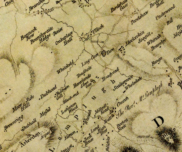
D4NY02SE.jpg Asby -- locality -- building/s -- NY06202038 (etc) -- 'Aspes' -- block or blocks, labelled in lowercase; a hamlet or just a house probably Black Beck -- river -- boundary -- parish boundary -- NY0924 (etc) -- single or double wiggly line; a river Branthwaite Row Farm -- building/s -- NY04922417 -- 'Bannock Row' -- block or blocks, labelled in lowercase; a hamlet or just a house probably bridge, Ullock -- bridge -- NY07412392 -- double line across a river; a bridge at Ullock Colliergate Beck -- river -- boundary -- parish boundary -- NY0619 (etc) -- single or double wiggly line; a river Crakeplace Hall -- building/s -- NY07012402 -- 'Crakeplace Hall' -- block or blocks, labelled in lowercase; a hamlet or just a house Dockray Nook -- building/s -- NY08822008 -- 'Dockra Nook' -- block or blocks, labelled in lowercase; a hamlet or just a house Dubhead -- building/s -- NY05902166 -- 'Dubhead' -- block or blocks, labelled in lowercase; a hamlet or just a house Far Branthwaite Edge -- building/s -- NY05902396 -- 'Branthwaite Hedge' -- block or blocks, labelled in lowercase; a hamlet or just a house Havercroft Farm -- building/s -- NY07742203 -- 'Haverlands' -- block or blocks, labelled in lowercase; a hamlet or just a house High Millgillhead -- building/s -- NY08202055 -- 'Millgillhead' -- block or blocks, labelled in lowercase; a hamlet or just a house High Trees East Farm -- building/s -- NY08231997 -- 'High Trees' -- block or blocks, labelled in lowercase; a hamlet or just a house High Trees West Farm -- building/s -- NY08211997 -- 'High Trees' -- block or blocks, labelled in lowercase; a hamlet or just a house Hodyoad -- building/s -- NY08252224 -- 'Hoadyoad' -- block or blocks, labelled in lowercase; a hamlet or just a house Holedale -- building/s -- NY09262196 -- 'Wholedale' -- block or blocks, labelled in lowercase; a hamlet or just a house Kidburngill -- building/s -- NY06432156 -- 'Ridburn Gill' -- block or blocks, labelled in lowercase; a hamlet or just a house Lackerton Wood -- building/s -- NY06962118 -- 'Lakerton Wood' -- block or blocks, labelled in lowercase; a hamlet or just a house Lamplugh Hall -- building/s -- NY08882071 -- 'Hall / The Rev. Mr. Lamplugh' -- house Lamplugh -- parish -- NY0819 -- 'Lamplugh' -- area Lanefoot Bridge -- bridge -- NY06552066 -- double line across a river; a bridge NE of Arlecdon Lingcroft -- building/s -- NY07622296 -- 'Ling Close' -- block or blocks, labelled in lowercase; a hamlet or just a house probably Low Millgillhead -- building/s -- NY08082069 -- 'Millgillhead' -- block or blocks, labelled in lowercase; a hamlet or just a house Lund, The -- building/s -- locality -- NY07851996 (?) -- 'Lund' -- block or blocks, labelled in lowercase; a hamlet or just a house Mill House -- building/s -- water mill (ex) -- mill (ex) -- corn mill (ex) -- NY08192069 -- circle with rays, mill wheel; a water mill at Millgillhead Mockerkin Tarn -- lake -- NY083232 ? -- 'Tarn' -- lake Mockerkin -- locality -- building/s -- NY09022328 (etc) -- 'Mockerkin' -- block or blocks, labelled in lowercase; a hamlet or just a house Murton -- building/s -- NY07502013 -- 'Morton' -- block or blocks, labelled in lowercase; a hamlet or just a house Near Branthwaite Edge -- building/s -- NY05652412 -- 'Branthwaite Hedge' -- block or blocks, labelled in lowercase; a hamlet or just a house North Mosses -- building/s -- NY06162114 -- 'Mosses' -- block or blocks, labelled in lowercase; a hamlet or just a house Old Scalesmoor -- building/s -- NY09242194 -- 'Scalesmoor' -- block or blocks, labelled in lowercase; a hamlet or just a house Raise, The -- building/s -- NY06162400 -- 'Raise' -- block or blocks, labelled in lowercase; a hamlet or just a house Sosgill -- locality -- building/s -- NY10212405 (etc) -- 'Sosgill' -- block or blocks, labelled in lowercase; a hamlet or just a house South Mosses -- building/s -- NY06172101 -- 'Mosses' -- block or blocks, labelled in lowercase; a hamlet or just a house St Michael's Church -- church -- NY08852079 -- 'Church' -- church Streetgate -- building/s -- NY07962215 -- 'Street Gate' -- block or blocks, labelled in lowercase; a hamlet or just a house and a house Todhole -- building/s -- NY07522223 -- 'Toadhole' -- block or blocks, labelled in lowercase; a hamlet or just a house Ullock -- locality -- building/s -- NY07692397 (etc) -- 'Ullock' -- block or blocks, labelled in lowercase; a hamlet or just a house Walk Mill -- water mill -- mill -- forge -- NY06982078 (estimate) -- circle with rays, mill wheel; a water mill S of Lakerton Wood Whinnah -- building/s -- inn (ex) -- NY07652049 -- 'Whinah' -- block or blocks, labelled in lowercase; a hamlet or just a house Whitekeld -- building/s -- NY07092273 -- 'Whitekeld' -- block or blocks, labelled in lowercase; a hamlet or just a house Wisenholme Beck -- river -- NY0920 (etc) -- single or double wiggly line; a river Wood Beck -- river -- NY0720 (etc) -- single or double wiggly line; a river Woodend -- building/s -- NY07152155 -- 'Wood end' -- block or blocks, labelled in lowercase; a hamlet or just a house | ||
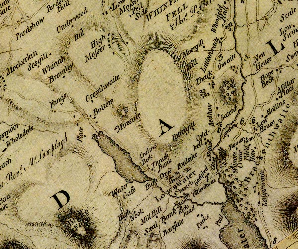
D4NY12SW.jpg Bargate -- building/s -- NY138202 (about) -- 'Bargate' -- block or blocks, labelled in lowercase; a hamlet or just a house Beech Hill -- building/s -- NY11032462 -- 'Hill' -- block or blocks, labelled in lowercase; a hamlet or just a house Blake Fell -- hill -- fell -- NY11071970 -- 'Blake Fell' -- 'Blake Fell' -- hill hachuring; a hill or mountain Bramley -- building/s -- NY10752367 -- 'Bramley' -- block or blocks, labelled in lowercase; a hamlet or just a house bridge, Loweswater (2) -- bridge -- NY11522268 -- double line across a river; a bridge Castle -- building/s -- NY13952079 (guess) -- 'Castle' -- house Church Bridge -- bridge -- NY14072087 -- double line across a river; a bridge at Loweswater Cocker, River -- river -- NY1426 ? -- 'Cocker River' -- single or double wiggly line; a river into the Derwent Cornhow -- building/s -- NY15082228 -- 'Cornhow' -- block or blocks, labelled in lowercase; a hamlet or just a house Crabtreebeck -- building/s -- NY13042156 -- 'Crabtree Beck' -- block or blocks, labelled in lowercase; a hamlet or just a house Dub Beck -- river -- NY13692087 -- single or double wiggly line; a river from Loweswater Dub Beck -- river -- boundary -- parish boundary -- NY1122 (etc) -- single or double wiggly line; a river into Loweswater Fangs -- building/s -- NY10592282 -- 'Fangs' -- block or blocks, labelled in lowercase; a hamlet or just a house Foulsyke -- building/s -- NY14172154 -- 'Foulsike' -- house Gillerthwaite -- building/s -- NY14402104 -- 'Gillerthwat' -- block or blocks, labelled in lowercase; a hamlet or just a house Godferhead -- building/s -- NY14592135 -- 'Godfred' -- block or blocks, labelled in lowercase; a hamlet or just a house Graythwaite -- building/s -- NY11562319 -- 'Graythwaite' -- block or blocks, labelled in lowercase; a hamlet or just a house High Latterhead -- building/s -- NY14922277 -- 'Laterd' -- block or blocks, labelled in lowercase; a hamlet or just a house High Liza Bridge -- bridge -- NY15592234 -- double line across a river; a bridge at Cornhow High Nook Farm -- building/s -- NY12912053 -- 'High Nook' -- block or blocks, labelled in lowercase; a hamlet or just a house Highcross -- building/s -- NY13662133 -- 'High Cross' -- house Highpark -- building/s -- NY14502026 -- 'Parks' -- block or blocks, labelled in lowercase; a hamlet or just a house Hill Farm -- building/s -- NY14632413 -- 'Hill' -- block or blocks, labelled in lowercase; a hamlet or just a house Hudson Place -- building/s -- NY11522220 ? -- 'Place' -- block or blocks, labelled in lowercase; a hamlet or just a house Kirkhead -- building/s -- NY13992076 -- 'Kirkhead' -- block or blocks, labelled in lowercase; a hamlet or just a house Lanthwaite Wood -- wood -- NY15312092 (etc) -- woodland Latterhead -- building/s -- locality -- NY14992265 -- 'Laterd' -- block or blocks, labelled in lowercase; a hamlet or just a house Littlethwaite -- building/s -- NY14972458 -- 'Littlethwaite' -- block or blocks, labelled in lowercase; a hamlet or just a house Liza Beck -- river -- NY1621 (etc) -- single or double wiggly line; a river Low Liza Bridge -- bridge -- NY15372239 -- double line across a river; a bridge at Cornhow Loweswater -- lake -- NY125217 -- lake Loweswater -- locality -- building/s -- NY14152090 (etc) -- 'Loweswater' -- area Lowpark -- building/s -- NY14422041 (etc) -- 'Parks' -- block or blocks, labelled in lowercase; a hamlet or just a house Meregill -- building/s -- NY14702439 (guess) -- 'Moorgill' -- block or blocks, labelled in lowercase; a hamlet or just a house Mill Hill -- building/s -- NY13462049 -- 'Mill Hill' -- block or blocks, labelled in lowercase; a hamlet or just a house Miresyke -- building/s -- NY12142256 -- 'Mireside' -- block or blocks, labelled in lowercase; a hamlet or just a house Mosser -- locality -- building/s -- NY11622496 (etc) -- 'High Mosser' -- block or blocks, labelled in lowercase; a hamlet or just a house Netherclose -- building/s -- NY14672170 -- 'Nether Close' -- block or blocks, labelled in lowercase; a hamlet or just a house Oakbank -- building/s -- NY14732219 ? -- 'Coldkell' -- block or blocks, labelled in lowercase; a hamlet or just a house probably Park Beck -- river -- NY15162056 -- single or double wiggly line; a river into Crummock Water Park Bridge -- bridge -- NY14452051 -- double line across a river; a bridge over beck from Loweswater Peel -- building/s -- pele tower (?) -- NY15012031 -- 'Peal' -- no symbol Pottergill -- building/s -- NY14292241 -- 'Pottergill' -- block or blocks, labelled in lowercase; a hamlet or just a house Redhow -- building/s -- NY14912293 -- 'Redhow' -- block or blocks, labelled in lowercase; a hamlet or just a house Scale Hill -- building/s -- NY15012164 -- 'Scale Hill' -- block or blocks, labelled in lowercase; a hamlet or just a house Scalehill Bridge -- bridge -- NY14862148 -- double line across a river; a bridge over the Cocker St Bartholomew's Church -- church -- NY14142095 -- church at Loweswater Steelbank -- building/s -- NY136202 (about) -- 'Steal Bank' -- block or blocks, labelled in lowercase; a hamlet or just a house Thackthwaite -- locality -- building/s -- NY14842365 (etc) -- 'Thackthwaite' -- block or blocks, labelled in lowercase; a hamlet or just a house Thrushbank -- building/s -- NY13222150 -- 'Thrush Bank' -- block or blocks, labelled in lowercase; a hamlet or just a house Turnerhow -- building/s -- NY15512225 -- 'Tunnerhow' -- block or blocks, labelled in lowercase; a hamlet or just a house Underwood -- building/s -- NY10862475 -- 'Underwood' -- block or blocks, labelled in lowercase; a hamlet or just a house Waterend -- locality -- building/s -- NY11612263 (etc) -- 'Bottom' -- block or blocks, labelled in lowercase; a hamlet or just a house Watergate Farm -- building/s -- NY12702111 -- 'Water Gate' -- block or blocks, labelled in lowercase; a hamlet or just a house Whinnah -- building/s -- NY10702402 -- 'Whinah' -- block or blocks, labelled in lowercase; a hamlet or just a house Wunore Crane -- building/s -- NY15292197 (guess) -- 'Wunore Crane' -- block or blocks, labelled in lowercase; a hamlet or just a house | ||
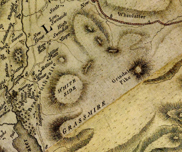
D4NY12SE.jpg Brackenthwaite Mill -- water mill -- mill -- NY15652228 (roughly) -- circle with rays, mill wheel; a water mill Brackenthwaite -- locality -- building/s -- NY15362219 (etc etc) -- 'Brackenthwaite' -- area Grasmoor -- hill -- NY17492034 -- 'GRASSMIRE' -- hill hachuring; a hill or mountain Grisedale Pike -- hill -- NY19852256 (?) -- 'Grisdale Pike' -- hill hachuring; a hill or mountain High Hollins -- building/s -- NY15912277 -- 'Hollins' -- block or blocks, labelled in lowercase; a hamlet or just a house High Swinside -- building/s -- NY16912461 -- 'High Swinside' -- block or blocks, labelled in lowercase; a hamlet or just a house Hope, The -- building/s -- NY16722399 -- 'Hope' -- block or blocks, labelled in lowercase; a hamlet or just a house Hopebeck -- building/s -- NY16312395 -- 'Hope Beck' -- block or blocks, labelled in lowercase; a hamlet or just a house Lanthwaite -- locality -- building/s -- NY15912078 (etc) -- 'Longthwaite' -- block or blocks, labelled in lowercase; a hamlet or just a house Low Hollins -- building/s -- NY15862264 -- 'Hollins' -- block or blocks, labelled in lowercase; a hamlet or just a house Low House -- building/s -- NY15612250 -- 'Low House' -- block or blocks, labelled in lowercase; a hamlet or just a house Low Swinside -- building/s -- NY16652467 -- 'Low Swinside' -- block or blocks, labelled in lowercase; a hamlet or just a house Miller Place -- building/s -- kennels (?) -- NY16202318 -- 'Millar Place' -- block or blocks, labelled in lowercase; a hamlet or just a house New House Farm -- building/s -- NY15612395 -- 'New House' -- block or blocks, labelled in lowercase; a hamlet or just a house Borrowdale and Buttermere -- route -- road -- NY22Borrowdale and Buttermere -- route -- road -- NY22 -- double line, narrower, solid or dotted with a dot and number at 1 mile intervals; road -- to junction S of Seatoller Whinlatter Pass -- pass -- NY19172457 (etc) -- 'Whinlatter' -- area between hachures, a pass Whiteside -- hill -- NY17042195 -- 'WHITE SIDE' -- hill hachuring; a hill or mountain | ||
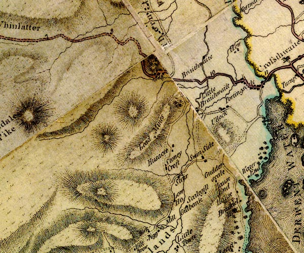
D4NY22SW.jpg Barrow Gill -- river -- NY2222 (etc) -- single or double wiggly line; a river Braithwaite How -- hill -- NY22932392 (etc) -- hill hachures, by Barithwaite Braithwaite -- building/s -- NY23122364 (etc) -- 'Braithwaite' -- block or blocks, labelled in lowercase; a hamlet or just a house bridge, Little Braithwaite (2) -- bridge -- NY23952286 -- double line across a river; a bridge near Little Braithwaite Coledale Beck -- river -- NY2222 (etc) -- single or double wiggly line; a river Derwent Bay -- building/s -- NY25082150 ? -- 'Water End' -- block or blocks, labelled in lowercase; a hamlet or just a house probably Ghyll Bank -- building/s -- NY23692052 -- 'Gillbank' -- block or blocks, labelled in lowercase; a hamlet or just a house Gutherscale -- building/s -- NY24542113 -- 'Gudderscale' -- block or blocks, labelled in lowercase; a hamlet or just a house Hause -- building/s -- NY25012103 (?) -- 'Hause' -- block or blocks, labelled in lowercase; a hamlet or just a house Hawes End -- building/s -- NY24922125 -- 'Hause End' -- block or blocks, labelled in lowercase; a hamlet or just a house How -- building/s -- NY24722434 -- 'How' -- block or blocks, labelled in lowercase; a hamlet or just a house Little Braithwaite Bridge -- bridge -- NY23862300 -- double line across a river; a bridge at Little Braithwaite Little Braithwaite -- locality -- building/s -- NY23752303 (etc) -- 'Little Braithwaite' -- block or blocks, labelled in lowercase; a hamlet or just a house Mill Dam -- building/s -- inn (ex) -- water mill (ex) -- mill (ex) -- NY23032008 -- 'Mill' -- circle with rays, mill wheel and a block; a water mill mill, Braithwaite -- building/s -- water mill (ex) -- mill (ex) -- corn mill (ex) -- NY23002357 (estimate) -- circle with rays, mill wheel; a water mill W of Braithwaite mine, Barrow -- lead mine -- mine -- NY227219 (guess) -- 'Lead Mines' -- + sign Old Brandelhow -- building/s -- NY25012064 -- 'Brandel How' -- block or blocks, labelled in lowercase; a hamlet or just a house Portinscale -- locality -- building/s -- NY25202355 (etc) -- 'Portingscale' -- block or blocks, labelled in lowercase; a hamlet or just a house Pow Beck Bridge -- bridge -- NY34722374 (?) -- double line across a river; a bridge at Portinscale Pow Beck -- river -- NY2424 (etc) -- single or double wiggly line; a river Keswick to Cockermouth -- road -- route -- NY22 -- 'C. to K. 11.7.24' -- double line, solid or dotted, with a dot or milestone and number at 1 mile intervals, tinted red; turnpike road Rowling End Farm -- building/s -- NY23452052 -- 'Low Ho.' -- block or blocks, labelled in lowercase; a hamlet or just a house Skelgill -- building/s -- NY24132082 -- 'Scalegill' -- block or blocks, labelled in lowercase; a hamlet or just a house Stair -- locality -- building/s -- NY23612121 (etc) -- 'Stair' -- block or blocks, labelled in lowercase; a hamlet or just a house Stonycroft -- building/s -- locality -- NY23292132 -- 'Stoney Croft' -- block or blocks, labelled in lowercase; a hamlet or just a house Swinside -- locality -- building/s -- NY24232173 (etc) -- 'Swin Side' -- block or blocks, labelled in lowercase; a hamlet or just a house Ullock -- locality -- building/s -- NY24472304 -- 'Ullock' -- block or blocks, labelled in lowercase; a hamlet or just a house Uzzicar -- building/s -- NY23412179 -- 'Husacre' -- block or blocks, labelled in lowercase; a hamlet or just a house | ||
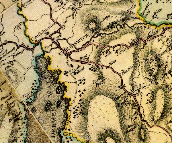
D4NY22SE.jpg bridge, St John's Castlerigg etc (3) -- bridge -- NY29402180 -- double line across a river; a bridge at Dale Bottom bridge, St John's Castlerigg etc -- bridge -- NY30032068 -- double line across a river; a bridge at Shoulthwaite presumably Brockle Beck -- river -- boundary -- parish boundary -- NY2822 (etc) -- single or double wiggly line; a river Brow Top -- building/s -- NY27332305 (estimate) ? -- 'Brow Top' -- block or blocks, labelled in lowercase; a hamlet or just a house Brundholme -- building/s -- NY29792497 -- 'Brindhom' -- block or blocks, labelled in lowercase; a hamlet or just a house Castle Head -- hill -- NY26972268 (etc) -- 'Castle Head' -- no symbol Castlerigg Stone Circle -- stone circle -- NY29142363 -- 'Druid Stones' -- circle of 7 spots Castlerigg -- locality -- building/s -- NY28242263 (etc) -- 'Castle Rigg' -- block or blocks, labelled in lowercase; a hamlet or just a house Cat Gill -- river -- NY2619 (etc) -- single or double wiggly line; a river Causeway Foot -- building/s -- NY29332181 -- 'Causeway Foot' -- block or blocks, labelled in lowercase; a hamlet or just a house Dale Bottom -- building/s -- NY29602178 -- 'Dale Bottom' -- block or blocks, labelled in lowercase; a hamlet or just a house Derwent Isle -- island -- NY261224 -- island in Derwent Water Derwent Water -- lake etc -- NY260210 ? -- 'DERWENT WATER' -- lake Derwent, River -- river -- NY2515 (etc) -- 'Derwent River' -- 'Derwent River' -- single or double wiggly line; a river in and from Derwent Water; into the sea Fieldside -- building/s -- NY28342357 -- 'Field Side' -- block or blocks, labelled in lowercase; a hamlet or just a house Gale Gill -- river -- NY2624 (etc) -- single or double wiggly line; a river Goosewell Farm -- building/s -- NY29452377 -- 'Goose Well' -- block or blocks, labelled in lowercase; a hamlet or just a house Great Crosthwaite -- locality -- building/s etc -- NY26032415 (etc) -- 'Crosthwaite' -- blocks, and usually a church, labelled in upright lowercase; a village Greta Bridge -- bridge -- NY26302374 ? ? -- double line across a river; a bridge over the Greta in Keswick Greta, River -- river -- NY2924 -- 'Greeta R.' -- single or double wiggly line; a river High Fieldside -- building/s -- NY28582369 -- 'Field Side' -- block or blocks, labelled in lowercase; a hamlet or just a house High Row -- building/s -- NY29302150 -- 'High Row' -- block or blocks, labelled in lowercase; a hamlet or just a house Keswick Mill -- water mill -- mill -- corn mill -- NY27062356 (estimate) -- circle with rays, mill wheel; a water mill E of Keswick probably Keswick -- locality -- building/s etc -- NY26652341 (etc) -- 'KESWICK' -- blocks, perhaps a church, labelled in block caps; a town and street plan Latrigg -- hill -- NY27842465 (about) -- 'Latrigg' -- hill hachuring; a hill or mountain Long Bridge -- footbridge -- bridge -- NY25362377 -- double line across a river; a bridge over the Derwent near Great Crosthwaite Lord's Island -- island -- NY26542189 -- island in Derwent Water mill, Brigham -- building/s -- water mill (ex) -- mill (ex) -- woollen mill (ex) -- NY27992392 -- 'Forge' -- circle with rays, mill wheel; a water mill Moor -- building/s -- NY28312295 -- 'Moor' -- block or blocks, labelled in lowercase; a hamlet or just a house Nest -- locality -- NY29002270 (etc) ? -- 'Piet Nest' -- block or blocks, labelled in lowercase; a hamlet or just a house Otter Island -- island -- NY25321942 -- island in Derwent Water Rampsholme Island -- island -- NY26392136 -- island in Derwent Water Ambleside to Keswick -- road -- route -- NY30 -- 'Road from Kendal' -- double line, solid or dotted, with a dot or milestone and number at 1 mile intervals, tinted red; turnpike road -- into Westmorland Borrowdale and Buttermere -- route -- road -- NY22Borrowdale and Buttermere -- route -- road -- NY22 -- double line, narrower, solid or dotted with a dot and number at 1 mile intervals; road -- goes beyond Seathwaite to the foot of the Styhead pass Keswick to Carlisle -- route etc -- double line, solid or dotted, with a dot or milestone and number at 1 mile intervals, tinted red; turnpike road Keswick to Cockermouth -- road -- route -- NY22 -- 'C. to K. 11.7.24' -- double line, solid or dotted, with a dot or milestone and number at 1 mile intervals, tinted red; turnpike road -- 'C. to K. 15:0:13' -- double line, solid or dotted, with a dot or milestone and number at 1 mile intervals, tinted red; turnpike road -- miles.furlongs.poles; Cockermouth to Keswick Penrith to Keswick -- route -- NY53 -- 'K. to P. 17:5:32' -- double line, solid or dotted, with a dot or milestone and number at 1 mile intervals, tinted red; turnpike road -- miles.furlongs.poles; Keswick to Penrith Scott How -- building/s -- NY29812095 -- 'Scoat How' -- block or blocks, labelled in lowercase; a hamlet or just a house Shoulthwaite Farm -- building/s -- NY29882047 -- 'Shoulthwaite' -- block or blocks, labelled in lowercase; a hamlet or just a house Shoulthwaite -- building/s -- locality -- NY29982036 -- 'Shoulthwaite' -- block or blocks, labelled in lowercase; a hamlet or just a house St Herbert's Island -- island -- NY259212 -- island in Derwent Water High Hill Tollgate -- toll gate (site) -- NY26152389 -- 'Turnp.' -- block on road between Great Crosthwaite and Keswick; toll house and toll gate Windy Brow -- locality -- NY27292422 -- 'Windy Brow' -- block or blocks, labelled in lowercase; a hamlet or just a house OR an area | ||
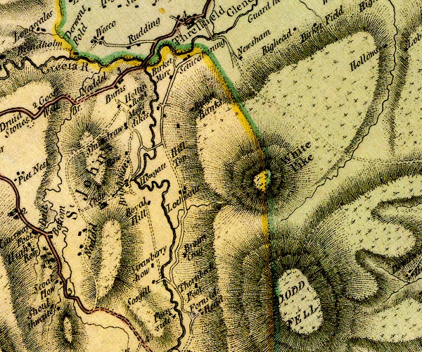
D4NY32SW.jpg Beckthorns -- building/s -- NY32012097 -- 'Thornbeck Foot' -- block or blocks, labelled in lowercase; a hamlet or just a house probably Birkett Mire -- NY31852442 -- 'Birket Mire' -- block or blocks, labelled in lowercase; a hamlet or just a house Bram Cragg -- building/s -- NY31852140 -- 'Braim Crag' -- block or blocks, labelled in lowercase; a hamlet or just a house Bridge House -- building/s -- NY30982265 -- 'Brighouse' -- block or blocks, labelled in lowercase; a hamlet or just a house bridge, St John's Castlerigg etc (4) -- bridge -- NY31002265 -- double line across a river; a bridge by Bridge House Burns Farm -- building/s -- NY30772424 -- 'Burns' -- block or blocks, labelled in lowercase; a hamlet or just a house Fornside -- building/s -- NY32092062 -- 'Fornside Head' -- block or blocks, labelled in lowercase; a hamlet or just a house Great Dodd -- hill -- parish boundary mark -- NY34192056 (etc) -- 'DODD FELL' -- hill hachuring; a hill or mountain Greta, River -- river -- NY2924 -- 'Greeta R.' -- single or double wiggly line; a river Hill Top -- building/s -- NY31722300 -- 'Hill Top' -- no symbol Hollin Root -- building/s -- NY30842391 -- 'Hollin Root' -- block or blocks, labelled in lowercase; a hamlet or just a house Howgate -- building/s (ruin) -- NY31242274 -- 'Howgate' -- block or blocks, labelled in lowercase; a hamlet or just a house Low Bridge End Farm -- building/s -- NY31752052 -- 'Fornside' -- block or blocks, labelled in lowercase; a hamlet or just a house Lowthwaite -- building/s -- NY31862257 -- 'Lothwaite' -- block or blocks, labelled in lowercase; a hamlet or just a house Mill Bridge -- bridge -- NY32572506 -- double line across a river; a bridge over the Glenderamackin near Threlkeld Moss Dikes -- building/s -- NY31102402 -- 'Moss dikes' -- block or blocks, labelled in lowercase; a hamlet or just a house Naddle Beck -- river -- NY2922 -- single or double wiggly line; a river into the Greta Naddle Bridge -- bridge -- NY30002385 -- 'Naddel Br.' -- double line across a river; a bridge Naddle -- locality -- NY30152150 (etc) -- 'Naddel' -- block or blocks, labelled in lowercase; a hamlet or just a house Near Birkett Bank -- building/s -- NY31952358 -- 'Birket Banks' -- block or blocks, labelled in lowercase; a hamlet or just a house Near Birkettbank -- building/s -- NY32132389 -- 'Birket Banks' -- block or blocks, labelled in lowercase; a hamlet or just a house Newsham -- building/s -- NY33082464 -- 'Newsham' -- block or blocks, labelled in lowercase; a hamlet or just a house Rake How -- building/s -- NY31232216 -- 'Royal Hill' -- block or blocks, labelled in lowercase; a hamlet or just a house possibly Riddings -- building/s -- NY31332497 -- 'Rudding' -- block or blocks, labelled in lowercase; a hamlet or just a house Penrith to Keswick -- route -- NY53 -- 'K. to P. 17:5:32' -- double line, solid or dotted, with a dot or milestone and number at 1 mile intervals, tinted red; turnpike road -- miles.furlongs.poles; Keswick to Penrith Setmabanning -- building/s -- NY32182472 -- 'Setucabaning' -- block or blocks, labelled in lowercase; a hamlet or just a house Shundraw -- building/s -- NY30812356 -- 'Shundraw' -- block or blocks, labelled in lowercase; a hamlet or just a house Sosgill Bridge -- bridge -- NY31572105 -- double line across a river; a bridge at Sosgill Sosgill -- building/s -- NY31482098 -- 'Sosgill' -- block or blocks, labelled in lowercase; a hamlet or just a house St John's Church -- church -- NY30642246 -- 'Chap' -- church St John's Beck -- river -- NY3123 ? -- single or double wiggly line; a river into the Greta St John's Castlerigg and Wythburn -- locality -- NY3118 (etc) -- 'St. John's' -- area Strawberryhow -- building/s -- NY31462121 (?) ? -- 'Strawberryhow' -- block or blocks, labelled in lowercase; a hamlet or just a house probably Threlkeld Bridge -- bridge -- NY314762467 -- double line across a river; a bridge over the Greta Wanthwaite Bridge -- bridge -- NY31402314 -- double line across a river; a bridge near Hill Top Wescoe -- locality -- building/s -- NY30422496 (etc) -- 'Wesco' -- block or blocks, labelled in lowercase; a hamlet or just a house White Pike -- hill -- NY33912294 (etc) -- 'White Pike' -- hill hachuring; a hill or mountain Yew Tree -- building/s -- NY30872301 -- 'Raw' -- block or blocks, labelled in lowercase; a hamlet or just a house probably | ||
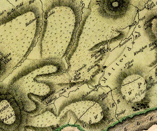
D4NY32SE.jpg Aira Beck -- river -- NY40001974 -- single or double wiggly line; a river Baldhow -- building/s -- NY40712367 -- 'Boathow' -- block or blocks, labelled in lowercase; a hamlet or just a house probably bridge, Dockray -- bridge -- NY39282158 -- double line across a river; a bridge at Dockwray Crookwath -- building/s -- NY38092148 -- 'Crook Wath' -- block or blocks, labelled in lowercase; a hamlet or just a house Dockray -- locality -- building/s -- NY39292161 (etc) -- 'Dockwray' -- block or blocks, labelled in lowercase; a hamlet or just a house Dowthwaitehead -- locality -- building/s -- NY37052082 (etc) ? -- 'Dowthwaite Head' -- block or blocks, labelled in lowercase; a hamlet or just a house Gowbarrow Park -- park -- NY40822126 (etc) -- 'GOWBARROW PARKS / Honble. Charles Howard Esqr.' -- outline, double line, plus lake shore High Hollows -- building/s -- NY35632495 -- 'Hollows' -- block or blocks, labelled in lowercase; a hamlet or just a house High Row -- locality -- building/s -- NY38012193 (etc) -- 'High Row' -- block or blocks, labelled in lowercase; a hamlet or just a house Hollows -- building/s -- NY39162277 -- 'Hollows' -- block or blocks, labelled in lowercase; a hamlet or just a house Lobbs -- building/s -- NY35972474 -- 'Lobbs' -- block or blocks, labelled in lowercase; a hamlet or just a house Matterdale Church -- church -- NY39442244 -- 'Church' -- church and buildings Matterdale End -- locality -- building/s -- NY39552348 (etc) -- 'Matterdale Head' -- block or blocks, labelled in lowercase; a hamlet or just a house Matterdale -- locality -- NY3922 (?) -- 'Matterdale' -- area -- building/s -- water mill (ex) -- mill (ex) -- corn mill (ex) -- NY39692158 -- circle with rays, mill wheel; a water mill by Dockray mill, Dockray -- water mill -- mill -- NY39162152 (guess) -- circle with rays, mill wheel; a water mill by Dockray Parkgate Farm -- building/s -- NY39642131 -- 'Park gate' -- block or blocks, labelled in lowercase; a hamlet or just a house Swinside -- building/s -- NY38502222 (estimate) -- 'Swinside' -- block or blocks, labelled in lowercase; a hamlet or just a house Ulcat Row -- building/s -- NY40612262 (etc) -- 'Ulkat Row' -- block or blocks, labelled in lowercase; a hamlet or just a house | ||
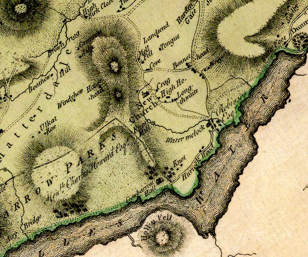
D4NY42SW.jpg All Saints Church -- church -- NY43172298 -- 'New Church' -- church Bennethead -- locality -- building/s -- NY44202383 (etc) -- 'Bennethead' -- block or blocks, labelled in lowercase; a hamlet or just a house bridge, Howtown -- bridge -- NY44331964 -- double line across a river; a bridge at Howtown probably Brownrigg -- building/s -- NY40812450 -- 'Brownrigg' -- block or blocks, labelled in lowercase; a hamlet or just a house Cove -- building/s -- NY43072361 -- 'Cove' -- block or blocks, labelled in lowercase; a hamlet or just a house Crag House -- building/s -- NY43282318 -- 'Crag' -- block or blocks, labelled in lowercase; a hamlet or just a house Goosegreen -- building/s -- NY41042350 -- 'Windyhow' -- block or blocks, labelled in lowercase; a hamlet or just a house possibly Gowbarrow Hall -- building/s -- NY43352138 -- 'Gowbarrow Hall' -- house Gowbarrow Park -- park -- NY40822126 (etc) -- 'GOWBARROW PARKS / Honble. Charles Howard Esqr.' -- outline, double line, plus lake shore Greenrow -- building/s -- NY41312442 -- 'Greenrow' -- block or blocks, labelled in lowercase; a hamlet or just a house Hallin Fell -- hill -- fell -- NY43301975 (etc) -- 'Hollin Fell' -- hill hachuring; a hill or mountain Hause Head -- building/s -- NY41852349 -- 'Hausehead' -- block or blocks, labelled in lowercase; a hamlet or just a house High House -- building/s -- NY43402291 -- 'High Ho.' -- block or blocks, labelled in lowercase; a hamlet or just a house High Longthwaite -- building/s -- NY43652300 ? -- 'Longthwaite' -- block or blocks, labelled in lowercase; a hamlet or just a house Hill -- building/s -- NY40972381 -- 'Hill' -- block or blocks, labelled in lowercase; a hamlet or just a house Horrock Wood Farm -- building/s -- NY44282201 -- 'Hurrock Wood' -- block or blocks, labelled in lowercase; a hamlet or just a house Knotts Farm -- building/s -- locality -- NY43752157 -- 'Knot' -- block or blocks, labelled in lowercase; a hamlet or just a house Land Ends -- building/s -- NY43292448 -- 'Landsend' -- block or blocks, labelled in lowercase; a hamlet or just a house Low Longthwaite -- building/s -- NY43932283 -- 'Longthwaite' -- block or blocks, labelled in lowercase; a hamlet or just a house Mellfell House -- building/s -- NY43022383 -- 'Mell Fell' -- block or blocks, labelled in lowercase; a hamlet or just a house Pencil Mill -- building/s -- NY43542224 -- 'Knot Mill' -- circle with rays, mill wheel; a water mill Pencilmill Beck -- river -- NY45082255 -- river into Ullswater at Watermillock Sike -- building/s -- NY41242420 -- 'Sike' -- block or blocks, labelled in lowercase; a hamlet or just a house Tongue House -- building/s -- NY43382425 -- 'Tongue' -- block or blocks, labelled in lowercase; a hamlet or just a house Ullswater -- lake -- NY422202 (etc) ? -- 'ULLES WATER' -- 'ULLES WATER' -- lake; the county boundary Cumberland and Westmorland down the middle, but the map colourist has put it in Westmorland only Watermillock House -- building/s -- NY44602245 -- 'Watermelock / Robinson Esqr.' -- house Watermillock -- building/s -- NY44622243 (etc) -- 'Watermelock' -- block or blocks, labelled in lowercase; a hamlet or just a house Wreay -- building/s -- NY444238 -- 'Wrey' -- block or blocks, labelled in lowercase; a hamlet or just a house | ||
D4NY42SE.jpg Dunmallard Hill -- hill -- NY46762456 -- 'Dunmallet' -- shown as a wooded hill Eamont, River -- river -- NY469243 (from) ? ? -- 'Eamont River' -- single or double wiggly line; a river from Ullswater, and county boundary, into the Eden Pooley Bridge -- locality -- building/s etc -- NY47082444 (etc) -- 'Pooly Bridge' -- block or blocks, labelled in lowercase; a hamlet or just a house Pooley Bridge -- bridge -- NY47002442 -- 'Pooly Bridge' -- double line across a river; a bridge at Pooley Bridge Ullswater -- lake -- NY422202 (etc) ? -- 'ULLES WATER' -- 'ULLES WATER' -- lake; the county boundary Cumberland and Westmorland down the middle, but the map colourist has put it in Westmorland only Waterfoot -- building/s -- locality -- NY46052457 -- 'Water Foot' -- block or blocks, labelled in lowercase; a hamlet or just a house | ||
D4NX91NW.jpg | ||
D4NX91NE.jpg Aikbank -- building/s -- NX98391943 (estimate) -- 'Ake Bank' -- block or blocks, labelled in lowercase; a hamlet or just a house Arrowthwaite -- locality -- NX96871759 (etc) -- 'Harrithwaite' -- block or blocks, labelled in lowercase; a hamlet or just a house Barrowmouth -- building/s -- NX96281600 (guess) -- 'Barrow Mouth' -- block or blocks, labelled in lowercase; a hamlet or just a house bowling green, Whitehaven -- bowling green -- NX96771806 (guess) -- 'Bowling Green' bridge, Whitehaven -- bridge -- NX97381738 -- double line across a river; a bridge possibly Chapel House -- building/s -- NX98571603 -- 'Chapless' -- block or blocks, labelled in lowercase; a hamlet or just a house possibly Corkickle -- locality -- building/s -- NX98051733 (etc) -- 'Corcickle' -- block or blocks, labelled in lowercase; a hamlet or just a house Distressed Sailor -- inn -- NX98581623 -- 'Distrest Sailor' -- inn Fox Houses -- building/s -- NX98061715 -- 'Fox Houses' -- block or blocks, labelled in lowercase; a hamlet or just a house Ginns -- locality -- NX97271737 (etc) -- 'Gins' -- block or blocks, labelled in lowercase; a hamlet or just a house Goose Butts -- building/s -- NY00151575 -- 'Butts' -- block or blocks, labelled in lowercase; a hamlet or just a house Greenbank Hotel -- inn -- NX97651558 -- 'Green Bank' -- block or blocks, labelled in lowercase; a hamlet or just a house Hall, The -- building/s -- NX98601674 (?) -- 'Hensingham / Anty. Benn Esqr.' -- house probably Harras -- locality -- building/s -- NX98481846 (etc) -- 'Harras' -- block or blocks, labelled in lowercase; a hamlet or just a house Hensingham -- locality -- building/s -- NX98611679 (etc) -- 'Hensingham' -- block or blocks, labelled in lowercase; a hamlet or just a house High Low Hall -- building/s -- NX99331545 -- 'Low Hall' -- block or blocks, labelled in lowercase; a hamlet or just a house Ingwell -- building/s -- school -- NX99571491 (etc) -- 'Starmire' -- block or blocks, labelled in lowercase; a hamlet or just a house possibly Pow Beck -- river -- NX9716 (etc) -- single or double wiggly line; a river into the sea at Whitehaven Harbour Prestonhows -- building/s -- NX96521590 (guess) -- 'Preston How' -- block or blocks, labelled in lowercase; a hamlet or just a house Cockermouth to Whitehaven -- route -- road -- NY13 -- 'W. to C. 13:6:12' -- double line, solid or dotted, with a dot or milestone and number at 1 mile intervals, tinted red; turnpike road -- miles.furlongs.poles; Whitehaven to Cockermouth Egremont to Whitehaven -- route -- NY01 -- 'E. to W. 5:6:20' -- double line, solid or dotted, with a dot or milestone and number at 1 mile intervals, tinted red; turnpike road -- miles.furlongs.poles; Egremont to Whitehaven St Bees road -- road -- route -- NY00 -- 'S. to W. 4:1:32' -- double line, solid or dotted, tinted red; turnpike road -- miles.furlongs.poles; St Bees to Whitehaven Whitehaven to Workington -- route -- NX91 -- 'W. to W. 7:7:4' -- double line, solid or dotted, with a dot or milestone and number at 1 mile intervals, tinted red; turnpike road -- miles.furlongs.poles; Whitehaven to Workington Saltom Pit -- coal mine -- mine -- NX96441737 -- 'Salton' -- block or blocks, labelled in lowercase; a hamlet or just a house possibly Scilly Bank -- locality -- building/s -- NX99211912 (etc) -- 'Silly Bank' -- block or blocks, labelled in lowercase; a hamlet or just a house Scragill Turnpike -- toll gate (site) -- NX98301718 (?) -- 'Turnpike' -- block by the road, perhaps a line across; toll house and toll gate Stephen Rudding -- building/s -- NY00131767 (guess) -- 'Stephen Ruddin' -- block or blocks, labelled in lowercase; a hamlet or just a house Thicket -- building/s -- NX97601623 -- 'Thicket' -- block or blocks, labelled in lowercase; a hamlet or just a house Tobacco Pipes -- building/s -- NX97641928 -- house 1 mile N from Whth possibly Whelpside -- building/s -- NX99921705 -- 'Whelpside Hall' -- block or blocks, labelled in lowercase; a hamlet or just a house probably Whitehaven Castle -- castle (ex) -- building/s -- hospital -- NX97701784 -- 'Flat / Sir James Lowther Bart.' -- house Whitehaven Harbour -- harbour -- NX97131841 (etc) -- several harbour moles Whitehaven -- locality -- building/s etc -- NX97181809 (etc) -- 'WHITEHAVEN' -- blocks, perhaps a church, labelled in block caps; a town and street plan windmill, Whitehaven -- windmill (gone?) -- mill (gone?) -- NX96881783 (roughly) -- 2 windmills at Bowling Green | ||
D4NY01NW.jpg Acrewalls -- building/s -- NY02601856 -- 'Acre Walls' -- block or blocks, labelled in lowercase; a hamlet or just a house Arlecdon Hill -- building/s -- NY04011870 -- 'Hungerhill' -- block or blocks, labelled in lowercase; a hamlet or just a house probably Arlecdon -- locality -- building/s -- NY04981891 (etc) -- 'Arlecdon' -- blocks, and usually a church, labelled in upright lowercase; a village Big Croft -- building/s -- NY03921897 -- 'Bigcroft' -- block or blocks, labelled in lowercase; a hamlet or just a house Birks -- building/s -- NY02581591 -- 'Birks' -- block or blocks, labelled in lowercase; a hamlet or just a house Bogdale -- building/s -- NY00471833 -- 'Bogels' -- block or blocks, labelled in lowercase; a hamlet or just a house Bowthorn Farm -- building/s -- NY01721623 -- 'Bowthorn' -- block or blocks, labelled in lowercase; a hamlet or just a house bridge, Cleator Moor -- bridge -- NY03451498 -- double line across a river; a bridge near Coal Beck Cringlagill -- building/s -- NY02781828 -- 'Cringlagill' -- block or blocks, labelled in lowercase; a hamlet or just a house Crofts -- building/s -- NY03651999 -- 'Crofts' -- block or blocks, labelled in lowercase; a hamlet or just a house Cross Gill -- building/s -- NY03521573 (estimate) -- 'Cross Gill' -- block or blocks, labelled in lowercase; a hamlet or just a house Crossfield -- locality -- building/s -- NY01231491 (etc) -- 'Cross Field' -- block or blocks, labelled in lowercase; a hamlet or just a house Crosslacon -- building/s -- NY02571603 -- 'Croslakin' -- block or blocks, labelled in lowercase; a hamlet or just a house Dike Nook -- building/s -- NY03821713 -- 'Dikenook' -- block or blocks, labelled in lowercase; a hamlet or just a house Dub Beck -- river -- NY0318 (etc) -- single or double wiggly line; a river into the Keekle Ehen, River -- river -- NY0515 (etc) ? -- 'Ehen River' -- 'Ehen River' -- single or double wiggly line; a river out of Ennerdale Water, into the sea Frizington Hall -- building/s -- NY01861706 -- 'Frisington Hall' -- house Galemire -- building/s -- NY00341566 -- 'Galemire' -- block or blocks, labelled in lowercase; a hamlet or just a house Hayston House (?) -- building/s -- NY03151738 -- 'Houthgill' -- block or blocks, labelled in lowercase; a hamlet or just a house possibly High House -- building/s -- NY03531552 (estimate) -- 'High Ho.' -- block or blocks, labelled in lowercase; a hamlet or just a house High Waterside -- building/s -- NY04991564 -- 'Waterside' -- block or blocks, labelled in lowercase; a hamlet or just a house High Wreah -- building/s -- NY00261717 -- 'Wreay' -- block or blocks, labelled in lowercase; a hamlet or just a house Hole Beck -- river -- boundary -- parish boundary -- NY0315 (etc) -- single or double wiggly line; a river into the Ehen Holebeck -- building/s -- NY03511525 -- 'Coal Beck' -- block or blocks, labelled in lowercase; a hamlet or just a house Hollowdyke Farm -- building/s -- NY03401661 -- 'Hollow Dike' -- block or blocks, labelled in lowercase; a hamlet or just a house Howgate -- building/s -- NY03171674 -- 'Haggot' -- block or blocks, labelled in lowercase; a hamlet or just a house Jacktrees -- building/s -- locality -- NY01821488 -- 'Jack Trees' -- block or blocks, labelled in lowercase; a hamlet or just a house Kirkland Howe -- building/s -- NY04121931 -- 'Kirkland How' -- block or blocks, labelled in lowercase; a hamlet or just a house Kirsgill How -- building/s -- NY02681719 -- 'Kirkscale' -- block or blocks, labelled in lowercase; a hamlet or just a house Low House -- building/s -- NY00761647 -- circle with rays, mill wheel; a water mill S of Weddicar Low Waterside -- building/s -- NY04451529 -- 'Waterside' -- block or blocks, labelled in lowercase; a hamlet or just a house Low Wreah -- building/s -- NY0035169 -- 'Wreay' -- block or blocks, labelled in lowercase; a hamlet or just a house mill, Weddicar -- building/s -- water mill (ex) -- mill (ex) -- corn mill (ex) -- NY00601572 -- circle with rays, mill wheel; a water mill at Galemire Millyeat -- building/s -- NY02351773 -- 'Millgate' -- block or blocks, labelled in lowercase; a hamlet or just a house Moorgate -- building/s -- NY00451806 (guess) -- 'Moorgate' -- block or blocks, labelled in lowercase; a hamlet or just a house Mowbray -- building/s -- NY03771679 -- 'Malbray' -- block or blocks, labelled in lowercase; a hamlet or just a house Parkside -- building/s -- NY03541608 -- 'Parkside' -- block or blocks, labelled in lowercase; a hamlet or just a house possibly Priest Gill -- building/s -- NY00141805 (estimate) -- 'Pressgill' -- block or blocks, labelled in lowercase; a hamlet or just a house Ratten Row -- building/s -- NY03311528 -- 'Ratten Row' -- block or blocks, labelled in lowercase; a hamlet or just a house Rheda Park -- locality -- park (once?) -- NY02491678 -- 'Reda' -- block or blocks, labelled in lowercase; a hamlet or just a house Routon Bridge -- bridge -- NY03221878 -- double line across a river; a bridge near Cringlagill Routon Syke -- building/s -- NY03261903 -- 'Routen Sike' -- block or blocks, labelled in lowercase; a hamlet or just a house Sands Close -- building/s -- NY01141913 -- 'Sand Closes' -- block or blocks, labelled in lowercase; a hamlet or just a house Scalelands -- building/s -- NY03921548 -- 'Scaleland' -- block or blocks, labelled in lowercase; a hamlet or just a house Threapthwaite -- building/s -- NY01991626 -- 'Threepthat' -- block or blocks, labelled in lowercase; a hamlet or just a house Walkmill Bridge -- bridge -- NY00811865 -- double line across a river; a bridge near Sand Closes Weddicar Hall -- building/s -- NY014173 -- 'Weddicar Hall' -- block or blocks, labelled in lowercase; a hamlet or just a house Winder Gill -- building/s -- NY05031745 (estimate) -- 'Winder Gill' -- block or blocks, labelled in lowercase; a hamlet or just a house Winder -- locality -- building/s -- NY04851764 (etc) -- 'Winder' -- block or blocks, labelled in lowercase; a hamlet or just a house Yeat House -- building/s -- NY04041712 -- 'Gatehouse' -- block or blocks, labelled in lowercase; a hamlet or just a house | ||
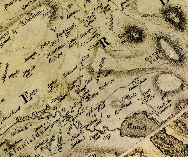
D4NY01NE.jpg Bank House -- building/s -- NY05821578 -- 'Bank Ho.' -- block or blocks, labelled in lowercase; a hamlet or just a house Bankend -- building/s -- NY07701707 -- 'Bank End' -- block or blocks, labelled in lowercase; a hamlet or just a house Beck -- locality -- building/s -- NY07531974 (etc) -- 'Beck House' -- block or blocks, labelled in lowercase; a hamlet or just a house Beckfoot -- building/s -- NY10281621 -- 'Beck Ho.' -- block or blocks, labelled in lowercase; a hamlet or just a house probably Birk Moss -- building/s -- NY07091551 -- 'Birkmoss' -- block or blocks, labelled in lowercase; a hamlet or just a house Cockan -- building/s -- NY07661857 -- 'Cocken' -- block or blocks, labelled in lowercase; a hamlet or just a house Cockleygill -- building/s -- NY08111939 -- 'Cockeltygill' -- block or blocks, labelled in lowercase; a hamlet or just a house Colliergate -- building/s -- NY06221884 -- 'Collier Gate' -- block or blocks, labelled in lowercase; a hamlet or just a house Crag Farm House -- building/s -- NY08551504 -- 'Crag' -- block or blocks, labelled in lowercase; a hamlet or just a house Croasdale -- locality -- building/s -- NY09391748 (etc) -- 'Crowsdale' -- block or blocks, labelled in lowercase; a hamlet or just a house Croftfoot -- building/s -- NY09621675 -- 'Croft Foot' -- block or blocks, labelled in lowercase; a hamlet or just a house Dryhurst -- building/s -- NY05651545 -- 'Drest' -- block or blocks, labelled in lowercase; a hamlet or just a house Ehen, River -- river -- NY0515 (etc) ? -- 'Ehen River' -- 'Ehen River' -- single or double wiggly line; a river out of Ennerdale Water, into the sea Ennerdale Bridge -- locality -- building/s -- NY06981582 (etc) -- 'Bridge' -- double line across a river; a bridge and houses Ennerdale Bridge -- bridge -- NY06931580 -- 'Bridge' -- double line across a river; a bridge and houses Ennerdale Mill -- water mill (ex) -- mill (ex) -- corn mill (ex) -- building/s -- NY08161531 -- 'Paper Mill' -- circle with rays, mill wheel; a water mill Ennerdale Water -- lake -- NY106150 -- 'Ennerdale Water' -- 'ENNERDALE WATER' -- lake Ennerdale -- valley -- NY108153 (etc etc) -- 'Ennerdale' -- area Eskett -- building/s -- NY05341669 -- 'Eskat' -- block or blocks, labelled in lowercase; a hamlet or just a house Far Moorend -- building/s -- NY07791543 -- 'Moorend' -- block or blocks, labelled in lowercase; a hamlet or just a house Felldyke -- locality -- building/s -- NY08491981 (etc) -- 'Felldike' -- block or blocks, labelled in lowercase; a hamlet or just a house Fellend -- building/s -- NY06831490 -- 'Fellend' -- block or blocks, labelled in lowercase; a hamlet or just a house Ghyll Farm -- building/s -- NY08271754 -- 'Gill' -- block or blocks, labelled in lowercase; a hamlet or just a house Hawes -- building/s -- NY07461713 -- 'Hall' -- block or blocks, labelled in lowercase; a hamlet or just a house probably High Gillfoot -- building/s -- NY06511492 -- 'Gillfoot' -- block or blocks, labelled in lowercase; a hamlet or just a house High Leys -- building/s -- NY06481862 -- 'Highleys' -- no symbol High Stowbank -- building/s -- NY07121713 -- 'High Stow Beck' -- block or blocks, labelled in lowercase; a hamlet or just a house Hollins -- building/s -- NY07441657 -- 'Hollins' -- block or blocks, labelled in lowercase; a hamlet or just a house How Hall Farm -- building/s -- NY09021635 -- 'How Hall' -- house Howside -- building/s -- NY09271670 -- 'How Side' -- block or blocks, labelled in lowercase; a hamlet or just a house Hunter How -- building/s -- NY08321723 -- 'Hunterhow' -- block or blocks, labelled in lowercase; a hamlet or just a house Kelton Head -- building/s -- NY06891892 -- 'Keltonhead' -- block or blocks, labelled in lowercase; a hamlet or just a house Kelton Mill -- building/s -- water mill (ex) -- mill (ex) -- corn mill (ex) -- NY07251629 -- circle with rays, mill wheel; a water mill near Ennerdale Kirkland -- locality -- building/s -- NY07221802 -- 'Kirkland' -- block or blocks, labelled in lowercase; a hamlet or just a house Knock Murton -- hill -- NY09451906 -- 'Knockmorton' -- hill hachuring; a hill or mountain Lavrock Hall -- building/s -- NY07681625 -- 'Laverick Hall' -- block or blocks, labelled in lowercase; a hamlet or just a house Longmoor -- building/s -- NY05881561 -- 'Longmoor' -- block or blocks, labelled in lowercase; a hamlet or just a house Low Gillfoot -- building/s -- NY06461508 -- 'Gillfoot' -- block or blocks, labelled in lowercase; a hamlet or just a house Low Leys -- building/s -- NY06721931 -- 'Lowleys' -- block or blocks, labelled in lowercase; a hamlet or just a house Low Moorend -- building/s -- NY07531555 -- 'Moorend' -- block or blocks, labelled in lowercase; a hamlet or just a house Low Stowbank -- building/s -- NY07231666 -- 'L. Stow Beck' -- block or blocks, labelled in lowercase; a hamlet or just a house Middle Leys -- building/s -- NY06491882 -- 'Middleleys' -- symbol Rowrah -- locality -- building/s -- NY05711854 (etc) -- 'Rowrah' -- block or blocks, labelled in lowercase; a hamlet or just a house Salter Hall -- building/s -- NY05941691 -- 'Salter Hall' -- block or blocks, labelled in lowercase; a hamlet or just a house Scallow -- building/s -- NY07071954 -- 'Scallow' -- block or blocks, labelled in lowercase; a hamlet or just a house Smaithwaite Farm -- building/s -- NY08071907 -- 'Smathwaite' -- block or blocks, labelled in lowercase; a hamlet or just a house St Mary's Church -- church -- NY06801586 -- 'Church' -- church Stockhow Hall -- building/s -- NY06541675 -- 'Stocka Hall' -- house Stoneywath -- building/s -- NY07981732 -- 'Stoney Wath' -- block or blocks, labelled in lowercase; a hamlet or just a house Swinside -- building/s -- NY06081491 -- 'Swinside' -- block or blocks, labelled in lowercase; a hamlet or just a house Teathes -- building/s -- NY07411810 -- 'Toes' -- block or blocks, labelled in lowercase; a hamlet or just a house Whins -- building/s -- NY09861664 -- 'Whins' -- block or blocks, labelled in lowercase; a hamlet or just a house | ||
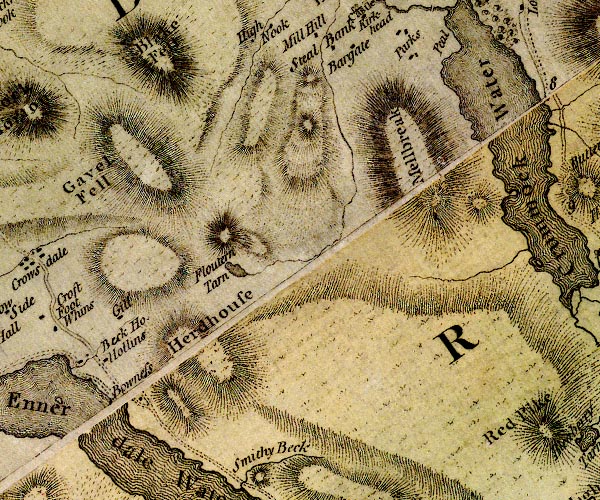
D4NY11NW.jpg Blake Fell -- hill -- fell -- NY11071970 -- 'Blake Fell' -- 'Blake Fell' -- hill hachuring; a hill or mountain Bowness -- building/s -- NY10781552 -- 'Bowness' -- block or blocks, labelled in lowercase; a hamlet or just a house Crummock Water -- lake -- NY15871867 (etc) -- 'Crummock Water' -- lake Floutern Tarn -- lake -- NY12461704 (etc) -- 'Floutern Tarn' -- lake Gavel Fell -- hill -- fell -- NY11621844 (etc) -- 'Gavel Fell' -- hill hachuring; a hill or mountain Gill -- building/s -- NY10641660 -- 'Gill' -- block or blocks, labelled in lowercase; a hamlet or just a house Herdus -- hill -- NY11601648 (etc) -- 'Herdhouse' -- hill hachuring; a hill or mountain Hollins -- building/s -- NY10901611 -- 'Hollins' -- block or blocks, labelled in lowercase; a hamlet or just a house Mellbreak -- hill -- NY14451905 (etc) -- 'Mellbreak' -- hill hachuring; a hill or mountain | ||
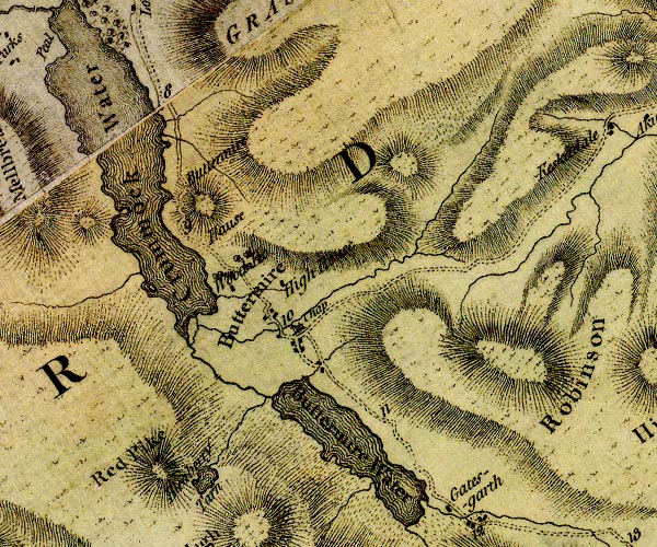
D4NY11NE.jpg Bleaberry Tarn -- lake -- NY16591544 (etc) ? ? -- 'Bleaberry Tarn' -- lake bridge, Buttermere -- bridge -- NY17491699 -- double line across a river; a bridge in Buttermere Buttermere Dubs -- river -- NY167166 (etc) -- single or double wiggly line; a river Buttermere Hause -- headland -- NY16281820 (etc) -- 'Buttermire Hause' -- hill hachuring; a hill or mountain Buttermere -- lake -- NY182158 -- 'Buttermire Water' -- lake Buttermere -- building/s -- locality -- NY175169 -- 'Buttermire' -- blocks, and usually a church, labelled in upright lowercase; a village and locality Cinderdale Beck -- river -- NY1619 -- single or double wiggly line; a river into Crummock Water Crummock Water -- lake -- NY15871867 (etc) -- 'Crummock Water' -- lake High House -- building/s -- NY17371743 -- 'High House' -- block or blocks, labelled in lowercase; a hamlet or just a house Mill Beck -- river -- NY16751728 -- single or double wiggly line; a river through Buttermere Rannerdale Beck -- river -- NY1618 (etc) -- single or double wiggly line; a river into Crummock Water Red Pike -- hill -- NY16051545 -- 'Red Pike' -- hill hachuring; a hill or mountain Borrowdale and Buttermere -- route -- road -- NY22Borrowdale and Buttermere -- route -- road -- NY22 -- double line, narrower, solid or dotted with a dot and number at 1 mile intervals; road -- to junction S of Seatoller Robinson -- hill -- NY20221692 (etc)7 -- 'Robinson' -- hill hachuring; a hill or mountain Scale Bridge -- bridge -- NY16791659 ? -- double line across a river; a bridge over Buttermere Dubs Sour Milk Gill -- river -- NY1615 (etc) -- single or double wiggly line; a river from Bleaberry Tarn St James's Church -- church -- NY17601703 -- 'Chap' -- church at Buttermere Wood House -- building/s -- NY16931744 -- 'Wood Ho.' -- block or blocks, labelled in lowercase; a hamlet or just a house | ||
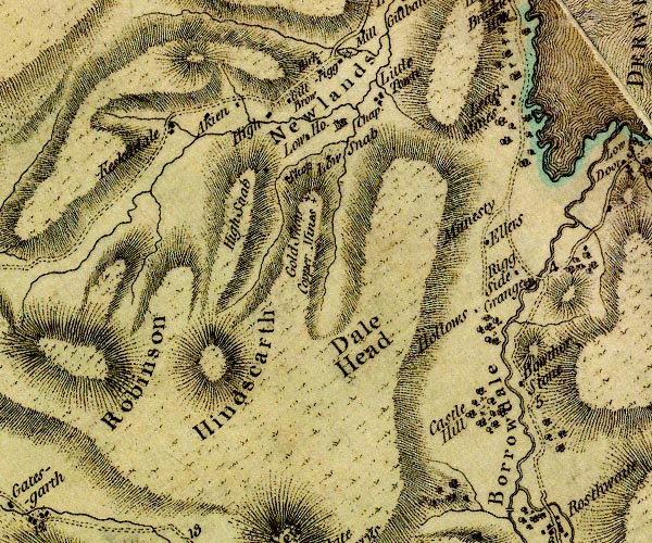
D4NY21NW.jpg Aikin -- building/s -- NY21461948 -- 'Akien' -- block or blocks, labelled in lowercase; a hamlet or just a house Bawd Hall -- building/s -- NY21881962 -- 'High' -- block or blocks, labelled in lowercase; a hamlet or just a house cf Low Ho. probably Birkrigg -- building/s -- NY22741991 -- 'Birkrigg' -- block or blocks, labelled in lowercase; a hamlet or just a house Borrowdale -- locality -- valley -- NY25611582 (etc etc) -- 'Borrowdale' -- area Bowder Stone -- stone -- glacial erratic (?) -- NY25391640 -- 'Bowthor Stone' -- a block on W of road Brandlehow Mine -- lead mine -- mine -- NY250196 -- 'Lead Mines' -- block or blocks, labelled in lowercase; a hamlet or just a house probably bridge, Keskadale -- bridge -- NY21011934 -- double line across a river; a bridge Castle Crag -- rocks -- NY24931592 -- 'Castle Hill' -- marked by woodland Dale Head -- hill -- NY22311532 (etc) -- 'Dale Head' -- hill hachuring; a hill or mountain Derwent, River -- river -- NY2515 (etc) -- 'Derwent River' -- 'Derwent River' -- single or double wiggly line; a river in and from Derwent Water; into the sea Ellers -- building/s -- NY24821792 -- 'Ellers' -- block or blocks, labelled in lowercase; a hamlet or just a house Gillbrow -- building/s -- NY22401954 -- 'Gill Brow' -- block or blocks, labelled in lowercase; a hamlet or just a house Goldscope Mine -- copper mine -- lead mine -- mine -- NY22771854 (etc) -- 'Gold Skop Copper Mines' -- 'Skop' -- crosses (+) -- block or blocks, W of the ridge Grange Bridge -- bridge -- NY25371747 & NY25421744 -- double line across a river; a bridge Grange -- locality -- building/s -- NY25281749 (etc) -- 'Grange' -- house High Snab -- building/s -- NY22181901 -- 'High Snab' -- block or blocks, labelled in lowercase; a hamlet or just a house Hindscarth -- hill -- NY215165 -- 'Hindscarth' -- hill hachuring; a hill or mountain Hollows Farm -- building/s -- NY24731712 ? -- 'Hollows' -- block or blocks, labelled in lowercase; a hamlet or just a house Ill Gill -- river -- NY2019 -- single or double wiggly line; a river Keskadale Beck -- river -- NY2119 ? -- single or double wiggly line; a river Keskadale Farm -- building/s -- NY21051928 -- 'Keskadale' -- block or blocks, labelled in lowercase; a hamlet or just a house Little Town -- locality -- building/s -- NY23441956 (etc) -- 'Little Town' -- block or blocks, labelled in lowercase; a hamlet or just a house Low House Farm -- building/s -- NY22721909 ? -- 'Low Ho.' -- block or blocks, labelled in lowercase; a hamlet or just a house Low Snab -- building/s -- NY22921865 -- 'Low Snab' -- block or blocks, labelled in lowercase; a hamlet or just a house Manesty -- building/s -- NY25031847 -- 'Manesty' -- no symbol Newlands Church -- chapel -- church -- school (ex) -- NY22991937 -- 'Chap' -- church Newlands Valley -- valley -- NY23052014 (etc etc) -- 'Newlands' -- area Rigg Beck -- river -- NY2220 -- single or double wiggly line; a river Rigg Side -- building/s -- NY25121754 -- 'Rigg Side' -- block or blocks, labelled in lowercase; a hamlet or just a house Scope Beck -- river -- NY2118 -- single or double wiggly line; a river | ||
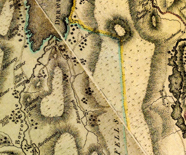
D4NY21NE.jpg Ashness -- locality -- NY27081923 (etc) -- 'Ashness' -- block or blocks, labelled in lowercase; a hamlet or just a house Borrowdale Fells -- hill -- fell -- NY25191202 (etc etc) -- 'BORROWDALE FELLS' -- hill hachuring; a hill or mountain bridge, Borrowdale -- bridge -- NY26772001 -- double line across a river; a bridge on main road over Barrow Beck Derwent Water -- lake etc -- NY260210 ? -- 'DERWENT WATER' -- lake Derwent, River -- river -- NY2515 (etc) -- 'Derwent River' -- 'Derwent River' -- single or double wiggly line; a river in and from Derwent Water; into the sea Lodore -- locality -- building/s -- NY26391889 (etc) -- 'Low Door' -- block or blocks, labelled in lowercase; a hamlet or just a house packhorse bridge, Watendlath -- packhorse bridge -- bridge -- NY27531633 -- double line across a river; a bridge at Watendlath Borrowdale and Buttermere -- route -- road -- NY22Borrowdale and Buttermere -- route -- road -- NY22 -- double line, narrower, solid or dotted with a dot and number at 1 mile intervals; road -- goes beyond Seathwaite to the foot of the Styhead pass Watendlath Beck -- river -- NY2717 (etc) -- single or double wiggly line; a river from Watendlath Tarn to Derwent Water Watendlath Tarn -- building/s -- NY275161 -- outline without form lines Watendlath -- locality -- building/s -- NY27601633 (etc) -- 'Watendlath' -- block or blocks, labelled in lowercase; a hamlet or just a house | ||
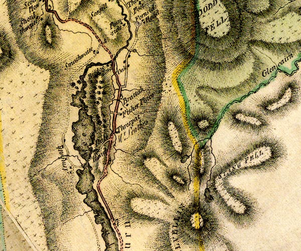
D4NY31NW.jpg Armboth -- locality -- NY305171 -- 'Armbath' -- block or blocks, labelled in lowercase; a hamlet or just a house Bridge End Farm -- building/s -- NY31431940 -- 'Bridge End' -- block or blocks, labelled in lowercase; a hamlet or just a house How Beck -- bridge -- NY31781887 -- double line across a river; a bridge bridge, Thirlspot -- bridge -- NY31671775 -- double line across a river; a bridge at Thirlspot Brotto -- building/s -- NY31851845 -- 'Brattah' -- block or blocks, labelled in lowercase; a hamlet or just a house Dalehead Hall -- building/s -- haunted house -- park (?) -- NY31371750 -- 'Dale Head / Mr. Leathes' -- house Fisher Gill -- river -- NY3016 (etc) -- single or double wiggly line; a river Fisher Place -- locality -- building/s -- NY31831841 (etc) -- 'Fisher Place' -- block or blocks, labelled in lowercase; a hamlet or just a house Fisherplace Gill -- river -- NY3218 -- single or double wiggly line; a river Glencoyne Beck -- river -- boundary -- county boundary -- NY38751881 ? -- 'Glencairn Beck' -- single or double wiggly line; a river and county boundary Glenridding Beck -- river -- NY35971603 (etc) ? -- single or double wiggly line; a river Great Dodd -- hill -- parish boundary mark -- NY34192056 (etc) -- 'DODD FELL' -- hill hachuring; a hill or mountain Helvellyn Gill -- river -- NY3117 -- single or double wiggly line; a river Helvellyn -- hill -- NY34241511 -- 'HELVELLIN' -- hill hachuring; hill or mountain, on county boundary How Beck -- river -- NY31651950 -- single or double wiggly line; a river Keppelcove Tarn -- lake (gone) -- NY34511650 (etc) -- lake Legburthwaite Mill -- building/s -- water mill (ex) -- mill (ex) -- corn mill (ex) -- NY31931976 -- circle with rays, mill wheel; a water mill Mill Gill -- river -- NY3219 -- single or double wiggly line; a river Oak House -- building/s -- NY31831948 -- 'Oak' -- block or blocks, labelled in lowercase; a hamlet or just a house Red Tarn Beck -- river -- NY3515 -- single or double wiggly line; a river Red Tarn -- lake -- NY34811525 (etc) -- lake N of Helvellyn Ambleside to Keswick -- road -- route -- NY30 -- 'Road from Kendal' -- double line, solid or dotted, with a dot or milestone and number at 1 mile intervals, tinted red; turnpike road -- into Westmorland Smaithwaite Bridge -- bridge -- NY31551955 -- double line across a river; a bridge at Bridge End Smaithwaite -- building/s -- NY31181968 ? -- 'Smathwaite' -- block or blocks, labelled in lowercase; a hamlet or just a house St John's Beck -- river -- NY3123 ? -- single or double wiggly line; a river into the Greta Stang -- NY35421756 (etc) -- 'STANG FELL' -- hill hachuring; a hill or mountain Sty Beck -- river -- NY3118 -- single or double wiggly line; a river Thirlmere -- lake -- NY32031423 (etc etc) ? -- 'Thurle Meer' -- lake Thirlspot -- locality -- building/s -- NY31681776 (etc) -- 'Threspat' -- block or blocks, labelled in lowercase; a hamlet or just a house Wath Bridge -- footbridge -- bridge -- NY310171 (guesses) -- track across Thirlmere | ||
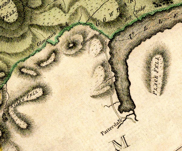
D4NY31NE.jpg Aira Beck -- river -- NY40001974 -- single or double wiggly line; a river Aira Bridge -- bridge -- NY40172003 -- 'Airy Bridge' -- double line across a river; a bridge Glencoyne Beck -- river -- boundary -- county boundary -- NY38751881 ? -- 'Glencairn Beck' -- single or double wiggly line; a river and county boundary Glencoyne -- building/s -- NY38451869 -- 'Glencairn' -- block or blocks, labelled in lowercase; a hamlet or just a house Glenridding Bridge -- bridge -- NY38691692 -- double line across a river; a bridge at Patterdale possibly Goldrill Bridge -- bridge -- NY39811582 ? -- double line across a river; a bridge Grisedale Bridge -- bridge -- NY39031614 -- double line across a river; a bridge possibly Patterdale -- locality -- building/s -- valley -- NY39411608 (etc) -- 'Patterdale' -- no symbol, labelled in upright lowercase as a village Place Fell -- hill -- NY40561696 (etc) -- 'PLACE FELL' -- hill hachuring; a hill or mountain Ullswater -- lake -- NY422202 (etc) ? -- 'ULLES WATER' -- 'ULLES WATER' -- lake; the county boundary Cumberland and Westmorland down the middle, but the map colourist has put it in Westmorland only | ||
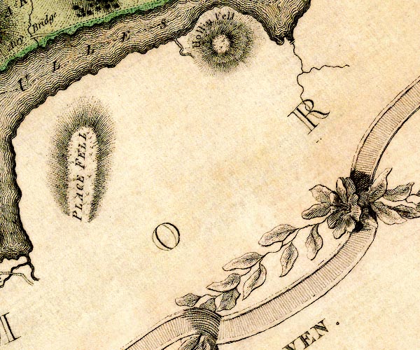
D4NY41NW.jpg | ||
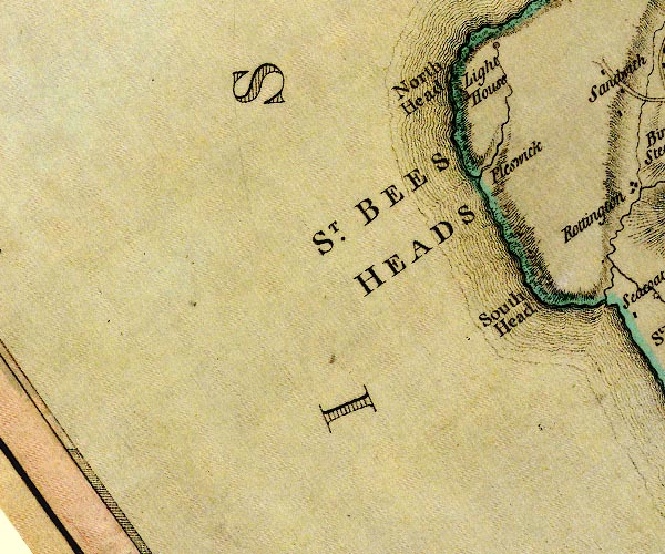
D4NX91SW.jpg Fleswick Bay -- bay -- beach -- coast -- geological site -- NX945133 -- 'Fleswick' -- no symbol Irish Sea -- sea area -- NY04 & NY03 & NX93 & NX92 & NX91 & NX90 & NY00 & SD09 & SD08 & SD18 & SD17 & SD16 & SD26 & SD36 -- 'THE IRISH SEA' -- sea area North Head -- headland -- geological site -- NX939145 (etc) -- 'North Head' -- headland South Head -- headland -- NX95191220 (etc) -- 'South Head' -- headland St Bees Head -- locality -- headland -- geological site -- NX95211337 (etc) -- 'ST. BEES HEADS' -- headland St Bees Lighthouse -- lighthouse -- NX94151437 -- 'Light House' -- lighthouse tower tarn, St Bees Head -- lake -- tarn -- NX95371520 -- lake on North Head probably | ||
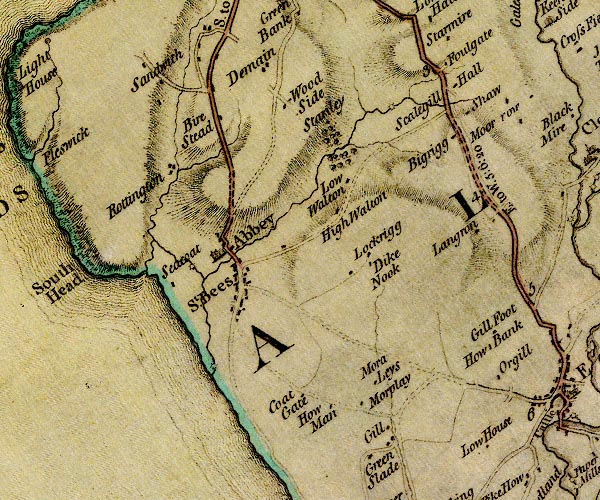
D4NX91SE.jpg Ashley Grove -- building/s -- NY000102 -- 'Low House' -- block or blocks, labelled in lowercase; a hamlet or just a house Beck Mill -- building/s -- water mill (ex) -- mill (ex) -- NX96551188 -- circle with rays, mill wheel; a water mill W of St Bees Bell House -- building/s -- NX97771426 -- 'Wood Side' -- block or blocks, labelled in lowercase; a hamlet or just a house possibly Bigrigg -- locality -- building/s -- NY00141304 (etc) -- 'Bigrigg' -- block or blocks, labelled in lowercase; a hamlet or just a house bridge, St Bees -- bridge -- NX96901349 -- double line across a river; a bridge S of Byerstead probably Byerstead -- building/s -- NX96841384 -- 'Bire Stead' -- block or blocks, labelled in lowercase; a hamlet or just a house Demesne -- building/s -- NX97331454 -- 'Demain' -- block or blocks, labelled in lowercase; a hamlet or just a house Dike Nook -- building/s -- NX98881205 (guess) -- 'Dike Nook' -- block or blocks, labelled in lowercase; a hamlet or just a house Foulyeat -- building/s -- NX99541472 -- 'Foulgate' -- block or blocks, labelled in lowercase; a hamlet or just a house Ghyll Cottage -- building/s -- NX98591013 -- 'Coat Gate' -- block or blocks, labelled in lowercase; a hamlet or just a house possibly Gill Cottage -- building/s -- NX98790994 -- 'Gill' -- block or blocks, labelled in lowercase; a hamlet or just a house Gillfoot -- building/s -- NY00321136 -- 'Gill Foot' -- block or blocks, labelled in lowercase; a hamlet or just a house High Walton -- building/s -- NX98301277 -- 'High Walton' -- block or blocks, labelled in lowercase; a hamlet or just a house How Bank -- building/s -- NY00261118 -- 'How Bank' -- block or blocks, labelled in lowercase; a hamlet or just a house Howman -- building/s -- NX98261021 -- 'How Man' -- block or blocks, labelled in lowercase; a hamlet or just a house Langhorn -- building/s -- NY00221255 -- 'Langron' -- block or blocks, labelled in lowercase; a hamlet or just a house Loughrigg -- building/s -- NX98651206 -- 'Lockrigg' -- block or blocks, labelled in lowercase; a hamlet or just a house Low Walton -- building/s -- NX98541312 -- 'Low Walton' -- block or blocks, labelled in lowercase; a hamlet or just a house mill, St Bees -- water mill -- mill -- NX98791392 (guess) -- circle with rays, mill wheel; a water mill on Scalegill Beck Moor Platt -- building/s -- NX98351045 -- 'Morplay' -- block or blocks, labelled in lowercase; a hamlet or just a house Moorleys Farm -- building/s -- NX98501054 -- 'Mora Leys' -- block or blocks, labelled in lowercase; a hamlet or just a house Needless Beck -- bridge -- NX9914 (etc) -- single or double wiggly line; a river Needless Bridge -- river -- boundary -- parish boundary -- NX99641417 -- double line across a river; a bridge nr Scalegill Hall Pow Beck -- river -- NX9712 (etc) -- single or double wiggly line; a river Pow Bridge -- bridge -- NX97011202 -- double line across a river; a bridge near St Bees Priory Egremont to Whitehaven -- route -- NY01 -- 'E. to W. 5:6:20' -- double line, solid or dotted, with a dot or milestone and number at 1 mile intervals, tinted red; turnpike road -- miles.furlongs.poles; Egremont to Whitehaven St Bees road -- road -- route -- NY00 -- 'S. to W. 4:1:32' -- double line, solid or dotted, tinted red; turnpike road -- miles.furlongs.poles; St Bees to Whitehaven Rottington Beck -- river -- boundary -- parish boundary -- NX9612 (etc) -- single or double wiggly line; a river Rottington -- locality -- building/s -- NX96231327 (etc) -- 'Rottington' -- block or blocks, labelled in lowercase; a hamlet or just a house Sandwith -- locality -- building/s -- NX96431476 (etc) -- 'Sandwith' -- block or blocks, labelled in lowercase; a hamlet or just a house Scalegill Beck -- river -- NX9813 (etc) -- single or double wiggly line; a river Scalegill Hall -- building/s -- NX99591439 -- 'Scalegill Hall' -- block or blocks, labelled in lowercase; a hamlet or just a house Sea Mill -- water mill -- mill -- NX96901089 -- circle with rays, mill wheel; a water mill Seacote Hotel -- hotel -- inn -- NX96251170 -- 'Seacoat' -- block or blocks, labelled in lowercase; a hamlet or just a house possibly Shaw -- building/s -- NX99791406 -- 'Shaw' -- block or blocks, labelled in lowercase; a hamlet or just a house St Bees -- locality -- building/s -- NX97111185 (etc) -- 'St. Bees' -- blocks, and usually a church, labelled in upright lowercase; a village St Mary and St Bega's Church -- church -- NX96871211 -- 'Abbey' -- church Stanley -- building/s -- NX98161401 -- 'Stanley' -- block or blocks, labelled in lowercase; a hamlet or just a house Thorney Beck -- river -- boundary -- parish boundary -- NX9713 (etc) -- single or double wiggly line; a river | ||
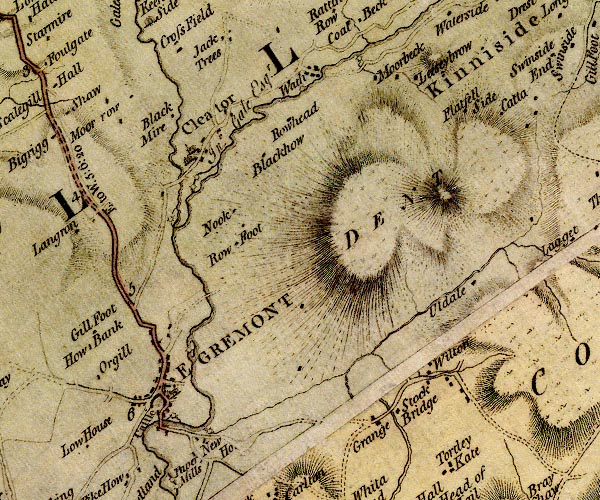
D4NY01SW.jpg Black How -- building/s -- NY02271336 -- 'Rowhead' -- block or blocks, labelled in lowercase; a hamlet or just a house Black Mire -- building/s -- NY01221420 (?) -- 'Black Mire' -- block or blocks, labelled in lowercase; a hamlet or just a house possibly bridge, Egremont -- bridge -- NY01101039 -- double line across a river; a bridge over the Ehen Cleator Forge -- forge -- NY01381308 -- circle with rays, mill wheel; a water mill at Cleator probably Cleator -- locality -- building/s -- NY01551350 (etc) -- 'Cleator' -- blocks, and usually a church, labelled in upright lowercase; a village Dent -- hill -- NY041128 -- 'DENT' -- hill hachuring; a hill or mountain Egremont Castle -- castle -- motte and bailey -- NY00981048 -- 'Castle' -- no symbol Egremont -- locality -- building/s etc -- NY01041062 (etc) -- 'EGREMONT' -- blocks, perhaps a church, labelled in block caps; a town with a street plan Ehen Hall -- building/s -- NY01451330 -- '/ Jno. Gale Esqr.' -- house at Cleator probably Ehen, River -- river -- NY0515 (etc) ? -- 'Ehen River' -- 'Ehen River' -- single or double wiggly line; a river out of Ennerdale Water, into the sea Flatfell End -- building/s -- NY04641415 -- 'Flatfell Side' -- block or blocks, labelled in lowercase; a hamlet or just a house possibly Grange -- building/s -- NY03181047 -- 'Grange' -- block or blocks, labelled in lowercase; a hamlet or just a house High Merebeck -- building/s -- NY03791447 -- 'Moorbeck' -- block or blocks, labelled in lowercase; a hamlet or just a house High Mill -- building/s -- water mill (ex) -- mill (ex) -- flax mill (ex) -- NY01281109 (?) -- circle with rays, mill wheel; a water mill NE of Egremont probably Keekle, River -- river -- boundary -- parish boundary -- NY0019 (etc) -- single or double wiggly line; a river into the Ehen Kinniside -- locality -- NY050155 (etc) -- 'Kinniside' -- area Lizza Brow -- building/s -- NY04341434 -- 'Leesey Brow' -- block or blocks, labelled in lowercase; a hamlet or just a house Low Keekle Bridge -- bridge -- NY01271311 -- double line across a river; a bridge over the Keekle Low Mill -- building/s -- water mill (ex) -- mill (ex) -- corn mill (ex) -- NY01471313 -- circle with rays, mill wheel; a water mill at Cleator mill, Egremont (2) -- water mill -- mill -- NY01521002 -- circle with rays, mill wheel; a water mill at New House mill, Egremont -- building/s -- water mill (ex) -- mill (ex) -- corn mill (ex) -- NY01111043 -- circle with rays, mill wheel; a water mill, Egremont mill, Wath -- building/s -- water mill (ex) -- mill (ex) -- corn mill (ex) -- NY03571472 (?) -- circle with rays, mill wheel; a water mill above Wath Moor Row -- locality -- building/s -- NY00561433 (etc) -- 'Moor Row' -- block or blocks, labelled in lowercase; a hamlet or just a house New House -- building/s -- NY01381007 -- 'New Ho.' -- block or blocks, labelled in lowercase; a hamlet or just a house Nook -- building/s -- NY01731262 -- 'Nook' -- block or blocks, labelled in lowercase; a hamlet or just a house Orgill -- locality -- NY003107 (etc) -- 'Orgill' -- block or blocks, labelled in lowercase; a hamlet or just a house Egremont to Whitehaven -- route -- NY01 -- 'E. to W. 5:6:20' -- double line, solid or dotted, with a dot or milestone and number at 1 mile intervals, tinted red; turnpike road -- miles.furlongs.poles; Egremont to Whitehaven Ravenglass to Egremont -- road -- route -- NY01 -- double line, narrower, solid or dotted with a dot and number at 1 mile intervals; road -- distances from Whitehaven Row Foot -- building/s -- NY01781231 -- 'Row Foot' -- block or blocks, labelled in lowercase; a hamlet or just a house Row -- building/s -- NY02021307 -- 'Blackhow' -- block or blocks, labelled in lowercase; a hamlet or just a house Stock Bridge -- bridge -- NY03521060 -- 'Stock Bridge' -- double line across a river; a bridge Stockbridge -- building/s -- NY03561065 -- 'Stock Bridge' -- block or blocks, labelled in lowercase; a hamlet or just a house Uldale Farm -- building/s -- NY04601224 -- 'Uldale' -- block or blocks, labelled in lowercase; a hamlet or just a house Wath -- locality -- building/s -- NY02771453 (etc) -- 'Wath' -- block or blocks, labelled in lowercase; a hamlet or just a house Wilton -- locality -- building/s -- NY03851106 (etc) -- 'Wilton' -- block or blocks, labelled in lowercase; a hamlet or just a house Woodend Mill -- building/s -- water mill (ex) -- mill (ex) -- corn mill (ex) -- NY01111266 -- circle with rays, mill wheel; a water mill on the Keekle probably | ||
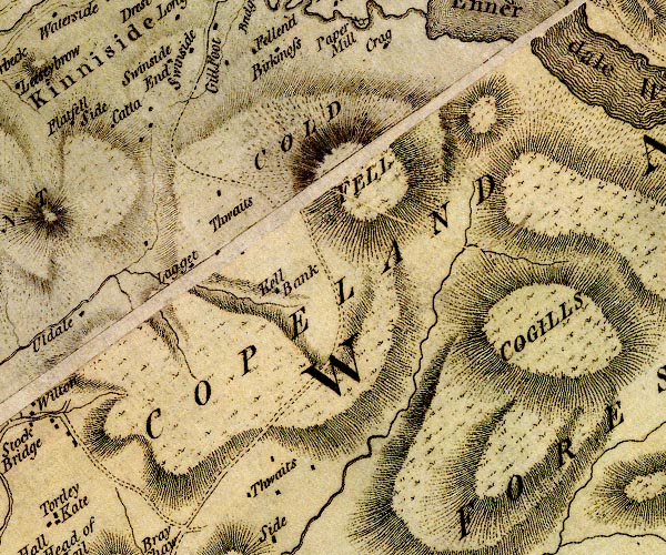
D4NY01SE.jpg Cathow -- building/s -- NY04681439 -- 'Catta' -- block or blocks, labelled in lowercase; a hamlet or just a house Caw Fell -- hill -- NY11521044 (etc) -- 'COGILLS' -- hill hachuring; a hill or mountain possibly Copeland Forest -- forest -- NY15460738 (etc etc) -- 'COPELAND FOREST' -- area Kell Bank -- building/s -- NY06461299 (guess) -- 'Kell Bank' -- block or blocks, labelled in lowercase; a hamlet or just a house Kinniside Common -- common -- NY08621191 (etc etc) -- 'COLD FELL' -- hill hachuring; a hill or mountain Lagget -- building/s -- NY05751262 -- 'Lagget' -- block or blocks, labelled in lowercase; a hamlet or just a house Near Thwaites -- locality -- NY06031289 (etc) -- 'Thwaits' -- block or blocks, labelled in lowercase; a hamlet or just a house Side -- building/s -- NY06250981 -- 'Side' -- block or blocks, labelled in lowercase; a hamlet or just a house Swinside End -- building/s -- NY05781475 -- 'Swinside End' -- block or blocks, labelled in lowercase; a hamlet or just a house Thwaites -- locality -- NY06191068 (etc) -- 'Thwaits' -- block or blocks, labelled in lowercase; a hamlet or just a house | ||
D4NY11SW.jpg Copeland Forest -- forest -- NY15460738 (etc etc) -- 'COPELAND FOREST' -- area Ennerdale Water -- lake -- NY106150 -- 'Ennerdale Water' -- 'ENNERDALE WATER' -- lake Gillerthwaite -- building/s -- NY13911410 -- 'Gillerthwaite' -- block or blocks, labelled in lowercase; a hamlet or just a house Liza, River -- river -- NY1613 (etc) -- 'Liza River' -- single or double wiggly line; a river Smithy Beck -- river -- NY1214 (etc) -- 'Smithy Beck' -- single or double wiggly line; a river Steeple -- hill -- NY15731167 -- 'Steeple' -- hill hachuring; a hill or mountain Woundell Beck -- river -- NY1313 (etc) -- single or double wiggly line; a river into the Liza | ||
D4NY11SE.jpg Fleetwith -- NY215133 -- 'Honistar Crag' -- hill hachuring; a hill or mountain Gatesgarth -- building/s -- locality -- NY19351503 -- 'Gatesgarth' -- block or blocks, labelled in lowercase; a hamlet or just a house Gatesgarthdale Beck -- river -- NY2014 -- single or double wiggly line; a river into Buttermere High Stile -- hill -- rocks -- NY16981479 (etc) -- 'High Stile' -- hill hachuring; a hill or mountain Pillar -- hill -- NY17121211 -- 'Pillar' -- hill hachuring; a hill or mountain Warnscale Beck -- river -- NY2013 (etc) -- single or double wiggly line; a river into Buttermere | ||
D4NY21SW.jpg Plumbago Mines -- black lead mine -- mine -- NY231127 (area) -- 'Black Lead or Wadd Mines' -- 2 circles Burthwaite Bridge -- bridge -- NY25451394 -- double line across a river; a bridge over Combe Gill Combe Gill -- river -- valley -- NY2512 (etc) -- single or double wiggly line; a river Grains Gill -- river -- valley -- NY2310 -- single or double wiggly line; a river Hause Gill -- river -- NY2313 -- single or double wiggly line; a river Honister Crag -- rocks -- NY21131421 (etc) -- 'Honistar Crag' -- hill hachuring; a hill or mountain Borrowdale and Buttermere -- route -- road -- NY22Borrowdale and Buttermere -- route -- road -- NY22 -- double line, narrower, solid or dotted with a dot and number at 1 mile intervals; road -- goes beyond Seathwaite to the foot of the Styhead pass -- double line, narrower, solid or dotted with a dot and number at 1 mile intervals; road -- to junction S of Seatoller Seathwaite Bridge -- bridge -- NY23951278 -- double line across a river; a bridge over the Derwent Seathwaite -- locality -- building/s -- NY23531217 (etc) -- 'Seathwaite' -- block or blocks, labelled in lowercase; a hamlet or just a house Seatoller Bridge -- bridge -- NY24571367 -- double line across a river; a bridge over Hause Gill Seatoller -- locality -- building/s -- NY24491378 (etc) -- 'Seatallor' -- block or blocks, labelled in lowercase; a hamlet or just a house Stonethwaite Beck -- river -- NY2614 -- single or double wiggly line; a river Strands Bridge -- bridge -- NY25061371 -- double line across a river; a bridge over the Derwent Styhead Gill -- river -- NY2210 -- single or double wiggly line; a river Yew Crag -- rocks -- NY22121455 (etc) -- 'Yew Crag' -- hill hachuring; a hill or mountain Yewcrag Quarries -- slate quarry (disused) -- quarry (disused) -- NY22351434 (etc) -- 'Slate Quarrys' -- no symbol | ||
D4NY21SE.jpg Borrowdale Fells -- hill -- fell -- NY25191202 (etc etc) -- 'BORROWDALE FELLS' -- hill hachuring; a hill or mountain Eagle Crag -- rocks -- NY27581216 (etc) -- 'Eagle Cragg' -- hill hachuring; a hill or mountain Greenup Gill -- river -- NY2712 (etc) -- single or double wiggly line; a river Langstrath Beck -- river -- NY2611 (etc) -- single or double wiggly line; a river New Bridge -- bridge -- NY25191510 -- double line across a river; a bridge over the Derwent probably Rosthwaite Bridge -- bridge -- NY25691511 -- double line across a river; a bridge over Stonethwaite Beck Rosthwaite -- locality -- building/s -- NY25851490 (etc) ? -- 'Rosthwaite' -- block or blocks, labelled in lowercase; a hamlet or just a house St Andrew's Church -- church -- NY25791399 -- 'Chapel' -- church Stonethwaite -- locality -- building/s -- NY26241374 (etc) -- 'Stonethwaite' -- block or blocks, labelled in lowercase; a hamlet or just a house | ||
D4NY31SW.jpg Birkside Gill -- river -- NY32541244 (etc) -- single or double wiggly line; a river into the Wyth Burn Cherry Tree Inn -- building/s -- inn -- NY322142 (approx) -- 'Cherrytree' -- inn City -- building/s -- NY319142 (approx) -- 'City' -- block or blocks, labelled in lowercase; a hamlet or just a house Comb Gill -- river -- boundary -- parish boundary -- NY1118 (etc) -- single or double wiggly line; a river into the Wyth Burn Dunmail Raise Stones -- cairn -- burial mound -- NY32721172 -- 'Dunmelraise Stones' -- on county boundary Helvellyn -- hill -- NY34241511 -- 'HELVELLIN' -- hill hachuring; hill or mountain, on county boundary Hollin Brow -- building/s -- NY323137 -- 'Brow' -- block or blocks, labelled in lowercase; a hamlet or just a house Homesdale Green Bridge -- bridge (on old road) -- NY32581244 -- double line across a river; a bridge Nook -- barn -- NY31921293 -- 'Nook' -- block or blocks, labelled in lowercase; a hamlet or just a house Quey Fold -- building/s -- NY32391259 (guess) -- 'Quey Fold' -- block or blocks, labelled in lowercase; a hamlet or just a house Raise Beck -- river -- boundary -- county boundary (once) -- parish boundary -- NY3211 (etc) -- single or double wiggly line; a river on county boundary Raise Bridge -- bridge -- NY32771159 -- double line across a river; a bridge Ambleside to Keswick -- road -- route -- NY30 -- 'Road from Kendal' -- double line, solid or dotted, with a dot or milestone and number at 1 mile intervals, tinted red; turnpike road -- into Westmorland Steel End -- building/s -- post office (?)(ex) -- NY32221278 -- 'Steal End' -- block or blocks, labelled in lowercase; a hamlet or just a house Stenkin -- building/s -- NY31971313 -- 'Stenkin' -- block or blocks, labelled in lowercase; a hamlet or just a house Stenock -- building/s -- NY31871382 (?) ? -- 'Stanwick' -- block or blocks, labelled in lowercase; a hamlet or just a house probably Thirlmere -- lake -- NY32031423 (etc etc) ? -- 'Thurle Meer' -- lake Waterhead -- building/s -- NY321147 (approx) -- 'Waterhead' -- block or blocks, labelled in lowercase; a hamlet or just a house West Head -- building/s -- NY31841334 -- 'Wasthead' -- block or blocks, labelled in lowercase; a hamlet or just a house Whelpside Gill -- river -- NY3213 (etc) -- single or double wiggly line; a river into the Wyth Burn Wyth Burn -- river -- NY3112 (etc) -- single or double wiggly line; a river into Thirlmere Wythburn Chapel -- church -- chapel -- NY32431358 -- 'Chapel' -- church Wythburn -- locality -- building/s -- NY32481292 (etc) -- 'Withburn' -- area | ||
D4NX90NE.jpg Black Ling -- building/s -- NX99840949 -- 'Blacking' -- block or blocks, labelled in lowercase; a hamlet or just a house Catgill Hall -- building/s -- NY00250918 -- 'Catgill' -- house and an avenue of trees Coulderton -- locality -- building/s -- NX98520899 (etc) -- 'Upper Town' -- block or blocks, labelled in lowercase; a hamlet or just a house Ellergill Beck -- river -- boundary -- parish boundary -- NX9907 (etc) -- single or double wiggly line; a river into the sea at Snab Bank Greenslade -- building/s -- NX98760978 -- 'Green Slade' -- block or blocks, labelled in lowercase; a hamlet or just a house Lop Bank -- locality -- NX99490751 -- 'Snab Bank' -- no symbol possibly Middletown -- locality -- building/s -- NX99210876 (etc) -- 'Middle Town' -- block or blocks, labelled in lowercase; a hamlet or just a house Nethertown -- locality -- building/s -- NX99060755 (etc) -- 'Nether Town / Miss Gale' -- no symbol Picket How -- building/s -- NY00510971 -- 'Pike How' -- block or blocks, labelled in lowercase; a hamlet or just a house (or next square) Snellings -- building/s -- NX99580886 -- 'Snillings' -- block or blocks, labelled in lowercase; a hamlet or just a house | ||
D4NY00NW.jpg Beckermet -- locality -- building/s -- NY01900667 (etc) -- 'Beckermouth' -- blocks, and usually a church, labelled in upright lowercase; a village Black Beck -- river -- booundary -- parish boundary -- NY0211 (etc) -- single or double wiggly line; a river into Kirk Beck Blackbeck Bridge -- bridge -- NY02770693 -- double line across a river; a bridge at Blackbeck Blackbeck -- locality -- building/s -- NY02800697 (etc) -- 'Black Beck' -- block or blocks, labelled in lowercase; a hamlet or just a house Braystones Tarn -- tarn -- lake -- NY00420602 (etc) -- lake at Bray Stones Braystones -- locality -- building/s -- NY00680603 (etc) -- 'Bray Stones' -- house and buildings bridge, Beckermet -- bridge -- NY01920667 -- double line across a river; a bridge at Beckermet Calder Bridge -- bridge -- NY04220598 ? -- double line across a river; a bridge Calder Bridge -- locality -- building/s -- NY04170600 (etc) ? -- 'Calder Br.' -- block or blocks, labelled in lowercase; a hamlet or just a house Carleton -- locality -- building/s -- NY01800946 (etc) -- 'Carlton' -- block or blocks, labelled in lowercase; a hamlet or just a house Catgill Summer House -- summer house -- NY00420891 -- tower nr Catgill Church Bridge -- bridge -- NY03010888 -- double line across a river; a bridge near Haile Haile Parish Church -- church -- NY03040881 -- church at Hail Dixon Hill -- building/s -- NY03620703 -- 'Moor H.' -- block or blocks, labelled in lowercase; a hamlet or just a house Ehen, River -- river -- NY0515 (etc) ? -- 'Ehen River' -- 'Ehen River' -- single or double wiggly line; a river out of Ennerdale Water, into the sea Ennerdale Mill -- water mill -- mill -- NY01220988 -- circle with rays, mill wheel; two water mills Haile Hall -- building/s -- NY03570914 -- 'Hail Hall / Ponsonby Esqr.' -- house Haile -- locality -- building/s -- NY03380864 (etc) -- 'Hail' -- blocks, and usually a church, labelled in upright lowercase; a village Head of Haile -- NY04080917 (?) -- 'Head of Hail' -- block or blocks, labelled in lowercase; a hamlet or just a house High Godderthwaite -- building/s -- NY03440652 -- 'Godderthwaite' -- block or blocks, labelled in lowercase; a hamlet or just a house Kersey Bridge -- bridge -- NY00700835 -- double line across a river; a bridge over the Ehen Kirk Beck -- river -- boundary -- parish boundary -- NY0106 (?) -- single or double wiggly line; a river into the Ehen Low Ehenside -- building/s -- NY00650692 -- 'Ehen Side' -- block or blocks, labelled in lowercase; a hamlet or just a house Low Godderthwaite -- building/s -- NY03270682 -- 'Godderthwaite' -- block or blocks, labelled in lowercase; a hamlet or just a house Low Mill -- building/s -- water mill (ex) -- mill (ex) -- NY00690862 -- circle with rays, mill wheel; a water mill Middle Ehenside -- building/s -- NY00840716 -- 'Ehen Side' -- block or blocks, labelled in lowercase; a hamlet or just a house Mill Farm -- building/s -- water mill (ex) -- mill (ex) -- corn mill (ex) -- NY02120695 -- circle with rays, mill wheel; a water mill at Beckermet mill, Beckermet -- water mill -- mill -- NY01160673 (guess) -- circle with rays, mill wheel; a water mill W of St John's mill, Calder Bridge -- building/s -- water mill (ex) -- mill (ex) -- corn mill (ex) -- NY04210608 -- circle with rays, mill wheel; a water mill at Calder Bridge Moadland Parks -- locality (?) -- NY00840940 (guess) -- 'Moadland Parks' -- block or blocks, labelled in lowercase; a hamlet or just a house Moor House -- building/s -- NY03980707 -- 'Dixon Hill' -- block or blocks, labelled in lowercase; a hamlet or just a house Parkhead Inn -- inn -- NY01390930 -- 'Park Head' -- block or blocks, labelled in lowercase; a hamlet or just a house Parsonage, The -- building/s -- NY03350873 -- 'Parsonage' -- block or blocks, labelled in lowercase; a hamlet or just a house Petersburgh -- building/s -- NY02170590 -- 'Petersborough' -- block or blocks, labelled in lowercase; a hamlet or just a house Ponsonby -- locality -- building/s -- NY05440566 (etc) -- 'Ponsonby' -- area and church Ravenglass to Egremont -- road -- route -- NY01 -- double line, narrower, solid or dotted with a dot and number at 1 mile intervals; road -- distances from Whitehaven Rothersyke House -- building/s -- NY00420861 -- 'Roder Sike' -- block or blocks, labelled in lowercase; a hamlet or just a house Rothersyke -- building/s -- NY00350844 -- 'Roder Sike' -- block or blocks, labelled in lowercase; a hamlet or just a house Sella Park House -- building/s -- park (once) etc -- NY03390545 -- 'Sella Park' -- block or blocks, labelled in lowercase; a hamlet or just a house St Bridget's Church -- church -- NY01500607 ? -- 'St. Bridgets' -- church St Bridget's Church -- church -- NY04200560 -- church at Ponsonby St John's Church -- church -- NY01870671 -- 'St. Johns' -- church Stephney -- building/s -- NY03980666 -- 'Stephney' -- block or blocks, labelled in lowercase; a hamlet or just a house Street Bridge -- bridge -- NY02410713 -- double line across a river; a bridge near Blackbeck Tortolocate -- building/s -- NY04240966 -- 'Tortley Kate' -- block or blocks, labelled in lowercase; a hamlet or just a house Town End -- building/s -- NY03260823 -- 'Hole of Hail' -- block or blocks, labelled in lowercase; a hamlet or just a house possibly Whitehow Head -- building/s -- NY03100954 -- 'Whita Head' -- block or blocks, labelled in lowercase; a hamlet or just a house Winscales -- building/s -- NY02330906 -- 'Windscales' -- block or blocks, labelled in lowercase; a hamlet or just a house Wodow Bank -- building/s -- NY00880809 -- 'Wada Bank' -- block or blocks, labelled in lowercase; a hamlet or just a house Yeorton -- building/s -- NY02650778 -- 'Yarton' -- house and avenue of trees | ||
D4NY00NE.jpg Beckcote -- building/s -- NY05290789 -- 'Beck Coat' -- block or blocks, labelled in lowercase; a hamlet or just a house Birrel Sike -- river -- boundary -- parish boundary -- NY0606 (etc) -- single or double wiggly line; a river into the Calder Bleng Fell -- hill -- fell -- NY07460551 (etc) -- 'BLAING AND PONSONBY FELLS' -- hill hachuring; a hill or mountain Bleng Tongue -- locality -- NY09200720 -- 'Blaing Tongue' -- block or blocks, labelled in lowercase; a hamlet or just a house Bleng, River -- river -- NY1108 -- 'Bleng River' -- single or double wiggly line; a river into the Irt Brayshaw -- building/s -- NY04750922 -- 'Bray Shaw' -- block or blocks, labelled in lowercase; a hamlet or just a house Calder Abbey -- abbey -- religious house -- NY05200647 -- 'Calder Abbey / Senhouse Esq.' -- house and church earthwork, Ponsonby -- earthwork -- pele tower -- tower -- NY06050612 -- 'Camp' -- square within a square; roman fort Farmery -- building/s -- NY07530713 -- 'Farmary' -- block or blocks, labelled in lowercase; a hamlet or just a house Fell Side -- building/s -- NY06890654 -- 'Fell Side' -- block or blocks, labelled in lowercase; a hamlet or just a house High Beck Cote -- building/s -- NY05300792 -- 'Beck Coat' -- block or blocks, labelled in lowercase; a hamlet or just a house High Broad Leys -- building/s -- NY04490763 -- 'Brad Leys' -- block or blocks, labelled in lowercase; a hamlet or just a house High Prior Scales -- building/s -- NY06270743 -- 'Prior Scale' -- block or blocks, labelled in lowercase; a hamlet or just a house Hurlbarrow -- building/s -- NY07110570 -- 'Hurrel Barrow / Wilkinson Esqr.' -- house ? Low Broad Leys -- building/s -- NY04130760 -- 'Brad Leys' -- block or blocks, labelled in lowercase; a hamlet or just a house Low Prior Scales -- building/s -- NY05960726 -- 'Prior Scale' -- block or blocks, labelled in lowercase; a hamlet or just a house Lowcray -- building/s -- NY08150590 -- 'Lockeay' -- block or blocks, labelled in lowercase; a hamlet or just a house Ponsonby Fell -- hill -- fell -- NY08480729 (etc) -- 'BLAING AND PONSONBY FELLS' -- hill hachuring; a hill or mountain Priorling -- building/s -- NY05860682 -- 'Pear Ling' -- block or blocks, labelled in lowercase; a hamlet or just a house Scalderskew Beck -- river -- boundary -- parish boundary -- NY0807 (etc) -- single or double wiggly line; a river into the Calder Scalderskew -- building/s -- NY08650776 -- 'Scalderskew' -- block or blocks, labelled in lowercase; a hamlet or just a house Strudda Bank -- building/s -- NY05930815 -- 'Struda Bank' -- block or blocks, labelled in lowercase; a hamlet or just a house Thornholme -- building/s -- NY06760888 -- 'Thorn Holm' -- block or blocks, labelled in lowercase; a hamlet or just a house Worm Gill -- river -- boundary -- parish boundary -- NY0809 -- single or double wiggly line; a river into the Calder | ||
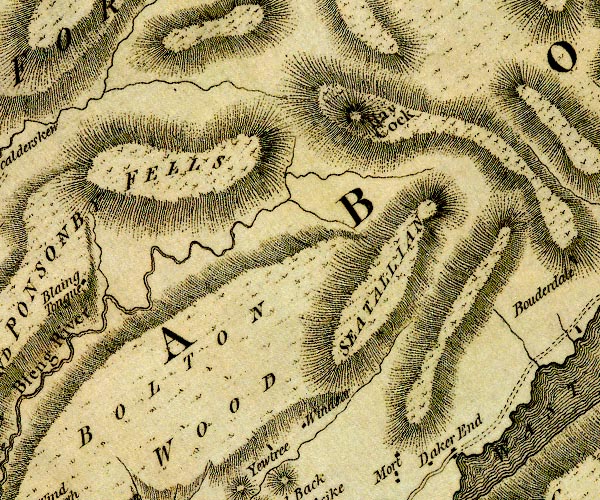
D4NY10NW.jpg Bleng Fell -- hill -- fell -- NY07460551 (etc) -- 'BLAING AND PONSONBY FELLS' -- hill hachuring; a hill or mountain Bolton Wood -- wood -- NY10680486 (etc) -- 'BOLTON WOOD' -- hill hachuring; a hill or mountain Haycock -- hill -- NY14471071 -- 'Hay Cock' -- hill hachuring; a hill or mountain Ponsonby Fell -- hill -- fell -- NY08480729 (etc) -- 'BLAING AND PONSONBY FELLS' -- hill hachuring; a hill or mountain Seatallan -- hill -- NY13960841 -- 'SEATALLAN' -- hill hachuring; a hill or mountain Windsor Farm -- building/s -- NY12090570 -- 'Windsor' -- block or blocks, labelled in lowercase; a hamlet or just a house Yew Tree -- building/s -- NY11770546 -- 'Yewtree' -- block or blocks, labelled in lowercase; a hamlet or just a house | ||
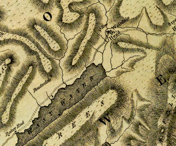
D4NY10NE.jpg Bowderdale -- building/s -- locality -- NY16480709 -- 'Bouderdale' -- block or blocks, labelled in lowercase; a hamlet or just a house Lingmell Beck -- river -- NY1908 (etc) ? -- single or double wiggly line; a river perhaps Lingmell Gill -- river -- NY1907 (etc) -- single or double wiggly line; a river perhaps Mosedale Beck -- river -- NY1808 (etc) -- single or double wiggly line; a river perhaps Over Beck -- river -- NY1608 -- single or double wiggly line; a river perhaps Screes, The -- scree -- NY15520453 (etc) -- 'SCREES' -- hill hachuring; a hill or mountain Wasdale Head -- locality -- building/s -- NY18670872 (etc) -- 'Wastdale Head' -- 'Row' -- blocks, and usually a church, labelled in upright lowercase; a village -- block or blocks, labelled in lowercase; a hamlet or just a house Wast Water -- lake -- NY161059 -- 'WAST WATER' -- lake | ||
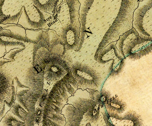
D4NY20NW.jpg Bow Fell -- hill -- fell -- boundary mark -- county boundary mark -- NY24470647 (etc) -- 'BOW FELL' -- hill hachuring; hill or mountain, on county boundary Sca Fell -- hill -- NY20680651 (?) -- 'SCA FELL' -- hill hachuring; a hill or mountain Sty Head -- pass -- NY21910951 (etc) -- 'Stye Head' -- area Styhead Tarn -- lake -- NY22170986 (etc) -- 'Sparkling Tarn' -- lake | ||
D4NY20NE.jpg | ||
D4NY00SW.jpg Bleawath -- building/s -- NY05530257 -- 'Blea Wath' -- block or blocks, labelled in lowercase; a hamlet or just a house Calder Foot -- river mouth -- NY02420269 -- 'Calderfoot' -- estuary of the Calder Calder Hall -- building/s -- NY03420378 -- 'Calder Hall' -- block or blocks, labelled in lowercase; a hamlet or just a house Calder -- building/s -- NY03920348 -- 'Calder' -- block or blocks, labelled in lowercase; a hamlet or just a house Calder, River -- river -- boundary -- parish boundary -- NY0712 (etc) ? -- 'Calder River' -- single or double wiggly line; a river, into the sea Ehen Foot -- river mouth -- NY02370282 -- 'Ehenfoot' -- estuary of the Ehen Ehen, River -- river -- NY0515 (etc) ? -- 'Ehen River' -- 'Ehen River' -- single or double wiggly line; a river out of Ennerdale Water, into the sea Newmill Beck -- river -- boundary -- parish boundary -- NY0403 (etc) -- single or double wiggly line; a river into the Calder probably Seascale Hall -- building/s -- NY03920285 -- 'Seascale Hall / Calder Esqr.' -- house Seascale How -- building/s -- NY03680219 -- 'Seascale How' -- block or blocks, labelled in lowercase; a hamlet or just a house Seascale -- locality -- building/s -- NY03760110 (etc) -- 'Seascales' -- block or blocks, labelled in lowercase; a hamlet or just a house Sellafield Tarn -- lake -- tarn -- NY022042 (etc) -- 'Tarn' -- lake Sellafield -- locality -- NY028040 (etc) -- 'Sella Field' -- block or blocks, labelled in lowercase; a hamlet or just a house Warborough Nook -- locality -- NY00780524 -- 'Waborough Nook' -- bay or headland? Whitriggs -- building/s -- NY04290066 -- 'Whitricks' -- block or blocks, labelled in lowercase; a hamlet or just a house Yottenfews -- building/s -- locality -- NY03200508 -- 'Yotton Fuse' -- block or blocks, labelled in lowercase; a hamlet or just a house | ||
D4NY00SE.jpg Addy House -- building/s -- NY07150076 -- 'Oddy Ho.' -- block or blocks, labelled in lowercase; a hamlet or just a house Bank House Farm -- building/s -- NY07700448 -- 'Bank Ho' -- block or blocks, labelled in lowercase; a hamlet or just a house Bleng Bridge -- bridge -- NY08430294 -- double line across a river; a bridge over the Bleng Bleng Fell -- hill -- fell -- NY07460551 (etc) -- 'BLAING AND PONSONBY FELLS' -- hill hachuring; a hill or mountain Blengdale -- building/s -- NY08530557 -- 'Blaingdale' -- block or blocks, labelled in lowercase; a hamlet or just a house Blengfell Gate -- building/s -- NY07100488 -- 'Blaing Fellgate' -- block or blocks, labelled in lowercase; a hamlet or just a house Bolt How -- building/s -- NY07490092 -- 'Bought How' -- block or blocks, labelled in lowercase; a hamlet or just a house Bolton Hall -- building/s -- NY08690260 -- 'Hall' -- block or blocks, labelled in lowercase; a hamlet or just a house Bolton Head -- building/s -- NY08790394 -- 'Boulton End' -- block or blocks, labelled in lowercase; a hamlet or just a house Boulton -- building/s -- NY09020341 (guess) -- 'Boulton' -- block or blocks, labelled in lowercase; a hamlet or just a house Bow Bridge -- inn (once) -- NY06990282 -- 'Bow Bridge' -- block or blocks, labelled in lowercase; a hamlet or just a house Bridge Petton -- building/s -- NY07020297 -- 'Bridge Pitten' -- block or blocks, labelled in lowercase; a hamlet or just a house bridge, Gosforth -- bridge -- NY06990292 -- double line across a river; a bridge at Bow Bridge bridge, New Mill -- bridge -- NY05190478 -- double line across a river; a bridge Broom Farm -- building/s -- NY06210271 -- 'Broom' -- block or blocks, labelled in lowercase; a hamlet or just a house Brownbank -- building/s -- NY05020236 -- 'Brown Bank' -- block or blocks, labelled in lowercase; a hamlet or just a house Gosforth -- locality -- building/s -- NY06830354 (etc) -- 'Gos[f]orth' -- blocks, and usually a church, labelled in upright lowercase; a village Hall Bolton -- building/s -- NY08950312 -- 'Hall Boulton' -- block or blocks, labelled in lowercase; a hamlet or just a house Hallsenna -- building/s -- locality -- NY06340116 -- 'Hall Sina' -- block or blocks, labelled in lowercase; a hamlet or just a house Hare Beck -- river -- NY0802 (etc) -- single or double wiggly line; a river into the Bleng at Hall Boulton Hewrigg Farm -- building/s -- NY08340106 -- 'Hewrigg' -- block or blocks, labelled in lowercase; a hamlet or just a house High Boonwood -- building/s -- NY06940447 -- 'Bone Wood' -- block or blocks, labelled in lowercase; a hamlet or just a house High House -- building/s -- NY08170056 -- 'High House' -- block or blocks, labelled in lowercase; a hamlet or just a house High Lingbank -- building/s -- NY05130449 -- 'Ling Bank' -- block or blocks, labelled in lowercase; a hamlet or just a house High Mill -- building/s -- water mill (ex) -- mill (ex) -- corn mill (ex) -- NY07990430 -- 'Mill' -- circle with rays, mill wheel; a water mill Julian Holme -- building/s -- NY09390337 -- 'Gilling Holm' -- block or blocks, labelled in lowercase; a hamlet or just a house King Camp -- roman fort (?) -- NY08960281 (guess) -- 'King Camp' -- square within a square; roman fort Little Lingbank -- building/s -- NY04840483 -- 'Cod Beck' -- block or blocks, labelled in lowercase; a hamlet or just a house possibly Longlands -- building/s -- NY05670407 -- 'Lang lands' -- block or blocks, labelled in lowercase; a hamlet or just a house Low Boonwood -- building/s -- NY06380446 -- 'Bone Wood' -- block or blocks, labelled in lowercase; a hamlet or just a house Low Lane -- building/s -- NY09220377 -- 'Low Lane' -- block or blocks, labelled in lowercase; a hamlet or just a house Meolbank -- building/s -- NY08060249 -- 'Scot Hall' -- block or blocks, labelled in lowercase; a hamlet or just a house possibly Middle Boonwood -- building/s -- NY06500444 -- 'Bone Wood' -- block or blocks, labelled in lowercase; a hamlet or just a house mill, New Mill -- building/s -- water mill (ex) -- mill (ex) -- corn mill (ex) -- NY05210481 (?) -- circle with rays, mill wheel; a water mill Moorside Farm -- building/s -- NY06540297 -- 'Moor Side' -- block or blocks, labelled in lowercase; a hamlet or just a house Moss Side -- building/s -- NY06380209 -- 'Moss Side' -- block or blocks, labelled in lowercase; a hamlet or just a house Newton Manor -- building/s -- NY04920395 -- 'Low Ling Bank' -- block or blocks, labelled in lowercase; a hamlet or just a house Newton -- building/s -- NY05510291 -- 'Newtown' -- block or blocks, labelled in lowercase; a hamlet or just a house Parknook -- building/s -- NY08100322 -- 'Park Nook' -- block or blocks, labelled in lowercase; a hamlet or just a house Peel Place -- building/s -- NY07110118 -- 'Peel Place' -- block or blocks, labelled in lowercase; a hamlet or just a house Peter Hill -- building/s -- NY06080190 (estimate) -- 'Peter Hill' -- block or blocks, labelled in lowercase; a hamlet or just a house Ponsonby Fell -- hill -- fell -- NY08480729 (etc) -- 'BLAING AND PONSONBY FELLS' -- hill hachuring; a hill or mountain Ponsonby Old Hall -- building/s -- NY05630506 -- '/ Stanley Esqr.' -- house Rainors -- building/s -- NY09110389 -- 'Reynold Close' -- block or blocks, labelled in lowercase; a hamlet or just a house Ravenglass to Egremont -- road -- route -- NY01 -- double line, narrower, solid or dotted with a dot and number at 1 mile intervals; road -- distances from Whitehaven Rowend Bridge -- bridge -- NY07780330 -- double line across a river; a bridge over the Bleng Sally Hill -- building/s -- NY05500460 -- 'Sally Hill' -- block or blocks, labelled in lowercase; a hamlet or just a house High School -- school -- NY06420369 -- 'School' -- block or blocks, labelled in lowercase; a hamlet or just a house Scot Hall -- building/s -- NY08480235 -- 'Cross' -- block or blocks, labelled in lowercase; a hamlet or just a house possibly Silver How -- building/s -- NY05690174 -- 'Silver How' -- block or blocks, labelled in lowercase; a hamlet or just a house Snowder -- building/s -- NY07850143 -- 'Snowder' -- block or blocks, labelled in lowercase; a hamlet or just a house Souly How -- building/s -- NY06710500 -- 'Souby How' -- block or blocks, labelled in lowercase; a hamlet or just a house Sowermyrr -- building/s -- NY08460401 -- 'Sour Mire' -- block or blocks, labelled in lowercase; a hamlet or just a house Stony How -- building/s -- NY05300032 -- 'Stoney Hall' -- block or blocks, labelled in lowercase; a hamlet or just a house Tarn How -- building/s -- NY06130241 -- 'Tarn How' -- block or blocks, labelled in lowercase; a hamlet or just a house Walk Mill -- building/s -- water mill (ex) -- mill (ex) -- corn mill (ex) -- sawmill (ex) -- NY07800386 -- circle with rays, mill wheel; a water mill Wellington Bridge -- bridge -- NY07950402 -- double line across a river; a bridge over the Bleng Whin Garth -- locality -- NY09110531 (etc) -- 'Wind Garth' -- block or blocks, labelled in lowercase; a hamlet or just a house Whinnerah -- building/s -- NY08150528 -- 'High Ho' -- block or blocks, labelled in lowercase; a hamlet or just a house possibly | ||
D4NY10SW.jpg Ain House -- building/s -- NY12480145 -- 'White Annis' -- block or blocks, labelled in lowercase; a hamlet or just a house Bengarth -- building/s -- NY11140462 -- 'Bengarth' -- block or blocks, labelled in lowercase; a hamlet or just a house Bitt -- building/s -- NY10180167 -- 'New House' -- block or blocks, labelled in lowercase; a hamlet or just a house possibly Bleng, River -- river -- NY1108 -- 'Bleng River' -- single or double wiggly line; a river into the Irt Bowerhouse Bridge -- bridge -- NY13190027 -- double line across a river; a bridge over the Mite at Lowkay Hall Burnt House -- building/s -- NY11910309 -- 'Bu[rnt] Ho.' -- block or blocks, labelled in lowercase; a hamlet or just a house Cubben -- building/s -- NY13050115 -- 'Cubbam' -- block or blocks, labelled in lowercase; a hamlet or just a house Dirt Hole -- building/s -- NY09380383 -- 'Dirt Hole' -- block or blocks, labelled in lowercase; a hamlet or just a house Easthwaite -- building/s -- NY13710344 -- 'Eastead' -- block or blocks, labelled in lowercase; a hamlet or just a house Foulsyke -- building/s -- NY12180436 -- 'Foulsike' -- block or blocks, labelled in lowercase; a hamlet or just a house Gill House -- building/s -- NY11570225 -- 'Gill Ho.' -- block or blocks, labelled in lowercase; a hamlet or just a house Greengate -- building/s -- NY11180210 (estimate) -- 'Green Gate' -- block or blocks, labelled in lowercase; a hamlet or just a house Hanging How -- building/s -- NY10110238 (guess) -- 'Hanging How' -- block or blocks, labelled in lowercase; a hamlet or just a house Hawkbarrow Farm -- building/s -- NY09940404 -- 'Green Ho.' -- block or blocks, labelled in lowercase; a hamlet or just a house High Keyhow, Irton with Santon -- building/s -- NY13340112 (guess) -- 'Highkay Hall' -- block or blocks, labelled in lowercase; a hamlet or just a house High Thistleton -- building/s -- NY09820469 -- 'Thistleton' -- block or blocks, labelled in lowercase; a hamlet or just a house Hunter How, Gosforth -- building/s -- NY11110435 (guess) -- 'Hunter How' -- block or blocks, labelled in lowercase; a hamlet or just a house possibly Irt, River -- river -- boundary -- parish boundary -- NY1002 (etc) ? -- 'Irt River' -- single or double wiggly line; a river into the sea; estuary Irton Hall -- building/s -- NY10540056 -- 'Irton / Geo. Irton Esqr.' -- house Keyhow -- building/s -- NY13240029 -- 'Lowkay Hall' -- block or blocks, labelled in lowercase; a hamlet or just a house Kid Beck -- river -- boundary -- parish boundary -- NY1104 (etc) -- single or double wiggly line; a river into the Irt Kidbeck Bridge -- bridge -- NY11460459 -- double line across a river; a bridge at Kid Back Kidbeck Farm -- building/s -- NY11520451 -- 'Kid Back' -- block or blocks, labelled in lowercase; a hamlet or just a house London Head -- building/s -- NY11660169 -- 'London Wall' -- block or blocks, labelled in lowercase; a hamlet or just a house presumably Longrigg Green -- building/s -- locality -- NY13580017 -- 'Langrow Green' -- block or blocks, labelled in lowercase; a hamlet or just a house Low Holme -- building/s -- NY14310065 -- 'Low Holm' -- block or blocks, labelled in lowercase; a hamlet or just a house Low Thistleton -- building/s -- NY09540453 -- 'Thistleton' -- block or blocks, labelled in lowercase; a hamlet or just a house Melthwaite Side -- building/s -- NY11080207 (guess) -- 'Melthwaite Side' -- block or blocks, labelled in lowercase; a hamlet or just a house Mill Place -- building/s -- NY10600110 -- 'Mill Place' -- block or blocks, labelled in lowercase; a hamlet or just a house mill, Nether Wasdale -- water mill -- mill -- sawmill -- NY12920379 -- circle with rays, mill wheel; a water mill mill, Santon Bridge -- water mill -- mill -- NY10550121 (guess) -- circle with rays, mill wheel; a water mill at Mill Place Murt -- building/s -- NY13090402 -- 'Mort' -- block or blocks, labelled in lowercase; a hamlet or just a house Nether Wasdale -- locality -- building/s -- NY12370403 (etc) -- 'Wastdale' -- blocks, and usually a church, labelled in upright lowercase; a village Outward Bound School -- building/s -- school -- NY14350022 -- 'Yate Houses' -- block or blocks, labelled in lowercase; a hamlet or just a house Park Grove -- building/s -- NY10290214 (guess) -- 'Park Grove' -- block or blocks, labelled in lowercase; a hamlet or just a house Santon Bridge -- building/s -- NY11010162 (etc) -- 'Sonton' -- block or blocks, labelled in lowercase; a hamlet or just a house Santon Bridge -- bridge -- NY11020162 -- double line across a river; a bridge at Santon Screes, The -- scree -- NY15520453 (etc) -- 'SCREES' -- hill hachuring; a hill or mountain Sorrowstones -- building/s -- NY09570220 -- 'Sorrow Stone' -- block or blocks, labelled in lowercase; a hamlet or just a house Stangends -- building/s -- NY11780366 -- '/ Wilkinson Esq' -- house Wasdale Hall -- building/s -- NY14480449 -- 'Daker End' -- block or blocks, labelled in lowercase; a hamlet or just a house probably Wast Water -- lake -- NY161059 -- 'WAST WATER' -- lake | ||
D4NY10SE.jpg Armont House -- building/s -- NY18270067 -- 'Armont Ho.' -- block or blocks, labelled in lowercase; a hamlet or just a house Bakerstead -- building/s -- outdoor pursuits centre (?) -- NY15920235 -- 'Beakerstead' -- block or blocks, labelled in lowercase; a hamlet or just a house Beckfoot Bridge -- bridge -- NY16890046 -- double line across a river; a bridge over Whillan Beck Beckfoot -- locality -- building/s -- NY16850044 (etc) -- 'Bankfoot' -- block or blocks, labelled in lowercase; a hamlet or just a house Boot -- locality -- building/s -- NY17640108 (etc) -- 'Eskdale Bout' -- block or blocks, labelled in lowercase; a hamlet or just a house Burnmoor Tarn -- lake -- NY183043 ? -- 'Burnmoor Tarn' -- lake; draining into Whillan Beck and the Mite Christcliff -- building/s -- NY18470117 -- 'Christ Left' -- block or blocks, labelled in lowercase; a hamlet or just a house Eel Beck -- river -- NY1801 (etc) -- single or double wiggly line; a river ? Eel Tarn -- lake -- NY189019 -- lake probably Eelbeck Bridge -- bridge -- NY17720090 -- double line across a river; a bridge over Eel Beck Gill Bank -- building/s -- NY18050179 -- 'Gill Bank' -- block or blocks, labelled in lowercase; a hamlet or just a house Hows -- building/s -- NY17940130 -- 'How' -- block or blocks, labelled in lowercase; a hamlet or just a house Low Place -- building/s -- NY15400177 -- 'Low Place' -- block or blocks, labelled in lowercase; a hamlet or just a house Miterdale Head -- building/s (ruin) -- NY16090246 -- 'Miterdale Head' -- block or blocks, labelled in lowercase; a hamlet or just a house Miterdale -- valley -- NY1501 -- 'Miterdale' -- area Paddock Wray -- building/s -- NY18290119 -- 'Pescoke Way' -- block or blocks, labelled in lowercase; a hamlet or just a house probably Peel Place -- building/s -- NY18810099 -- 'Pea Lee' -- block or blocks, labelled in lowercase; a hamlet or just a house probably Penny Hill Farm -- building/s -- NY19360077 -- 'Pyet Nest' -- block or blocks, labelled in lowercase; a hamlet or just a house possibly Screes, The -- scree -- NY15520453 (etc) -- 'SCREES' -- hill hachuring; a hill or mountain Spout House Farm -- building/s -- NY15790031 -- 'Spout Ho.' -- block or blocks, labelled in lowercase; a hamlet or just a house St Catherine's Church -- church -- NY17590026 -- 'Church' -- church Wha House Farm -- building/s -- NY20030083 -- 'Spot Ho.' -- block or blocks, labelled in lowercase; a hamlet or just a house possibly Whillan Beck -- river -- NY1803 (etc) -- single or double wiggly line; a river ? Woolpack Inn -- inn -- NY19030100 -- 'Dawson Ground' -- block or blocks, labelled in lowercase; a hamlet or just a house | ||
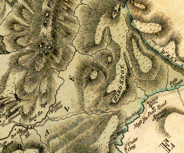
D4NY20SW.jpg Birdhow -- building/s -- NY20530110 -- 'Bird Ho.' -- block or blocks, labelled in lowercase; a hamlet or just a house Birks -- building/s -- SD23049911 -- 'Birks' -- block or blocks, labelled in lowercase; a hamlet or just a house Black Hall -- building/s -- youth hostel -- NY23920120 ? ? -- 'Blackhall' -- block or blocks, labelled in lowercase; a hamlet or just a house bridge, Eskdale (2) -- bridge -- NY21200116 -- double line across a river; a bridge over Hardknott Gill Brotherilkeld -- building/s -- NY21270143 -- 'Butter Ilket' -- block or blocks, labelled in lowercase; a hamlet or just a house Cockley Beck Bridge -- bridge -- NY24660167 -- double line across a river; a bridge at Cockley Beck Cockley Beck -- building/s -- locality -- NY24690163 -- 'Cockley Beck' -- block or blocks, labelled in lowercase; a hamlet or just a house Dale Head -- building/s -- NY24150074 -- 'Dale Head' -- block or blocks, labelled in lowercase; a hamlet or just a house Duddon, River -- river -- boundary -- parish boundary -- county boundary (old counties) -- NY2602 (etc) -- 'Duddon River' -- single or double wiggly line; a river and county boundary, into the sea Eskdale -- valley -- locality -- NY18130029 (etc etc) -- 'ESKDALE' -- valley, between hachures Hard Knott -- hill -- NY23180237 -- 'HARD KNOT' -- hill hachuring; a hill or mountain Hardknott Gill -- river -- valley -- NY2301 (etc) -- single or double wiggly line; a river ??? Moasdale Beck -- river -- NY2402 (etc) -- single or double wiggly line; a river ??? Moss House -- building/s -- SD2399 (?) -- 'Moss Ho.' -- block or blocks, labelled in lowercase; a hamlet or just a house Sca Fell -- hill -- NY20680651 (?) -- 'SCA FELL' -- hill hachuring; a hill or mountain Taw House -- building/s -- NY21060159 -- 'Toes' -- block or blocks, labelled in lowercase; a hamlet or just a house Whahouse Bridge -- bridge -- NY20380089 -- double line across a river; a bridge | ||
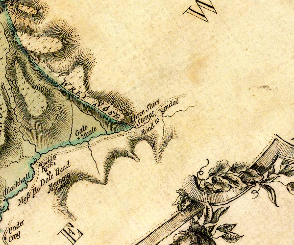
D4NY20SE.jpg Duddon, River -- river -- boundary -- parish boundary -- county boundary (old counties) -- NY2602 (etc) -- 'Duddon River' -- single or double wiggly line; a river and county boundary, into the sea Gaitscale -- building/s -- NY25580224 -- 'Gale Scale' -- block or blocks, labelled in lowercase; a hamlet or just a house Hinning House -- building/s -- SD24029991 -- 'Henning House' Three Shire Stones -- boundary stone -- stone -- county boundary mark -- NY27720274 ? -- 'Three Shire Stones' -- no symbol, marking county boundary with Westmorland and Lancashire Wrynose Fell -- hill -- fell -- NY2704 -- 'WREY NOSE' -- hill hachuring; hill or mountain, on county boundary | ||
D4SD09NW.jpg | ||
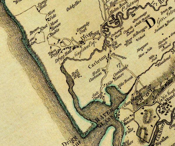
D4SD09NE.jpg Aikbank Farm -- building/s -- NY09510027 -- 'Oak Bank' -- block or blocks, labelled in lowercase; a hamlet or just a house Barrow -- building/s -- SD09249718 (estimate) -- 'Barrow' -- block or blocks, labelled in lowercase; a hamlet or just a house Bell Hill Farm -- building/s -- SD08189801 -- 'Hall Carleton' -- block or blocks, labelled in lowercase; a hamlet or just a house Black Beck -- river -- boundary -- parish boundary -- SD0799 (etc) -- single or double wiggly line; a river into the Irt Blackbeck Bridge -- bridge -- SD07859970 -- double line across a river; a bridge over Black Beck Brown Knott -- building/s -- SD05169960 (estimate) -- 'Brown Knot' -- block or blocks, labelled in lowercase; a hamlet or just a house Carleton Hall -- building/s -- SD08249877 -- 'Parsonage' -- block or blocks, labelled in lowercase; a hamlet or just a house Carleton -- locality -- building/s -- SD08239869 (etc) -- 'Carleton' -- blocks, and usually a church, labelled in upright lowercase; a village but no church Cookson Place -- building/s -- SD08559970 -- 'Cockstone Place' -- block or blocks, labelled in lowercase; a hamlet or just a house Cranklands -- building/s -- SD09239678 (estimate) -- 'Cranklands' -- block or blocks, labelled in lowercase; a hamlet or just a house Cumblands -- building/s -- SD08419779 -- 'Cumlands' -- block or blocks, labelled in lowercase; a hamlet or just a house Drigg Hall -- building/s -- SD06679908 -- 'Drigg Hall / Singleton Esq.' -- house Drigg Moorside -- building/s -- SD05579982 -- 'Moor House' -- block or blocks, labelled in lowercase; a hamlet or just a house Drigg -- locality -- building/s -- SD06849915 (etc) -- 'Drigg' -- blocks, and usually a church, labelled in upright lowercase; a village Esk, River -- river -- NY2101 (etc) ? -- 'Esk River' -- single or double wiggly line; a river into the sea; estuary Greenside -- building/s -- SD06329912 -- 'Town End' -- block or blocks, labelled in lowercase; a hamlet or just a house possibly Groundy Croft -- building/s -- SD07019953 -- 'Groundy Croft' -- block or blocks, labelled in lowercase; a hamlet or just a house Gubbergill -- building/s -- SD08359935 -- 'Bell Thorn' -- block or blocks, labelled in lowercase; a hamlet or just a house possibly Hall Carleton -- building/s -- SD07069788 -- 'Bell Hill' -- block or blocks, labelled in lowercase; a hamlet or just a house harbour, Ravenglass -- harbour -- SD08159602 (etc) Hill Farm -- building/s -- SD07829961 -- 'Hill' -- block or blocks, labelled in lowercase; a hamlet or just a house Holmrook Hall -- building/s -- NY08100009 -- 'Holm Rook / Vineyard / C Lutwidge Esq.' -- house with avenue of trees and vineyard Irt Bridge -- bridge -- SD08029954 -- double line across a river; a bridge over the Irt Irt Cottage -- building/s -- inn (ex) -- SD08219943 -- 'Bridge End' -- block or blocks, labelled in lowercase; a hamlet or just a house possibly Irt, River -- river -- boundary -- parish boundary -- NY1002 (etc) ? -- 'Irt River' -- single or double wiggly line; a river into the sea; estuary Kirklands Farm -- building/s -- NY08950018 -- 'Church Land' -- block or blocks, labelled in lowercase; a hamlet or just a house Low Holm -- building/s -- SD04969903 -- 'Low Holm' -- block or blocks, labelled in lowercase; a hamlet or just a house Mainsgate -- building/s -- SD09689991 -- 'Mainsgate' -- block or blocks, labelled in lowercase; a hamlet or just a house mill, Holmrook -- water mill -- mill -- corn mill -- SD07959992 (estimate) -- circle with rays, mill wheel; a water mill Mite Bank -- building/s -- SD08269733 (estimate) -- 'Mile Bank' -- block or blocks, labelled in lowercase; a hamlet or just a house Mite Houses -- building/s -- SD08019747 -- 'Mile House' -- block or blocks, labelled in lowercase; a hamlet or just a house Mite, River -- river etc -- NY1602 -- 'Mite River' -- single or double wiggly line; a river into the sea; estuary Moor End -- building/s -- SD088991 -- 'Moor End' -- block or blocks, labelled in lowercase; a hamlet or just a house Moor House -- building/s -- SD05369996 -- 'Mire Side' -- block or blocks, labelled in lowercase; a hamlet or just a house Moorgate -- building/s -- SD09459896 -- 'Moorgate' -- block or blocks, labelled in lowercase; a hamlet or just a house Muncaster Mill Bridge -- bridge -- SD09449772 -- double line across a river; a bridge over the Mite Muncaster Mill -- water mill -- mill -- museum (ex) -- SD09589772 -- circle with rays, mill wheel; a water mill on the Mite Old Vicarage, The -- building/s -- NY09190035 -- 'Parsonage' -- block or blocks, labelled in lowercase; a hamlet or just a house Ravenglass -- locality -- building/s etc -- SD08419633 (etc) -- 'RAVENGLASS' -- blocks, perhaps a church, labelled in block caps; a town Broughton in Furness to Ravenglass -- road -- route -- SD09 -- double line, narrower, solid or dotted with a dot and number at 1 mile intervals; road -- distances from Whitehaven -- to Duddon Bridge, into Lancashire Ravenglass to Egremont -- road -- route -- NY01 -- double line, narrower, solid or dotted with a dot and number at 1 mile intervals; road -- distances from Whitehaven Glannoventa -- roman fort -- roman bath house -- SD08859580 (etc) -- 'Castle in Ruins' -- large building; a castle Saltcoats -- locality -- building/s -- SD07959688 (etc) -- 'Salt Coat' -- block or blocks, labelled in lowercase; a hamlet or just a house school, Irton with Santon (3) -- school (gone) -- SD09709938 -- 'School' -- block or blocks, labelled in lowercase; a hamlet or just a house St Paul's Church -- church -- NY09160047 -- 'Church' -- church Stubble, The -- building/s -- SD05639949 -- 'Stable' -- block or blocks, labelled in lowercase; a hamlet or just a house Walls -- building/s -- SD08949576 -- 'Walls' -- block or blocks, labelled in lowercase; a hamlet or just a house | ||
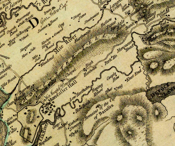
D4SD19NW.jpg Barnscar -- british settlement -- SD13279590 -- 'Remains of the City of Barsea' -- blocks and perhaps smal buildings Branken Wall -- building/s -- SD09829697 -- 'Burnham Walls' -- block or blocks, labelled in lowercase; a hamlet or just a house possibly Chapels -- building/s -- SD11079753 -- 'Chapel' -- block or blocks, labelled in lowercase; a hamlet or just a house Cragg Farm -- building/s -- SD10879975 -- 'Crag' -- block or blocks, labelled in lowercase; a hamlet or just a house Cragg Farm -- building/s -- SD12929731 -- 'Crag' -- block or blocks, labelled in lowercase; a hamlet or just a house Cray Cottage -- building/s -- SD12769733 -- 'Fows' -- block or blocks, labelled in lowercase; a hamlet or just a house possibly Cropple How -- building/s -- SD12879774 -- 'Coople How' -- block or blocks, labelled in lowercase; a hamlet or just a house Eelbeck Ground -- building/s -- SD10329931 (estimate) -- 'Illbeck Ground' -- block or blocks, labelled in lowercase; a hamlet or just a house Esk Bank -- building/s -- SD14449975 -- 'Bank House' -- block or blocks, labelled in lowercase; a hamlet or just a house probably Esk, River -- river -- NY2101 (etc) ? -- 'Esk River' -- single or double wiggly line; a river into the sea; estuary Gasketh -- building/s -- SD09919864 -- 'Moor Side' -- block or blocks, labelled in lowercase; a hamlet or just a house probably Graymains -- building/s -- SD11369568 -- 'Graymains' -- block or blocks, labelled in lowercase; a hamlet or just a house High Eskholme -- building/s -- SD11879791 -- 'High Hestholm' -- block or blocks, labelled in lowercase; a hamlet or just a house Hinning House -- building/s -- SD12389728 -- 'Hening House' -- block or blocks, labelled in lowercase; a hamlet or just a house Hollin How -- building/s -- NY14820007 -- 'Holling House' -- block or blocks, labelled in lowercase; a hamlet or just a house Hollowstones -- building/s -- SD13669991 -- 'Hollow Stones' -- block or blocks, labelled in lowercase; a hamlet or just a house Howbank -- building/s -- SD11889659 -- 'How Bank' -- block or blocks, labelled in lowercase; a hamlet or just a house Kitchen Ground -- building/s -- SD10659956 -- 'Kitchen Ground' -- block or blocks, labelled in lowercase; a hamlet or just a house Knott End -- building/s -- SD13419760 -- 'Knot End' -- block or blocks, labelled in lowercase; a hamlet or just a house Linbeck Gill -- river -- boundary -- parish boundary -- SD1497 (etc) -- single or double wiggly line; a river from Devoke Water into the Esk Linbeck Mill -- water mill -- mill -- corn mill -- SD14049826 (estimate) -- circle with rays, mill wheel; a water mill on Linbeck Gill Low Eskholme -- building/s -- SD11549707 -- 'Low Hestholm' -- block or blocks, labelled in lowercase; a hamlet or just a house Mite, River -- river etc -- NY1602 -- 'Mite River' -- single or double wiggly line; a river into the sea; estuary Miteside -- building/s -- SD10059839 -- 'Mile Side' -- block or blocks, labelled in lowercase; a hamlet or just a house Muncaster Bridge -- bridge -- SD11249642 -- double line across a river; a bridge over the Esk Muncaster Castle -- castle -- haunted house -- garden -- SD10359634 ? -- 'Moncaster Hall / Sir Joseph Penington' -- house, and park, also the church Muncaster Fell -- hill -- fell -- SD115982 (etc) -- 'MONCASTER FELL' -- hill hachuring; a hill or mountain Muncaster Head -- building/s -- SD14059896 -- 'Moncaster Head' -- block or blocks, labelled in lowercase; a hamlet or just a house Murthwaite -- building/s -- SD11659929 (estimate) -- 'Murthwaite' -- no symbol Nether Stainton -- building/s -- SD11409536 -- 'Nether Stenton' -- block or blocks, labelled in lowercase; a hamlet or just a house Park House -- building/s -- SD12969852 -- 'Park Ho.' -- block or blocks, labelled in lowercase; a hamlet or just a house Parkgate -- building/s -- NY11320023 -- 'Stape Stone' -- block or blocks, labelled in lowercase; a hamlet or just a house possibly Randlehow -- building/s -- SD14329988 -- 'Randale Holm' -- block or blocks, labelled in lowercase; a hamlet or just a house Broughton in Furness to Ravenglass -- road -- route -- SD09 -- double line, narrower, solid or dotted with a dot and number at 1 mile intervals; road -- distances from Whitehaven -- to Duddon Bridge, into Lancashire Sleathwaite -- building/s -- NY12290012 -- 'Sleathwaite' -- block or blocks, labelled in lowercase; a hamlet or just a house St Michael's Church -- church -- SD10399657 -- church summer house, Irton with Santon -- summer house -- NY10560050 -- 'Summer House' -- small building Woodend -- building/s -- SD09989804 (guess) -- 'Woodend' -- block or blocks, labelled in lowercase; a hamlet or just a house | ||

D4SD19NE.jpg Birkerthwaite -- building/s -- SD17959813 -- 'Birker Thwaits' -- block or blocks, labelled in lowercase; a hamlet or just a house Brighouse -- building/s -- SD19479467 (?) -- 'Brig Ho.' -- block or blocks, labelled in lowercase; a hamlet or just a house Crosbythwaite Bridge -- bridge -- SD18919506 -- bridge, over Crosby Gill Crosbythwaite -- building/s -- SD19049499 -- 'Crosby Thwaite' -- block or blocks, labelled in lowercase; a hamlet or just a house Dalegarth Hall -- building/s -- NY17000012 ? -- 'Dalegarth Hall' -- block or blocks, labelled in lowercase; a hamlet or just a house Devoke Water -- lake -- SD158969 -- 'DEVOCK WATER' -- lake Esk, River -- river -- NY2101 (etc) ? -- 'Esk River' -- single or double wiggly line; a river into the sea; estuary Eskdale -- valley -- locality -- NY18130029 (etc etc) -- 'ESKDALE' -- valley, between hachures Fisher Ground -- building/s -- NY15180015 -- 'Fisher Ground' -- block or blocks, labelled in lowercase; a hamlet or just a house Forge Bridge -- bridge -- SD14929952 -- double line across a river; a bridge over the Esk nr Yester Field Forge House -- building/s -- SD14709927 -- 'Yester Field' -- block or blocks, labelled in lowercase; a hamlet or just a house possibly Grimecrag -- building/s -- SD19599426 -- 'Crime Crag' -- block or blocks, labelled in lowercase; a hamlet or just a house High Ground -- building/s -- SD17349809 -- 'High Ground' -- block or blocks, labelled in lowercase; a hamlet or just a house Low Birker -- building/s -- NY18840041 -- 'Low Birket' -- block or blocks, labelled in lowercase; a hamlet or just a house Low Ground -- building/s -- SD17509883 -- 'Low Ground' -- block or blocks, labelled in lowercase; a hamlet or just a house Milkingstead -- building/s -- SD15389976 -- 'Red Brow' -- block or blocks, labelled in lowercase; a hamlet or just a house possibly Broughton in Furness to Ravenglass -- road -- route -- SD09 -- double line, narrower, solid or dotted with a dot and number at 1 mile intervals; road -- distances from Whitehaven -- to Duddon Bridge, into Lancashire Sword House -- building/s -- SD14879907 -- 'Yester Field' -- block or blocks, labelled in lowercase; a hamlet or just a house possibly Underbank -- building/s -- SD17699997 -- 'Underbank' -- block or blocks, labelled in lowercase; a hamlet or just a house Whincop -- building/s -- SD17789905 -- 'Whincroft' -- block or blocks, labelled in lowercase; a hamlet or just a house Woodend -- building/s -- SD16749635 -- 'Woodend' -- block or blocks, labelled in lowercase; a hamlet or just a house | ||
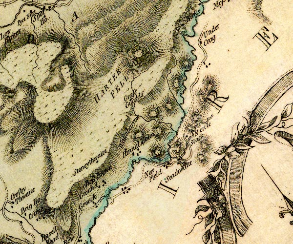
D4SD29NW.jpg Bess Brown Ground -- building/s -- SD21219532 -- 'Bess Brown Ground' -- block or blocks, labelled in lowercase; a hamlet or just a house Crook, The -- building/s -- SD20859496 -- 'Croock' -- block or blocks, labelled in lowercase; a hamlet or just a house Duddon, River -- river -- boundary -- parish boundary -- county boundary (old counties) -- NY2602 (etc) -- 'Duddon River' -- single or double wiggly line; a river and county boundary, into the sea Grassguards -- building/s -- SD22399812 -- 'Grass Guards' -- block or blocks, labelled in lowercase; a hamlet or just a house Hall Bridge -- bridge -- SD21309533 -- double line across a river; a bridge over the Duddon Harter Fell -- hill -- SD21849971 -- 'HARTER FELL' -- hill hachuring; a hill or mountain High Stonythwaite -- building/s -- SD21599678 -- 'Stoneythwaite' -- block or blocks, labelled in lowercase; a hamlet or just a house Low Stonythwaite -- building/s -- SD22009686 -- 'Stoneythwaite' -- block or blocks, labelled in lowercase; a hamlet or just a house Nettle Slack -- building/s (ruin) -- SD22989716 -- 'Nettle Slack' -- block or blocks, labelled in lowercase; a hamlet or just a house Newfield -- locality -- SD227959 (etc) -- 'New Field' -- block or blocks, labelled in lowercase; a hamlet or just a house Pannel Holme -- building/s -- SD21409565 -- 'Pannal Holm' -- block or blocks, labelled in lowercase; a hamlet or just a house possibly Rake Beck -- river -- SD2296 (etc) -- single or double wiggly line; a river into the Duddon Seathwaite Bridge -- bridge -- SD23199683 -- double line across a river; a bridge nr Nettleslack Seathwaite -- locality -- building/s -- SD22899608 (etc) ? -- 'Seathwaite' -- block or blocks, labelled in lowercase; a hamlet or just a house and a church Under Crag -- building/s -- SD23529947 (guess) -- 'Under Crag' -- block or blocks, labelled in lowercase; a hamlet or just a house Wallowbarrow Heald -- area -- SD21479722 (etc) -- 'Wallabarrow' -- hill hachuring; a hill or mountain OR block or blocks, labelled in lowercase; a hamlet or just a house | ||
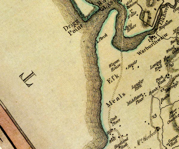
D4SD09SE.jpg Drigg Point -- headland -- sea area -- SD07109526 (etc) -- 'Drigg Point' -- sea area? Esk Estuary -- estuary -- river estuary -- NY3165 (etc) -- single or double wiggly line; a river, estuary into the sea Eskmeals House -- building/s -- SD09089353 -- 'Meals' -- block or blocks, labelled in lowercase; a hamlet or just a house Eskmeals -- locality -- SD09129300 (etc) -- 'Esk Meals' -- area Hill, The -- building/s -- SD08109042 -- 'Hill' -- block or blocks, labelled in lowercase; a hamlet or just a house Langley Park -- building/s -- SD09699295 -- 'Langley Park' -- no symbol Middleton Place -- building/s -- SD09689216 -- 'Middleton Place' -- block or blocks, labelled in lowercase; a hamlet or just a house Perch -- sea mark -- cross (?) -- SD07669461 (guess) -- 'Perch' -- cross on a post sands road, Esk Estuary -- sands road -- ford -- SD08699438 (etc) -- double dotted lines, sands road across the Esk Stubb Place -- building/s -- SD08179066 -- 'Stub Place' -- block or blocks, labelled in lowercase; a hamlet or just a house Warren House -- building/s -- SD08139374 (guess) -- 'Warren House' -- block or blocks, labelled in lowercase; a hamlet or just a house | ||
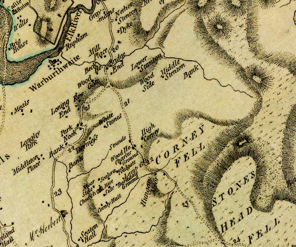
D4SD19SW.jpg Bank -- building/s -- SD10229259 (guess) -- 'Bank' -- block or blocks, labelled in lowercase; a hamlet or just a house Beck House -- building/s -- SD11299456 (guess) -- 'Beck Ho.' -- block or blocks, labelled in lowercase; a hamlet or just a house Bootle Fell -- hill -- fell -- SD13398887 (etc etc) -- 'STONES HEAD FELL' -- hill hachuring; a hill or mountain possibly Borrowdale Ground -- building/s -- SD11419117 -- 'Boradale Ground' -- block or blocks, labelled in lowercase; a hamlet or just a house Bridge End -- building/s -- SD11369462 -- 'Bridge End' -- block or blocks, labelled in lowercase; a hamlet or just a house bridge, Muncaster -- bridge -- SD11409463 -- double line across a river; a bridge at Bridge End Broadoak Beck -- river -- boundary -- parish boundary -- SD1095 (etc) -- single or double wiggly line; a river into the Esk Charlesground -- building/s -- SD11989219 -- 'Wood Ho.' -- block or blocks, labelled in lowercase; a hamlet or just a house probably Corney Fell -- hill -- fell -- SD13499180 (etc etc) -- 'CORNEY FELL' -- hill hachuring; a hill or mountain Corney Hall -- building/s -- SD111907 -- 'Corney Hall' -- block or blocks, labelled in lowercase; a hamlet or just a house Dyke -- building/s -- SD11469517 -- 'Dyke' -- block or blocks, labelled in lowercase; a hamlet or just a house Fold Gate -- building/s -- SD11869189 -- 'Foulgate' -- block or blocks, labelled in lowercase; a hamlet or just a house Gillfoot -- building/s -- SD11599184 -- 'Charles Ground' -- block or blocks, labelled in lowercase; a hamlet or just a house probably Grange -- building/s -- SD12299399 -- 'Bank' -- block or blocks, labelled in lowercase; a hamlet or just a house possibly Hall Waberthwaite -- locality -- building/s -- SD10029507 (etc) -- 'Warburthwaite' -- blocks, and usually a church, labelled in upright lowercase; a village High Corney -- building/s -- SD12359285 -- 'High Corney' -- block or blocks, labelled in lowercase; a hamlet or just a house How End -- building/s -- SD11649259 -- 'Strands' -- block or blocks, labelled in lowercase; a hamlet or just a house possibly Lambground, Corney -- building/s -- SD12069162 -- 'Lamb G.' -- block or blocks, labelled in lowercase; a hamlet or just a house Lane End -- locality -- building/s -- SD10529338 (etc) -- 'Loning End' -- block or blocks, labelled in lowercase; a hamlet or just a house Lower Stainton -- building/s -- SD11809446 (guess) -- 'Lower Stanton' -- block or blocks, labelled in lowercase; a hamlet or just a house Middle Bank -- building/s -- SD10389169 -- 'Bank' -- block or blocks, labelled in lowercase; a hamlet or just a house Mill Place -- building/s -- SD11279495 (guess) -- 'Mill Place' -- block or blocks, labelled in lowercase; a hamlet or just a house Mireground -- building/s -- SD11749123 -- 'Mire Side' -- block or blocks, labelled in lowercase; a hamlet or just a house Moor House -- building/s -- SD11719125 ? -- 'Hungary Moor' -- block or blocks, labelled in lowercase; a hamlet or just a house probably Moorside -- building/s -- SD11069156 -- 'Moor Side' -- block or blocks, labelled in lowercase; a hamlet or just a house Near Bank -- building/s -- SD10569150 -- 'Bank' -- block or blocks, labelled in lowercase; a hamlet or just a house Normoss -- building/s -- SD10969278 -- 'Dormoss' -- block or blocks, labelled in lowercase; a hamlet or just a house Park Nook -- building/s -- SD10669301 -- 'Park Nook' -- block or blocks, labelled in lowercase; a hamlet or just a house Broughton in Furness to Ravenglass -- road -- route -- SD09 -- double line, narrower, solid or dotted with a dot and number at 1 mile intervals; road -- distances from Whitehaven -- to Duddon Bridge, into Lancashire Rougholme -- building/s -- SD10699546 -- 'Rupham' -- block or blocks, labelled in lowercase; a hamlet or just a house possibly Row -- building/s -- SD11029413 -- 'Row' -- block or blocks, labelled in lowercase; a hamlet or just a house Skellerah -- building/s -- SD11419163 -- 'Scalera' -- block or blocks, labelled in lowercase; a hamlet or just a house St John's Church -- church -- SD11249131 -- 'Church' -- church Stainton -- building/s -- SD12679474 -- 'Middle Stenton' -- block or blocks, labelled in lowercase; a hamlet or just a house Swallowhurst -- building/s -- SD10299101 -- '/ Herbert, Mr.' -- house probably Whitestones -- building/s -- SD11249318 -- 'White Stones' -- block or blocks, labelled in lowercase; a hamlet or just a house Woodgate -- building/s -- SD11109428 -- 'Wood Gate' -- block or blocks, labelled in lowercase; a hamlet or just a house Woodside -- building/s -- SD11869429 -- 'Wood Side' -- block or blocks, labelled in lowercase; a hamlet or just a house | ||
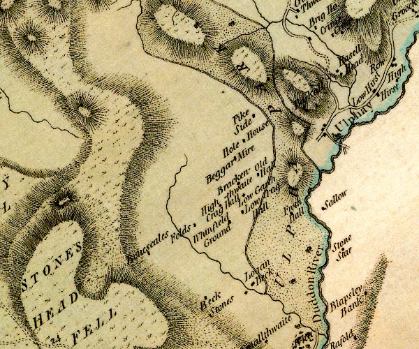
D4SD19SE.jpg Baskill -- building/s -- SD19299384 -- 'Baskall' -- block or blocks, labelled in lowercase; a hamlet or just a house Beckstones -- building/s -- SD18329031 -- 'Beck Stones' -- block or blocks, labelled in lowercase; a hamlet or just a house Bigert Mire -- building/s -- SD17909266 -- 'Beggar Mire' -- block or blocks, labelled in lowercase; a hamlet or just a house Bowscale -- building/s -- SD16899093 -- 'Bonescales' -- block or blocks, labelled in lowercase; a hamlet or just a house Brackenthwaite -- building/s -- SD18019226 -- 'Brackenthwaite' -- block or blocks, labelled in lowercase; a hamlet or just a house Duddon, River -- river -- boundary -- parish boundary -- county boundary (old counties) -- NY2602 (etc) -- 'Duddon River' -- single or double wiggly line; a river and county boundary, into the sea Folds -- building/s -- SD17819113 -- 'Folds' -- block or blocks, labelled in lowercase; a hamlet or just a house Frith Hall -- building/s -- haunted house -- SD18909163 -- 'Froth Hall' -- block or blocks, labelled in lowercase; a hamlet or just a house Hazel Head -- building/s -- SD19619415 -- 'Hasell Head' -- block or blocks, labelled in lowercase; a hamlet or just a house High Craghall -- building/s -- SD17959162 -- 'High Crag Hall' -- block or blocks, labelled in lowercase; a hamlet or just a house Hole House -- building/s -- SD18089302 -- 'Hole House' -- block or blocks, labelled in lowercase; a hamlet or just a house Loganbeck -- building/s -- SD18319046 -- 'Logan Beck' -- block or blocks, labelled in lowercase; a hamlet or just a house Long Garth -- building/s -- SD18119198 -- 'Low Garth' -- block or blocks, labelled in lowercase; a hamlet or just a house Low Craghall -- building/s -- SD18139163 -- 'Low Crag Hall' -- block or blocks, labelled in lowercase; a hamlet or just a house Old Hall -- building/s (ruin) -- pele tower -- SD18209247 (?) -- 'Old Hall' -- block or blocks, labelled in lowercase; a hamlet or just a house Pike Side -- building/s -- SD18409319 -- 'Pike Side' -- block or blocks, labelled in lowercase; a hamlet or just a house Sella -- building/s -- SD19629257 -- 'Sallow' -- block or blocks, labelled in lowercase; a hamlet or just a house Stonestar -- building/s -- SD20129120 -- 'Stone Star' -- block or blocks, labelled in lowercase; a hamlet or just a house Ulpha Bridge -- bridge -- SD19659304 -- double line across a river; a bridge at Ulpha Ulpha Park -- park -- SD19019106 (etc) -- 'ULPHA PARK' -- double outline with suggested fence palings; a park Ulpha -- locality -- building/s -- SD19739335 (etc) -- 'Ulphay' -- blocks, and usually a church, labelled in upright lowercase; a village Whinfield Ground -- building/s -- SD18039129 -- 'Whinfield Ground' -- block or blocks, labelled in lowercase; a hamlet or just a house | ||
D4SD29SW.jpg Crosby Bridge -- bridge -- SD20069370 -- double line across a river; a bridge Crosby Gill -- river -- SD1895 -- single or double wiggly line; a river Duddon, River -- river -- boundary -- parish boundary -- county boundary (old counties) -- NY2602 (etc) -- 'Duddon River' -- single or double wiggly line; a river and county boundary, into the sea Far Kiln Bank -- building/s -- SD21249398 -- 'Kell Bank' -- block or blocks, labelled in lowercase; a hamlet or just a house High Hurst -- building/s -- SD20579410 -- 'High Hirst' -- block or blocks, labelled in lowercase; a hamlet or just a house High Kiln Bank -- building/s -- SD21239430 -- 'Kell Bank' -- block or blocks, labelled in lowercase; a hamlet or just a house High Whineray Ground -- building/s -- SD20159032 -- 'Blapsley' -- block or blocks, labelled in lowercase; a hamlet or just a house possibly Hurstside -- building/s -- SD20239393 -- 'Low Hirst' -- block or blocks, labelled in lowercase; a hamlet or just a house Low Kiln Bank -- building/s -- SD21189423 -- 'Kell Bank' -- block or blocks, labelled in lowercase; a hamlet or just a house Low, The -- building/s -- SD20589441 -- 'Row' -- block or blocks, labelled in lowercase; a hamlet or just a house | ||

D4SD08NE.jpg Annas, River -- river -- boundary -- parish boundary -- SD0887 (etc) -- single or double wiggly line; a river into the sea Annaside -- building/s -- SD09018655 -- 'Anns's Side' -- block or blocks, labelled in lowercase; a hamlet or just a house Ashes -- building/s -- SD08768919 (guess) -- 'Ashes' -- block or blocks, labelled in lowercase; a hamlet or just a house Beeby Gate -- building/s -- SD09628958 (guess) -- 'Beeby Gate' -- block or blocks, labelled in lowercase; a hamlet or just a house bridge, Whicham -- bridge -- SD09618676 -- double line across a river; a bridge High Kiskin -- building/s -- SD09028705 -- 'Kecken' -- block or blocks, labelled in lowercase; a hamlet or just a house Hill Farm -- building/s -- SD07698931 -- 'Hill' -- block or blocks, labelled in lowercase; a hamlet or just a house Hycemoor House -- building/s -- SD09088976 -- 'Hartland Hall' -- block or blocks, labelled in lowercase; a hamlet or just a house possibly Hycemoor School -- school -- SD09278927 -- 'School' -- block or blocks, labelled in lowercase; a hamlet or just a house Hycemoor Side -- building/s -- SD08628883 -- 'Hise Moor Side' -- block or blocks, labelled in lowercase; a hamlet or just a house Lane End -- building/s -- SD09548907 -- 'Lonning End' -- block or blocks, labelled in lowercase; a hamlet or just a house Selker -- building/s -- SD07738859 -- 'Selker' -- block or blocks, labelled in lowercase; a hamlet or just a house Tarn, The -- building/s -- SD07808979 -- 'Tarn' -- block or blocks, labelled in lowercase; a hamlet or just a house Well Farm -- building/s -- SD08469046 -- 'Well' -- block or blocks, labelled in lowercase; a hamlet or just a house Willy Gap -- building/s -- SD09018920 (guess) -- 'Willy Gap' -- block or blocks, labelled in lowercase; a hamlet or just a house | ||
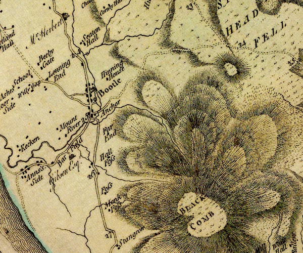
D4SD18NW.jpg Barfield -- building/s -- SD10408703 -- 'Bar Field / Gibson Esqr.' -- house Black Combe -- hill -- SD135855 (summit) -- 'BLACK COMB' -- hill hachuring; a hill or mountain Bootle -- locality -- building/s etc -- SD10798820 (etc) -- 'Bootle' -- blocks, and usually a church, labelled in upright lowercase; a village bridge, Bootle -- bridge -- SD11018760 -- double line across a river; a bridge Broomhill Beck -- river -- boundary -- parish boundary -- SD1187 (etc) -- single or double wiggly line; a river Far End -- building/s -- SD11518750 -- 'Far End' -- block or blocks, labelled in lowercase; a hamlet or just a house Foss House -- building/s -- SD11418623 -- 'Foss' -- block or blocks, labelled in lowercase; a hamlet or just a house Hall Foss -- building/s -- SD11638701 -- 'Hall Foss' -- block or blocks, labelled in lowercase; a hamlet or just a house Hinning House -- building/s -- SD11238886 (etc) -- 'Hinning House' -- block or blocks, labelled in lowercase; a hamlet or just a house Hinninghouse Bridge -- bridge -- SD10928902 -- double line across a river; a bridge over Kinmont Beck probably Holegill Back -- river -- SD1186 (etc) -- single or double wiggly line; a river Holegill Bridge -- bridge -- SD11258678 -- double line across a river; a bridge Kinmont Beck -- river -- boundary -- parish boundary -- SD1390 (etc) -- single or double wiggly line; a river mill, Bootle -- building/s -- water mill (ex) -- mill (ex) -- corn mill (ex) -- SD10888823 -- circle with rays, mill wheel; a water mill at Bootle Millholme Bridge -- bridge -- SD10808786 -- double line across a river; a bridge Millholme -- locality -- building/s -- SD10788794 (etc) -- 'Anchor' -- inn? Monk Foss Farm -- building/s -- SD11288565 -- 'Monk Foss' -- block or blocks, labelled in lowercase; a hamlet or just a house Mount Rivers -- building/s -- SD10028750 -- 'Mount River' -- block or blocks, labelled in lowercase; a hamlet or just a house Millom road -- route -- SD18 -- double line, narrower, solid or dotted with a dot and number at 1 mile intervals; road -- distances from Whitehaven -- through Holborn Hill; Millom is not there yet Seaton Hall -- building/s -- priory (ex) -- religious house (ex) -- SD10748992 -- 'Seaton Hall' -- block or blocks, labelled in lowercase; a hamlet or just a house | ||
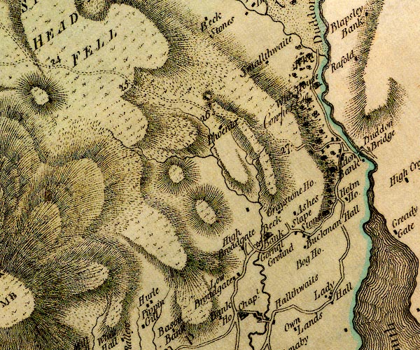
D4SD18NE.jpg Ash House -- building/s -- SD18968732 -- 'Ashes' -- block or blocks, labelled in lowercase; a hamlet or just a house Beck Bank Farm -- building/s -- SD18378684 -- 'Beck Bank' -- house Beckfoot -- building/s -- SD19318987 -- 'Wha' -- no symbol possibly Bootle Fell -- hill -- fell -- SD13398887 (etc etc) -- 'STONES HEAD FELL' -- hill hachuring; a hill or mountain possibly bridge, Millom Without -- bridge -- SD19508990 -- double line across a river; a bridge over Logan Bec Broadgate -- building/s -- SD18108669 -- 'High Broadgate' -- block or blocks, labelled in lowercase; a hamlet or just a house possibly Buckman Hall -- building/s -- SD19038687 -- 'Buckman Hall' -- block or blocks, labelled in lowercase; a hamlet or just a house Duddon Bridge -- locality -- building/s -- SD19638819 (etc) -- 'Duddon Bank' -- block or blocks, labelled in lowercase; a hamlet or just a house Duddon Hall -- building/s -- SD19378957 -- 'Who House / Cowper Esqr.' -- house Duddon, River -- river -- boundary -- parish boundary -- county boundary (old counties) -- NY2602 (etc) -- 'Duddon River' -- single or double wiggly line; a river and county boundary, into the sea Fenwick -- building/s -- SD16798928 -- 'Phoenix' -- block or blocks, labelled in lowercase; a hamlet or just a house possibly Gornal Ground -- building/s -- locality -- SD18668661 -- 'Gornal Ground' -- block or blocks, labelled in lowercase; a hamlet or just a house Graystone House -- building/s -- SD18808742 -- 'Graystone Ho.' -- block or blocks, labelled in lowercase; a hamlet or just a house Grice Croft -- building/s -- SD17098620 -- 'Hurle' -- block or blocks, labelled in lowercase; a hamlet or just a house possibly High Boghouse -- building/s -- SD19048650 -- 'Bog Ho.' -- no symbol Holme -- building/s -- SD19638733 -- 'Holm Ho.' -- block or blocks, labelled in lowercase; a hamlet or just a house Lady Hall -- locality -- building/s -- SD19288597 (etc) -- 'Lady Hall' -- block or blocks, labelled in lowercase; a hamlet or just a house Logan Beck -- river -- boundary -- parish boundary -- SD1790 (etc) -- single or double wiggly line; a river into the Duddon Low Broadgate -- building/s -- SD17898624 -- 'Low Broadgate' -- block or blocks, labelled in lowercase; a hamlet or just a house Old Broadgate -- building/s -- SD18028667 -- 'High Broadgate' -- block or blocks, labelled in lowercase; a hamlet or just a house possibly Broughton in Furness to Ravenglass -- road -- route -- SD09 -- double line, narrower, solid or dotted with a dot and number at 1 mile intervals; road -- distances from Whitehaven -- to Duddon Bridge, into Lancashire Millom road -- route -- SD18 -- double line, narrower, solid or dotted with a dot and number at 1 mile intervals; road -- distances from Whitehaven -- through Holborn Hill; Millom is not there yet Slapestone -- building/s -- SD18868694 -- 'Slape Stones' -- block or blocks, labelled in lowercase; a hamlet or just a house Smallthwaite -- building/s -- SD18598961 -- 'Smallthwaite' -- block or blocks, labelled in lowercase; a hamlet or just a house Thwaites Mill Bridge -- bridge -- SD18288661 -- double line across a river; a bridge Thwaites Mill -- water mill -- sawmill -- mill -- SD18238664 -- circle with rays, mill wheel; a water mill | ||
D4SD28NW.jpg Angerton -- building/s -- SD2184 -- 'Angerton' -- block or blocks, labelled in lowercase; a hamlet or just a house Duddon Bridge -- bridge -- SD19928818 -- 'Duddon Bridge' -- double line across a river; a bridge Duddon Estuary -- estuary -- river estuary etc -- SD1475 (etc) -- 'Duddon Mouth' -- estuary and county boundary Duddon, River -- river -- boundary -- parish boundary -- county boundary (old counties) -- NY2602 (etc) -- 'Duddon River' -- single or double wiggly line; a river and county boundary, into the sea Greety Gate -- building/s -- SD20418687 -- 'Gready Gate' -- block or blocks, labelled in lowercase; a hamlet or just a house High Cross -- building/s -- inn (?) -- SD20758769 -- 'High Cross' -- block or blocks, labelled in lowercase; a hamlet or just a house Rawfold -- building/s -- SD20048942 -- 'Rafold' -- block or blocks, labelled in lowercase; a hamlet or just a house | ||
D4SD08SE.jpg | ||
D4SD18SW.jpg Black Combe -- hill -- SD135855 (summit) -- 'BLACK COMB' -- hill hachuring; a hill or mountain bridge, Whicham (2) -- bridge -- SD14358384 -- double line across a river; a bridge nr Hill End bridge, Whitbeck -- bridge -- SD11488463 -- double line across a river; a bridge N of Whitbeck Cumpstones -- building/s -- SD13318256 -- 'Cumpstones' -- block or blocks, labelled in lowercase; a hamlet or just a house Fell Brow -- building/s -- SD12988274 -- 'Fell End' -- block or blocks, labelled in lowercase; a hamlet or just a house Gateside -- building/s -- SD14488396 -- 'Gate Side' -- block or blocks, labelled in lowercase; a hamlet or just a house Gutterby -- building/s -- SD10398444 -- 'Gutterby' -- block or blocks, labelled in lowercase; a hamlet or just a house Hill End -- building/s -- SD14308384 -- 'Hill End' -- block or blocks, labelled in lowercase; a hamlet or just a house Kellbank -- building/s -- SD13298239 -- 'Kell Bank' -- block or blocks, labelled in lowercase; a hamlet or just a house Kirksanton Bridge -- bridge -- SD14098077 -- double line across a river; a bridge by Kirksanck Town Kirksanton -- locality -- building/s -- SD14018079(etc) -- 'Kirksanck Town' -- block or blocks, labelled in lowercase; a hamlet or just a house mill, Kirksanton -- building/s -- water mill (ex) -- mill (ex) -- corn mill (ex) -- SD14048082 -- circle with rays, mill wheel; a water mill Millergill Beck -- river -- SD1085 (etc) -- single or double wiggly line; a river Po House -- building/s -- SD14808248 -- 'Pow House' -- block or blocks, labelled in lowercase; a hamlet or just a house Rectory -- building/s -- SD13488285 -- 'Parsonage' -- house Sicklemill Beck -- river -- SD1483 (etc) -- single or double wiggly line; a river Silecroft -- locality -- building/s -- SD13108193 (etc) -- 'Silecroft' -- block or blocks, labelled in lowercase; a hamlet or just a house Southfield -- building/s -- SD12858060 -- 'Southfield' -- block or blocks, labelled in lowercase; a hamlet or just a house St Mary's Church -- church -- SD13498270 -- 'Church' -- church St Mary's Church -- church -- SD11938397 -- church Standing Stones -- building/s -- SD13508099 -- 'Standing Stones' -- block or blocks, labelled in lowercase; a hamlet or just a house Stangrah -- building/s -- SD11298528 -- 'Stangrow' -- block or blocks, labelled in lowercase; a hamlet or just a house Townend Gill -- river -- SD1284 (etc) -- single or double wiggly line; a river Wha -- building/s -- SD14618367 (guess) -- 'Wha' -- block or blocks, labelled in lowercase; a hamlet or just a house Whicham Hall -- building/s -- SD14378301 -- 'Hall' -- block or blocks, labelled in lowercase; a hamlet or just a house Whicham -- parish -- SD1385 -- 'Whitchamp' -- area Whitbeck Mill -- water mill -- mill -- SD11778466 -- circle with rays, mill wheel; a water mill Whitbeck -- locality -- building/s -- SD11828439 (etc) -- 'Whitbeck' -- blocks, and usually a church, labelled in upright lowercase; a village Wood House -- building/s -- SD12438298 -- 'Wood House' -- block or blocks, labelled in lowercase; a hamlet or just a house | ||
D4SD18SE.jpg Applehead -- building/s -- SD17388399 -- 'Apple End' -- block or blocks, labelled in lowercase; a hamlet or just a house probably Arnaby -- locality -- building/s -- SD18338471 (etc) -- 'Arnaby' -- block or blocks, labelled in lowercase; a hamlet or just a house Bank House -- building/s -- SD17428557 -- 'Bank Ho.' -- block or blocks, labelled in lowercase; a hamlet or just a house Bankside -- building/s -- SD15828311 -- 'Bank Side' -- block or blocks, labelled in lowercase; a hamlet or just a house Baystone Bank Farm -- building/s -- SD17078561 -- 'Bason Bank' -- block or blocks, labelled in lowercase; a hamlet or just a house Beck, The -- building/s -- SD16458099 -- 'Beck' -- house Black Beck -- river -- SD1886 (etc) -- single or double wiggly line; a river into the Duddon Estuary bridge, Green -- bridge -- SD17928462 -- double line across a river; a bridge bridge, Hallthwaites -- bridge -- SD18218534 -- double line across a river; a bridge bridge, Millom Without (2) -- bridge -- SD18298428 -- double line across a river; a bridge Burnfield -- building/s -- SD17998189 -- 'Patern Field' -- block or blocks, labelled in lowercase; a hamlet or just a house possibly Chappels -- building/s -- SD16348481 -- 'Claplaws' -- block or blocks, labelled in lowercase; a hamlet or just a house probably Cross Bank -- building/s -- SD15588470 -- 'Cross Bank' -- block or blocks, labelled in lowercase; a hamlet or just a house Dashatgate -- building/s -- SD17578313 -- 'Dashwood Gate' -- block or blocks, labelled in lowercase; a hamlet or just a house Duddon Mount -- building/s -- SD18378252 -- 'Marsh Side' -- block or blocks, labelled in lowercase; a hamlet or just a house Green, The -- locality -- building/s -- SD17898463 (etc) -- 'Ralley Green' -- block or blocks, labelled in lowercase; a hamlet or just a house Hallbeck House -- building/s -- SD14988460 -- 'Hole Beck' -- block or blocks, labelled in lowercase; a hamlet or just a house Hallthwaites -- locality -- building/s -- SD18098539 (etc) -- 'Hallthwaits' -- block or blocks, labelled in lowercase; a hamlet or just a house Haws -- building/s -- SD18138401 -- 'Haws' -- block or blocks, labelled in lowercase; a hamlet or just a house High Beckstones Mill -- building/s -- water mill (ex) -- mill (ex) -- corn mill (ex) -- SD17888474 -- circle with rays, mill wheel; a water mill High Dunningwell -- building/s -- SD17348431 -- 'Dunning Well' -- block or blocks, labelled in lowercase; a hamlet or just a house High Lowscales -- building/s -- SD16088226 -- 'High Lascals' -- block or blocks, labelled in lowercase; a hamlet or just a house Hill Brow -- locality -- SD18078311 (etc) -- 'Heberah' -- block or blocks, labelled in lowercase; a hamlet or just a house possibly Hole House -- building/s -- SD15258306 -- 'Hall House' -- block or blocks, labelled in lowercase; a hamlet or just a house Holy Trinity Chapel -- church -- SD17108130 -- church by Millom Castle Low Dunningwell -- building/s -- SD17508442 -- 'Dunning Well' -- block or blocks, labelled in lowercase; a hamlet or just a house Low Marshside -- building/s -- SD18018243 -- 'Marsh Side' -- block or blocks, labelled in lowercase; a hamlet or just a house Low Scales -- building/s -- SD15818167 -- 'Low Lascals' -- block or blocks, labelled in lowercase; a hamlet or just a house Low Shaw -- building/s -- SD19538468 -- 'Low Shaw' -- block or blocks, labelled in lowercase; a hamlet or just a house Middle Marshside -- building/s -- SD18108249 -- 'Marsh Side' -- block or blocks, labelled in lowercase; a hamlet or just a house Millhaw -- building/s -- SD15158513 (guess) -- 'Mill Hall' -- block or blocks, labelled in lowercase; a hamlet or just a house Millom Castle -- castle -- SD17128133 -- 'Castle / Sir Edworth Williamson' -- house Millom -- parish -- SD1779 -- 'Millam' -- area Millom Park -- park -- SD16718281 (etc) -- 'MILLAM PARKS' -- hill hachuring; a hill or mountain Mire House -- building/s -- SD16788438 -- 'Mire House' -- block or blocks, labelled in lowercase; a hamlet or just a house Mire Mouth -- building/s -- SD15848471 -- 'Mire Mouth' -- block or blocks, labelled in lowercase; a hamlet or just a house Ralliss -- building/s -- SD15268493 -- 'Ralleys' -- block or blocks, labelled in lowercase; a hamlet or just a house Millom road -- route -- SD18 -- double line, narrower, solid or dotted with a dot and number at 1 mile intervals; road -- distances from Whitehaven -- through Holborn Hill; Millom is not there yet Roanlands -- building/s -- SD18658546 -- 'Own Lands' -- block or blocks, labelled in lowercase; a hamlet or just a house Salthouse -- building/s -- SD175808 -- 'Salt Ho.' -- block or blocks, labelled in lowercase; a hamlet or just a house School Ellis -- building/s -- SD17148340 -- 'School' -- block or blocks, labelled in lowercase; a hamlet or just a house St Anne's Church -- church -- SD17818552 -- 'Chapl.' -- church Stockholm -- building/s -- SD17518455 (guess) -- 'Stockholm' -- block or blocks, labelled in lowercase; a hamlet or just a house Strands Bridge -- bridge -- SD18708406 -- double line across a river; a bridge Taite House -- building/s -- SD18058361 (guess) -- 'Taite House' -- block or blocks, labelled in lowercase; a hamlet or just a house Under Hill -- locality -- building/s -- SD18058297 (etc) -- 'Wander Hill' -- block or blocks, labelled in lowercase; a hamlet or just a house Waterblean -- building/s -- SD17728244 -- 'Water Blain' -- block or blocks, labelled in lowercase; a hamlet or just a house Whicham Mill -- building/s -- SD15258510 -- circle with rays, mill wheel; a water mill at Mill Hall Whicham -- parish -- SD1385 -- 'Whitchamp' -- area Whins -- building/s -- SD17738194 (estimate) -- 'Whins' -- block or blocks, labelled in lowercase; a hamlet or just a house Whirl Pippin -- building/s -- SD16718570 -- 'Pippin Gill' -- block or blocks, labelled in lowercase; a hamlet or just a house probably White Hall -- building/s -- SD15808518 (estimate) -- 'White Hall' -- block or blocks, labelled in lowercase; a hamlet or just a house Wood House -- building/s -- SD17758452 (guess) -- 'Wood House' -- block or blocks, labelled in lowercase; a hamlet or just a house | ||
D4SD28SW.jpg Duddon Estuary -- estuary -- river estuary etc -- SD1475 (etc) -- 'Duddon Mouth' -- estuary and county boundary | ||
D4SD17NW.jpg Haverigg Haws -- area -- SD145785 (etc) -- 'Haverigg Haws' -- headland | ||
D4SD17NE.jpg Borwick Rails -- building/s -- SD18647972 (guess) -- 'Burrow Crails' -- block or blocks, labelled in lowercase; a hamlet or just a house Drinkalds -- building/s -- SD15958031 -- 'Drinkets' -- block or blocks, labelled in lowercase; a hamlet or just a house Haverigg Pool -- river -- SD1579 (etc) -- single or double wiggly line; a river into the sea Haverigg -- locality -- building/s -- SD16057869 (etc) -- 'Haveriggs' -- block or blocks, labelled in lowercase; a hamlet or just a house Hestham Hall Farm -- building/s -- SD15177998 -- 'Low Hestholm' -- house probably Hodbarrow Point -- headland -- SD18267806 -- 'Hodbarrow Point' -- headland Hodbarrow -- building/s -- locality -- SD18377825 (etc) -- 'Hodbarrow' -- block or blocks, labelled in lowercase; a hamlet or just a house Holborn Hill -- locality -- street -- SD16828034 (etc) -- 'Holburn Hill' -- block or blocks, labelled in lowercase; a hamlet or just a house Langthwaite Farm -- building/s -- SD15508007 -- 'Land Thet' -- block or blocks, labelled in lowercase; a hamlet or just a house Millom -- parish -- SD1779 -- 'Millam' -- area Moor End -- building/s -- SD16577941 -- 'Moor' -- block or blocks, labelled in lowercase; a hamlet or just a house OR just an area? possibly New Hall -- building/s -- SD17397947 -- 'New Hall' -- block or blocks, labelled in lowercase; a hamlet or just a house New Town -- building/s -- SD17337996 (guess) -- 'New Town' -- block or blocks, labelled in lowercase; a hamlet or just a house Red Hills -- building/s -- SD18267913 -- 'Red Hill' -- block or blocks, labelled in lowercase; a hamlet or just a house Millom road -- route -- SD18 -- double line, narrower, solid or dotted with a dot and number at 1 mile intervals; road -- distances from Whitehaven -- through Holborn Hill; Millom is not there yet Rottington -- building/s -- SD17967982 (guess) -- 'Rottenton' -- block or blocks, labelled in lowercase; a hamlet or just a house Whitriggs Close -- building/s -- SD16387928 -- 'Whetherigg Claw' -- block or blocks, labelled in lowercase; a hamlet or just a house probably | ||
 Lakes Guides menu.