 Old Cumbria Gazetteer
 |
 |
|
||
| tramroad, Whingill Collieries | ||||
| possible | ||||
| locality:- | Whingill Collieries | |||
| locality:- | David Pit | |||
| locality:- | Davy Pit | |||
| locality:- | George Pit | |||
| locality:- | James's Pit | |||
| civil parish:- | Whitehaven (formerly Cumberland) | |||
| county:- | Cumbria | |||
| locality type:- | tramroad (?) | |||
| locality type:- | track | |||
| coordinates:- | NX97551852 (etc) | |||
| 1Km square:- | NX9718 | |||
| 10Km square:- | NX91 | |||
| references:- | Donald 1774 |
|||
|
|
||||
| evidence:- | old map:- Donald 1774 (Cmd) placename:- Waggon Road |
|||
| source data:- | Map, hand coloured engraving, 3x2 sheets, The County of Cumberland, scale about 1
inch to 1 mile, by Thomas Donald, engraved and published by Joseph Hodskinson, 29
Arundel Street, Strand, London, 1774.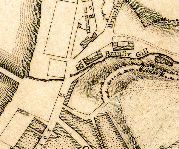 D49718M.jpg 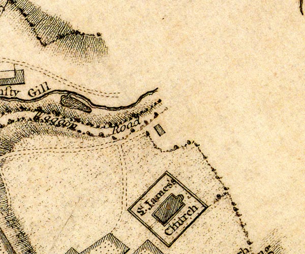 D49718S.jpg "Waggon Road" track item:- Carlisle Library : Map 2 Images © Carlisle Library |
|||
|
|
||||
| hearsay:- |
Coal was brought on a wooden waggonway from Whingill Collieries to Bransty, a ¼mile
(?), and from there by cart the short distance to the harbour. The waggonway had been
considered in 1738, but was not built till 1754, by Carlisle Spedding. He planned
to continue the line by a bridge over the turnpike road, the Bransty Arch. Carlisle
Spedding died in a mine explosion, 1755, and the bridge was not opened till 1803. |
|||
| Lewis, M J T: 1970: Early Wooden Railways: Routlegde and Kegan Paul (London):: ISBN
0 7100 7818 8 Joy, David: 1983 & 1990: Regional History of the Railways of Great Britain &Lake Counties, The: David and Charles (Newton Abbot, Devon) |
||||
|
|
||||
| places:- |
|
|||
 Lakes Guides menu.