 Old Cumbria Gazetteer
 |
 |
|
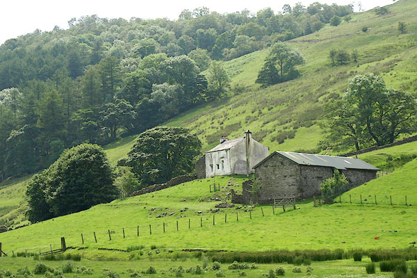
| barn, Longsleddale (7) | ||
| locality:- | Hill Cottage | |
| civil parish:- | Longsleddale (formerly Westmorland) | |
| county:- | Cumbria | |
| locality type:- | barn | |
| locality type:- | bank barn | |
| coordinates:- | NY48860462 | |
| 1Km square:- | NY4804 | |
| 10Km square:- | NY40 | |
|
|
||
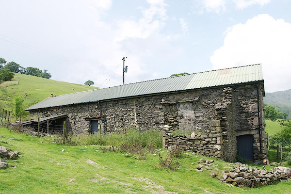 BQX70.jpg (taken 28.6.2009) 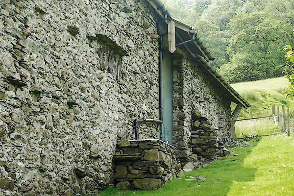 BQX71.jpg (taken 28.6.2009) |
||
|
|
||
| evidence:- | old map:- OS County Series (Wmd 27 7) placename:- Hill House |
|
| source data:- | Maps, County Series maps of Great Britain, scales 6 and 25
inches to 1 mile, published by the Ordnance Survey, Southampton,
Hampshire, from about 1863 to 1948.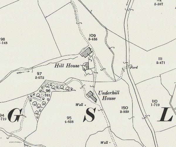 C5E007.jpg "Hill House" |
|
|
|
||
| evidence:- | map:- OS Six Inch (1956) placename:- Hill Cottage |
|
| source data:- | Map series, various editions with the national grid, scale about
6 inches to 1 mile, published by the Ordnance Survey,
Southampton, Hampshire, scale 1 to 10560 from 1950s to 1960s,
then 1 to 10000 from 1960s to 2000s, superseded by print on
demand from digital data.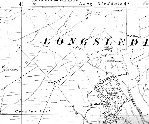 SINY4804.jpg "Hill Cottage" |
|
|
|
||
 BQX73.jpg (taken 28.6.2009) |
||
|
|
||
 Lakes Guides menu.