 Old Cumbria Gazetteer
 |
 |
|
| Fern Cottage, Setmurthy | ||
| Fern Cottage | ||
| Ruddings Farm | ||
| locality:- | Ruddings, The | |
| civil parish:- | Setmurthy (formerly Cumberland) | |
| county:- | Cumbria | |
| locality type:- | buildings | |
| coordinates:- | NY19683187 | |
| 1Km square:- | NY1931 | |
| 10Km square:- | NY13 | |
|
|
||
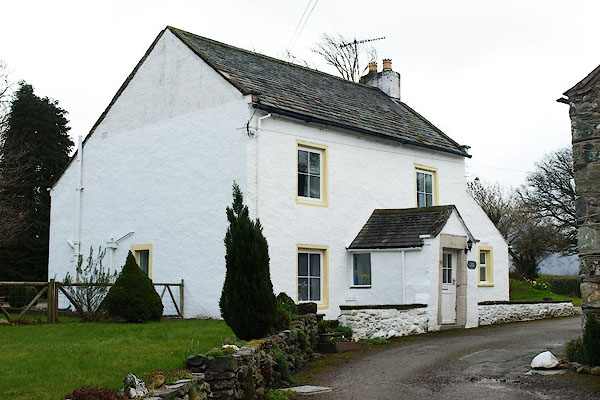 BQH31.jpg (taken 27.3.2009) 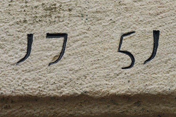 BQH32.jpg Date stone:- "17 51" (taken 27.3.2009) |
||
|
|
||
| evidence:- | possibly old map:- OS County Series (Cmd 46 15) placename:- High Ruddings placename:- Ruddings, High |
|
| source data:- | Maps, County Series maps of Great Britain, scales 6 and 25
inches to 1 mile, published by the Ordnance Survey, Southampton,
Hampshire, from about 1863 to 1948. |
|
|
|
||
| evidence:- | old map:- Crosthwaite 1783-94 (Bas) placename:- High Rudding |
|
| source data:- | Map, uncoloured engraving, An Accurate Map of Broadwater or
Bassenthwaite Lake, scale about 3 inches to 1 mile, by Peter
Crosthwaite, Keswick, Cumberland, 1783, version published 1800.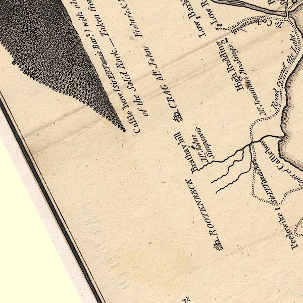 CT6NY13V.jpg "High Rudding / Mr. Jonathan Beaking's" item:- Armitt Library : 1959.191.4 Image © see bottom of page |
|
|
|
||
 Lakes Guides menu.