Old Cumbria Gazetteer
 |
 |
|
||
| Ais Gill | ||||
| locality:- | Mallerstang | |||
| civil parish:- | Mallerstang (formerly Westmorland) | |||
| county:- | Cumbria | |||
| locality type:- | river | |||
| 1Km square:- | SD7797 (etc) | |||
| 10Km square:- | SD79 | |||
|
|
||||
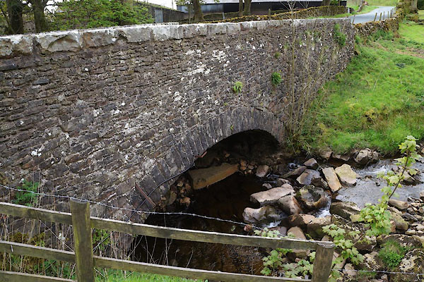
 CDC24.jpg At Aisgill Bridge, (taken 26.5.2015) |
||||
|
|
||||
| evidence:- | probably old map:- Jefferys 1770 (Wmd) |
|||
| source data:- | Map, 4 sheets, The County of Westmoreland, scale 1 inch to 1
mile, surveyed 1768, and engraved and published by Thomas
Jefferys, London, 1770.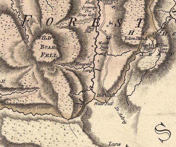 J5SD79NE.jpg single or double wiggly line; river item:- National Library of Scotland : EME.s.47 Image © National Library of Scotland |
|||
|
|
||||
| places:- |
|
|||
|
||||
|
||||
|
||||
 Lakes Guides menu.