 Old Cumbria Gazetteer
 |
 |
|
| Anns Hill, Bridekirk | ||
| Anns Hill | ||
| Annshill | ||
| civil parish:- | Bridekirk (formerly Cumberland) | |
| county:- | Cumbria | |
| locality type:- | buildings | |
| coordinates:- | NY11903259 | |
| 1Km square:- | NY1132 | |
| 10Km square:- | NY13 | |
|
|
||
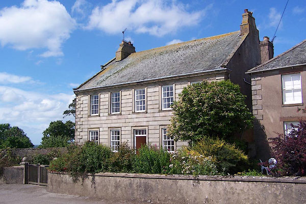 BNV45.jpg (taken 20.6.2007) |
||
|
|
||
| evidence:- | old map:- OS County Series (Cmd 45 16) placename:- Annshill |
|
| source data:- | Maps, County Series maps of Great Britain, scales 6 and 25
inches to 1 mile, published by the Ordnance Survey, Southampton,
Hampshire, from about 1863 to 1948. |
|
|
|
||
| evidence:- | old map:- Donald 1774 (Cmd) placename:- Anns Hill |
|
| source data:- | Map, hand coloured engraving, 3x2 sheets, The County of Cumberland, scale about 1
inch to 1 mile, by Thomas Donald, engraved and published by Joseph Hodskinson, 29
Arundel Street, Strand, London, 1774.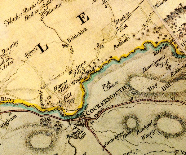 D4NY13SW.jpg "Anns Hill" house item:- Carlisle Library : Map 2 Image © Carlisle Library |
|
|
|
||
| evidence:- | road book:- Cary 1798 (2nd edn 1802) placename:- Ann's Hill |
|
| source data:- | Road book, itineraries, Cary's New Itinerary, by John Cary, 181
Strand, London, 2nd edn 1802. goto source goto source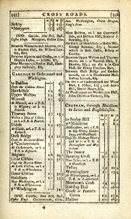 click to enlarge click to enlargeC38557.jpg page 557-558 "On the r. of Cockermouth are ... and Ann's Hill, Daniel Moore, Esq." item:- JandMN : 228.2 Image © see bottom of page |
|
|
|
||
| evidence:- | old map:- Ford 1839 map placename:- Anns Hill |
|
| source data:- | Map, uncoloured engraving, Map of the Lake District of
Cumberland, Westmoreland and Lancashire, scale about 3.5 miles
to 1 inch, published by Charles Thurnam, Carlisle, and by R
Groombridge, 5 Paternoster Row, London, 3rd edn 1843.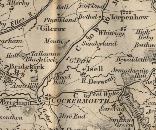 FD02NY13.jpg "Anns Hill" Building and park. item:- JandMN : 100.1 Image © see bottom of page |
|
|
|
||
| evidence:- | database:- Listed Buildings 2010 placename:- Anns Hill |
|
| source data:- | courtesy of English Heritage "ANNS HILL / / / BRIDEKIRK / ALLERDALE / CUMBRIA / II / 72575 / NY1190232589" |
|
|
|
||
Lakes Guides menu.