 Old Cumbria Gazetteer
 |
 |
|
| Armathwaite Hall, Bassenthwaite | ||
| Armathwaite Hall | ||
| civil parish:- | Bassenthwaite (formerly Cumberland) | |
| county:- | Cumbria | |
| locality type:- | buildings | |
| locality type:- | hotel | |
| coordinates:- | NY20703249 | |
| 1Km square:- | NY2032 | |
| 10Km square:- | NY23 | |
|
|
||
| MN photo:- |
Complete rebuild, a country gentleman's residence, by Thomas Hartley, mine owner from
Bridekirk near Cockermouth, 1880. The hall is now a hotel. |
|
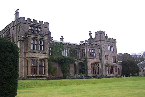 BLO52.jpg Lakeside face. (taken 20.1.2006) |
||
|
|
||
| evidence:- | old map:- OS County Series (Cmd 46 15) placename:- Armthwaite Hall |
|
| source data:- | Maps, County Series maps of Great Britain, scales 6 and 25
inches to 1 mile, published by the Ordnance Survey, Southampton,
Hampshire, from about 1863 to 1948. |
|
|
|
||
| evidence:- | old map:- Saxton 1579 placename:- Armanthwate |
|
| source data:- | Map, hand coloured engraving, Westmorlandiae et Cumberlandiae Comitatus ie Westmorland
and Cumberland, scale about 5 miles to 1 inch, by Christopher Saxton, London, engraved
by Augustinus Ryther, 1576, published 1579-1645.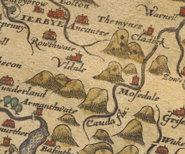 Sax9NY23.jpg Tower, symbol for a house, hall, tower, etc. "Armanthwate" item:- private collection : 2 Image © see bottom of page |
|
|
|
||
| evidence:- | old map:- Mercator 1595 (edn?) placename:- Armanthwate |
|
| source data:- | Map, hand coloured engraving, Northumbria, Cumberlandia, et
Dunelmensis Episcopatus, ie Northumberland, Cumberland and
Durham etc, scale about 6.5 miles to 1 inch, by Gerard Mercator,
Duisberg, Germany, about 1595.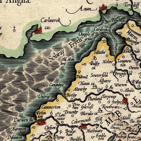 MER8CumB.jpg "Armanthwate" circle item:- JandMN : 169 Image © see bottom of page |
|
|
|
||
| evidence:- | old map:- Speed 1611 (Cmd) placename:- Armanthwat |
|
| source data:- | Map, hand coloured engraving, Cumberland and the Ancient Citie
Carlile Described, scale about 4 miles to 1 inch, by John Speed,
1610, published by J Sudbury and George Humble, Popes Head
Alley, London, 1611-12.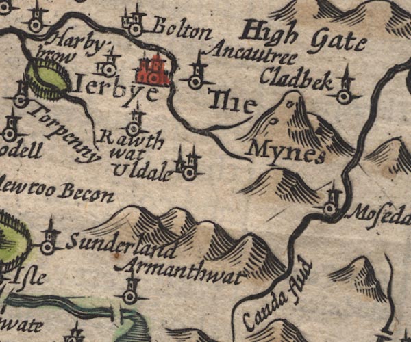 SP11NY23.jpg "Armanthwat" circle, tower item:- private collection : 16 Image © see bottom of page |
|
|
|
||
| evidence:- | old map:- Jansson 1646 placename:- Armanthwat |
|
| source data:- | Map, hand coloured engraving, Cumbria and Westmoria, ie
Cumberland and Westmorland, scale about 3.5 miles to 1 inch, by
John Jansson, Amsterdam, Netherlands, 1646.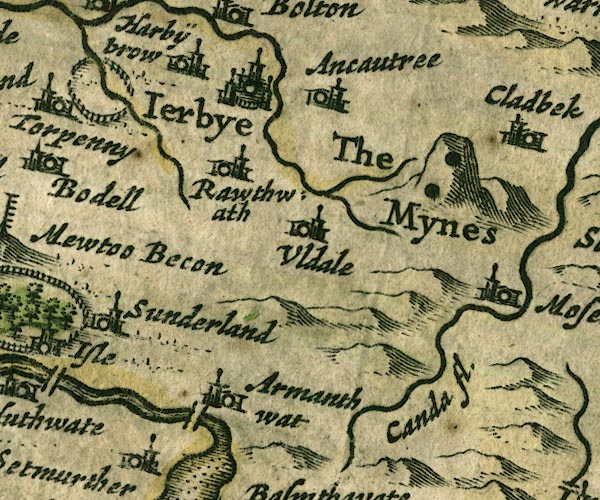 JAN3NY23.jpg "Armanthwat" Buildings and tower. item:- JandMN : 88 Image © see bottom of page |
|
|
|
||
| evidence:- | presumably old map:- Ogilby 1675 (plate 96) placename:- Armanthwate |
|
| source data:- | Road strip map, hand coloured engraving, the Road from Kendal to
Cockermouth, and the Road from Egremond to Carlisle, scale about
1 inch to 1 mile, by John Ogilby, London, 1675. OG96m035.jpg In mile 37, Cumberland. "Armanthwate" two rows of houses down a turning right off the road. item:- JandMN : 22 Image © see bottom of page |
|
|
|
||
| evidence:- | old map:- Seller 1694 (Cmd) placename:- Armanthwray |
|
| source data:- | Map, uncoloured engraving, Cumberland, scale about 12 miles to 1
inch, by John Seller, 1694. click to enlarge click to enlargeSEL9.jpg "Arman[thwray]" circle, italic lowercase text; settlement or house item:- Dove Cottage : 2007.38.89 Image © see bottom of page |
|
|
|
||
| evidence:- | old map:- Morden 1695 (Cmd) placename:- Armanthwate |
|
| source data:- | Map, uncoloured engraving, Cumberland, scale about 4 miles to 1
inch, by Robert Morden, 1695, published by Abel Swale, the
Unicorn, St Paul's Churchyard, Awnsham, and John Churchill, the
Black Swan, Paternoster Row, London, 1695-1715.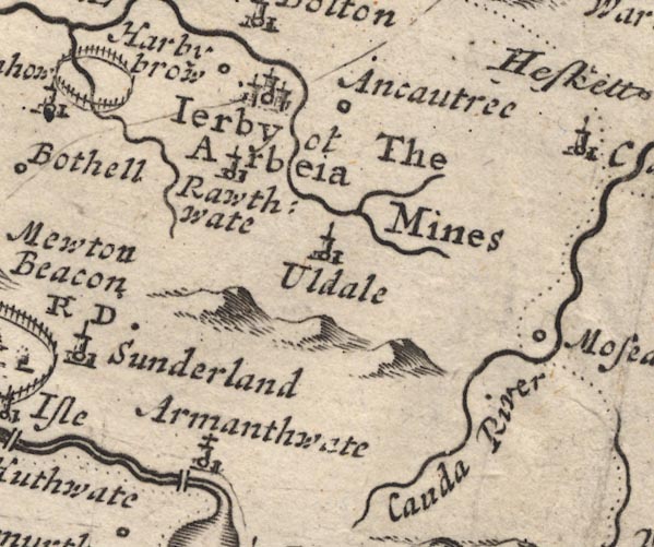 MD12NY23.jpg "Armanthwate" Circle, building and tower, the tower has a cross. item:- JandMN : 90 Image © see bottom of page |
|
|
|
||
| evidence:- | old map:- Bowen 1720 (plate 260) placename:- Armanthwate |
|
| source data:- | Road strip map, uncoloured engraving, pl.260, The Road from
Kendal to Cockermouth, scale about 2 miles to 1 inch, with
sections in Westmorland and Cumberland, published by Emanuel
Bowen, St Katherines, London, 1720. B260m35.jpg At mile 38. item:- private collection : 1.260 Image © see bottom of page |
|
|
|
||
| evidence:- | old map:- Badeslade 1742 placename:- Armanthwate |
|
| source data:- | Map, uncoloured engraving, A Map of Cumberland North from
London, scale about 11 miles to 1 inch, with descriptive text,
by Thomas Badeslade, London, engraved and published by William
Henry Toms, Union Court, Holborn, London, 1742. click to enlarge click to enlargeBD10.jpg "Armanthwate" circle, italic lowercase text; village, hamlet or locality item:- JandMN : 115 Image © see bottom of page |
|
|
|
||
| evidence:- | old map:- Bowen and Kitchin 1760 placename:- Armanthwate |
|
| source data:- | Map, hand coloured engraving, A New Map of the Counties of
Cumberland and Westmoreland Divided into their Respective Wards,
scale about 4 miles to 1 inch, by Emanuel Bowen and Thomas
Kitchin et al, published by T Bowles, Robert Sayer, and John
Bowles, London, 1760.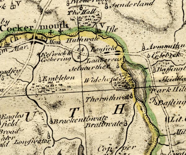 BO18NY12.jpg "Armanthwate" circle, tower item:- Armitt Library : 2008.14.10 Image © see bottom of page |
|
|
|
||
| evidence:- | old map:- Donald 1774 (Cmd) placename:- Armathwaite |
|
| source data:- | Map, hand coloured engraving, 3x2 sheets, The County of Cumberland, scale about 1
inch to 1 mile, by Thomas Donald, engraved and published by Joseph Hodskinson, 29
Arundel Street, Strand, London, 1774. D4NY23SW.jpg "Armathwaite / Spedding Esqr." house item:- Carlisle Library : Map 2 Image © Carlisle Library |
|
|
|
||
| evidence:- | descriptive text:- West 1778 (11th edn 1821) placename:- Armathwaite House item:- scots pine; pine |
|
| source data:- | Guide book, A Guide to the Lakes, by Thomas West, published by
William Pennington, Kendal, Cumbria once Westmorland, and in
London, 1778 to 1821. goto source goto sourcePage 119:- "..." "'From Mr. Spedding's, of Armathwaite, at the low extremity of the lake, you have a fine view of the whole [Bassenthwaite Lake].'" goto sourcePage 120:- "[Mr. Gray] '... Armathwaite-house is a modern fabric, not large, and built of dark red stone.'" "..." goto sourcePage 127:- "... in the point of beauty [from Beck Wythop] Armathwaite is seated, queen of the lake, on which she smiles in graceful beauty." goto sourceAddendum; Mr Gray's Journal, 1769 Page 208:- "..." "Oct. 6. Went in a chaise eight miles along the east side of Bassenthwaite-water to Ouse-bridge, ... At the foot of it [Bassenthwaite Lake], a few paces from the brink, gently sloping upwards, stands Armathwaite, in a thick grove of Scotch firs, commanding a noble view directly up the lake; at a small distance behind the house is a large extent of wood, and still behind this a ridge of cultivated hills on which, according to the Keswick proverb, the sun always shines. ..." goto sourcePage 209:- "... Armathwaite-house is a modern fabric, not large, and built of dark red stone, belonging to Mr. Spedding, whose grandfather was steward to old Sir James Lowther, and bought this estate of the Highmores." |
|
|
|
||
| evidence:- | old map:- Crosthwaite 1783-94 (Bas) placename:- Armathwaite Hall |
|
| source data:- | Map, uncoloured engraving, An Accurate Map of Broadwater or
Bassenthwaite Lake, scale about 3 inches to 1 mile, by Peter
Crosthwaite, Keswick, Cumberland, 1783, version published 1800.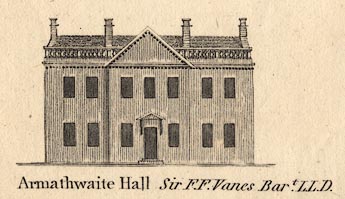 CT06Vgn6.jpg "Armathwaite Hall Sir F. F. Vane's Bart. LLD." item:- Armitt Library : 1959.191.4 Image © see bottom of page |
|
|
|
||
| evidence:- | old map:- Crosthwaite 1783-94 (Bas) placename:- Armathwaite Hall placename:- station, Bassenthwaite, West 1 |
|
| source data:- | Map, uncoloured engraving, An Accurate Map of Broadwater or
Bassenthwaite Lake, scale about 3 inches to 1 mile, by Peter
Crosthwaite, Keswick, Cumberland, 1783, version published 1800.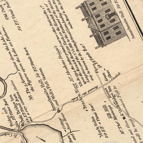 CT6NY23B.jpg "Armathwaite Hall / Sir F. F. Vane's Bart. / and West's First Station" item:- Armitt Library : 1959.191.4 Image © see bottom of page |
|
|
|
||
| evidence:- | old map:- West 1784 map placename:- Armathwaite |
|
| source data:- | Map, hand coloured engraving, A Map of the Lakes in Cumberland,
Westmorland and Lancashire, scale about 3.5 miles to 1 inch,
engraved by Paas, 53 Holborn, London, about 1784.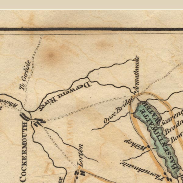 Ws02NY13.jpg item:- Armitt Library : A1221.1 Image © see bottom of page |
|
|
|
||
| evidence:- | old text:- Clarke 1787 placename:- Armathwaite |
|
| source data:- | Guide book, A Survey of the Lakes of Cumberland, Westmorland,
and Lancashire, written and published by James Clarke, Penrith,
Cumberland, and in London etc, 1787; published 1787-93. goto source Page 95:- "..." "At a little distance is Armathwaite, the seat of J. Spedding, Esq: It is situated on a rising ground, which has a gentle declivity to the Lake; the building is neat, being of red freestone, and has from the front a pleasant view of the Lake, Wythop-Brows, the barren side of Skiddow, and the cluster of mountains called Newland-Fells: when Skiddow is enlightened by the evening sun, its appearance is not so gloomy as at other times." |
|
|
|
||
| evidence:- | old map:- Clarke 1787 map (Bassenthwaite Lake) placename:- Armathwaite |
|
| source data:- | Map, A Map of Broadwater and its Environs, ie Bassenthwaite
Lake, scale about 6.5 ins to 1 mile, by James Clarke, engraved
by Neele, 352 Strand, published by James Clarke, Penrith,
Cumberland and in London etc, 1787.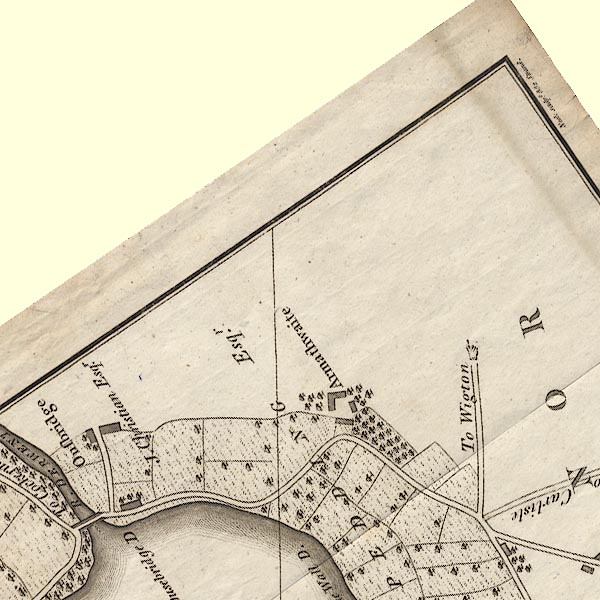 CL8NY23B.jpg "Armathwaite / J. SPEDDING Esqr." item:- private collection : 10.8 Image © see bottom of page |
|
|
|
||
| evidence:- | old map:- Hall 1820 (Cmd) placename:- Armathwaite |
|
| source data:- | Map, hand coloured engraving, Cumberland, scale about 21 miles
to 1 inch, engraved by Sidney Hall, published by S Leigh, 18
Strand, London, 1820-31. click to enlarge click to enlargeHA14.jpg "Armathwaite" circle, italic lowercase text; settlement item:- JandMN : 91 Image © see bottom of page |
|
|
|
||
| evidence:- | descriptive text:- Ford 1839 (3rd edn 1843) placename:- Armathwaite Hall |
|
| source data:- | Guide book, A Description of Scenery in the Lake District, by
Rev William Ford, published by Charles Thurnam, Carlisle, by W
Edwards, 12 Ave Maria Lane, Charles Tilt, Fleet Street, William
Smith, 113 Fleet Street, London, by Currie and Bowman,
Newcastle, by Bancks and Co, Manchester, by Oliver and Boyd,
Edinburgh, and by Sinclair, Dumfries, 1839. goto source Page 85:- "... After descending a hill, the road winds through a narrow dale, with moderate eminences on either side clothed with wood, till it reaches the water's edge: at this point there is spread out before the eyes a sweet view of Armathwaite Hall, the residence of Sir -- Vane, with its trees, single or in clumps, sprinkled over the sloping lawns, the rising grounds behind enrobed with forests, and the silvery lake filling the middle of the picture." |
|
|
|
||
| evidence:- | old map:- Ford 1839 map placename:- Armathwaite Hall |
|
| source data:- | Map, uncoloured engraving, Map of the Lake District of
Cumberland, Westmoreland and Lancashire, scale about 3.5 miles
to 1 inch, published by Charles Thurnam, Carlisle, and by R
Groombridge, 5 Paternoster Row, London, 3rd edn 1843.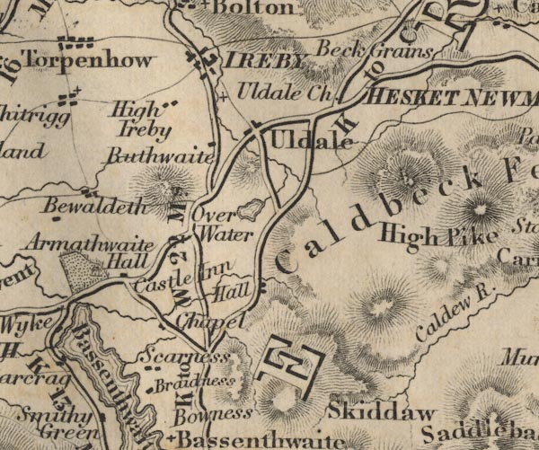 FD02NY23.jpg "Armathwaite Hall" Building and park. item:- JandMN : 100.1 Image © see bottom of page |
|
|
|
||
| evidence:- | old map:- Garnett 1850s-60s H placename:- Armathwaite Hall |
|
| source data:- | Map of the English Lakes, in Cumberland, Westmorland and
Lancashire, scale about 3.5 miles to 1 inch, published by John
Garnett, Windermere, Westmorland, 1850s-60s.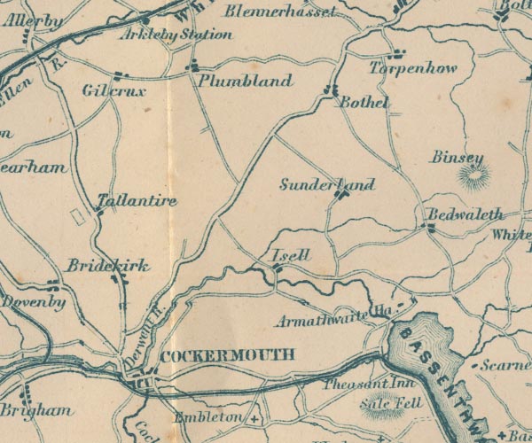 GAR2NY13.jpg "Armathwaite Ha." block, building item:- JandMN : 82.1 Image © see bottom of page |
|
|
|
||
| evidence:- | database:- Listed Buildings 2010 placename:- Armathwaite Hall Hotel |
|
| source data:- | courtesy of English Heritage "ARMATHWAITE HALL HOTEL / / / BASSENTHWAITE / ALLERDALE / CUMBRIA / II / 72096 / NY2063732464" |
|
| source data:- | courtesy of English Heritage "House now hotel. Mid C19 with late C19 extension (on the site of an earlier house) for the Fletcher-Vane family. Dressed red sandstone, with calciferous sandstone ashlar dressings, flush quoins, string courses and battlemented parapet, on plinth of similar material. Graduated greenslate roofs with tall ashlar chimney stacks. 2 storeys of numerous bays with flanking 3-storey towers and right-angled 2 1/2-storey, 5-bay wing, forming overall L-shape. Tudor style. Garden facade has central recessed bays with square tower to right and rectangular tower to left, all with cross-mullioned windows of numerous cusped-headed lights. Right tower has battlemented angle turret. Rear facade has projecting entrance bay, with panelled door in Tudor archway and flanking cusped-headed side lights, all under large cross-mullioned staircase window. Gabled pediment above with Fletcher-Vane coat-of-arms. Large ground-floor windows similar to garden facade and smaller 2 &3-light stone-mullioned windows. Wing of similar design has 2- and 3-light stone-mullioned windows and segmental-arched dormer windows. Interior has mid C19 rooms with Tudor-style fireplaces and moulded plaster ceilings. Late C19 rooms have wood panelled walls and ceilings. Bar has large German wood fireplace with carved figures and animals." |
|
|
|
||
| notes:- |
Formerly the home of the Vane Family and Spedding Family. |
|
| In the late 19th century J Boustead enlarged the hall. He built high wall round the
grounds and had the road lowered so that passers by did not spoil his view. |
||
|
|
||
Lakes Guides menu.