 Old Cumbria Gazetteer
 |
 |
|
|
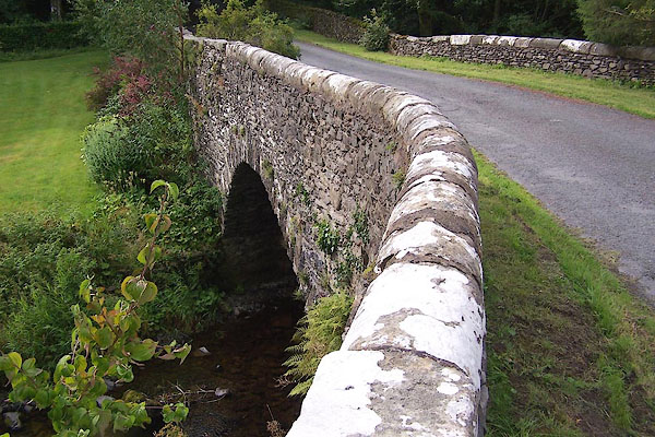
| Bannisdale High Bridge, Whitwell and Selside | |||
| Bannisdale High Bridge | |||
| site name:- | Bannisdale Beck | ||
| locality:- | Bannisdale | ||
| civil parish:- | Whitwell and Selside (formerly Westmorland) | ||
| civil parish:- | Fawcett Forest (formerly Westmorland) | ||
| county:- | Cumbria | ||
| locality type:- | bridge | ||
| coordinates:- | NY54100117 | ||
| 1Km square:- | NY5401 | ||
| 10Km square:- | NY50 | ||
|
|
|||
 BJT43.jpg (taken 22.8.2005) |
|||
|
|
|||
| evidence:- | old map:- OS County Series (Wmd 28 13) placename:- Bannisdale Old Bridge placename:- Bannisdale Bridge, Old |
||
| source data:- | Maps, County Series maps of Great Britain, scales 6 and 25
inches to 1 mile, published by the Ordnance Survey, Southampton,
Hampshire, from about 1863 to 1948.
|
||
|
|
|||
| evidence:- | old map:- Ogilby 1675 (plate 38) |
||
| source data:- | Road strip map, hand coloured engraving, continuation of the
Road from London to Carlisle, scale about 1 inch to 1 mile, by
John Ogilby, London, 1675.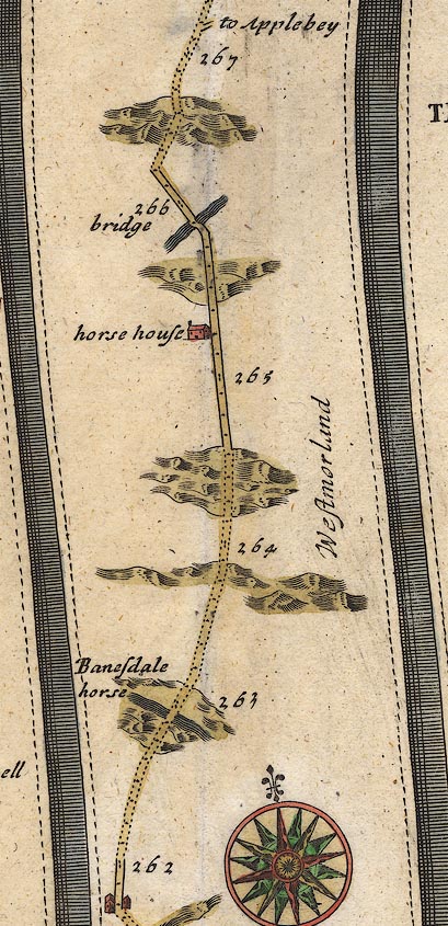 OG38m262.jpg In mile 262, Westmorland. Road crosses a river, no bridge drawn. item:- JandMN : 21 Image © see bottom of page |
||
|
|
|||
| evidence:- | old map:- Jefferys 1770 (Wmd) |
||
| source data:- | Map, 4 sheets, The County of Westmoreland, scale 1 inch to 1
mile, surveyed 1768, and engraved and published by Thomas
Jefferys, London, 1770.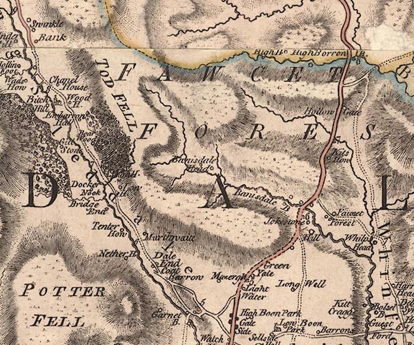 J5NY50SW.jpg double line, road, across a stream; bridge item:- National Library of Scotland : EME.s.47 Image © National Library of Scotland |
||
|
|
|||
| evidence:- | old map:- Cary 1789 (edn 1805) |
||
| source data:- | Map, uncoloured engraving, Westmoreland, scale about 2.5 miles
to 1 inch, by John Cary, London, 1789; edition 1805.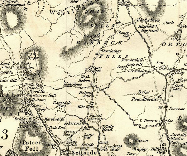 CY24NY50.jpg road across a stream; bridge over the Bannisdale Beck item:- JandMN : 129 Image © see bottom of page |
||
|
|
|||
| evidence:- | old map:- Laurie and Whittle 1806 placename:- Bannisdale Bridge |
||
| source data:- | Road map, Completion of the Roads to the Lakes, scale about 10
miles to 1 inch, by Nathaniel Coltman? 1806, published by Robert
H Laurie, 53 Fleet Street, London, 1834. click to enlarge click to enlargeLw18.jpg "Bannisdale Bridge 268" bridge; distance from London item:- private collection : 18.18 Image © see bottom of page |
||
|
|
|||
| evidence:- | database:- Listed Buildings 2010 placename:- Bannisdale High Bridge |
||
| source data:- | courtesy of English Heritage "BANNISDALE HIGH BRIDGE / / / FAWCETT FOREST / SOUTH LAKELAND / CUMBRIA / II / 75630 / NY5410101160" |
||
| source data:- | courtesy of English Heritage "Bridge over Bannisdale Beck. Probably C18 with late C18 widening to east. Stone rubble with dressed coping. Segmental arch; voussoirs to west side of irregular length, some outer voussoirs to shoulders. Plain parapets. Roadway is 8m wide. Originally on the route of the Heron Syke to Eamont Bridge turnpike road until 1820s when it was replaced by Bannisdale Low Bridge (q.v.) on new route." |
||
|
|
|||
 Lakes Guides menu.