 Old Cumbria Gazetteer
 |
 |
|
| Barfield Tarn, Whicham | ||
| Barfield Tarn | ||
| civil parish:- | Whicham (formerly Cumberland) | |
| county:- | Cumbria | |
| locality type:- | tarn | |
| coordinates:- | SD10778692 (etc) | |
| 1Km square:- | SD1086 | |
| 10Km square:- | SD18 | |
| altitude:- | 79 feet | |
| altitude:- | 24m | |
|
|
||
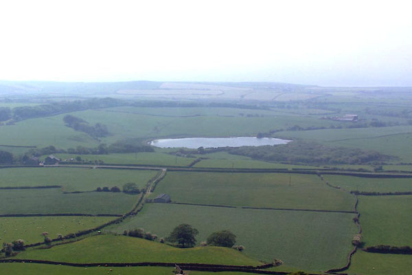 BWQ94.jpg (taken 27.5.2012) |
||
|
|
||
| evidence:- | old map:- OS County Series (Cmd 87 4) placename:- Barfield Tarn |
|
| source data:- | Maps, County Series maps of Great Britain, scales 6 and 25
inches to 1 mile, published by the Ordnance Survey, Southampton,
Hampshire, from about 1863 to 1948. |
|
|
|
||
| evidence:- | old map:- Otley 1818 |
|
| source data:- | Map, uncoloured engraving, The District of the Lakes,
Cumberland, Westmorland, and Lancashire, scale about 4 miles to
1 inch, by Jonathan Otley, 1818, engraved by J and G Menzies,
Edinburgh, Scotland, published by Jonathan Otley, Keswick,
Cumberland, et al, 1833.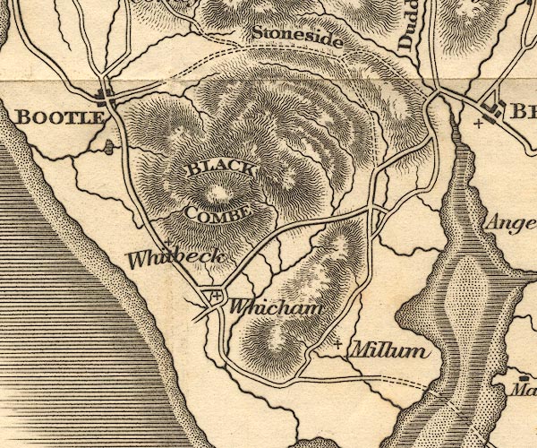 OT02SD18.jpg item:- JandMN : 48.1 Image © see bottom of page |
|
|
|
||
 Lakes Guides menu.