 Old Cumbria Gazetteer
 |
 |
|
| Barton Hall, Barton | ||
| Barton Hall | ||
| civil parish:- | Barton (formerly Westmorland) | |
| county:- | Cumbria | |
| locality type:- | buildings | |
| coordinates:- | NY47802510 | |
| 1Km square:- | NY4725 | |
| 10Km square:- | NY42 | |
|
|
||
| evidence:- | old map:- OS County Series (Wmd 7 6) placename:- Newhouse |
|
| source data:- | Maps, County Series maps of Great Britain, scales 6 and 25
inches to 1 mile, published by the Ordnance Survey, Southampton,
Hampshire, from about 1863 to 1948. |
|
|
|
||
| evidence:- | database:- Listed Buildings 2010 placename:- Barton Hall item:- date stone (1710); date stone (1863) |
|
| source data:- | courtesy of English Heritage "BARTON HALL / / B5320 / BARTON / EDEN / CUMBRIA / II / 74506 / NY4780125093" |
|
|
|
||
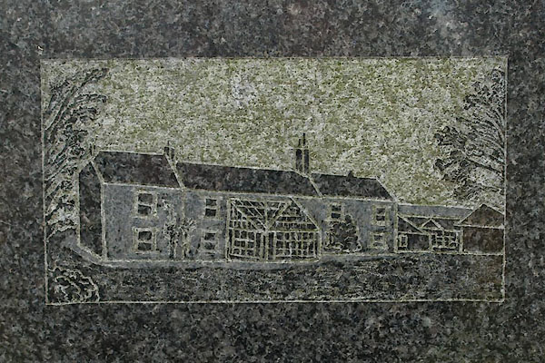 BXO92.jpg On a gravestone, St Michael's Church, 2011. (taken 26.10.2012) |
||
|
|
||
 Lakes Guides menu.