Old Cumbria Gazetteer
 |
 |
|
||
| Bassenthwaite | ||||
| Hause | ||||
| Bassenthat | ||||
| civil parish:- | Bassenthwaite (formerly Cumberland) | |||
| county:- | Cumbria | |||
| locality type:- | locality | |||
| locality type:- | buildings | |||
| coordinates:- | NY23003220 (etc) | |||
| 1Km square:- | NY2332 | |||
| 10Km square:- | NY23 | |||
|
|
||||
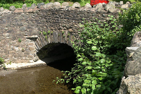
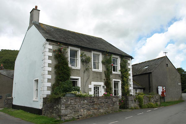
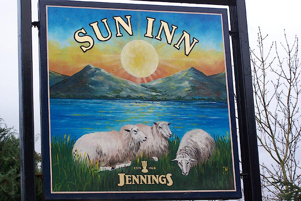
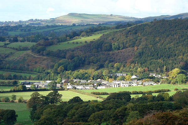 CEB85.jpg (taken 13.10.2015) |
||||
|
|
||||
| evidence:- | old map:- OS County Series (Cmd 46) placename:- Hause |
|||
| source data:- | Maps, County Series maps of Great Britain, scales 6 and 25
inches to 1 mile, published by the Ordnance Survey, Southampton,
Hampshire, from about 1863 to 1948. "Hause" |
|||
|
|
||||
| evidence:- | old map:- Saxton 1579 placename:- Basinthwate |
|||
| source data:- | Map, hand coloured engraving, Westmorlandiae et Cumberlandiae Comitatus ie Westmorland
and Cumberland, scale about 5 miles to 1 inch, by Christopher Saxton, London, engraved
by Augustinus Ryther, 1576, published 1579-1645.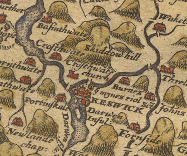 Sax9NY22.jpg Church, symbol for a parish or village, with a parish church. "Basinthwate" item:- private collection : 2 Image © see bottom of page |
|||
|
|
||||
| evidence:- | old map:- Mercator 1595 (edn?) placename:- Bosingtwate |
|||
| source data:- | Map, hand coloured engraving, Northumbria, Cumberlandia, et
Dunelmensis Episcopatus, ie Northumberland, Cumberland and
Durham etc, scale about 6.5 miles to 1 inch, by Gerard Mercator,
Duisberg, Germany, about 1595.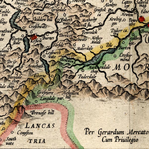 MER8CumF.jpg "Bosingtwate" circle item:- JandMN : 169 Image © see bottom of page |
|||
|
|
||||
| evidence:- | old map:- Keer 1605 placename:- Basinthwate |
|||
| source data:- | Map, hand coloured engraving, Westmorland and Cumberland, scale
about 16 miles to 1 inch, probably by Pieter van den Keere, or
Peter Keer, about 1605 edition perhaps 1676. click to enlarge click to enlargeKER8.jpg "Basinthwate" dot, circle and tower; village item:- Dove Cottage : 2007.38.110 Image © see bottom of page |
|||
|
|
||||
| evidence:- | old map:- Speed 1611 (Cmd) placename:- Basinthavate |
|||
| source data:- | Map, hand coloured engraving, Cumberland and the Ancient Citie
Carlile Described, scale about 4 miles to 1 inch, by John Speed,
1610, published by J Sudbury and George Humble, Popes Head
Alley, London, 1611-12.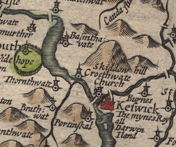 SP11NY22.jpg "Basinthavate" circle, building, tower item:- private collection : 16 Image © see bottom of page |
|||
|
|
||||
| evidence:- | old map:- Jenner 1643 placename:- Basinthwate |
|||
| source data:- | Table of distances, with map, hand coloured engraving,
Cumberland, scale about 21 miles to 1 inch, engraved by Jacob
van Langeren, published by Thomas Jenner, Cornhill, London, 1643. JEN4Sq.jpg "Basinthwate" circle item:- private collection : 52.Cmd Image © see bottom of page |
|||
|
|
||||
| evidence:- | old map:- Jansson 1646 placename:- Bassenthwaite |
|||
| source data:- | Map, hand coloured engraving, Cumbria and Westmoria, ie
Cumberland and Westmorland, scale about 3.5 miles to 1 inch, by
John Jansson, Amsterdam, Netherlands, 1646.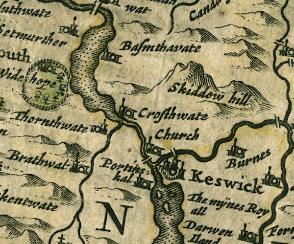 JAN3NY22.jpg "Bassenthwaite" Buildings and tower. item:- JandMN : 88 Image © see bottom of page |
|||
|
|
||||
| evidence:- | old map:- Ogilby 1675 (plate 96) placename:- Basinthwait |
|||
| source data:- | Road strip map, hand coloured engraving, the Road from Kendal to
Cockermouth, and the Road from Egremond to Carlisle, scale about
1 inch to 1 mile, by John Ogilby, London, 1675. OG96m035.jpg In mile 36, Cumberland. "Basinthwait" church and houses on the right of the road. item:- JandMN : 22 Image © see bottom of page |
|||
|
|
||||
| evidence:- | old map:- Morden 1695 (Cmd) placename:- Bassingthwate |
|||
| source data:- | Map, uncoloured engraving, Cumberland, scale about 4 miles to 1
inch, by Robert Morden, 1695, published by Abel Swale, the
Unicorn, St Paul's Churchyard, Awnsham, and John Churchill, the
Black Swan, Paternoster Row, London, 1695-1715.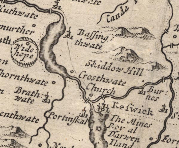 MD12NY22.jpg "Bassingthwate" Circle, building and tower. item:- JandMN : 90 Image © see bottom of page |
|||
|
|
||||
| evidence:- | old map:- Bowen 1720 (plate 260) |
|||
| source data:- | Road strip map, uncoloured engraving, pl.260, The Road from
Kendal to Cockermouth, scale about 2 miles to 1 inch, with
sections in Westmorland and Cumberland, published by Emanuel
Bowen, St Katherines, London, 1720.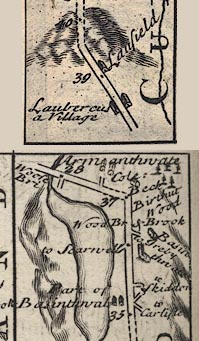 B260m35.jpg 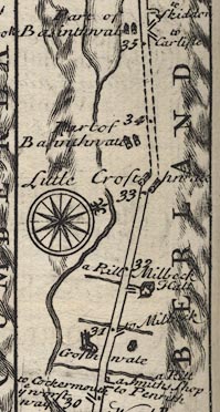 B260m30.jpg part of Basinthwate / 34 ... 35 / part of Basinthwate / 36, Basinthwate on right / 37 item:- private collection : 1.260 Image © see bottom of page |
|||
|
|
||||
| evidence:- | old map:- Badeslade 1742 placename:- Bassingwate |
|||
| source data:- | Map, uncoloured engraving, A Map of Cumberland North from
London, scale about 11 miles to 1 inch, with descriptive text,
by Thomas Badeslade, London, engraved and published by William
Henry Toms, Union Court, Holborn, London, 1742. click to enlarge click to enlargeBD10.jpg "Bassingwate" circle, italic lowercase text; village, hamlet or locality item:- JandMN : 115 Image © see bottom of page |
|||
|
|
||||
| evidence:- | old map:- Bowen and Kitchin 1760 placename:- Bassingthwate |
|||
| source data:- | Map, hand coloured engraving, A New Map of the Counties of
Cumberland and Westmoreland Divided into their Respective Wards,
scale about 4 miles to 1 inch, by Emanuel Bowen and Thomas
Kitchin et al, published by T Bowles, Robert Sayer, and John
Bowles, London, 1760.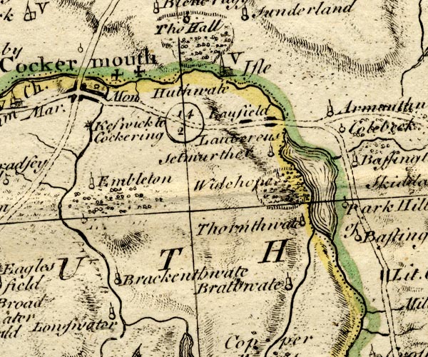 BO18NY12.jpg "Bassingthwate" circle, tower item:- Armitt Library : 2008.14.10 Image © see bottom of page |
|||
|
|
||||
| evidence:- | old map:- Donald 1774 (Cmd) placename:- Halls |
|||
| source data:- | Map, hand coloured engraving, 3x2 sheets, The County of Cumberland, scale about 1
inch to 1 mile, by Thomas Donald, engraved and published by Joseph Hodskinson, 29
Arundel Street, Strand, London, 1774.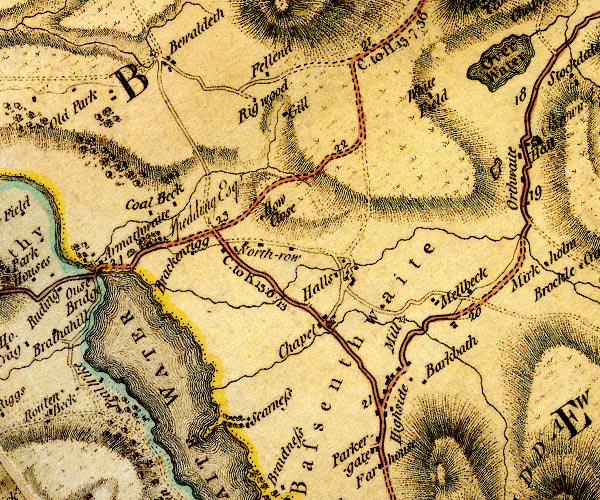 D4NY23SW.jpg "Halls" item:- Carlisle Library : Map 2 Image © Carlisle Library |
|||
|
|
||||
| evidence:- | descriptive text:- West 1778 (11th edn 1821) placename:- Bassenthwaite Halls |
|||
| source data:- | Guide book, A Guide to the Lakes, by Thomas West, published by
William Pennington, Kendal, Cumbria once Westmorland, and in
London, 1778 to 1821. goto source goto sourcePage 123:- "... from Scareness, take the road to Bassenthwaite-halls (a few houses so called) ..." |
|||
|
|
||||
| evidence:- | old text:- Clarke 1787 placename:- Bassenthwaite item:- land tenure; tithes; inclosure |
|||
| source data:- | Guide book, A Survey of the Lakes of Cumberland, Westmorland,
and Lancashire, written and published by James Clarke, Penrith,
Cumberland, and in London etc, 1787; published 1787-93. goto source Page 97:- "The parish of Bassenthwaite, which was an entire manor granted by Waldeof Lord of Allerdale above Derwent, (and son of Gospatric Earl of Dunbar in Scotland,) to his bastard son Gospatric; his posterity were very flourishing, took the name of Bassenthwaite, and remained owners of it in that name, till Adam de Bassenthwaite divided it between his two daughters; it continued in this family till one of the descendants of the younger sister forfeited his part to the crown, viz. Roger Martindale. It was afterwards granted by the crown to the Earl of Derby, who gave it with his daughter Lady Henrietta Stanley, as a child's portion. to Lord Ashburnham; he sold it to the tenants, reserving a small quitrent, now paid to the Earl of Egremont, though not as part of his great Barony of Copeland aforesaid. The other part came by purchase to a family in Northumberland of the name of Lawson, in which family it continues, and the present owner is Sir Gilfrid Lawson, Baronet, of Brayton Hall, in this county. In this manor are about twenty customary tenants who pay arbitrary fines, and about thirty freeholders who pay to him a small quitrent." "..." "... Bassenthwaite paid tithes of corn, hay, &c. till the year 1773, when an act was obtained for dividing and inclosing the common and waste grounds within this parish. By this act the commissioners were empowered to set out lands upon the common, in lieu of all manner of tithes, moduses, oblations, prescriptions, surplice-fees, &c. which was accordingly done. This method has, on all late divisions of waste lands, been pursued in these northern counties: as there have been many such commons divided within these last 25 years, the convenience of it has been sensibly felt. Both tithe-gatherers and land-holders have been eased, not to mention the avoiding of disputes and trouble with those people called Quakers." |
|||
|
|
||||
| evidence:- | old map:- Clarke 1787 map (Bassenthwaite Lake) placename:- Bassenthwaite Halls |
|||
| source data:- | Map, A Map of Broadwater and its Environs, ie Bassenthwaite
Lake, scale about 6.5 ins to 1 mile, by James Clarke, engraved
by Neele, 352 Strand, published by James Clarke, Penrith,
Cumberland and in London etc, 1787.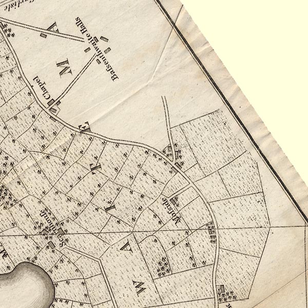 CL8NY23F.jpg "Bassenthwaite Halls" item:- private collection : 10.8 Image © see bottom of page |
|||
|
|
||||
| evidence:- | old map:- Cooper 1808 placename:- Bassenthwaite |
|||
| source data:- | Map, uncoloured engraving, Cumberland, scale about 10.5 miles to
1 inch, drawn and engraved by Cooper, published by R Phillips,
Bridge Street, Blackfriars, London, 1808. click to enlarge click to enlargeCOP3.jpg "Bassenthwaite" circle; village or hamlet item:- JandMN : 86 Image © see bottom of page |
|||
|
|
||||
| evidence:- | old text:- Green 1810 placename:- Bassenthwaite Halls |
|||
| source data:- | Set of prints, soft ground etchings, Sixty Studies from Nature,
by William Green, Ambleside, Westmorland, drawn 1808-10,
published 1810. goto source page 73:- "[round Bassenthwaite Lake] ... the road passes by Bassenthwaite Halls, a few houses so called, to Ouse Bridge ..." |
|||
|
|
||||
| evidence:- | perhaps old map:- Otley 1818 placename:- Halls |
|||
| source data:- | Map, uncoloured engraving, The District of the Lakes,
Cumberland, Westmorland, and Lancashire, scale about 4 miles to
1 inch, by Jonathan Otley, 1818, engraved by J and G Menzies,
Edinburgh, Scotland, published by Jonathan Otley, Keswick,
Cumberland, et al, 1833.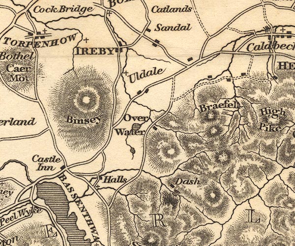 OT02NY23.jpg item:- JandMN : 48.1 Image © see bottom of page |
|||
|
|
||||
| evidence:- | descriptive text:- Ford 1839 (3rd edn 1843) placename:- Haws, The |
|||
| source data:- | Guide book, A Description of Scenery in the Lake District, by
Rev William Ford, published by Charles Thurnam, Carlisle, by W
Edwards, 12 Ave Maria Lane, Charles Tilt, Fleet Street, William
Smith, 113 Fleet Street, London, by Currie and Bowman,
Newcastle, by Bancks and Co, Manchester, by Oliver and Boyd,
Edinburgh, and by Sinclair, Dumfries, 1839. goto source Page 86:- "..." "... the Haws, a village watered by a stream called White Water Dash, ..." |
|||
|
|
||||
| evidence:- | old map:- Garnett 1850s-60s H placename:- Bassentwhaite |
|||
| source data:- | Map of the English Lakes, in Cumberland, Westmorland and
Lancashire, scale about 3.5 miles to 1 inch, published by John
Garnett, Windermere, Westmorland, 1850s-60s. GAR2NY22.jpg "Bassentwhaite" cross, a church item:- JandMN : 82.1 Image © see bottom of page |
|||
|
|
||||
| evidence:- | old print:- Pyne 1853 |
|||
| source data:- | Print, tinted lithograph, Bassenthwaite Lake, Vale and Village, Bassenthwaite, Cumberland,
by James Baker Pyne, engraved by W Gauci, published by Thomas Agnew and Sons, Manchester,
Lancashire, 1853.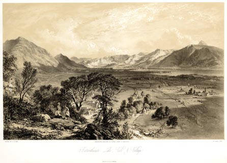 click to enlarge click to enlargePYN216.jpg "PAINTED BY J. B. PYNE. / W. GAUCI LITH. / MANCHESTER, PUBLISHED BY THOMAS AGNEW & SONS, 1853. / Bassenthwaite Lake, Vale & Village. / M & N HANHART IMPT." item:- Armitt Library : A6678.17 Image © see bottom of page |
|||
|
|
||||
| evidence:- | old print:- Pyne 1853 |
|||
| source data:- | Print, coloured lithograph, Bassenthwaite Lake, Vale and Village, Bassenthwaite, Cumberland,
by James Baker Pyne, engraved by W Gauci, published by Thomas Agnew and Sons, Manchester,
Lancashire, 1853.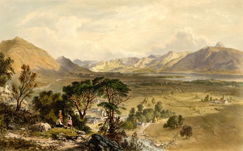 click to enlarge click to enlargePYN416.jpg item:- Armitt Library : A6677.17 Image © see bottom of page |
|||
|
|
||||
 Martineau Directory 1855 Martineau Directory 1855 |
||||
|
|
||||
| evidence:- | old map:- Post Office 1850s-1900s placename:- Bassenthwaite |
|||
| source data:- | Post road maps, General Post Office Circulation Map for England
and Wales, for the General Post Office, London, 1850s-1900s. click to enlarge click to enlargePOF7Cm.jpg "Bassenthwaite" map date 1909 |
|||
|
|
||||
| evidence:- | old map:- Post Office 1850s-1900s placename:- Bassenthwaite |
|||
| source data:- | Post road maps, General Post Office Circulation Map for England
and Wales, for the General Post Office, London, 1850s-1900s. click to enlarge click to enlargePF10Cm.jpg "Bassenthwaite" map date 1892 |
|||
|
|
||||
| evidence:- | old map:- Post Office 1850s-1900s placename:- Bassenthwaite |
|||
| source data:- | Post road maps, General Post Office Circulation Map for England
and Wales, for the General Post Office, London, 1850s-1900s. click to enlarge click to enlargePOF2Cm.jpg "Bassenthwaite" map date 1890 |
|||
|
|
||||
| :- |
images courtesy of the British Postal Museum and Hampshire CC Museums |
|||
|
|
||||
| notes:- |
The avenue of lime trees on the village green were planted to commemorate the diamond
jubill of Victoria,1897. |
|||
|
|
||||
| places:- |
|
|||
|
||||
|
||||
|
||||
|
||||
|
||||
|
||||
|
||||
|
||||
|
||||
|
||||
|
||||
|
||||
|
||||
|
||||
Lakes Guides menu.