 Old Cumbria Gazetteer
 |
 |
|
| beacon, Moota Hill | ||
| Moota Hill Beacon | ||
| site name:- | Moota Hill | |
| civil parish:- | Blindcrake (formerly Cumberland) | |
| county:- | Cumbria | |
| locality type:- | beacon | |
| coordinates:- | NY14443632 (?) | |
| 1Km square:- | NY1436 | |
| 10Km square:- | NY13 | |
|
|
||
| evidence:- | old map:- Saxton 1579 placename:- Mewtoobecon |
|
| source data:- | Map, hand coloured engraving, Westmorlandiae et Cumberlandiae Comitatus ie Westmorland
and Cumberland, scale about 5 miles to 1 inch, by Christopher Saxton, London, engraved
by Augustinus Ryther, 1576, published 1579-1645.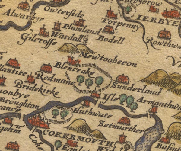 Sax9NY13.jpg "Mewtoobecon" On a hillock, post with rungs to climb to fire basket on top. item:- private collection : 2 Image © see bottom of page |
|
|
|
||
| evidence:- | old map:- Speed 1611 (Cmd) placename:- Mewtoo Becon |
|
| source data:- | Map, hand coloured engraving, Cumberland and the Ancient Citie
Carlile Described, scale about 4 miles to 1 inch, by John Speed,
1610, published by J Sudbury and George Humble, Popes Head
Alley, London, 1611-12.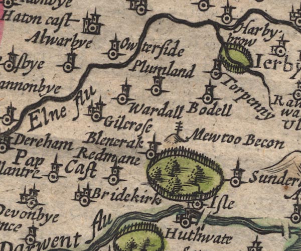 SP11NY13.jpg "Mewtoo Becon" post with cross rails on a hillock item:- private collection : 16 Image © see bottom of page |
|
|
|
||
| evidence:- | old map:- Jansson 1646 placename:- Mewtoo Becon |
|
| source data:- | Map, hand coloured engraving, Cumbria and Westmoria, ie
Cumberland and Westmorland, scale about 3.5 miles to 1 inch, by
John Jansson, Amsterdam, Netherlands, 1646.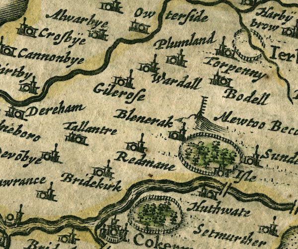 JAN3NY13.jpg "Mewtoo Becon" Tall post with ladder rungs etc, on a hillock. item:- JandMN : 88 Image © see bottom of page |
|
|
|
||
| evidence:- | old map:- Morden 1695 (Cmd) placename:- Mewton Beacon |
|
| source data:- | Map, uncoloured engraving, Cumberland, scale about 4 miles to 1
inch, by Robert Morden, 1695, published by Abel Swale, the
Unicorn, St Paul's Churchyard, Awnsham, and John Churchill, the
Black Swan, Paternoster Row, London, 1695-1715.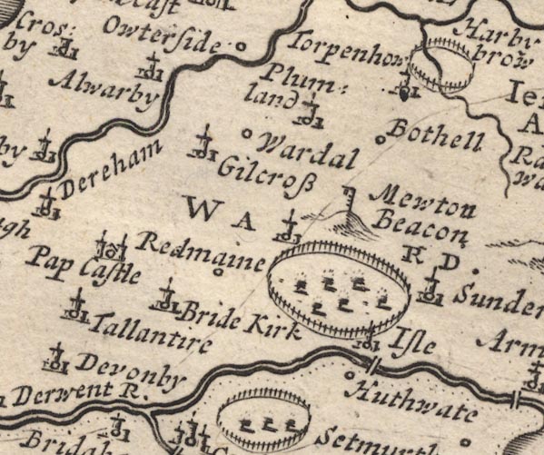 MD12NY13.jpg "Mewton Beacon" Hillock, post with rungs, and hanging cresset. item:- JandMN : 90 Image © see bottom of page |
|
|
|
||
| evidence:- | old map:- Bowen and Kitchin 1760 placename:- Newton Beacon |
|
| source data:- | Map, hand coloured engraving, A New Map of the Counties of
Cumberland and Westmoreland Divided into their Respective Wards,
scale about 4 miles to 1 inch, by Emanuel Bowen and Thomas
Kitchin et al, published by T Bowles, Robert Sayer, and John
Bowles, London, 1760.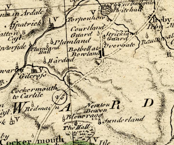 BO18NY13.jpg "Newton Beacon" hill hachuring item:- Armitt Library : 2008.14.10 Image © see bottom of page |
|
|
|
||
| hearsay:- |
The beacons of west Cumberland were on: Black Combe, Boothill, Moota Hill, Muncaster
Fell, Skiddaw, St Bees Head, and Workington Hill. (Questionable information.) |
|
|
|
||
 Lakes Guides menu.