 Old Cumbria Gazetteer
 |
 |
|
| Beda Fell, Martindale | ||
| Beda Fell | ||
| locality:- | Martindale Common | |
| civil parish:- | Martindale (formerly Westmorland) | |
| county:- | Cumbria | |
| locality type:- | hill | |
| locality type:- | fell | |
| coordinates:- | NY42331645 (etc) | |
| 1Km square:- | NY4216 | |
| 10Km square:- | NY41 | |
|
|
||
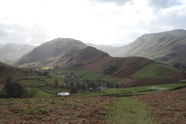 BZZ09.jpg (taken 27.2.2014) 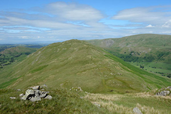 CDM06.jpg (taken 30.6.2015) |
||
|
|
||
| evidence:- | old map:- OS County Series (Wmd 12 12) placename:- Beda Fell |
|
| source data:- | Maps, County Series maps of Great Britain, scales 6 and 25
inches to 1 mile, published by the Ordnance Survey, Southampton,
Hampshire, from about 1863 to 1948. |
|
|
|
||
| evidence:- | old map:- Jefferys 1770 (Wmd) |
|
| source data:- | Map, 4 sheets, The County of Westmoreland, scale 1 inch to 1
mile, surveyed 1768, and engraved and published by Thomas
Jefferys, London, 1770.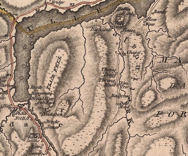 J5NY41NW.jpg hill hachuring; hill or mountain item:- National Library of Scotland : EME.s.47 Image © National Library of Scotland |
|
|
|
||
 Lakes Guides menu.