 Old Cumbria Gazetteer
 |
 |
|
| Birkhaw, Sedbergh | ||
| Birkhaw | ||
| civil parish:- | Sedbergh (formerly Yorkshire) | |
| county:- | Cumbria | |
| locality type:- | buildings | |
| coordinates:- | SD63809470 | |
| 1Km square:- | SD6394 | |
| 10Km square:- | SD69 | |
|
|
||
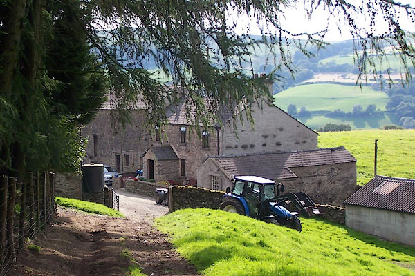 BTJ23.jpg (taken 16.8.2010) 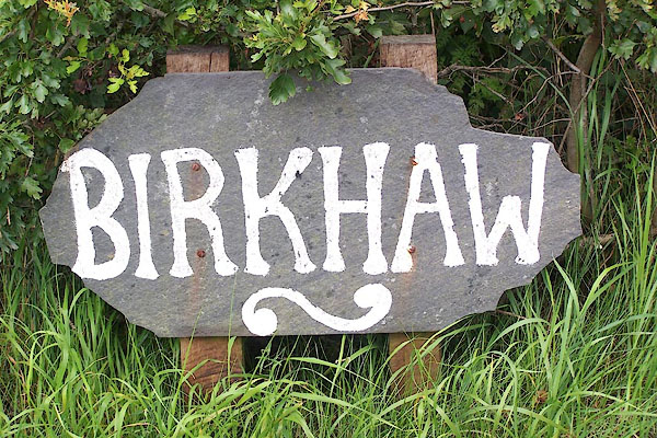 BNX70.jpg (taken 8.8.2007) |
||
|
|
||
| evidence:- | old map:- OS County Series (Yrk 48 11) placename:- Birkhaw |
|
| source data:- | Maps, County Series maps of Great Britain, scales 6 and 25
inches to 1 mile, published by the Ordnance Survey, Southampton,
Hampshire, from about 1863 to 1948. |
|
|
|
||
| evidence:- | old map:- Jefferys 1770 (Wmd) placename:- Birks |
|
| source data:- | Map, 4 sheets, The County of Westmoreland, scale 1 inch to 1
mile, surveyed 1768, and engraved and published by Thomas
Jefferys, London, 1770.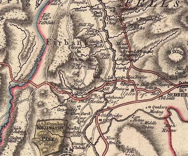 J5SD69SW.jpg "Birks" circle, labelled in italic lowercase text; settlement, farm, house, or hamlet? item:- National Library of Scotland : EME.s.47 Image © National Library of Scotland |
|
|
|
||
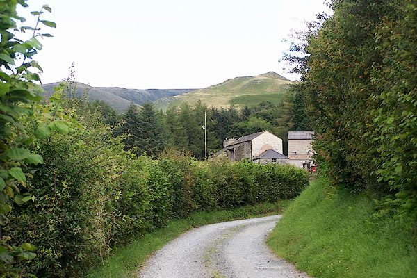 BNX71.jpg (taken 8.8.2007) 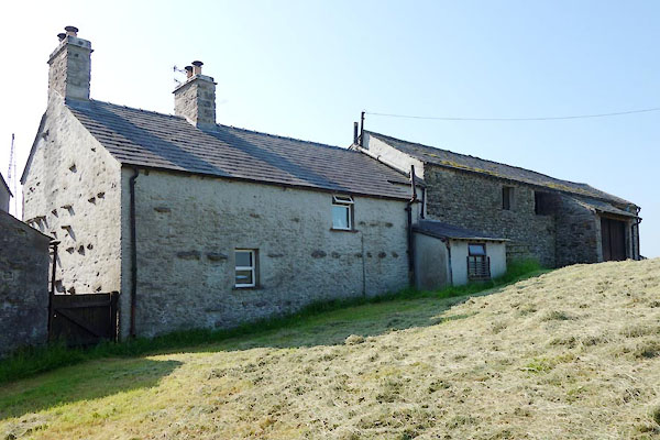 BYT73.jpg (taken 9.7.2013) |
||
|
|
||
 Lakes Guides menu.