 Old Cumbria Gazetteer
 |
 |
|
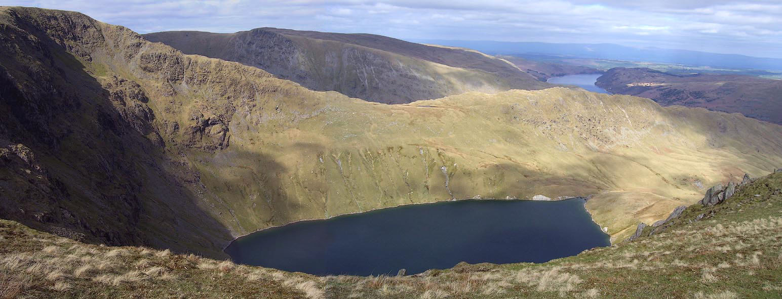
| Blea Water, Mardale | ||
| runs into:- |  Blea Water Beck Blea Water Beck |
|
|
|
||
| Blea Water | ||
| civil parish:- | Shap Rural (formerly Westmorland) | |
| county:- | Cumbria | |
| locality type:- | tarn | |
| coordinates:- | NY44871075 (etc) | |
| 1Km square:- | NY4410 | |
| 10Km square:- | NY41 | |
| altitude:- | 1585 feet | |
| altitude:- | 483m | |
|
|
||
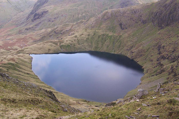 BPV14.jpg (taken 17.11.2008) 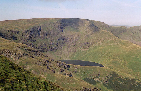 BJE09.jpg From Harter Fell. (taken 7.9.2004) |
||
|
|
||
| evidence:- | old map:- Otley 1818 |
|
| source data:- | Map, uncoloured engraving, The District of the Lakes,
Cumberland, Westmorland, and Lancashire, scale about 4 miles to
1 inch, by Jonathan Otley, 1818, engraved by J and G Menzies,
Edinburgh, Scotland, published by Jonathan Otley, Keswick,
Cumberland, et al, 1833.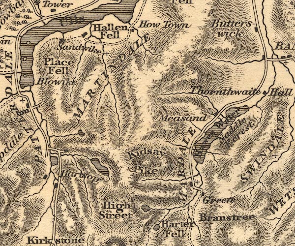 OT02NY41.jpg item:- JandMN : 48.1 Image © see bottom of page |
|
|
|
||
| evidence:- | descriptive text:- Otley 1823 (5th edn 1834) |
|
| source data:- | Guide book, A Concise Description of the English Lakes, the
mountains in their vicinity, and the roads by which they may be
visited, with remarks on the mineralogy and geology of the
district, by Jonathan Otley, published by the author, Keswick,
Cumberland now Cumbria, by J Richardson, London, and by Arthur
Foster, Kirkby Lonsdale, Cumbria, 1823; published 1823-49,
latterly as the Descriptive Guide to the English Lakes. goto source Page 35:- "... Blea Water, separated from the last [Small Water] by a projection of High Street, lies at the foot of a lofty rock called Blea Water Crag. Before reaching the valley of Mardale, their two streams become united." |
|
|
|
||
| evidence:- | old map:- Garnett 1850s-60s H placename:- Blea Water |
|
| source data:- | Map of the English Lakes, in Cumberland, Westmorland and
Lancashire, scale about 3.5 miles to 1 inch, published by John
Garnett, Windermere, Westmorland, 1850s-60s.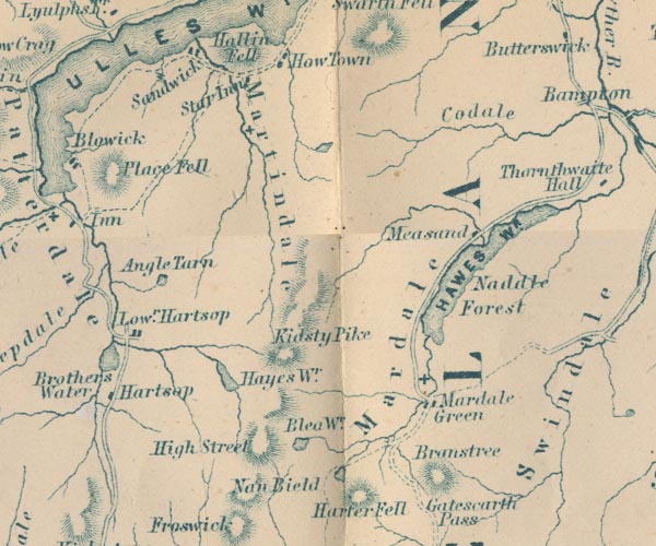 GAR2NY41.jpg "Blea Wr." outline with shore form lines, lake or tarn item:- JandMN : 82.1 Image © see bottom of page |
|
|
|
||
| evidence:- | old map:- Postlethwaite 1877 (3rd edn 1913) placename:- Blea Water |
|
| source data:- | Map, uncoloured engraving, Map of the Lake District Mining Field, Westmorland, Cumberland,
Lancashire, scale about 5 miles to 1 inch, by John Postlethwaite, published by W H
Moss and Sons, 13 Lowther Street, Whitehaven, Cumberland, 1877 edn 1913.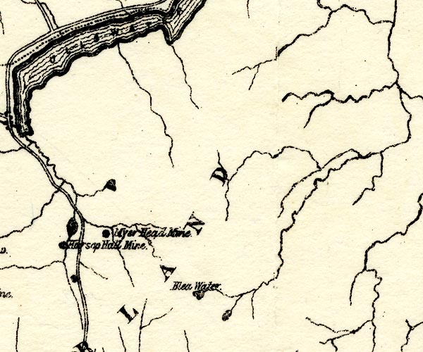 PST2NY41.jpg "Blea Water" lake item:- JandMN : 162.2 Image © see bottom of page |
|
|
|
||
| evidence:- | old photograph:- Marr 1916 placename:- Bleawater Tarn |
|
| source data:- | Photograph, halftone print, Bleawater Tarn, near Haweswater, Mardale, Westmorland,
1916.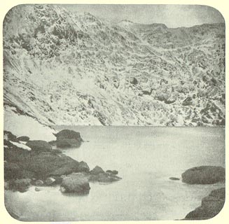 click to enlarge click to enlargeMA1225.jpg item:- JandMN : 173.33 Image © see bottom of page |
|
|
|
||
| evidence:- | old print, old text:- Rose 1832-35 placename:- Bley Water Tarn item:- horse racing |
|
| source data:- | Print, engraving, Bley Water Tarn from the Top of the High Street Mountain, Westmorland,
by Thomas Allom, engraved by J W Lowry, 1835.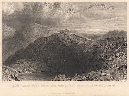 click to enlarge click to enlargeR348.jpg "BLEY WATER TARN FROM THE TOP OF HIGH STREET." The accompanying descriptive text is:- "BLEY-WATER TARN, FROM HIGH STREET MOUNTAIN,- WESTMORLAND." "Bley-Water Tarn lies beneath a lofty crag of the same name, forming part of the Mountain High Street. In its approach to the valley of Mardale, the stream from this tarn unites with that of Small Water Tarn, and both flow together northward to the lake of Haweswater." "The artist has alluded in this view to the annual, festivities which take place on the broad top of High Street. Horse-racing forms the principal feature in the sports, which derive no little additional zest from a copious supply of cakes and ale from the neighbouring villages." "Ulverstone lies in the distance." item:- JandMN : 42 Image © see bottom of page |
|
|
|
||
 Click to enlarge BNO76.jpg (taken 18.4.2007) 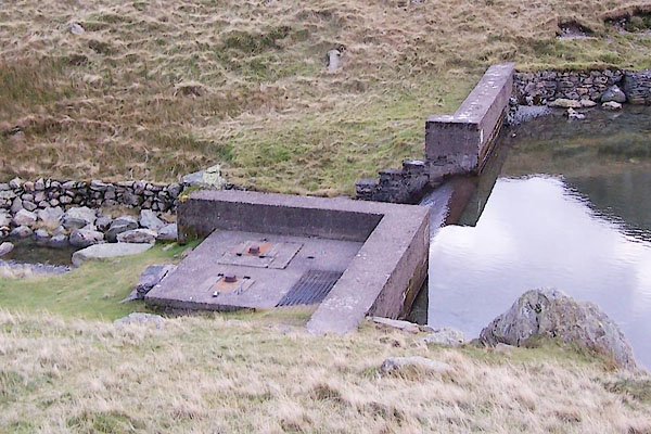 BPV18.jpg Outlet weir. (taken 17.11.2008) 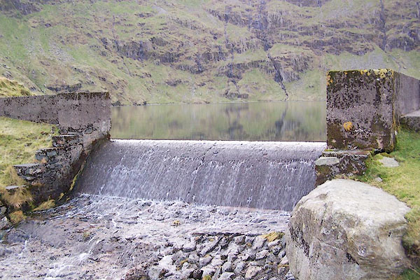 BPV19.jpg Outlet weir. (taken 17.11.2008) |
||
|
|
||
| notes:- |
The deepest of the cirque tarns, about 207 feet (63m) deep. |
|
|
|
||
| notes:- |
Nancy Price:- |
|
| "... a sad looking piece of water; like a deserted child he stands lonely and uncared
for" |
||
| Price, Nancy:: Vagabond's Way Brown 1925 |
||
|
|
||
| fiction:- |
Perhaps called Bleacliff Tarn in |
|
| Ward, Humphrey, Mrs: 1888: Robert Elsmere |
||
| Book 1 chapter 10:- |
||
| "... '... Lasst Midsummer Day aa was on t' Shanmoor road, i' t' gloaming. An' aa saw
theer t' bogle - thee knaws, t' bogle o' Bleacliff Tarn; ...'" |
||
| earlier in the chapter:- |
||
| "... the tarn under the frowning precipitous cliffs which marked the western end of
High Fell [Harter Fell] ..." |
||
|
|
||
Lakes Guides menu.