 Old Cumbria Gazetteer
 |
 |
|
| Borwens, Middleton | ||
| Borwens | ||
| civil parish:- | Middleton (formerly Westmorland) | |
| county:- | Cumbria | |
| locality type:- | buildings | |
| coordinates:- | SD62708374 | |
| 1Km square:- | SD6283 | |
| 10Km square:- | SD68 | |
|
|
||
| evidence:- | old map:- OS County Series (Wmd 44 9) placename:- Borrowens |
|
| source data:- | Maps, County Series maps of Great Britain, scales 6 and 25
inches to 1 mile, published by the Ordnance Survey, Southampton,
Hampshire, from about 1863 to 1948. |
|
|
|
||
| evidence:- | hearth tax returns:- Hearth Tax 1675 placename:- Borrans |
|
| source data:- | Records, hearth tax survey returns, Westmorland, 1674/75. "Borrans" in "Middleton in Lonsdale ward" |
|
|
|
||
| evidence:- | old map:- Jefferys 1770 (Wmd) placename:- Barrons |
|
| source data:- | Map, 4 sheets, The County of Westmoreland, scale 1 inch to 1
mile, surveyed 1768, and engraved and published by Thomas
Jefferys, London, 1770.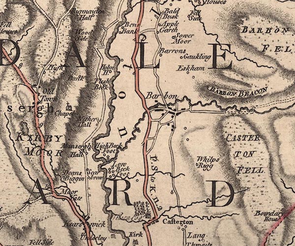 J5SD68SW.jpg "Barrons" circle, labelled in italic lowercase text; settlement, farm, house, or hamlet? item:- National Library of Scotland : EME.s.47 Image © National Library of Scotland |
|
|
|
||
| evidence:- | old map:- Cary 1789 (edn 1805) placename:- Barrons |
|
| source data:- | Map, uncoloured engraving, Westmoreland, scale about 2.5 miles
to 1 inch, by John Cary, London, 1789; edition 1805.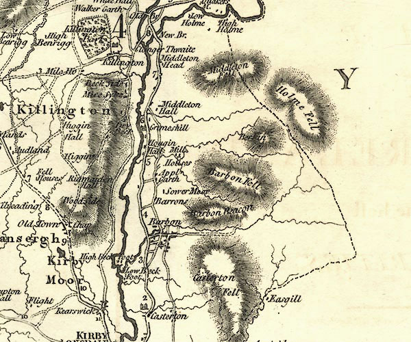 CY24SD68.jpg "Barrons" block/s, labelled in italic lowercase; house, or hamlet item:- JandMN : 129 Image © see bottom of page |
|
|
|
||
| evidence:- | database:- Listed Buildings 2010 placename:- Borrens Farm item:- date stone (1718) |
|
| source data:- | courtesy of English Heritage "BORRENS FARMHOUSE AND ATTACHED BARN / / HIGH ROAD / MIDDLETON / SOUTH LAKELAND / CUMBRIA / II / 75738 / SD6269983731" |
|
|
|
||
| evidence:- | database:- Listed Buildings 2010 |
|
| source data:- | courtesy of English Heritage "BARN APPROXIMATELY 50 METRES TO NORTH WEST OF BORRENS / / HIGH ROAD / MIDDLETON / SOUTH LAKELAND / CUMBRIA / II / 75739 / SD6267883779" |
|
|
|
||
 Lakes Guides menu.