 Old Cumbria Gazetteer
 |
 |
|
| boundary stone, Mosedale | ||
| locality:- | Low Mill Bridge | |
| locality:- | Mosedale | |
| civil parish:- | Mungrisdale (formerly Cumberland) | |
| county:- | Cumbria | |
| locality type:- | boundary stone | |
| locality type:- | township boundary mark | |
| coordinates:- | NY36563249 | |
| 1Km square:- | NY3632 | |
| 10Km square:- | NY33 | |
| locality:- | Mosedale | |
| locality type:- | township | |
|
|
||
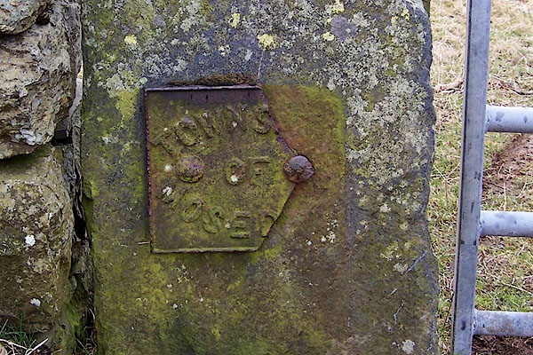 BLR28.jpg Cast iron:- "TOWNS[ ] OF MOSE[D ]" ie Mosedale Township. (taken 9.3.2006) |
||
|
|
||
| evidence:- | database:- Listed Buildings 2010 |
|
| source data:- | courtesy of English Heritage "BOUNDARY STONE AT WEST END OF LOW MILL BRIDGE / / / MUNGRISDALE / EDEN / CUMBRIA / II / 73539 / NY3655932492" |
|
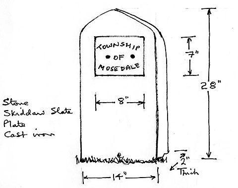
| source data:- | courtesy of English Heritage "Boundary stone. Probably C19. Split slate with roughly-shaped head, set at the upstream side of the west end of Low Mill Bridge. Cast-iron plate inscribed TOWNSHIP OF MOSEDALE." |
|
|
|
||
| notes:- |
Courtesy of Colin Smith, probably 1999. |
|
| Mungrisdale 00001 |
||
 PH0115.jpg 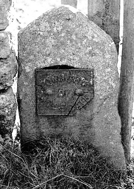 PH0116.jpg |
||
| OS County Series (Cmd 48 14) 'B.S' |
||
|
|
||
| Richardson, John: 1985: Local Historians Encyclopedia: Historical Publications (New
Barnet, Hertfordshire) Bulmer, T F: 1884: History, Topography and Directory of East Cumberland: Bulmer, T and Co (Manchester, Lancashire) Bulmer, T F: 1885: History, Topography, and Directory of Westmoreland: Bulmer, T and Co (Manchester, Lancashire) |
||
|
|
||
 Lakes Guides menu.