 Old Cumbria Gazetteer
 |
 |
|
| boundary stone, Hutton | ||
| locality:- | Huttonsoil | |
| civil parish:- | Hutton (formerly Cumberland) | |
| county:- | Cumbria | |
| locality type:- | boundary stone | |
| locality type:- | township boundary mark | |
| coordinates:- | NY43122751 | |
| 1Km square:- | NY4327 | |
| 10Km square:- | NY42 | |
|
|
||
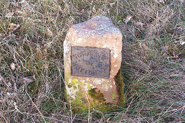 BLP70.jpg Cast iron plate on a stone:- "TOWNSHIP OF HUTTONSOIL" A township was a group of houses, usually a division for the purposes of local administration. In northern counties of England the term continued to be used after The Conquest. (taken 4.2.2006) |
||
|
|
||
| Richardson, John: 1985: Local Historians Encyclopedia: Historical Publications (New
Barnet, Hertfordshire) Bulmer, T F: 1884: History, Topography and Directory of East Cumberland: Bulmer, T and Co (Manchester, Lancashire) Bulmer, T F: 1885: History, Topography, and Directory of Westmoreland: Bulmer, T and Co (Manchester, Lancashire) |
||
|
|
||
 Lakes Guides menu.