 Old Cumbria Gazetteer
 |
 |
|
| included in:- |
 Longsleddale Woods, Longsleddale Longsleddale Woods, Longsleddale |
|
| Bowers Wood, Longsleddale | ||
| Bowers Wood | ||
| locality:- | Longsleddale | |
| civil parish:- | Longsleddale (formerly Westmorland) | |
| county:- | Cumbria | |
| locality type:- | wood | |
| locality type:- | SSSI | |
| coordinates:- | NY50720235 (etc) | |
| 1Km square:- | NY5002 | |
| 10Km square:- | NY50 | |
|
|
||
| evidence:- | old map:- OS County Series (Wmd 27 16) placename:- Bowers Wood |
|
| source data:- | Maps, County Series maps of Great Britain, scales 6 and 25
inches to 1 mile, published by the Ordnance Survey, Southampton,
Hampshire, from about 1863 to 1948. Parcels 319 13.859 acres, 318 3.402 acres? |
|
|
|
||
| evidence:- | old map:- Jefferys 1770 (Wmd) |
|
| source data:- | Map, 4 sheets, The County of Westmoreland, scale 1 inch to 1
mile, surveyed 1768, and engraved and published by Thomas
Jefferys, London, 1770.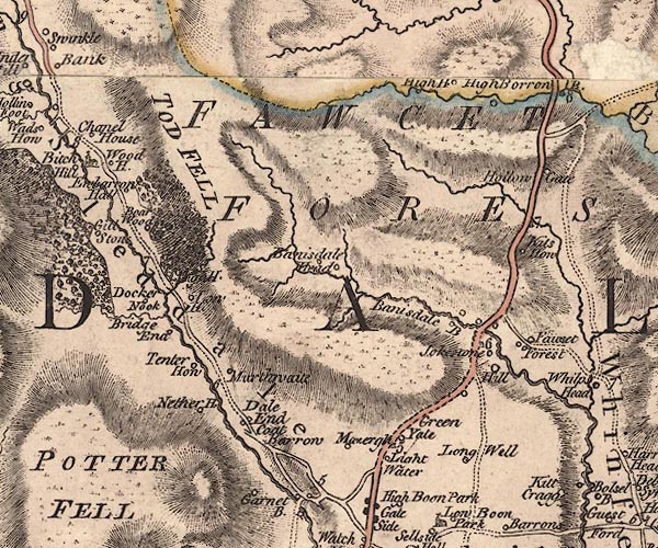 J5NY50SW.jpg trees; woodland item:- National Library of Scotland : EME.s.47 Image © National Library of Scotland |
|
|
|
||
| evidence:- | old map:- OS 1881-82 New Series (outline edition) placename:- Bowers Wood |
|
| source data:- | Map, engraving, area north of Kendal, Westmorland, New Series
one inch map, outline edition, sheet 39, scale 1 inch to 1 mile,
published by the Ordnance Survey, Southampton, Hampshire,
1881-82.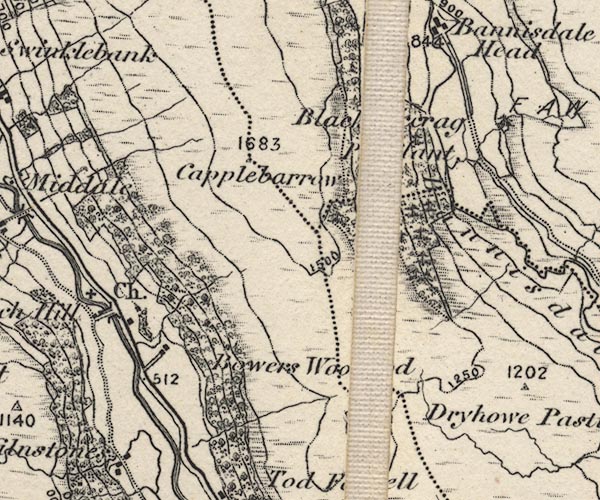 O21NY50B.jpg "Bowers Wood" item:- JandMN : 61 Image © see bottom of page |
|
|
|
||
| evidence:- | textbook:- EPNS Westmorland 1967 placename:- Bowerwood |
|
| source data:- | Book, The Place Names of Westmorland, two volumes, by A H Smith,
published for the English Place Name Society by Cambridge
University Press, Cambridgeshire, 1967 |
|
|
|
||
| evidence:- | map:- OS Six Inch (1956) placename:- Bowers Wood |
|
| source data:- | Map series, various editions with the national grid, scale about
6 inches to 1 mile, published by the Ordnance Survey,
Southampton, Hampshire, scale 1 to 10560 from 1950s to 1960s,
then 1 to 10000 from 1960s to 2000s, superseded by print on
demand from digital data.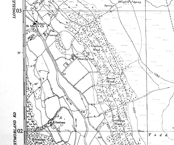 SINY5002.jpg "Bowers Wood" |
|
|
|
||
Lakes Guides menu.