 Old Cumbria Gazetteer
 |
 |
|
| Bradleyfield House, Underbarrow and Bradleyfield | ||
| Bradleyfield House | ||
| Bradley Field House | ||
| civil parish:- | Underbarrow and Bradleyfield (formerly Westmorland) | |
| county:- | Cumbria | |
| locality type:- | buildings | |
| coordinates:- | SD49549248 | |
| 1Km square:- | SD4992 | |
| 10Km square:- | SD49 | |
|
|
||
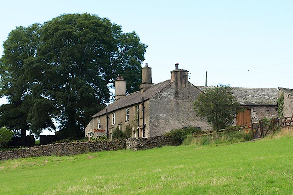 BPO25.jpg (taken 8.8.2008) 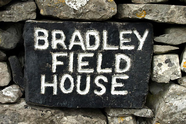 BPO26.jpg Inscribed stone:- "BRADLEY / FIELD / HOUSE" (taken 8.8.2008) |
||
|
|
||
| evidence:- | old map:- OS County Series (Wmd 38 7) placename:- Bradleyfield |
|
| source data:- | Maps, County Series maps of Great Britain, scales 6 and 25
inches to 1 mile, published by the Ordnance Survey, Southampton,
Hampshire, from about 1863 to 1948. |
|
|
|
||
 Lakes Guides menu.