 Old Cumbria Gazetteer
 |
 |
|
| Bridge End, Ouse Bridge | ||
| Bridge End | ||
| locality:- | Ouse Bridge | |
| civil parish:- | Blindcrake (formerly Cumberland) | |
| county:- | Cumbria | |
| locality type:- | buildings | |
| coordinates:- | NY19983222 | |
| 1Km square:- | NY1932 | |
| 10Km square:- | NY13 | |
| references:- | Crosthwaite 1783-94 |
|
|
|
||
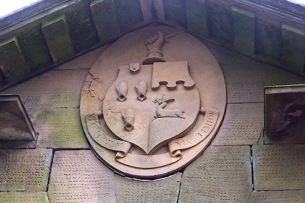 BLO56.jpg Coat of arms on the gatehouse to Armathwaite Hall? Vane impaling ? (taken 20.1.2006) |
||
|
|
||
| evidence:- | old map:- OS County Series (Cmd 46 15) placename:- West Lodge |
|
| source data:- | Maps, County Series maps of Great Britain, scales 6 and 25
inches to 1 mile, published by the Ordnance Survey, Southampton,
Hampshire, from about 1863 to 1948. |
|
|
|
||
| evidence:- | old map:- Crosthwaite 1783-94 (Bas) placename:- Bridge End |
|
| source data:- | Map, uncoloured engraving, An Accurate Map of Broadwater or
Bassenthwaite Lake, scale about 3 inches to 1 mile, by Peter
Crosthwaite, Keswick, Cumberland, 1783, version published 1800.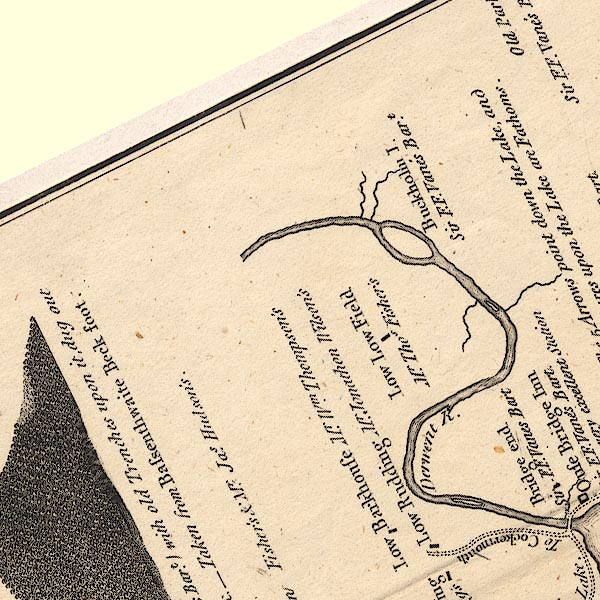 CT6NY13W.jpg "Bridge end / Sir F. F. Vanes Bart." item:- Armitt Library : 1959.191.4 Image © see bottom of page |
|
|
|
||
 Lakes Guides menu.