 Old Cumbria Gazetteer
 |
 |
|
| Bryers Fold, Claife | ||
| Bryers Fold | ||
| Bryerswood | ||
| locality:- | Far Sawrey | |
| civil parish:- | Claife (formerly Lancashire) | |
| county:- | Cumbria | |
| locality type:- | buildings | |
| coordinates:- | SD38189523 | |
| 1Km square:- | SD3895 | |
| 10Km square:- | SD39 | |
|
|
||
| evidence:- | old map:- OS County Series (Lan 5 11) placename:- Bryers |
|
| source data:- | Maps, County Series maps of Great Britain, scales 6 and 25
inches to 1 mile, published by the Ordnance Survey, Southampton,
Hampshire, from about 1863 to 1948. |
|
|
|
||
| evidence:- | old map:- OS County Series (Lan 5) placename:- Briers |
|
| source data:- | Maps, County Series maps of Great Britain, scales 6 and 25
inches to 1 mile, published by the Ordnance Survey, Southampton,
Hampshire, from about 1863 to 1948. "Briers" in large wooded grounds |
|
|
|
||
| evidence:- | old map:- Jefferys 1770 (Wmd) placename:- Briars |
|
| source data:- | Map, 4 sheets, The County of Westmoreland, scale 1 inch to 1
mile, surveyed 1768, and engraved and published by Thomas
Jefferys, London, 1770.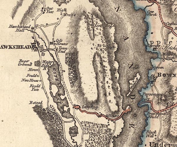 J5SD39NE.jpg "Briars" blocks, labelled in italic lowercase text; settlement, village? item:- National Library of Scotland : EME.s.47 Image © National Library of Scotland |
|
|
|
||
| evidence:- | old map:- Crosthwaite 1783-94 (Win/Ble) placename:- Briers |
|
| source data:- | Map, uncoloured engraving, An Accurate Map of the Grand Lake of
Windermere, scale about 2 inches to 1 mile, by Peter
Crosthwaite, Keswick, Cumberland, 1783, version published 1819.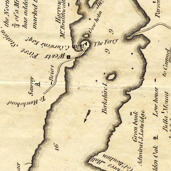 CT9SD39X.jpg "Briers" block, building/s item:- Armitt Library : 2008.14.102 Image © see bottom of page |
|
|
|
||
| evidence:- | old map:- Clarke 1787 map (Windermere S) placename:- Briers |
|
| source data:- | Map, A Map of the Southern Part of the Lake Winandermere and its
Environs, scale about 6.5 ins to 1 mile, by James Clarke,
engraved by Samuel John Neele, 352 Strand, published by James
Clarke, Penrith, Cumberland and in London etc, 1787.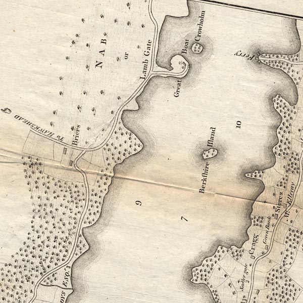 CLBSD39X.jpg "Briers" item:- private collection : 10.11 Image © see bottom of page |
|
|
|
||
| evidence:- | old map:- Cary 1789 (edn 1805) placename:- Briers |
|
| source data:- | Map, uncoloured engraving, Westmoreland, scale about 2.5 miles
to 1 inch, by John Cary, London, 1789; edition 1805.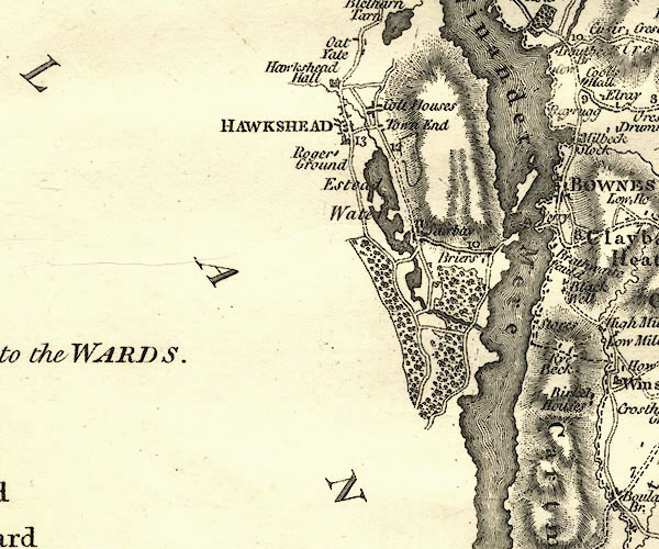 CY24SD39.jpg "Briers" block/s, labelled in italic lowercase; house, or hamlet item:- JandMN : 129 Image © see bottom of page |
|
|
|
||
| evidence:- | old drawing:- Aspland 1840s-60s placename:- Briers Farm |
|
| source data:- | Drawing, pencil, Breyrs Fold, Claife, Lancashire, by Theophilus Lindsey Aspland, 1860s?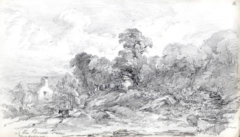 click to enlarge click to enlargeAS0413.jpg "nr the Breirs Farm / Windermere" page number "16" item:- Armitt Library : 2008.60.13 Image © see bottom of page |
|
|
|
||
| notes:- |
Built 1887 for Joseph Ridgway Bridson of Bolton, on west shore of Windermere lake.
The architect was Richard Knill Freeman; the landscaping by Thomas H Mawson. Only
the kitchen garden and greenhouse now remain (2009). |
|
| Waymark, Janet: 2009: Thomas Mawson, Life, Gardens and Landscapes: Lincoln, Francis
(London) |
||
|
|
||
 Lakes Guides menu.