 Old Cumbria Gazetteer
 |
 |
|
| Briscoemill Bridge, Egremont | ||
| Briscoemill Bridge | ||
| site name:- | Ehen, River | |
| Street:- | Briscoe Road | |
| locality:- | Briscoe (?) | |
| civil parish:- | Egremont (formerly Cumberland) | |
| civil parish:- | St John Beckermet (formerly Cumberland) | |
| county:- | Cumbria | |
| locality type:- | bridge | |
| coordinates:- | NY01521158 | |
| 1Km square:- | NY0111 | |
| 10Km square:- | NY01 | |
|
|
||
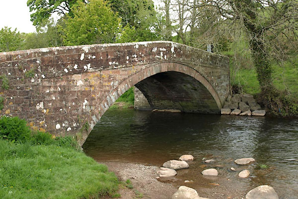 BWK70.jpg (taken 16.5.2012) 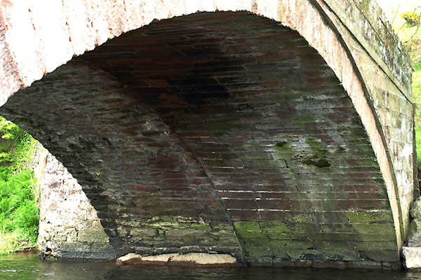 BWK71.jpg Under; evidence of widening. (taken 16.5.2012) |
||
|
|
||
| evidence:- | old map:- OS County Series (Cmd 72 4) placename:- Brisco Mill Bridge |
|
| source data:- | Maps, County Series maps of Great Britain, scales 6 and 25
inches to 1 mile, published by the Ordnance Survey, Southampton,
Hampshire, from about 1863 to 1948. |
|
|
|
||
| evidence:- | perhaps old map:- Saxton 1579 |
|
| source data:- | Map, hand coloured engraving, Westmorlandiae et Cumberlandiae Comitatus ie Westmorland
and Cumberland, scale about 5 miles to 1 inch, by Christopher Saxton, London, engraved
by Augustinus Ryther, 1576, published 1579-1645. Sax9NX91.jpg item:- private collection : 2 Image © see bottom of page |
|
|
|
||
| evidence:- | old map:- Mercator 1595 (edn?) placename:- |
|
| source data:- | Map, hand coloured engraving, Northumbria, Cumberlandia, et
Dunelmensis Episcopatus, ie Northumberland, Cumberland and
Durham etc, scale about 6.5 miles to 1 inch, by Gerard Mercator,
Duisberg, Germany, about 1595. MER8CumE.jpg "" double across a stream; bridge, over the Ehen item:- JandMN : 169 Image © see bottom of page |
|
|
|
||
| evidence:- | perhaps old map:- Speed 1611 (Cmd) |
|
| source data:- | Map, hand coloured engraving, Cumberland and the Ancient Citie
Carlile Described, scale about 4 miles to 1 inch, by John Speed,
1610, published by J Sudbury and George Humble, Popes Head
Alley, London, 1611-12. SP11NY01.jpg double line across the Ehen at Egremont item:- private collection : 16 Image © see bottom of page |
|
|
|
||
| evidence:- | probably old map:- Jansson 1646 |
|
| source data:- | Map, hand coloured engraving, Cumbria and Westmoria, ie
Cumberland and Westmorland, scale about 3.5 miles to 1 inch, by
John Jansson, Amsterdam, Netherlands, 1646.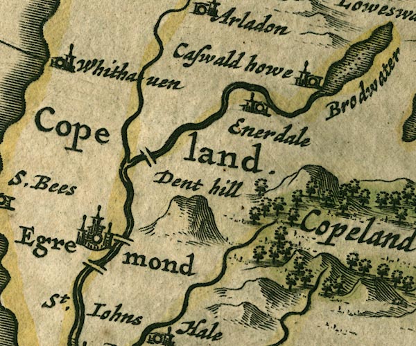 JAN3NY01.jpg Double line crossing the stream. item:- JandMN : 88 Image © see bottom of page |
|
|
|
||
| evidence:- | perhaps old map:- Morden 1695 (Cmd) |
|
| source data:- | Map, uncoloured engraving, Cumberland, scale about 4 miles to 1
inch, by Robert Morden, 1695, published by Abel Swale, the
Unicorn, St Paul's Churchyard, Awnsham, and John Churchill, the
Black Swan, Paternoster Row, London, 1695-1715.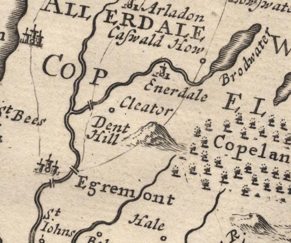 MD12NY01.jpg Double line over the Ehen, at Egremont. item:- JandMN : 90 Image © see bottom of page |
|
|
|
||
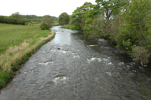 BWK72.jpg View of river. (taken 16.5.2012) |
||
|
|
||
 Lakes Guides menu.