 Old Cumbria Gazetteer
 |
 |
|
| Brough Hill, Warcop | ||
| Brough Hill | ||
| civil parish:- | Warcop (formerly Westmorland) | |
| county:- | Cumbria | |
| locality type:- | hill | |
| coordinates:- | NY76521551 (etc) | |
| 1Km square:- | NY7615 | |
| 10Km square:- | NY71 | |
|
|
||
| evidence:- | old map:- OS County Series (Wmd 16 10) placename:- Brough Hill |
|
| source data:- | Maps, County Series maps of Great Britain, scales 6 and 25
inches to 1 mile, published by the Ordnance Survey, Southampton,
Hampshire, from about 1863 to 1948. |
|
|
|
||
| evidence:- | old map:- Jefferys 1770 (Wmd) placename:- Brough Hill |
|
| source data:- | Map, 4 sheets, The County of Westmoreland, scale 1 inch to 1
mile, surveyed 1768, and engraved and published by Thomas
Jefferys, London, 1770.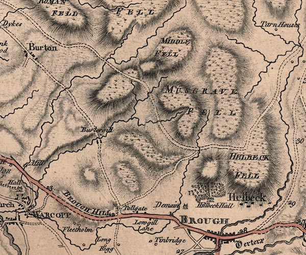 J5NY71NE.jpg "BROUGH HILL" hill hachuring; hill or mountain, the road on the ridge item:- National Library of Scotland : EME.s.47 Image © National Library of Scotland |
|
|
|
||
| evidence:- | old map:- Cary 1789 (edn 1805) placename:- Brough Hill |
|
| source data:- | Map, uncoloured engraving, Westmoreland, scale about 2.5 miles
to 1 inch, by John Cary, London, 1789; edition 1805.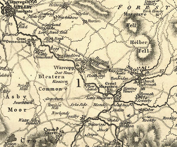 CY24NY71.jpg "Brough Hill" hill hachuring item:- JandMN : 129 Image © see bottom of page |
|
|
|
||
| evidence:- | old text:- Capper 1808 placename:- Broug Hill item:- fair; Brough Hill Fair |
|
| source data:- | Gazetteer, A Topographical Dictionary of the United Kingdom,
compiled by Benjamin Pitts Capper, published by Richard
Phillips, Bridge Street, Blackfriars, London, 1808; published
1808-29. goto source goto source"... Brough-hill fair, held in a field 2 miles from the town [Brough], 30 September, where immense numbers of cattle, horses, and all kinds of goods are sold." |
|
|
|
||
Lakes Guides menu.