 Old Cumbria Gazetteer
 |
 |
|
| Augill Foundry, Augill | ||
| Augill Foundry | ||
| locality:- | Augill | |
| civil parish:- | Stainmore (formerly Westmorland) | |
| county:- | Cumbria | |
| locality type:- | foundry | |
| locality type:- | lead foundry (?) | |
| coordinates:- | NY81591466 | |
| 1Km square:- | NY8114 | |
| 10Km square:- | NY81 | |
|
|
||
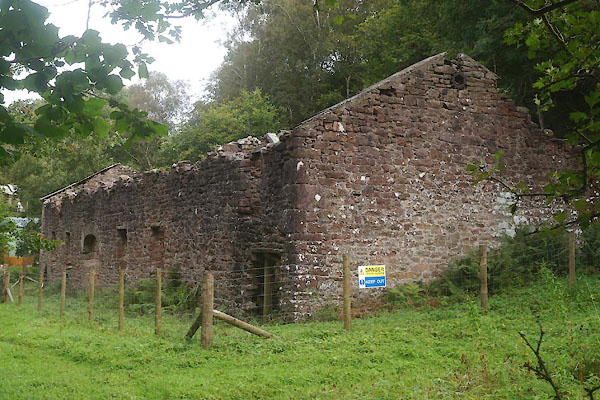 CFN06.jpg (taken 23.9.2016) |
||
|
|
||
| evidence:- | old map:- OS County Series (Wmd 16 16) placename:- Augill Foundry |
|
| source data:- | Maps, County Series maps of Great Britain, scales 6 and 25
inches to 1 mile, published by the Ordnance Survey, Southampton,
Hampshire, from about 1863 to 1948. |
|
|
|
||
| :- |
Smelt mill, erected 1846 |
|
| Marshall, J D &Davies-Shiel, Michael: 1977 (2nd edn): Industrial Archaeology of the
Lake Counties: Moon, Michael (Beckermet, Cumbria):: ISBN 0 904131 13 0 |
||
|
|
||
| notes:- |
Or, a lead smelter according to a local resident: 2016. |
|
|
|
||
 Lakes Guides menu.