 Old Cumbria Gazetteer
 |
 |
|
| Bullgill, Wharton | ||
| Bullgill | ||
| Bullghyll | ||
| civil parish:- | Wharton (formerly Westmorland) | |
| county:- | Cumbria | |
| locality type:- | buildings | |
| coordinates:- | NY76700524 | |
| 1Km square:- | NY7605 | |
| 10Km square:- | NY70 | |
|
|
||
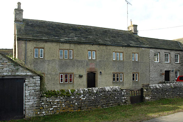 BRU25.jpg (taken 29.10.2009) 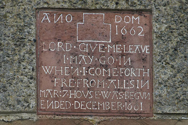 BRU26.jpg Date stone:- "ANO DOM / 1662 / LORD GIVE ME LEAVE / I MAY GO IN / WHEN I COME FORTH / FRE FROM ALL SIN / MAR: 7 HOUSE WAS BEGUN / ENDED DECEMBER 1661" (taken 29.10.2009) |
||
|
|
||
| evidence:- | old map:- OS County Series (Wmd 30 6) placename:- Bull Gill |
|
| source data:- | Maps, County Series maps of Great Britain, scales 6 and 25
inches to 1 mile, published by the Ordnance Survey, Southampton,
Hampshire, from about 1863 to 1948. |
|
|
|
||
| evidence:- | database:- Listed Buildings 2010 placename:- Bullgill Farm item:- date stone (1661) |
|
| source data:- | courtesy of English Heritage "BULLGILL FARMHOUSE / / / WHARTON / EDEN / CUMBRIA / II / 73044 / NY7668505234" |
|
|
|
||
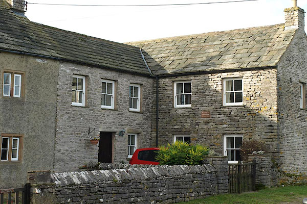 BRU27.jpg (taken 29.10.2009) 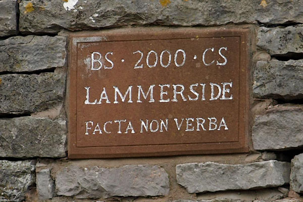 BRU28.jpg Date stone:- "BS 2000 CS / LAMMERSIDE / FACTA NON VERBA" (taken 29.10.2009) |
||
|
|
||
 Lakes Guides menu.