 |
 |
|
|
|
|
Burthwaite |
| civil parish:- |
St Cuthbert Without (formerly Cumberland) |
| county:- |
Cumbria |
| locality type:- |
locality |
| locality type:- |
buildings |
| coordinates:- |
NY41524958 (etc) |
| 1Km square:- |
NY4149 |
| 10Km square:- |
NY44 |
|
|
| evidence:- |
old map:- OS County Series (Cmd 30 4)
placename:- Burthwaite
|
| source data:- |
Maps, County Series maps of Great Britain, scales 6 and 25
inches to 1 mile, published by the Ordnance Survey, Southampton,
Hampshire, from about 1863 to 1948.
|
|
|
| evidence:- |
old map:- Donald 1774 (Cmd)
placename:- Burthwaite
|
| source data:- |
Map, hand coloured engraving, 3x2 sheets, The County of Cumberland, scale about 1
inch to 1 mile, by Thomas Donald, engraved and published by Joseph Hodskinson, 29
Arundel Street, Strand, London, 1774.
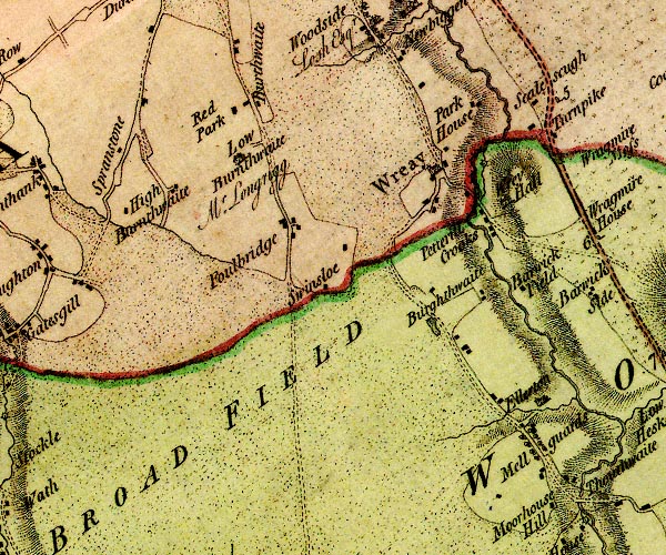
D4NY44NW.jpg
"Burthwaite"
block or blocks, labelled in lowercase; a hamlet or just a house
item:- Carlisle Library : Map 2
Image © Carlisle Library |
|
|
| places:- |
 |
NY41234955 Blackhall Park (St Cuthbert Without) |
|
|
|
NY6923 Burthwaite Beck river |
|
|
|
NY41444954 Burthwaite Croft (St Cuthbert Without) |
|
|
|
NY41695035 Burthwaite Hill (St Cuthbert Without) |
|
|
|
NY21333328 Burthwaite Wood (Bassenthwaite) |
|
|
|
NY70162301 Castle Hill (Dufton) |
|
|
|
NY31684907 Liverpool Row (St Cuthbert Without) gone |
|
|
|
NY41355015 Low Burthwaite (St Cuthbert Without) |
|
|
|
NY41564964 Orchard House (St Cuthbert Without) |
|
