Old Cumbria Gazetteer
 |
 |
|
||
| Burton-in-Kendal | ||||
| Bortun | ||||
| civil parish:- | Burton-in-Kendal (formerly Westmorland) | |||
| county:- | Cumbria | |||
| locality type:- | locality | |||
| locality type:- | buildings | |||
| locality type:- | market town (?) | |||
| locality type:- | selected place | |||
| coordinates:- | SD53007638 (etc) | |||
| 1Km square:- | SD5376 | |||
| 10Km square:- | SD57 | |||
| latitude; longitude:- | 2d 43.2m W; 54d 10.9m N | |||
|
|
||||
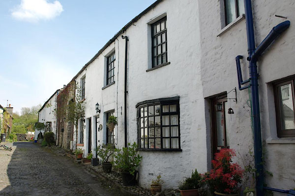
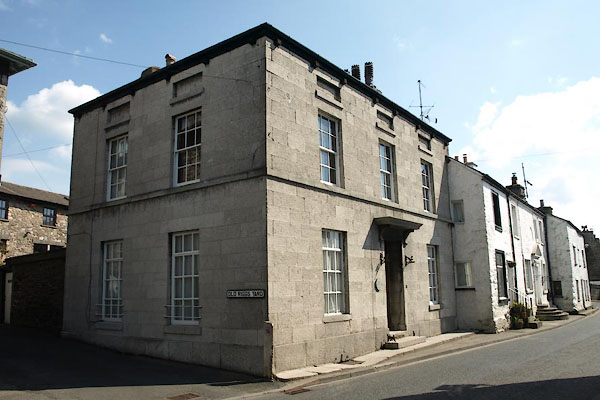
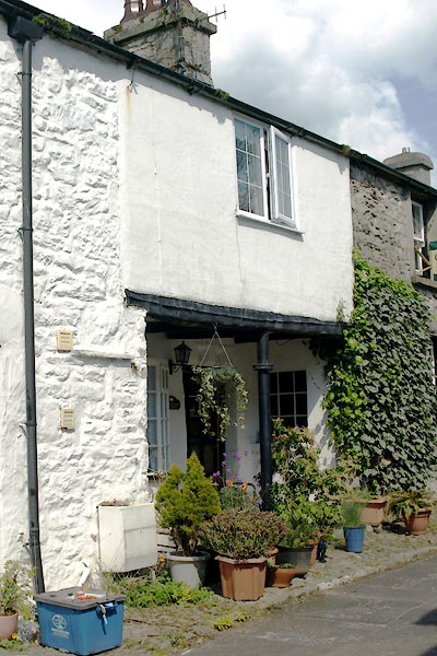
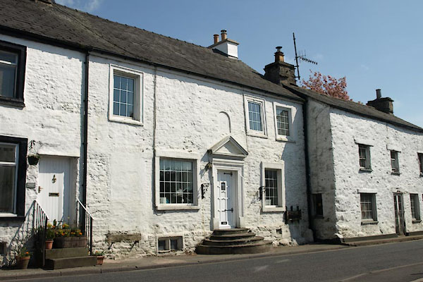
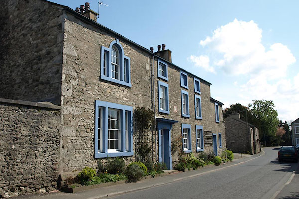
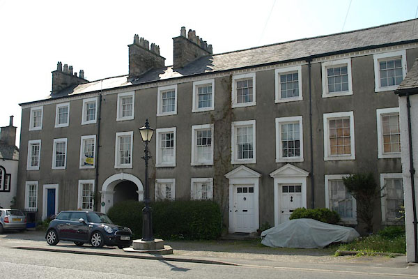
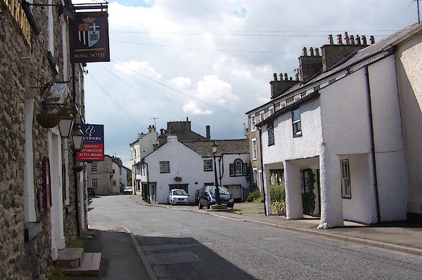 BJS10.jpg Main Street, looking south. (taken 12.8.2005) |
||||
|
|
||||
| evidence:- | old map:- OS County Series (Wmd 47 13) placename:- Burton in Kendal |
|||
| source data:- | Maps, County Series maps of Great Britain, scales 6 and 25
inches to 1 mile, published by the Ordnance Survey, Southampton,
Hampshire, from about 1863 to 1948. |
|||
|
|
||||
| evidence:- | descriptive text:- Myddylton 1544 placename:- Burton |
|||
| source data:- | Book, Cronycle of Yeres, including an early table of highways,
published by Wyllyam Myddylton, at the sign of the George, Fleet
Street, London, 1544. "And also the wayes leadynge to the / most notable places: and the dy- / staunce betwyxte the / same / Anno. 1544" "Here foloweth the waye fro~ Coker / mouth to lancastre, and so to London. / From Cokermouth to Kyswike. vi myle. / from Kyswike to Grosener. viii. myle. / from Grosener to Kendale. xiiii. myle. / from Kendale to Burton. vii. myle. / from Burton to Lancastre. viii. myle. / ..." |
|||
|
|
||||
| evidence:- | old map:- Lloyd 1573 placename:- Burton |
|||
| source data:- | Map, hand coloured copper plate engraving, Angliae Regni,
Kingdom of England, with Wales, scale about 24 miles to 1 inch, authored by Humphrey
Lloyd, Denbigh, Clwyd, drawn and engraved
by Abraham Ortelius, Netherlands, 1573.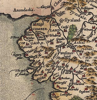 click to enlarge click to enlargeLld1Cm.jpg "Burton" item:- Hampshire Museums : FA1998.69 Image © see bottom of page |
|||
|
|
||||
| evidence:- | old map:- Saxton 1579 placename:- Burton |
|||
| source data:- | Map, hand coloured engraving, Westmorlandiae et Cumberlandiae Comitatus ie Westmorland
and Cumberland, scale about 5 miles to 1 inch, by Christopher Saxton, London, engraved
by Augustinus Ryther, 1576, published 1579-1645.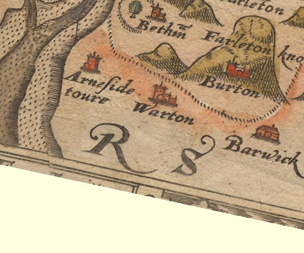 Sax9SD47.jpg Church, symbol for a parish or village, with a parish church. "Burton" On the side of Farleton knot. item:- private collection : 2 Image © see bottom of page |
|||
|
|
||||
| evidence:- | old map:- Mercator 1595 (edn?) placename:- Burton |
|||
| source data:- | Map, hand coloured engraving, Westmorlandia, Lancastria, Cestria
etc, ie Westmorland, Lancashire, Cheshire etc, scale about 10.5
miles to 1 inch, by Gerard Mercator, Duisberg, Germany, 1595,
edition 1613-16. MER5WmdA.jpg "Burton" circle item:- Armitt Library : 2008.14.3 Image © see bottom of page |
|||
|
|
||||
| evidence:- | old map:- Speed 1611 (Wmd) placename:- Burton |
|||
| source data:- | Map, hand coloured engraving, The Countie Westmorland and
Kendale the Cheif Towne, scale about 2.5 miles to 1 inch, by
John Speed, 1610, published by George Humble, Popes Head Alley,
London, 1611-12.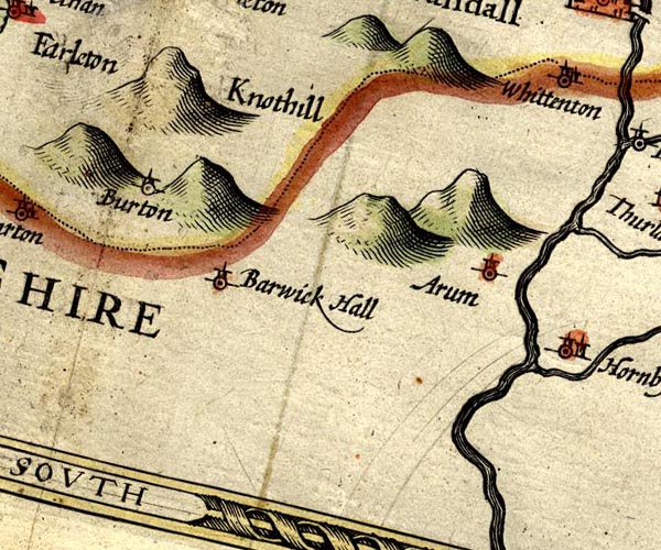 SP14SD57.jpg "Burton" circle, tower item:- Armitt Library : 2008.14.5 Image © see bottom of page |
|||
|
|
||||
| evidence:- | old map:- Jansson 1646 placename:- Burton |
|||
| source data:- | Map, hand coloured engraving, Cumbria and Westmoria, ie
Cumberland and Westmorland, scale about 3.5 miles to 1 inch, by
John Jansson, Amsterdam, Netherlands, 1646.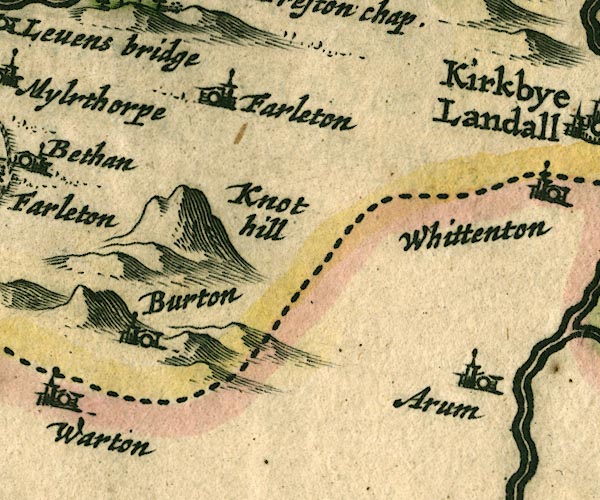 JAN3SD57.jpg "Burton" Buildings and tower. item:- JandMN : 88 Image © see bottom of page |
|||
|
|
||||
| evidence:- | old road book:- Ogilby 1675 (edn 1698) placename:- Burton |
|||
| source data:- | OB16p018.txt page 18; describing plate 38 "The Continuation of the Road from / LONDON to CARLISLE in Cumberland." "... at 243'5 enter Westmoreland, and 6 F. beyond Burton of 2 F. on the South of Farleton-Knot; an indifferent Thorough-fare with a Market on Tuesdays." item:- private collection : 367 Image © see bottom of page |
|||
|
|
||||
| evidence:- | old map:- Ogilby 1675 (plate 38) placename:- Burton |
|||
| source data:- | Road strip map, hand coloured engraving, continuation of the
Road from London to Carlisle, scale about 1 inch to 1 mile, by
John Ogilby, London, 1675.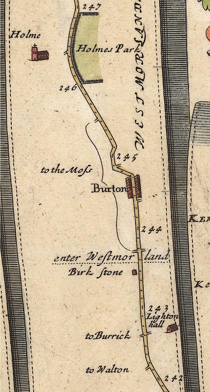 OG38m242.jpg In mile 244, Westmorland. "Burton" row of houses each side of the road. item:- JandMN : 21 Image © see bottom of page |
|||
|
|
||||
| evidence:- | old map:- Berry 1679 placename:- Burton |
|||
| source data:- | Road map, diagram, The Grand Roads of England, engraved by John
Rich, made and published by William Berry, at the Sign of the
Globe, London, 1679. "Burton" market Tuesday |
|||
|
|
||||
| evidence:- | old map:- Seller 1694 (Wmd) placename:- Burton |
|||
| source data:- | Map, hand coloured engraving, Westmorland, scale about 8 miles
to 1 inch, by John Seller, 1694. click to enlarge click to enlargeSEL7.jpg "Burton" circle, italic lowercase text; settlement or house item:- Dove Cottage : 2007.38.87 Image © see bottom of page |
|||
|
|
||||
| evidence:- | old map:- Morden 1695 (EW) placename:- Burton |
|||
| source data:- | Map, hand coloured engraving, England, including Wales, scale
about 27 miles to 1 inch, by Robert Morden, published by Abel
Swale Awnsham and John Churchil, London, about 1695. click to enlarge click to enlargeMRD3Cm.jpg "Burton" circle; village or town item:- JandMN : 339 Image © see bottom of page |
|||
|
|
||||
| evidence:- | old map:- Morden 1695 (Wmd) placename:- Burton |
|||
| source data:- | Map, hand coloured engraving, Westmorland, scale about 2.5 miles to 1 inch, by Robert
Morden, published by Abel Swale, the Unicorn, St Paul's Churchyard, Awnsham, and John
Churchill, the Black Swan, Paternoster Row, London, 1695.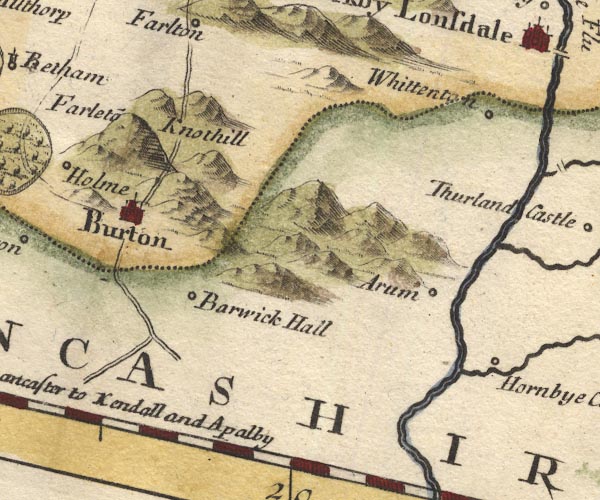 MD10SD57.jpg "Burton" Circle, buildings, towers. item:- JandMN : 24 Image © see bottom of page |
|||
|
|
||||
| evidence:- | old map:- Ogilby 1699 map (edn 1712) placename:- Burton |
|||
| source data:- | Road map, uncoloured engraving, a New Mapp of the Roads of England, by John Ogilby,
published by William Bray, Exeter Court, Strand, London, 1712. "Burton" 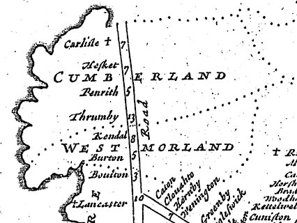 click to enlarge click to enlargeOGY7Cm.jpg item:- private collection : 263.1 Image © see bottom of page |
|||
|
|
||||
| evidence:- | old map:- Bowen 1720 (plate 93) placename:- Burton |
|||
| source data:- | Strip maps, uncoloured engravings, road maps, The Road from
London to Carlisle, scale about 2 miles to 1 inch, with sections
in Lancashire and Westmorland, published by Emanuel Bowen, St
Katherines, London, 1720.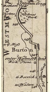 B093m242.jpg item:- Dove Cottage : 2007.38.100 Image © see bottom of page |
|||
|
|
||||
| evidence:- | old map:- Millward and Dickinson 1737 placename:- Burton |
|||
| source data:- | Road map, photocopy, diagram, A New and Correct Map of Roads of
England, probably published by T Millward and B Dickinson, Inigo
Jones's Head, Fleet Street, London, 1737. "Burton / 244" miles from London  click to enlarge click to enlargeMWD1Cm.jpg item:- private collection : 264 Image © see bottom of page |
|||
|
|
||||
| evidence:- | old map:- Badeslade 1742 placename:- Burton |
|||
| source data:- | Maps, Westmorland North from London, scale about 10 miles to 1
inch, and Cumberland North from London, scale about 11 miles to
1 inch, with descriptive text, by Thomas Badeslade, London,
engraved and published by William Henry Toms, Union Court,
Holborn, London, 1742; published 1742-49. "Burton Tuesd. Fairs March 25. and Whitsun-monday." |
|||
|
|
||||
| evidence:- | old map:- Badeslade 1742 placename:- Burton |
|||
| source data:- | Map, uncoloured engraving, A Map of Westmorland North from
London, scale about 10 miles to 1 inch, with descriptive text,
by Thomas Badeslade, London, engraved and published by William
Henry Toms, Union Court, Holborn, London, 1742. click to enlarge click to enlargeBD12.jpg "Burton" circle, tower/s, upright lowercase text; town item:- Dove Cottage : 2007.38.62 Image © see bottom of page |
|||
|
|
||||
| evidence:- | old map:- Simpson 1746 map (Wmd) placename:- Burton |
|||
| source data:- | Map, uncoloured engraving, Westmorland, scale about 8 miles to 1
inch, printed by R Walker, Fleet Lane, London, 1746. SMP2SDN.jpg "Burton" Building; labelled as a town. item:- Dove Cottage : 2007.38.59 Image © see bottom of page |
|||
|
|
||||
| evidence:- | old map:- Bickham 1753-54 (Wmd) placename:- Burton |
|||
| source data:- | Map, uncoloured engraving, perspective view, A Map of
Westmorland, North from London, by George Bickham, James Street,
Bunhill Fields, London, 1753.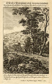 click to enlarge click to enlargeBCK3.jpg "Burton" view (sort of) item:- Armitt Library : 2008.14.71 Image © see bottom of page |
|||
|
|
||||
| evidence:- | old map:- Bowen and Kitchin 1760 placename:- Burton |
|||
| source data:- | Map, hand coloured engraving, A New Map of the Counties of
Cumberland and Westmoreland Divided into their Respective Wards,
scale about 4 miles to 1 inch, by Emanuel Bowen and Thomas
Kitchin et al, published by T Bowles, Robert Sayer, and John
Bowles, London, 1760.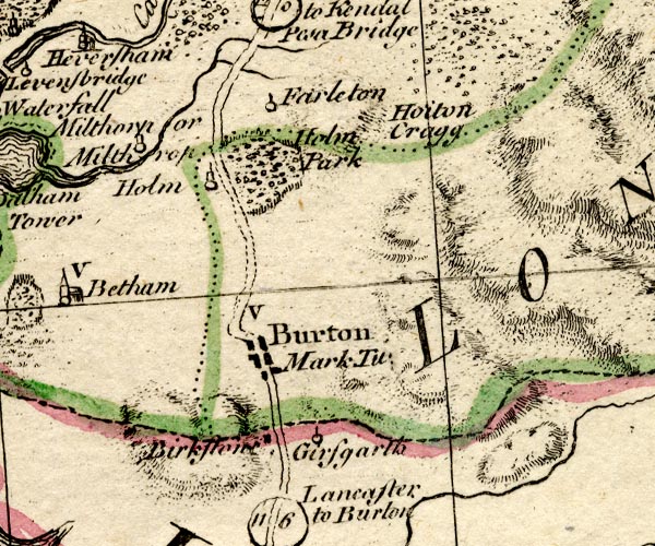 BO18SD47.jpg "Burton Mark Tu. / V" blocks, on road, vicarage, town, market item:- Armitt Library : 2008.14.10 Image © see bottom of page |
|||
|
|
||||
| evidence:- | old map:- Jefferys 1770 (Wmd) placename:- Burton in Kendal |
|||
| source data:- | Map, 4 sheets, The County of Westmoreland, scale 1 inch to 1
mile, surveyed 1768, and engraved and published by Thomas
Jefferys, London, 1770.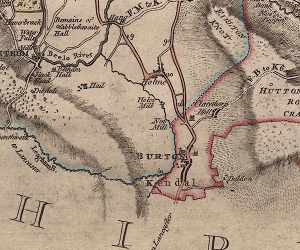 J5SD57NW.jpg "BURTON in Kendal" blocks on a street plan, labelled in block caps; settlement, market town? item:- National Library of Scotland : EME.s.47 Image © National Library of Scotland |
|||
|
|
||||
| evidence:- | old map:- Jefferys 1770 placename:- Burton in Kendal |
|||
| source data:- | Map, 4 sheets, The County of Westmoreland, scale 1 inch to 1
mile, surveyed 1768, and engraved and published by Thomas
Jefferys, London, 1770.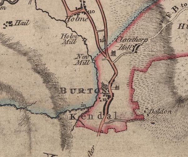 JEF5Brtn.jpg "BURTON in Kendal" blocks along a street, church, large house item:- National Library of Scotland : EME.s.47 Image © National Library of Scotland |
|||
|
|
||||
| evidence:- | old map:- Pennant 1777 placename:- Burton |
|||
| source data:- | Map, hand coloured engraving, A Map of Scotland, Hebrides and
Part of England, drawn for Thomas Pennant, engraved by J Bayly,
published by Benjamin White, London, 1777. click to enlarge click to enlargePEN1Cm.jpg "Burton" circle; buildings, village, etc item:- private collection : 66 Image © see bottom of page |
|||
|
|
||||
| evidence:- | descriptive text:- West 1778 (11th edn 1821) placename:- Burton placename:- Coccium |
|||
| source data:- | Guide book, A Guide to the Lakes, by Thomas West, published by
William Pennington, Kendal, Cumbria once Westmorland, and in
London, 1778 to 1821. goto source goto sourcePage 26, footnote:- "... From Lancaster to Burton ... (There observe Mr. Atkinson's neat house of freestone.) ..." "..." West 1778 (11th edn 1821) goto sourcePage 188:- "..." "To Lancaster, by Burton-in-Kendal,[2] is 22 miles." "[2] (Coccium, Rav. Chor.)" goto sourceAddendum; Mr Gray's Journal, 1769 Page 215:- "..." "Oct. 10. I proceeded by Burton to Lancaster, twenty-two miles; ..." |
|||
|
|
||||
| evidence:- | old map:- West 1784 map placename:- Burton |
|||
| source data:- | Map, hand coloured engraving, A Map of the Lakes in Cumberland,
Westmorland and Lancashire, scale about 3.5 miles to 1 inch,
engraved by Paas, 53 Holborn, London, about 1784.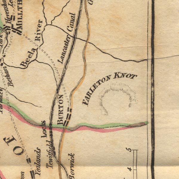 Ws02SD57.jpg "BURTON" item:- Armitt Library : A1221.1 Image © see bottom of page |
|||
|
|
||||
| evidence:- | old map:- Cary 1789 (edn 1805) placename:- Burton in Kendal |
|||
| source data:- | Map, uncoloured engraving, Westmoreland, scale about 2.5 miles
to 1 inch, by John Cary, London, 1789; edition 1805.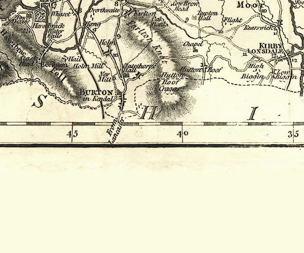 CY24SD57.jpg "BURTON in Kendal" group of blocks, labelled in block caps; town item:- JandMN : 129 Image © see bottom of page |
|||
|
|
||||
| evidence:- | old map:- Aikin 1790 (Wmd) placename:- Burton |
|||
| source data:- | Map, uncoloured engraving, Westmoreland ie Westmorland, scale
about 8.5 miles to 1 inch, by John Aikin, London, 1790.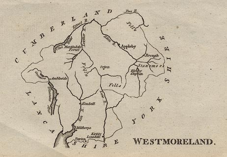 click to enlarge click to enlargeAIK2.jpg "Burton" circle; town item:- JandMN : 51 Image © see bottom of page |
|||
|
|
||||
| evidence:- | old map:- Bailey 1797 placename:- Burton |
|||
| source data:- | Map, soil etc, uncoloured engraving, Westmoreland, scale about
12 miles to 1 inch, by J Bailey, engraved by Neele, Strand,
published by Messrs Robinson, Paternoster Row and G Nicol, Pall
Mall, London, 1797.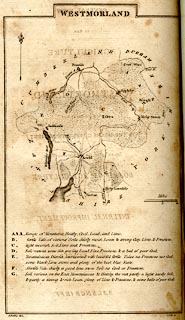 click to enlarge click to enlargeBY05.jpg "Burton" group of blocks; town item:- Armitt Library : A680.3 Image © see bottom of page |
|||
|
|
||||
| evidence:- | road book:- Cary 1798 (2nd edn 1802) placename:- Burton |
|||
| source data:- | Road book, itineraries, Cary's New Itinerary, by John Cary, 181
Strand, London, 2nd edn 1802. goto source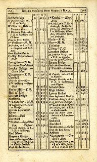 click to enlarge click to enlargeC38267.jpg page 267-268 "Burton - Royal Oak Inn, Westmor. / Through Burton, on l. a T.R. to Milthorpe." market town goto source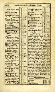 click to enlarge click to enlargeC38269.jpg page 269-270 "INNS. ... Burton, Green Dragon, Royal Oak. ..." goto source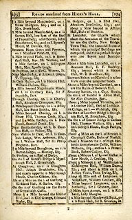 click to enlarge click to enlargeC38273.jpg page 273-274 "Entering Burton, on r. Capt. Stovin." goto source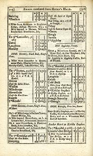 click to enlarge click to enlargeC38315.jpg page 315-316 "To Burton, p.267" market town, post office item:- JandMN : 228.1 Image © see bottom of page |
|||
|
|
||||
| evidence:- | descriptive text:- Baker 1802 placename:- Burton |
|||
| source data:- | Perspective road map with sections in Lancashire, Westmorland,
and Cumberland, by J Baker, London 1802. pp.25-26:- "Burton and Carnforth are the first villages on the great road at leaving Lancaster, ..." "..." "Burton is a small post town, with good inns, and a few decent private dwellings. ..." |
|||
|
|
||||
| evidence:- | old map:- Baker 1802 placename:- Burton |
|||
| source data:- | Perspective road maps with sections in Lancashire, Westmorland
and Cumberland, by J Baker, London 1802.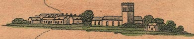 Bk03Vg19.jpg "Burton" item:- private collection : 3 Image © see bottom of page |
|||
|
|
||||
| evidence:- | old map:- Cooke 1802 placename:- Burton in Kendal |
|||
| source data:- | Map, Westmoreland ie Westmorland, scale about 12 miles to 1
inch, by George Cooke, 1802, published by Sherwood, Jones and
Co, Paternoster Road, London, 1824. click to enlarge click to enlargeGRA1Wd.jpg "Burton in Kendal / 246" blocks, upright lowercase text; town, distance from London item:- Hampshire Museums : FA2000.62.4 Image © see bottom of page |
|||
|
|
||||
| evidence:- | old map:- Luffman 1803 placename:- Burton |
|||
| source data:- | Map, hand coloured engraving, Westmoreland ie Westmorland, scale
about 37 miles to 1 inch, by John Luffman, 28 Little Bell Alley,
Coleman Street, London, 1803-06.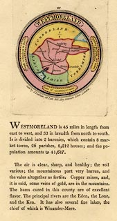 click to enlarge click to enlargeLUF4.jpg "Burton" circle; town item:- Dove Cottage : 2007.38.46 Image © see bottom of page |
|||
|
|
||||
| evidence:- | old map:- Laurie and Whittle 1806 placename:- Burton |
|||
| source data:- | Road map, Completion of the Roads to the Lakes, scale about 10
miles to 1 inch, by Nathaniel Coltman? 1806, published by Robert
H Laurie, 53 Fleet Street, London, 1834. click to enlarge click to enlargeLw18.jpg "Burton 251" market town; distance from London; travellers supplied with post horses or carriages item:- private collection : 18.18 Image © see bottom of page |
|||
|
|
||||
| evidence:- | old text:- Capper 1808 placename:- Burton item:- population; market; fair |
|||
| source data:- | Gazetteer, A Topographical Dictionary of the United Kingdom,
compiled by Benjamin Pitts Capper, published by Richard
Phillips, Bridge Street, Blackfriars, London, 1808; published
1808-29. goto source "..." "BURTON, a parish and market-town in Lonsdale ward, Westmoreland, 5 miles from Kirby Lonsdale, 11 from Lancaster, and 250½from London, on the borders of Lancashire; containing 123 houses and 548 inhabitants. It has a canal navigation joining the rivers Ribble, Dee, Mersey, Humber, Severn, and Thames. The town is well built, and has a good market on Thursday. Fair on Whit-Monday. It is a vicarage, value 15l. 17s." "..." |
|||
|
|
||||
| evidence:- | old map:- Cooper 1808 placename:- Burton |
|||
| source data:- | Map, hand coloured engraving, Westmoreland ie Westmorland, scale
about 9 miles to 1 inch, by H Cooper, 1808, published by R
Phillips, Bridge Street, Blackfriars, London, 1808. click to enlarge click to enlargeCOP4.jpg "Burton" circle with two side bars; town item:- Dove Cottage : 2007.38.53 Image © see bottom of page |
|||
|
|
||||
| evidence:- | old map:- Wallis 1810 (Wmd) placename:- Burton in Kendal |
|||
| source data:- | Road map, Westmoreland, scale about 19 miles to 1 inch, by James
Wallis, 77 Berwick Street, Soho, 1810, published by W Lewis,
Finch Lane, London, 1835? click to enlarge click to enlargeWAL5.jpg "Burton in Kendal / 246" town; distance from London item:- JandMN : 63 Image © see bottom of page |
|||
|
|
||||
| evidence:- | old map:- Otley 1818 placename:- Burton |
|||
| source data:- | Map, uncoloured engraving, The District of the Lakes,
Cumberland, Westmorland, and Lancashire, scale about 4 miles to
1 inch, by Jonathan Otley, 1818, engraved by J and G Menzies,
Edinburgh, Scotland, published by Jonathan Otley, Keswick,
Cumberland, et al, 1833.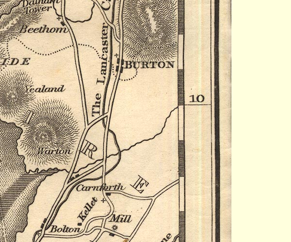 OT02SD57.jpg "BURTON" item:- JandMN : 48.1 Image © see bottom of page |
|||
|
|
||||
| evidence:- | old map:- Hall 1820 (Wmd) placename:- Burton |
|||
| source data:- | Map, hand coloured engraving, Westmoreland ie Westmorland, scale
about 14.5 miles to 1 inch, by Sidney Hall, London, 1820,
published by Samuel Leigh, 18 Strand, London, 1820-31. click to enlarge click to enlargeHA18.jpg "Burton / 251" circle, upright lowercase text; town; distance from London item:- Armitt Library : 2008.14.58 Image © see bottom of page |
|||
|
|
||||
| evidence:- | old map:- Perrot 1823 placename:- Burton |
|||
| source data:- | Map, hand coloured engraving, Cumberland and Westmoreland ie
Westmorland, scale about 38 miles to 1 inch, by Aristide Michel
Perrot, engraved by Migneret, 1823, published by Etienne Ledoux,
9 Rue Guenegaud, Paris, France, 1824-48. click to enlarge click to enlargePER2.jpg "Burton" no symbol item:- Dove Cottage : 2007.38.45 Image © see bottom of page |
|||
|
|
||||
| evidence:- | old map:- Greenwood 1824 (Wmd) placename:- Burton in Kendal |
|||
| source data:- | Map, hand coloured engraving, Map of the County of Westmorland,
scale about 1 inch to 1 mile, by C and J Greenwood, published by
George Pringle jnr, 70 Queen Street, Cheapside, London, 1824.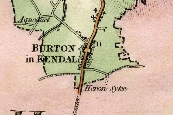 grw5brtk.jpg "BURTON in KENDAL" street map, notice the central square; labelled in in block caps for a market town. item:- Armitt Library : A1827 Image © see bottom of page |
|||
|
|
||||
| evidence:- | old map:- Cobbett 1832 placename:- Burton |
|||
| source data:- | Map, uncoloured engraving, Westmoreland ie Westmorland, scale
about 7 miles to 1 inch, by William Cobbett, 11 Bolt Court,
Fleet Street, London, 1832. click to enlarge click to enlargeCOB4.jpg "Burton" dot and circle; town item:- JandMN : 116 Image © see bottom of page |
|||
|
|
||||
| evidence:- | old map:- Ford 1839 map placename:- Burton |
|||
| source data:- | Map, uncoloured engraving, Map of the Lake District of
Cumberland, Westmoreland and Lancashire, scale about 3.5 miles
to 1 inch, published by Charles Thurnam, Carlisle, and by R
Groombridge, 5 Paternoster Row, London, 3rd edn 1843.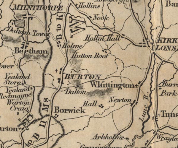 FD02SD57.jpg "BURTON" item:- JandMN : 100.1 Image © see bottom of page |
|||
|
|
||||
| evidence:- | old map:- Garnett 1850s-60s H placename:- Burton |
|||
| source data:- | Map of the English Lakes, in Cumberland, Westmorland and
Lancashire, scale about 3.5 miles to 1 inch, published by John
Garnett, Windermere, Westmorland, 1850s-60s. GAR2SD57.jpg "Burton" blocks, settlement item:- JandMN : 82.1 Image © see bottom of page |
|||
|
|
||||
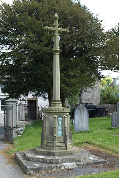
| evidence:- | old text:- Harper 1907 placename:- Burton-in-Kendal item:- market, Burton-in-Kendal |
|||
| source data:- | Guidebook, The Manchester and Glasgow Road, by Charles G Harper,
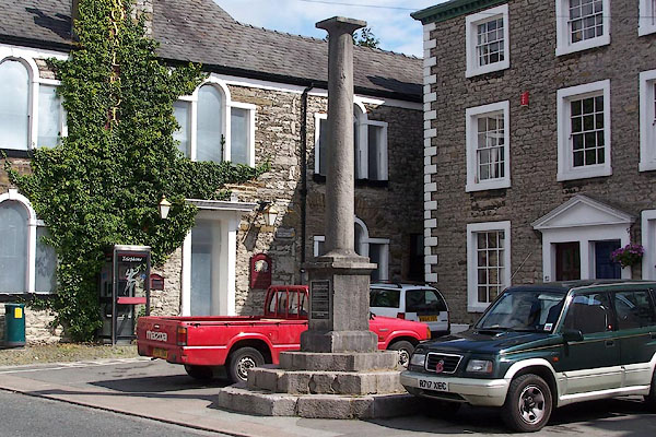
published by Chapman and Hall Ltd, London, 1907. HP01p098.txt Page 98:- "..." "The old wool-market of Burton-in-Kendal is extinct, and that is a very quiet uneventful place nowadays, in which a narrow street of grey stone houses opens into a little square where the granite pillar of a market-cross, reared upon three steps, stands, bearing witness to an importance otherwise not only past, but almost forgotten. ..." "..." "Burton is, or was, a loyal place, and does what it can to celebrate national events. It cannot, in the very nature of things, with the slender resources at its command, do much, and its highwater-mark of effort is seen in a very ordinary" HP01p099.txt Page 99:- "gas-lamp, erected to commemorate the wedding of the Prince of Wales in 1863." |
|||
|
|
||||
| evidence:- | market notes:- item:- market |
|||
| source data:- | www.history.ac.uk/cmh/gaz/gazweb2.htmBowen, Emanuel &Kitchin, Thomas: 1760: New Map of the Counties of Cumberland and Westmoreland | |||
|
|
||||
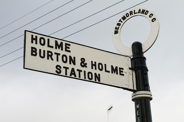
 Post Office maps Post Office maps |
||||
|
|
||||
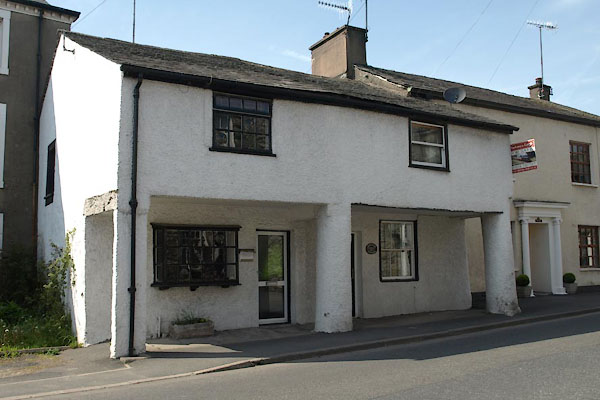
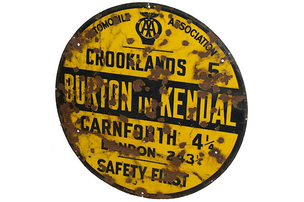 BWJ82.jpg AA placename sign. (taken 11.5.2012) |
||||
|
|
||||
| hearsay:- |
A Quaker meeting house was licensed, 1818, continued to 1844, now a private house.
There is a plaque in Hilderstone Lane (Lancashire). |
|||
|
|
||||
| hearsay:- |
One of Oliver Cromwell's soldiers was found dead by the roadside here; where the neighbours
buried him, and marked his grave with a hawthorn tree. |
|||
|
|
||||
| personal | ||||
| person:- | soldier (Parliamentarian) : |
|||
| place:- | burial place | |||
|
|
||||
| places:- |
|
|||
|
||||
|
||||
|
||||
|
||||
|
||||
|
||||
|
||||
|
||||
|
||||
|
||||
|
||||
|
||||
|
||||
|
||||
|
||||
|
||||
|
||||
|
||||
|
||||
|
||||
|
||||
|
||||
|
||||
|
||||
|
||||
|
||||
|
||||
|
||||
|
||||
|
||||
|
||||
|
||||
|
||||
|
||||
|
||||
|
||||
|
||||
|
||||
|
||||
|
||||
|
||||
|
||||
|
||||
|
||||
|
||||
|
||||
|
||||
|
||||
|
||||
|
||||
|
||||
|
||||
Lakes Guides menu.