 Old Cumbria Gazetteer
 |
 |
|
| Calf Top, Middleton | ||
| Calf Top | ||
| civil parish:- | Middleton (formerly Westmorland) | |
| civil parish:- | Dent (formerly Yorkshire) | |
| county:- | Cumbria | |
| locality type:- | hill | |
| locality type:- | boundary feature | |
| locality type:- | parish boundary feature | |
| locality type:- | county boundary feature (old) | |
| coordinates:- | SD66448563 | |
| 1Km square:- | SD6685 | |
| 10Km square:- | SD68 | |
| altitude:- | 1998 feet | |
| altitude:- | 609m | |
|
|
||
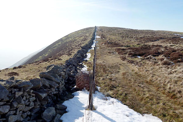 BXX33.jpg (taken 18.2.2013) |
||
|
|
||
| evidence:- | old map:- OS County Series (Wmd 44 6) placename:- Calf Top |
|
| source data:- | Maps, County Series maps of Great Britain, scales 6 and 25
inches to 1 mile, published by the Ordnance Survey, Southampton,
Hampshire, from about 1863 to 1948. |
|
|
|
||
| evidence:- | probably old map:- Jefferys 1770 (Wmd) placename:- Berkin |
|
| source data:- | Map, 4 sheets, The County of Westmoreland, scale 1 inch to 1
mile, surveyed 1768, and engraved and published by Thomas
Jefferys, London, 1770.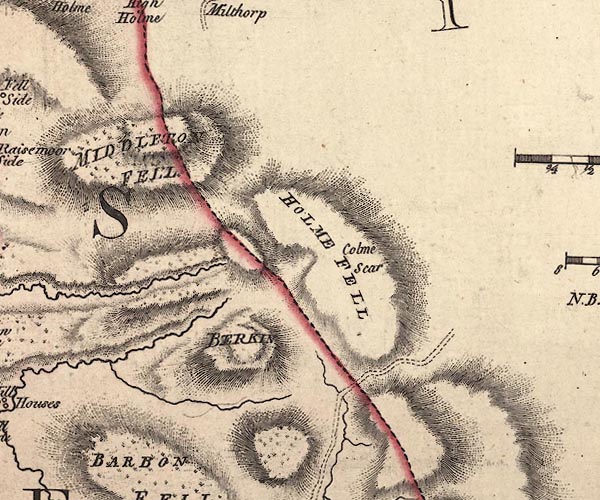 J5SD68NE.jpg "BERKIN" hill hachuring; hill or mountain item:- National Library of Scotland : EME.s.47 Image © National Library of Scotland |
|
|
|
||
| evidence:- | old map:- Balderston c1890 map placename:- Calf Top |
|
| source data:- | Map, the hills in the Ingleton area, probably by Robert R
Balderston, engraved by Goodall and Suddick, Leeds, West
Yorkshire, about 1890.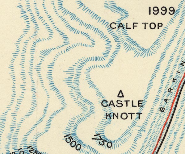 BS1SD68M.jpg "CALF TOP / 1999" item:- private collection : 27.1 Image © see bottom of page |
|
|
|
||
 Lakes Guides menu.