 Old Cumbria Gazetteer
 |
 |
|
| Capplebarrow, Longsleddale | ||
| Capplebarrow | ||
| civil parish:- | Longsleddale (formerly Westmorland) | |
| county:- | Cumbria | |
| locality type:- | hill | |
| locality type:- | boundary feature | |
| locality type:- | parish boundary feature | |
| coordinates:- | NY50760355 (etc) | |
| 1Km square:- | NY5003 | |
| 10Km square:- | NY50 | |
| altitude:- | 1683 feet | |
| altitude:- | 513m | |
|
|
||
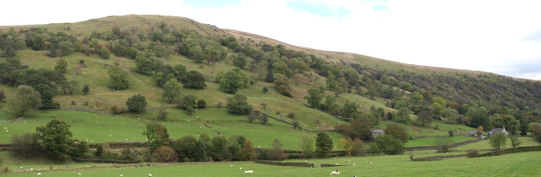 Click to enlarge BXM75.jpg (taken 14.10.2012) 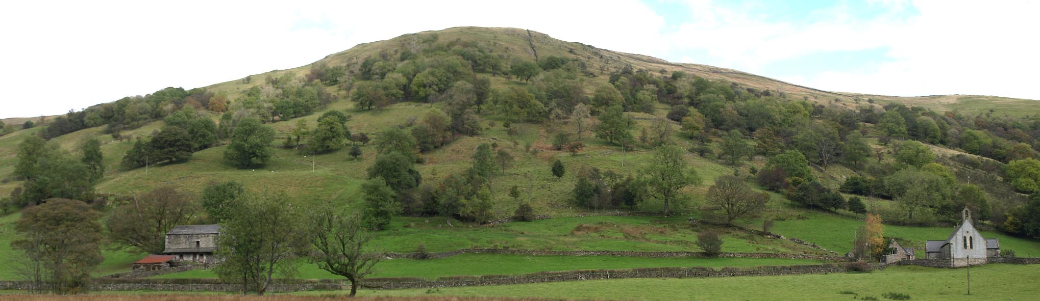 Click to enlarge BXM82.jpg (taken 14.10.2012) |
||
|
|
||
| evidence:- | old map:- OS County Series (Wmd 27 12) placename:- Capplebarrow |
|
| source data:- | Maps, County Series maps of Great Britain, scales 6 and 25
inches to 1 mile, published by the Ordnance Survey, Southampton,
Hampshire, from about 1863 to 1948. Marked as Trigonometrical Station. |
|
|
|
||
| evidence:- | old map:- OS 1881-82 New Series (outline edition) placename:- Capplebarrow |
|
| source data:- | Map, engraving, area north of Kendal, Westmorland, New Series
one inch map, outline edition, sheet 39, scale 1 inch to 1 mile,
published by the Ordnance Survey, Southampton, Hampshire,
1881-82.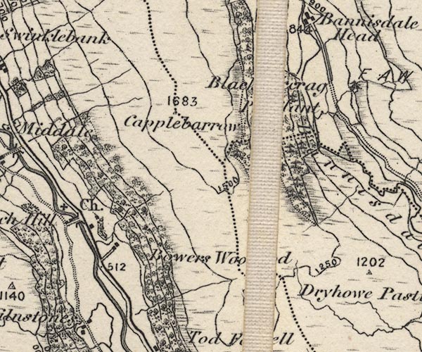 O21NY50B.jpg "Capplebarrow / 1683" item:- JandMN : 61 Image © see bottom of page |
|
|
|
||
| evidence:- | descriptive text:- Wilson 1912 |
|
| source data:- | Guide book, Longsleddale, by F M Wilson, published by T Wilson,
Kendal, Westmorland, 1912. WILSON1.txt "An extensive view may be had from the top of Capel Barrow, which is not a difficult climb though it is 1683 feet above sea level." |
|
|
|
||
| evidence:- | map:- OS Six Inch (1956) placename:- Capplebarrow |
|
| source data:- | Map series, various editions with the national grid, scale about
6 inches to 1 mile, published by the Ordnance Survey,
Southampton, Hampshire, scale 1 to 10560 from 1950s to 1960s,
then 1 to 10000 from 1960s to 2000s, superseded by print on
demand from digital data.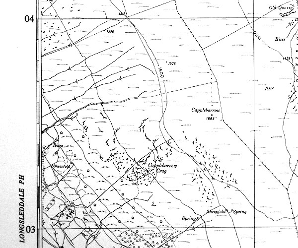 SINY5003.jpg "Capplebarrow / 1683" |
|
|
|
||
| evidence:- | old newspaper:- Z8900705.txt placename:- Capel Barrow item:- placename, Capplebarrow; barrow |
|
| source data:- | Z8900705.txt Westmorland Gazette Transcription from the Westmorland Gazette 5 July 1890 page 6:- "... tradition would support the view that Capel Barrow receives its name from the adjacent chapel or church. There are no traces of any chapel or sanctuary on the hill, and, the chapel going back beyond the seventeenth century, by our written records, gives a date sufficiently early to warrant the idea that the name of the hill is derived from the church. ..." "..." "And here we may be allowed to add, ... that a local authority makes barrow mean a burial place, but we make it mean a hill or rising ground of any kind as well. Capel Barrow has no traces of having been a place of burial. Most of the places in our country to which we find the word barrow affixed, are elevated, and hence the term." |
|
|
|
||
 Lakes Guides menu.