 Old Cumbria Gazetteer
 |
 |
|
| Cartmel Wharf, Morecambe Bay | ||
| Cartmel Wharf | ||
| locality:- | Morecambe Bay | |
| civil parish:- | Lower Holker (formerly Lancashire) | |
| county:- | Cumbria | |
| locality type:- | sands | |
| 1Km square:- | SD3668 (etc etc) | |
| 10Km square:- | SD36 | |
|
|
||
| evidence:- | old text:- Mackenzie 1776 placename:- Cartmel Wharfs Bank |
|
| source data:- | Charts, and sailing directions, Nautical Descriptions of the
West Coast of Great Britain, Bristol Channel to Cape Wrath, by
Murdoch Mackenzie, published London, 1776. goto source goto sourcePage 18:- "... ..." "... Cartmel-wharfs Bank, which dries about low-water only, the other on the E. side of it: at four hours of flood, a vessel, that draws ten or twelve feet, will have sufficient water over Cartmel-wharfs, near the channel. These channels often discover themselves, by the appearance of the water in them; a good look-out is therefore necessary here." |
|
|
|
||
| evidence:- | old map:- Otley 1818 placename:- Cartmel Wharf |
|
| source data:- | Map, uncoloured engraving, The District of the Lakes,
Cumberland, Westmorland, and Lancashire, scale about 4 miles to
1 inch, by Jonathan Otley, 1818, engraved by J and G Menzies,
Edinburgh, Scotland, published by Jonathan Otley, Keswick,
Cumberland, et al, 1833.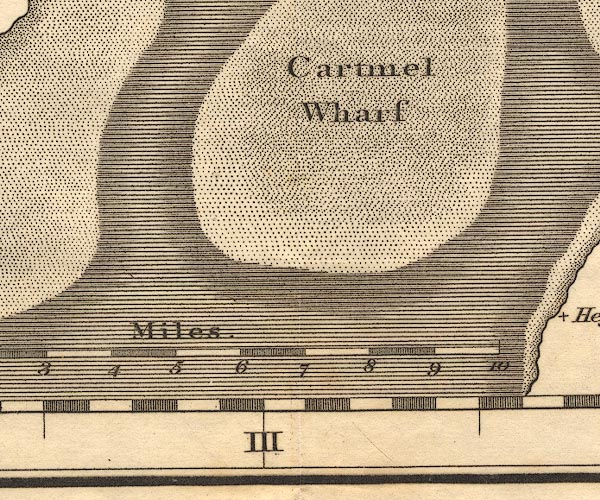 OT02SD36.jpg item:- JandMN : 48.1 Image © see bottom of page |
|
|
|
||
| evidence:- | old text:- Admiralty 1933 placename:- Cartmel Wharf |
|
| source data:- | goto source Page 375:- "..." "Ulverston channel. - Ulverston channel is a tortuous and shifting channel, formed by the outfall of the River Leven, passing westward of Bardsea bank, Cartmel Wharf, and Furness bank, and eastward of Mort bank and flat, which extends off the northern shore of Morecambe bay." |
|
|
|
||
Lakes Guides menu.