 Old Cumbria Gazetteer
 |
 |
|
| Castle Crag, Mardale | ||
| Castle Crag | ||
| Crag Castle | ||
| site name:- | Birks Crag | |
| locality:- | Mardale | |
| civil parish:- | Bampton (formerly Westmorland) | |
| county:- | Cumbria | |
| locality type:- | rocks | |
| coordinates:- | NY46941277 | |
| 1Km square:- | NY4612 | |
| 10Km square:- | NY41 | |
|
|
||
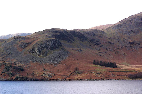
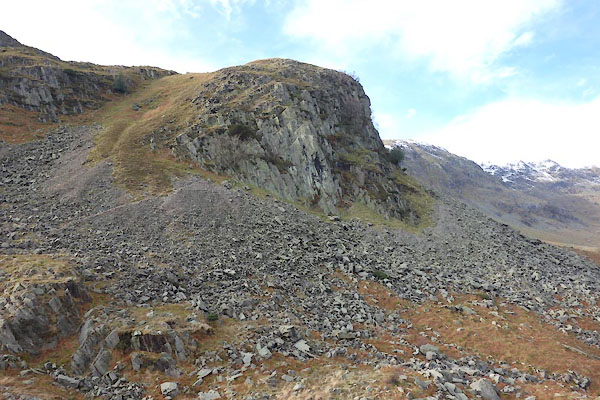 BZW44.jpg (taken 10.2.2014) 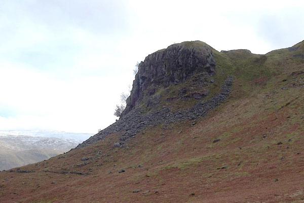 BZW45.jpg (taken 10.2.2014) |
||
|
|
||
| evidence:- | old map:- OS County Series (Wmd 20 2) placename:- Castle Crag |
|
| source data:- | Maps, County Series maps of Great Britain, scales 6 and 25
inches to 1 mile, published by the Ordnance Survey, Southampton,
Hampshire, from about 1863 to 1948. |
|
|
|
||
| evidence:- | outline view:- Otley 1823 (8th edn 1849) placename:- Castle Crag |
|
| source data:- | Engraving, outline view of mountains, Hawes Water from Measand Beck, drawn by T Binns,
engraved by O Jewitt, opposite p.16 of A Descriptive Guide of the English Lakes, by
Jonathan Otley, 8th edition, 1849.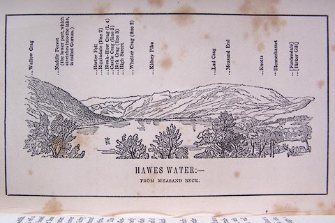 click to enlarge click to enlargeO80E09.jpg item:- Armitt Library : A1180.10 Image © see bottom of page |
|
|
|
||
| evidence:- | site plan:- Historical Monuments 1936 placename:- Castle Crag |
|
| source data:- | Site plan, uncoloured lithograph, Castle Crag, Mardale, Bampton, Westmorland, scale
about 1 to 550, published by Royal Commission on Historical Monuments England, London,
1936.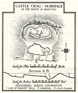 click to enlarge click to enlargeHMW024.jpg On p.32 of the Inventory of the Historical Monuments in Westmorland. printed, top "CASTLE CRAG : MARDALE / IN THE PARISH OF BAMPTON" RCHME no. Wmd, Bampton 68 item:- Armitt Library : A745.24 Image © see bottom of page |
|
|
|
||
| evidence:- | outline view:- Black 1856 (23rd edn 1900) placename:- Castle Crag |
|
| source data:- | Print, lithograph, Outline Views, Haws and Wastwater - Mountains as seen from Burn-Banks
near the Foot of Hawes Water, and Mountains as seen near Nether Wastdale at the First
Bridge on the road to Wast-Water, by J Flintoft, Keswick, Cumberland, engraved by
R Mason, Edinburgh, Lothian, about 1900.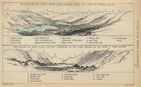 click to enlarge click to enlargeBC08E6.jpg "... Castle Crag ..." item:- JandMN : 37.21 Image © see bottom of page |
|
|
|
||
| evidence:- | outline view:- Black 1841 (3rd edn 1846) placename:- Castle Crag |
|
| source data:- | Print, engraving, outline view, Mountains as seen from Burn Banks near the Foot of
Hawes Water, and Mountains as seen near Strands in Wastdale at the First bridge on
the Road to Wast Water, by J Flintoft, Keswick, Cumberland, engraved by R Mason, Edinburgh,
Lothian, about 1846.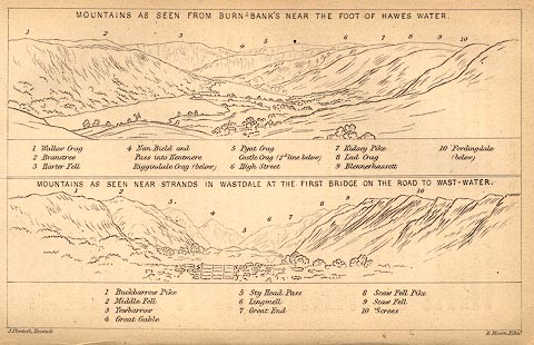 click to enlarge click to enlargeBC02E8.jpg "... Castle Crag ..." item:- JandMN : 32.12 Image © see bottom of page |
|
|
|
||
 BLO66.jpg (taken 25.1.2006) |
||
|
|
||
| hearsay:- |
A party of border reivers were expected to pass through Mardale to cross either Nan
Bield Pass or Gatescarth Pass into the heart of Lakeland. Bowmen from Kendal laid
a trap, stationing themselves on the rocky ground around Castle Crag. Their volleys
of arrows killed all the raiders, who were buried on the hill. |
|
| Kendal bowmen were famed at the Battle of Agincourt:- |
||
| "These were the bows of Kendale bold / Who fierce will fight and never flee" |
||
|
|
||
| personal | ||
| person:- | border reiver : |
|
| place:- | burial place | |
|
|
||
 Lakes Guides menu.