Old Cumbria Gazetteer
 |
 |
|
||
| Cockermouth | ||||
| civil parish:- | Cockermouth (formerly Cumberland) | |||
| county:- | Cumbria | |||
| locality type:- | locality | |||
| locality type:- | buildings | |||
| locality type:- | market town | |||
| locality type:- | selected place | |||
| locality type:- | twinned town | |||
| locality type:- | flood | |||
| coordinates:- | NY12093071 (etc) | |||
| 1Km square:- | NY1230 | |||
| 10Km square:- | NY13 | |||
| latitude; longitude:- | 3d 21.8m W; 54d 39.8m N | |||
|
|
||||
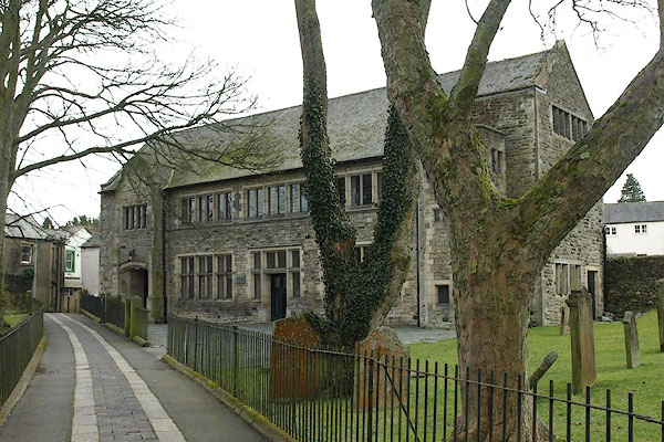
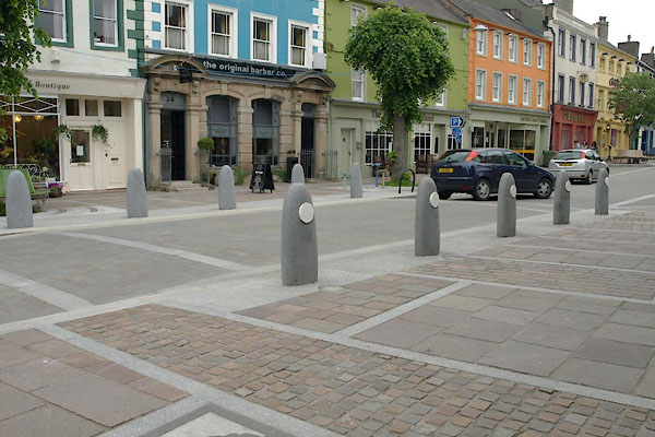
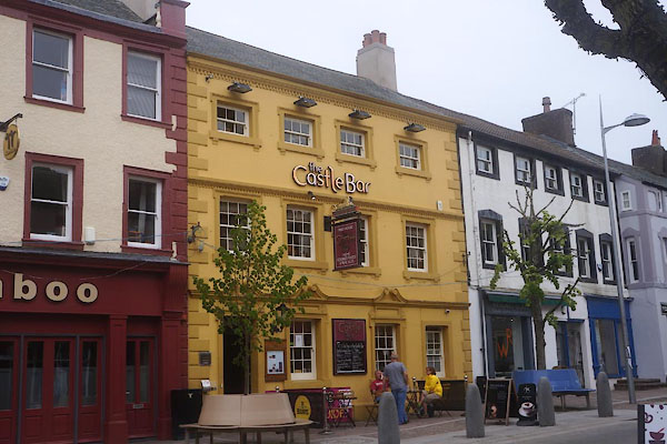
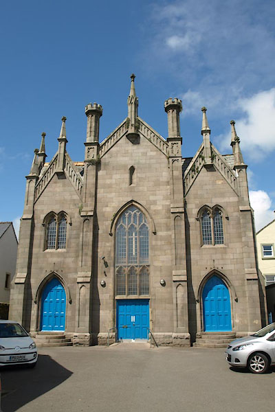
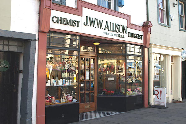
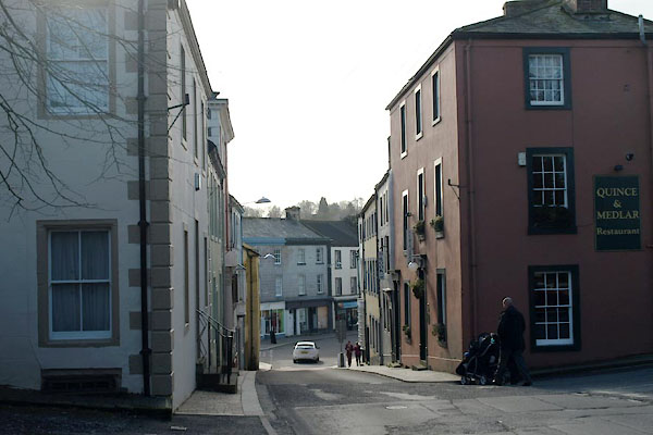
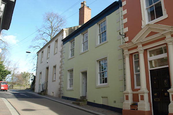
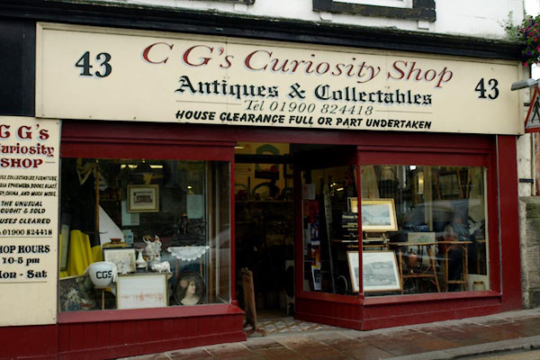
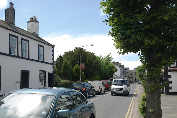
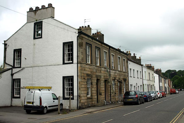
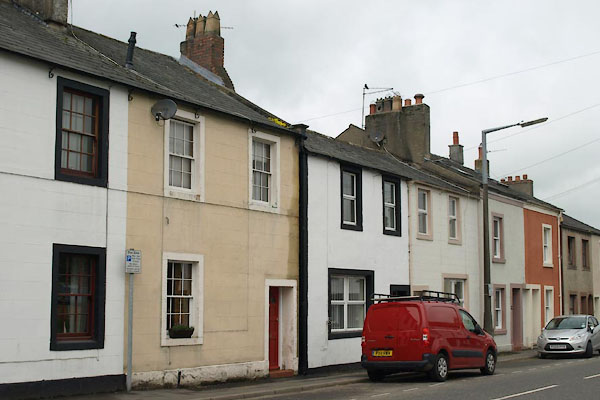
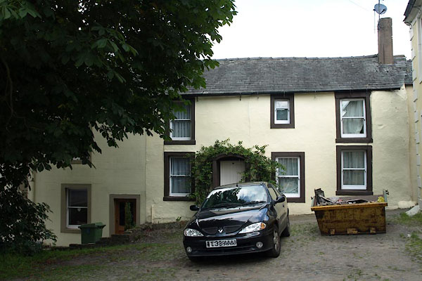
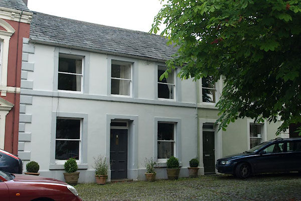
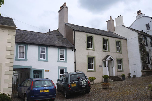
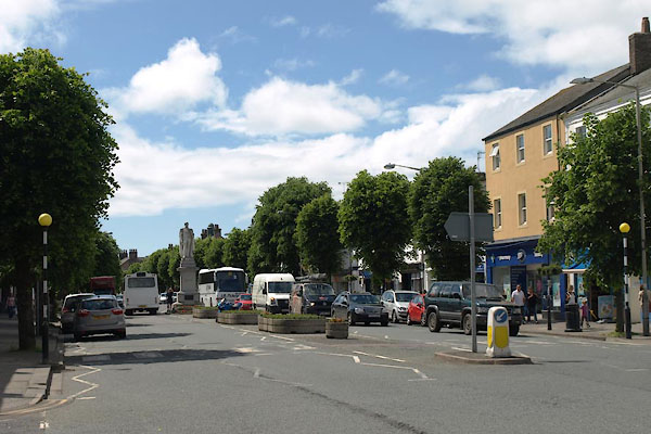
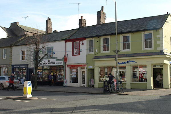
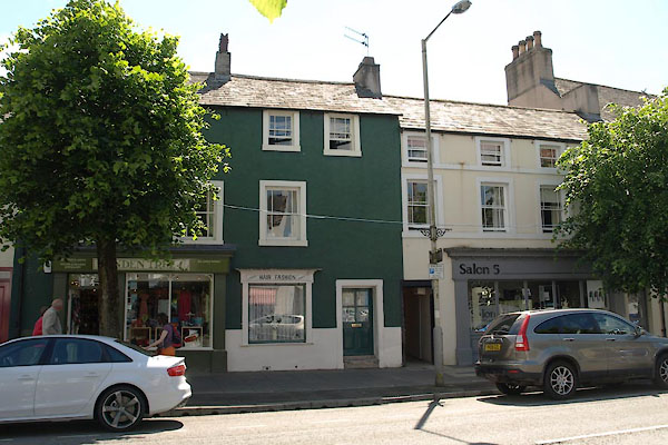
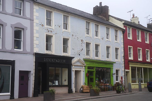
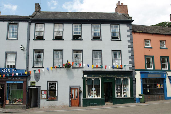
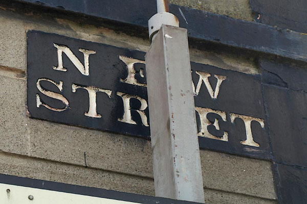
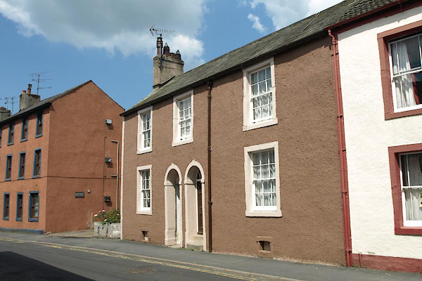
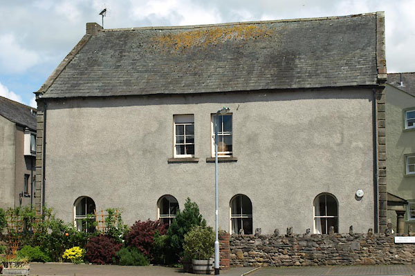
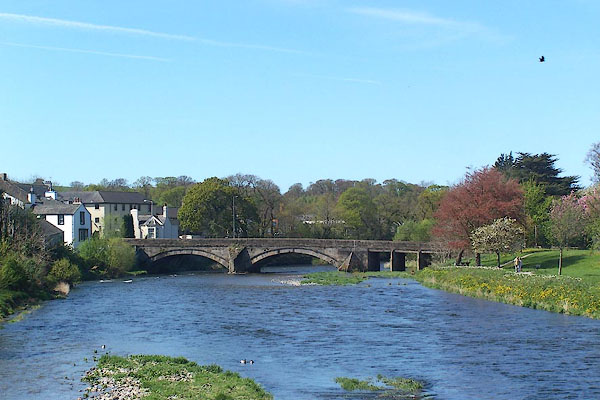
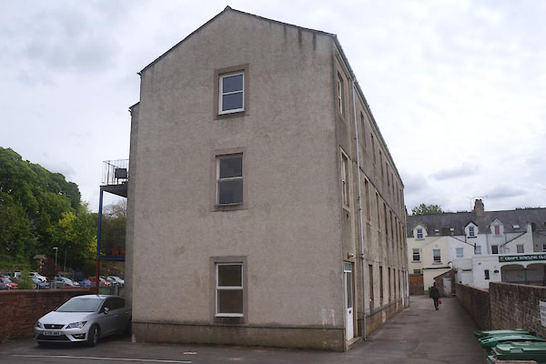
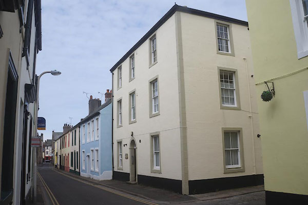
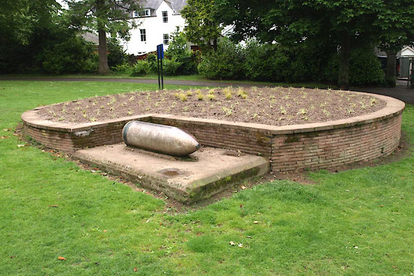
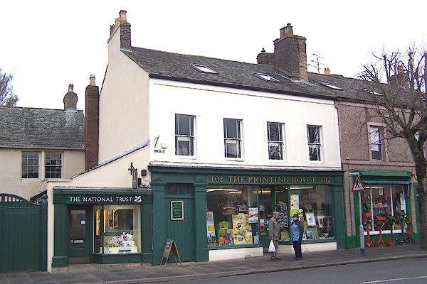
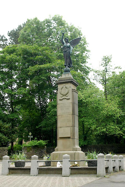
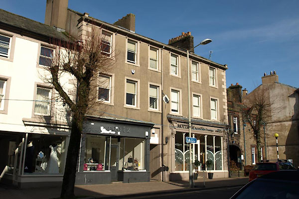
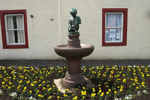
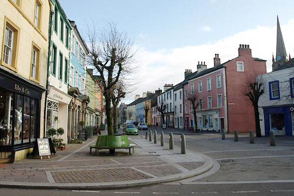
 BUQ39.jpg Market Place. (taken 27.5.2011) |
||||
|
|
||||
| evidence:- | old map:- OS County Series (Cmd 54 4) placename:- Cockermouth |
|||
| source data:- | Maps, County Series maps of Great Britain, scales 6 and 25
inches to 1 mile, published by the Ordnance Survey, Southampton,
Hampshire, from about 1863 to 1948. OS County Series (Cmd 54 8) |
|||
|
|
||||
| evidence:- | old map:- Gough 1350s-60s placename:- Cokermouth |
|||
| source data:- | Map, colour photozincograph copy, reduced size facsimile, Gough
Map of Britain, scale about 28.5 miles to 1 inch, published by
the Ordnance Survey, Southampton, Hampshire, 1875. click to enlarge click to enlargeGgh1Cm.jpg item:- JandMN : 33 Image © see bottom of page |
|||
|
|
||||
| evidence:- | old map:- Gough 1350s-60s placename:- Cokermouth |
|||
| source data:- | Map, lithograph facsimile, Gough Map of Britain, 20 miles to 1
inch? published by the Ordnance Survey, Southampton, Hampshire,
1935. click to enlarge click to enlargeGgh2Cm.jpg item:- JandMN : 34 Image © see bottom of page |
|||
|
|
||||
| evidence:- | descriptive text:- Myddylton 1544 placename:- Cokermouth |
|||
| source data:- | Book, Cronycle of Yeres, including an early table of highways,
published by Wyllyam Myddylton, at the sign of the George, Fleet
Street, London, 1544. "And also the wayes leadynge to the / most notable places: and the dy- / staunce betwyxte the / same / Anno. 1544" "Here foloweth the waye fro~ Coker / mouth to lancastre, and so to London. / From Cokermouth to Kyswike. vi myle. / from Kyswike to Grosener. viii. myle. / from Grosener to Kendale. xiiii. myle. / from Kendale to Burton. vii. myle. / from Burton to Lancastre. viii. myle. / ..." |
|||
|
|
||||
| evidence:- | old map:- Lloyd 1573 placename:- Cokermouth |
|||
| source data:- | Map, hand coloured copper plate engraving, Angliae Regni,
Kingdom of England, with Wales, scale about 24 miles to 1 inch, authored by Humphrey
Lloyd, Denbigh, Clwyd, drawn and engraved
by Abraham Ortelius, Netherlands, 1573. click to enlarge click to enlargeLld1Cm.jpg "Cokermouth" item:- Hampshire Museums : FA1998.69 Image © see bottom of page |
|||
|
|
||||
| evidence:- | old map:- Saxton 1579 placename:- Cokermouth |
|||
| source data:- | Map, hand coloured engraving, Westmorlandiae et Cumberlandiae Comitatus ie Westmorland
and Cumberland, scale about 5 miles to 1 inch, by Christopher Saxton, London, engraved
by Augustinus Ryther, 1576, published 1579-1645. Sax9NY13.jpg Buildings and towers, symbol for a town. "COKERMOUTH" item:- private collection : 2 Image © see bottom of page |
|||
|
|
||||
| evidence:- | old map:- Mercator 1595 (edn?) placename:- Cokermouth |
|||
| source data:- | Map, hand coloured engraving, Northumbria, Cumberlandia, et
Dunelmensis Episcopatus, ie Northumberland, Cumberland and
Durham etc, scale about 6.5 miles to 1 inch, by Gerard Mercator,
Duisberg, Germany, about 1595. MER8CumB.jpg "Cokermouth" circle, building/s, tower, tinted red item:- JandMN : 169 Image © see bottom of page |
|||
|
|
||||
| evidence:- | old map:- Keer 1605 placename:- Cokermouth |
|||
| source data:- | Map, hand coloured engraving, Westmorland and Cumberland, scale
about 16 miles to 1 inch, probably by Pieter van den Keere, or
Peter Keer, about 1605 edition perhaps 1676. click to enlarge click to enlargeKER8.jpg "Cokermouth" dot, two circle, tower, tinted red; town item:- Dove Cottage : 2007.38.110 Image © see bottom of page |
|||
|
|
||||
| evidence:- | old map:- Speed 1611 (Cum/EW) placename:- Cokermouth |
|||
| source data:- | Map, hand coloured engraving, Kingdome of Great Britaine and
Ireland, scale about 36 miles to 1 inch, by John Speed, about
1610-11, published by Thomas Bassett, Fleet Street and Richard
Chiswell, St Paul's Churchyard, London, 1676? click to enlarge click to enlargeSPD6Cm.jpg "Cokermouth" dot, circle, and tower item:- private collection : 85 Image © see bottom of page |
|||
|
|
||||
| evidence:- | old map:- Speed 1611 (Cmd) placename:- Cokermouth |
|||
| source data:- | Map, hand coloured engraving, Cumberland and the Ancient Citie
Carlile Described, scale about 4 miles to 1 inch, by John Speed,
1610, published by J Sudbury and George Humble, Popes Head
Alley, London, 1611-12. SP11NY12.jpg "Cokermouth" circle, buildings, towers item:- private collection : 16 Image © see bottom of page |
|||
|
|
||||
| evidence:- | poem:- Drayton 1612/1622 text placename:- Cokermouth item:- placename, Cockermouth |
|||
| source data:- | Poem, Poly Olbion, by Michael Drayton, published by published by
John Marriott, John Grismand and Thomas Dewe, and others?
London, part 1 1612, part 2 1622. goto source goto sourcepage 165:- "Cleere Coker ... Gives Coker-mouth the name, by standing at her fall, Into fair Darwents Banks, ..." |
|||
|
|
||||
| evidence:- | old map:- Drayton 1612/1622 placename:- Cockermouth |
|||
| source data:- | Map, hand coloured engraving, Cumberlande and Westmorlande, by
Michael Drayton, probably engraved by William Hole, scale about
4 or 5 miles to 1 inch, published by John Mariott, John
Grismand, and Thomas Dewe, London, 1622.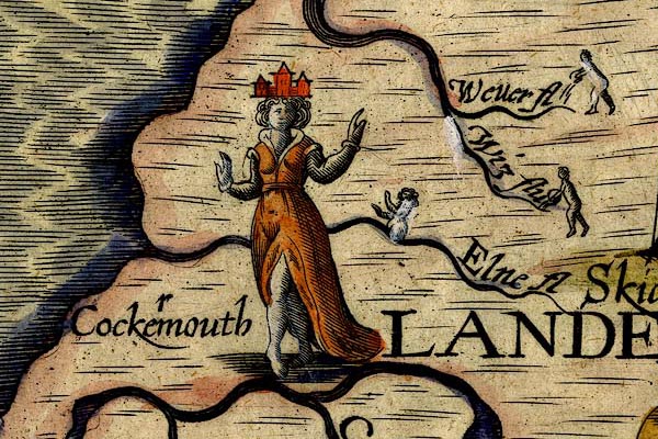 DRY506.jpg "Cockermouth" Lady with 'town' headress; r inserted as a correction. item:- JandMN : 168 Image © see bottom of page |
|||
|
|
||||
| evidence:- | table of distances:- Simons 1635 placename:- Cockermouth |
|||
| source data:- | Table of distances, uncoloured engraving, Cumberland, with a
thumbnail map, scale about 41 miles to 1 inch, by Mathew Simons,
published in A Direction for the English Traviller, 1635.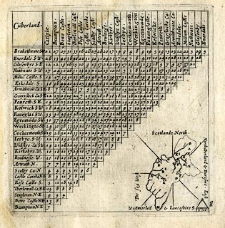 click to enlarge click to enlargeSIM4.jpg "Cockermouth SW" and tabulated distances; C on thumbnail map item:- private collection : 50.11 Image © see bottom of page |
|||
|
|
||||
| evidence:- | old map:- Jenner 1643 placename:- Cokermouth |
|||
| source data:- | Tables of distances with a maps, Westmerland, scale about 16
miles to 1 inch, and Cumberland, scale about 21 miles to 1 inch,
published by Thomas Jenner, London, 1643; published 1643-80.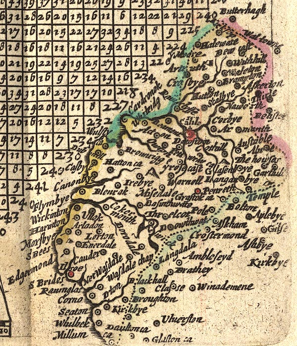 JEN4Sq.jpg "Cokermouth" circle |
|||
|
|
||||
| evidence:- | old map:- Jansson 1646 placename:- Cokermouth |
|||
| source data:- | Map, hand coloured engraving, Cumbria and Westmoria, ie
Cumberland and Westmorland, scale about 3.5 miles to 1 inch, by
John Jansson, Amsterdam, Netherlands, 1646. JAN3NY12.jpg "Cokermouth" Buildings and towers, suggestion of a wall, notice ?fence palings; upright lowercase text; market town. item:- JandMN : 88 Image © see bottom of page |
|||
|
|
||||
| evidence:- | old map:- Ogilby 1675 (plate 96) placename:- Cockermouth |
|||
| source data:- | Road strip map, hand coloured engraving, the Road from Kendal to
Cockermouth, and the Road from Egremond to Carlisle, scale about
1 inch to 1 mile, by John Ogilby, London, 1675.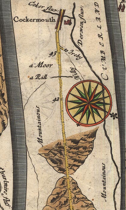 OG96m040.jpg In mile 43, Cumberland. "Cockermouth" street of houses on each side of the road, the castle on the right, and the River Cocker flowing under the road to the River Derwent. item:- JandMN : 22 Image © see bottom of page |
|||
| source data:- | Road strip map, hand coloured engraving, the Road from Kendal to
Cockermouth, and the Road from Egremond to Carlisle, scale about
1 inch to 1 mile, by John Ogilby, London, 1675.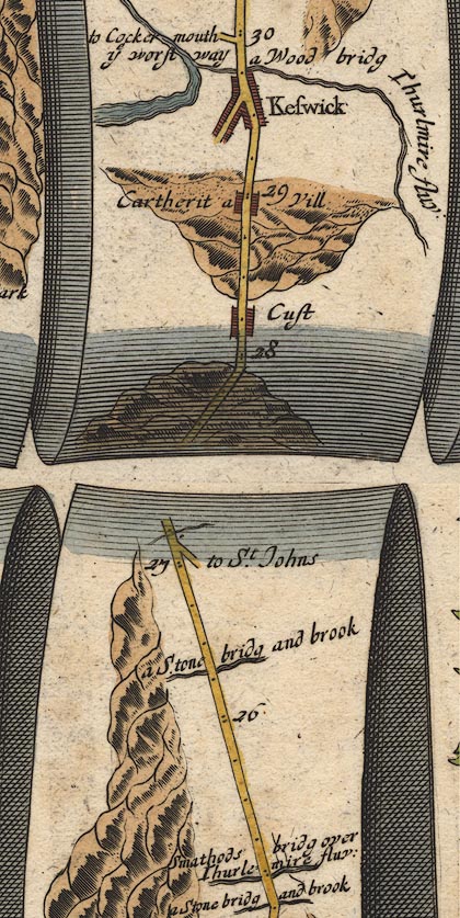 OG96m025.jpg In mile 29, Cumberland. Turning left:- "to Cockermouth ye worst way" item:- JandMN : 22 Image © see bottom of page |
|||
| source data:- | Road strip map, hand coloured engraving, the Road from Kendal to
Cockermouth, and the Road from Egremond to Carlisle, scale about
1 inch to 1 mile, by John Ogilby, London, 1675.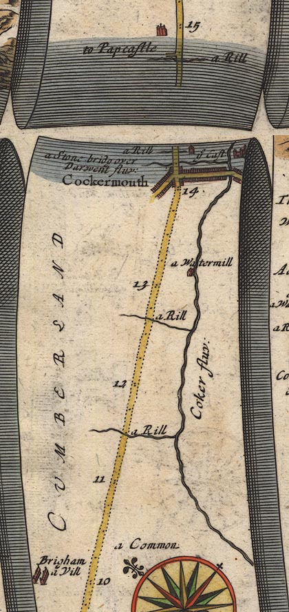 OG96Bm10.jpg In mile 14, Cumberland. "Cockermouth" street of houses at right angles to the road, and a castle, the street to the right crossing the River Cocker, the road crosses the Derwent beyond the town. item:- JandMN : 22 Image © see bottom of page |
|||
|
|
||||
| evidence:- | old map:- Berry 1679 placename:- Cockermouth |
|||
| source data:- | Road map, diagram, The Grand Roads of England, engraved by John
Rich, made and published by William Berry, at the Sign of the
Globe, London, 1679. "Cockermouth" market Monday |
|||
|
|
||||
| evidence:- | old map:- Sanson 1679 placename:- Cokermouth |
|||
| source data:- | Map, hand coloured engraving, Ancien Royaume de Northumberland
aujourdhuy Provinces de Nort, ie the Ancient Kingdom of
Northumberland or the Northern Provinces, scale about 9.5 miles
to 1 inch, by Nicholas Sanson, Paris, France, 1679. click to enlarge click to enlargeSAN2Cm.jpg "Cokermouth" circle, buildings and towers; town item:- Dove Cottage : 2007.38.15 Image © see bottom of page |
|||
|
|
||||
| evidence:- | old map:- Seller 1694 (Cmd) placename:- Cokermouth |
|||
| source data:- | Map, uncoloured engraving, Cumberland, scale about 12 miles to 1
inch, by John Seller, 1694. click to enlarge click to enlargeSEL9.jpg "Cokermouth" circle, upright lowercase text; town item:- Dove Cottage : 2007.38.89 Image © see bottom of page |
|||
|
|
||||
| evidence:- | old map:- Morden 1695 (EW) placename:- Cockermouth |
|||
| source data:- | Map, hand coloured engraving, England, including Wales, scale
about 27 miles to 1 inch, by Robert Morden, published by Abel
Swale Awnsham and John Churchil, London, about 1695. click to enlarge click to enlargeMRD3Cm.jpg "Cockermouth" circle; village or town item:- JandMN : 339 Image © see bottom of page |
|||
|
|
||||
| evidence:- | old map:- Morden 1695 (Cmd) placename:- Cockermouth |
|||
| source data:- | Map, uncoloured engraving, Cumberland, scale about 4 miles to 1
inch, by Robert Morden, 1695, published by Abel Swale, the
Unicorn, St Paul's Churchyard, Awnsham, and John Churchill, the
Black Swan, Paternoster Row, London, 1695-1715. MD12NY12.jpg "Cockermouth" Circle, buildings, towers. item:- JandMN : 90 Image © see bottom of page |
|||
|
|
||||
| evidence:- | old text:- Ogilby 1699 (edn 1712) placename:- Cockermouth item:- market |
|||
| source data:- | Road book, itineraries and map, The Traveller's Guide, by John
Ogilby, published by Abel Swall, Tim Child, White Hart, and R
Knaplock, the Angel and Crown, St Paul's Churchyard, London,
1699. OGY7p179.txt page 179 Distances from Kendal "... at 43'4 enter Cockermouth, on Derwen and Coker flv. a Place of good Account, with a fair Ch. and strong Castle. As a Borough-Town it elects Parl. Men, and has a Mt.on Mond. with 2 Fairs." |
|||
|
|
||||
| evidence:- | old map, descriptive text:- Bowen 1720 (plate 261) placename:- Cockermouth item:- market; fair |
|||
| source data:- | Road strip map, uncoloured engraving, pl.261, the end of the
road from Kendal to Cockermouth and the road from Egremont to
Carlisle, scale about 2 miles to 1 inch, published by Emanuel
Bowen, St Katherines, London, 1720.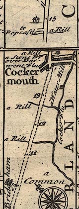 B261m10.jpg "Cockermouth. Is an ancient Boro[ ]. probably so called by its Ld. Will. Meschines, Ld. of Copeland (Brother of Ranulph E: of Chester) on whom it was bestowed by ye Conqueror. The Honor was afterwds. successively possessed by ye Lucys, Multons, Umframvils & Piercy's E: of Northumberland, wch last remained Ld. of it till ye death of Iosceline Piercy, ye 11th. & last E: of that Illustrious Family, May ye 21st. 1670 [o.] Upon failure of his Issue Male it came to his Grace ye present D. of Somerset, by Marriage of Eliz. Lady Piercy (Relict of Henry Cavendish E. of Ogle) sole Daughter and Heir of ye aforesaid E. of Northumberland. This Borough (for 'tis no Corporation) is govern'd by a Bayliff, chosen yearly by a Jury of 16 Burghers at ye D. of Somerset's Court. It sent Burgesses to Parl. so early as 23d. K. Ed. 1st which it afterwds. omitted, till by order of Parl. Decr. 4th. 1640. This Borough, together with Oakhampton, Honiton, Ashburton, Malton, had that privilege restored, & has ever since carefully preserved it by a constant return of Membs. who are elected by the Inhabitants at large in Number about 300 & returned by the said Bayliff. The Market here is on Mond. & Fair Septr. [2]0th. The Castle is mostly ruinous except that part where ye D. of Somersets Auditor keeps his Courts twice a year, & an apartment over ye Gates where is a large Dining Room, with other Chambers. Tho' his Grace has built a very convenient New House &c for his Bayliffs residence." item:- Dove Cottage : Lowther.36 Image © see bottom of page |
|||
|
|
||||
| evidence:- | descriptive text:- Defoe 1724-26 placename:- Cockermouth |
|||
| source data:- | Tour through England and Wales, by Daniel Defoe, published in
parts, London, 1724-26. "About ten miles from Whitehaven north east, lies Cockermouth, upon the little River Cocker, just where it falls into the Derwent. ..." "..." "Cockermouth stands upon the River Derwent, about twelve miles from the sea, but more by the windings of the river, yet vessels of good burthen may come up to it. The Duke of Somerset is chief lord of this town, in right of his lady, the only heiress of the ancient family of the Piercy's, Earls of Northumberland, and which the duke of Somerset now enjoys in right of marriage." |
|||
|
|
||||
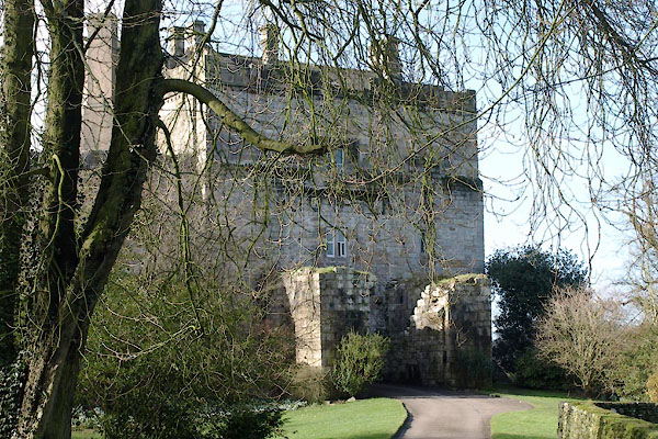
| evidence:- | old print:- Buck 1739 |
|||
| source data:- | Print, uncoloured engraving, The North West View of Cockermouth Castle, in the County
of Cumberland, drawn and engraved by Samuel and Nathaniel Buck, published 1739.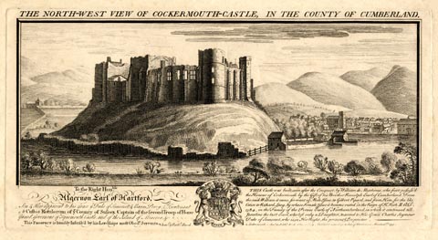 click to enlarge click to enlargeBU0204.jpg printed, top "THE NORTH-WEST VIEW OF COCKERMOUTH CASTLE, IN THE COUNTY OF CUMBERLAND." item:- Armitt Library : 1959.67.4 Image © see bottom of page |
|||
|
|
||||
| evidence:- | old map:- Badeslade 1742 placename:- Cockermouth |
|||
| source data:- | Maps, Westmorland North from London, scale about 10 miles to 1
inch, and Cumberland North from London, scale about 11 miles to
1 inch, with descriptive text, by Thomas Badeslade, London,
engraved and published by William Henry Toms, Union Court,
Holborn, London, 1742; published 1742-49. "Cockermouth sends 2 Members [to Parliament], Market Monday, Fair September 29." |
|||
|
|
||||
| evidence:- | old map:- Badeslade 1742 placename:- Cockermouth |
|||
| source data:- | Map, uncoloured engraving, A Map of Cumberland North from
London, scale about 11 miles to 1 inch, with descriptive text,
by Thomas Badeslade, London, engraved and published by William
Henry Toms, Union Court, Holborn, London, 1742. click to enlarge click to enlargeBD10.jpg "Cockermouth" circle, tower/s, upright lowercase text; town, and two stars item:- JandMN : 115 Image © see bottom of page |
|||
|
|
||||
| evidence:- | descriptive text:- Simpson 1746 placename:- Cockermouth item:- population, Cockermouth |
|||
| source data:- | Atlas, three volumes of maps and descriptive text published as
'The Agreeable Historian, or the Compleat English Traveller
...', by Samuel Simpson, 1746. goto source "..." "Cockermouth, almost surrounded by the meeting of the Rivers Derwent and Cocker, is a good trading Market Town, with a Castle, formerly belonging to the Earls of Northumberland, and is 226 Miles computed from London, and 288 measured. The Duke of Somerset, is, at present, chief Lord of Cockermouth, in Right of his late Duchess, the only Heiress of the ancient Family of the Piercys, Earls of Northumberland. It is neatly built, but of a low Situation between two Hills, upon one of which is the Church, and upon the other, which seems to be artificially raised on Purpose, stands the Castle, very strong of itself, but more by its advantageous Situation." "This Town was anciently an Hamlet to Bridgeham. which stands about a Mile off, and had then only a Chapel for the Worship of God; but now it is a Parish, and hath had a Church of its own, dedicated to St. Michael, ... The Houses in the Town are built with Stone, and slated, except some few, and are ranged into two Streets, the one above the River Cocker, in which are the Moot-Hall and Market-House, which is used chiefly for Corn, and the other below, in which is the Beast-Market. The Market is kept on Mondays; and the Fairs are annually on September 29, and Whit-Monday." "This Borough is no Corporation; its chief Magistrate is a Bailiff, chosen annually by a Jury of 16 Burghers, at the Duke of Somerset's Courts. He is Returning Officer of the Members of Parliament, who are elected by" goto source"the Inhabitants at large, in Number about 300, tho' the Houses are not above 240, some of them containing several Families." |
|||
|
|
||||
| evidence:- | old text:- Gents Mag item:- storm, 1749; rain; flood, 1749 |
|||
| source data:- | Magazine, The Gentleman's Magazine or Monthly Intelligencer or
Historical Chronicle, published by Edward Cave under the
pseudonym Sylvanus Urban, and by other publishers, London,
monthly from 1731 to 1922. goto source Gentleman's Magazine 1749 p.389 "Cockermouth, Cumberland, September 3." "IN the night between the 22d and 23d ult. in the midst of the most terrible lightning and thunder that ever was seen and heard; a large rock near the tops of the mountain was rent assunder; out of which came so great a deluge of water, and with such violence and rapidity, as carried all before it, such as solid stones of incredible weight, houses, barns, mills, &c. and even erased their very foundations, so that you cannot now tell where they stood; the mill stones are carried some hundred yards from the mill, and tossed upon the rubbish and sand, the quantity of which is so great that it has laid waste a great tract of arable and meadow land, which will for the future be for" goto sourceGentleman's Magazine 1749 p.390 "ever spoil'd, being as deep in some places as the tops of trees." "It would surpass all credit to give you every particular circumstance of this surprizing cataract, which still continues to discharge a large quantity of water of such a strange nature as to tincture all the river Derwent, quite down to the sea, which must be near twenty miles. The damage done to the hay, corn, and proprietors of the neighbouring fields and houses, is computed at near 4000l." |
|||
|
|
||||
| evidence:- | old map:- Gents Mag 1751 placename:- Cockermouth |
|||
| source data:- | Map, uncoloured engraving, Map of the Black Lead Mines in
Cumberland, and area, scale about 2 miles to 1 inch, by George
Smith, published in the Gentleman's Magazine, 1751. GM1304.jpg "COCKERMOUTH" blocks on streest; town item:- JandMN : 114 Image © see bottom of page |
|||
|
|
||||
| evidence:- | old map:- Bickham 1753-54 (Cmd) placename:- Cockermouth |
|||
| source data:- | Map, uncoloured engraving, perspective map, Map of Cumberland
North from London, by George Bickham, James Street, Bunhill
Fields, London, 1753, published by F Jollie and Sons, Carlisle,
Cumberland, 1811. click to enlarge click to enlargeJL05.jpg "Cockermouth" view (sort of) item:- Carlisle Library : 4.2 Image © Carlisle Library |
|||
|
|
||||
| evidence:- | old text:- Morgan 1759 placename:- Cockermouth |
|||
| source data:- | MG02q013.txt "At Cockermouth are the ruins of a castle, the gateway of which is defended by a Portcullis, over which is a lofty tower. Authors differ about the founder of this castle, though they agree that it arose soon after the Conquest." |
|||
|
|
||||
| evidence:- | old map:- Bowen and Kitchin 1760 placename:- Cockermouth |
|||
| source data:- | Map, hand coloured engraving, A New Map of the Counties of
Cumberland and Westmoreland Divided into their Respective Wards,
scale about 4 miles to 1 inch, by Emanuel Bowen and Thomas
Kitchin et al, published by T Bowles, Robert Sayer, and John
Bowles, London, 1760. BO18NY12.jpg "Cockermouth Mar. Mon." blocks, street plan, two crosses potent for charity schools, town, market item:- Armitt Library : 2008.14.10 Image © see bottom of page |
|||
|
|
||||
| evidence:- | old map:- Mackenzie 1760s placename:- Cockermouth |
|||
| source data:- | Chart, uncoloured engraving, Solway Firth, Cumberland and
Scotland, scale about 1 inch to 1 mile, by Murdoch Mackenzie
snr, engraved by Thomas Bowen, Fleet Street, published by
Murdoch Mackenzie snr, Kenneth Mackenzie and Murdoch Mackenzie
jnr, London, 1776.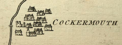 click to enlarge click to enlargeMCK9P2.jpg "COCKERMOUTH" item:- Carlisle Library : Map 327 Image © Carlisle Library |
|||
|
|
||||
| evidence:- | old map:- Donald 1774 (Cmd) placename:- Cockermouth |
|||
| source data:- | Map, hand coloured engraving, 3x2 sheets, The County of Cumberland, scale about 1
inch to 1 mile, by Thomas Donald, engraved and published by Joseph Hodskinson, 29
Arundel Street, Strand, London, 1774.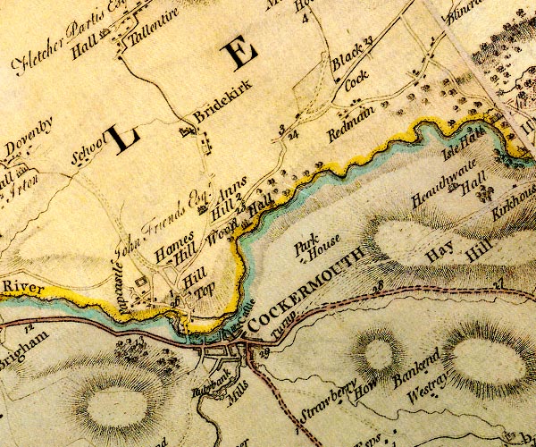 D4NY13SW.jpg "COCKERMOUTH" blocks, perhaps a church, labelled in block caps; a town, with a street plan item:- Carlisle Library : Map 2 Image © Carlisle Library |
|||
|
|
||||
| evidence:- | old map:- Donald 1774 (Cmd) placename:- Cockermouth |
|||
| source data:- | Map, hand coloured engraving, 3x2 sheets, The County of Cumberland, scale about 1
inch to 1 mile, by Thomas Donald, engraved and published by Joseph Hodskinson, 29
Arundel Street, Strand, London, 1774.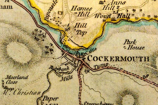 DN04Cckr.jpg "COCKERMOUTH" Labelled in block caps for a market town; street map. item:- Carlisle Library : Map 2 Image © Carlisle Library |
|||
|
|
||||
| evidence:- | old map:- Donald 1774 (Cmd) placename:- Cockermouth |
|||
| source data:- | Map, hand coloured engraving, 3x2 sheets, The County of Cumberland, scale about 1
inch to 1 mile, by Thomas Donald, engraved and published by Joseph Hodskinson, 29
Arundel Street, Strand, London, 1774.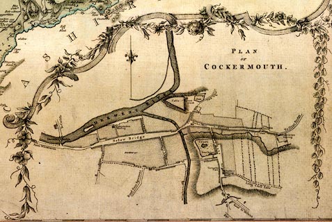 click to enlarge click to enlargeDN04Cc.jpg "PLAN OF COCKERMOUTH" item:- Carlisle Library : Map 2 Image © Carlisle Library |
|||
|
|
||||
| evidence:- | old map:- Donald 1774 (Cmd) |
|||
| source data:- | Map, hand coloured engraving, 3x2 sheets, The County of Cumberland, scale about 1
inch to 1 mile, by Thomas Donald, engraved and published by Joseph Hodskinson, 29
Arundel Street, Strand, London, 1774.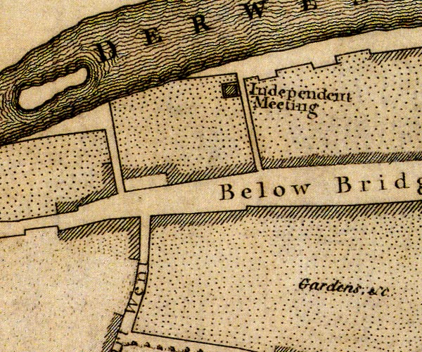 D41130Y.jpg 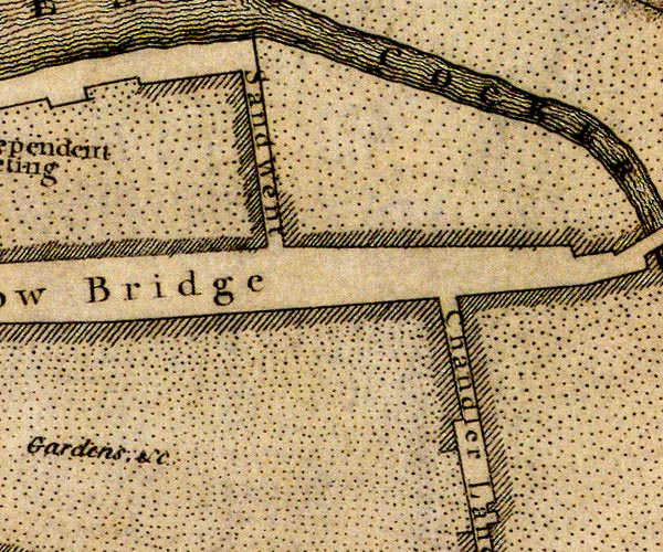 D41230D.jpg "Gardens, &c" area south of Main Street, now built up item:- Carlisle Library : Map 2 Images © Carlisle Library |
|||
|
|
||||
| evidence:- | old map:- Pennant 1777 placename:- Cockermouth |
|||
| source data:- | Map, hand coloured engraving, A Map of Scotland, Hebrides and
Part of England, drawn for Thomas Pennant, engraved by J Bayly,
published by Benjamin White, London, 1777. click to enlarge click to enlargePEN1Cm.jpg "Cockermouth" circle with side bars and spike; town item:- private collection : 66 Image © see bottom of page |
|||
|
|
||||
| evidence:- | descriptive text:- West 1778 (11th edn 1821) |
|||
| source data:- | Guide book, A Guide to the Lakes, by Thomas West, published by
William Pennington, Kendal, Cumbria once Westmorland, and in
London, 1778 to 1821. goto source Mrs Radcliffe's Ride over Skiddaw, 1794 Page 307:- "..." "[on Skiddaw] ... and Cockermouth seemed almost under the eye. ..." |
|||
|
|
||||
| evidence:- | old map:- West 1784 map placename:- Cockermouth |
|||
| source data:- | Map, hand coloured engraving, A Map of the Lakes in Cumberland,
Westmorland and Lancashire, scale about 3.5 miles to 1 inch,
engraved by Paas, 53 Holborn, London, about 1784.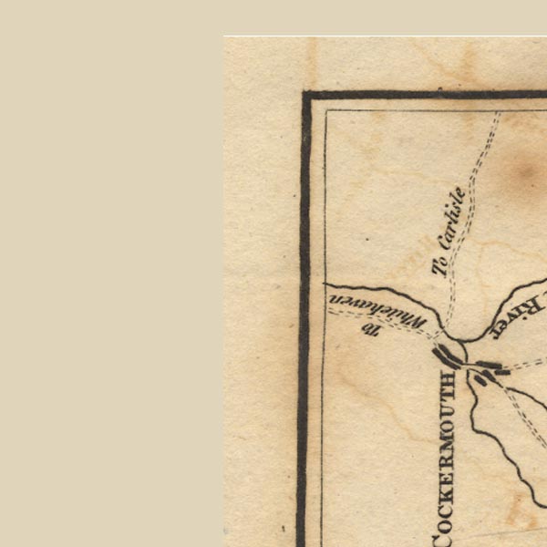 Ws02NY03.jpg "COCKERMOUTH" item:- Armitt Library : A1221.1 Image © see bottom of page |
|||
|
|
||||
| evidence:- | old text:- Camden 1789 placename:- Cokarmouth item:- market |
|||
| source data:- | Book, Britannia, or A Chorographical Description of the Flourishing Kingdoms of England,
Scotland, and Ireland, by William Camden, 1586, translated from the 1607 Latin edition
by Richard Gough, published London, 1789. goto source Page 170:- "..." "... the Derwent ... the Cokar. These two rivers at their confluence almost surround Cokarmouth, a plentiful market town and castle of the earls of Northumberland. The town is handsomely built, but stands low between two hills, on one of which is the church, and on the other overagainst it the strong castle, ..." |
|||
|
|
||||
| evidence:- | old text:- Camden 1789 (Gough Additions) placename:- Cokermuth |
|||
| source data:- | Book, Britannia, or A Chorographical Description of the Flourishing Kingdoms of England,
Scotland, and Ireland, by William Camden, 1586, translated from the 1607 Latin edition
by Richard Gough, published London, 1789. goto source Page 183:- ""Cokermuth, a market town, standing on the west side of Darwent, four or five miles from the se shore and 20 from Carluel." It is a large borough town with broad streets, washed by the Derwent, and divided by the Cocker, at whose mouth it stands; the inhabitants amount to 3 or 4000; the manufactory is shalloons, worsted stockings and hats. ... The town gives title of viscount to the earl of Egremont, ..." |
|||
|
|
||||
| evidence:- | old map:- Aikin 1790 (Cmd) placename:- Cockermouth |
|||
| source data:- | Map, uncoloured engraving, Cumberland, by John Aikin, London,
1790. click to enlarge click to enlargeAIK3.jpg "Cockermouth" circle; town item:- JandMN : 145 Image © see bottom of page |
|||
|
|
||||
| evidence:- | old map:- Bailey 1797 placename:- Cockermouth |
|||
| source data:- | Map, soil etc, uncoloured engraving, Cumberland, scale about 21
miles to 1 inch, by J Bailey, engraved by Neele, Strand,
published by Messrs Robinson, Paternoster Row and G Nicol, Pall
Mall, London, 1797. click to enlarge click to enlargeBY04.jpg "Cockermouth" group of blocks; town item:- Armitt Library : A680.2 Image © see bottom of page |
|||
|
|
||||
| evidence:- | road book:- Cary 1798 (2nd edn 1802) placename:- Cockermouth |
|||
| source data:- | Road book, itineraries, Cary's New Itinerary, by John Cary, 181
Strand, London, 2nd edn 1802. goto source click to enlarge click to enlargeC38317.jpg page 317-318 "Cockermouth / At Cockermouth, on r. a T.R. to Carlisle." market town, post office "To Cockermouth, p.317 / At Cockermouth. on r. a T.R. to Carlisle" market town, post office, again goto source click to enlarge click to enlargeC38319.jpg page 319-320 "To Cockermouth, p.317" market town, post office item:- JandMN : 228.1 Image © see bottom of page |
|||
|
|
||||
| evidence:- | road book:- Cary 1798 (2nd edn 1802) placename:- Cockermouth |
|||
| source data:- | Road book, itineraries, Cary's New Itinerary, by John Cary, 181
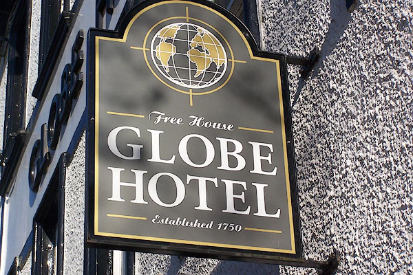
Strand, London, 2nd edn 1802. goto source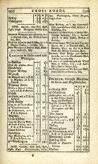 click to enlarge click to enlargeC38557.jpg page 557-558 "Cockermouth / At Cockermouth, on l. a T.R. to Keswick." market town, post office "INNS. ... Cockermouth, Globe, Sun. ..." item:- JandMN : 228.2 Image © see bottom of page |
|||
|
|
||||
| evidence:- | old map:- Cooke 1802 placename:- Cockermouth |
|||
| source data:- | Map, Cumberland, scale about 15.5 miles to 1 inch, by George
Cooke, 1802, bound in Gray's New Book of Roads, 1824, published
by Sherwood, Jones and Co, Paternoster Road, London, 1824. click to enlarge click to enlargeGRA1Cd.jpg "Cockermouth / 308" blocks, upright lowercase text; town, distance from London item:- Hampshire Museums : FA2000.62.2 Image © see bottom of page |
|||
|
|
||||
| evidence:- | old map:- Cooke 1802 placename:- Cockermouth |
|||
| source data:- | Map, The Lakes, Westmorland and Cumberland, scale about 8.5
miles to 1 inch, engravedby Neele and Son, published by
Sherwood, Jones and Co, Paternoster Road, London, 1824. click to enlarge click to enlargeGRA1Lk.jpg "Cockermouth" blocks, upright lowercase text; town item:- Hampshire Museums : FA2000.62.5 Image © see bottom of page |
|||
|
|
||||
| evidence:- | old map:- Laurie and Whittle 1806 placename:- Cockermouth |
|||
| source data:- | Road map, Completion of the Roads to the Lakes, scale about 10
miles to 1 inch, by Nathaniel Coltman? 1806, published by Robert
H Laurie, 53 Fleet Street, London, 1834. click to enlarge click to enlargeLw18.jpg "Cockermouth 305½" market town; distance from London; travellers supplied with post horses or carriages item:- private collection : 18.18 Image © see bottom of page |
|||
|
|
||||
| evidence:- | old text:- Capper 1808 placename:- Cockermouth item:- population; market; fair; placename, Cockermouth |
|||
| source data:- | Gazetteer, A Topographical Dictionary of the United Kingdom,
compiled by Benjamin Pitts Capper, published by Richard
Phillips, Bridge Street, Blackfriars, London, 1808; published
1808-29. goto source "..." "COCKERMOUTH, a borough and market-town, formerly in the parish of Brigham, but now a distinct parish, in Allerdale ward above Derwent, Cumberland, 25 miles from Carlisle, and 302 from London; containing 417 houses and 2865 inhabitants, being 1255 males and 1610 females, of whom 1545 were returned as being employed in trade, &c. It stands on the river Cocker, near its conflux with the Derwent, whence it is named. It contains the ruins of a very ancient castle; ... The town in general is irregularly built; but there are several modern and well built streets and houses, particularly the one ascending to the castle gate, which is very steep; and in that which leads to Derwent bridge, some of the houses are handsomely built of red freestone. The upper and lower parts of the town are divided by the Coker, and united by a bridge of one arch. The church or chapel was rebuilt in 1711. Beneath the Derwent is an extensive plain, with a public walk a mile long; the river on one hand falling in gentle cascades, and the banks enriched by corn-fields and meadows; while, on the other hand, the level mead is bounded by a rising ground covered with wood. The one end of this walk terminates by scattered rocks, covered with trees, and the other by the ruins of the castle. The town is governed by a bailiff, chosen at the court of the lord of the manor by a jury of 16 burgesses, and sends two members to parliament. The principal manfactures here are, tanned leather, hats, shalloons, coarse woollens, and linens. The principal market is on Mondays, well supplied with provision and grain, and a small one on Saturdays. Fairs, Monday after Martinmas and Whitsunday, for hiring servants; one for horned cattle, first Monday in May, continuing that day fortnight till 30th October, concluding with the Michaelmas fair, the only one for horses. The fair for servants is held in the castle-yard; the cattle fair in the spacious street below the bridge; and the horse fair on a common adjoining Gallow Barrow. The church is a curacy. - Hutchinson's Cumberland." "..." |
|||
|
|
||||
| evidence:- | old map:- Cooper 1808 placename:- Cockermouth |
|||
| source data:- | Map, uncoloured engraving, Cumberland, scale about 10.5 miles to
1 inch, drawn and engraved by Cooper, published by R Phillips,
Bridge Street, Blackfriars, London, 1808. click to enlarge click to enlargeCOP3.jpg "Cockermouth" circle with two side bars; town item:- JandMN : 86 Image © see bottom of page |
|||
|
|
||||
| evidence:- | old map:- Wallis 1810 (Cmd) placename:- Cockermouth |
|||
| source data:- | Road map, hand coloured engraving, Cumberland, scale about 16
miles to 1 inch, by James Wallis, 77 Berwick Stree, Soho,
London, 1810. click to enlarge click to enlargeWL13.jpg "Cockermouth / 308" town; distance from London item:- Dove Cottage : 2009.81.10 Image © see bottom of page |
|||
|
|
||||
| evidence:- | old print with text:- Farington 1816 placename:- Cockermouth item:- |
|||
| source data:- | Print, uncoloured engraving and descriptive text, Cockermouth, Cumberland, drawn by
Joseph Farington, engraved by J Landseer, published by T Cadell and W Davies, Strand,
London, 1816.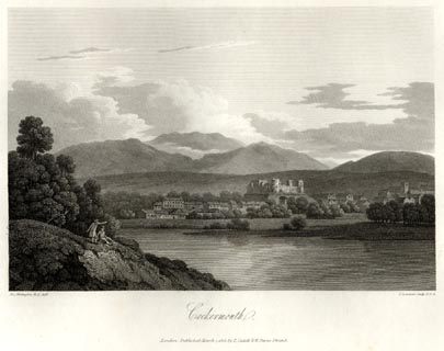 click to enlarge click to enlargeFA0423.jpg printed, bottom left, right, centre "Drawn by J. Farington R.A. / Engraved by J. Landseer A.R.A. / Cockermouth. / London Published March 7, 1816, by T. Cadell &W. Davies, Strand." Descriptive text:- "VIEW OF COCKERMOUTH." "COCKERMOUTH is a considerable borough and market-town, about 13 miles from Whitehaven, 26 from Carlisle, and 314 from London. The Barony, or Honour, of Cockermouth, was given by William de Meschines to Waldeof, son of Gospatrick, Earl of Dunbar, whose grand-daughter brought it to William Fitz Duncan, nephew of Malcolm, King of Scotland. One of the co-heiresses of Fitz Duncan, who was twice married, died without issue; the two others, whose issue eventually shared this barony between them, married William Le Gros, Earl of Albemarle, and Reginald de Lucy; the heiress of Lucy married Multon, who took the name of Lucy. After the death of William de Fortibus, Earl of Albemarle, and Isabel, his Countess, without issue, a moiety of the castle and honour of Cockermouth fell to the Crown, and having been for a while in the possession of Pierre Gaveston, by the grant of Edward II., was, some years afterwards, granted to Anthony, Lord Lucy, already possessed by inheritance of the other moiety. Maud, sister and heiress of this nobleman, who died in 1366, settled the castle and honour of Cockermouth on Henry Percy, Earl of Northumberland, her second husband, and his heirs male, on condition that they should bear the arms of Lucy quartered with their own. Elizabeth, sole daughter and heiress of Josceline, last Earl of Northumberland, brought Cockermouth and other large estates to Charles Seymour, Duke of Somerset. Lady Catherine, second daughter and co-heiress of the Duke, married Sir William Wyndham, whose son, Sir Charles, was, in 1749, created Earl of Egremont, and was father of George, Earl of Egremont, the present possessor of the honour or barony of Cockermouth. The park, which was long ago disparked and sold to Sir Thomas Wharton, has since been reunited to the honour." "..." "Cockermouth returned members to Parliament in the reign of Edward I. This ancient privilege was restored in 1640. The right of election is in the burgess holders, who are about 280 in number. The Bailiff is the returning officer. The late Earl of Liverpool, before his elevation to the peerage, was member of parliament for this borough. The Epiphany Sessions are held at Cockermouth." "The market on Monday was granted to William de Fortibus, Earl of Albemarle, in 1226; it is a considerable market for corn, provisions, &c. A great market, or fair, is held every other Wednesday, from the beginning of May till Michaelmas, and there are annual fairs on Whit-Monday and Martinmas-Monday, for hiring servants." "Browne Willis states the number of houses at Cockermouth only at 255, in 1714; in 1785 there were, according to Hutchinson, 663 families, and 2652 inhabitants; in 1801, there were 417 inhabited houses, 690 families, and 2865 inhabitants; in 1811, 602 houses, 709 families, and 2964 inhabitants, according to the returns made to Parliament at those periods. At Cockermouth are considerable manufactories of cotton, linen, and woollen, and the tanning and currying trade is carried on to a great extent." "There was at this place a chapel of ease to Brigham, in 1394; the present structure was built in 1711; the old tower remains. The Earl of Lonsdale is patron of the curacy. There are meeting-houses at Cockermouth for the Presbyterians, Quakers, and the Methodists. The Rev. John Fell, an eminent dissenting minister, born at Cockermouth in 1735, wrote on the Demoniacs, on Rowley's Poems, on English Grammar, and on the Idolatry of Greece and Rome. He died at London in the year 1797." "..." item:- Armitt Library : A6666.23 Image © see bottom of page |
|||
|
|
||||
| evidence:- | old map:- Otley 1818 placename:- Cockermouth |
|||
| source data:- | Map, uncoloured engraving, The District of the Lakes,
Cumberland, Westmorland, and Lancashire, scale about 4 miles to
1 inch, by Jonathan Otley, 1818, engraved by J and G Menzies,
Edinburgh, Scotland, published by Jonathan Otley, Keswick,
Cumberland, et al, 1833. OT02NY13.jpg "COCKERMOUTH" item:- JandMN : 48.1 Image © see bottom of page |
|||
|
|
||||
| evidence:- | old text:- Gents Mag item:- Demoniacs |
|||
| source data:- | Magazine, The Gentleman's Magazine or Monthly Intelligencer or
Historical Chronicle, published by Edward Cave under the
pseudonym Sylvanus Urban, and by other publishers, London,
monthly from 1731 to 1922. goto source Gentleman's Magazine 1819 part 1 p.506 From the Compendium of County History:- "1387. Cockermouth surprised, and Peter Tilliol, Sheriff of the county, taken by the Scots, under the Earls of Douglas and Fife. ..." "..." "Fell, John, dissenting divine, author of Demoniacs, Cockermouth, 1735." |
|||
|
|
||||
| evidence:- | old map:- Hall 1820 (Cmd) placename:- Cockermouth |
|||
| source data:- | Map, hand coloured engraving, Cumberland, scale about 21 miles
to 1 inch, engraved by Sidney Hall, published by S Leigh, 18
Strand, London, 1820-31. click to enlarge click to enlargeHA14.jpg "Cockermouth / 305" circle, upright lowercase text; town; two stars for MPs; distance from London item:- JandMN : 91 Image © see bottom of page |
|||
|
|
||||
| evidence:- | descriptive text:- Otley 1823 (5th edn 1834) |
|||
| source data:- | Guide book, A Concise Description of the English Lakes, the
mountains in their vicinity, and the roads by which they may be
visited, with remarks on the mineralogy and geology of the
district, by Jonathan Otley, published by the author, Keswick,
Cumberland now Cumbria, by J Richardson, London, and by Arthur
Foster, Kirkby Lonsdale, Cumbria, 1823; published 1823-49,
latterly as the Descriptive Guide to the English Lakes. goto source Page 40:- "... the river Cocker, which falls into the Derwent at the town named, from this circumstance, Cockermouth. ..." "..." goto sourcePage 137:- "Cockermouth is a good market town with 4536 inhabitants. It possesses an ancient castle, has a handsome bridge over the river Cocker, which runs through the town to join the Derwent; and the Globe is an inn furnished with every requisite accommodation for travellers." |
|||
|
|
||||
| evidence:- | old map:- Perrot 1823 placename:- Cockermouth |
|||
| source data:- | Map, hand coloured engraving, Cumberland and Westmoreland ie
Westmorland, scale about 38 miles to 1 inch, by Aristide Michel
Perrot, engraved by Migneret, 1823, published by Etienne Ledoux,
9 Rue Guenegaud, Paris, France, 1824-48. click to enlarge click to enlargePER2.jpg "Cockermouth" circle; town item:- Dove Cottage : 2007.38.45 Image © see bottom of page |
|||
|
|
||||
| evidence:- | old map:- Greenwood 1824 placename:- Cockermouth |
|||
| source data:- | Map, engraving, Map of the County of Cumberland, scale about 1
inch to 1 mile, etc, by Christopher and John Greenwood,
published by George Pringle jnr, 70 Queen Street, Cheapside,
London, 1823.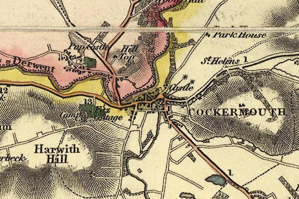 gw12cckr.jpg "COCKERMOUTH" street map; labelled in block caps for a market town; two stars for members sent to Parliament; notice the windmill. item:- National Library of Scotland : EME.b.3.11 Image © National Library of Scotland |
|||
|
|
||||
| evidence:- | old map:- Dawson 1830s placename:- Cockermouth |
|||
| source data:- | Map, hand coloured lithograph, Cockermouth, proposed new
boundary, scale about 2 inches to 1 mile, by Captain Robert K
Dawson, printed by R Cartwright, London? about 1832.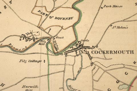 click to enlarge click to enlargeDAW6P1.jpg item:- Carlisle Library : Map 126 Image © Carlisle Library |
|||
|
|
||||
| evidence:- | old map:- Cobbett 1832 placename:- Cockermouth |
|||
| source data:- | Map, uncoloured engraving, Cumberland, scale about 20 miles to 1
inch, by William Cobbett, 11 Bolt Court, Fleet Street, London,
1832. click to enlarge click to enlargeCOB5.jpg "Cockermouth" dot and circle; town item:- JandMN : 117 Image © see bottom of page |
|||
|
|
||||
| evidence:- | descriptive text:- Ford 1839 (3rd edn 1843) placename:- Cockermouth |
|||
| source data:- | Guide book, A Description of Scenery in the Lake District, by
Rev William Ford, published by Charles Thurnam, Carlisle, by W
Edwards, 12 Ave Maria Lane, Charles Tilt, Fleet Street, William
Smith, 113 Fleet Street, London, by Currie and Bowman,
Newcastle, by Bancks and Co, Manchester, by Oliver and Boyd,
Edinburgh, and by Sinclair, Dumfries, 1839. goto source Page 81:- "..." "COCKERMOUTH." "This is an ancient borough and market-town at the confluence of the Derwent and Cocker, which after flowing through Buttermere and Crummock," goto sourcePage 82:- "and through the vale of Lorton, loses its name in the elder, brother-stream. It is divided by the Cocker, the market-place, castle, and church, being on its eastern side. The two principal streets are spacious. ... Besides being well watered by these fine rivers [Derwent and Cocker], it is intersected by small rivulets, which is a great convenience to the manufacturers, who produce cotton checks, ginghams, and coarse woollen goods. The whole place is very prosperous; the markets and fairs are numerously attended and well supplied. The borough returns two members to Parliament, and is also the nomination place for the western division of the county under the Reform Act, and was anciently the place of election for the whole county." "The church or chapel of ease, is dedicated to All Saints, ... There are also" goto sourcePage 83:- "alms-houses and charitable societies for different purposes; neither is that most useful of all wanting, a dispensary. The late Earl of Egremont, with his wonted munificence, presented the sum of £2000 to the inhabitants, to be disposed of for the benefit of the town. It has accordingly been applied in the erection of a convenient and handsome market-place." "The castle stands on a bold elevation, strong by nature, between the Derwent and the Cocker, ..." goto sourcePage 84:- "... On the margin of the Derwent is a plain of considerable extent, in which is a public walk beautifully terminated by lofty cliffs, covered with trees - at the other by the ruins of the castle impending over the river, whose opposite banks are diversified by tillage. Indeed, the country round the town is pleasantly varied with hill and dale, wood and water. The Globe is the chief inn, and is most respectably conducted. The Sun and the Apple Tree inns may be mentioned." |
|||
|
|
||||
| evidence:- | old map:- Ford 1839 map placename:- Cockermouth |
|||
| source data:- | Map, uncoloured engraving, Map of the Lake District of
Cumberland, Westmoreland and Lancashire, scale about 3.5 miles
to 1 inch, published by Charles Thurnam, Carlisle, and by R
Groombridge, 5 Paternoster Row, London, 3rd edn 1843. FD02NY13.jpg "COCKERMOUTH" item:- JandMN : 100.1 Image © see bottom of page |
|||
|
|
||||
| evidence:- | old map:- Garnett 1850s-60s H placename:- Cockermouth |
|||
| source data:- | Map of the English Lakes, in Cumberland, Westmorland and
Lancashire, scale about 3.5 miles to 1 inch, published by John
Garnett, Windermere, Westmorland, 1850s-60s. GAR2NY13.jpg "COCKERMOUTH" blocks, settlement item:- JandMN : 82.1 Image © see bottom of page |
|||
|
|
||||
| evidence:- | old itinerary:- Tinsley 1877 (Roads/Cum) placename:- Cockermouth |
|||
| source data:- | Itinerary, route 7, London to Whitehaven via the Lake Districts, including from Settle,
Lancashire; through Kirkby Lonsdale, Kendal, Ambleside, Westmorland; then Keswick,
Cockermouth to Whitehaven, Cumberland, published by Tinsley Bros, 8 Catherine Street,
Strand, London, 1877.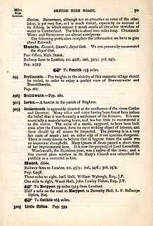 click to enlarge click to enlargeTLY190.jpg pp.71-91 in British High Roads, North and North Eastern Routes; pp.84-91. printed at p.71:- "... / ROUTE VII. - LONDON to WHTEHAVEN via THE LAKE / DISTRICTS. (See Maps 65 to 80.) / Hitchin (as per Route I.) 34, Shefford 41, Bedford 50, Higham-Ferrers, / 64¾, Kettering 74½, Rockingham 83¼, Uppingham 88¾, Oakham, / 94¾, Melton Mowbray 104¾, Nottingham 123¼, Rotherham 159¼, / Barnsley 171¾, Huddersfield 188¾, Halifax 196¾, Keighley 208¾, / Skipton 218¾, Settle 234¾, Kirkby Lonsdale 252½, Kendal 264½, / Ambleside 278½, Keswick 293½, Cockermouth 305½, Whitehaven / 319½. / ..." item:- private collection : 270.2 Image © see bottom of page |
|||
|
|
||||
| evidence:- | old strip map:- Tinsley 1877 (Roads/Cum) placename:- Cockermouth |
|||
| source data:- | Strip map, road map, part of London to Whitehaven, including from before Keswick through
Cockermouth to Whitehaven, Cumberland, published by Tinsley Bros, 8 Catherine Street,
Strand, London, 1877.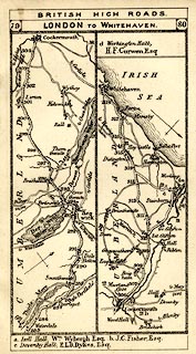 click to enlarge click to enlargeTLY1M5.jpg Map pp.79-80 in British High Roads, North and North Eastern Routes. printed at top:- "BRITISH HIGH ROADS / 79 LONDON TO WHITEHAVEN. 80" item:- private collection : 270.7 Image © see bottom of page |
|||
|
|
||||
| evidence:- | old map:- Postlethwaite 1877 (3rd edn 1913) placename:- Cockermouth |
|||
| source data:- | Map, uncoloured engraving, Map of the Lake District Mining Field, Westmorland, Cumberland,
Lancashire, scale about 5 miles to 1 inch, by John Postlethwaite, published by W H
Moss and Sons, 13 Lowther Street, Whitehaven, Cumberland, 1877 edn 1913.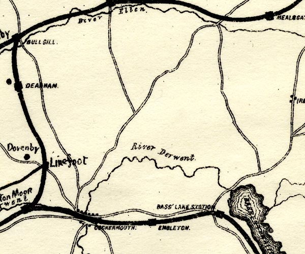 PST2NY13.jpg "COCKERMOUTH" dots, road, railway item:- JandMN : 162.2 Image © see bottom of page |
|||
|
|
||||
| evidence:- | market notes:- placename:- Cokermue placename:- Cokermuth item:- market |
|||
| source data:- | www.history.ac.uk/cmh/gaz/gazweb2.htmPalmer's Index No.93:: Public Record OfficeOwen: 1792: New Book of FairsBowen, Emanuel &Kitchin, Thomas: 1760: New Map of the Counties of Cumberland and Westmoreland | |||
|
|
||||
 Post Office maps Post Office maps |
||||
|
|
||||
| evidence:- | old print:- Sylvan 1847 placename:- Cockermouth |
|||
| source data:- | Print, engraving, Cockermouth, Cumberland, published by John Johnstone, Paternoster
Row, London, et al, 1847.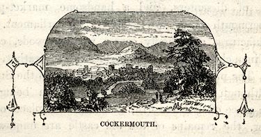 click to enlarge click to enlargeSYL158.jpg On p.224 of Sylvan's Pictorial Guide to the English Lakes. printed at bottom:- "COCKERMOUTH." item:- Armitt Library : A1201.58 Image © see bottom of page |
|||
|
|
||||
| evidence:- | old print:- Rose 1832-35 (vol.1 no.4) placename:- Cockermouth |
|||
| source data:- | Print, uncoloured engraving, Cockermouth, Cumberland, drawn by Thomas Allom, engraved
by R Sands, published by Fisher, Son and Co, London, 1832-35.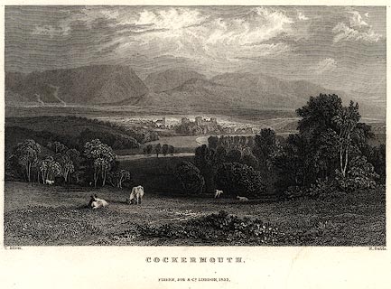 click to enlarge click to enlargePR0393.jpg vol.1 pl.4 in the set of prints, Westmorland, Cumberland, Durham and Northumberland Illustrated. printed at bottom left, right, centre:- "T. Allom. / R. Sands. / COCKERMOUTH. / FISHER, SON &CO. LONDON, 1832." item:- Dove Cottage : 2008.107.2 Image © see bottom of page |
|||
|
|
||||
| longcase clocks |
||||
|
|
||||
| hearsay:- |
The market bell, the Butter Bell, hangs in Market Place on the corner of a shop. The
market charter was granted 1221. |
|||
|
|
||||
| hearsay:- |
Fearon Fallows was born, son of a weaver, at 2 Crown Street, Cockermouth, the house
next to William Wordsworth's home, 1788. He was later a teacher at Plumbland. He excelled
at algebra, went to St Johns College, Cambridge and was later a lecturer in Mathematics
at Corpus Christi College. He became an astronomer and sailed for Cape Town, 1821,
to set up an observatory; died Cape of Good Hope, South Africa, 25 July 1831. |
|||
|
|
||||
| person:- | : Henry III |
|||
| person:- | : Charles I |
|||
| date:- | 1221 |
|||
| date:- | 1638 |
|||
| period:- | 13th century | |||
| period:- | 17th century, early | |||
| item:- | charter; market charter |
|||
| Market charter granted by Henry III, 1221; Monday market. Charter for a fair granted
by Charles I, 1638; every Wednesday from 1st week in May to Michaelmas. |
||||
|
|
||||
| personal | ||||
| person:- | astronomer : Fallows, Fearon |
|||
| place:- | birthplace | |||
| date:- | 1788 |
|||
|
|
||||
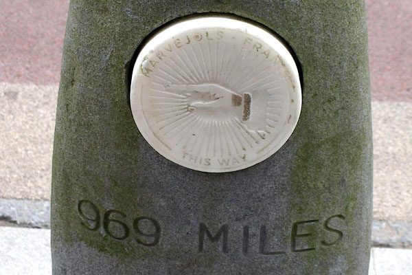
| twinned with:- | Marjevols, France |
|||
|
|
||||
| places:- |
|
|||
|
||||
|
||||
|
||||
|
||||
|
||||
|
||||
|
||||
|
||||
|
||||
|
||||
|
||||
|
||||
|
||||
|
||||
|
||||
|
||||
|
||||
|
||||
|
||||
|
||||
|
||||
|
||||
|
||||
|
||||
|
||||
|
||||
|
||||
|
||||
|
||||
|
||||
|
||||
|
||||
|
||||
|
||||
|
||||
|
||||
|
||||
|
||||
|
||||
|
||||
|
||||
|
||||
|
||||
|
||||
|
||||
|
||||
|
||||
|
||||
|
||||
|
||||
|
||||
|
||||
|
||||
|
||||
|
||||
|
||||
|
||||
|
||||
|
||||
|
||||
|
||||
|
||||
|
||||
|
||||
|
||||
|
||||
|
||||
|
||||
|
||||
|
||||
|
||||
|
||||
|
||||
|
||||
|
||||
|
||||
|
||||
|
||||
|
||||
|
||||
|
||||
|
||||
|
||||
|
||||
|
||||
|
||||
|
||||
|
||||
|
||||
|
||||
|
||||
|
||||
|
||||
|
||||
|
||||
|
||||
|
||||
|
||||
|
||||
|
||||
|
||||
|
||||
|
||||
|
||||
|
||||
|
||||
|
||||
|
||||
|
||||
|
||||
|
||||
|
||||
|
||||
|
||||
|
||||
|
||||
|
||||
|
||||
|
||||
|
||||
|
||||
|
||||
|
||||
|
||||
|
||||
|
||||
|
||||
|
||||
|
||||
|
||||
|
||||
|
||||
|
||||
|
||||
|
||||
|
||||
|
||||
|
||||
|
||||
|
||||
|
||||
|
||||
|
||||
|
||||
|
||||
|
||||
|
||||
|
||||
|
||||
|
||||
|
||||
|
||||
|
||||
|
||||
|
||||
|
||||
|
||||
|
||||
|
||||
|
||||
|
||||
|
||||
|
||||
|
||||
|
||||
|
||||
|
||||
|
||||
|
||||
|
||||
|
||||
|
||||
|
||||
|
||||
|
||||
|
||||
|
||||
|
||||
|
||||
|
||||
|
||||
|
||||
|
||||
|
||||
|
||||
|
||||
|
||||
|
||||
|
||||
|
||||
|
||||
|
||||
|
||||
|
||||
|
||||
|
||||
|
||||
|
||||
|
||||
|
||||
|
||||
|
||||
|
||||
|
||||
|
||||
|
||||
|
||||
|
||||
|
||||
|
||||
|
||||
|
||||
|
||||
|
||||
|
||||
|
||||
|
||||
|
||||
|
||||
|
||||
|
||||
|
||||
|
||||
|
||||
|
||||
|
||||
|
||||
|
||||
|
||||
|
||||
|
||||
|
||||
|
||||
|
||||
|
||||
|
||||
|
||||
|
||||
Lakes Guides menu.