 Old Cumbria Gazetteer
 |
 |
|
| Cowan Head, Strickland Ketel | ||
| Cowan Head | ||
| civil parish:- | Strickland Ketel (formerly Westmorland) | |
| county:- | Cumbria | |
| locality type:- | buildings | |
| coordinates:- | SD49269733 | |
| 1Km square:- | SD4997 | |
| 10Km square:- | SD49 | |
|
|
||
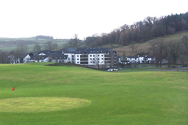 BLP75.jpg (taken 15.2.2006) |
||
|
|
||
| evidence:- | old map:- Jefferys 1770 (Wmd) placename:- Cowan Head |
|
| source data:- | Map, 4 sheets, The County of Westmoreland, scale 1 inch to 1
mile, surveyed 1768, and engraved and published by Thomas
Jefferys, London, 1770.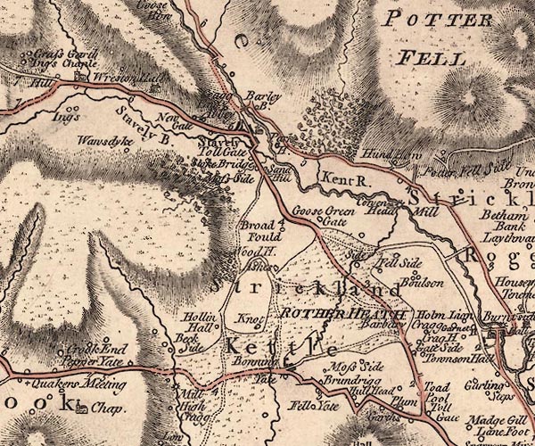 J5SD49NE.jpg "Cowan Head" house item:- National Library of Scotland : EME.s.47 Image © National Library of Scotland |
|
|
|
||
| evidence:- | old map:- Cary 1789 (edn 1805) placename:- Cowan Head |
|
| source data:- | Map, uncoloured engraving, Westmoreland, scale about 2.5 miles
to 1 inch, by John Cary, London, 1789; edition 1805.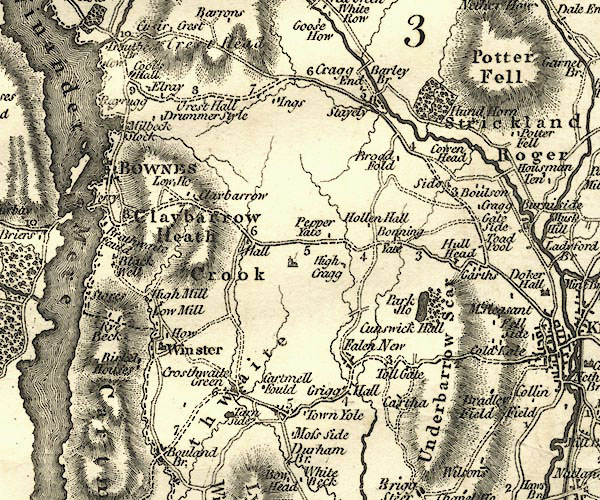 CY24SD49.jpg "Cowan Head" circle ?no rays, a mill item:- JandMN : 129 Image © see bottom of page |
|
|
|
||
| evidence:- | old map:- Garnett 1850s-60s H placename:- Cowanhead |
|
| source data:- | Map of the English Lakes, in Cumberland, Westmorland and
Lancashire, scale about 3.5 miles to 1 inch, published by John
Garnett, Windermere, Westmorland, 1850s-60s.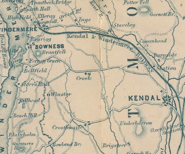 GAR2SD49.jpg "Cowanhead" block, building item:- JandMN : 82.1 Image © see bottom of page |
|
|
|
||
 Lakes Guides menu.