 Old Cumbria Gazetteer
 |
 |
|
| Crabtreebeck, Loweswater | ||
| Crabtreebeck | ||
| civil parish:- | Loweswater (formerly Cumberland) | |
| county:- | Cumbria | |
| locality type:- | buildings | |
| coordinates:- | NY13042156 | |
| 1Km square:- | NY1321 | |
| 10Km square:- | NY12 | |
|
|
||
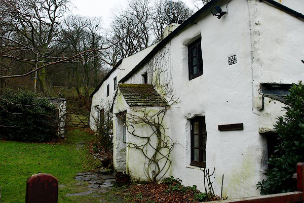 BQD28.jpg (taken 17.2.2009) 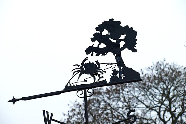 BQD29.jpg Weathervane (taken 17.2.2009) |
||
|
|
||
| evidence:- | old map:- OS County Series (Cmd 62 12) placename:- Crabtree |
|
| source data:- | Maps, County Series maps of Great Britain, scales 6 and 25
inches to 1 mile, published by the Ordnance Survey, Southampton,
Hampshire, from about 1863 to 1948. |
|
|
|
||
| evidence:- | old map:- Donald 1774 (Cmd) placename:- Crabtree Beck |
|
| source data:- | Map, hand coloured engraving, 3x2 sheets, The County of Cumberland, scale about 1
inch to 1 mile, by Thomas Donald, engraved and published by Joseph Hodskinson, 29
Arundel Street, Strand, London, 1774.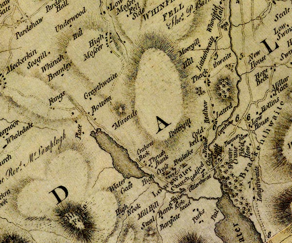 D4NY12SW.jpg "Crabtree Beck" block or blocks, labelled in lowercase; a hamlet or just a house item:- Carlisle Library : Map 2 Image © Carlisle Library |
|
|
|
||
| evidence:- | old map:- Crosthwaite 1783-94 (But/Cru/Low) placename:- Crabtree Beck |
|
| source data:- | Map, uncoloured engraving, An Accurate Map of Buttermere,
Crummock and Loweswater Lakes, scale about 3 inches to 1 mile,
by Peter Crosthwaite, Keswick, Cumberland, 1794, version
published 1800.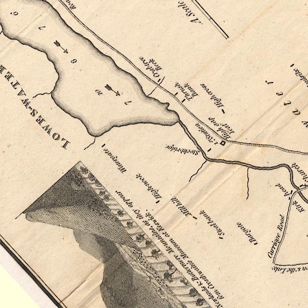 CT8NY12F.jpg "Crabtree Beck" item:- Armitt Library : 1959.191.2 Image © see bottom of page |
|
|
|
||
| evidence:- | database:- Listed Buildings 2010 placename:- Crabtreebeck item:- date stone (1660) |
|
| source data:- | courtesy of English Heritage "CRABTREEBECK AND STABLES ADJOINING / / / LOWESWATER / ALLERDALE / CUMBRIA / II / 72698 / NY1305121565" |
|
|
|
||
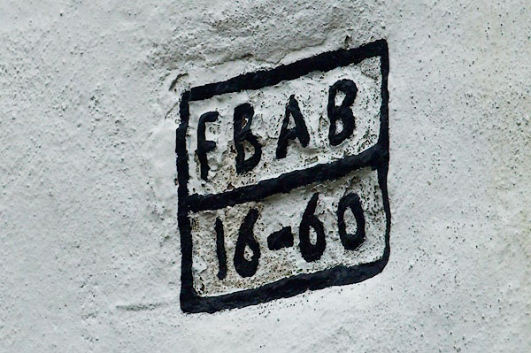 BQD30.jpg Date stone:- "FBAB / 16-60" (taken 17.2.2009) 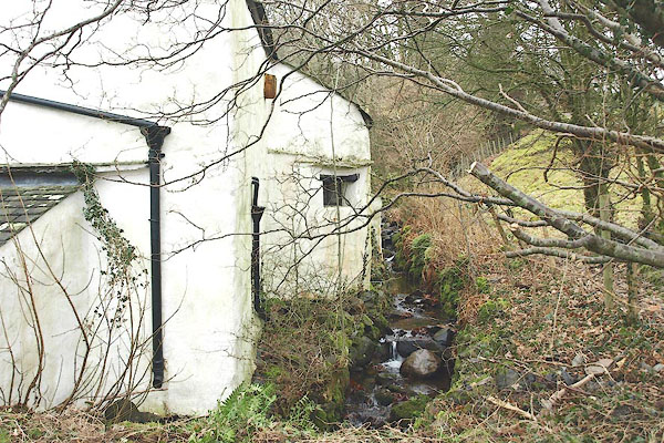 BQD31.jpg Rear of house, outshot stair, and the beck. (taken 17.2.2009) |
||
|
|
||
 Lakes Guides menu.