 Old Cumbria Gazetteer
 |
 |
|
| Dale Bottom, St John's Castlerigg etc | ||
| Dale Bottom | ||
| Dalebottom Farm | ||
| civil parish:- | St John's Castlerigg and Wythburn (formerly Cumberland) | |
| county:- | Cumbria | |
| locality type:- | buildings | |
| coordinates:- | NY29602178 | |
| 1Km square:- | NY2921 | |
| 10Km square:- | NY22 | |
|
|
||
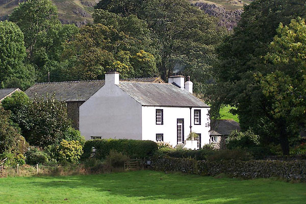 BMR38.jpg (taken 19.9.2006) |
||
|
|
||
| evidence:- | old map:- OS County Series (Cmd 64 11) placename:- Dale Bottom |
|
| source data:- | Maps, County Series maps of Great Britain, scales 6 and 25
inches to 1 mile, published by the Ordnance Survey, Southampton,
Hampshire, from about 1863 to 1948. |
|
|
|
||
| evidence:- | old map:- Donald 1774 (Cmd) placename:- Dale Bottom |
|
| source data:- | Map, hand coloured engraving, 3x2 sheets, The County of Cumberland, scale about 1
inch to 1 mile, by Thomas Donald, engraved and published by Joseph Hodskinson, 29
Arundel Street, Strand, London, 1774.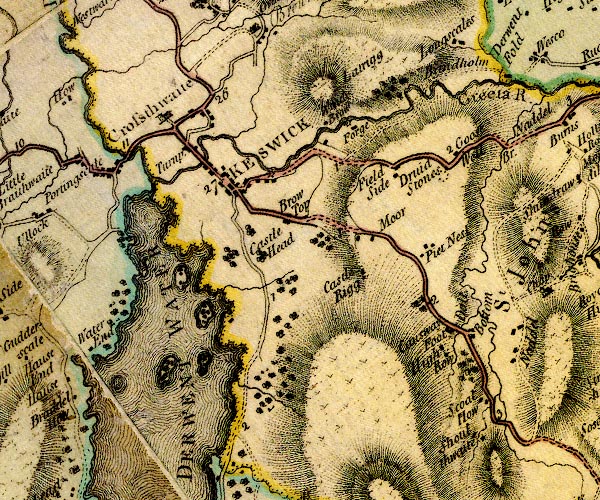 D4NY22SE.jpg "Dale Bottom" block or blocks, labelled in lowercase; a hamlet or just a house item:- Carlisle Library : Map 2 Image © Carlisle Library |
|
|
|
||
| evidence:- | old map:- Clarke 1787 map (Ambleside to Keswick) placename:- Dale Bottom |
|
| source data:- | Map, A Map of the Roads Lakes etc between Keswick and Ambleside,
scale about 2.5 ins to 1 mile, by James Clarke, engraved by S J
Neele, 352 Strand, published by James Clarke, Penrith,
Cumberland and in London etc, 1787.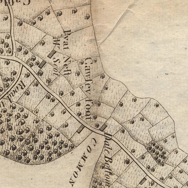 CL9NY22V.jpg "Dale Bottom" item:- private collection : 10.9 Image © see bottom of page |
|
|
|
||
| evidence:- | old map:- Ford 1839 map placename:- Dale Bottom |
|
| source data:- | Map, uncoloured engraving, Map of the Lake District of
Cumberland, Westmoreland and Lancashire, scale about 3.5 miles
to 1 inch, published by Charles Thurnam, Carlisle, and by R
Groombridge, 5 Paternoster Row, London, 3rd edn 1843.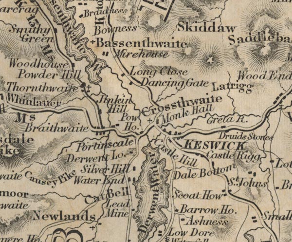 FD02NY22.jpg "Dale Bottom" item:- JandMN : 100.1 Image © see bottom of page |
|
|
|
||
| hearsay:- |
There are hound trailing competions here in Autumn. |
|
|
|
||
 Lakes Guides menu.