 Old Cumbria Gazetteer
 |
 |
|
| Dale, Ainstable | ||
| Dale | ||
| civil parish:- | Ainstable (formerly Cumberland) | |
| county:- | Cumbria | |
| locality type:- | buildings | |
| coordinates:- | NY54464410 | |
| 1Km square:- | NY5444 | |
| 10Km square:- | NY54 | |
|
|
||
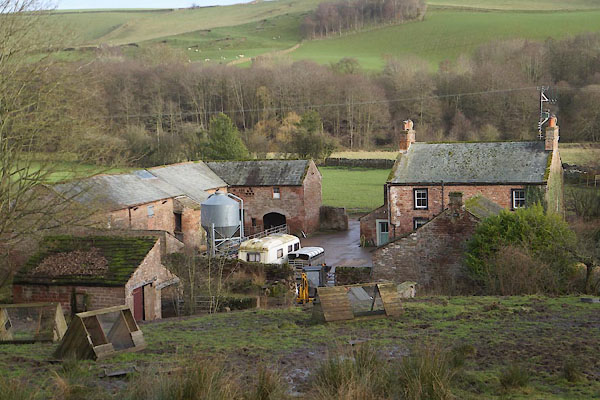 CFT70.jpg (taken ) |
||
|
|
||
| evidence:- | old map:- Donald 1774 (Cmd) placename:- Dale |
|
| source data:- | Map, hand coloured engraving, 3x2 sheets, The County of Cumberland, scale about 1
inch to 1 mile, by Thomas Donald, engraved and published by Joseph Hodskinson, 29
Arundel Street, Strand, London, 1774.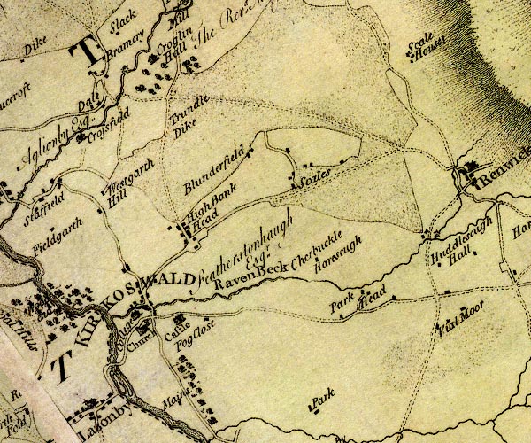 D4NY54SE.jpg "Dale" block or blocks, labelled in lowercase; a hamlet or just a house item:- Carlisle Library : Map 2 Image © Carlisle Library |
|
|
|
||
| evidence:- | database:- Listed Buildings 2010 placename:- Dale Farm |
|
| source data:- | courtesy of English Heritage "DALE FARMHOUSE AND ADJOINING BARN (NOT TO BE CONFUSED WITH DALE FARMHOUSE TO WEST) / / / AINSTABLE / EDEN / CUMBRIA / II / 73437 / NY5449144115" |
|
|
|
||
| evidence:- | database:- Listed Buildings 2010 placename:- Dale, The item:- date stone (1752) |
|
| source data:- | courtesy of English Heritage "THE DALE / / / AINSTABLE / EDEN / CUMBRIA / II / 73436 / NY5446644104" |
|
|
|
||
| MN photo:- |
Nearby. |
|
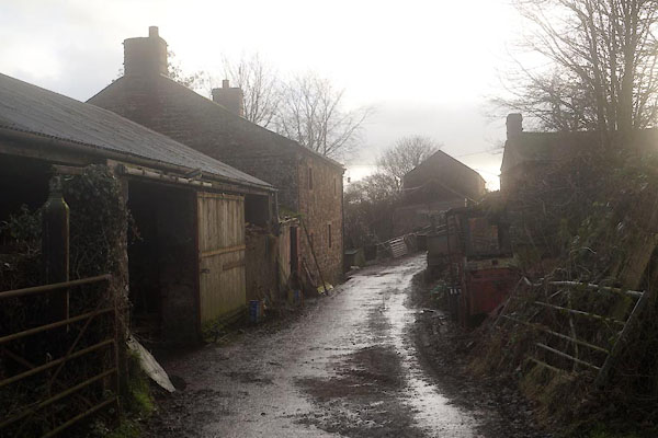 CFT69.jpg (taken 11.1.2017) 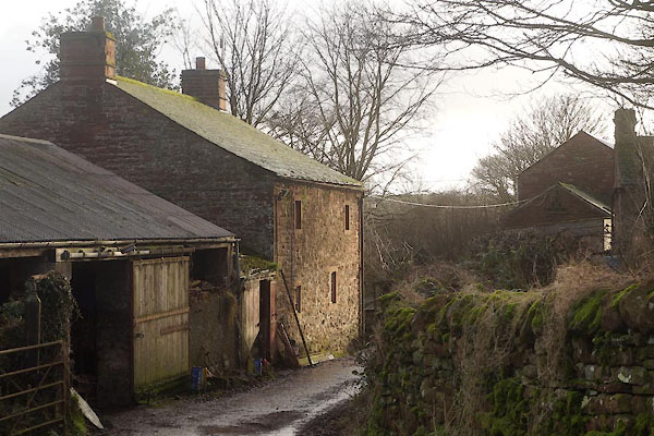 CFT71.jpg (taken 11.1.2017) |
||
|
|
||
 Lakes Guides menu.