 Old Cumbria Gazetteer
 |
 |
|
| Dentdale, Dent | ||
| Dentdale | ||
| civil parish:- | Dent (formerly Yorkshire) | |
| county:- | Cumbria | |
| locality type:- | valley | |
| coordinates:- | SD71838673 (etc) | |
| 1Km square:- | SD7186 | |
| 10Km square:- | SD78 | |
|
|
||
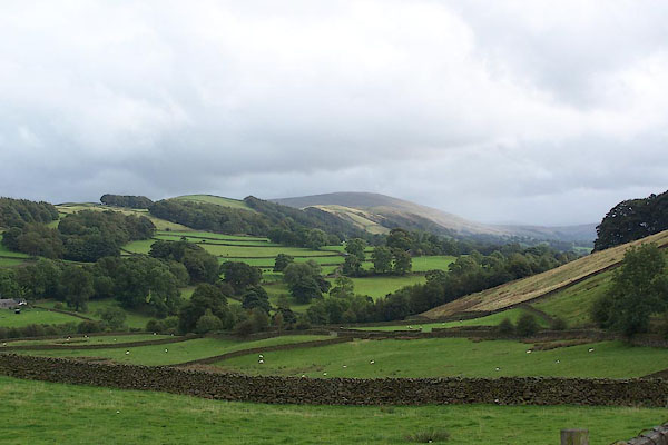 BJW09.jpg (taken 23.9.2005) |
||
|
|
||
| evidence:- | descriptive text:- West 1778 (11th edn 1821) |
|
| source data:- | Guide book, A Guide to the Lakes, by Thomas West, published by
William Pennington, Kendal, Cumbria once Westmorland, and in
London, 1778 to 1821. goto source goto sourceTour to the Caves in the West Riding of Yorkshire, late 18th century Page 270:- "... Being so near the top of Whernside, we ventured to ascend to the summit. The prospects were not diversified with many pleasing objects, being surrounded almost on all sides with brown and blue chaotic mountains. We had a peep into the pleasant vale of Dent beneath us, which made us wish to see it all. ..." |
|
|
|
||
| evidence:- | old map:- Clark and Hughes 1890 placename:- Vale of Dent |
|
| source data:- | Map of the Vale of Dent and Surrounding Country, Dent,
Yorkshire, scale about 1.5 miles to 1 inch, published by
Cambridge University Press, Cambridge, Cambridgeshire, 1890.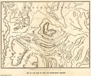 click to enlarge click to enlargeCH02M1.jpg Print, Map of the Vale of Dent and Surrounding Country, Dent, Yorkshire, scale about 1.5 miles to 1 inch, published by Cambridge University Press, Cambridge, Cambridgeshire, 1890. Between pp.6-7 vol.1 of The Life and Letters of the Reverend Adam Sedgwick. item:- private collection : 195.2 Image © see bottom of page |
|
|
|
||
Lakes Guides menu.