Old Cumbria Gazetteer
 |
 |
|
||
| Dovedale Beck | ||||
| runs into:- |  Kirkstone Beck Kirkstone Beck |
|||
|
|
||||
| civil parish:- | Patterdale (formerly Westmorland) | |||
| county:- | Cumbria | |||
| locality type:- | river | |||
| 1Km square:- | NY3811 (etc) | |||
| 10Km square:- | NY31 | |||
|
|
||||
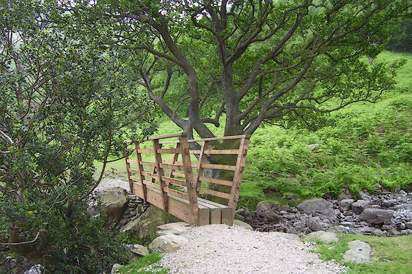
 CAS32.jpg (taken 21.5.2014) |
||||
|
|
||||
| evidence:- | old map:- OS County Series (Wmd 19 7) placename:- Hartsop Beck |
|||
| source data:- | Maps, County Series maps of Great Britain, scales 6 and 25
inches to 1 mile, published by the Ordnance Survey, Southampton,
Hampshire, from about 1863 to 1948. |
|||
|
|
||||
| evidence:- | probably old map:- Morden 1695 (Wmd) |
|||
| source data:- | Map, hand coloured engraving, Westmorland, scale about 2.5 miles to 1 inch, by Robert
Morden, published by Abel Swale, the Unicorn, St Paul's Churchyard, Awnsham, and John
Churchill, the Black Swan, Paternoster Row, London, 1695.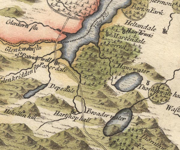 MD10NY41.jpg Running into Brothers Water. item:- JandMN : 24 Image © see bottom of page |
|||
|
|
||||
| evidence:- | old map:- Jefferys 1770 (Wmd) |
|||
| source data:- | Map, 4 sheets, The County of Westmoreland, scale 1 inch to 1
mile, surveyed 1768, and engraved and published by Thomas
Jefferys, London, 1770.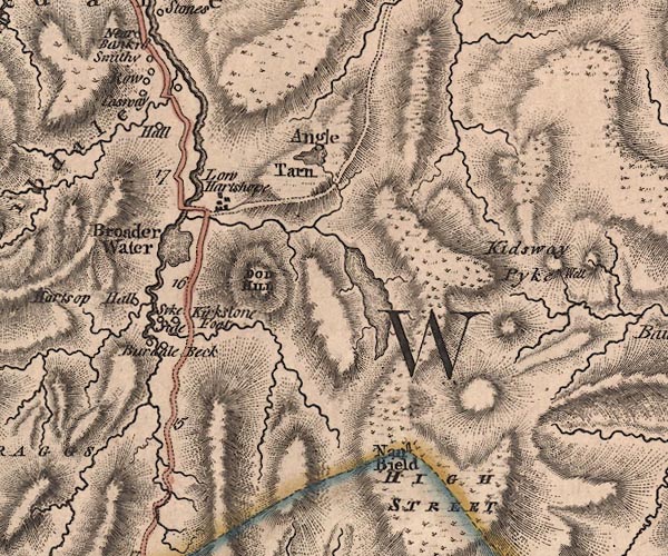 J5NY41SW.jpg single or double wiggly line; river item:- National Library of Scotland : EME.s.47 Image © National Library of Scotland |
|||
|
|
||||
| evidence:- | old map:- Cary 1789 (edn 1805) |
|||
| source data:- | Map, uncoloured engraving, Westmoreland, scale about 2.5 miles
to 1 inch, by John Cary, London, 1789; edition 1805.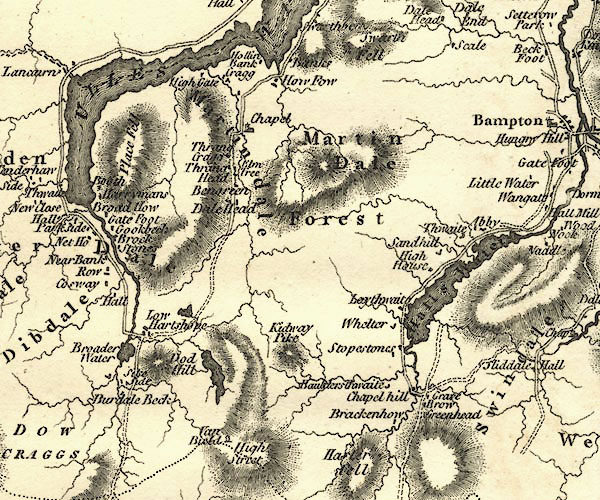 CY24NY41.jpg river running into the Kirkstone Beck item:- JandMN : 129 Image © see bottom of page |
|||
|
|
||||
| evidence:- | old painting:- Green 1790s-1820s |
|||
| source data:- | Painting, watercolour, Dovedale, Patterdale, Westmorland, by William Green, Ambleside,
Westmorland, 1800-10s?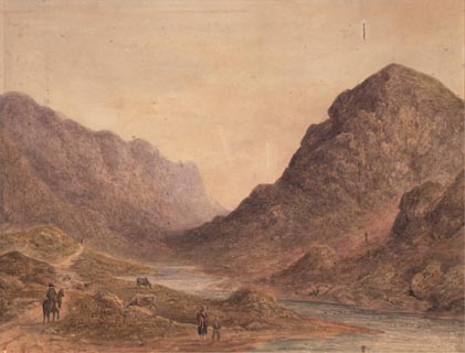 click to enlarge click to enlargePR1747.jpg item:- Dove Cottage : 2001.75.9 Image © see bottom of page |
|||
|
|
||||
| evidence:- | probably old print:- Green 1810 (plate 55) |
|||
| source data:- | Print, soft ground etching, Dove Crag in Hartsope, Patterdale, Westmorland, by William
Green, Ambleside, Westmorland, 1808.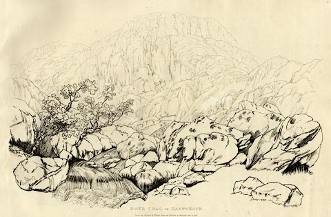 click to enlarge click to enlargeGN1255.jpg Plate 55 in Sixty Studies from Nature, 1810. printed at top right:- "55" printed at bottom:- "DOVE CRAG IN HARTSOPE. / Drawn and Engraved by William Green, and Published at Ambleside, June 24, 1808." watermark:- "J WHATMAN / 1813" item:- Armitt Library : A6641.55 Image © see bottom of page |
|||
|
|
||||
| evidence:- | old text:- Wordsworth 1810 |
|||
| source data:- | Guide book, A Description of the Scenery of the Lakes, later A
Guide through the District of The Lakes, by William Wordsworth,
1810-35. goto source page xxii "[is]sues from a cove richly decorated with native wood. This spot is, I believe, never explored by Travellers; but, from these sylvan rocky recesses, whoever looks back on the gleaming surface of Brotherswater, or forward to the precipitous sides and lofty ridges of Dove Crag, &c. will be equally pleased with the beauty, the grandeur, and the wildness of the scenery." |
|||
|
|
||||
| evidence:- | old text, old text:- Green 1814 |
|||
| source data:- | Set of prints, soft ground etchings, Sixty Small Prints, with
text, A Description of a Series of Sixty Small Prints, by
William Green, Ambleside, Westmorland, 1814. goto source page 27:- "..." "Under Dove Crag, a stupendous rock three miles west of Brother Water, runs a stream, which after a steep descent" Green 1814 goto sourcepage 28:- "serpentines sweetly down the vale, amidst rich assemblage of beautiful trees, by Hartsope Hall (a picturesque old farm-house) to Brother Water." |
|||
|
|
||||
| places:- |
|
|||
|
||||
Lakes Guides menu.