 Old Cumbria Gazetteer
 |
 |
|
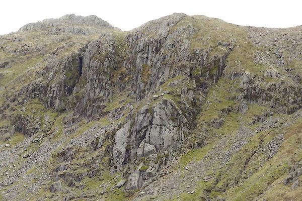
| Dovenest Crag, Borrowdale | ||
| Dovenest Crag | ||
| Dove's Nest | ||
| civil parish:- | Borrowdale (formerly Cumberland) | |
| county:- | Cumbria | |
| locality type:- | rocks | |
| locality type:- | cave | |
| coordinates:- | NY25341162 (etc) | |
| 1Km square:- | NY2511 | |
| 10Km square:- | NY21 | |
|
|
||
 CDA94.jpg (taken 13.5.2015) 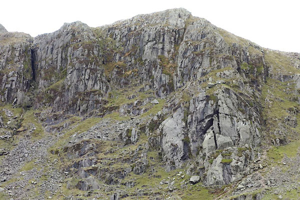 CDA95.jpg (taken 13.5.2015) |
||
|
|
||
| evidence:- | old map:- OS County Series (Cmd 75 2) placename:- Dovenest Crag |
|
| source data:- | Maps, County Series maps of Great Britain, scales 6 and 25
inches to 1 mile, published by the Ordnance Survey, Southampton,
Hampshire, from about 1863 to 1948. |
|
|
|
||
| hearsay:- |
The crag is a detached piece of mountain which has slid down the fell to its current
position, which may not be stable! There are passages and caves where the slab leans
against the mountain, one called Attic Cave. |
|
| The cave entrance is at the bottom of the south chimney; then there is a mountain
rock climb in the dark; the exit is at the Attic Cave top centre of the face of the
crag. This is not for the inexperienced. |
||
|
|
||
 Lakes Guides menu.