 Old Cumbria Gazetteer
 |
 |
|
| Drigg Point, Drigg and Carleton | ||
| Drigg Point | ||
| civil parish:- | Drigg and Carleton (formerly Cumberland) | |
| county:- | Cumbria | |
| locality type:- | headland | |
| locality type:- | sea area | |
| coordinates:- | SD07109526 (etc) | |
| 1Km square:- | SD0795 | |
| 10Km square:- | SD09 | |
|
|
||
| evidence:- | old map:- OS County Series (Cmd 82 10) placename:- Drigg Point |
|
| source data:- | Maps, County Series maps of Great Britain, scales 6 and 25
inches to 1 mile, published by the Ordnance Survey, Southampton,
Hampshire, from about 1863 to 1948. |
|
|
|
||
| evidence:- | perhaps old map:- Badeslade 1742 placename:- Point Drigg |
|
| source data:- | Map, uncoloured engraving, A Map of Cumberland North from
London, scale about 11 miles to 1 inch, with descriptive text,
by Thomas Badeslade, London, engraved and published by William
Henry Toms, Union Court, Holborn, London, 1742. click to enlarge click to enlargeBD10.jpg "P. Drigg" circle, italic lowercase text; village, hamlet or locality item:- JandMN : 115 Image © see bottom of page |
|
|
|
||
| evidence:- | old map:- Donald 1774 (Cmd) placename:- Drigg Point |
|
| source data:- | Map, hand coloured engraving, 3x2 sheets, The County of Cumberland, scale about 1
inch to 1 mile, by Thomas Donald, engraved and published by Joseph Hodskinson, 29
Arundel Street, Strand, London, 1774.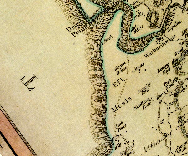 D4SD09SE.jpg "Drigg Point" sea area? item:- Carlisle Library : Map 2 Image © Carlisle Library |
|
|
|
||
 Lakes Guides menu.