Old Cumbria Gazetteer
 |
 |
|
||
| Farleton Beck | ||||
| runs into:- |  Peasey Beck Peasey Beck |
|||
|
|
||||
| civil parish:- | Beetham (formerly Westmorland) | |||
| civil parish:- | Preston Patrick (formerly Westmorland) | |||
| county:- | Cumbria | |||
| locality type:- | river | |||
| locality type:- | boundary | |||
| locality type:- | parish boundary | |||
| coordinates:- | SD52358206 (etc) | |||
| 1Km square:- | SD5282 | |||
| 10Km square:- | SD58 | |||
|
|
||||
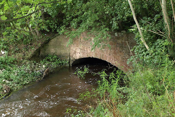
 BLO20.jpg East from Farleton Bridge. (taken 13.1.2006) |
||||
|
|
||||
| evidence:- | old map:- OS County Series (Wmd 42 16) placename:- Farleton Beck |
|||
| source data:- | Maps, County Series maps of Great Britain, scales 6 and 25
inches to 1 mile, published by the Ordnance Survey, Southampton,
Hampshire, from about 1863 to 1948. OS County Series (Wmd 47 1) |
|||
|
|
||||
| evidence:- | old map:- Ogilby 1675 (plate 38) |
|||
| source data:- | Road strip map, hand coloured engraving, continuation of the
Road from London to Carlisle, scale about 1 inch to 1 mile, by
John Ogilby, London, 1675.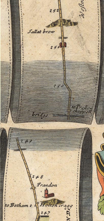 OG38m247.jpg In mile 248, Westmorland road crosses a river. item:- JandMN : 21 Image © see bottom of page |
|||
|
|
||||
| evidence:- | old map:- Jefferys 1770 (Wmd) |
|||
| source data:- | Map, 4 sheets, The County of Westmoreland, scale 1 inch to 1
mile, surveyed 1768, and engraved and published by Thomas
Jefferys, London, 1770.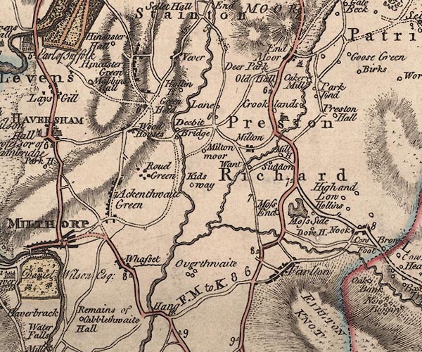 J5SD58SW.jpg single or double wiggly line; river item:- National Library of Scotland : EME.s.47 Image © National Library of Scotland |
|||
|
|
||||
| evidence:- | old map:- Cary 1789 (edn 1805) |
|||
| source data:- | Map, uncoloured engraving, Westmoreland, scale about 2.5 miles
to 1 inch, by John Cary, London, 1789; edition 1805.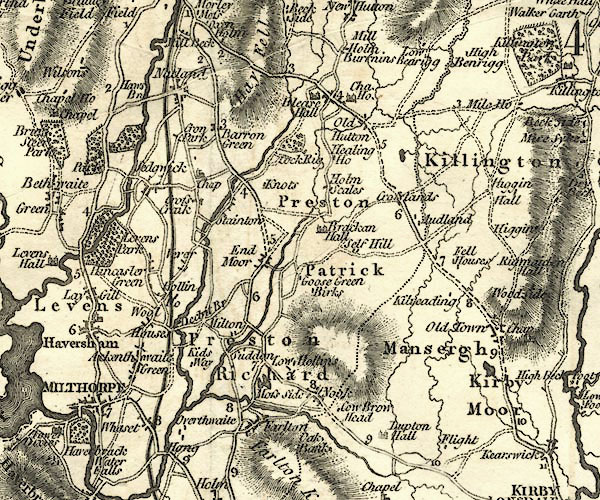 CY24SD58.jpg river running into the Peasey item:- JandMN : 129 Image © see bottom of page |
|||
|
|
||||
| places:- |
|
|||
|
||||
Lakes Guides menu.