 Old Cumbria Gazetteer
 |
 |
|
| Froswick, Kentmere | ||
| Froswick | ||
| civil parish:- | Kentmere (formerly Westmorland) | |
| civil parish:- | Lakes (formerly Westmorland) | |
| county:- | Cumbria | |
| locality type:- | hill | |
| coordinates:- | NY43520852 | |
| 1Km square:- | NY4308 | |
| 10Km square:- | NY40 | |
|
|
||
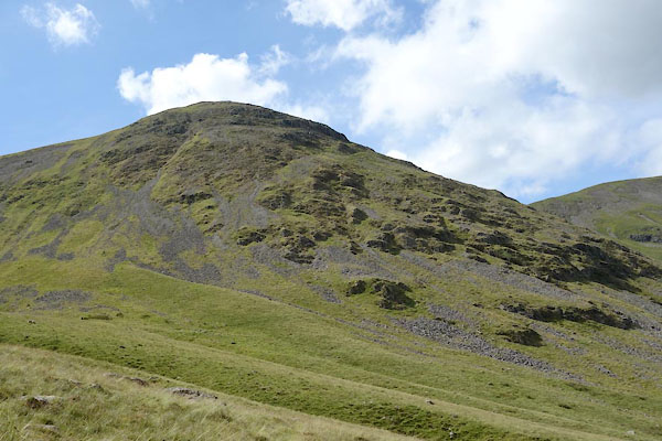
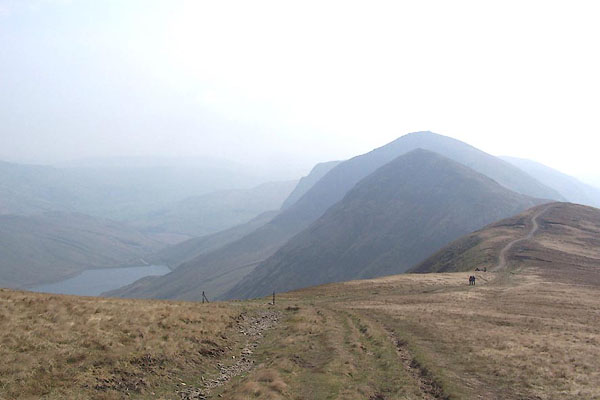 BQK92.jpg Froswick, Ill Bell, Kentmere Reservoir, ... (taken 16.4.2009) 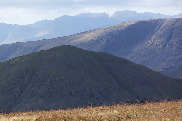 BPV11.jpg From The Knowe. (taken 17.11.2008) |
||
|
|
||
| evidence:- | old map:- OS County Series (Wmd 20 13) placename:- Froswick |
|
| source data:- | Maps, County Series maps of Great Britain, scales 6 and 25
inches to 1 mile, published by the Ordnance Survey, Southampton,
Hampshire, from about 1863 to 1948. |
|
|
|
||
| evidence:- | old map:- Jefferys 1770 (Wmd) |
|
| source data:- | Map, 4 sheets, The County of Westmoreland, scale 1 inch to 1
mile, surveyed 1768, and engraved and published by Thomas
Jefferys, London, 1770.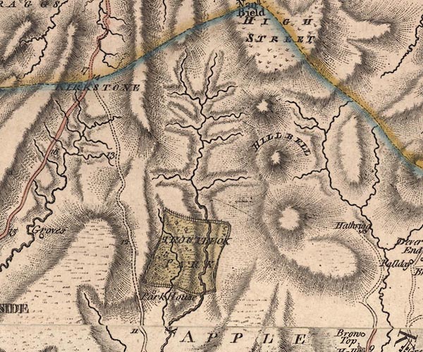 J5NY40NW.jpg hill hachuring; hill or mountain item:- National Library of Scotland : EME.s.47 Image © National Library of Scotland |
|
|
|
||
| evidence:- | outline view:- Otley 1823 (8th edn 1849) placename:- Froswick |
|
| source data:- | Engraving, outline view of mountains, Windermere looking towards the North East from
Bowness, drawn by T Binns, engraved by O Jewitt, opposite p.2 of A Descriptive Guide
of the English Lakes, by Jonathan Otley, 8th edition, 1849.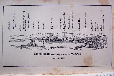 click to enlarge click to enlargeO80E02.jpg With a list of mountains. item:- Armitt Library : A1180.3 Image © see bottom of page |
|
|
|
||
| evidence:- | outline view:- Otley 1823 (5th edn 1834) |
|
| source data:- | Print, woodcut outline view, Mountains North East of Windermere, by Jonathan Otley,
Keswick, Cumberland, 1830.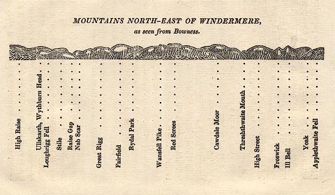 click to enlarge click to enlargeOT2E11.jpg Printed on p.99 of A Concise Description of the English Lakes, by Jonathan Otley, 5th edition, 1834. "MOUNTAINS NORTH-EAST OF WINDERMERE, as seen from Bowness." Mountains are listed:- "High Raise / Ullskarth, Wythburn Head / Loughrigg Fell / Stile / Raise Gap / Nab Scar / Great Rigg / Fairfield / Rydal Park / Wansfell Pike / Red Screes / Cawdale Moor / Threshthwaite Mouth / High Street / Froswick / Ill Bell / Yoak / Applethwaite Fell" item:- JandMN : 48.12 Image © see bottom of page |
|
|
|
||
| evidence:- | old map:- Garnett 1850s-60s H placename:- Froswick |
|
| source data:- | Map of the English Lakes, in Cumberland, Westmorland and
Lancashire, scale about 3.5 miles to 1 inch, published by John
Garnett, Windermere, Westmorland, 1850s-60s. GAR2NY40.jpg "Froswick" hill hachuring item:- JandMN : 82.1 Image © see bottom of page |
|
|
|
||
| evidence:- | old photograph:- Bell 1880s-1940s |
|
| source data:- | Photograph, sepia, Froswick and Ill Bell from High Street, Kentmere, Westmorland,
by Herbert Bell, photographer, Ambleside, Westmorland, 1890s.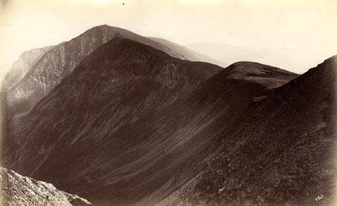 click to enlarge click to enlargeHB0751.jpg internegative at lower right:- "H. Bell" item:- Armitt Library : ALPS414 Image © see bottom of page |
|
|
|
||
| evidence:- | outline view:- Black 1856 (23rd edn 1900) placename:- Froswick |
|
| source data:- | Print, lithograph, Outline Views, Windermere - Mountains as seen from the North End
of Belle Isle, Windermere, and Mountains as seen from Biscay How, Bowness, by J Flintoft,
Keswick, Cumberland, engraved by R Mason, Edinburgh, Lothian, about 1900.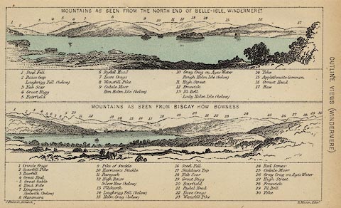 click to enlarge click to enlargeBC08E1.jpg "... 12 Froswick ... 28 Froswick ..." item:- JandMN : 37.4 Image © see bottom of page |
|
|
|
||
| evidence:- | outline view:- Black 1841 (3rd edn 1846) placename:- Froswick |
|
| source data:- | Print, engraving, outline view, Mountains as seen from the North End of Belle Isle,
Windermere, and Mountains as seen from Bisket How, Bowness, by J Flintoft, Keswick,
Cumberland, engraved by R Mason, Edinburgh, about 1844.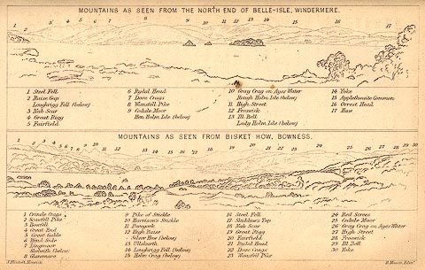 click to enlarge click to enlargeBC02E1.jpg "... 12 Froswick ... 28 Froswick ..." item:- JandMN : 32.3 Image © see bottom of page |
|
|
|
||
 CBE04.jpg From Over Cove. (taken 15.7.2014) 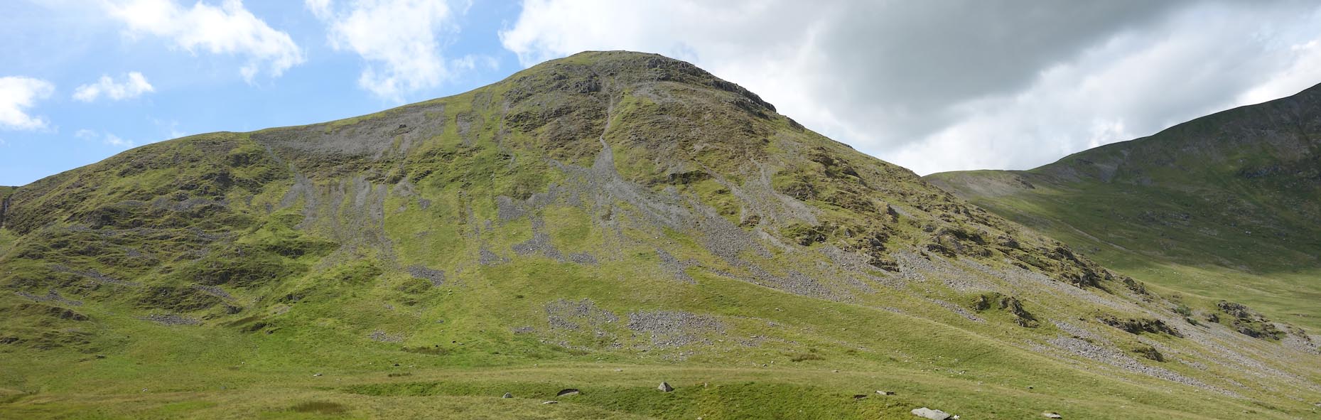 Click to enlarge CBE05.jpg From Over Cove. (taken 15.7.2014) 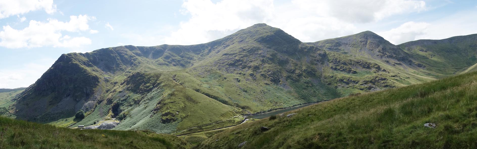 Click to enlarge CBE01.jpg Rainsborrow Crag and Cove, Ill Bell, Froswick. (taken 15.7.2014) 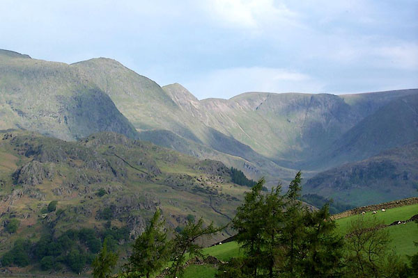 BMF58.jpg Rainsborrow Crag, Ill Bell, Froswick, and High Street, above Kentmere Valley (and a little vertical exageration). (taken 4.6.2006) 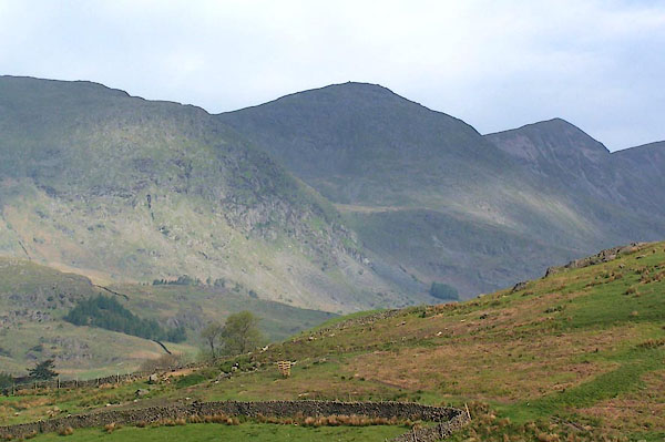 BMF59.jpg Rainsborrow Crag, Ill Bell, and Froswick. (taken 4.6.2006) 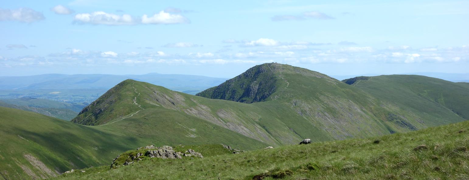 Click to enlarge CDO73.jpg Froswick and Ill Bell, from the west. (taken 9.7.2015) |
||
|
|
||
 Lakes Guides menu.