 Old Cumbria Gazetteer
 |
 |
|
| Galeforth Brow, Longsleddale | ||
| Galeforth Brow | ||
| locality:- | Sleddale Fell | |
| civil parish:- | Longsleddale (formerly Westmorland) | |
| county:- | Cumbria | |
| locality type:- | rocks | |
| locality type:- | plantations | |
| coordinates:- | NY48720663 (etc) | |
| 1Km square:- | NY4806 | |
| 10Km square:- | NY40 | |
|
|
||
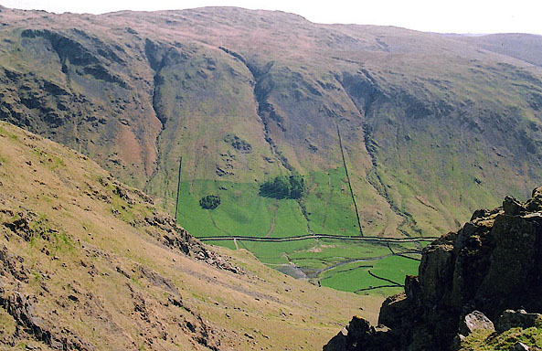 BIQ33.jpg From near Goatscar. Notice the pattern of stone walls, irregular in the meadows, and regular, straight lines drawn on maps for enclosure awards, on the hillsides. (taken 25.4.2004) |
||
|
|
||
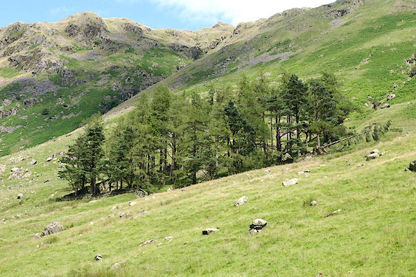 BRB86.jpg Plantation at NY48360677 etc (taken 19.7.2009) |
||
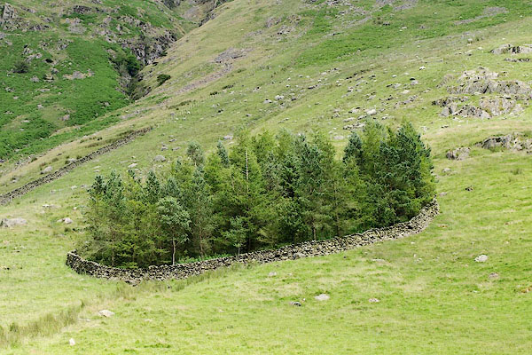 BRB90.jpg Small plantation at NY48280691 etc (taken 19.7.2009) |
||
|
|
||
| evidence:- | old map:- OS County Series (Wmd 27 3) placename:- Galeforth Brow |
|
| source data:- | Maps, County Series maps of Great Britain, scales 6 and 25
inches to 1 mile, published by the Ordnance Survey, Southampton,
Hampshire, from about 1863 to 1948. |
|
|
|
||
| evidence:- | map:- OS Six Inch (1956) placename:- Galeforth Brow |
|
| source data:- | Map series, various editions with the national grid, scale about
6 inches to 1 mile, published by the Ordnance Survey,
Southampton, Hampshire, scale 1 to 10560 from 1950s to 1960s,
then 1 to 10000 from 1960s to 2000s, superseded by print on
demand from digital data.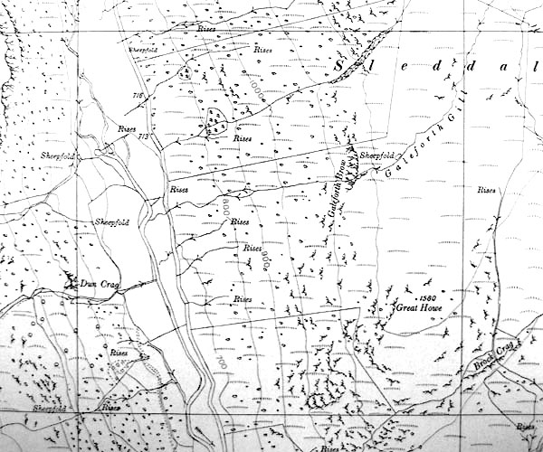 SINY4806.jpg "Galeforth Brow" |
|
|
|
||
 Lakes Guides menu.