 Old Cumbria Gazetteer
 |
 |
|
| Gategill Fell Top, Threlkeld | ||
| Gategill Fell Top | ||
| site name:- | Saddleback | |
| locality:- | Gategill Fell | |
| civil parish:- | Threlkeld (formerly Cumberland) | |
| county:- | Cumbria | |
| locality type:- | hill | |
| locality type:- | fell | |
| coordinates:- | NY31772736 | |
| 1Km square:- | NY3127 | |
| 10Km square:- | NY32 | |
| altitude:- | 2792 feet | |
| altitude:- | 851m | |
|
|
||
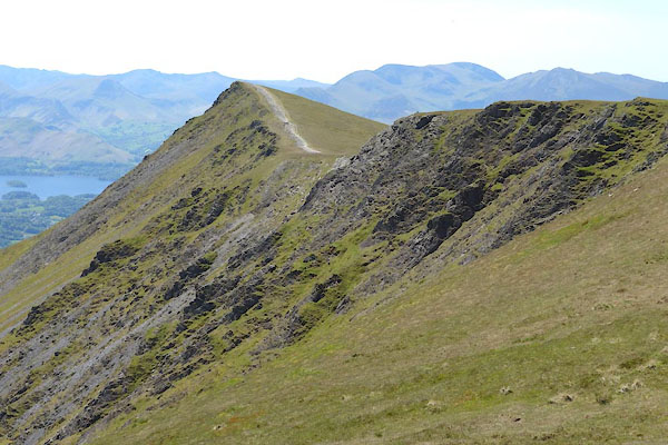 CDI80.jpg (taken 11.6.2015) 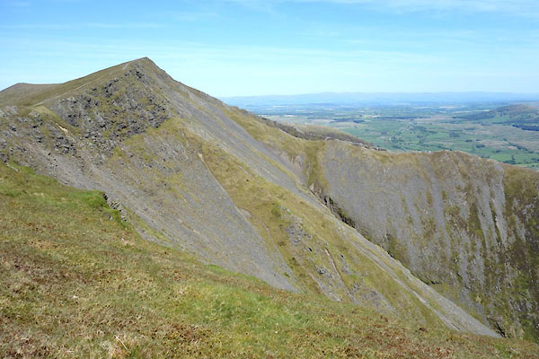 CDI81.jpg (taken 11.6.2015) |
||
|
|
||
| evidence:- | perhaps old print:- Westall 1820 |
|
| source data:- | Print, uncoloured mezzotint, Keswick Lake, from Saddleback, Cumberland, drawn and
engraved by William Westall, published by Rodwell and Martin, New Bond Street, London,
1820.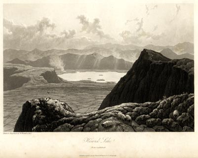 click to enlarge click to enlargeWTL103.jpg printed, bottom left, centre "Drawn & Engraved by W. Westall A.R.A. / Keswick Lake. / From Saddleback. / Published April 1, 1820, by Hurst, Robinson &Co. Cheapside." item:- Armitt Library : A6671.3 Image © see bottom of page |
|
|
|
||
| evidence:- | perhaps outline view:- Otley 1823 (4th edn 1830) placename:- Priest Man |
|
| source data:- | Print, engraving, Outline View of Skiddaw, and Saddleback, as seen on approaching
Keswick from the South, published by Jonathan Otley, Keswick, Cumberland et al, 1830.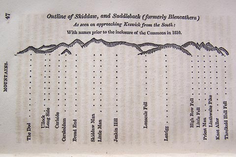 click to enlarge click to enlargeO75E01.jpg p.47 in A Concise Description of the English Lakes, by Jonathan Otley, 4th edition, 1830. "Outline View of Skiddaw, and Saddleback (formerly Blencathera) As seen on approaching Keswick from the South: With names prior to the inclosure of the Commons in 1810." "The Dod / Ullock / Long Side / Carleside / Carsleddam / Broad End / Skiddaw Man / Little Man / Jenkin Hill / Lonscale Fell / Latrigg / High Row Fell / Little Fell / Priest Man / Linthwaite Pike / Knot Aller / Threlkeld Hall Fell" item:- Armitt Library : A1175.2 Image © see bottom of page |
|
|
|
||
| evidence:- | outline view:- Otley 1823 (5th edn 1834) placename:- Priest Man |
|
| source data:- | Print, woodcut outline view, Skiddaw and Saddleback, by Jonathan Otley, Keswick, Cumberland,
1830.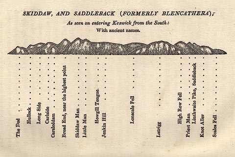 click to enlarge click to enlargeOT2E08.jpg Printed on p.49 of A Concise Description of the English Lakes, by Jonathan Otley, 5th edition, 1834. "SKIDDAW, AND SADDLEBACK (FORMERLY BLENCATHRA): As seen entering Keswick from the South: With ancient names." "The Dod / Hullock / Long Side / Carlside / Carsleddam / Broad End, near the highest point / Skiddaw Man / Little Man / Howgill Tongue / Jenkin Hill / Lonscale Fell / Latrigg / High Row Fell / Priest Man / Linthwaite Pike, Saddleback / Knot Aller / Scales Fell" item:- JandMN : 48.9 Image © see bottom of page |
|
|
|
||
| evidence:- | perhaps outline view:- Otley 1823 (8th edn 1849) placename:- Priest Man |
|
| source data:- | Engraving, outline view of mountains, Skiddaw, and Saddleback ... as seen on entering
Keswick from the South, drawn by T Binns, engraved by O Jewitt, opposite p.46 of A
Descriptive Guide of the English Lakes, by Jonathan Otley, 8th edition, 1849.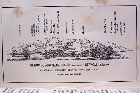 click to enlarge click to enlargeO80E16.jpg item:- Armitt Library : A1180.17 Image © see bottom of page |
|
|
|
||
 Lakes Guides menu.