 Old Cumbria Gazetteer
 |
 |
|
|||||||||||||||||||||||||||
| Great Langdale, Lakes | |||||||||||||||||||||||||||||
| Great Langdale | |||||||||||||||||||||||||||||
| Girt Langden | |||||||||||||||||||||||||||||
| locality:- | Langdales | ||||||||||||||||||||||||||||
| civil parish:- | Lakes (formerly Westmorland) | ||||||||||||||||||||||||||||
| county:- | Cumbria | ||||||||||||||||||||||||||||
| locality type:- | valley | ||||||||||||||||||||||||||||
| coordinates:- | NY31230557 (etc) | ||||||||||||||||||||||||||||
| 1Km square:- | NY3105 | ||||||||||||||||||||||||||||
| 10Km square:- | NY30 | ||||||||||||||||||||||||||||
|
|
|||||||||||||||||||||||||||||
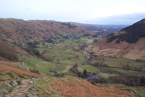 BSI85.jpg (taken 23.3.2010) 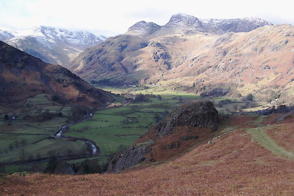 BVX03.jpg (taken 15.2.2012) |
|||||||||||||||||||||||||||||
|
|
|||||||||||||||||||||||||||||
| evidence:- | old map:- OS County Series (Wmd 25 6) placename:- Langdale |
||||||||||||||||||||||||||||
| source data:- | Maps, County Series maps of Great Britain, scales 6 and 25
inches to 1 mile, published by the Ordnance Survey, Southampton,
Hampshire, from about 1863 to 1948. OS County Series (Wmd 25 7) |
||||||||||||||||||||||||||||
|
|
|||||||||||||||||||||||||||||
| evidence:- | old map:- Saxton 1579 placename:- Langdale Magna |
||||||||||||||||||||||||||||
| source data:- | Map, hand coloured engraving, Westmorlandiae et Cumberlandiae Comitatus ie Westmorland
and Cumberland, scale about 5 miles to 1 inch, by Christopher Saxton, London, engraved
by Augustinus Ryther, 1576, published 1579-1645.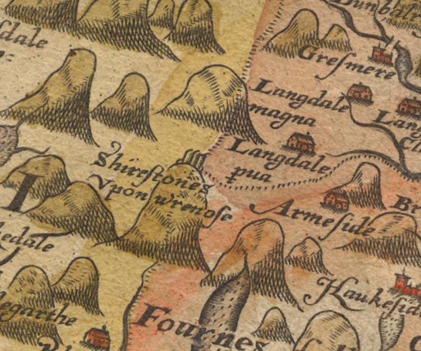 Sax9NY20.jpg Building, symbol for a hamlet, which may or may not have a nucleus. "Langdale magna" item:- private collection : 2 Image © see bottom of page |
||||||||||||||||||||||||||||
|
|
|||||||||||||||||||||||||||||
| evidence:- | old map:- Keer 1605 placename:- Langdala |
||||||||||||||||||||||||||||
| source data:- | Map, hand coloured engraving, Westmorland and Cumberland, scale
about 16 miles to 1 inch, probably by Pieter van den Keere, or
Peter Keer, about 1605 edition perhaps 1676. click to enlarge click to enlargeKER8.jpg "Langdala" dot, circle and tower; village item:- Dove Cottage : 2007.38.110 Image © see bottom of page |
||||||||||||||||||||||||||||
|
|
|||||||||||||||||||||||||||||
| evidence:- | old map:- Speed 1611 (Wmd) placename:- Great Langdale |
||||||||||||||||||||||||||||
| source data:- | Map, hand coloured engraving, The Countie Westmorland and
Kendale the Cheif Towne, scale about 2.5 miles to 1 inch, by
John Speed, 1610, published by George Humble, Popes Head Alley,
London, 1611-12.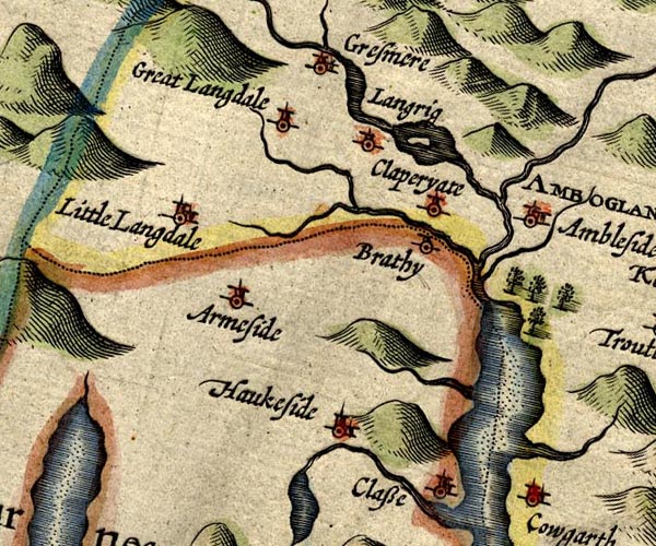 SP14NY30.jpg "Great Langdale" circle, tower item:- Armitt Library : 2008.14.5 Image © see bottom of page |
||||||||||||||||||||||||||||
|
|
|||||||||||||||||||||||||||||
| evidence:- | old map:- Jenner 1643 placename:- Langdala |
||||||||||||||||||||||||||||
| source data:- | Table of distances, with map, hand coloured engraving,
Westmerland ie Westmorland, scale about 16 miles to 1 inch,
engraved by Jacob van Langeren, published by Thomas Jenner,
Cornhill, London, 1643.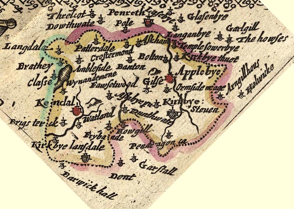 JEN3Sq.jpg "Langdala" dot, circle, tower item:- private collection : 52.Wmd Image © see bottom of page |
||||||||||||||||||||||||||||
|
|
|||||||||||||||||||||||||||||
| evidence:- | old map:- Jansson 1646 placename:- Great Langdale |
||||||||||||||||||||||||||||
| source data:- | Map, hand coloured engraving, Cumbria and Westmoria, ie
Cumberland and Westmorland, scale about 3.5 miles to 1 inch, by
John Jansson, Amsterdam, Netherlands, 1646.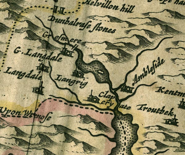 JAN3NY30.jpg "G. Langdale" Buildings and tower. item:- JandMN : 88 Image © see bottom of page |
||||||||||||||||||||||||||||
|
|
|||||||||||||||||||||||||||||
| evidence:- | hearth tax returns:- Hearth Tax 1675 placename:- Langdale |
||||||||||||||||||||||||||||
| source data:- | Records, hearth tax survey returns, Westmorland, 1674/75. "Langdale" |
||||||||||||||||||||||||||||
|
|
|||||||||||||||||||||||||||||
| evidence:- | hearth tax returns:- Hearth Tax 1670 placename:- Langdaile |
||||||||||||||||||||||||||||
| source data:- | Records, hearth tax returns, exchequer duplicates, Westmorland,
1670. "Langdaile" |
||||||||||||||||||||||||||||
|
|
|||||||||||||||||||||||||||||
| evidence:- | old map:- Morden 1695 (Cmd) placename:- Great Langdale |
||||||||||||||||||||||||||||
| source data:- | Map, uncoloured engraving, Cumberland, scale about 4 miles to 1
inch, by Robert Morden, 1695, published by Abel Swale, the
Unicorn, St Paul's Churchyard, Awnsham, and John Churchill, the
Black Swan, Paternoster Row, London, 1695-1715.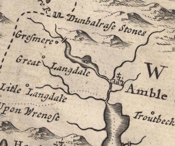 MD12NY30.jpg "Great Langdale" Circle. item:- JandMN : 90 Image © see bottom of page |
||||||||||||||||||||||||||||
|
|
|||||||||||||||||||||||||||||
| evidence:- | old map:- Morden 1695 (Wmd) placename:- Great Langdal |
||||||||||||||||||||||||||||
| source data:- | Map, hand coloured engraving, Westmorland, scale about 2.5 miles to 1 inch, by Robert
Morden, published by Abel Swale, the Unicorn, St Paul's Churchyard, Awnsham, and John
Churchill, the Black Swan, Paternoster Row, London, 1695.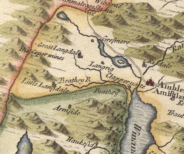 MD10NY30.jpg "Great Langdal" Circle, building and tower. item:- JandMN : 24 Image © see bottom of page |
||||||||||||||||||||||||||||
|
|
|||||||||||||||||||||||||||||
| evidence:- | old map:- Simpson 1746 map (Wmd) placename:- Great Langdale |
||||||||||||||||||||||||||||
| source data:- | Map, uncoloured engraving, Westmorland, scale about 8 miles to 1
inch, printed by R Walker, Fleet Lane, London, 1746.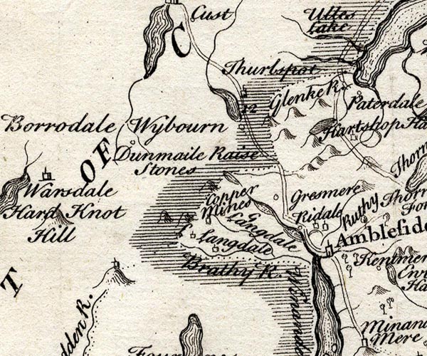 SMP2NYF.jpg "G Langdale" Building. item:- Dove Cottage : 2007.38.59 Image © see bottom of page |
||||||||||||||||||||||||||||
|
|
|||||||||||||||||||||||||||||
| evidence:- | old map:- Bowen and Kitchin 1760 placename:- Langdale Magna |
||||||||||||||||||||||||||||
| source data:- | Map, hand coloured engraving, A New Map of the Counties of
Cumberland and Westmoreland Divided into their Respective Wards,
scale about 4 miles to 1 inch, by Emanuel Bowen and Thomas
Kitchin et al, published by T Bowles, Robert Sayer, and John
Bowles, London, 1760.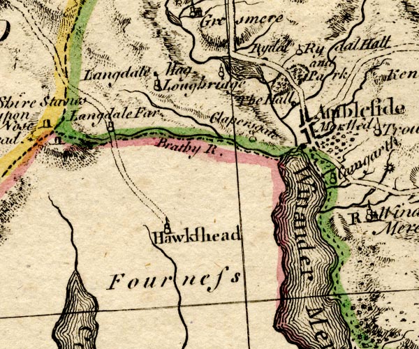 BO18SD29.jpg "Langdale Mag." circle, tower item:- Armitt Library : 2008.14.10 Image © see bottom of page |
||||||||||||||||||||||||||||
|
|
|||||||||||||||||||||||||||||
| evidence:- | old map:- Jefferys 1770 (Wmd) placename:- Great Langdale placename:- Langdale, Great |
||||||||||||||||||||||||||||
| source data:- | Map, 4 sheets, The County of Westmoreland, scale 1 inch to 1
mile, surveyed 1768, and engraved and published by Thomas
Jefferys, London, 1770.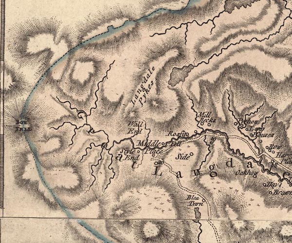 J5NY20NE.jpg "Great Langdale" hill hachuring; valley item:- National Library of Scotland : EME.s.47 Image © National Library of Scotland |
||||||||||||||||||||||||||||
|
|
|||||||||||||||||||||||||||||
| evidence:- | descriptive text:- West 1778 (11th edn 1821) placename:- Langdale |
||||||||||||||||||||||||||||
| source data:- | Guide book, A Guide to the Lakes, by Thomas West, published by
William Pennington, Kendal, Cumbria once Westmorland, and in
London, 1778 to 1821. goto source goto sourceAddendum; Mr Gray's Journal, 1769 Page 213:- "... at the head [of Windermere] two vallies open among the mountains: one, that by which we came down, the other Langdale, in which Wrynose and Hardknot, two great mountains, rise above the rest: from thence the fells visibly sink, and soften along its sides; sometimes they run into it (but with a gentle declivity) in their own dark and natural complexion: oftener they are green and cultivated, with farms interspersed, and round eminences, on the border covered with trees: ..." |
||||||||||||||||||||||||||||
|
|
|||||||||||||||||||||||||||||
| evidence:- | descriptive text:- West 1778 (11th edn 1821) |
||||||||||||||||||||||||||||
| source data:- | Guide book, A Guide to the Lakes, by Thomas West, published by
William Pennington, Kendal, Cumbria once Westmorland, and in
London, 1778 to 1821. goto source Rev Plumtre's Night Piece on Windermere, 1797 Page 231:- "[1] The river Brathay is formed chiefly from two steams,- the one rising in Little Langdale, the other in Great Langdale, where it passes the Pikes and the slate quarry: ..." |
||||||||||||||||||||||||||||
|
|
|||||||||||||||||||||||||||||
| evidence:- | old painting:- Green 1790s-1820s item:- cattle |
||||||||||||||||||||||||||||
| source data:- | Painting, watercolour, Great Langdale, Westmorland, by William Green, Ambleside, Westmorland,
1800s-10s?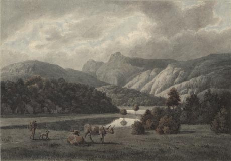 click to enlarge click to enlargePR1750.jpg item:- Dove Cottage : 2007.25.4 Image © see bottom of page |
||||||||||||||||||||||||||||
|
|
|||||||||||||||||||||||||||||
| evidence:- | probably old map:- Cooper 1808 placename:- Longdale |
||||||||||||||||||||||||||||
| source data:- | Map, hand coloured engraving, Westmoreland ie Westmorland, scale
about 9 miles to 1 inch, by H Cooper, 1808, published by R
Phillips, Bridge Street, Blackfriars, London, 1808. click to enlarge click to enlargeCOP4.jpg "Longdale" area item:- Dove Cottage : 2007.38.53 Image © see bottom of page |
||||||||||||||||||||||||||||
|
|
|||||||||||||||||||||||||||||
| evidence:- | old print:- Green 1810 (plate 50) placename:- Vale of Langdale |
||||||||||||||||||||||||||||
| source data:- | Print, soft ground etching, Vale of Langdale from Bays Brown, Great Langdale, Westmorland,
by William Green, Ambleside, Westmorland, 1810.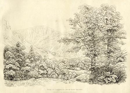 click to enlarge click to enlargeGN1250.jpg Plate 50 in Sixty Studies from Nature, 1810. printed at top right:- "50" printed at bottom:- "VALE OF LANGDALE FROM BAYS BROWN. / Drawn and Engraved by William Green, and Published at Ambleside, June 24, 1810." watermark:- "J WHATMAN / 1813" item:- Armitt Library : A6641.50 Image © see bottom of page |
||||||||||||||||||||||||||||
|
|
|||||||||||||||||||||||||||||
| evidence:- | old text:- Green 1814 placename:- Great Langdale |
||||||||||||||||||||||||||||
| source data:- | Set of prints, soft ground etchings, Sixty Small Prints, with
text, A Description of a Series of Sixty Small Prints, by
William Green, Ambleside, Westmorland, 1814. goto source page 9:- "... the vales of Langdale are considered by some people of taste as the finest in the north of England. ..." |
||||||||||||||||||||||||||||
|
|
|||||||||||||||||||||||||||||
| evidence:- | old map:- Otley 1818 placename:- Langdale |
||||||||||||||||||||||||||||
| source data:- | Map, uncoloured engraving, The District of the Lakes,
Cumberland, Westmorland, and Lancashire, scale about 4 miles to
1 inch, by Jonathan Otley, 1818, engraved by J and G Menzies,
Edinburgh, Scotland, published by Jonathan Otley, Keswick,
Cumberland, et al, 1833.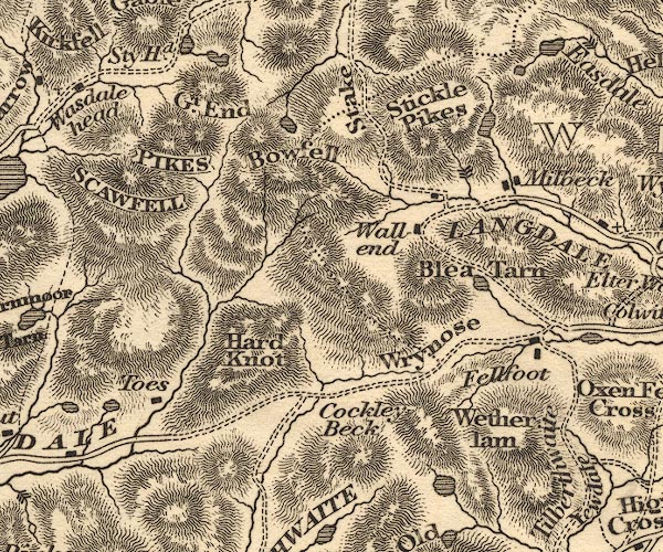 OT02NY20.jpg "LANGDALE" item:- JandMN : 48.1 Image © see bottom of page |
||||||||||||||||||||||||||||
|
|
|||||||||||||||||||||||||||||
| evidence:- | old map:- Hall 1820 (Wmd) placename:- Great Langdale |
||||||||||||||||||||||||||||
| source data:- | Map, hand coloured engraving, Westmoreland ie Westmorland, scale
about 14.5 miles to 1 inch, by Sidney Hall, London, 1820,
published by Samuel Leigh, 18 Strand, London, 1820-31. click to enlarge click to enlargeHA18.jpg "Gt. Langdale" circle, italic lowercase text; settlement item:- Armitt Library : 2008.14.58 Image © see bottom of page |
||||||||||||||||||||||||||||
|
|
|||||||||||||||||||||||||||||
| evidence:- | descriptive text:- Ford 1839 (3rd edn 1843) placename:- Langdale |
||||||||||||||||||||||||||||
| source data:- | Guide book, A Description of Scenery in the Lake District, by
Rev William Ford, published by Charles Thurnam, Carlisle, by W
Edwards, 12 Ave Maria Lane, Charles Tilt, Fleet Street, William
Smith, 113 Fleet Street, London, by Currie and Bowman,
Newcastle, by Bancks and Co, Manchester, by Oliver and Boyd,
Edinburgh, and by Sinclair, Dumfries, 1839. goto source Page 162:- "..." "A more extended excursion generally performed from Ambleside, is that into Langdale, which may be made partly in carriages, although it is more usual to effect it in carts, which way will indeed be found the most convenient and suitable to the roads, as well as enabling the tourist to carry the necessary creature comforts for a mountain ramble. ... Descending the hill to the head of Great Langdale, the Langdale Pikes appear immediately in front, with Bowfell on the left. The conical pike is called Pike of Stickle, and the broad-headed pike, Harrison Stickle. Great Langdale is entered at the farm-house of Wall End, whence Bowfell may be ascended, or Borrodale penetrated, by passing over the Stake. The regular excursion, however, will bring the tourist down to Millbeck, where he may see the waterfall of Dungeon Gill. Still descending the valley, he may, when in view of Elter Water," goto sourcePage 163:- "turn to the left, and cross the hill by High Close, whence are interesting views of Windermere and Langdale, on one side, and the vale and lake of Grasmere, on the other. A road back by Langdale Chapel, will bring him again to Ambleside, after a circuit of nineteen miles, viz.:"
|
||||||||||||||||||||||||||||
|
|
|||||||||||||||||||||||||||||
| evidence:- | old map:- Ford 1839 map placename:- Great Langdale |
||||||||||||||||||||||||||||
| source data:- | Map, uncoloured engraving, Map of the Lake District of
Cumberland, Westmoreland and Lancashire, scale about 3.5 miles
to 1 inch, published by Charles Thurnam, Carlisle, and by R
Groombridge, 5 Paternoster Row, London, 3rd edn 1843.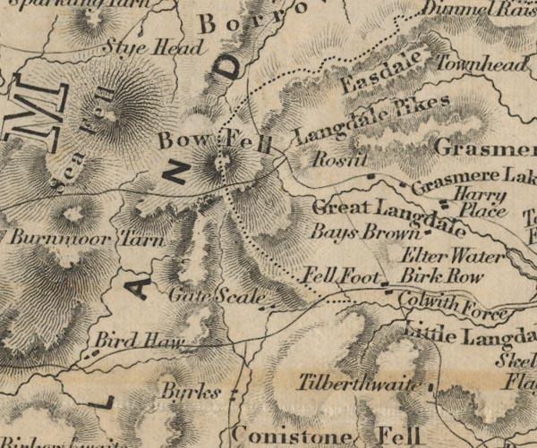 FD02NY20.jpg "Great Langdale" Area, beside beck. item:- JandMN : 100.1 Image © see bottom of page |
||||||||||||||||||||||||||||
|
|
|||||||||||||||||||||||||||||
| evidence:- | old drawing:- Aspland 1840s-60s |
||||||||||||||||||||||||||||
| source data:- | Drawing, pencil, Great Langdale? Westmorland, by Theophilus Lindsey Aspland, 1849.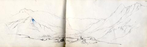 click to enlarge click to enlargeAS0157.jpg item:- Armitt Library : 1958.487.57 Image © see bottom of page |
||||||||||||||||||||||||||||
|
|
|||||||||||||||||||||||||||||
| evidence:- | probably old drawing:- Aspland 1840s-60s |
||||||||||||||||||||||||||||
| source data:- | Drawing, pencil and ink wash, Great Langdale? Westmorland, by Theophilus Lindsey Aspland,
1849.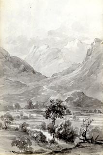 click to enlarge click to enlargeAS0158.jpg item:- Armitt Library : 1958.487.58 Image © see bottom of page |
||||||||||||||||||||||||||||
|
|
|||||||||||||||||||||||||||||
| evidence:- | probably old drawing:- Aspland 1840s-60s |
||||||||||||||||||||||||||||
| source data:- | Drawing, pencil and ink wash, Great Langdale? Westmorland, by Theophilus Lindsey Aspland,
1849.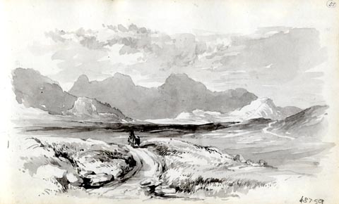 click to enlarge click to enlargeAS0159.jpg item:- Armitt Library : 1958.487.59 Image © see bottom of page |
||||||||||||||||||||||||||||
|
|
|||||||||||||||||||||||||||||
| evidence:- | old text:- Miller 1847 item:- rain |
||||||||||||||||||||||||||||
| source data:- | Book, Report on the Fall of Rain in the Lake Districts of
Cumberland and Westmoreland in 1846, by John Fletcher Miller,
printed by G Irwin, Lowther Street, Whitehaven, Cumberland, 1847. goto source Page 5:- "At Seathwaite, there have been thirty-six days in which the quantity of measured rain was between one and two inches; six days between two and three inches; five days between three and four inches; one day between four and five inches; and one day between five and six inches." "At Langdale Head, there have been thirty-eight days of the first; five days of the second; and four days of third class; and one day wherein the fall exceeded four inches." |
||||||||||||||||||||||||||||
|
|
|||||||||||||||||||||||||||||
| evidence:- | old map:- Garnett 1850s-60s H placename:- Langdale |
||||||||||||||||||||||||||||
| source data:- | Map of the English Lakes, in Cumberland, Westmorland and
Lancashire, scale about 3.5 miles to 1 inch, published by John
Garnett, Windermere, Westmorland, 1850s-60s.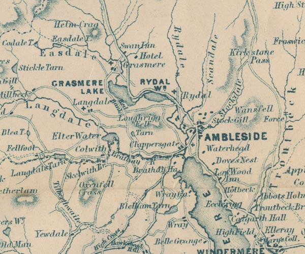 GAR2NY30.jpg "Langdale" river valley item:- JandMN : 82.1 Image © see bottom of page |
||||||||||||||||||||||||||||
|
|
|||||||||||||||||||||||||||||
 Martineau Directory 1855 Martineau Directory 1855 |
|||||||||||||||||||||||||||||
|
|
|||||||||||||||||||||||||||||
| evidence:- | probably old print:- Payn 1867 |
||||||||||||||||||||||||||||
| source data:- | Print, uncoloured engraving, Rocks in Langdale, Westmorland, by T L Aspland, engraved
by W T Green, published by J Garnett, Windermere, Westmorland, 1867.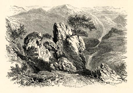 click to enlarge click to enlargePN0322.jpg On p.44 of The Lakes in Sunshine, text by James Payn. printed at lower right:- "W. T. GREEN Sc" item:- Fell and Rock Climbing Club : 184.22 Image © see bottom of page |
||||||||||||||||||||||||||||
|
|
|||||||||||||||||||||||||||||
| evidence:- | perhaps old photograph:- Payn 1867 placename:- Great Langdale |
||||||||||||||||||||||||||||
| source data:- | Photograph, sepia, Head of Great Langdale, with Passes to Borrowdale and Wastwater,
Westmorland, by Garnett and Sproat, published by J Garnett, Windermere, Westmorland,
1867.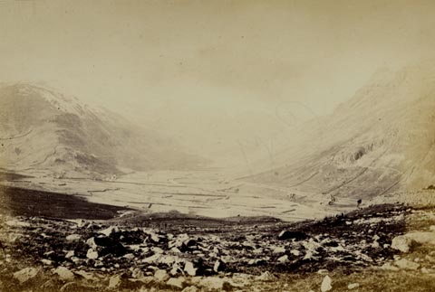 click to enlarge click to enlargePN0323.jpg Tipped in opposite p.46 of The Lakes in Sunshine, text by James Payn. printed at bottom:- "HEAD OF GREAT LANGDALE, WITH PASSES TO BORROWDALE AND WASTWATER." item:- Fell and Rock Climbing Club : 184.23 Image © see bottom of page |
||||||||||||||||||||||||||||
|
|
|||||||||||||||||||||||||||||
| evidence:- | old photograph:- Bell 1880s-1940s |
||||||||||||||||||||||||||||
| source data:- | Photograph, sepia, near Dungeon Ghyll, Great Langdale, Westmorland, by Herbert Bell,
photographer, Ambleside, Westmorland, 1890s.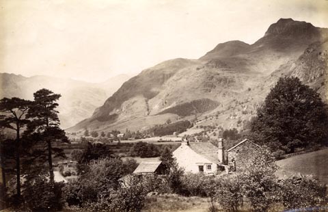 click to enlarge click to enlargeHB0923.jpg item:- Armitt Library : ALPS600 Image © see bottom of page |
||||||||||||||||||||||||||||
|
|
|||||||||||||||||||||||||||||
| evidence:- | old photograph:- Bell 1880s-1940s |
||||||||||||||||||||||||||||
| source data:- | Photograph, black and white, Great Langdale, Westmorland, by Herbert Bell, photographer,
Ambleside, Westmorland, 1890s.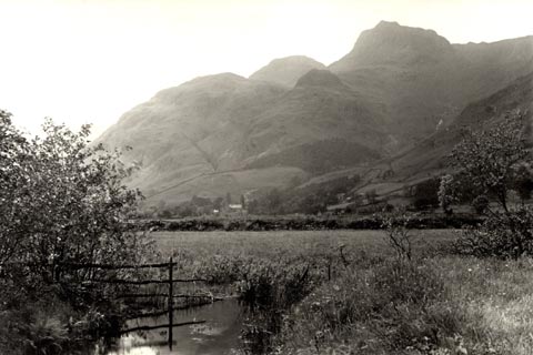 click to enlarge click to enlargeHB0922.jpg item:- Armitt Library : ALPS599 Image © see bottom of page |
||||||||||||||||||||||||||||
|
|
|||||||||||||||||||||||||||||
| evidence:- | old photograph:- Bell 1880s-1940s |
||||||||||||||||||||||||||||
| source data:- | Photograph, sepia, Great Langdale, Westmorland, by Herbert Bell, photographer, Ambleside,
Westmorland, 1890s.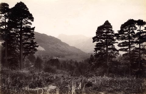 click to enlarge click to enlargeHB0851.jpg item:- Armitt Library : ALPS522 Image © see bottom of page |
||||||||||||||||||||||||||||
|
|
|||||||||||||||||||||||||||||
| evidence:- | old photograph:- Bell 1880s-1940s |
||||||||||||||||||||||||||||
| source data:- | Photograph, sepia, Great Langdale in winter, Westmorland, by Herbert Bell, photographer,
Ambleside, Westmorland, 1890s.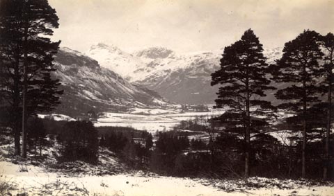 click to enlarge click to enlargeHB0646.jpg item:- Armitt Library : ALPS309 Image © see bottom of page |
||||||||||||||||||||||||||||
|
|
|||||||||||||||||||||||||||||
| evidence:- | old photograph:- Bell 1880s-1940s |
||||||||||||||||||||||||||||
| source data:- | Photograph, sepia, Great Langdale, Westmorland, by Herbert Bell, photographer, Ambleside,
Westmorland, 1890s.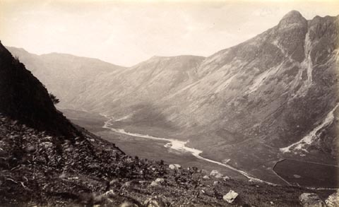 click to enlarge click to enlargeHB0640.jpg Mickleden Beck in the valley bottom; Pike of Stickle on the right, Stake Pass vaguely recognizable towards the left. item:- Armitt Library : ALPS303 Image © see bottom of page |
||||||||||||||||||||||||||||
|
|
|||||||||||||||||||||||||||||
| evidence:- | old photograph:- Bell 1880s-1940s |
||||||||||||||||||||||||||||
| source data:- | Photograph, black and white, Great Langdale, Westmorland, by Herbert Bell, photographer,
Ambleside, Westmorland, 1890s.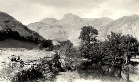 click to enlarge click to enlargeHB0636.jpg stamped on reverse:- "HERBERT BELL / Photographer / AMBLESIDE" item:- Armitt Library : ALPS298 Image © see bottom of page |
||||||||||||||||||||||||||||
|
|
|||||||||||||||||||||||||||||
| evidence:- | old photograph:- Bell 1880s-1940s |
||||||||||||||||||||||||||||
| source data:- | Photograph, black and white, Great Langdale, Westmorland, by Herbert Bell, photographer,
Ambleside, Westmorland, 1890s.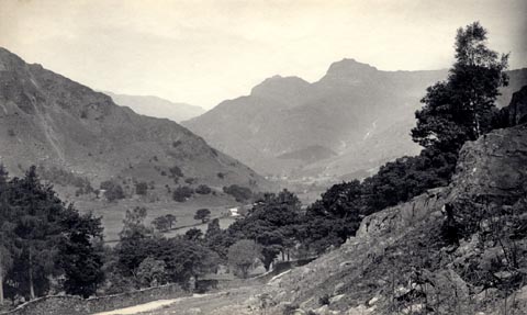 click to enlarge click to enlargeHB0631.jpg internegative at lower left:- "H. Bell" stamped on reverse:- "HERBERT BELL / Photographer / AMBLESIDE" item:- Armitt Library : ALPS293 Image © see bottom of page |
||||||||||||||||||||||||||||
|
|
|||||||||||||||||||||||||||||
| evidence:- | old photograph:- Bell 1880s-1940s |
||||||||||||||||||||||||||||
| source data:- | Photograph, b/w, Great Langdale, Westmorland, by Herbert Bell, Ambleside, Westmorland,
1890s?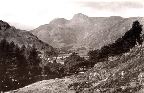 click to enlarge click to enlargeHB0268.jpg at internegative, left, right:- "91. LANGDALE. / H. BELL." item:- Armitt Library : ALPS623 Image © see bottom of page |
||||||||||||||||||||||||||||
|
|
|||||||||||||||||||||||||||||
| evidence:- | old photograph:- Bell 1880s-1940s item:- carriage |
||||||||||||||||||||||||||||
| source data:- | Photograph, carriage accident, Great Langdale, by Herbert Bell, Ambleside, Westmorland,
1890s?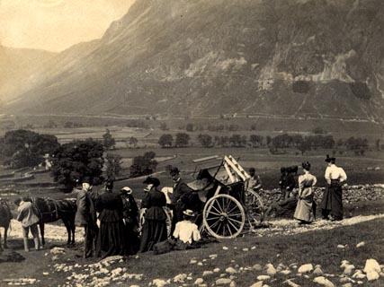 click to enlarge click to enlargeHB0238.jpg item:- Armitt Library : 1958.5097 Image © see bottom of page |
||||||||||||||||||||||||||||
|
|
|||||||||||||||||||||||||||||
| evidence:- | old print:- Brabant 1902 placename:- Great Langdale |
||||||||||||||||||||||||||||
| source data:- | Print, uncoloured lithograph, Langdale Pikes and Great Langdale, Westmorland, by Edmund
H New, published by Methuen and Co, 36 Essex Street, Strand, London, 1902.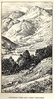 click to enlarge click to enlargeBBT103.jpg Tipped in opposite p.102 of The English Lakes, by F G Brabant. printed at bottom right:- "E. H. NEW" printed at bottom:- "LANGDALE PIKES AND GREAT LANGDALE" item:- JandMN : 502.7 Image © see bottom of page |
||||||||||||||||||||||||||||
|
|
|||||||||||||||||||||||||||||
| evidence:- | old map:- Postlethwaite 1877 (3rd edn 1913) placename:- Great Langdale |
||||||||||||||||||||||||||||
| source data:- | Map, uncoloured engraving, Map of the Lake District Mining Field, Westmorland, Cumberland,
Lancashire, scale about 5 miles to 1 inch, by John Postlethwaite, published by W H
Moss and Sons, 13 Lowther Street, Whitehaven, Cumberland, 1877 edn 1913.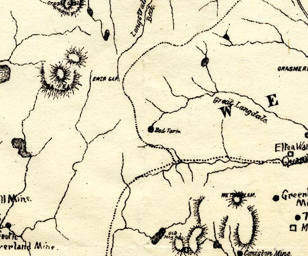 PST2NY20.jpg "Great Langdale" locality item:- JandMN : 162.2 Image © see bottom of page |
||||||||||||||||||||||||||||
|
|
|||||||||||||||||||||||||||||
| evidence:- | perhaps old print:- MacBride 1922 item:- snow; weather |
||||||||||||||||||||||||||||
| source data:- | Print, colour, Melting Snow, Langdale, by Alfred Heaton Cooper, published by Adam
and Charles Black, 4-6 Soho Square, London, 2nd edn 1928.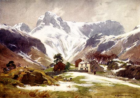 click to enlarge click to enlargeMB0106.jpg Tipped in opposite p.28 in Wild Lakeland by MacKenzie MacBride. printed at bottom:- "MELTING SNOW, LANGDALE" signed at lower right:- "A. HEATON COOPER" item:- JandMN : 195.8 Image © see bottom of page |
||||||||||||||||||||||||||||
|
|
|||||||||||||||||||||||||||||
| evidence:- | old print:- Bogg 1898 |
||||||||||||||||||||||||||||
| source data:- | Print, engraving, The Langdales, Lakes, Westmorland, by Gilbert Foster, published
by Edmund Bogg, 3 Woodhouse Lane, and James Miles, Guildford Street, Leeds, Yorkshire,
1898.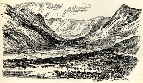 click to enlarge click to enlargeBGG168.jpg Included on p.183 of Lakeland and Ribblesdale, by Edmund Bogg. item:- JandMN : 231.68 Image © see bottom of page |
||||||||||||||||||||||||||||
|
|
|||||||||||||||||||||||||||||
| evidence:- | old print:- Rowbotham 1875 |
||||||||||||||||||||||||||||
| source data:- | Print, chromograph, Great Langdale, Westmorland, by T L Rowbotham, published by Marcus
Ward and Co, 67-68 Chandos Street, Covent Garden, London, and Belfast, 1875.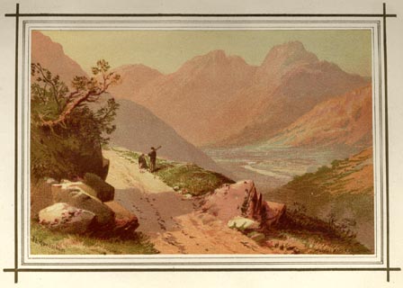 click to enlarge click to enlargeLF1E04.jpg Tipped in opposite p.30 of English Lake Scenery, by W J Loftie. printed at lower left:- "T L Rowbotham" item:- Armitt Library : A963.4 Image © see bottom of page |
||||||||||||||||||||||||||||
|
|
|||||||||||||||||||||||||||||
| evidence:- | old print:- Sylvan 1847 placename:- Great Langdale |
||||||||||||||||||||||||||||
| source data:- | Print, engraving, Great Langdale and the Pikes, Westmorland, engraved by Thomas Gilks,
published by John Johnstone, Paternoster Row, London, et al, 1847. click to enlarge click to enlargeSYL123.jpg On p.72 of Sylvan's Pictorial Guide to the English Lakes. printed at bottom right, centre:- "T. GILKS [Sc] / GREAT LANGDALE AND THE PIKES." item:- Armitt Library : A1201.23 Image © see bottom of page |
||||||||||||||||||||||||||||
|
|
|||||||||||||||||||||||||||||
| evidence:- | outline view:- Tattersall 1836 placename:- Great Langdale |
||||||||||||||||||||||||||||
| source data:- | Print, engraving, Great Langdale, Westmorland, drawn by George Tattersall, engraved
by W F Topham, published by Sherwood and Co, Paternoster Row, London, about 1836.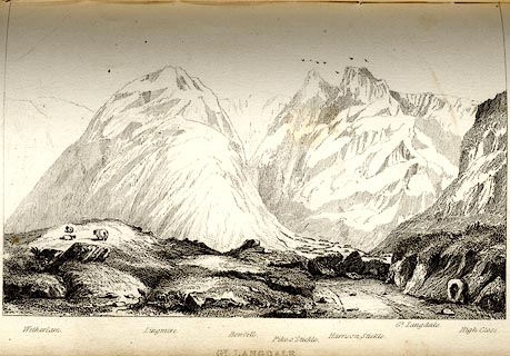 click to enlarge click to enlargeTAT112.jpg The print is captioned with mountain names and acts as an outline view. Tipped in opposite p.46 of The Lakes of England, by George Tattersall. printed at bottom:- "GT. LANGDALE." printed at bottom left to right:- "Wetherlam. / Lingmire. / Bowfell. / Pike o'Stickle. / Harrison Stickle. / Gt. Langdale. / High Close." item:- Armitt Library : A1204.13 Image © see bottom of page |
||||||||||||||||||||||||||||
|
|
|||||||||||||||||||||||||||||
| evidence:- | probably old print:- Britton and Brayley 1802 placename:- Valley of Langdale |
||||||||||||||||||||||||||||
| source data:- | Print, uncoloured engraving, View in the Valley of Langdale, with Langdale Pikes,
Westmorland, painted by G Arnald, engraved by W Angus, published by Vernor, Hood and
Sharpe, Poultry, London, 1807. click to enlarge click to enlargePR0143.jpg Included in the Beauties of England and Wales, by John Britton and Edward W Brayley. printed at bottom left, right, centre:- "Engrav'd by W. Angus from a painting by G. Arnald, / for the Beauties of England & Wales. E.W.B dxt. / View in the Valley of Langdale, / (Looking Westward towards Langdale Pikes) / Westmoreland. / London, Published by Vernor, Hood &Sharpe, Poultry, Augt. 1. 1807." item:- Dove Cottage : 2008.107.143 Image © see bottom of page |
||||||||||||||||||||||||||||
|
|
|||||||||||||||||||||||||||||
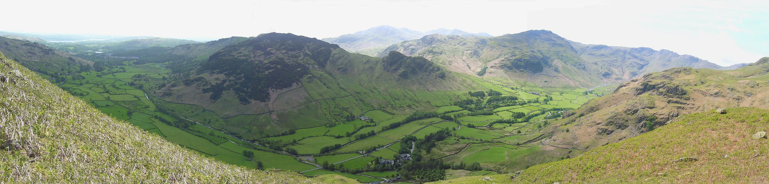 Click to enlarge BNR46.jpg (taken 22.5.2007) |
|||||||||||||||||||||||||||||
|
|
|||||||||||||||||||||||||||||
Lakes Guides menu.