 Old Cumbria Gazetteer
 |
 |
|
| Grune Point, Silloth-on-Solway | ||
| Grune Point | ||
| locality:- | Solway Firth | |
| locality:- | Moricambe | |
| civil parish:- | Silloth-on-Solway (formerly Cumberland) | |
| county:- | Cumbria | |
| locality type:- | headland | |
| coordinates:- | NY14335690 (etc) | |
| 1Km square:- | NY1456 | |
| 10Km square:- | NY15 | |
|
|
||
| evidence:- | old map:- OS County Series (Cmd 21 1) placename:- Grune Point |
|
| source data:- | Maps, County Series maps of Great Britain, scales 6 and 25
inches to 1 mile, published by the Ordnance Survey, Southampton,
Hampshire, from about 1863 to 1948. |
|
|
|
||
| evidence:- | old text:- Gents Mag placename:- Grune, The |
|
| source data:- | Magazine, The Gentleman's Magazine or Monthly Intelligencer or
Historical Chronicle, published by Edward Cave under the
pseudonym Sylvanus Urban, and by other publishers, London,
monthly from 1731 to 1922. goto source goto sourceGentleman's Magazine 1748 p.291 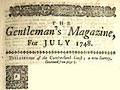 click to enlarge click to enlargeG748E04.jpg "..." "The Grune is a remarkable head of land, whose position the common maps have widely mistaken. It is now only a rabbet warren, and hardly any vestige left where an ancient chapel stood, called the chapel of the Grune; the whole is a low beachy coast. The Dutch would make a gainful acquisition by diking of this bay, was it in Holland, for the tide recedes so far as one may pass it in any place for several hours together." |
|
|
|
||
| evidence:- | old map:- Donald 1774 (Cmd) placename:- Grune Point |
|
| source data:- | Map, hand coloured engraving, 3x2 sheets, The County of Cumberland, scale about 1
inch to 1 mile, by Thomas Donald, engraved and published by Joseph Hodskinson, 29
Arundel Street, Strand, London, 1774.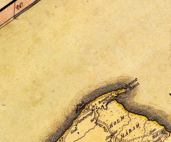 D4NY15NW.jpg "Grune Point" headland item:- Carlisle Library : Map 2 Image © Carlisle Library |
|
|
|
||
| evidence:- | old map:- Ford 1839 map placename:- Grune Point |
|
| source data:- | Map, uncoloured engraving, Map of the Lake District of
Cumberland, Westmoreland and Lancashire, scale about 3.5 miles
to 1 inch, published by Charles Thurnam, Carlisle, and by R
Groombridge, 5 Paternoster Row, London, 3rd edn 1843.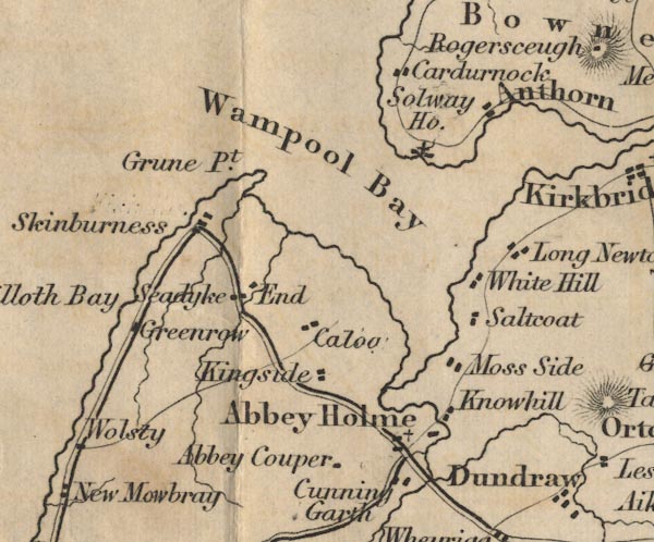 FD02NY15.jpg "Grune Pt." item:- JandMN : 100.1 Image © see bottom of page |
|
|
|
||
| evidence:- | old map:- Garnett 1850s-60s H placename:- Grune Point |
|
| source data:- | Map of the English Lakes, in Cumberland, Westmorland and
Lancashire, scale about 3.5 miles to 1 inch, published by John
Garnett, Windermere, Westmorland, 1850s-60s.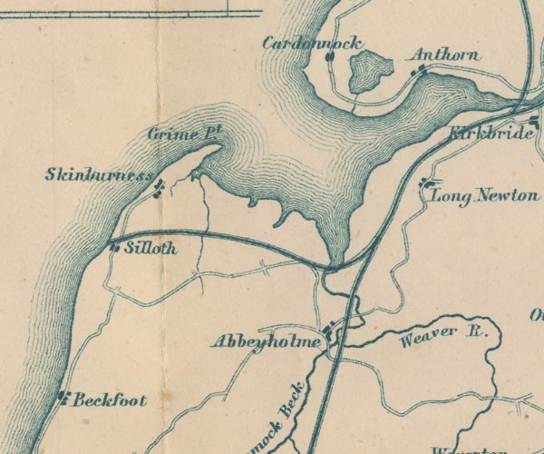 GAR2NY15.jpg "Grune pt." headland item:- JandMN : 82.1 Image © see bottom of page |
|
|
|
||
Lakes Guides menu.