 Old Cumbria Gazetteer
 |
 |
|
| Ainstable Hall, Ainstable | ||
| Ainstable Hall | ||
| locality:- | Rowfoot | |
| civil parish:- | Ainstable (formerly Cumberland) | |
| county:- | Cumbria | |
| locality type:- | buildings | |
| coordinates:- | NY52534652 | |
| 1Km square:- | NY5246 | |
| 10Km square:- | NY54 | |
|
|
||
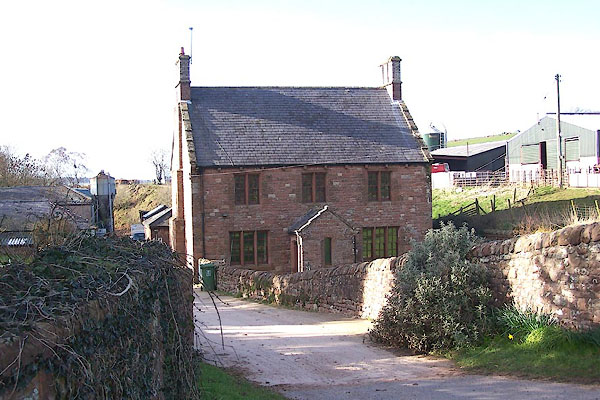 BNI60.jpg Rebuilt? (taken 9.3.2007) |
||
|
|
||
| evidence:- | old map:- OS County Series (Cmd 32 9) placename:- Low Hall placename:- Hall, Low |
|
| source data:- | Maps, County Series maps of Great Britain, scales 6 and 25
inches to 1 mile, published by the Ordnance Survey, Southampton,
Hampshire, from about 1863 to 1948. "Low Hall" "Sluice / Mill Dam" |
|
|
|
||
| evidence:- | old map:- Donald 1774 (Cmd) |
|
| source data:- | Map, hand coloured engraving, 3x2 sheets, The County of Cumberland, scale about 1
inch to 1 mile, by Thomas Donald, engraved and published by Joseph Hodskinson, 29
Arundel Street, Strand, London, 1774.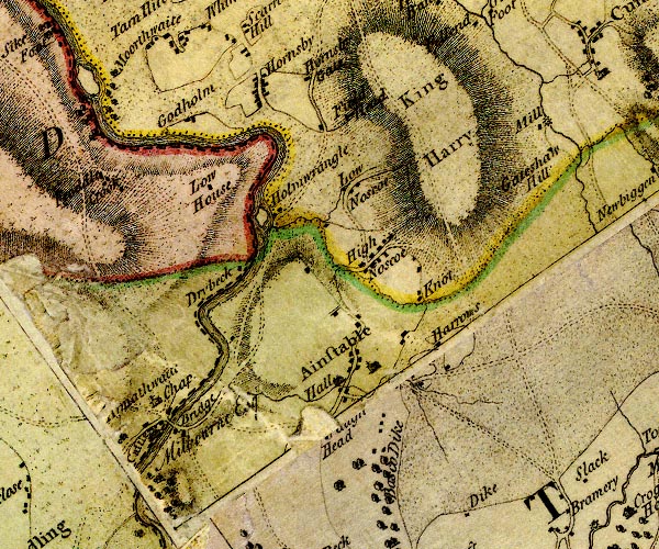 D4NY54NW.jpg "Hall" house at Ainstable item:- Carlisle Library : Map 2 Image © Carlisle Library |
|
|
|
||
| evidence:- | database:- Listed Buildings 2010 placename:- Ainstable Hall |
|
| source data:- | courtesy of English Heritage "AINSTABLE HALL / / / AINSTABLE / EDEN / CUMBRIA / II / 73429 / NY5253846522" |
|
|
|
||
 Lakes Guides menu.