 Old Cumbria Gazetteer
 |
 |
|
| Hallbeck, Killington | ||
| out of sight | ||
| Hallbeck | ||
| civil parish:- | Killington (formerly Westmorland) | |
| county:- | Cumbria | |
| locality type:- | buildings | |
| coordinates:- | SD62068841 | |
| 1Km square:- | SD6288 | |
| 10Km square:- | SD68 | |
|
|
||
| evidence:- | old map:- OS County Series (Wmd 39 16) placename:- Hallbeck |
|
| source data:- | Maps, County Series maps of Great Britain, scales 6 and 25
inches to 1 mile, published by the Ordnance Survey, Southampton,
Hampshire, from about 1863 to 1948. |
|
|
|
||
| evidence:- | hearth tax returns:- Hearth Tax 1675 placename:- Halbecke |
|
| source data:- | Records, hearth tax survey returns, Westmorland, 1674/75. "Halbecke" in "Killington in Lonsdale ward" |
|
|
|
||
| evidence:- | old map:- Jefferys 1770 (Wmd) placename:- Hall Beck |
|
| source data:- | Map, 4 sheets, The County of Westmoreland, scale 1 inch to 1
mile, surveyed 1768, and engraved and published by Thomas
Jefferys, London, 1770.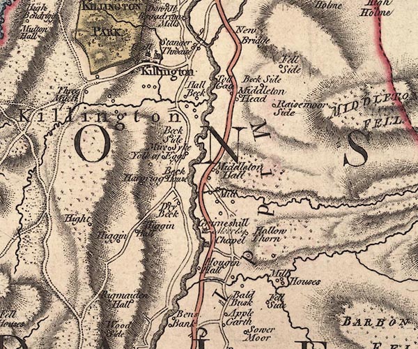 J5SD68NW.jpg "Hall Beck" circle, labelled in italic lowercase text; settlement, farm, house, or hamlet? item:- National Library of Scotland : EME.s.47 Image © National Library of Scotland |
|
|
|
||
| evidence:- | database:- Listed Buildings 2010 placename:- Hallbeck item:- date stone (1684) |
|
| source data:- | courtesy of English Heritage "HALLBECK / / / KILLINGTON / SOUTH LAKELAND / CUMBRIA / II[star] / 75684 / SD6210288411" |
|
|
|
||
| evidence:- | database:- Listed Buildings 2010 |
|
| source data:- | courtesy of English Heritage "BARN APPROXIMATELY 100M TO EAST OF HALLBECK / / / KILLINGTON / SOUTH LAKELAND / CUMBRIA / II / 75689 / SD6220688434" |
|
|
|
||
| evidence:- | database:- Listed Buildings 2010 |
|
| source data:- | courtesy of English Heritage "BARN IMMEDIATELY WEST OF HALLBECK / / / KILLINGTON / SOUTH LAKELAND / CUMBRIA / II / 75685 / SD6208488406" |
|
|
|
||
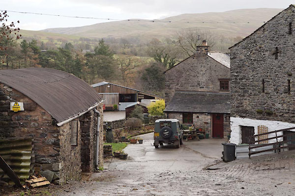 BZS11.jpg Farmyard. (taken 29.11.2013) |
||
|
|
||
 Lakes Guides menu.