 |
 |
|
|
|
|
Harras |
| civil parish:- |
Whitehaven (formerly Cumberland) |
| county:- |
Cumbria |
| locality type:- |
locality |
| locality type:- |
buildings |
| coordinates:- |
NX98481846 (etc) |
| 1Km square:- |
NX9818 |
| 10Km square:- |
NX91 |
|
|
| evidence:- |
old map:- Donald 1774 (Cmd)
placename:- Harras
|
| source data:- |
Map, hand coloured engraving, 3x2 sheets, The County of Cumberland, scale about 1
inch to 1 mile, by Thomas Donald, engraved and published by Joseph Hodskinson, 29
Arundel Street, Strand, London, 1774.
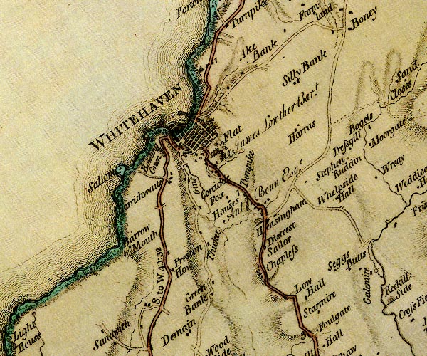
D4NX91NE.jpg
"Harras"
block or blocks, labelled in lowercase; a hamlet or just a house
item:- Carlisle Library : Map 2
Image © Carlisle Library |
|
|
| places:- |
 |
NX98401821 Burton High (Whitehaven) |
|
|
|
NX98831869 Harras Dyke (Whitehaven) |
|
|
|
NX98871848 Harras Moor (Whitehaven) |
|
|
|
NX98751835 High Harras (Whitehaven) |
|
|
|
NX98721835 Hope (Whitehaven) |
|
|
|
NX97961872 Lady Pit (Whitehaven) gone |
|
|
|
NX98001880 Ladypit Pottery (Whitehaven) |
|
|
|
NX98461844 Low Harras (Whitehaven) |
|
|
|
NX98611845 North Pit (Whitehaven) |
|
|
|
NX98911863 Whitehaven Race Course (Whitehaven) |
|
|
|
NX9818 tramroad, North Pit (Workington) gone |
|
|
|
NX98581836 Windsor Hill (Whitehaven) |
|
|
|
NX98791832 Windsor Terrace (Whitehaven) |
|
|
|
NX98941853 (Whitehaven) |
|
